Eight Czech P100s around Plzeň in one day
Eight short P100 walks around Plzeň became a full day of summit-finding: obvious towers were not always on the correct bump, and the final hill, Bambule, arrived with the last light.
Contents
Eight summits in one day sounds more heroic than it was. None of these hills demanded a long approach. The challenge was linking them efficiently while checking whether the most conspicuous landmark was also the summit indicated by the terrain, map and old survey marks.
On 14 March 2026, after driving down from Prague, I linked eight Czech P100s across the Plzeň Region, starting on Koráb above Kdyně and finishing on Bambule above Strašice. Across the eight separate walks I covered 16.2 km on foot, climbed 749 m and spent about 4h01 walking. The full road-linked trip track covered 133.9 km over 6h46.
This was not a continuous traverse but a road-linked peakbagging day built around short, separate objectives. Moving east from Kdyně through the wooded hills around Klatovy and Švihov towards Strašice, the rhythm was simple: drive, get out, read a different summit, return to the car and move on.
Four different summit puzzles
Koráb set the tone immediately. The road, hut and lookout tower dominate the developed western bump; my P100 objective lay farther east along the ridge. It was the strongest peak of the day by prominence at 240 m, yet what made it memorable was not the number. It was the simple fact that the busiest part of the mountain was not the point I had come to visit.
Velký Bítov repeated the trick in a completely different form. A tall cross, antenna and picnic table occupy the lower southern bump, giving it all the visual authority of a summit. The real 713 m top waits farther north beside old triangulation remains.
By the third stop, Doubrava, the day had moved from summit misdirection to summit clutter. Survey blocks, a first-order triangulation diagram, antennas and the remains of Cold War radar history occupy the crest, while an active paragliding launch sits just below.
Říčej was quieter again. The mapped summit looked slightly low, so I continued roughly 30 m along the broad beech-covered crest to an old survey remnant and ground that felt more convincing as the natural high point. Nothing dramatic happened there, which was precisely the appeal. A small discrepancy between map and terrain turned an otherwise simple 1.6 km forest walk into a tiny exercise in summit judgement.
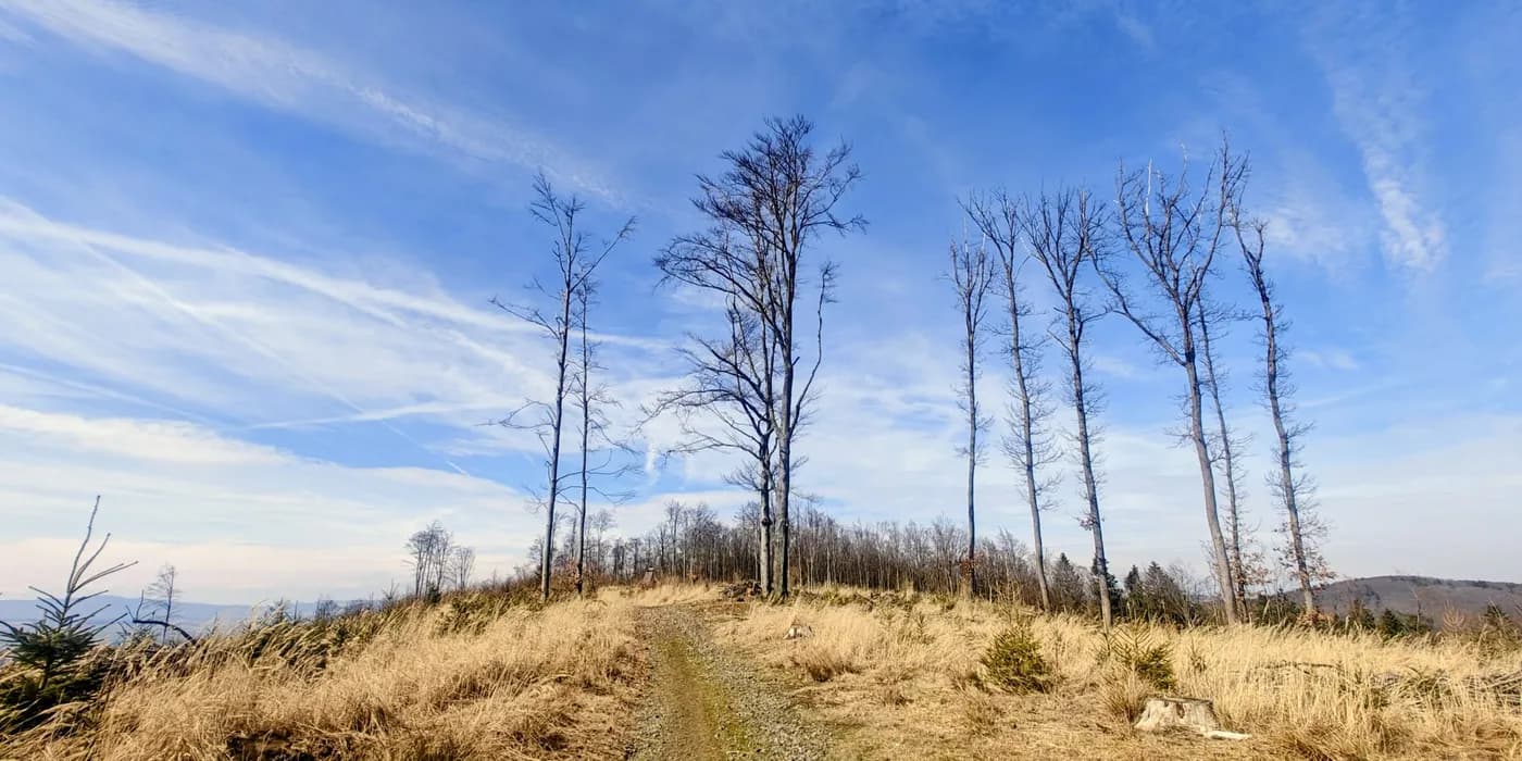
The real summit beyond Koráb’s lookout tower
What people left on the hills
The second half of the day became less about finding the right bump and more about the marks people had left on these hills.
Běleč was the most straightforward summit of the group. A broad forest road led to a clearly marked top with a picnic table, register and concrete survey block dated 1938. The surrounding old woodland is protected, and a local account connects the hill with people fleeing Švihov during the Thirty Years’ War. After several subtler summit puzzles, the clarity was almost relaxing.
Tuhošť was only 0.9 km on foot, but it packed several different periods into one small wooded crest. A summit sign, tree-mounted thermometer and 1940 survey marker sit inside the surviving earthworks of a late-Bronze-Age hillfort. From inside the trees it feels like a modest forest hill; from the fields near Mezihoří its compact shape makes much more sense.
Then came Stramchyně, where local tradition had solved the problem of a modest 543 m summit by physically adding to it. Walkers carry stones uphill, the cairn grows, and the running joke is that the mountain gets a little higher every year. A painted penguin on the summit pile was the detail I remembered best. It was one of the shortest walks of the day and one of the least anonymous.
Several starts were unusually high because the roads were passable in the dry conditions I found that day. They record what worked on 14 March 2026, not permanent parking advice.
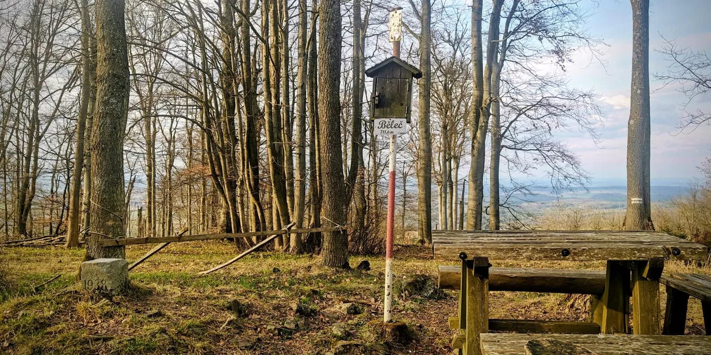
Běleč’s 1938 summit marker above Švihov
Bambule in the last light
By Bambule, the day had acquired its own rhythm: park, climb, question the first plausible top, keep going if the ground says otherwise. I still managed to make the final kilometre more awkward by trying a bad shortcut through young spruce before finding the better upper path.
A rough cairn marked the more convincing high point, with a separate concrete survey block nearby. The surrounding history was anything but quiet: local sources record wartime bombs falling on Bambule in March 1945, and the wooded slopes still hold that story beneath a landscape that now feels completely ordinary.
The best moment came below the crest. Strašice was beginning to light up as the sky faded, with dark conifers framing the town and lower ridges beyond. After seven efficient daylight summits, the last hill finally provided a sense of an ending.

Finding Bambule’s true summit at dusk
The day in numbers
| Peak | Altitude | Prominence | Isolation | Distance | Ascent | Time |
|---|---|---|---|---|---|---|
| Koráb | 776 m | 240 m | 15.38 km | 4.0 km | 102 m | 0h50 |
| Velký Bítov | 713 m | 117 m | 4.00 km | 3.6 km | 135 m | 0h47 |
| Doubrava | 727 m | 199 m | 8.57 km | 1.4 km | 72 m | 0h27 |
| Říčej | 695 m | 133 m | 2.86 km | 1.6 km | 91 m | 0h30 |
| Běleč | 712 m | 210 m | 5.73 km | 2.3 km | 140 m | 0h33 |
| Tuhošť | 601 m | 125 m | 2.16 km | 0.9 km | 84 m | 0h16 |
| Stramchyně | 543 m | 119 m | 2.67 km | 1.4 km | 76 m | 0h20 |
| Bambule | 659 m | 136 m | 9.78 km | 1.0 km | 49 m | 0h18 |
| On foot total | 16.2 km | 749 m | 4h01 |
Eight modest P100s could easily have blurred into one long sequence of short forest walks. They did not. By the time Strašice lit up below Bambule, each summit had supplied its own reason to remember it.