After snow closed Pikes Peak Highway on my first attempt in 2019, I returned years later and finally drove to the summit. The day brought bighorn sheep, a crowded visitor centre, brake checks, a $16 magnet I did not buy, and a distinctly mixed verdict.
Back in December 2019, my first attempt to drive Pikes Peak ended before the mountain really started. My wife and I arrived in the morning to find the road closed by snow. Nobody could tell us whether it would reopen the next day or the day after, so waiting around made little sense. We changed plans and drove to Great Sand Dunes National Park instead.
This time I approached from Parachute, Colorado, after spending the previous day on Mount Peale in Utah. It was a several-hundred-kilometre transfer and, after the 2019 failure, I had little interest in making a third long detour. I paid $18 for entry. For my summer visit I also needed a $2 timed reservation. Because I did not know exactly when I would arrive, I booked two slots and used one. Elegant it was not, but it reduced the chance of repeating 2019. After the extra $100 foreign-visitor fee I had paid at Yellowstone, even this slightly wasteful solution felt relatively civilized.
From the ranger station upwards, the highway was good: wide, paved and well maintained. It twisted steadily through the mountain, but I did not find the gradients frightening. There were plenty of cars and several school buses. With so much mixed mountain-driving experience on the road, the controlled traffic probably was not a bad idea.
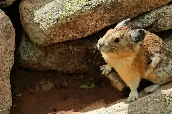
Above treeline, the road crossed open alpine ground beneath heavy cloud. The bighorn sheep beside the carriageway seemed less concerned about traffic than the traffic was about it.
At one point a bighorn sheep (Ovis canadensis) was standing right beside the road. The animal itself was no problem. Drivers braking suddenly to photograph it were more interesting.
Near the top, despite the volume of traffic, I found a parking place almost immediately. My original plan had been to park at the highest point beside the old ruins. Once there, that plan revealed its minor technical flaw: the summit marker itself is reached on foot from the parking area.
Cloudy weather still left good views across the winding road and lower ridges. At roughly 4,300 metres it was cold enough that most people were in jackets; I was still walking around in shorts and short sleeves, attracting a few looks.
The summit was much busier than the road photographs suggest. The black summit marker makes the destination very clear, and nearby rocks carry several official markers, memorials and plaques.
The modern summit marker and an older U.S. Forest Service marker sit only a short walk from the parking area, which was enough to defeat my fantasy of parking directly beside the summit marker.
One bronze plaque commemorates Zebulon Montgomery Pike. Its inscription records that he first saw the mountain in November 1806 and made an unsuccessful attempt to climb it later that month. Nearby, the surviving red stone walls are from the U.S. Army Signal Service weather station established on the summit in 1873.
The summit mixes memorials with surviving infrastructure from a much earlier era. Pike's plaque recalls the explorer; the stone walls belonged to the 1873 Signal Service weather station.
I had planned to eat at the summit. I knew it was unlikely to be a culinary revelation, but I had time and nowhere urgent to be. Then I saw the tables: people at them, beside them, around them and, as it felt at the time, almost under them. I postponed the summit meal to some theoretical future visit.
Inside the visitor centre I looked through the exhibition but did not find much I had not already read elsewhere. The souvenir shop produced a stronger memory. I had no particular need for anything, but I thought I might find an interesting small souvenir. The thing that caught my attention was a rather crooked, rough-looking magnet priced at $16 before tax. I left it there and returned to the car.
Another route to the summit is the Manitou and Pikes Peak Cog Railway, which I noticed while walking around. I also thought I saw something resembling a chairlift, although I never worked out exactly what it was, so I will leave that one unresolved.
Below the summit, bare rock quickly gives way to darker forest and reservoirs. The views were good without being spectacular, which was a fair summary of my reaction to the mountain as a whole.
On the descent, near the reservoirs, rangers stopped cars and checked brake temperatures. If the brakes were too hot, drivers were told to wait for them to cool. The highway did not feel especially steep to me, but judging by the range of drivers using it, the precaution made sense.
I cannot say Pikes Peak itself impressed me as much as some mountains I have climbed. Still, a summit is a summit, whether reached on foot or by road. There are plenty of mountains in the world that cannot be driven to, so I am happy to save the walking for those. From Pikes Peak I got back in the car and continued east towards Black Mesa in Oklahoma, the next summit on the itinerary.