After an unsuccessful Mount Ellen attempt and a night at Green River, I drove into Utah's La Sal Mountains for Mount Peale. The hike was straightforward until loose scree and a building thunderstorm turned the final ridge into a sprint to the summit and an even faster retreat.
Mount Peale had already become part of a slightly chaotic road trip before I even started hiking it. I came from the Green River petrol-station car park, where I had spent the night after an unsuccessful attempt on Mount Ellen and a much better visit to Capitol Reef National Park. Peale was another ultra-prominent summit on my list, and on paper it looked like a relatively short outing. That part was true. The weather eventually made the rest less relaxed.
The drive into the La Sal Mountains was mostly straightforward, although one or two stream crossings needed more attention. One deeper crossing was muddy enough to have the useful side effect of washing some dirt off the wheels. I also managed to drive farther along small forest tracks than I expected, until a steep, rooty section finally persuaded me to reverse. The result was only about ten extra minutes on foot. There are worse penalties on a hiking day.
The green La Sal Mountains look almost misplaced above the desert country around Moab. Their geology is equally distinctive: the range was formed by magma intruding beneath sedimentary rocks and pushing the overlying layers upward, with erosion later exposing the harder igneous cores.
At the start I met a camper with an angry dog near the road map, as well as a couple already walking down. Once moving, the trail was pleasant and gradual through the forest, never particularly steep.
The lower slopes had the quieter side of the day: mule deer in the meadows and small summer life beside the trail. Mount Peale, Mount Mellenthin and Mount Tukuhnikivatz were designated as a USDA Forest Service Research Natural Area in 1988.
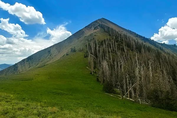
Above the forest the character changed. The trail reached the open slopes and continued beside a stream through loose scree. In places it was quite steep, with sliding gravel that made balance harder than the gradient alone suggested.
A few times I lost the trail and tried to go more directly uphill. That was a mistake. The loose slope was slower and less comfortable, and I soon worked my way back into the bottom of the ravine, where the "kind of" trail continued towards the saddle.
By then I had started watching the sky. Small but reasonably dark clouds were building near the mountain. They became thicker, although for a while they stayed to the left of the summit. I heard a few distant rumbles of thunder, but they still seemed far enough away.
That changed on the final ridge. As I approached the summit, I heard one thunderclap, then another, then a third. The last one sounded close enough to end any discussion about whether this was a place to linger.
I ran the final metres to the summit and, only seconds later, started running back down even faster. It was an efficient summit visit, if not a particularly enjoyable one.
Before I reached the forest I turned around to see what was happening behind me. The sky above Mount Peale had become completely dark, and the thunder continued repeatedly. Once I was back near the tree line I felt somewhat better, although not exactly relaxed. In retrospect, runing was clearly the right decision for me.
The route itself had not been especially difficult apart from the steep scree section. In different weather I think it would have been a very pleasant hike. Instead, it became one of those outings where the technical difficulty mattered much less than the timing.
I still had enough afternoon left to drive to Arches National Park. The contrast was absurdly neat: Arches was in full sunshine and very hot, while Mount Peale was still sitting under dark cloud. In some of my photographs from the park, the storm clouds are visibly concentrated above the La Sal massif.
Later, as I drove away from Arches, the mountain appeared again. Then I saw it once more from the north. By the end of the day I had the strange feeling that I had spent hours orbiting Mount Peale: approaching from the south-east, climbing it, driving around its southern side towards Arches, then seeing the same massif again and again from the surrounding country.
Eventually I continued towards Parachute, Colorado, with Pikes Peak as the next major objective. Mount Peale was not the hardest summit of the trip, but it supplied an interesting experience, another ultra-prominent peak, and a reminder that even a short mountain day can change character very quickly.