A first-light start from West Tensleep Lake became a 40.4 km, 15-hour day: easy lake trails, slow granite boulder fields, a clear summit above Cloud Peak Glacier, then wildlife and a careful return over the same log crossing after dark.
Cloud Peak was on my list for more than its 4,014.4 m elevation. Peakbagger gives it 2,174 m of prominence and 233.39 km of isolation, making it both an Ultra-prominent peak and a 100-mile-isolation peak. It is the highest point of the Bighorn Mountains and the high point of both Big Horn and Johnson counties. Peakbagger's current figures also put its prominence slightly above Gannett Peak's, so Cloud Peak is Wyoming's most prominent mountain even though it is not the state's highest.
Those statistics are neat. The practical version was a 40.4 km day with 1,250 m of ascent and 15:06 on my track. The standard western approach is not technically difficult in dry summer conditions, but the distance, altitude and upper boulder fields make the word "easy" fairly unhelpful.
I had spent the night in the large parking area at West Tensleep Lake and started hiking with first light. The first kilometres were quiet and cool, with the sort of morning light that justified getting moving before the rest of my brain had fully joined the project.
The day began beside West Tensleep Lake, then quickly moved into meadows, streams and forest.
About a kilometre from the parking area I reached a small river. It looked roughly knee-deep, and soaking my shoes this early with a very long day still ahead had little appeal. A little downstream I found two narrow logs across the water. They did not look especially reassuring, but they did look dry. I used them and crossed successfully.
The next roughly 12 km were comparatively gentle: gradual ascent, several lakes, a few deer and a few sleepy hikers walking down. The route never felt busy. Over the whole day I probably met only 20 or 30 people, surprisingly few considering the mountain's prominence and reputation.
The Forest Service's Misty Moon Trail forms the main trail approach from West Tensleep, passing Lake Helen, Lake Marion and Misty Moon Lake before the route towards Cloud Peak becomes much rougher.
Early sunlight, open meadows and the first wildlife made the long approach feel much more civilized than the upper mountain would later become.
The gentle section continued through a sequence of remarkably still lakes. For a while the day was mostly reflections, forest and steady walking rather than mountain problem-solving.
Several lakes broke up the long western approach, with almost no wind on the water that morning.
Higher up, the scenery became more open and the trail began to feel more alpine. After Misty Moon Lake I had to descend into a valley, perhaps around 100 m, before climbing again on a steeper section. A small waterfall came down on the right. I had seen a few tents near the lakes and another one around this waterfall, but otherwise the country felt lightly used.
The forest gradually gave way to more open granite terrain and higher lakes.
From the valley onwards, the route became much less obvious. I would find the line, lose it, find it again, and repeatedly check GPS tracks from previous climbers. Slabs led into grassy slope sections, then boulder fields, then more boulder fields. Progress slowed far more than I had expected. Roughly 6 km here took something like three to four hours.
The terrain has a geological explanation, even if that was not much consolation while crossing it. USGS descriptions of the high Bighorns emphasize their old Precambrian granite and gneiss and the strong imprint of Pleistocene glaciation, which carved the cirques and high basins. On foot, the simplified version was granite, granite and more granite.
The upper route exchanged the maintained trail for broad boulder fields and a much rougher high-alpine landscape.
Gaining height made the morning's lakes look increasingly small and distant.
Once I reached the ridge, things became more pleasant again. There were still a few exposed steps, but generally the ridge was straightforward compared with the slow boulder terrain below.
The summit itself had a substantial cairn and a register box. The weather had stayed unusually warm, around 30°C by my memory, and the summit was completely free of cloud. The reward was a clear panorama across the Bighorns and a direct view into the cirque containing the remains of Cloud Peak Glacier.
From the summit area, the glacier, lingering snow and intensely blue lakes gave the northeastern side of Cloud Peak a much sharper character than the broad western approach.
The summit area is a world of broken granite cliffs, towers and long ridges rather than the gentle-looking mountain suggested from far away.
My summit stop was practical rather than ceremonial: a few minutes, one apple, then I turned around. There was still a very long way back.
Descending was much faster. The boulders still demanded attention, but at least the overall direction now worked in my favour. By the time I was back among the greener basins and lakes, the day had shifted from summit effort to the simple arithmetic of getting back before I ran out of daylight.
The return dropped back through green basins and lakes as the light became noticeably later in the day.
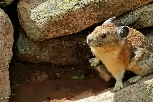
I also saw more animals on the way down. A marmot sat beside the trail, then I spotted a moose feeding on the far side of a stream. Later a squirrel watched from the trees. The moose was easily the largest animal of the day, although by then almost anything that stood still for a photograph was welcome.
The descent added a marmot, a moose and a squirrel to the day's wildlife sightings.
When I finally returned to the little river crossing, it was already dark. The two logs had seemed only mildly questionable in the morning; darkness did nothing to improve their engineering. I crossed carefully, reached the car in the dark, rested briefly and then drove to Worland, where we spent the night.
Cloud Peak ended up being a good example of how misleading the phrase "non-technical" can be. There was no serious climbing problem on my route in those dry conditions, but 40.4 km, 1,250 m of ascent, a summit above 4,000 m and hours of slow granite made it a severe endurance day. I had come for the prominence and isolation. What I remember just as clearly is first light, endless boulders, one apple on the summit and the same two narrow logs waiting in the dark.