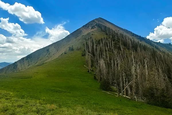
Late in the afternoon after Roberts County High Point, I reached an empty White Butte trailhead and followed a short, well-maintained path through unexpectedly rugged pale buttes to North Dakota's highest point before continuing west towards Cloud Peak.
White Butte was the second high point of my afternoon. I came in from Roberts County High Point in South Dakota, arriving late in the day but with plenty of time left to reach North Dakota's highest point. The contrast became obvious on the approach: an enormous stretch of open Great Plains, then a pale, steep-sided cluster of buttes rising out of land that had otherwise spent most of the day being remarkably horizontal.
The final miles were on a good gravel road. At the dedicated parking area I was completely alone. I changed for the hike and started towards the summit on an obvious trail.
White Butte is reached across private ranchland, which makes access etiquette part of the experience even though the hike itself is straightforward. On my visit there was no ambiguity: the parking area was established, the trail was easy to follow, and the whole place was quiet.
My recorded route was about 3 km round trip with roughly 111 m of ascent. The trail was in very good condition and the climb went quickly. What made it interesting was not the effort but the setting. Flat prairie gave way almost immediately to eroded faces, gullies and pale slopes. White Butte has only about 168 m of prominence, yet here it looked much more distinctive than that number suggests.
The geology helps explain the abrupt change of scenery. North Dakota Geological Survey mapping around White and Chalky Buttes shows light-coloured White River Group rocks with younger Arikaree Formation caprock. Erosion has left these resistant remnants standing above the surrounding plains. From the trail, the effect is less like a conventional mountain and more like a compact piece of badlands dropped into ranch country.
One small detail beside the trail fitted that dry Great Plains setting particularly well: a narrow-leaved purple coneflower (Echinacea angustifolia). It is a native prairie species adapted to dry grassland and rocky slopes. The same southwestern North Dakota grassland-and-butte habitat is also prairie rattlesnake country, a useful reminder that a short state-highpoint trail is not quite the same thing as a city park.
The good trail continued almost to the summit, and I reached the top quickly. At about 1,069 m, White Butte is the highest point in North Dakota and also the high point of Slope County. The elevation itself is modest; its importance comes from geography rather than mountain scale. State borders have a talent for making otherwise ordinary-looking points suddenly significant.
Near the top were the familiar pieces of highpointing infrastructure: a register box and survey marker. I checked the surroundings, took a few photographs and did not spend long there. The openness of the country did most of the work. With very little nearby to block the horizon, the views stretched far across the plains and the eroded country immediately below the summit.
Then I headed back down the same well-maintained trail. The whole visit had been pleasantly simple: good gravel road, empty parking area, a short hike and a quick summit. One more state high point done. Nice.
From White Butte I kept moving west, driving to the Cloud Peak trailhead in Wyoming and sleeping there. White Butte had been a compact stop between long drives and larger mountains, but the landscape gave it more character than the statistics suggested. The memorable part was the contrast: immense prairie, then suddenly a small island of pale, broken terrain carrying the highest point in North Dakota.
Mount Nebo: Thunder, Wildflowers and a Parking Ticket