Anatolia 2024
The idea for our Anatolia trip started as a straightforward acclimatization hike before tackling higher peaks. Dave and I thought the 5,137m Mount Ararat (Ağrı Dağı) in Turkey would be the perfect warm-up before the 4,506m Gora Belukha in Kazakhstan. Simple, right? : ) But naturally, we decided to make things more interesting by adding…
Contents
The idea for our Anatolia trip started as a straightforward acclimatization hike before tackling higher peaks. Dave and I thought the 5,137m Mount Ararat (Ağrı Dağı) in Turkey would be the perfect warm-up before the 4,506m Gora Belukha in Kazakhstan. Simple, right? : ) But naturally, we decided to make things more interesting by adding another peak before Mount Ararat. Süphan Dağı is the usual go-to, but we wanted something different. A good friend, Aris from Indonesia, recommended Ramida BKK Travel, which led us to Araratclimb. I asked if we could climb three ultra-prominent peaks in Turkey’s southeast, a region closed to foreigners for a decades, near the Iranian and Syrian borders. Ramida confirmed we could do Mor Dağı and Uludoruk, but Samdi Dağı was off-limits—too close to the border and under military control. Good enough for us! So, we agreed on two peaks in the southeast, then Süphan Dağı, and finally Mount Ararat. While planning with Dave, we added a few buffer days—just in case. Turns out, it was a smart move, as we ended up bagging even more ultra prominent peaks in the end.
Then Dave invited Adam, which was great—more company and we could split the costs better. Not long after, Rob called, saying he might ditch his Norway trip and asked if there was room on our Anatolia adventure. Absolutely! We also checked with Steven to see if he was bailing on Norway and wanted to join us as well. Before I knew it, our team of five was heading to Turkey. Rob had already done many peaks in the region and was particularly interested in Mor Dağı, Uludoruk, and Akbaba Tepesi. However, he had an intriguing plan for other peaks both before and after this trip. Akbaba Tepesi wasn’t on the original Daves and mine list, but, like everything else, we added it too. And, since it was close to Keşiş Dağı, we threw that in too at the very last moment. So, from what was supposed to be a quick detour to Mount Ararat, step by step, this evolved into a full-scale, one ribu plus seven ultra-prominent peak adventure. Excellent.
Here’s a summary of our complex logistics:
- Rob, Dave, Steven, Adam and I climbed: Kara Dağ (replacement for Uludoruk) and Mor Dağı. Logistics by Araratclimb.
- Dave, Steven, Adam and I climbed: Süphan Dağı. Logistics by Araratclimb.
- Dave, Steven, and I climbed: Mount Ararat. Logistics by Araratclimb.
- Rob, Dave, Steven and Iclimbed: Akbaba Tepesi. Additional logistics by Araratclimb.
- Dave, Steven, and I climbed: Keşiş Dağı. Self-organized hike, with Sabri’s help.
- Rob and I climbed: Uludaz, Ahirdaği, Ahir Daği – Peak 2345, Engizek Dağı (attempt), and Killi Tepe. All self-organized hikes.
Day 1: Routine Flight and Meeting Peakbaggers
The routine three-hour flight TK1408 from Vilnius to Istanbul went smoothly. We flew over Lithuania, passing Trakai, Alytus, and Lazdijai. As we entered Poland, we flew above Suwałki, Siedlce, and Krosno. In Slovakia, we passed over Prešov and touched the edge of Hungary before reaching Romania. There, we flew above Carei, Cluj-Napoca, Turda, Aiud, Mediaș, and Câmpulung. We then glimpsed Bucharest, Silistra, and the Bulgarian coast by the Black Sea before landing at Istanbul Airport in Turkey.
I landed a few hours before Dave, Steven, and Adam. It took another chaotic hour to collect my luggage and arrange transport to the Luxury Airport Hotel in Arnavutköy. After checking in and finishing some work, I received a message from Dave saying he was at the reception. We grabbed dinner at the Harun Usta Çağ Kebab restaurant nearby, visited the impressive Yeşil Camii (Green Mosque), and then returned to the hotel to greet Adam and Steven, who had just arrived.
Costs, logistics…
- Araratclimb company: 1200 EUR, this included permits and all realted logistics to Kara Dağ (replacement for Uludoruk), Mor Dağı, Süphan Dağı and Mount Ararat climbs. I think company actually great at everything they list on their website..
- Bolt taxi to Vilnius airport: 6.20 EUR.
- Charlie Pizza coffee at the airport: 3.50 EUR.
- Maya mobile eSIM card (Turkey 10GB 15 days): 12 EUR.
- Turkish Airline flight tickets (Vilnius -> Istanbul -> Astana -> Istanbul -> Vilnius): 451.28 EUR
- Turkish Airline flight tickets change (Vilnius -> Istanbul -> Gaziantep -> Istanbul -> Vilnius): 368.75 EUR, yes – change can be as expensive as new tickets, promised ~90 EUR refund was never refunded by Turkish Airlines.
- Turkish Airline flight tickets (Istanbul -> Hakkari/Yüksekova): 2057.38 TRY (54.72 EUR).
- Turkish Airline flight tickets (Igdir -> Istanbul): 2046.88 TRY (54.44 EUR).
- Istanbul airport transfer to hotel: 30 EUR, overpriced, like the whole IST airport.
- Luxury Airport Hotel: 47.60 EUR, including a bit weird breakfast in the room.
- Harun Usta Çağ Kebab dinner with Dave: 1220 TRY for two of us (32.43 EUR).
Day 2: Yüksekova and Hakkâri Camping
Early start today. We needed to be at the airport before 6 a.m. for the 2-hour, 20-minute flight TK2670 to Hakkâri Yüksekova. Amusingly, this domestic flight was nearly as long as my international one. As usual, Turkish Airlines served quite good food with at least two meal options. We met up with Rob at the airport as planned, ready to begin our journey together.
The flight flew over Istanbul, Kocaeli, Ankara, Kırıkkale, Sefatli, Elazığ, Kovancılar, Palu, Şırnak, and Kurtalan before landing at Yüksekova. Although the airport is officially named Yüksekova/Hakkâri, it’s closer to Yüksekova and about 100 km from Hakkâri. At the airport, Recep, who will be our guide for the next week, met us. In Hakkâri, we also met another local guide before heading to the Sait Hotel restaurant in Hakkâri for a meal.
Unfortunately, just before trip, Recep informed us that our permit for Uludoruk was canceled. The police claimed there was “too much snow at the summit,” which seemed bit odd. How could they know the conditions so precisely? We met a team of locals heading up, and Facebook later confirmed they reached the top. Ok, maybe next time..
We turned our attention to Kara Dağ, an unreported Ribu peak boasting 1,265 meters of prominence. We camped at the trailhead, and, as usual, had to gently “guide the guides” on picking the ideal camping spot. They had their own creative ideas about tomorrow’s “high point,” but we steered them in the right direction.
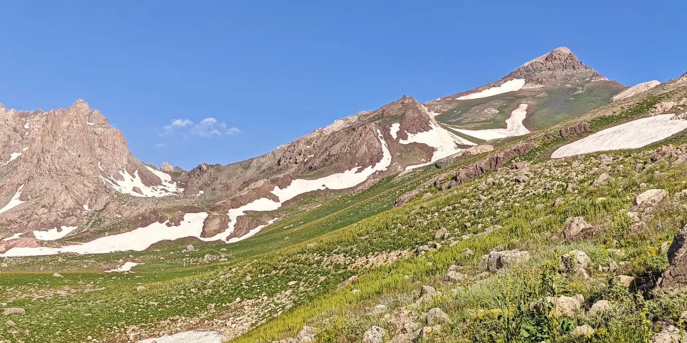
Kara Dağ
Costs, logistics…
- Sait Hotel restaurant lunch for seven: ~45 EUR. We paid all five of us, plus the guide and driver.
- Snacks and drinks at grocery shop: ~8 EUR
- Camping and dinner included in the package.
Day 3: First Peak of the Trip
We woke up at first light, enjoyed breakfast, and packed up the tents. The ascent of Kara Dağ went smoothly, and we successfully reached the summit. After returning to the car, we treated ourselves to sweet, cold watermelon and set off for our next destination. For the next two nights, we stayed at the Grand Yılmaz Hotel in Yüksekova. It wasn’t a bad place, but, worth mentioning, like most spots around here, it lacked air conditioning. Dinner was excellent at a local restaurant near the hotel.
Costs, logistics…
- Snacks and drinks at grocery shop: ~5 EUR
- Grand Yılmaz Hotel included in the package.
- Dinner at local restaurant near the hotel: 2320 TRY (61.70 EUR). We paid all five of us, plus the guide and driver.
Day 4: Tea with Shepherds
We started early again today. We met Erdem, our fantastic local guide, on the highway and had breakfast at the trailhead before setting off to climb Mor Dağı. After enjoying welcome tea at a shepherd’s camp, we reached the summit by noon. Later, we had tea with Erdem and his family in Kışlaköy. After their warm hospitality, we returned to the Grand Yılmaz Hotel in Yüksekova for a quick dinner and some ice cream before calling it a night.
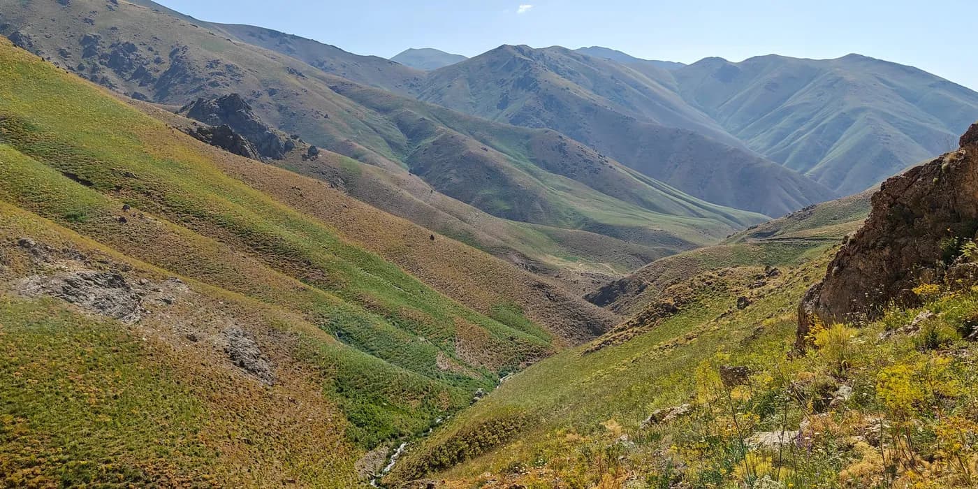
Mor Dağı
Costs, logistics…
- Tips to guide: 1000 TRY p.p. (26.60 EUR)
- Drinks at grocery shop: ~3 EUR
- Grand Yılmaz Hotel included in the package.
- Dinner at local restaurant: ~49 EUR.We paid all five of us, plus the guide and driver.
Day 5: Long Drive, Big Lake
After breakfast, we packed everything into the car and headed north. We first dropped Rob off at Yüksekova/Hakkâri Airport for his flight to Istanbul and then Erzurum. We planned to meet him again in a few days at Erzincan. The long drive took most of the day, and we passed through Ormetaş, Poyrazalan, Hatipova, Çamlık, Erek, Asalan, Aşağı Yolimacayır, Hoşap, Zernek Reservoir, Çavuştepe, Gürpınar, the large city of Van, Durrukkapı, Aşağı Kozluca, and finally Erciş. Along the way, we stopped at a few checkpoints where we showed our passports. In Erciş, we picked up supplies and grabbed a street kebab. We then settled in for the night at a campsite at the base of Süphan Dağı. The views of Lake Van were superb, and Recep prepared a great dinner. We went to bed, excited for tomorrow’s hike up Süphan Dağı.
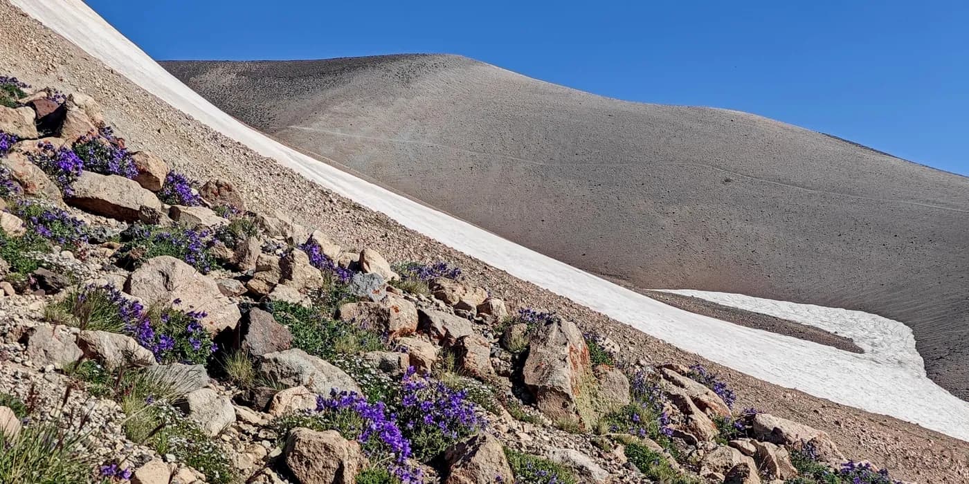
Suphan Dağı
Costs, logistics…
- Snacks and drinks at grocery shop: ~8 EUR
- Street food lunch: ~26 EUR. Four good kebabs.
- Camping and dinner included in the package.
Day 6: The Big Volcano
We woke up before sunrise, had a quick breakfast, and began our climb. After about four hours, we reached the summit of Süphan Dağı. The rugged summit plateau was challenging, but the descent on sandy trails was swift.
After packing up the tents, we drove toward Mount Ararat (Ağrı Dağı)—Turkey’s tallest mountain. A few hours later, we arrived at the Atlıhan Plus Hotel in Doğubayazıt, where the highlight was the stunning view of the majestic Mount Ararat volcano, glowing in the reddish hues of the sunset. Ramida, who had flown to İzmir and then driven to Doğubayazıt to meet us, came to greet us at the hotel. Together, we headed to Mis Beyzade Cafe & Restaurant for a very good dinner.
Costs, logistics…
- Atlıhan Plus Hotel included in the package.
- Mis Beyzade Cafe & Restaurant ~62.63 EUR. We paid all four of us, plus the orginizer, guide and driver.
Day 7: Horses to the Base Camp
After breakfast, we left behind the unnecessary gear and drove to the trailhead of Mount Ararat, where horses were ready to carry our equipment. After a few hours of hiking, we reached the base camp. We enjoyed some tea, a good dinner, and then settled into our tents for the night.
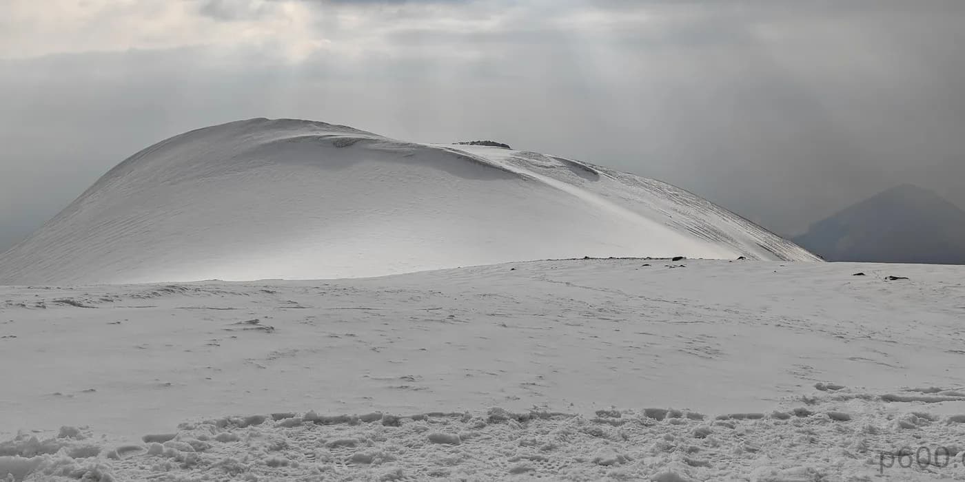
Mount Ararat
Costs, logistics…
- Snacks and drinks at grocery shop: ~10 EUR
- Camping and dinner included in the package.
Day 8: Horses at the High Camp Too
Ramida stayed at base camp, waiting for our return from the summit. We didn’t start too early, as the hike to the high camp was only a few hours. By 1 p.m., we had arrived. It was tempting to push for the summit that same day, but i stuck to the original plan and decided to go for it the next morning. The rest of the day was spent resting—I managed to sleep for over 12 hours, a personal record at high altitude.
Costs, logistics…
- Camping and dinner included in the package.
Day 9: Resting-place of Noah’s Ark
We agreed to start the summit climb at 5 a.m. to avoid hiking in the dark. Shortly after sunrise, we passed teams that had started at 1 a.m., and a little later, we were standing on Mount Ararat’s summit, with most teams still behind us. The weather was perfect, so I’m quite confident everyone had a successful ascent that day.
We rested a bit at the high camp, then descended to the base camp, where we had a snack and took a break. Afterward, we continued down to the car. That night, we enjoyed showers and a great dinner at a restaurant near the Atlıhan Plus Hotel.
Costs, logistics…
- Tips to the cook and guide: ~20 EUR p.p.
- Atlıhan Plus Hotel included in the package.
- Local restaurant near hotel: 1580 TRY (~42.04 EUR). We paid all three of us.
Day 10: Longest Drive
After a good breakfast, we said goodbye to Recep and Ramida. Today’s drive was long—about half a thousand kilometers east to Erzincan. We passed through Tasıçay, Ağrı, Eleşkirt, Horasan, Köprüköy, Erzurum, Aşkale, and Tercan before arriving at Hotel Beyrut in Erzincan. Rob rejoined us here, and we had a decent dinner at Çağan Restaurant.
Costs, logistics…
- Transport from Doğubayazıt to Erzincan and back cost us about 396 EUR, shared among the four of us. Thankfully, we got a refund of 4000 TRY (~106.38 EUR) since we changed our plans and adjusted our flight tickets to depart from Erzincan.
- Flight tickets from Erzincan to Istambul:
- Lunch at restaurant: 1350 TRY (35.90 EUR). We paid all four of us, plus driver.
- Hotel Beyrut: ~50 EUR per person.
- Çağan Restaurant: 1700 TRY (45.23EUR). Shared between four of us.
Day 11: Vulture Peak
Another early start. We met our new guide and hopped into two cars, heading for the Akbaba Tepesi (Vulture Peak in English) trailhead. Given our unfamiliarity with the area, we took it slow, unsure if the road was drivable. Turns out, the guide was leading us the wrong way. After a quick course correction, we located the trailhead ourselves. The hike to Akbaba Tepesi was short and straightforward. Later, back at Hotel Beyrut in Erzincan, we relaxed and grabbed dinner at a small street restaurant.
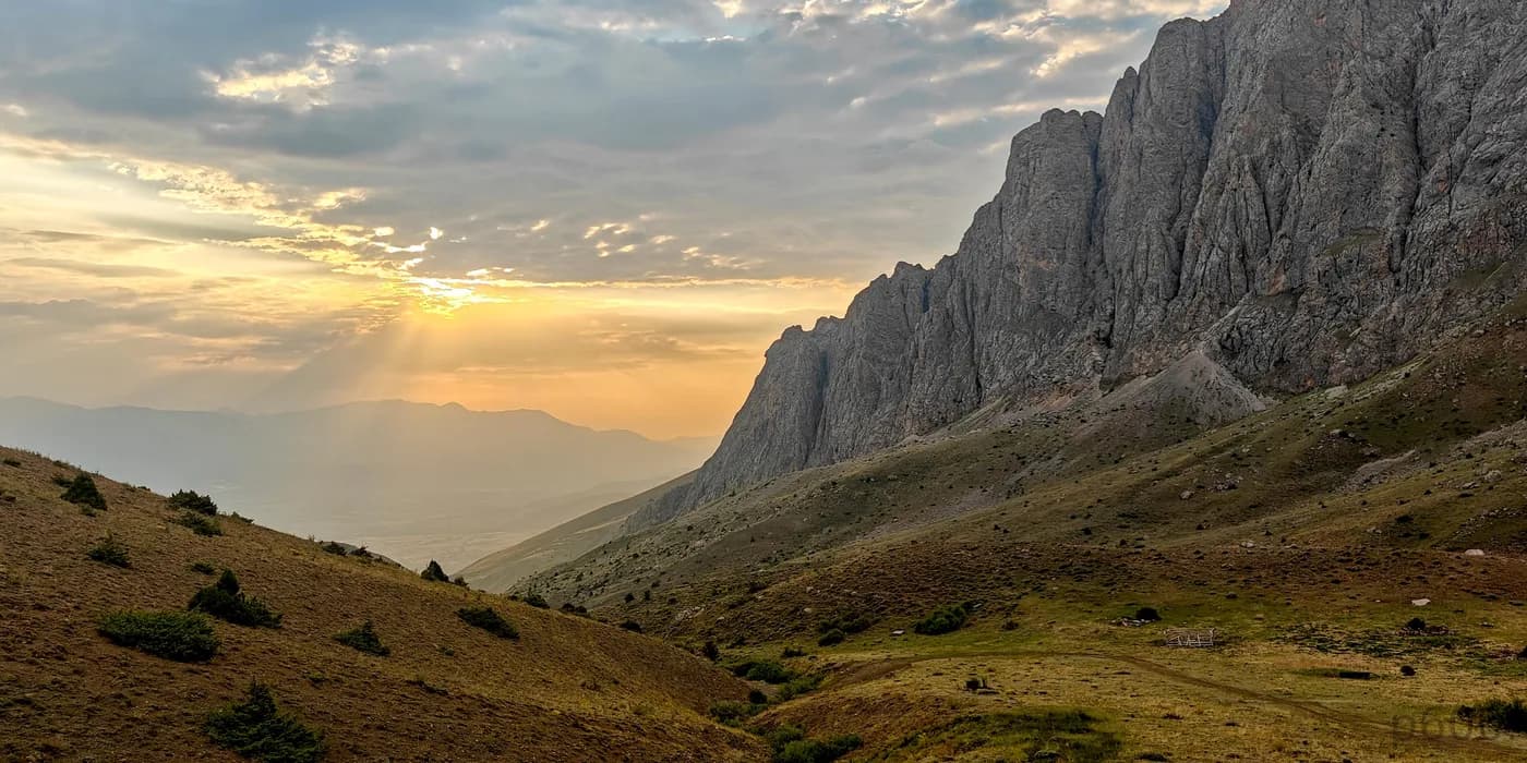
Akbaba Tepesi
Costs, logistics…
- Akbaba transport and guiding set us back 1050 EUR total for a half day hike. The guide was supposedly needed for the permit, but we later found out a permit is only required if you’re camping. Obviously overpriced. It’s very unusual that the guide is charging 1x amount per person, and 5 persons end up paying 5x amount.. But hey, we got the mountain, he got the money, and everyone went home happy.
- Snacks and drinks at grocery: ~5 EUR
- Hotel Beyrut: ~50 EUR per room.
- Local Restaurant: ~25 EUR. Share betwen three of us.
Day 12: Bonus Peak for Bonus Peak
Yesterday, we arranged with Sabri, our driver, to head to Keşiş Dağı. This wasn’t part of the original plan, but we had time before our afternoon flight to Istanbul. We successfully climbed this bonus peak. That afternoon, we took TK2655 from Erzincan to Istanbul, where I said goodbye to Steven and Adam as they headed to Norway for peakbagging.
Overall, it was a successful trip, though it wasn’t quite over for me. At Istanbul Airport, I grabbed a burger at an overpriced McDonald’s and waited for my 2 a.m. flight to Gaziantep. The peakbagging continued as I prepared for the next adventure.
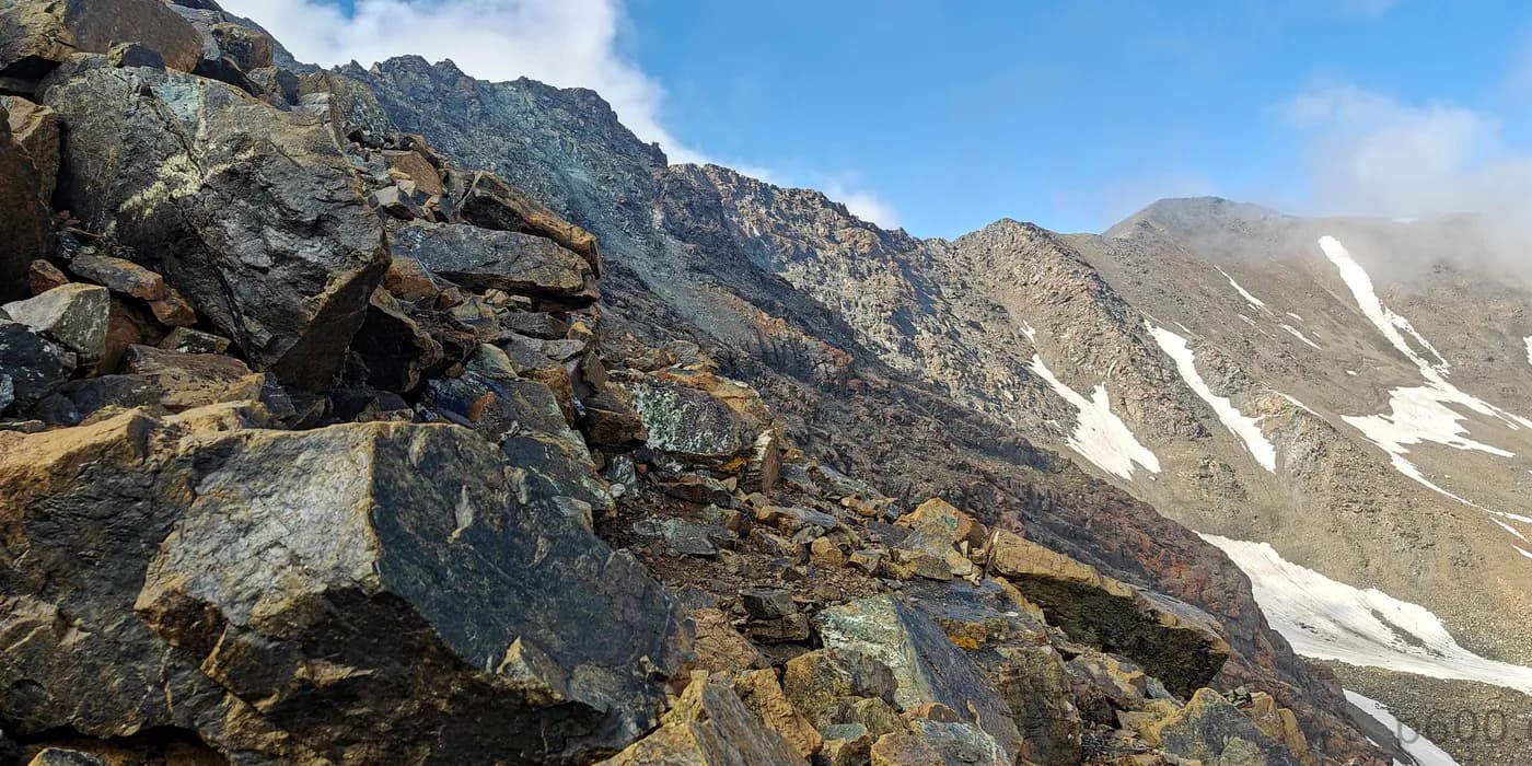
Kesis Dağı
Costs, logistics…
- 4WD car with driver: ~300 USD (~271 EUR). Shared between three of us.
- Snacks and drinks at grocery: ~5 EUR
- Lunch before airport at local restaurant: 500 TRY (~13.30 EUR); Shared between three of us.
- Coffee at airport: ~4 EUR
- Night at the airport: Free of charge; at least something is cheap at this airport.
- McDonald’s: 26 EUR; notably overpriced Big Mac meal.
Day 13: Alpine Start for Drive Up
After meeting Rob at Gaziantep Airport at 4 a.m., we got into our rented car and drove toward Uludaz, the next ultra-prominent peak on our list. We made a short stop for snacks at Kale, then parked a short distance from the Uludaz summit, bagged it, and headed to the city with the long name, Kahramanmaraş. There, we enjoyed a very good breakfast at Marin Pastanesi, which I highly recommend.
After breakfast, we drove to the nearby Ahirdaği, known for its communication masts, and bagged its summit. We then tackled another P300 peak, Ahir Daği. We headed toward Engizek Dağı but had to turn back near the trailhead since it was too late to summit. On our way back, we encountered a new challenge: halfway down, we got a flat tire about ten kilometers from the nearest village. By 10:30 p.m., we had resolved the car issues (the whole wheel was damaged and needed to be replaced), explained the situation to the curious police multiple times (honestly, it felt like a bit of a cross-examination), and retrieved our passports. Despite the hiccup, we ended the day on a positive note at the Ramada by Wyndham Elbistan.

Uludaz
Costs, logistics…
- Car rental for 2 days: 200 EUR. Shared between two of us.
- Snacks and drinks at the grocery shop: ~5 EUR
- Good breakfast at Marin Pastanesi restaurant: 400 TRY (~10.64 EUR)
- Replacing flat tire (better to say, a whole new wheel): ~115 EUR. Shared between two of us.
- Ramada by Wyndham Elbistan hotel: 75 EUR per room., A good and comfortable place.
- Unfortunately, we arrived too late for dinner, so we had a snack in the room.
Day 14: Last Climb of the Trip
Killi Tepe was my final ultra-prominent peak for the Anatolia trip, marking the end of this rewarding leg of our adventure. After the hike, we drove to Gaziantep and checked into the Shimal Deluxe Hotel for our final dinner. We celebrated our successful trip and the completion of our ultra climbs without any major issues. Climbing Mount Ararat was a notable achievement, even if it is a bit commercialized. We also tackled Mor Dağı, Akbaba Tepesi, and Killi Tepe—less-climbed peaks.
After dinner, I said goodbye to Rob, who would stay in Turkey to climb more Ribus. We planned to meet again in two weeks in Istanbul on our way to Mongolia, where we would continue with last year’s project.
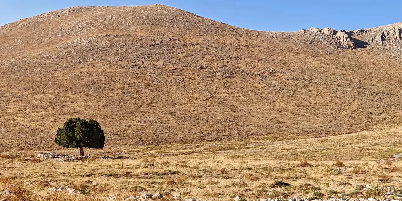
Killi Tepe
Costs, logistics…
- Petrol: 1827.50 TRY p.p. (48.62 EUR). Shared between two of us.
- Shimal Deluxe Hotel: 79 EUR per room. A good and comfortable place.
- Dinner at hotel: 700 TRY (18.62 EUR). Shared between two of us.
- Tea at hotel: 150 TRY p.p. (3.99 EUR ). Shared between two of us.
Day 15: Home is Calling..
After a good night’s sleep, I headed to the airport for my noon flight, TK2239, to Istanbul. I landed around 1:30 p.m., quickly transferred, and caught my connecting flight, TK1407, to Vilnius. On the return flight, we flew over Istanbul and the Bulgarian coast, then passed through Romania, spotting cities like Cluj-Napoca and Bucharest. We continued through Slovakia, seeing Prešov, and through Poland, with views of Suwałki and Siedlce. Finally, we flew over Lithuania, including Trakai, Alytus, and Lazdijai, before landing in Vilnius. By 9 p.m., I was home, enjoying a hot cup of coffee and already planning my next adventure—Mongolia in a few weeks!
Costs, logistics…
- Taxi from hotel to Gaziantep airport: 450 TRY (~11.97 EUR), not bad considering the more than 20 km ride.
- Coffee at airport: 4 EUR
- Coffee at Istanbul airport: 8 EUR, notably overpriced
- Taxi in Vilnius: 6 EUR
Thanks
Thanks to Ramida for organizing everything from permits to guides. Thanks Araratclimb company for organzieing all logistics, all was smooth and easy for us. Greate level of comfort. Thanks to Recep for navigating the complex logistics of the Southeast Turkey peaks. Thanks to Erdem for his excellent guiding on Mor Dağı and to Sabri for ensuring smooth travels and logistics in the Erzincan region. Special thanks to the team—Dave, Steven, Adam, and Rob—for the great company, and to Rob for planning and logistics in Central Anatolia.
Ramida
Recep
Erdem
Sabri
Rob
Dave
Adam
Steven
me
Araratclimb – web: araratclimb.com, phone/WhastApp: +90 554 598 9673, +66 81447 5663, email: Info@araratclimb.com
Contact me for Ramida, Recep and Sabri contact details
| Peak | Altitude | Prominence ↓ | Isolation | Distance | Elevation Gain | Time |
|---|---|---|---|---|---|---|
| Central Anatolia | 17.7 km | 1,359 m | 7h13 | |||
| Uludaz | 2,233 m | 1,720 m | 44.4 km | 1.6 km | 142 m | 0h32 |
| Killi Tepe | 3,075 m | 1,547 m | 176.0 km | 14.5 km | 1,152 m | 6h00 |
| Engizek Dağı | 2,820 m | 1,308 m | 27.3 km | 0.0 km | - | 0h00 |
| Ahir Daği - Peak 2345 | 2,345 m | 940 m | - | 1.2 km | 56 m | 0h25 |
| Ahirdaği | 1,820 m | 312 m | - | 0.4 km | 9 m | 0h16 |
| Anatolia 2024 | - | - | - | 0.0 km | - | 0h00 |
| Pontic Mountains | 7.0 km | 770 m | 3h00 | |||
| Kesis Dağı | 3,546 m | 1,559 m | 142.1 km | 7.0 km | 770 m | 3h00 |
| Anatolia 2024 | - | - | - | 0.0 km | - | 0h00 |
| Southeast Anatolia | 70.3 km | 7,726 m | 80h05 | |||
| Mount Ararat | 5,137 m | 3,611 m | 379.3 km | 23.4 km | 3,052 m | 56h00 |
| Suphan Dağı | 4,058 m | 2,189 m | 151.2 km | 15.4 km | 1,654 m | 7h20 |
| Mor Dağı | 3,800 m | 1,805 m | 39.0 km | 10.9 km | 1,317 m | 8h05 |
| Akbaba Tepesi | 3,457 m | 1,509 m | 30.3 km | 10.0 km | 828 m | 5h15 |
| Kara Dağ | 3,752 m | 1,265 m | 33.1 km | 10.6 km | 875 m | 3h25 |
| Anatolia 2024 | - | - | - | 0.0 km | - | 0h00 |
| 95.0 km hiked and 9,855 m elevation gained in 90h18 |