Ústí nad Labem: eight summits from sandstone to dusk
Eight road-linked summits around Ústí nad Labem packed 20.8 km of walking into a day that shifted from sandstone cliffs and open pasture to summit puzzles, a barbecue and a quiet dusk finish.
Some days are built around one mountain. This one was built around rhythm: park, climb, find the top, move on, then discover that eight short hills can still feel nothing alike.
On 7 March 2026 I linked eight summits around Ústí nad Labem and the Elbe valley, starting on the sandstone plateau of Děčínský Sněžník and finishing in the evening quiet of Vaňovský vrch. The full-day GPX covered 83.7 km because it also recorded the road links between the hills. The walking itself came to about 20.8 km, 974 m of ascent and 5h21 on foot.
That distinction describes the day better than any single distance. This was a road-linked peakbagging trip, not one continuous hike. The attraction was how quickly the landscape changed: sandstone cliffs in the morning, volcanic woodland and meadows through the middle of the day, then increasingly urban and finally quiet forested summits as the light faded.
From sandstone to open pasture
Děčínský Sněžník: a summit puzzle on Czechia’s highest table mountain
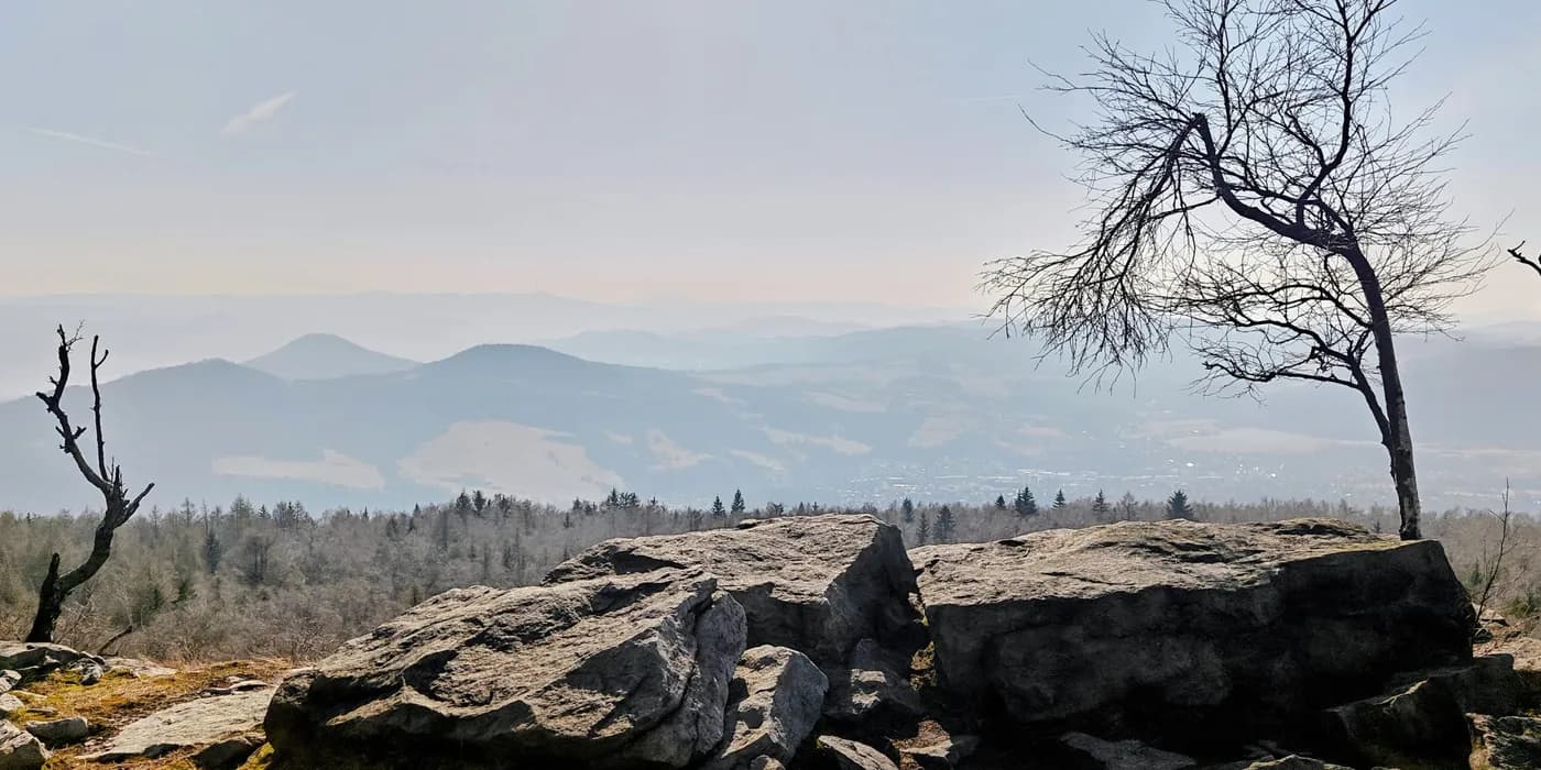
Děčínský Sněžník was the obvious place to begin. The lower approach from the west-side parking was easy, but higher up the mountain became much more distinctive: mossy boulders, sandstone, sparse woodland and a broad summit plateau rather than one neat top. The mapped summit point in the trees did not look especially decisive, and a nearby rock outcrop at the cliff edge looked at least as convincing. It was a useful introduction to a day on which “the summit” would not always mean one obvious object.
The plateau also carried more history than I expected from a short morning walk. Its stone lookout tower dates from 1864, and local sources record an early television reception experiment here during the 1936 Berlin Olympic broadcasts. Between the cliffs, the tower and the summit ambiguity, Děčínský Sněžník immediately felt larger than its 59-minute loop.
Chmelník: three summit bumps and a vanished lookout tower
Chmelník changed almost everything. Instead of a broad sandstone table mountain, I entered leaf-covered volcanic woodland and climbed onto a ridge with three plausible summit bumps. The central high point looked most convincing on the ground, while a western bump briefly produced the higher GPS reading despite appearing lower. A grave, a Czech picnic group, early hepatica and carved wooden figures made the summit area stranger still.
Its missing architecture added another layer. A 15 m lookout tower, restaurant and beer garden opened here in 1895; after storm damage, a major landslide in 1914 and a fire shortly afterwards, the summit complex disappeared for good. The modern hill is much quieter, but it still feels like a local recreation place that has been accumulating odd details for generations.
Lotarův vrch: a cairned summit and a wooden dragon
From Chmelník's western saddle I continued directly towards Lotarův vrch. After the argument over Chmelník's three bumps, Lotarův was almost suspiciously clear. The route crossed an open meadow, entered bare deciduous forest and reached a substantial stone cairn on the wooded crest. I then took a direct descent, using a short optional off-path shortcut before the forest opened into meadows and longer views towards Děčín.
Near the finish came the detail that made the hill impossible to confuse with any of the others: a carved wooden dragon beside the road. Lotarův did not need a complicated summit story. A meadow, a definite cairn, an open descent and a dragon were enough.
Javorský vrch: wide views and a summit barbecue
Javorský vrch then removed the trees altogether. From a small roadside pull-off west of Javory I climbed directly across grass to a broad summit pasture, with views opening almost immediately. Its 217 m of prominence was easier to understand from the landscape than from the number; the hill stood out clearly above fields, woodland patches and the surrounding volcanic country.
The summit itself was understated, but somebody had improved the facilities without consulting geography. A couple, their dog and a barbecue had occupied the top. After several hours of summit markers, GPS questions and forest tracks, finding somebody grilling food on an open 617 m pasture was an excellent reminder that local hills have lives completely unrelated to peakbagging lists.
Děčínský Sněžník: a summit puzzle on Czechia’s highest table mountain
The compact afternoon
Vysoký kámen: 21 minutes to a rocky summit above Povrly
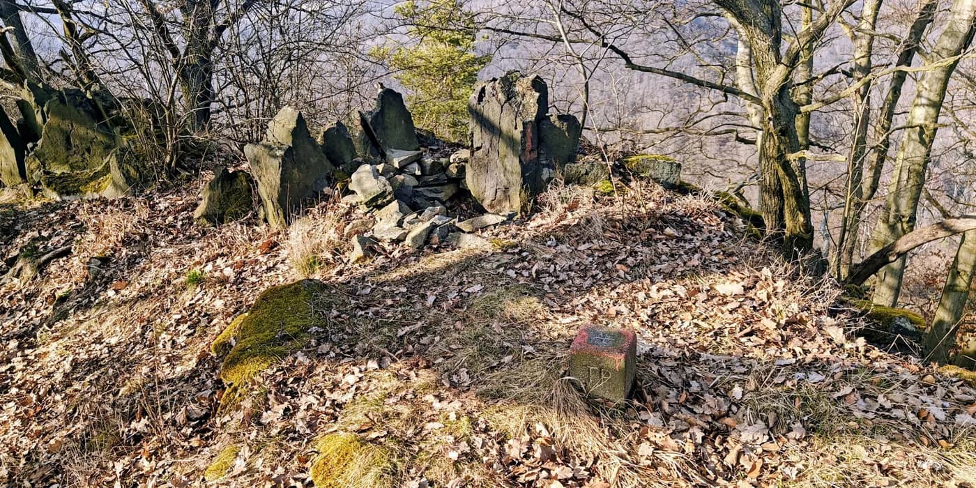
Vysoký kámen was the shortest and most literal stop. Thirteen minutes after leaving a small forest turnout I was on its rocky wooded crown; eight minutes later I was back. There was no panorama and very little route-finding, but the rock outcrops and small concrete summit marker gave the high point a clear physical identity. After the ambiguity of several earlier hills, that simplicity was welcome.
Radešín: the trig point beyond the power line
Radešín offered another summit problem, this time in miniature. A straight old access road led quickly uphill to a power-line corridor where an obvious earth mound looked temptingly summit-like. On the ground it appeared disturbed rather than natural. A few metres into the forest I found the small concrete trig point that made more sense as the summit reference. The best scenery was not on top at all, but lower down where late-afternoon light spread across fields and wooded ridges.
Střížovický vrch: the summit beyond the telecom tower
Střížovický vrch was the day's urban outlier. The large telecom tower marks the obvious named summit area, while my P100 target was the separate 346 m high point farther east along the broad ridge. The route was mostly paved and busy with walkers, runners, dogs, mountain bikes and other signs that this is part of Ústí nad Labem's everyday recreation landscape rather than an isolated hill.
A hot-air balloon drifting above the bare trees supplied the least expected view of the day. The actual high-point area near the pond and picnic ground was subtle, but that was precisely what made the visit interesting: the visible tower, the named summit and the point I had come to reach were not quite the same place.
Vaňovský vrch: a quiet final summit at dusk
By the time I reached Vaňovský vrch, the day had finally gone quiet. I started from the western roadside clearing near the Skály crossroads and followed a forest track towards the summit. I met no one. A few deer moving between the trees were the only company before I reached the broad wooded top, marked modestly by a low cairn, a small concrete block and a nearby clearing.
There was no dramatic final viewpoint and no need to manufacture one. With 235 m of prominence, Vaňovský vrch was the most prominent summit of the eight, but what made it the right ending was atmosphere rather than statistics: empty forest, fading light and a last quiet walk after a day of constant movement.
Vysoký kámen: 21 minutes to a rocky summit above Povrly
The day in numbers
| Peak | Altitude | Prominence | Isolation | Distance | Elevation gain | Time |
|---|---|---|---|---|---|---|
| Děčínský Sněžník | 724 m | 122 m | 23.5 km | 4.5 km | 137 m | 0h59 |
| Chmelník | 508 m | 134 m | 1.5 km | 3.1 km | 221 m | 1h00 |
| Lotarův vrch | 509 m | 125 m | 3.6 km | 4.0 km | 101 m | 0h55 |
| Javorský vrch | 617 m | 217 m | 6.7 km | 1.6 km | 123 m | 0h32 |
| Vysoký kámen | 494 m | 132 m | 4.9 km | 1.2 km | 119 m | 0h22 |
| Radešín | 550 m | 106 m | 5.5 km | 1.4 km | 70 m | 0h22 |
| Střížovický vrch | 346 m | 108 m | 4.6 km | 3.1 km | 29 m | 0h39 |
| Vaňovský vrch | 561 m | 235 m | 2.9 km | 1.8 km | 174 m | 0h32 |
| Walking total | 20.8 km | 974 m | 5h21 |
On paper this could have become a day of eight interchangeable short climbs. It did not. Děčínský Sněžník had sandstone cliffs and a summit question; Chmelník had three bumps and a vanished tower; Lotarův had its cairn and dragon; Javorský had open pasture and a barbecue; Vysoký kámen had a definite rocky crown; Radešín hid its trig point beyond a power-line mound; Střížovický mixed a telecom tower with city recreation; and Vaňovský finished everything with deer and dusk.
That variety was the real success of the trip. The individual mountains were modest, but the landscape kept changing. By the time the last light faded above the Elbe, the eight summits felt less like a checklist than a sequence of places that happened to fit neatly into one day.