Skip to content
Menu
p600.org
  • home
  • map
  • trips
  • about
p600.org

El Morrón de la Agujereada

hike | 2024-04-04

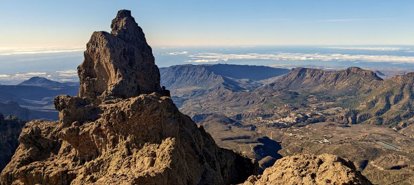
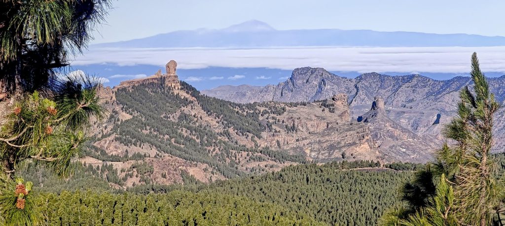
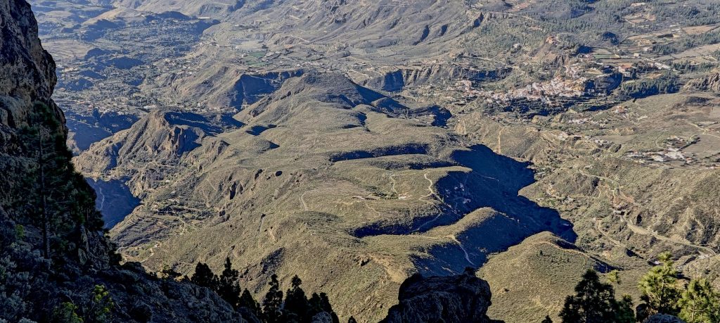
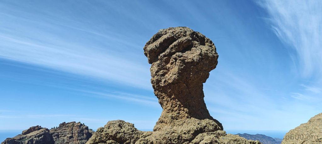
El Morrón de la Agujereada stands as the island’s highpoint—an ultra-prominent peak with nearly 100 km of isolation. It boasts an exposed climbing ‘trail’ that snakes its way to the true summit. This challenge is precisely why 99.99 percent of visitors park their cars, stop at the Pico de las Nieves (“touristic high point”) just a few meters off, and claim they’ve conquered Gran Canaria. Understandable, but as peakbaggers, we aim for the genuine summit.

Gran Canarians call these volcanic pinnacles “Morróns,” flaunting nature’s flair for dramatic architecture with Tenerife’s Pico de Teide towering in the background.

Waking up in the hotel, I check my messages—only Aron has written, expecting to meet at 8:30 am with a Google Maps link attached. I still have plenty of time. En route to the meeting point, I grab a cup of cappuccino and a warm croissant filled with ham and cheese. Mid-bite, I receive a message from John saying he’s landed at Gran Canaria Airport and met Aron. All is well, so I finish my breakfast and walk to the meeting point in the middle of the Telde city park. Deciding where to wait, I choose the gates, grand enough to be called the main entrance to the park.

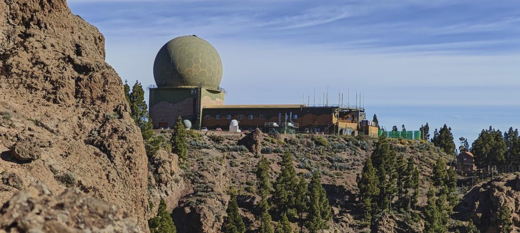
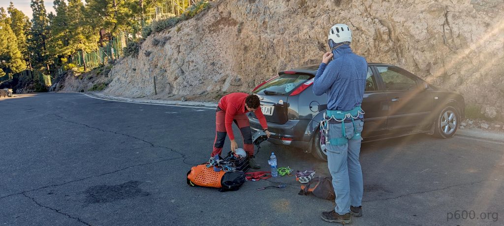
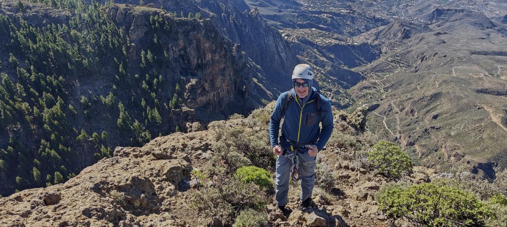
A few minutes later, I spot two figures emerging from one of the cars—Aron and John. For the next hour, we drive towards the summit, parking at the touristic summit parking area. There, Aron double-checks and prepares all the necessary gear. We don our harnesses and helmets, and in about 20 minutes, we start our short hike to the true summit.

The surrounding peaks stand impressively.
The landscape shines under the clear day.
The landscape bursts with green.
A military radar perches next to the peak, overseeing our climb preparations like a stern chaperone.
El Morrón de la Agujereada stands as the true highpoint, looking utterly inaccessible from this angle—nature’s version of ‘keep out’.
The first abseil is easy, not hard but exposed.
These few steps down are straightforward, not hard but definitely exposed.

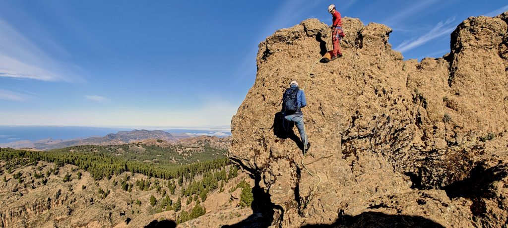
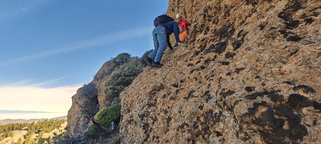
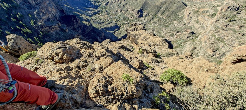
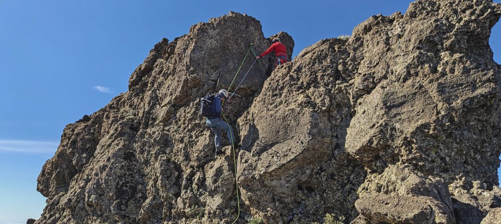
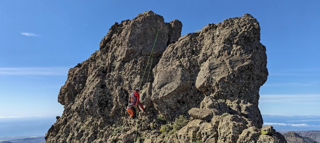
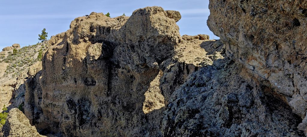
We descend a bit down the ridge, just a few meters. Then comes the first quick scramble down. It’s doable solo, but Aron thinks it’s smart to rope up. Probably a good call, considering the lovely view—straight down a hundred meters. Next, we stroll along the ledge, nothing too tricky, but definitely exposed. Requires a touch of focus. After that, we squeeze through a gap between two rocks. A few more meters on the ledge, then a simple scramble up, a couple more steps, another short stretch to scramble, and we’re on easy ground. Aron kept checking if we needed a hand, which we didn’t, but hey, nice gesture. Thanks.

It’s nature’s way of checking your fitness—squeeze between the rocks before you can continue.
Aron and John are scrambling up behind.
Aron is busy fixing ropes on the few-hundred-meter cliff, like a pro securing his office for the day.
John traverses the slope, which isn’t complicated but, once again, it’s exposed.
The last meters to the summit feature easy scrambling.

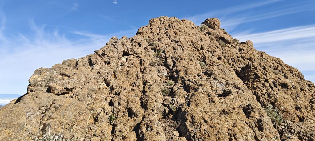
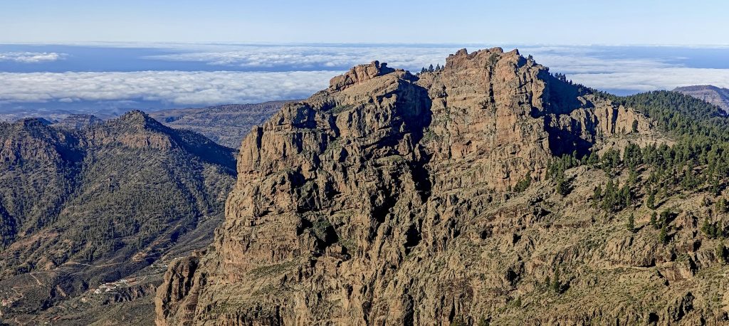
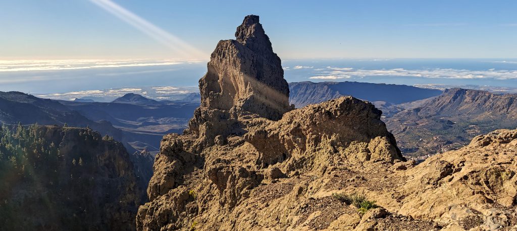
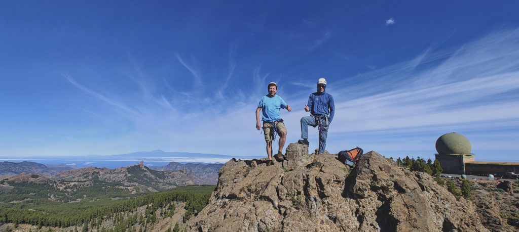
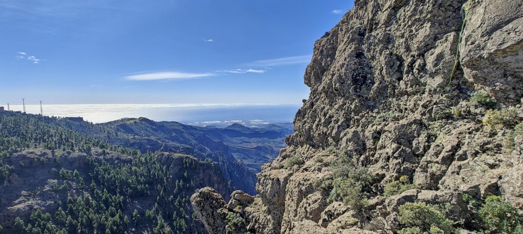
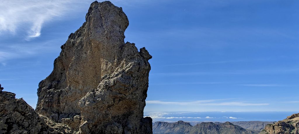
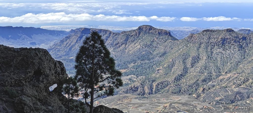
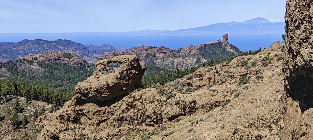
The true summit’s this tiny outcrop, clearly towering above everything else. There’s a logbook where we leave our mark. The views? Pretty much what we’ve been soaking in for the past hour, just now in full 360-degree glory. Snap a few selfies, and we’re all set to head back down.

John approaches the summit.
Aron captured John and me in a photo at the highpoint, documenting our peak moment.
Nice views with the ocean stretching out in the background, as if nature framed the perfect postcard for us.
Surrounding, lower peaks play a humble supporting role in this majestic landscape.
Then we tackled a short, few-meter abseil down, just a quick hop to the next challenge.

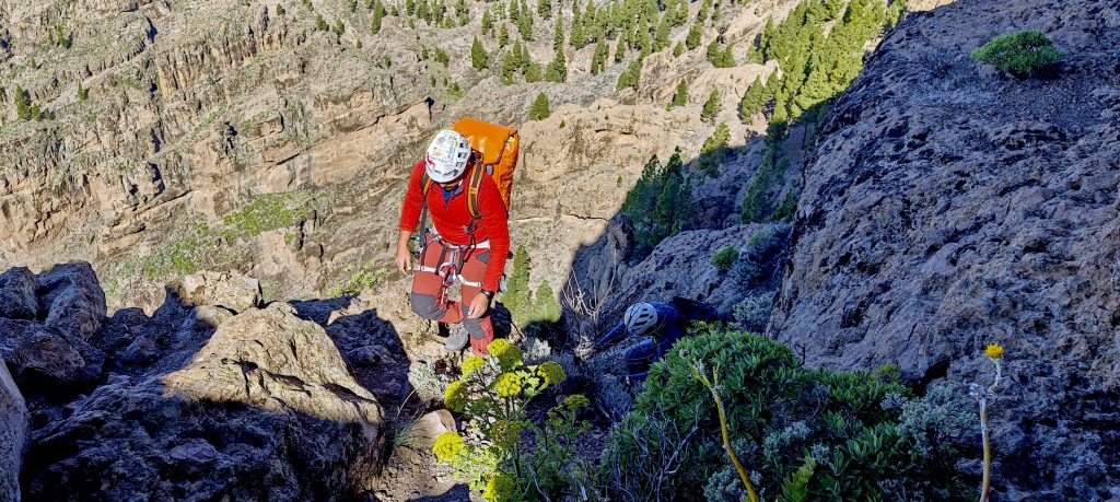
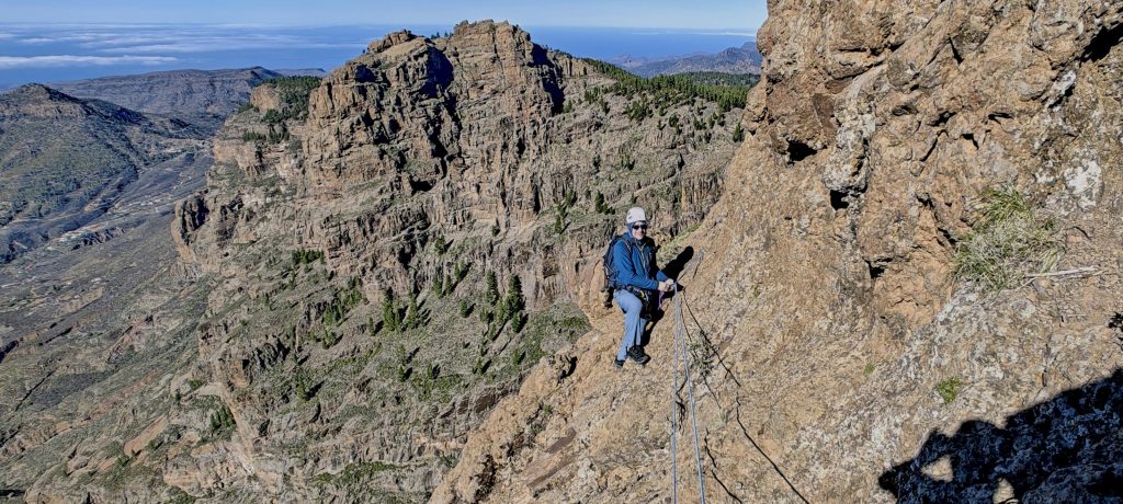
Heading down, we opt for a different route. Aron sets up the ropes, and we rappel down about five meters. Once we’re on a flat platform with a few more bolts, we take a breather. From here, we spot three more folks making their way up to the true peak. Seems like this mountain’s quite the hotspot. Nice. Smooth rappelling for the next 25 meters. Aron’s on point, double-checking every connection, making sure we’re comfy before we kick off. Nice touch. Once we’re down, we navigate an exposed ramp. Not too tough, got some handholds, but definitely requires attention.

Probably the longest abseil of this climb, a thrilling 25 meters down.
John finishes the abseil.

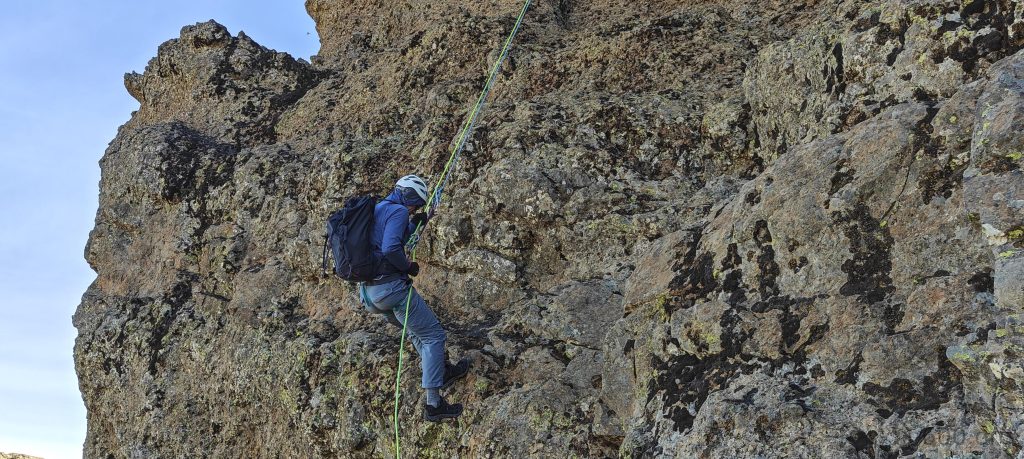
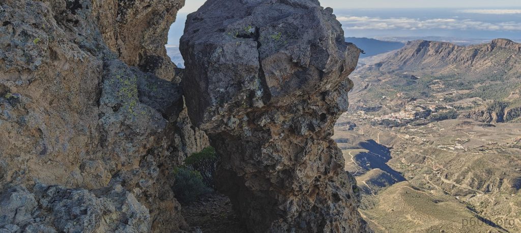
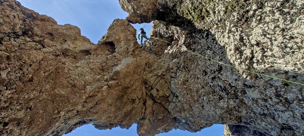
Aron suggests trying a different route, later dubbing it the most beautiful abseil in Gran Canaria. And you know what? I think he’s onto something. The 15-meter abseil is like hanging in mid-air, not many footholds around. You gotta maneuver through this “double arch” setup—start in one, then make your way to the other. It’s a stellar experience, even for a guy like me who conveniently forgot his gloves at home. Hands get a bit toasty, but definitely memorable. Once we’re at the bottom of the arch, there’s still another 5 meters to descend. Sure, we could probably manage without ropes, but why risk it when we’ve got ’em? Safety first, folks.

We’re approaching the arch, as if drawn by some grand, natural doorway inviting us in.
Abseiling through the double window arch was the highlight of the day, soaring through the air and stealing the show—of course, only after reaching that ultra-prominent summit.
John is abseiling through the arch, a graceful 15-meter descent.
Holes in the rocks are quite common here, like nature’s version of Swiss cheese.
One more Morrón on the way to the parking.

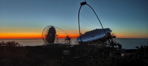
A short stroll back to the parking lot, where tourists in slippers eye us like we’re from another planet. Aron offers us some locally typical and tasty corn snacks, and John and I are fueled up for our next adventure: Roque de los Muchachos on La Palma island.

And here we have an all-in-one picture: a rock with a hole, a Morrón, the ocean, and Tenerife with Spain’s high point in the background—nature’s grand ensemble on display.

Knowing it would be an exposed climb, we wisely hired a mountain guide from Aron Perez de Umiaga Experience (WhatsApp: +34 646 396 746). Aron demonstrated professionalism and excellent local knowledge throughout the ascent. I’m delighted to have climbed with him and look forward to future encounters. Thanks!


El Morrón de la Agujereada1960 m altitude
1960 m prominence
96.69 km isolation
RangesMid-Atlantic Islands - North Atlantic Islands
Countries/regionsSpain - Islas Canarias
Distance0.30 km up0.40 km down
Elevation64 m gain64 m loss
Time
1h10 up
0h05 other
1h10 down
2h25 total
Trailhead1895 m altitude27.9620270, -15.5720000
RouteFrom the parking lot, the route ascends to the touristy high point before descending slightly along the ridge. A short scramble follows, aided by ropes, continuing along the ridge. Veering right from the summit, a ramp leads to the descent, with a few exposed sections but manageable. Squeezing through two rocks, another scramble ensues, with Aron providing rope protection at key spots. The final stretch involves an easy scramble to the summit plateau. On the descent, we opt for abseiling to the North. The first abseil spans approximately 5 meters, followed by a 25-meter abseil to the west. We could return via the same route to avoid further abseils, but Aron insists on showcasing the "most beautiful abseil" in Gran Canaria—an exhilarating 15-meter descent through a double window. Undeniably breathtaking. Finally, an easy walk along the trail leads back to the car park.
DifficultiesExposed scrambles are no joke, but ropes definitely make life easier, not to mention safer.
LinksGPX trail
  • Mid-Atlantic Islands 2024
  • « Montaña de las Palmas
  • Roque de los Muchachos »

Mountain Ranges

Anatolia
Central Anatolia
Pontic Mountains
Southeast Anatolia
Taurus Mountains
Western Anatolia
Andes
Puna de Atacama
Atlas Mountains
High Atlas
Northwestern Atlas
Central America Ranges
Costa Rica-Panama Ranges
Central Central America
East China
Taiwan
Eastern Europe Ranges
Southeast Baltic Plains
Iberian Peninsula
Cordillera Cantabrica
Castile Ranges
Portugal-Galicia
Pyrenees
Intermountain West
Great Basin Ranges
Korea-Amur Area
Taebaek Sanmae
Malay Archipelago
Java
Nusa Tengarra
Sulawesi
Sumatra
Mid-Atlantic Islands
North Atlantic Islands
Mongolia Ranges
Altai
Gobi Desert Ranges
Hangay Mountains
Northwest Europe
Great Britain
North France-West Rhine Area
Pacific Ranges
Cascade Range
Northwest U.S. Coast Ranges
Sierra Nevada
Central and Southern California Ranges
Philippines
Central Philippines
Luzon
Mindanao
Southeast Asia
Malay Peninsula
Southeast South America
Pampas
Sierras de Cordoba
Southern Africa
Malawi Highlands
West Africa Mountains
Bight of Benin
Cameroon Mountains
Guinea Highlands

Countries / regions

Algeria
Ain Guezzam
Ain Salah
Aïn Témouchent
El Bayadh
Ghardaïa
Oran
Ouargla
Saïda
Sidi Bel Abbès
Tamanrasset
Argentina
Catamarca
Ciudad Autónoma de Buenos Aires
Córdoba
Jujuy
Salta
Tucumán
Belgium
Brussels Capital Region
Flemish Region
Cameroon
Southwest
China
Taiwan
Costa Rica
Alajuela
Cartago
Guanacaste
Heredia
Limón
San José
Czechia
Prague
Denmark
Greenland
France
Hauts-de-France
Occitania
Germany
Berlin
Niedersachsen
Indonesia
Bali
Jambi
Jawa Tengah
Jawa Timur
Nusa Tenggara Barat
Sulawesi Tengah
Sulawesi Utara
Sumatera Barat
Lithuania
Vilnius County
Mongolia
Bayankhongor
Govi-Altai
Khovd
Omnogovi
Ovorkhangai
Ulan Bator
Zavkhan
Morocco
Béni Mellal-Khénifra
Drâa-Tafilalet
Fez-Meknes
Marrakesh-Safi
Souss-Massa
Tangier-Tetouan-Al Hoceima
Mozambique
Zambezia
Netherlands
Gelderland
Noord-Holland
Zeeland
Nicaragua
Chinandega
Managua
Masaya
Rivas
Philippines
Bicol Region (V)
Cagayan Valley (II)
Calabarzon (IV-A)
Central Luzon (III)
Cordillera Administrative Region
Davao Region
Metro Manila
Soccsksargen (XII)
Western Visayas (VI)
Poland
Greater Poland Voivodeship
Masovian Voivodeship
Portugal
Castelo Branco
Leiria
Lisbon
Madeira
Santarém
Qatar
Ad-Dawhah
São Tomé and Príncipe
São Tomé Province
Sierra Leone
Northern Province
Western Area
Singapore
South Korea
Gyeongsangnam-do
Seoul
Spain
Aragón
Asturias
Castilla-La Mancha
Castilla y León
Catalonia
Islas Canarias
Switzerland
Zürich
Turkey
Antalya
Bitlis
Erzincan
Hakkâri
Igdir
Isparta
Kahraman Maras
Muğla
United Kingdom
England
Scotland
United States
California
Delaware
Florida
Maryland
Nevada
New Jersey
New York
Pennsylvania
South Carolina
Utah

TRIPS

2024
Southern Africa 2024
Mid-Atlantic Islands 2024
North America 2024
Anatolia 2024
Korea-Amur Area 2024
East China 2024
2023
Mongolia Ranges 2023
Philippines 2023
West Africa III 2023
West Africa II 2023
Iberian Peninsula 2023
West Africa 2023
Central America 2023
2022
Andes 2022
Northwest Europe 2022
Malay Archipelago III 2022
Malay Archipelago II 2022
Anatolia Mountains 2022
Iberian Peninsula 2022
Atlas Mountains 2022
North France-West Rhine Area 2022

archaeology (3) climb (157) food (2) hike (155) p30 (17) p50 (4) p100 (24) p300 (12) p600 (17) p1000 (11) p1500 (76) ribu (10) sight (46) summary (16) trig (44) ultra (76)

1 591 km walked, 121 298 m climbed

©2025 p600.org | WordPress Theme by Superbthemes.com