Skip to content
Menu
p600.org
  • home
  • map
  • trips
  • about
p600.org

Pico do Arieiro

hike | 2024-04-07

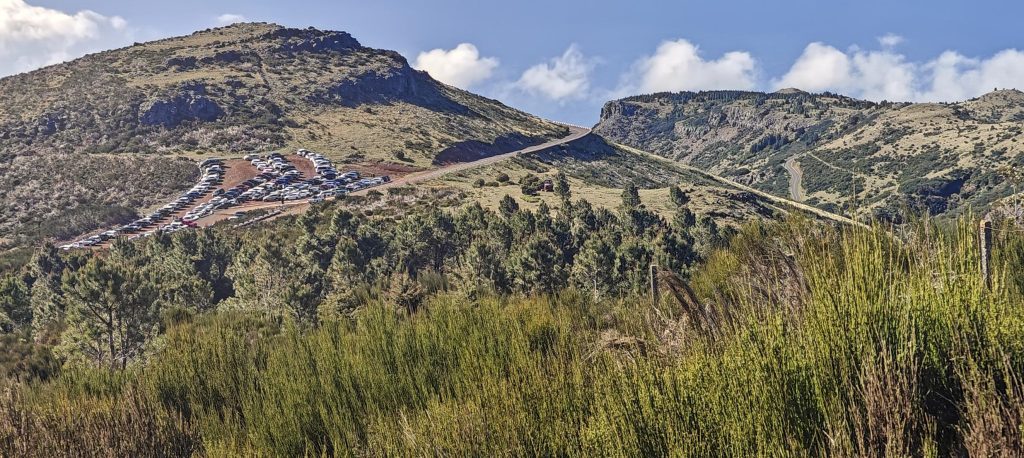
Expecting a speedy drive to the top, we hit a roadblock three kilometers out due to police intervention. We found ourselves in a bustling parking lot nestled between two hills, filling rapidly. As newcomers circled in search of spots, I changed shoes and swiftly moved ahead of the pack.

The parking lot sprawls across the saddle.
Pico do Arieiro is home to a radar installation, but thankfully the summit’s highpoint is a little distance away.
Pico Ruivo stands proudly in all its beauty.
The Pico Ruivo east ridge looms in the background.
The steep green slopes seem to plunge downward.
Plethora of captivating peaks awaiting exploration.

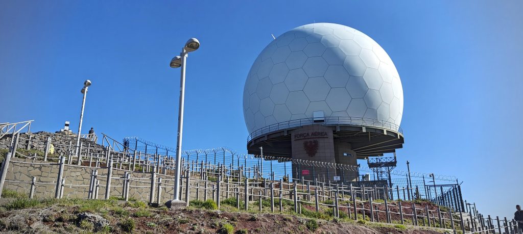
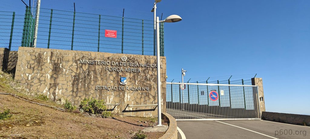
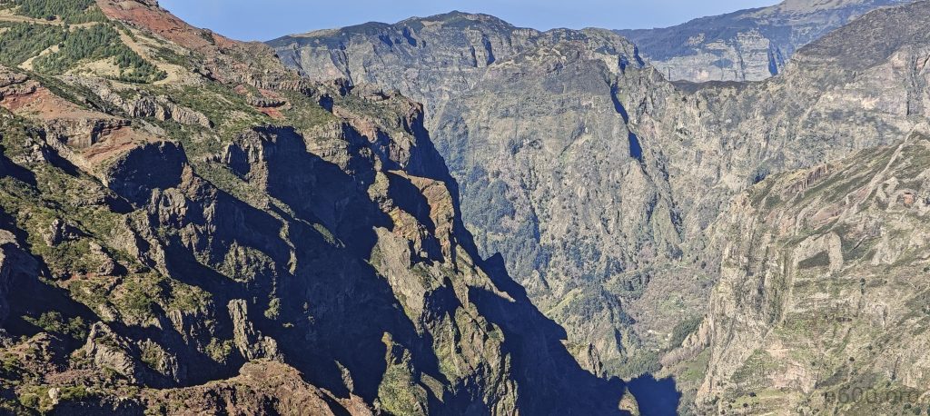
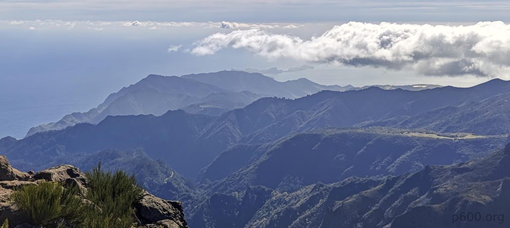
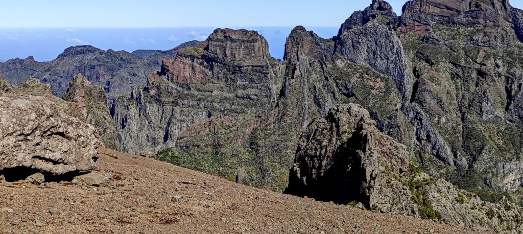
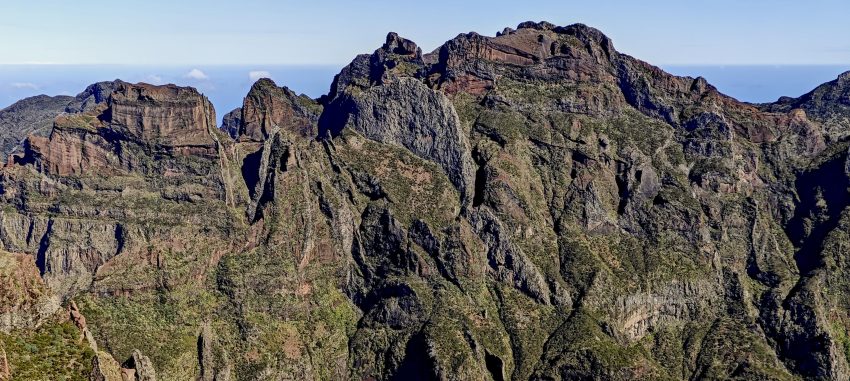
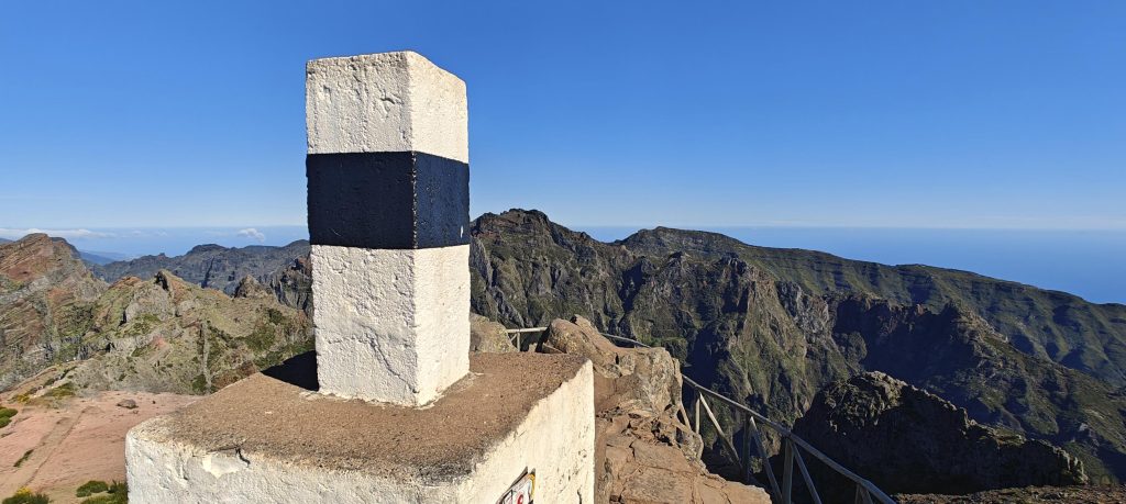
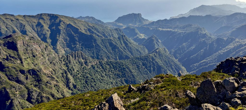
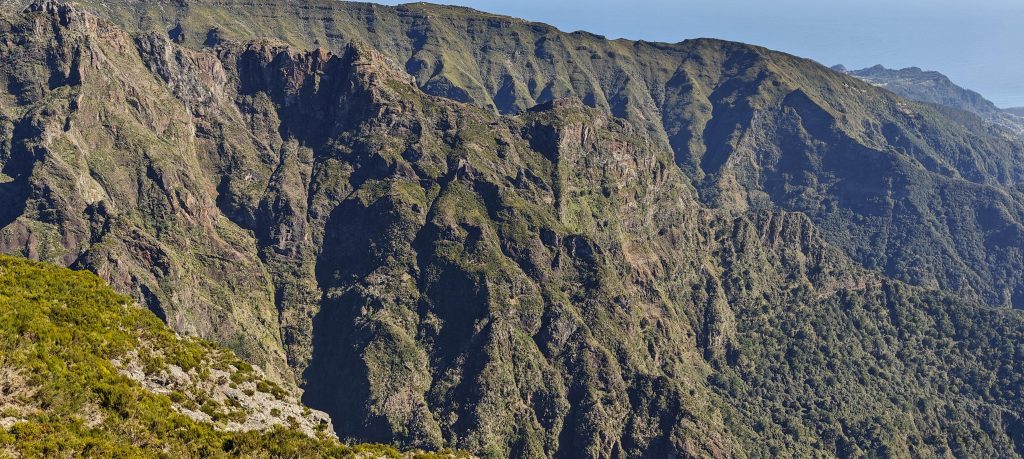
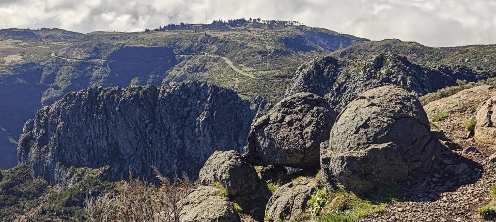
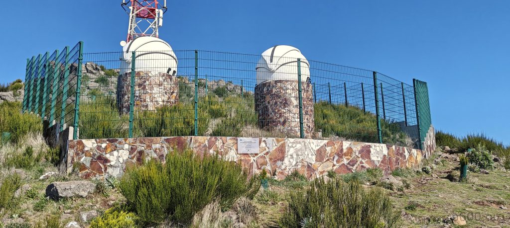
As I climbed up to the radar balloon, I reached a view platform with a standard trig pillar. It was a sunny day, offering stunning views of all the peaks I had seen yesterday from the north during the Pico Ruivo hike.

The summit is marked by a trig pillar.
The Ribeira das Lajes begins its journey here.
The ridge is sharp and dramatic.
Penha d’Águia stands tall and sharp, daring you to climb it later today—because why not?
Pico Ruivo
Several sharp, green valleys cut their way toward the ocean, creating a stunning geometric landscape that would make even a topographer jealous.

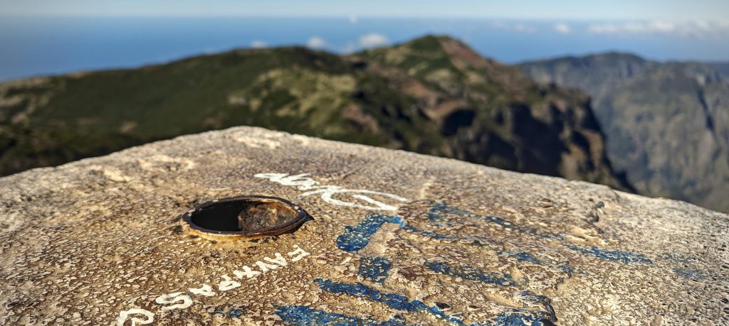
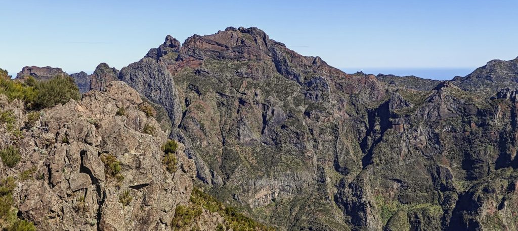
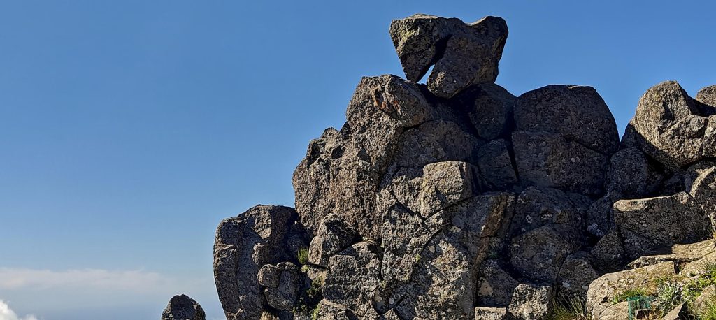
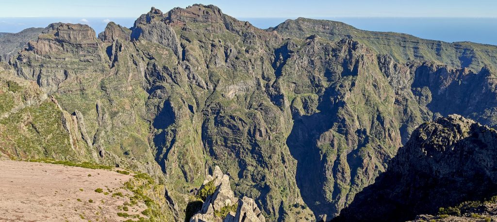
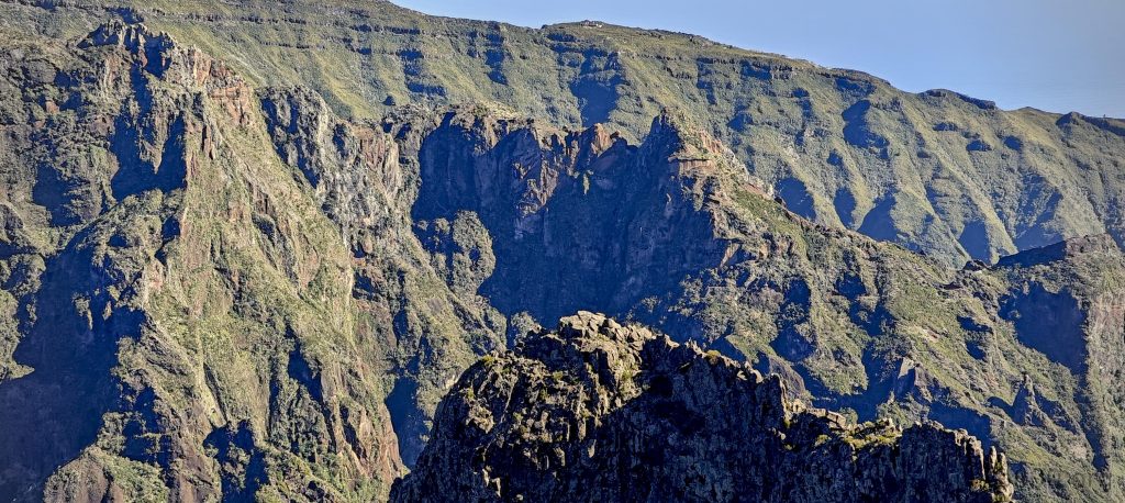
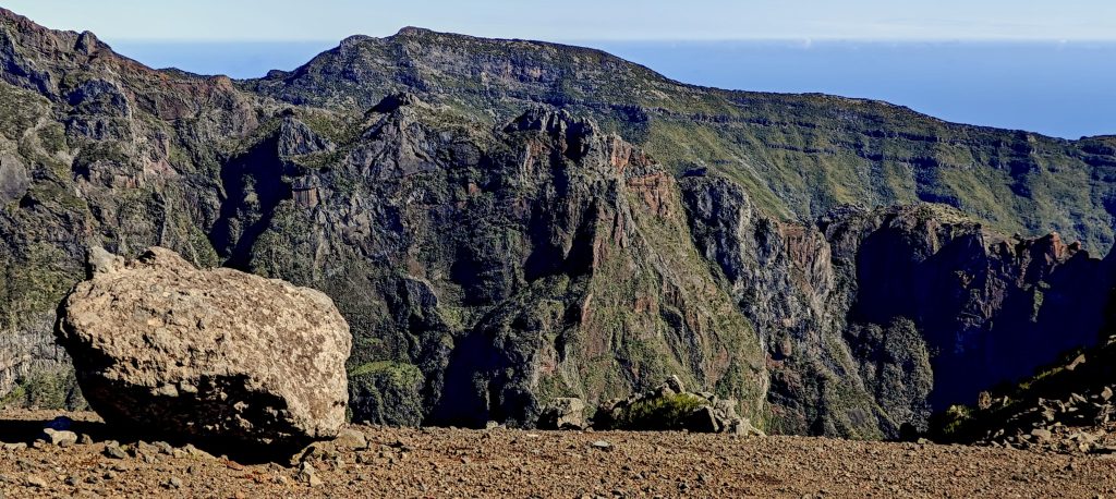
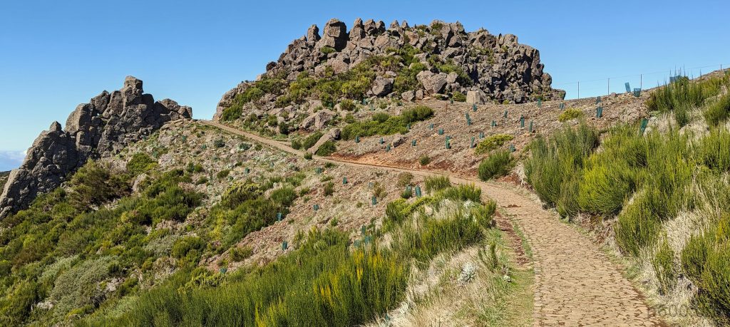
Then, I noticed a pile of rocks to the east. Although it seemed to be a similar height, without a hand level, it was hard to be certain. Upon closer inspection, I spotted a few footprints indicating people had climbed it before. However, with so many others enjoying the area, I hesitated to step over the fence and join them, fearing it might be seen as vandalism. So, I decided to leave it be, hoping it was slightly lower. If anyone discovers it’s higher, I’d be keen to know, as I’d be interested in repeating the hike.

The point is probably lower in elevation, but it could still be the highpoint.
Observação Ótica do Pico do Areeiro.

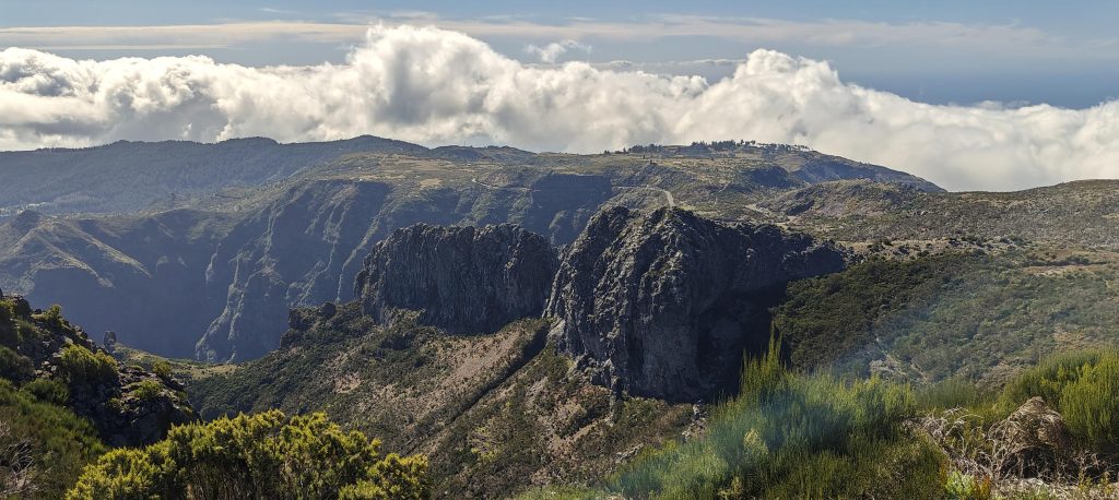
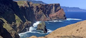
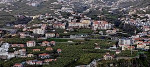
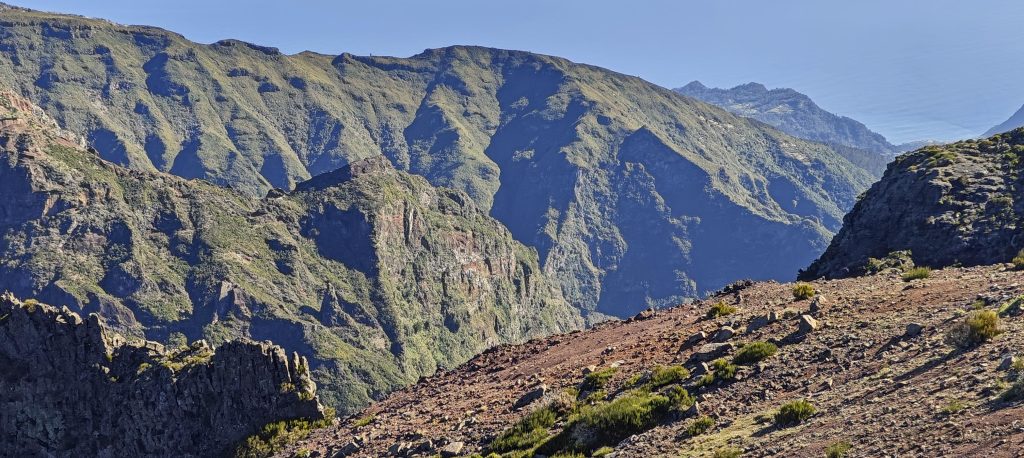
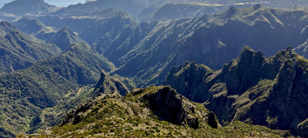
The Miradouro do Juncal offered a lovely view of the north valleys, making the detour of a few hundred meters well worth it. On the return journey, I chose a less crowded trail parallel to the overcrowded paved road. Now, I’m heading towards the easternmost tourist spot in Madeira, Pico do Furado, located on the Ponta de São Lourenço peninsula.

Ponta de São Lourenço’s peninsula is visible in the distance.
Pico das Torres, standing at 1851 meters, holds the title of Madeira’s second-highest peak.
The rock formations here are quite interesting.

Pico do Arieiro1818 m altitude
248 m prominence
1.55 km isolation
RangesMid-Atlantic Islands - North Atlantic Islands
Countries/regionsPortugal - Madeira
Distance0.90 km up1.60 km down
Elevation111 m gain111 m loss
Time
0h15 up
0h05 other
0h25 down
0h45 total
Trailhead1707 m altitude32.7304160, -16.9268050
RouteA crowded parking lot frames the starting point of a gradual trail leading to the summit, while a detour to a viewpoint and a less congested parallel trail offer a refreshing route back.
LinksGPX trail
  • Mid-Atlantic Islands 2024
  • « Pico da Torre
  • Pico do Furado »

Mountain Ranges

Anatolia
Central Anatolia
Pontic Mountains
Southeast Anatolia
Taurus Mountains
Western Anatolia
Andes
Puna de Atacama
Atlas Mountains
High Atlas
Northwestern Atlas
Central America Ranges
Costa Rica-Panama Ranges
Central Central America
East China
Taiwan
Eastern Europe Ranges
Southeast Baltic Plains
Iberian Peninsula
Cordillera Cantabrica
Castile Ranges
Portugal-Galicia
Pyrenees
Intermountain West
Great Basin Ranges
Korea-Amur Area
Taebaek Sanmae
Malay Archipelago
Java
Nusa Tengarra
Sulawesi
Sumatra
Mid-Atlantic Islands
North Atlantic Islands
Mongolia Ranges
Altai
Gobi Desert Ranges
Hangay Mountains
Northwest Europe
Great Britain
North France-West Rhine Area
Pacific Ranges
Cascade Range
Northwest U.S. Coast Ranges
Sierra Nevada
Central and Southern California Ranges
Philippines
Central Philippines
Luzon
Mindanao
Southeast Asia
Malay Peninsula
Southeast South America
Pampas
Sierras de Cordoba
Southern Africa
Malawi Highlands
West Africa Mountains
Bight of Benin
Cameroon Mountains
Guinea Highlands

Countries / regions

Algeria
Ain Guezzam
Ain Salah
Aïn Témouchent
El Bayadh
Ghardaïa
Oran
Ouargla
Saïda
Sidi Bel Abbès
Tamanrasset
Argentina
Catamarca
Ciudad Autónoma de Buenos Aires
Córdoba
Jujuy
Salta
Tucumán
Belgium
Brussels Capital Region
Flemish Region
Cameroon
Southwest
China
Taiwan
Costa Rica
Alajuela
Cartago
Guanacaste
Heredia
Limón
San José
Czechia
Prague
Denmark
Greenland
France
Hauts-de-France
Occitania
Germany
Berlin
Niedersachsen
Indonesia
Bali
Jambi
Jawa Tengah
Jawa Timur
Nusa Tenggara Barat
Sulawesi Tengah
Sulawesi Utara
Sumatera Barat
Lithuania
Vilnius County
Mongolia
Bayankhongor
Govi-Altai
Khovd
Omnogovi
Ovorkhangai
Ulan Bator
Zavkhan
Morocco
Béni Mellal-Khénifra
Drâa-Tafilalet
Fez-Meknes
Marrakesh-Safi
Souss-Massa
Tangier-Tetouan-Al Hoceima
Mozambique
Zambezia
Netherlands
Gelderland
Noord-Holland
Zeeland
Nicaragua
Chinandega
Managua
Masaya
Rivas
Philippines
Bicol Region (V)
Cagayan Valley (II)
Calabarzon (IV-A)
Central Luzon (III)
Cordillera Administrative Region
Davao Region
Metro Manila
Soccsksargen (XII)
Western Visayas (VI)
Poland
Greater Poland Voivodeship
Masovian Voivodeship
Portugal
Castelo Branco
Leiria
Lisbon
Madeira
Santarém
Qatar
Ad-Dawhah
São Tomé and Príncipe
São Tomé Province
Sierra Leone
Northern Province
Western Area
Singapore
South Korea
Gyeongsangnam-do
Seoul
Spain
Aragón
Asturias
Castilla-La Mancha
Castilla y León
Catalonia
Islas Canarias
Switzerland
Zürich
Turkey
Antalya
Bitlis
Erzincan
Hakkâri
Igdir
Isparta
Kahraman Maras
Muğla
United Kingdom
England
Scotland
United States
California
Delaware
Florida
Maryland
Nevada
New Jersey
New York
Pennsylvania
South Carolina
Utah

TRIPS

2024
Southern Africa 2024
Mid-Atlantic Islands 2024
North America 2024
Anatolia 2024
Korea-Amur Area 2024
East China 2024
2023
Mongolia Ranges 2023
Philippines 2023
West Africa III 2023
West Africa II 2023
Iberian Peninsula 2023
West Africa 2023
Central America 2023
2022
Andes 2022
Northwest Europe 2022
Malay Archipelago III 2022
Malay Archipelago II 2022
Anatolia Mountains 2022
Iberian Peninsula 2022
Atlas Mountains 2022
North France-West Rhine Area 2022

archaeology (3) climb (157) food (2) hike (155) p30 (17) p50 (4) p100 (24) p300 (12) p600 (17) p1000 (11) p1500 (76) ribu (10) sight (46) summary (16) trig (44) ultra (76)

1 591 km walked, 121 298 m climbed

©2025 p600.org | WordPress Theme by Superbthemes.com