Skip to content
Menu
p600.org
  • home
  • map
  • trips
  • about
p600.org

Kemmelberg

hike | 2022-04-15
154 m altitude, 92 m prominence, 23.36 km isolation

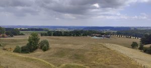
The Kemmelberg is a hill near the village of Kemmel in the Belgian province of West Flanders. It is the highest point in the province. About 2,500 years ago, a Celtic community of the Hallstatt culture settled on the Kemmelberg and had trade relations with the Romans.

Monument to the French Soldiers or “The Angel”

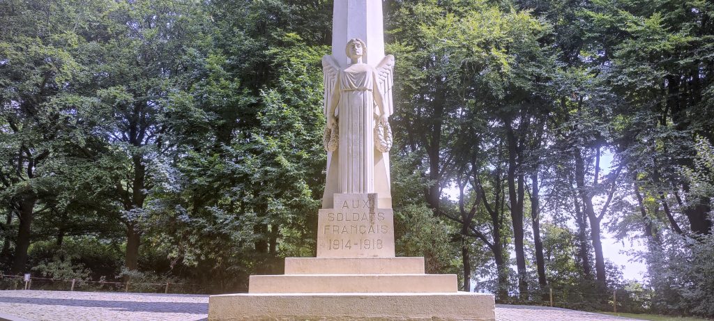
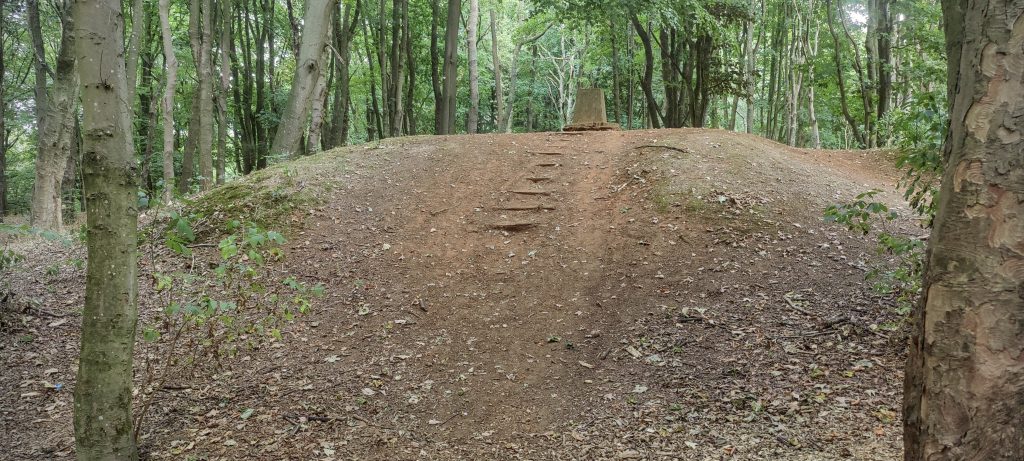
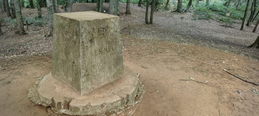
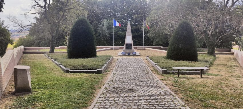
I left my car at the monument to the French soldiers. From there I could drive all the way to the top of the hill, but I thought it would be nice to walk a few hundred metres at a leisurely pace, admiring another monument along the way. At the top, I found a small hill with a concrete trigonometric pillar.

Nice hill, but inner voice says it is artificial..maybe it is wrong this time.
Concrete trig pillar marks the summit
Views from top

Kemmelberg 154 m altitude
92 m prominence
23.36 km isolation
Ranges Northwest Europe - North France-West Rhine Area
Countries/regions
Belgium - Flemish Region
Distance 0.40 km up 0.40 km down
Elevation 19 m gain 19 m loss
Time
0h06 up
0h01 other
0h06 down
0h13 total
Trailhead 135 m altitude 50.7788610, 2.8081940
Route

Walked along the tarmac road

Links GPX trail
  • « Hotondberg
  • Lille »

Mountain Ranges

Anatolia
Taurus Mountains
Western Anatolia
Andes
Puna de Atacama
Atlas Mountains
High Atlas
Northwestern Atlas
Central America Ranges
Costa Rica-Panama Ranges
Central Central America
Eastern Europe Ranges
Southeast Baltic Plains
Iberian Peninsula
Cordillera Cantabrica
Castile Ranges
Portugal-Galicia
Pyrenees
Malay Archipelago
Java
Nusa Tengarra
Sulawesi
Sumatra
Mongolia Ranges
Altai
Gobi Desert Ranges
Northwest Europe
Great Britain
North France-West Rhine Area
Philippines
Central Philippines
Luzon
Mindanao
Southeast Asia
Malay Peninsula
Southeast South America
Pampas
Sierras de Cordoba
West Africa Mountains
Bight of Benin
Cameroon Mountains
Guinea Highlands

Countries / regions

Algeria
Ain Guezzam
Ain Salah
Aïn Témouchent
El Bayadh
Ghardaïa
Oran
Ouargla
Saïda
Sidi Bel Abbès
Tamanrasset
Argentina
Catamarca
Ciudad Autónoma de Buenos Aires
Córdoba
Jujuy
Salta
Tucumán
Belgium
Brussels Capital Region
Flemish Region
Cameroon
Southwest
Costa Rica
Alajuela
Cartago
Guanacaste
Heredia
Limón
San José
Czechia
Prague
Denmark
Greenland
France
Hauts-de-France
Germany
Berlin
Niedersachsen
Indonesia
Bali
Jambi
Jawa Tengah
Jawa Timur
Nusa Tenggara Barat
Sulawesi Tengah
Sulawesi Utara
Sumatera Barat
Lithuania
Vilnius County
Mongolia
Bayankhongor
Omnogovi
Ovorkhangai
Ulan Bator
Morocco
Béni Mellal-Khénifra
Drâa-Tafilalet
Fez-Meknes
Marrakesh-Safi
Souss-Massa
Tangier-Tetouan-Al Hoceima
Netherlands
Gelderland
Noord-Holland
Zeeland
Nicaragua
Chinandega
Managua
Masaya
Rivas
Philippines
Bicol Region (V)
Cagayan Valley (II)
Calabarzon (IV-A)
Central Luzon (III)
Cordillera Administrative Region
Davao Region
Metro Manila
Soccsksargen (XII)
Western Visayas (VI)
Poland
Greater Poland Voivodeship
Masovian Voivodeship
Portugal
Castelo Branco
Leiria
Lisbon
Santarém
Qatar
Ad-Dawhah
São Tomé and Príncipe
São Tomé Province
Sierra Leone
Northern Province
Western Area
Singapore
Spain
Aragón
Asturias
Castilla-La Mancha
Castilla y León
Switzerland
Zürich
Turkey
Antalya
Isparta
Muğla
United Kingdom
England
Scotland
United States
Delaware
Florida
Maryland
New Jersey
New York
South Carolina
Pennsylvania

TRIPS

2023
Mongolia Ranges 2023
Philippines 2023
West Africa III 2023
West Africa II 2023
Iberian Peninsula 2023
West Africa 2023
Central America 2023
2022
Andes 2022
Northwest Europe 2022
Malay Archipelago III 2022
Malay Archipelago II 2022
Anatolia Mountains 2022
Iberian Peninsula 2022
Atlas Mountains 2022
North France-West Rhine Area 2022

archaeology (3) climb (96) food (2) hike (95) p30 (9) p100 (14) p300 (10) p600 (14) p1000 (6) p1500 (46) ribu (5) sight (41) summary (13) ultra (46)

1 118 km walked, 84 987 m climbed

©2023 p600.org | WordPress Theme by Superbthemes.com