Skip to content
Menu
p600.org
  • home
  • map
  • trips
  • about
p600.org

Cerro Castillejos

hike | 2022-12-09
2490 m altitude, 1515 m prominence, 102.73 km isolation

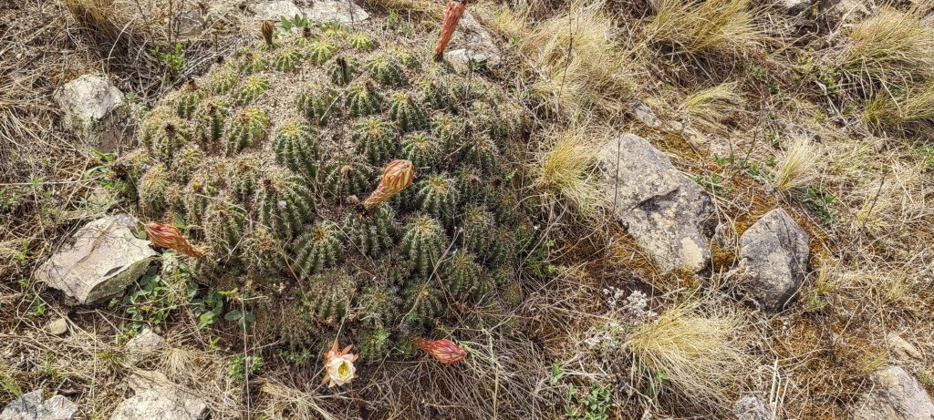
After we drive ten or fifteen kilometres along a private road, we stop at a farm, Franco talks to the owner’s brother, and we pitch our tents in the yard. The most spectacular sight of the evening is the huge insects flying around and glowing bright green. The light is so strong that you can see them from half a hundred metres away.

Sunrise
Views from the ridge

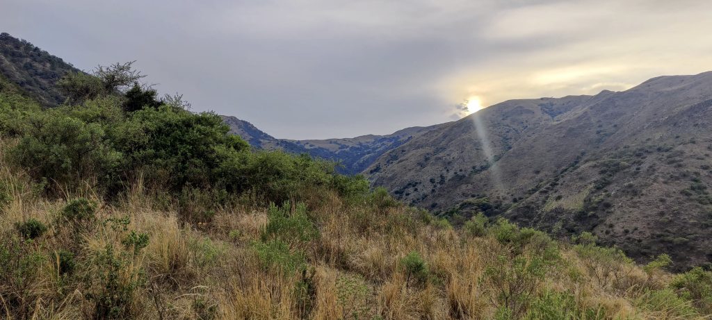
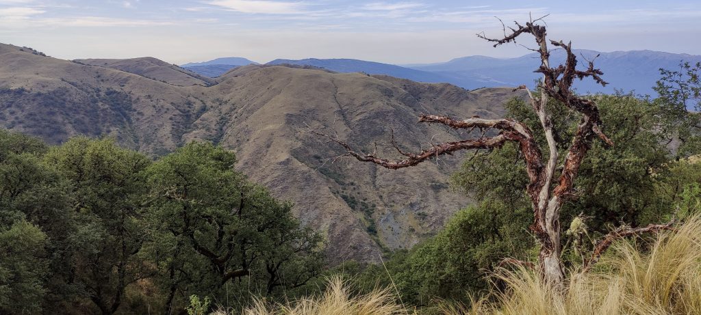
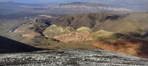
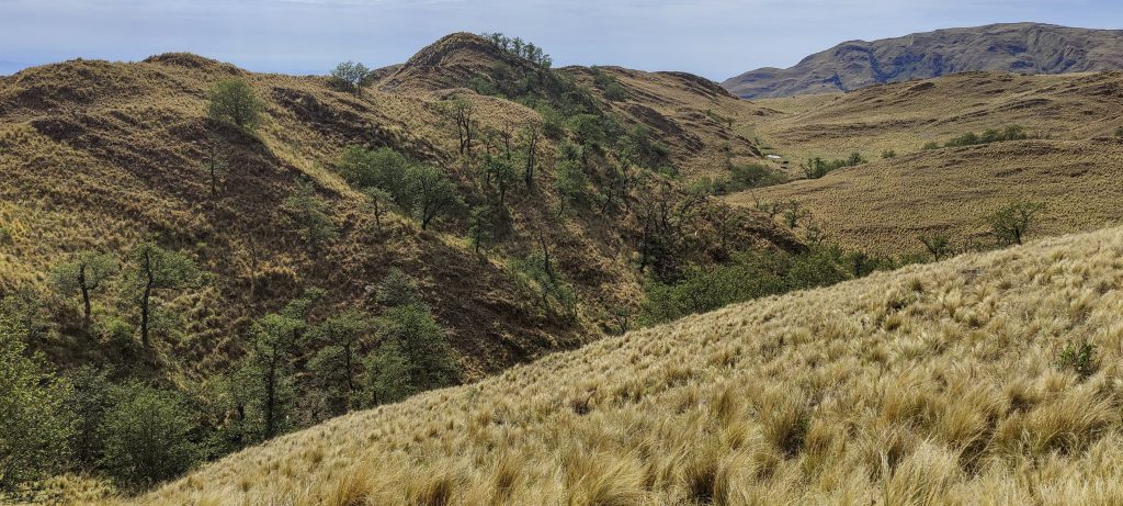
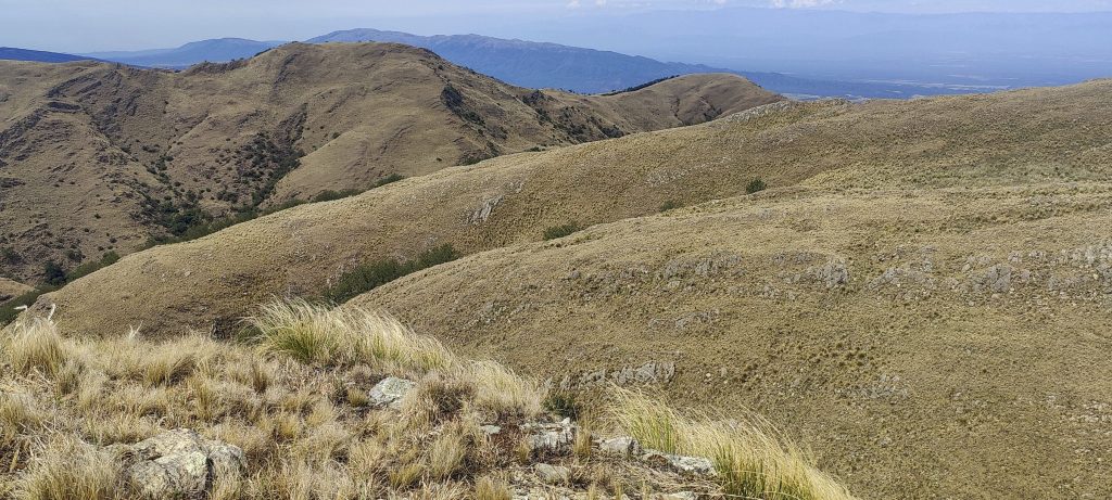
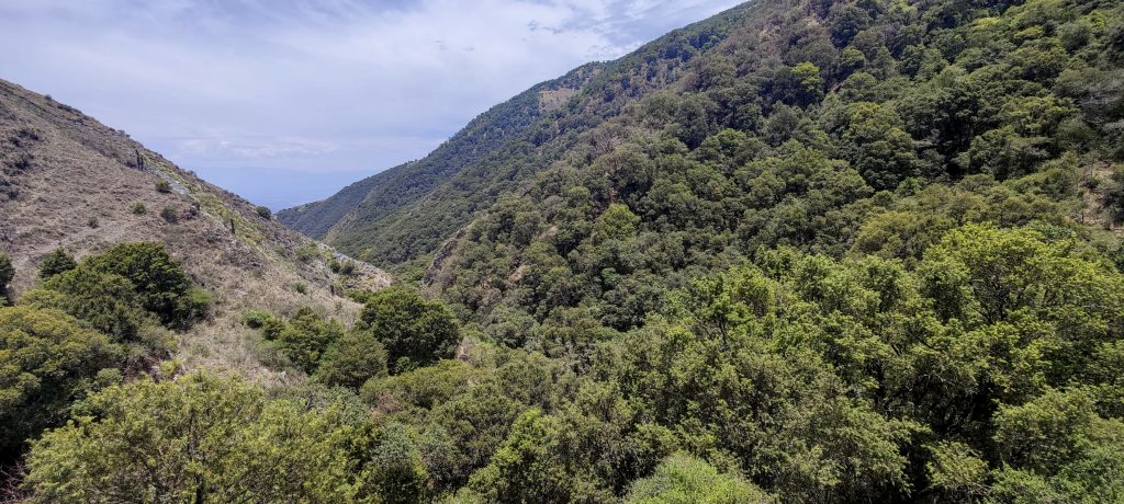
To avoid the heat of the day and possible afternoon rain, get up early, before sunrise. A car can cover about one and a half extra kilometers, so we do. Further on, there is a path along the stream. At some point, we have to leave the stream and climb up the slope to the ridge. There is a path, but it is heavily overgrown with bushes. As we climb up to the ridge, the trees and bushes are reduced, and the trail improves.

Rob, Rockinstraw and Franco climbing the slope
Views as you climb to the top
Tarantula (Theraphosidae). Photo by Franco
Watching us closely
Meet Alejandro, a gentleman from Argentina

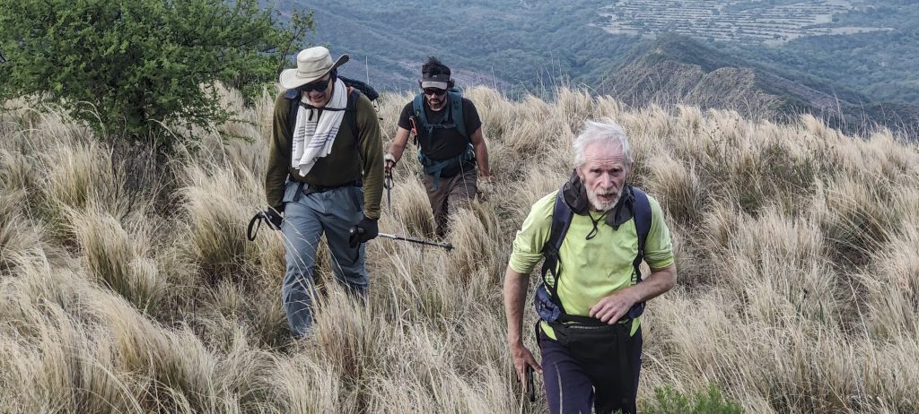
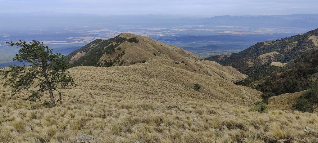
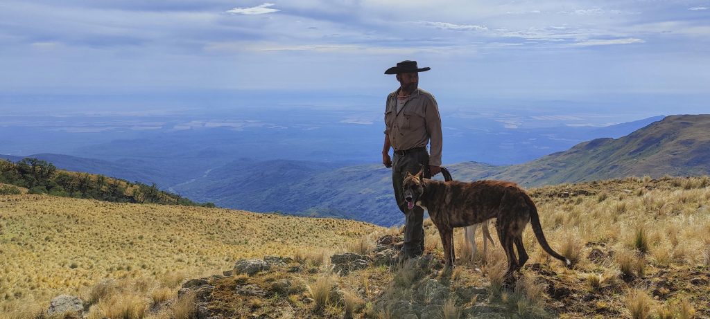
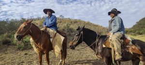
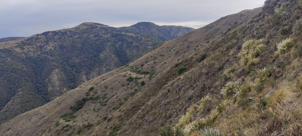
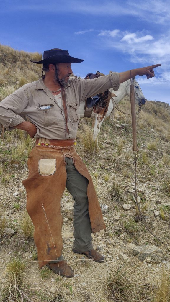
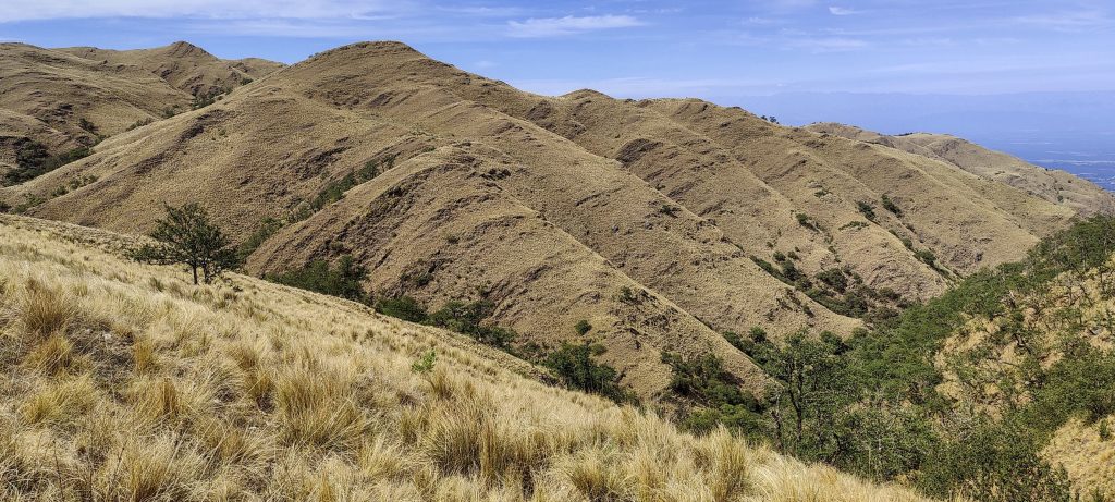
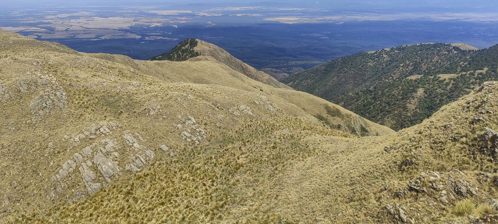
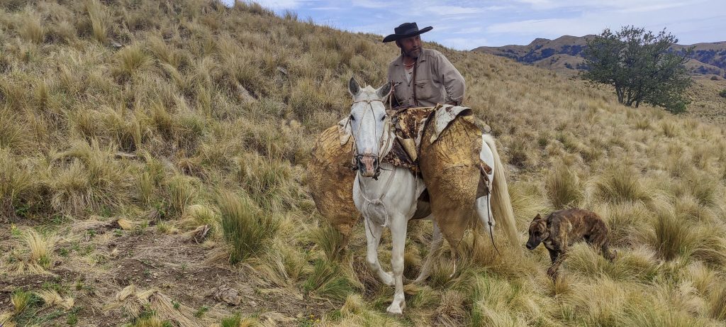
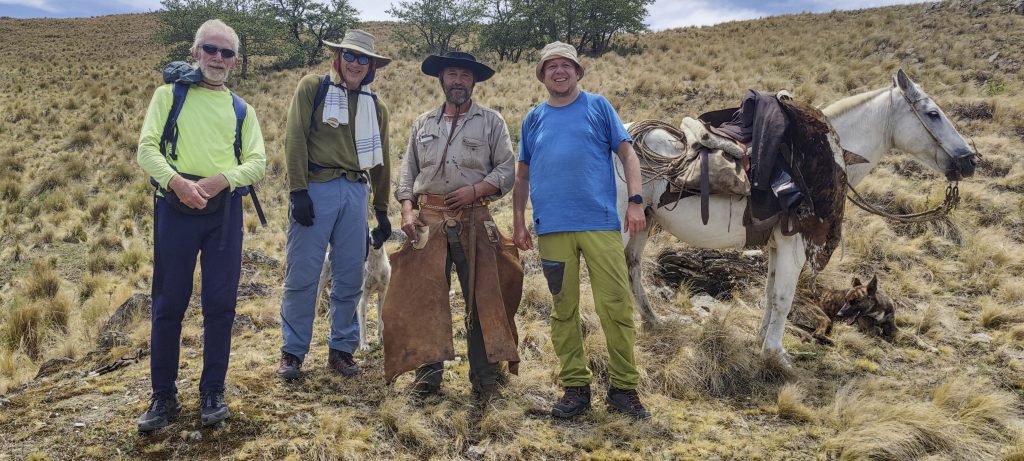
We continue along the mountain’s crest, still about four or five kilometres from the summit, and ascend to a slightly lower, remote peak. We will have to descend some 100 metres, but there is no other option. We meet Alejandro, who is escorted by a couple of dogs and wears a fancy cowboy outfit. He shows us how to get to the top more easily. I give him some sweets, and he puts the whole package in his pocket. It’s a good thing I have one more…

On the way, towards the top
Alejandro showing the trails and the highest peak
??
Cacti, like everywhere

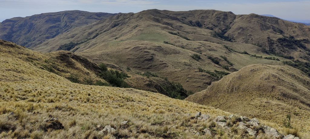
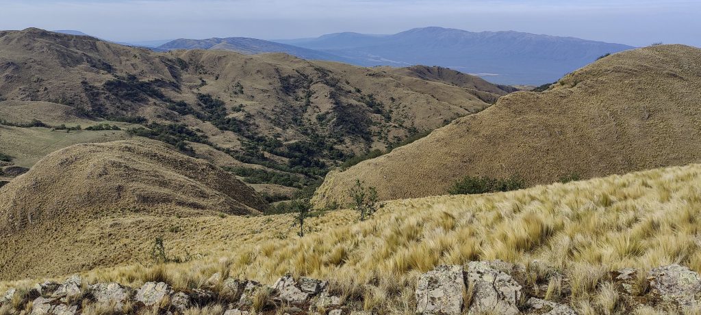
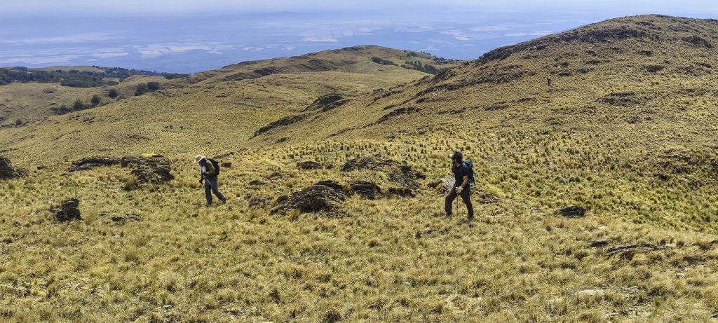
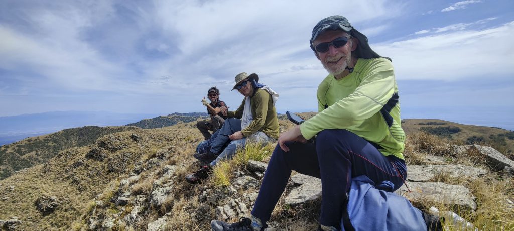
We follow the paths shown by Alejandro to the summit. Rob measures with the handlevel and finds that the next peak, a few hundred metres away, is higher. That’s where we all go. We take our time and enjoy the views, perhaps spending 20 or 30 minutes on top. 

Views from the top
Rockinstraw and Franco are on their way to the summit
Downward view
Franco (left), Rockinstraw (middle) and Rob (right) at the true summit
View from the summit

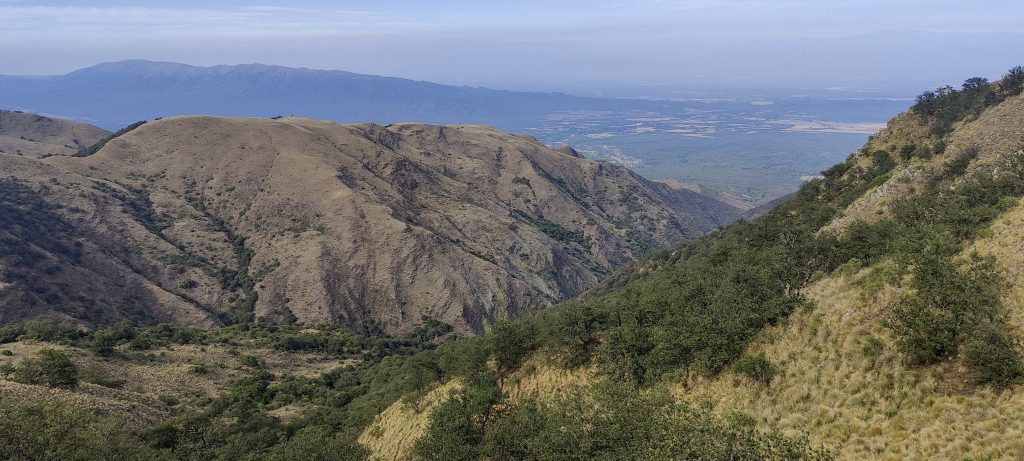
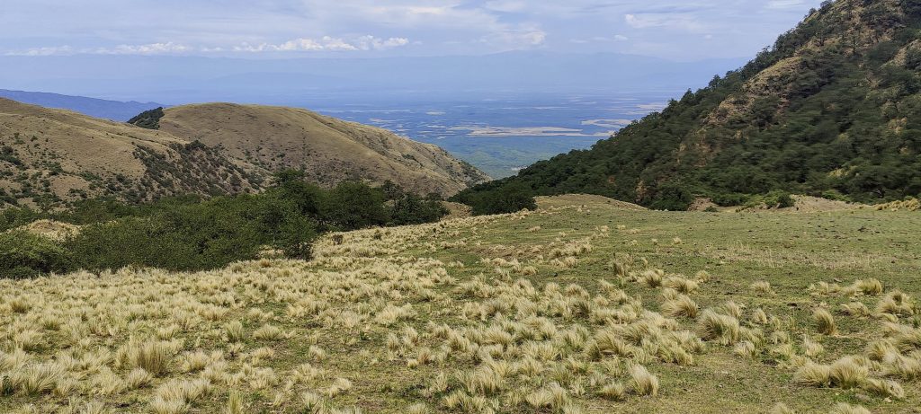
We take the same path back. Alejandro is waiting for us again on the way. This time he meets us on horseback with a hunting rifle bullet in his belt. I have seen something similar in Western films. Alejandro advises us to go back by the valley, not by the ridge. and this is very good advice. The valley path is not overgrown with bushes and runs alongside a nice, clear stream. Most of it is in the forest, so the sun and the heat don’t bother us too much. The packet of sweets paid off.

On the descent
A bull was waiting for us at the false summit
Alejandro, his horse, and a dog
Goodbye photo. Left to right: Rob, Rockinstraw, Alejandro, and me

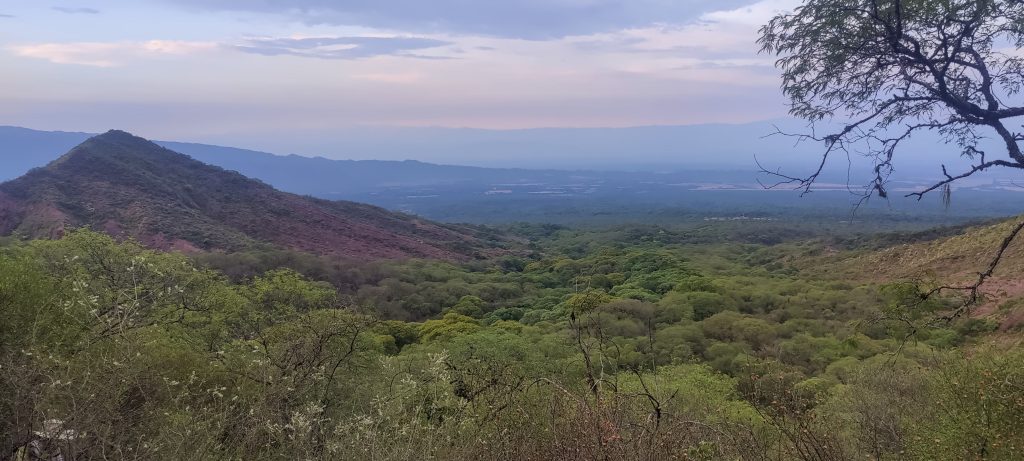
We reach the car at a brisk pace and the camp a few minutes later. We rest, pack up, and drive towards San Miguel de Tucumán. Rockinstraw is flying home tomorrow, and Rob and I will climb a few more peaks in the coming days. We will start with Cerro el Pelao tomorrow. Unfortunately, due to the weather conditions, we must skip Cerro Laguna Blanca this time. Anyway, I guess this was the last ultra this year, and I’m finishing the year with a total of 98 in my bag. happy about this!


Cerro Castillejos 2490 m altitude
1515 m prominence
102.73 km isolation
Ranges South America - Andes - Puna de Atacama
Countries/regions Argentina – Salta
Distance 10.60 km up 12.00 km down
Elevation 1199 m gain 1199 m loss
Time
4h35 up
0h40 other
3h40 down
8h55 total
Trailhead 1290 m altitude -26.0978610, -64.9486110
Links GPX trail
  • Andes 2022
  • « Cerros de Pereyra
  • Cerro el Pelao »

Mountain Ranges

Anatolia
Taurus Mountains
Western Anatolia
Andes
Puna de Atacama
Atlas Mountains
High Atlas
Northwestern Atlas
Central America Ranges
Costa Rica-Panama Ranges
Central Central America
Eastern Europe Ranges
Southeast Baltic Plains
Iberian Peninsula
Cordillera Cantabrica
Castile Ranges
Portugal-Galicia
Pyrenees
Malay Archipelago
Java
Nusa Tengarra
Sulawesi
Sumatra
Northwest Europe
Great Britain
North France-West Rhine Area
Southeast South America
Pampas
Sierras de Cordoba
West Africa Mountains
Bight of Benin
Cameroon Mountains

Countries / regions

Algeria
Ain Guezzam
Ain Salah
Aïn Témouchent
El Bayadh
Ghardaïa
Oran
Ouargla
Saïda
Sidi Bel Abbès
Tamanrasset
Argentina
Catamarca
Ciudad Autónoma de Buenos Aires
Córdoba
Jujuy
Salta
Tucumán
Belgium
Flemish Region
Brussels Capital Region
Cameroon
Southwest
Costa Rica
Alajuela
Cartago
Guanacaste
Heredia
Limón
San José
Czechia
Prague
Denmark
Greenland
France
Hauts-de-France
Germany
Berlin
Niedersachsen
Indonesia
Bali
Jambi
Jawa Tengah
Jawa Timur
Nusa Tenggara Barat
Sulawesi Tengah
Sulawesi Utara
Sumatera Barat
Lithuania
Vilnius County
Morocco
Béni Mellal-Khénifra
Drâa-Tafilalet
Fez-Meknes
Marrakesh-Safi
Souss-Massa
Tangier-Tetouan-Al Hoceima
Netherlands
Gelderland
Noord-Holland
Nicaragua
Chinandega
Managua
Masaya
Rivas
Poland
Greater Poland Voivodeship
Masovian Voivodeship
Portugal
Castelo Branco
Leiria
Lisbon
Santarém
São Tomé and Príncipe
São Tomé Province
Spain
Aragón
Asturias
Castilla-La Mancha
Castilla y León
Switzerland
Zürich
Turkey
Antalya
Isparta
Muğla
United Kingdom
England
Scotland
United States
Delaware
Florida
Georgia
Maryland
New Jersey
New York
North Carolina
South Carolina
Pennsylvania
Virginia

TRIPS

2023
West Africa 2023 II
Iberian Peninsula 2023
West Africa 2023
Central America 2023
2022
Andes 2022
Northwest Europe 2022
Malay Archipelago III 2022
Malay Archipelago II 2022
Anatolia Mountains 2022
Iberian Peninsula 2022
Atlas Mountains 2022

archaeology (3) climb (69) food (2) hike (68) p30 (3) p100 (9) p300 (8) p600 (13) p1000 (5) p1500 (34) ribu (4) sight (34) summary (11) ultra (34)

839 km walked, 65 247 m climbed

©2023 p600.org | WordPress Theme by Superbthemes.com