Skip to content
Menu
p600.org
  • home
  • map
  • trips
  • about
p600.org

Cerros de Pereyra

hike | 2022-12-07

For the second time, we head towards Cerros de Pereyra. The first time we came to a gravel road, due to a very heavy downpour, we turned around. Maybe we would have reached the village of El Fuerte, but we probably would not have reached the trailhead. This time the weather was good. We believe that there is a shorter and easier route from the pass. So we stopped at a farmhouse at the pass and asked if we could go through their private property to the summit. However, a worker at the farmhouse informed us that the owner would be late. We didn’t want to wait, especially as it was not clear whether the owner would turn up and, even more so, whether he would allow us to go through his property. We drove to the known trailhead.

Woodcutters working on the road
Cleaning the road from branches
A worker cuts the downed tree

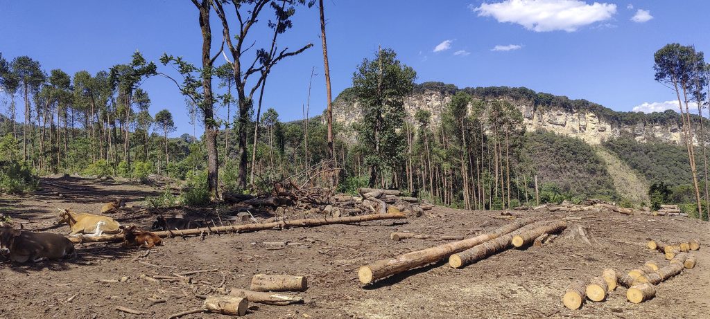
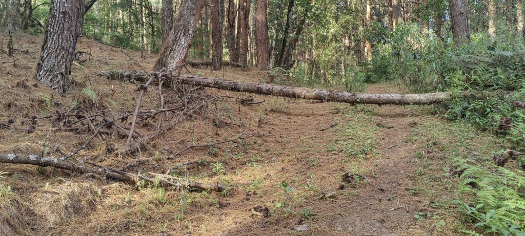
A gravel road and a forest path run through the riverbed. Five kilometres later, we meet loggers at work; they tell us that if we want to go further, we have to wait for the boss. Lucky for us, Marcelo turns up quite soon. We explain our peakbagging objective to him, and then a small smile appears on his face. He tells us that we can drive but that the road will finish soon. We are relieved, because earlier we were afraid that we might be turned around or not allowed to pass through his land at all. We thank him and move on. Not very far, the road is littered with branches. One of the workers waves for us to wait and pushes the branches sideways with a giant tractor. Excellent, we can proceed. Less than a kilometre later, a half-metre-thick tree lies across the road, and a worker with a saw stands next to it. We talk to him, and he kindly offers to help us clear the road. Thanks! Great, we’ll roll on for a one more kilometre and see another tree on the path, this time with no woodcutters, no workmen, and no saw. So, we find it a good place for camping.

On the way, there is a dense and uniform forest
A fallen tree across the road, which we could no longer negotiate. Setting up camp here
Sunset at the camp
??
??
Aechmea distichantha ??
??
Some interesting plants
Out of the bushes for the first time
Distant peaks that are slightly lower 

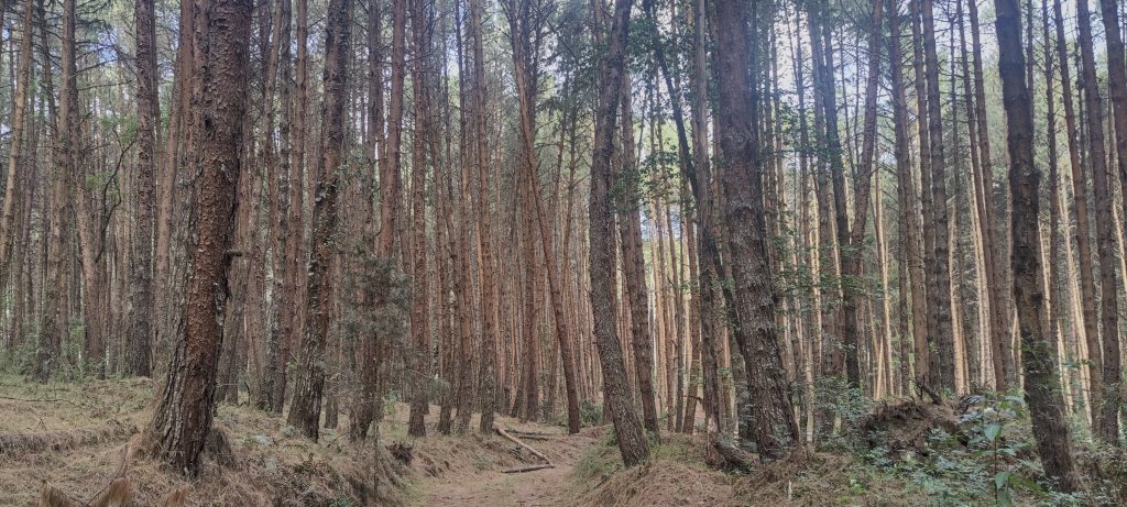
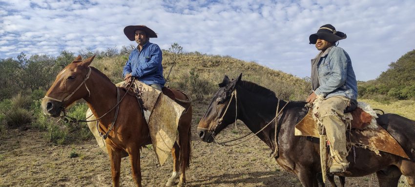
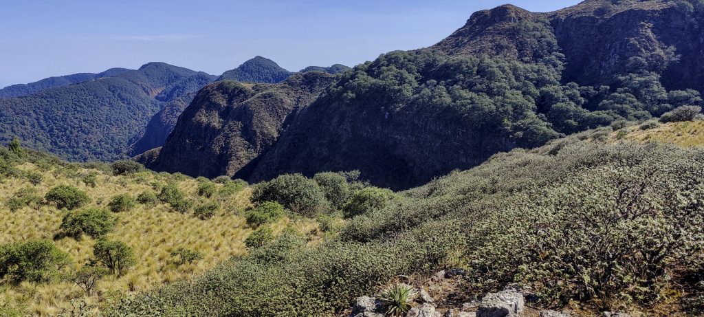
We get up before dawn, have a cup of coffee, and head for the summit. Half a kilometre later, the road ends and the bush begins. Still dark, we stand and wait for fifteen or twenty minutes. It starts to get light, and we move on. There are bushes and game trails, but pretty soon we find a decent trail, and we follow it. The only problem is that we lose the trail from time to time and have to look again. At the ridge, the trail disappeared for the next time, and we started going straight through the bushes. To our great surprise, two cowboys emerged from the bushes: Renaldo and his friend. I think they must have been surprised to see four hikers in the bush too. We explain to them our goal, and not only do they show us where the trail is, but they also accompany us for a good kilometre. Apparently, they don’t believe that we can manage on our own.

A small lake was fenced off, and we had to climb over fence twice
Views from the ridge

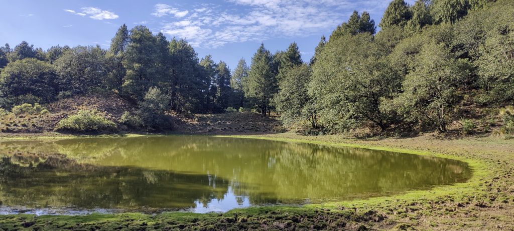
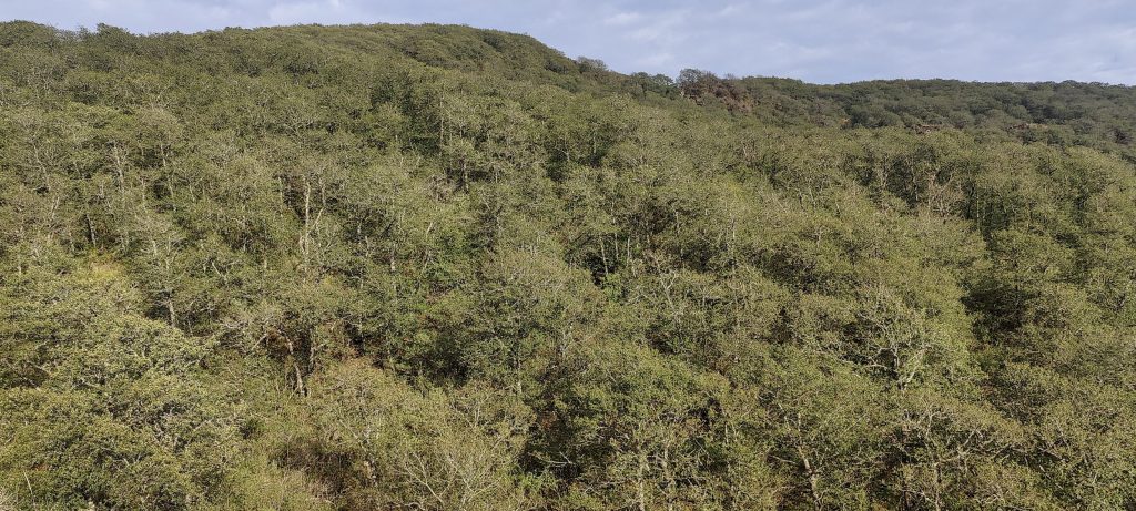
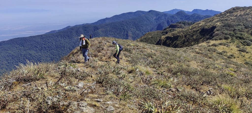
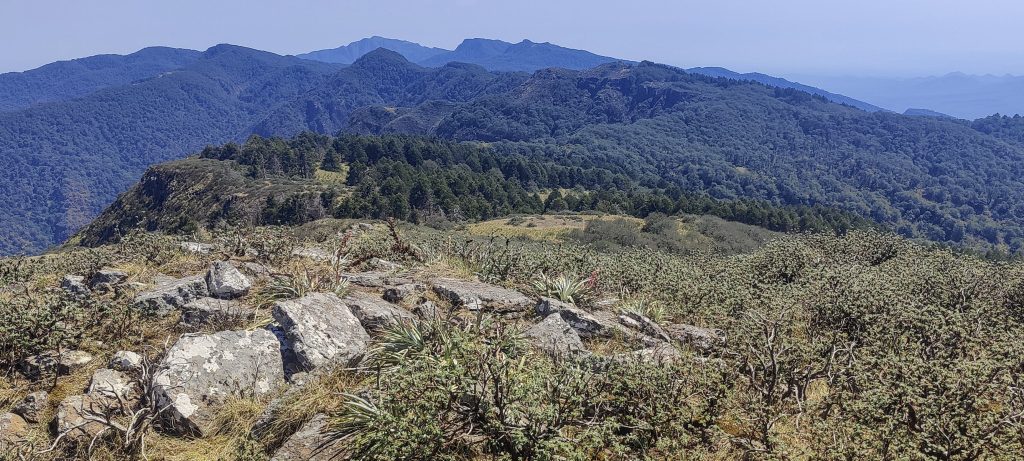
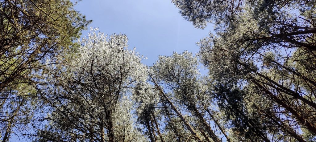
The path over the ridge is quite clear and easy, practically flat. It is easier to walk in the shade of the forest than in open grassland. We have to climb over a fence a couple of times; if I understand correctly, it is a fenced small lake. 

Views from the ridge

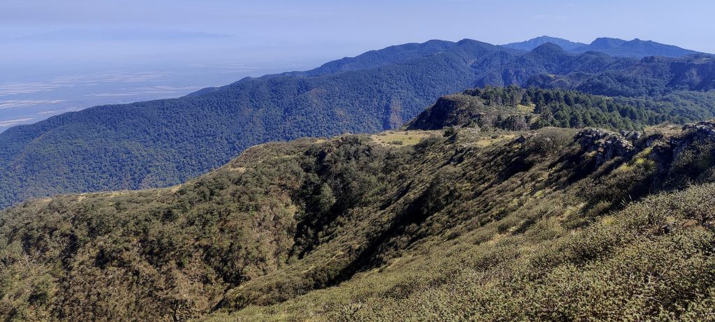
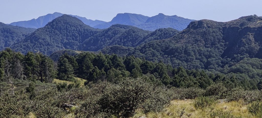
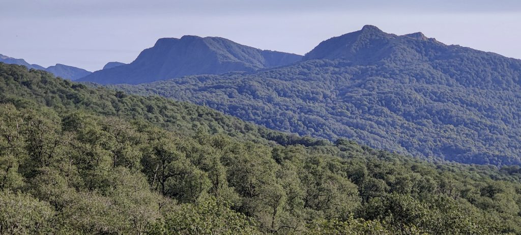
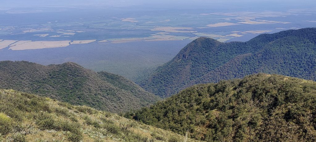
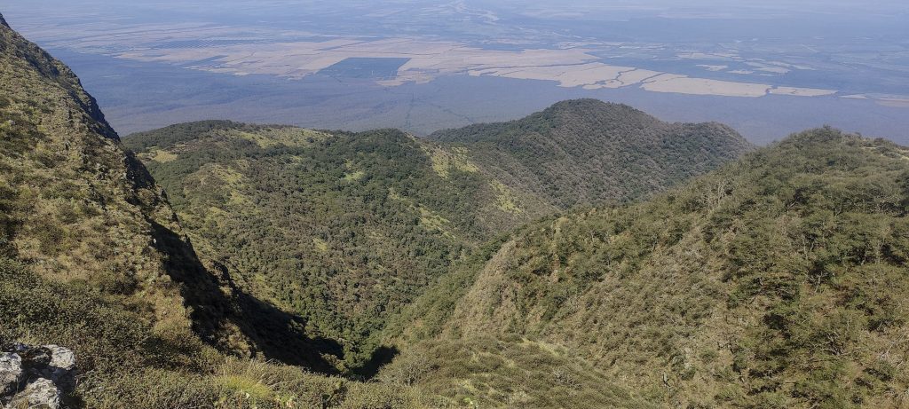
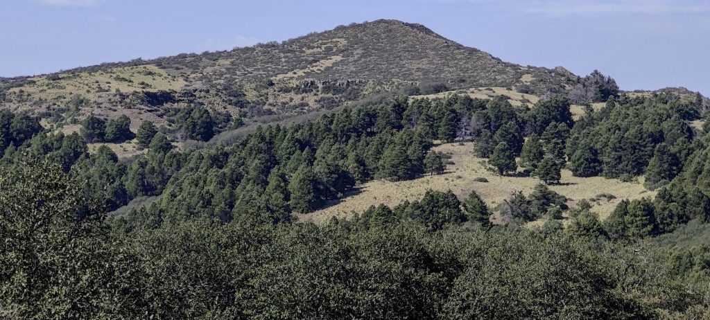
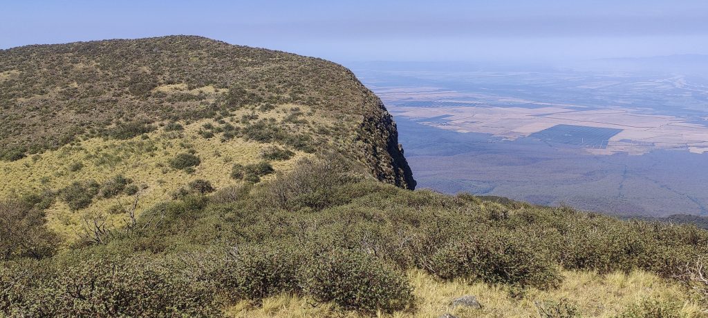
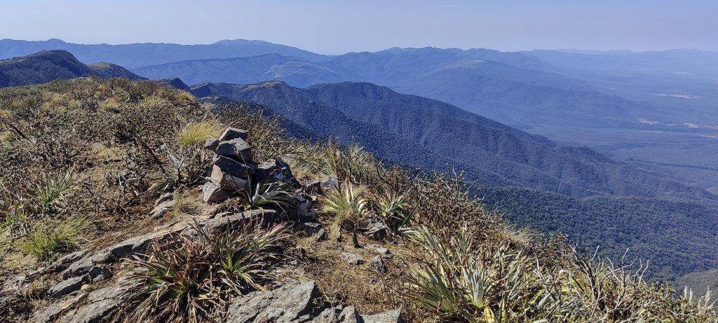
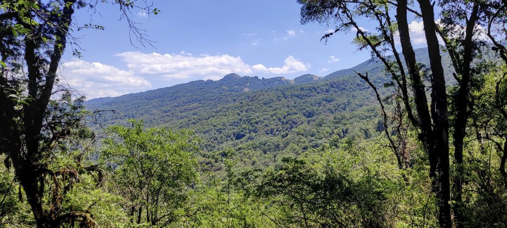
A kilometre or two later, the summit is visible—the first, lower peak, to be precise. After climbing it, Rob measures it with his hand level and confirms that the next peak, three hundred metres away, is higher. We walk up to highpoint and find the cairn that Petter and Adam built. Great views all around. We take a good half-hour break before continuing down the same path, mostly following the trail. 

Slightly lower NW peak, with the true peak behind it
The true, higher peak is about 300 metres away
The highest point with Petter and Adam cairn
John, Rob and Franco are approaching the summit 
John (middle), Rob (right), and me (left) at the summit
Icarus
The ridge from where we came
There are lots of strange pine trees along the way
Views on the way down
The tops of some trees are white, as if covered in snow
??

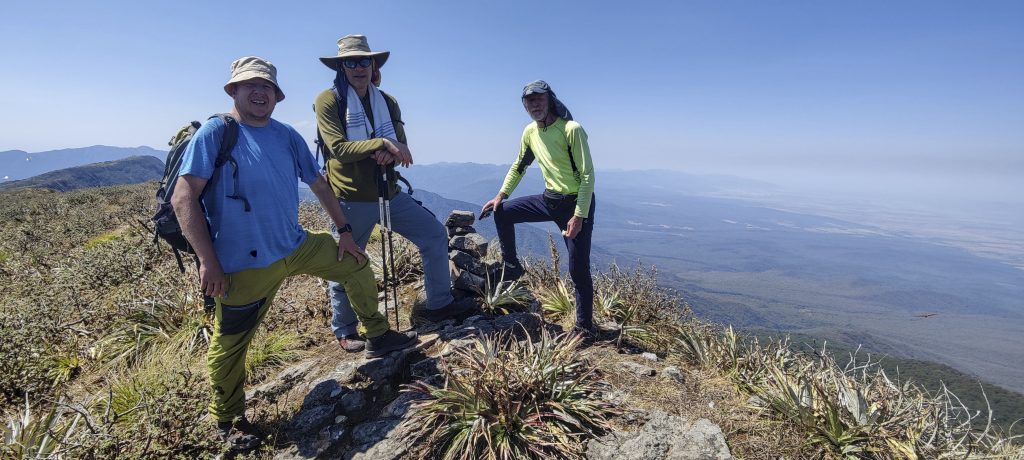
Within four hours, we get back to our tents, rest, pack up, and head down to Cerro Castillejos. Another ultra peak was completed on a cool day.

Post header photo: Renaldo and his friend


Cerros de Pereyra2600 m altitude
1650 m prominence
73.43 km isolation
RangesSouth America - Andes - Puna de Atacama
Countries/regionsArgentina - Jujuy
Distance13.00 km up12.00 km down
Elevation598 m gain598 m loss
Time
5h00 up
0h20 other
3h45 down
9h05 total
Trailhead2001 m altitude-24.1504720, -64.4773610
Difficulties<p style="color: #252525;">finding a trail in the darkness through the bushes at the beginning</p>
LinksGPX trail
  • Andes 2022
  • « Cerro Bolsón de los Cerillos
  • Cerro Castillejos »

Mountain Ranges

Anatolia
Central Anatolia
Pontic Mountains
Southeast Anatolia
Taurus Mountains
Western Anatolia
Andes
Puna de Atacama
Atlas Mountains
High Atlas
Northwestern Atlas
Central America Ranges
Costa Rica-Panama Ranges
Central Central America
East China
Taiwan
Eastern Europe Ranges
Southeast Baltic Plains
Iberian Peninsula
Cordillera Cantabrica
Castile Ranges
Portugal-Galicia
Pyrenees
Intermountain West
Great Basin Ranges
Korea-Amur Area
Taebaek Sanmae
Malay Archipelago
Java
Nusa Tengarra
Sulawesi
Sumatra
Mid-Atlantic Islands
North Atlantic Islands
Mongolia Ranges
Altai
Gobi Desert Ranges
Hangay Mountains
Northwest Europe
Great Britain
North France-West Rhine Area
Pacific Ranges
Cascade Range
Northwest U.S. Coast Ranges
Sierra Nevada
Central and Southern California Ranges
Philippines
Central Philippines
Luzon
Mindanao
Southeast Asia
Malay Peninsula
Southeast South America
Pampas
Sierras de Cordoba
Southern Africa
Malawi Highlands
West Africa Mountains
Bight of Benin
Cameroon Mountains
Guinea Highlands

Countries / regions

Algeria
Ain Guezzam
Ain Salah
Aïn Témouchent
El Bayadh
Ghardaïa
Oran
Ouargla
Saïda
Sidi Bel Abbès
Tamanrasset
Argentina
Catamarca
Ciudad Autónoma de Buenos Aires
Córdoba
Jujuy
Salta
Tucumán
Belgium
Brussels Capital Region
Flemish Region
Cameroon
Southwest
China
Taiwan
Costa Rica
Alajuela
Cartago
Guanacaste
Heredia
Limón
San José
Czechia
Prague
Denmark
Greenland
France
Hauts-de-France
Occitania
Germany
Berlin
Niedersachsen
Indonesia
Bali
Jambi
Jawa Tengah
Jawa Timur
Nusa Tenggara Barat
Sulawesi Tengah
Sulawesi Utara
Sumatera Barat
Lithuania
Vilnius County
Mongolia
Bayankhongor
Govi-Altai
Khovd
Omnogovi
Ovorkhangai
Ulan Bator
Zavkhan
Morocco
Béni Mellal-Khénifra
Drâa-Tafilalet
Fez-Meknes
Marrakesh-Safi
Souss-Massa
Tangier-Tetouan-Al Hoceima
Mozambique
Zambezia
Netherlands
Gelderland
Noord-Holland
Zeeland
Nicaragua
Chinandega
Managua
Masaya
Rivas
Philippines
Bicol Region (V)
Cagayan Valley (II)
Calabarzon (IV-A)
Central Luzon (III)
Cordillera Administrative Region
Davao Region
Metro Manila
Soccsksargen (XII)
Western Visayas (VI)
Poland
Greater Poland Voivodeship
Masovian Voivodeship
Portugal
Castelo Branco
Leiria
Lisbon
Madeira
Santarém
Qatar
Ad-Dawhah
São Tomé and Príncipe
São Tomé Province
Sierra Leone
Northern Province
Western Area
Singapore
South Korea
Gyeongsangnam-do
Seoul
Spain
Aragón
Asturias
Castilla-La Mancha
Castilla y León
Catalonia
Islas Canarias
Switzerland
Zürich
Turkey
Antalya
Bitlis
Erzincan
Hakkâri
Igdir
Isparta
Kahraman Maras
Muğla
United Kingdom
England
Scotland
United States
California
Delaware
Florida
Maryland
Nevada
New Jersey
New York
Pennsylvania
South Carolina
Utah

TRIPS

2024
Southern Africa 2024
Mid-Atlantic Islands 2024
North America 2024
Anatolia 2024
Korea-Amur Area 2024
East China 2024
2023
Mongolia Ranges 2023
Philippines 2023
West Africa III 2023
West Africa II 2023
Iberian Peninsula 2023
West Africa 2023
Central America 2023
2022
Andes 2022
Northwest Europe 2022
Malay Archipelago III 2022
Malay Archipelago II 2022
Anatolia Mountains 2022
Iberian Peninsula 2022
Atlas Mountains 2022
North France-West Rhine Area 2022

archaeology (3) climb (157) food (2) hike (155) p30 (17) p50 (4) p100 (24) p300 (12) p600 (17) p1000 (11) p1500 (76) ribu (10) sight (46) summary (16) trig (44) ultra (76)

1 591 km walked, 121 298 m climbed

©2025 p600.org | WordPress Theme by Superbthemes.com