Skip to content
Menu
p600.org
  • home
  • map
  • trips
  • about
p600.org

Cerro el Pelao

hike | 2022-12-10
2624 m altitude, 359 m prominence, - km isolation

There was heavy rain in the morning, but we are not afraid of rain, unfortunately the weather forecast for the rest of the day is even worse. The day starts late, and we are in no hurry, so we drive towards Dique la Angustura lake. On the way, we have to wait for a few hours until the rain-washed road is fixed. We arrive and see that the weather has completely improved, with the sun shining through the clouds. We don’t wait for anything, so we drive to the Cerro el Pelao trailhead and climb.

Few horses on the ascent 
Wide trail
Surrounding views

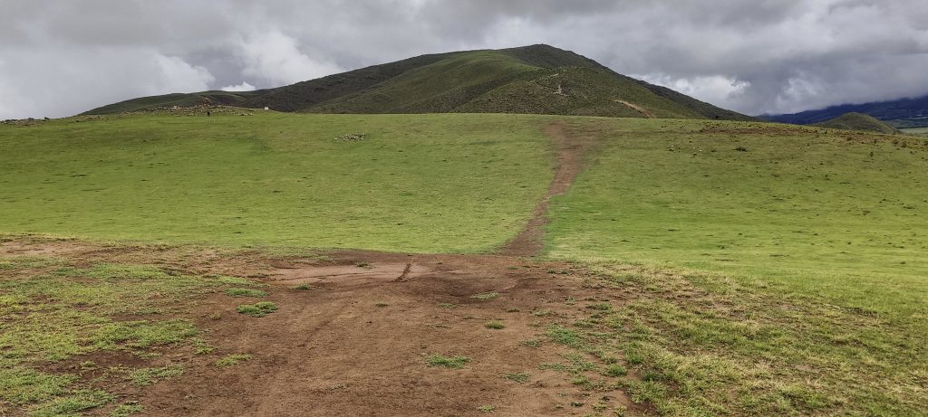
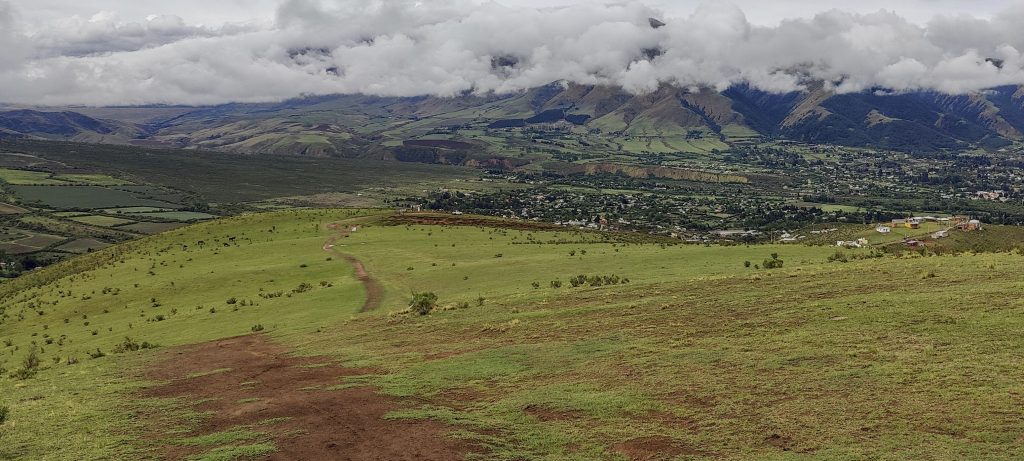
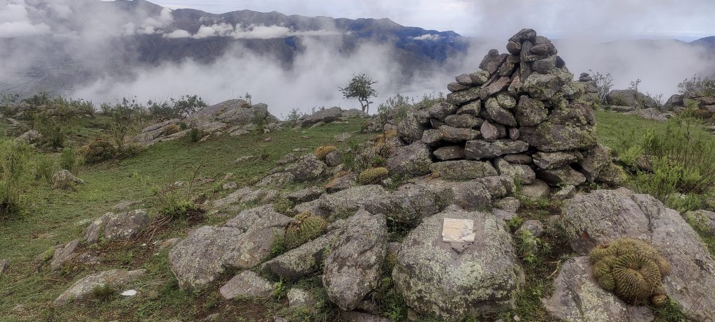
The whole trail, several kilometres long, is very gradual. A few small descents and climbs later, we are at the top, where a small cairn is located. Nearby, on a slightly lower stone, there is a plaque and big cairn

Highest point
Cacti at the top
Dique la Angostura lake from the summit
Views from the top
Near the highest point, there is a plaque with the name of the mountain and a large cairn
Cactus blossoms
Descending views
Few clouds gathered
One of several lower peaks
Views on descent
Fungus ??
Beginning of massive ridge Cerro Bolsón de los Cerillos
Side views
Cumbres Calchaquies in the right side
Franco waited up in the car

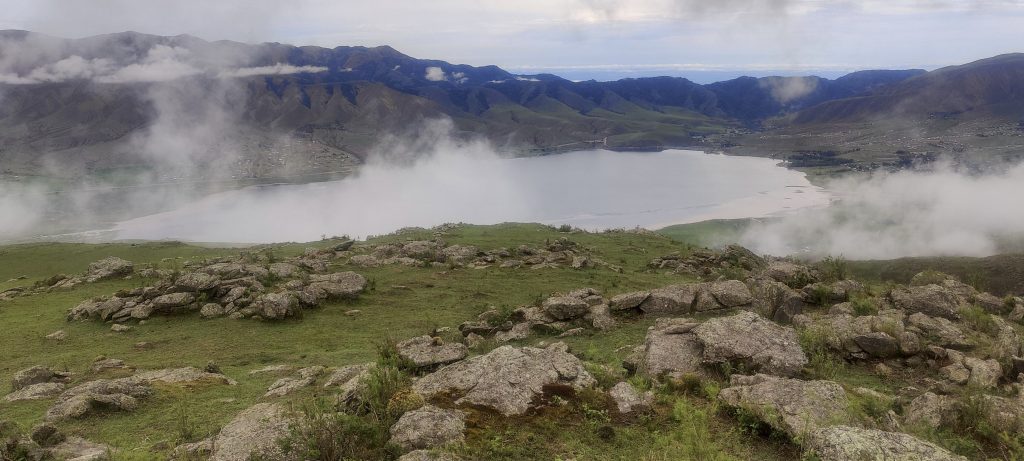
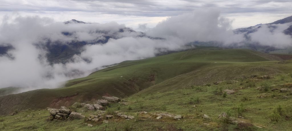
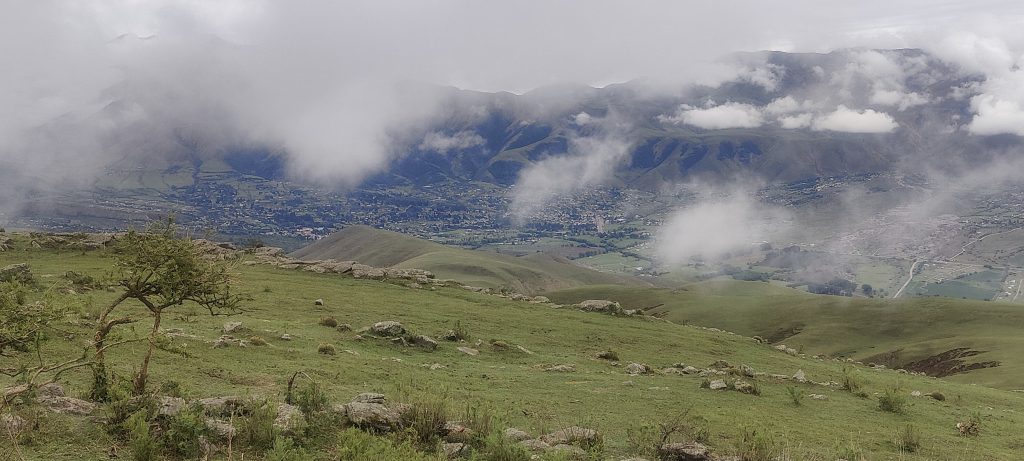
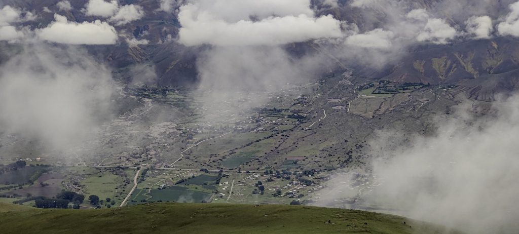
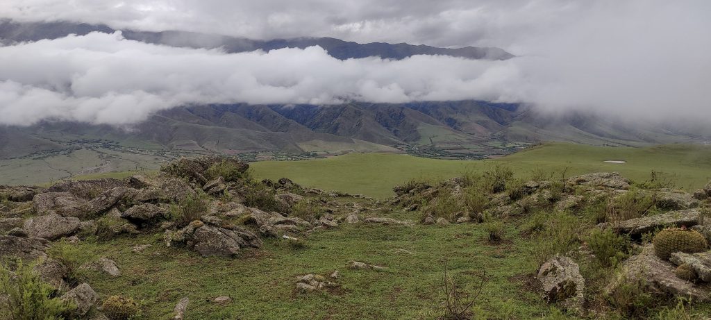
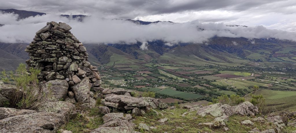
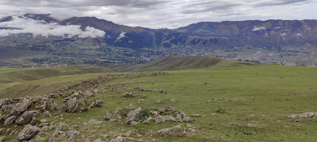
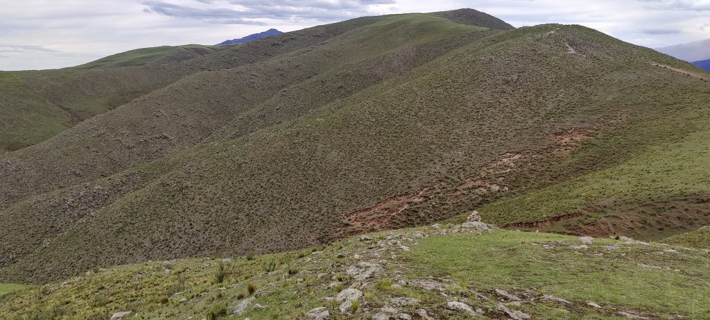
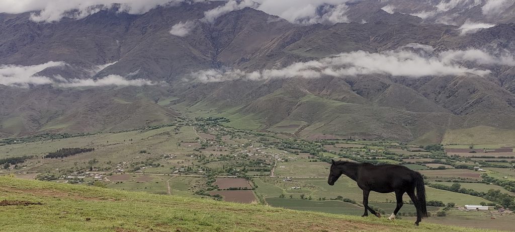
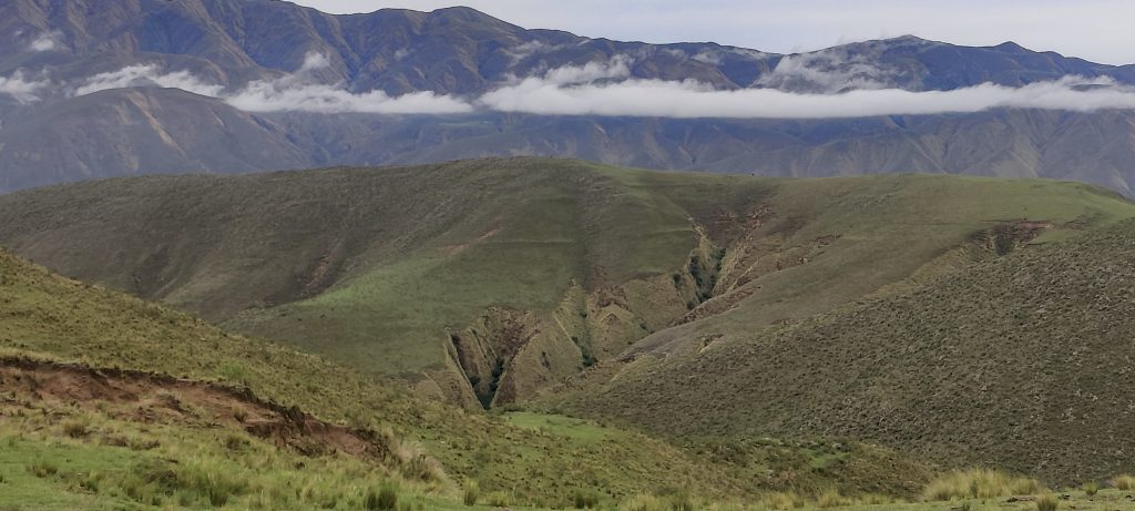
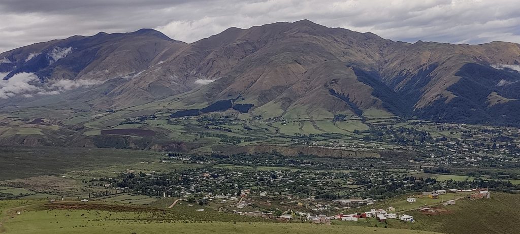
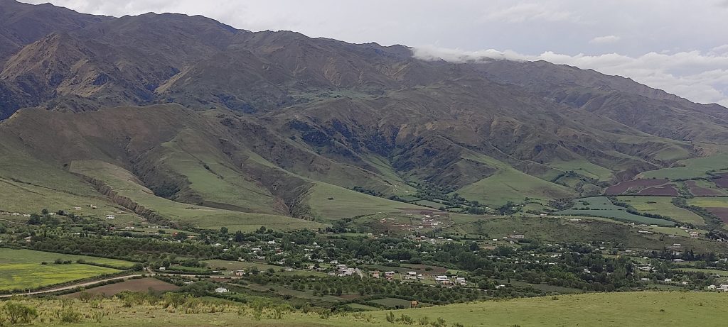
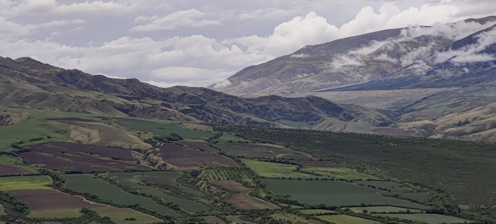
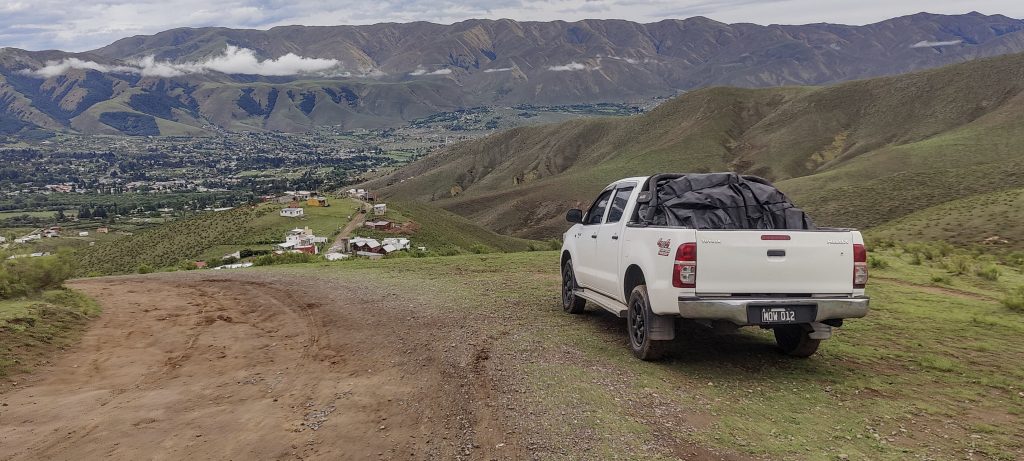
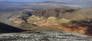
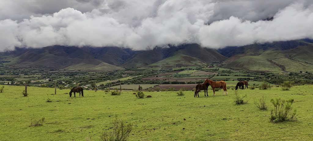
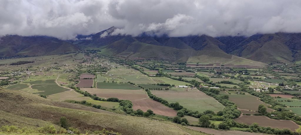
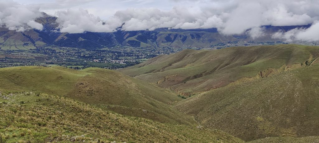
The views around the area are great, with the Cumbres Calchaquies and the foot of Cerro Bolsón de los Cerillos. Soon we’re back in the car, driving to the hotel and thinking about dinner. The setting of Dique la Angostura lake resembles a mountain holiday area, with many tourists and attractions for them. A cool place to relax. Tomorrow morning the weather forecast is positive and we will try to climb Cerro Nuñorco Grande


Cerro el Pelao 2624 m altitude
359 m prominence
Ranges South America - Andes - Puna de Atacama
Countries/regions Argentina - Tucumán
Distance 4.10 km up 4.10 km down
Elevation 604 m gain 604 m loss
Time
0h55 up
0h10 other
0h50 down
1h55 total
Trailhead 2189 m altitude -26.8721940, -65.7393330
Links GPX trail
  • Andes 2022
  • « Cerro Castillejos
  • Cerro Nuñorco Grande »

Mountain Ranges

Anatolia
Taurus Mountains
Western Anatolia
Andes
Puna de Atacama
Atlas Mountains
High Atlas
Northwestern Atlas
Central America Ranges
Costa Rica-Panama Ranges
Central Central America
Eastern Europe Ranges
Southeast Baltic Plains
Iberian Peninsula
Cordillera Cantabrica
Castile Ranges
Portugal-Galicia
Pyrenees
Malay Archipelago
Java
Nusa Tengarra
Sulawesi
Sumatra
Northwest Europe
Great Britain
North France-West Rhine Area
Southeast South America
Pampas
Sierras de Cordoba
West Africa Mountains
Bight of Benin
Cameroon Mountains

Countries / regions

Algeria
Ain Guezzam
Ain Salah
Aïn Témouchent
El Bayadh
Ghardaïa
Oran
Ouargla
Saïda
Sidi Bel Abbès
Tamanrasset
Argentina
Catamarca
Ciudad Autónoma de Buenos Aires
Córdoba
Jujuy
Salta
Tucumán
Belgium
Flemish Region
Brussels Capital Region
Cameroon
Southwest
Costa Rica
Alajuela
Cartago
Guanacaste
Heredia
Limón
San José
Czechia
Prague
Denmark
Greenland
France
Hauts-de-France
Germany
Berlin
Niedersachsen
Indonesia
Bali
Jambi
Jawa Tengah
Jawa Timur
Nusa Tenggara Barat
Sulawesi Tengah
Sulawesi Utara
Sumatera Barat
Lithuania
Vilnius County
Morocco
Béni Mellal-Khénifra
Drâa-Tafilalet
Fez-Meknes
Marrakesh-Safi
Souss-Massa
Tangier-Tetouan-Al Hoceima
Netherlands
Gelderland
Noord-Holland
Nicaragua
Chinandega
Managua
Masaya
Rivas
Poland
Greater Poland Voivodeship
Masovian Voivodeship
Portugal
Castelo Branco
Leiria
Lisbon
Santarém
São Tomé and Príncipe
São Tomé Province
Spain
Aragón
Asturias
Castilla-La Mancha
Castilla y León
Switzerland
Zürich
Turkey
Antalya
Isparta
Muğla
United Kingdom
England
Scotland
United States
Delaware
Florida
Georgia
Maryland
New Jersey
New York
North Carolina
South Carolina
Pennsylvania
Virginia

TRIPS

2023
West Africa 2023 II
Iberian Peninsula 2023
West Africa 2023
Central America 2023
2022
Andes 2022
Northwest Europe 2022
Malay Archipelago III 2022
Malay Archipelago II 2022
Anatolia Mountains 2022
Iberian Peninsula 2022
Atlas Mountains 2022

archaeology (3) climb (69) food (2) hike (68) p30 (3) p100 (9) p300 (8) p600 (13) p1000 (5) p1500 (34) ribu (4) sight (34) summary (11) ultra (34)

839 km walked, 65 247 m climbed

©2023 p600.org | WordPress Theme by Superbthemes.com