Skip to content
Menu
p600.org
  • home
  • map
  • trips
  • about
p600.org

Cerro Pan de Azúcar

hike | 2022-11-24
1260 m altitude, 129 m prominence, 1.81 km isolation

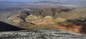
After a coffee break in Asunción, our plane lands in Córdoba. Through the aeroplane window, I can see a mountain range. The first question is whether there is a peak that we could reach relatively easily. The second question is how much time we have before the next flight. The third question is: what transportation could we use to get to the trailhead and back.

Cordoba in the window, descending 

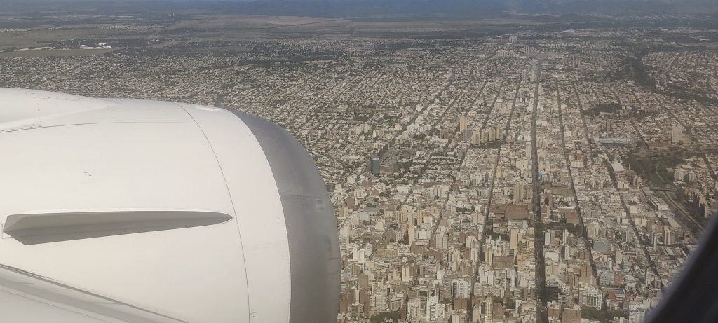
We discuss and find positive answers to all three questions. Yes, there are many peaks, but only one is close and easy enough to reach. We have about 8 hours before our flight to Salta. Of course, we have to keep in mind the passport checks and other procedures that await us on our return. Anyway, we have 4-5 full hours. Rob checks the app after landing to see if there is a taxi nearby and how much it might cost. We find a driver who can take us to the foot of the mountain for approximately 20 USD. We go through the formal procedures and get in the car.

I was surprised that the Argentina Immigration Department sent me my visa by email instead of stamping it on my passport. We just have to wait for the time when a citizen will not only be issued a passport but also an email address. Or maybe one day there will be no bureaucracy at all… uhh.. wake up D.. 

Cerro Pan de Azúcar peak

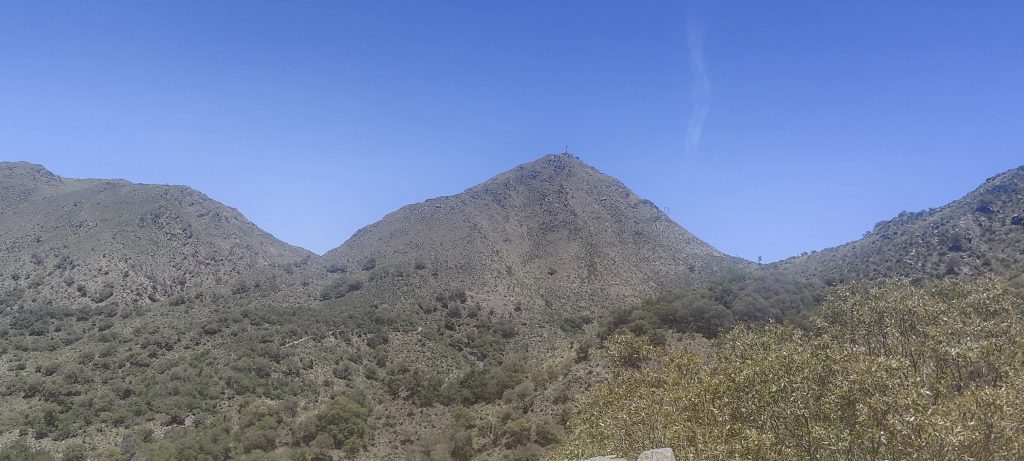
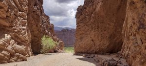
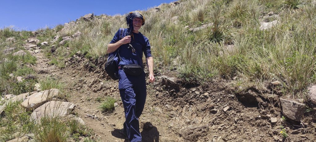
We are driving on a gravel road towards Cerro Pan de Azúcar and realise that calling another taxi driver might be difficult. With the help of a translator app, we agreed to pay another 20 USD if the driver would wait for us for an hour. 

Warm welcome at the trailhead

At the foot of the mountain, the driver speaks to the man working and happily tells us that the mountain is closed. We ask if he is talking about the chair lift, but it remains unclear. The driver calms down only when I tell him that we are going to have a look and will be back in five minutes or an hour. My best guess is that the chair lift is only operational on weekends or during peak seasons.

Looking back from the trail

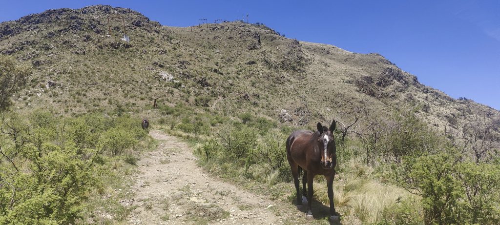
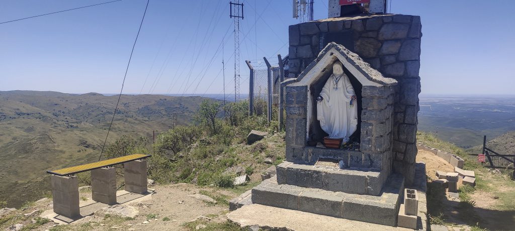
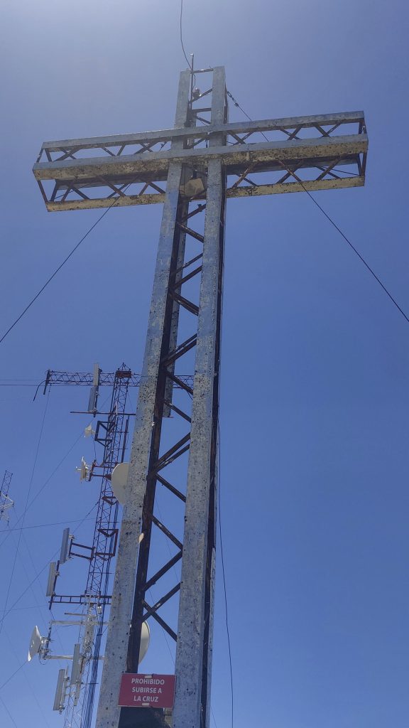
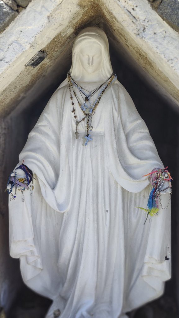
Twenty minutes later, we reach the top of the “closed mountain”. Antennas, Madonna and cross. Apparently everything is connected in one way or another.

Madonna shares space with a cross and antennas.
Cerro Lasalle 1283m p264, but not this time, although the trail is visible.
Rob with his newly invented sunhat
At the summit
Eryngium nudicaule ??

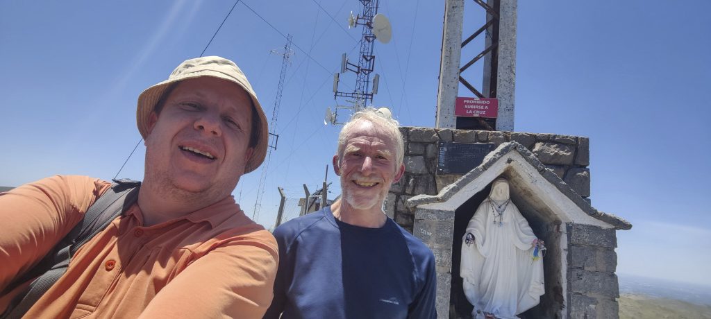
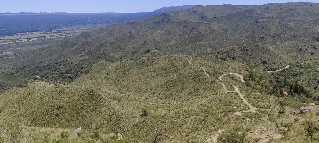
We climb down even faster, shortening the road at the bottom. The driver was delighted to see us, as he didn’t expect us to come back so quickly. Another hour, and we are back at the airport. A minor misunderstanding occurred when the taxi company charged us for the return trip while the driver received cash, but everything has been resolved and the taxi company has returned the money. All good. Our plan of a few hours worked out perfectly; we certainly had a better time than waiting at departure gates. The first P100 peak is done, and in a couple of days we will try our luck with a slightly bigger mountain, the Cumbres Calchaquies.

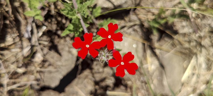
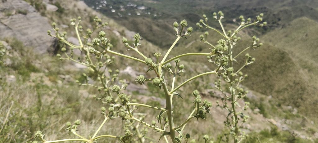
Post header photo: Glandularia Tweediana ??


Cerro Pan de Azúcar 1260 m altitude
129 m prominence
1.81 km isolation
Ranges South America - Southeast South America - Sierras de Cordoba
Countries/regions Argentina - Córdoba
Distance 0.90 km up 0.80 km down
Elevation 225 m gain 225 m loss
Time
0h20 up
0h05 other
0h15 down
0h40 total
Trailhead 1034 m altitude -31.2334720, -64.4167500
Links GPX trail
  • Andes 2022
  • « Northwest Europe 2022
  • Calchaquí Valleys »

Mountain Ranges

Anatolia
Taurus Mountains
Western Anatolia
Andes
Puna de Atacama
Atlas Mountains
High Atlas
Northwestern Atlas
Central America Ranges
Costa Rica-Panama Ranges
Central Central America
Eastern Europe Ranges
Southeast Baltic Plains
Iberian Peninsula
Cordillera Cantabrica
Castile Ranges
Portugal-Galicia
Pyrenees
Malay Archipelago
Java
Nusa Tengarra
Sulawesi
Sumatra
Northwest Europe
Great Britain
North France-West Rhine Area
Southeast South America
Pampas
Sierras de Cordoba
West Africa Mountains
Bight of Benin
Cameroon Mountains

Countries / regions

Algeria
Ain Guezzam
Ain Salah
Aïn Témouchent
El Bayadh
Ghardaïa
Oran
Ouargla
Saïda
Sidi Bel Abbès
Tamanrasset
Argentina
Catamarca
Ciudad Autónoma de Buenos Aires
Córdoba
Jujuy
Salta
Tucumán
Belgium
Brussels Capital Region
Flemish Region
Cameroon
Southwest
Costa Rica
Alajuela
Cartago
Guanacaste
Heredia
Limón
San José
Czechia
Prague
Denmark
Greenland
France
Hauts-de-France
Germany
Berlin
Niedersachsen
Indonesia
Bali
Jambi
Jawa Tengah
Jawa Timur
Nusa Tenggara Barat
Sulawesi Tengah
Sulawesi Utara
Sumatera Barat
Lithuania
Vilnius County
Morocco
Béni Mellal-Khénifra
Drâa-Tafilalet
Fez-Meknes
Marrakesh-Safi
Souss-Massa
Tangier-Tetouan-Al Hoceima
Netherlands
Gelderland
Noord-Holland
Zeeland
Nicaragua
Chinandega
Managua
Masaya
Rivas
Poland
Greater Poland Voivodeship
Masovian Voivodeship
Portugal
Castelo Branco
Leiria
Lisbon
Santarém
São Tomé and Príncipe
São Tomé Province
Spain
Aragón
Asturias
Castilla-La Mancha
Castilla y León
Switzerland
Zürich
Turkey
Antalya
Isparta
Muğla
United Kingdom
England
Scotland
United States
Delaware
Florida
Maryland
New Jersey
New York
South Carolina
Pennsylvania

TRIPS

2023
West Africa II 2023
Iberian Peninsula 2023
West Africa 2023
Central America 2023
2022
Andes 2022
Northwest Europe 2022
Malay Archipelago III 2022
Malay Archipelago II 2022
Anatolia Mountains 2022
Iberian Peninsula 2022
Atlas Mountains 2022
North France-West Rhine Area 2022

archaeology (3) climb (72) food (2) hike (71) p30 (6) p100 (9) p300 (8) p600 (13) p1000 (5) p1500 (34) ribu (4) sight (35) summary (11) ultra (34)

843 km walked, 65 330 m climbed

©2023 p600.org | WordPress Theme by Superbthemes.com