Skip to content
Menu
p600.org
  • home
  • map
  • trips
  • about
p600.org

Montaña de Breña

hike | 2024-04-05

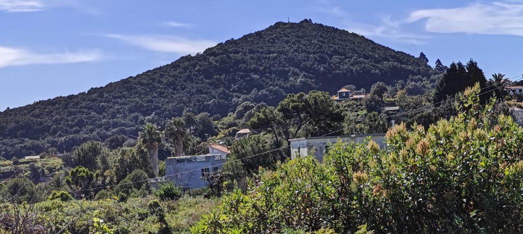
On the way to the airport, a darkened dot on the map catches my attention. Dark signifies less than 100 meters of prominence. With a spare hour and few other plans, why not take a detour? I didn’t delve into the details but spotted a road at the base and headed for the peak.

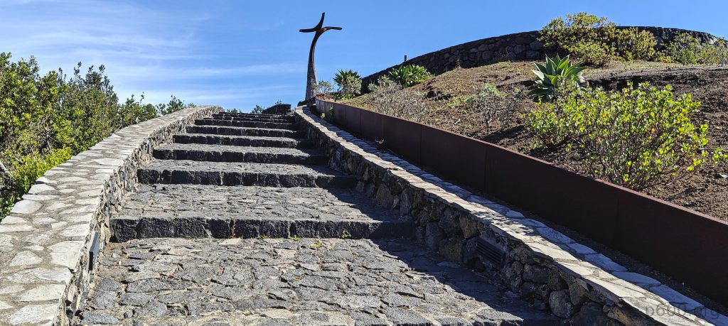
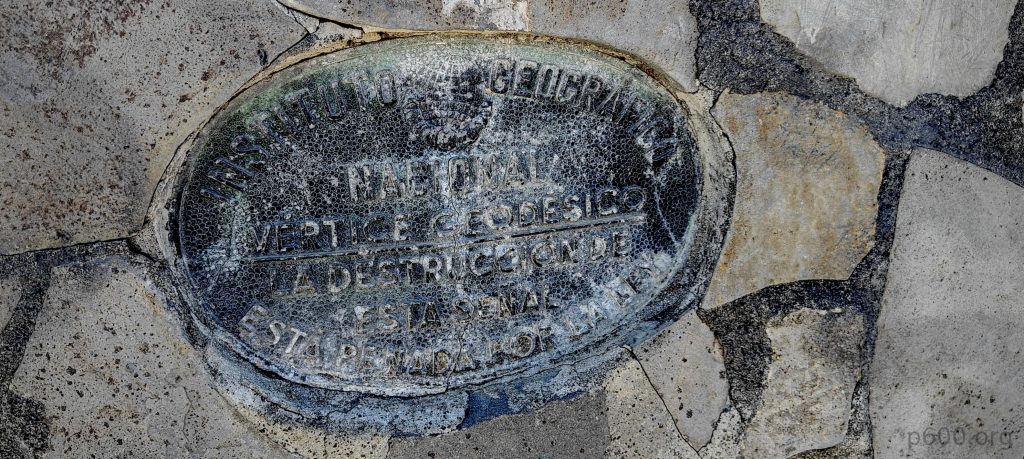
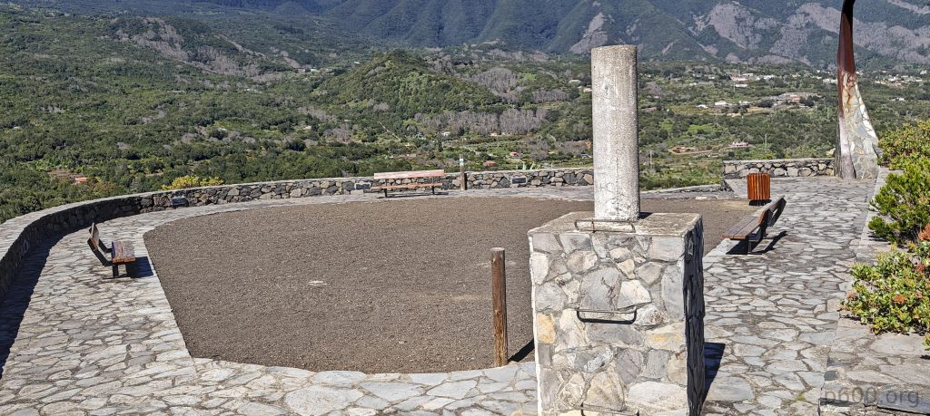
The photo captures Montaña de Breña peak as I approach by road.
A stylized summit cross at the peak.
A mirador offers a panoramic view.
At the summit, there’s a trig pillar adorned with a geographic society plaque.

To my surprise, I found a paved road leading all the way to the top. I stopped about 20 meters short, where stone stairs lead to a viewing platform and a cross. My second surprise was a trig pillar at the summit, neatly placed on a one-meter-high platform.

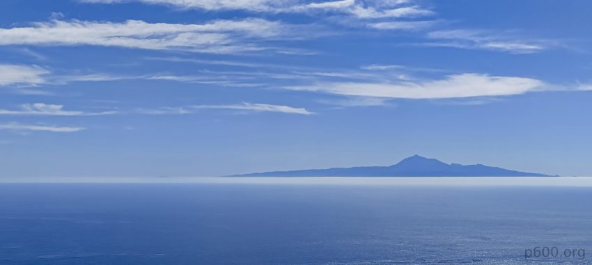
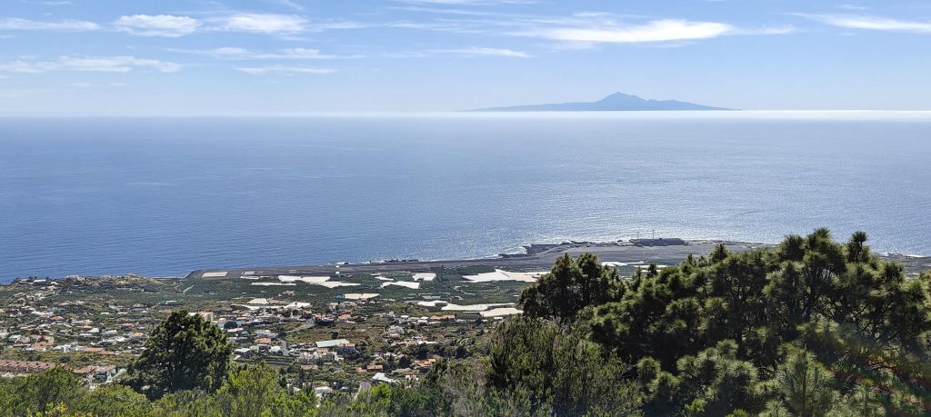
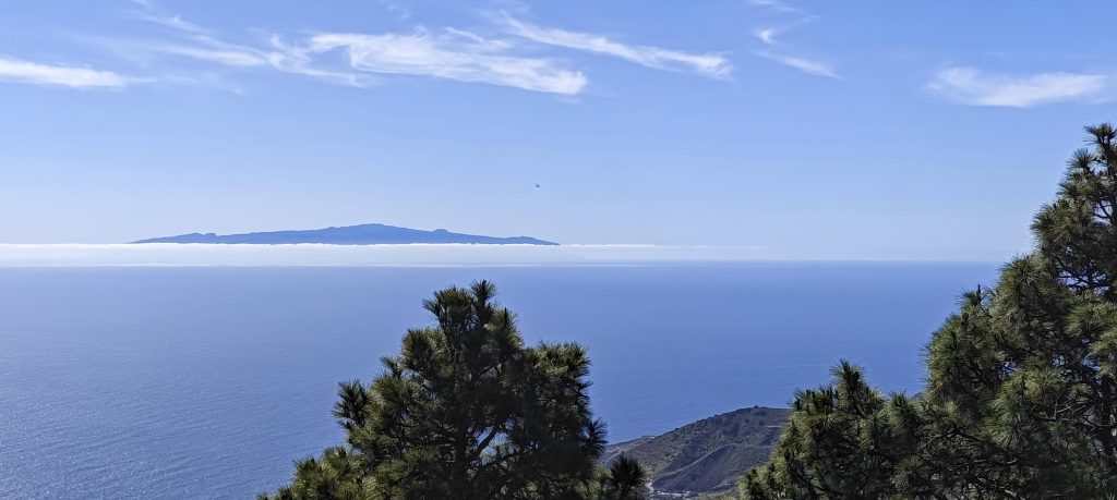
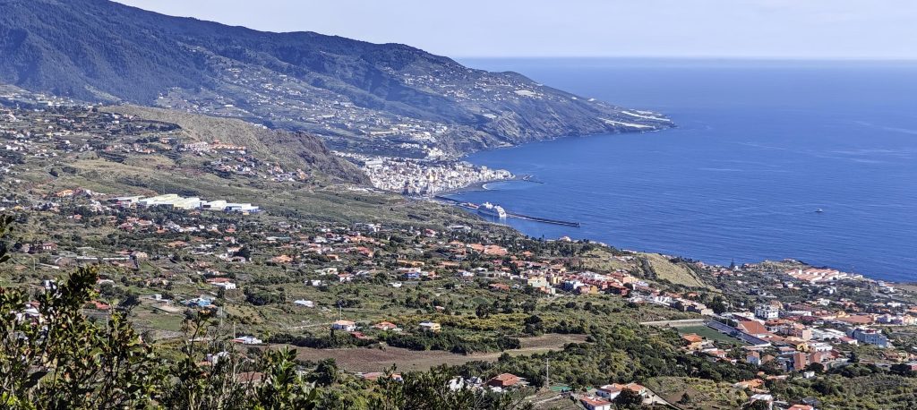
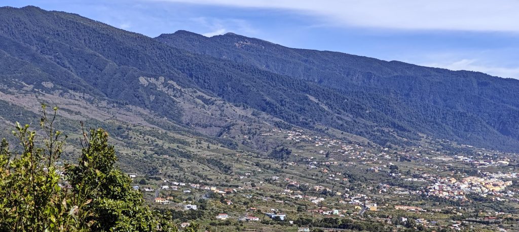
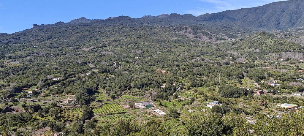
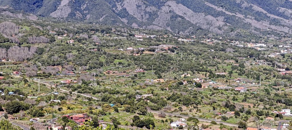
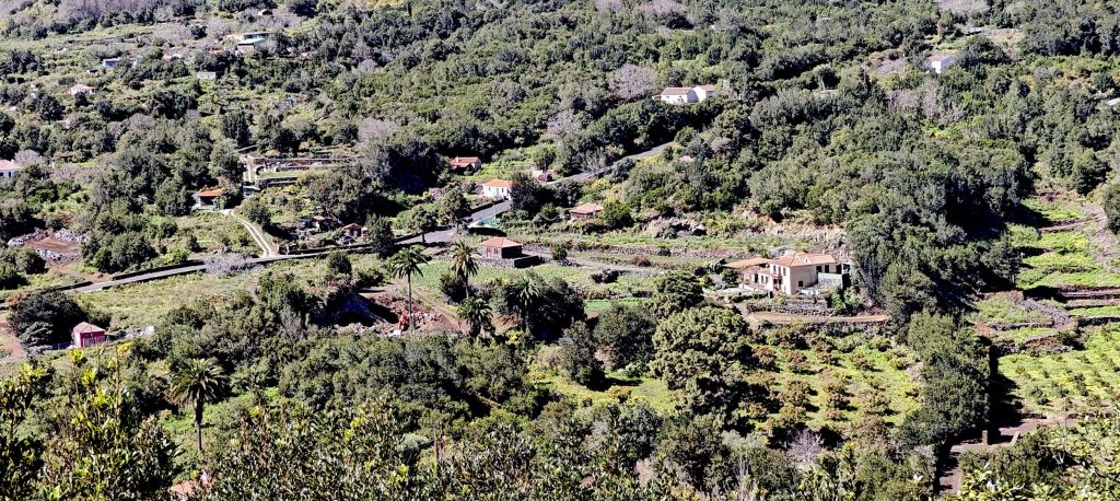
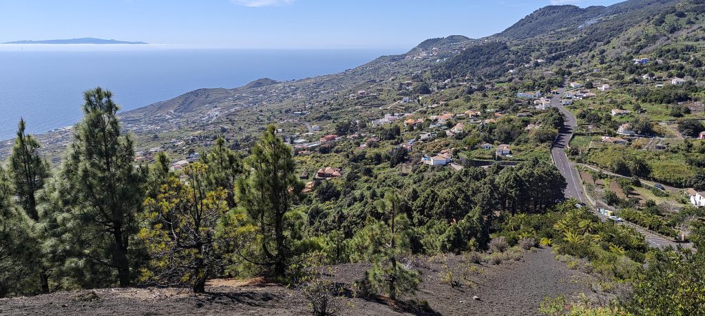
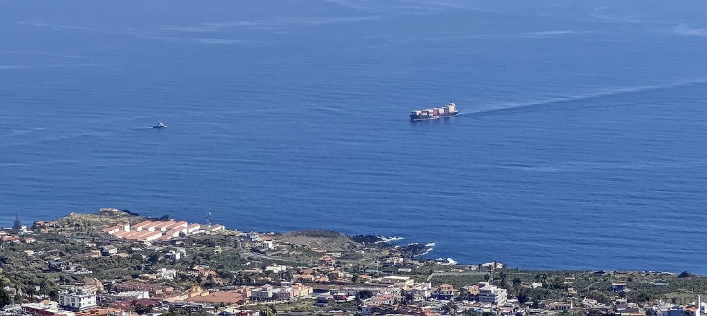
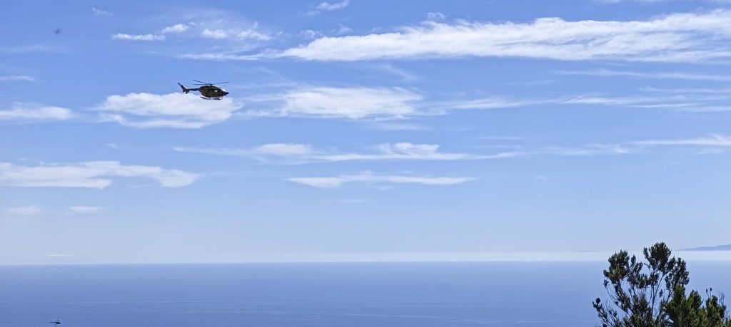
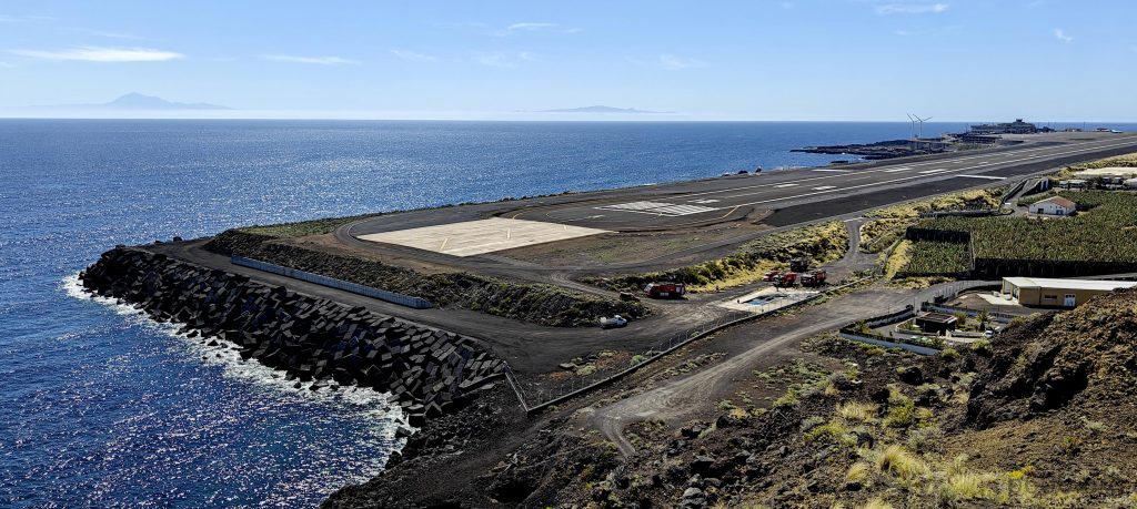
The view stretches across the ocean to Tenerife Island, where Pico de Teide 3715m P3715 peak dominates the horizon.
La Gomera Island is famous for its verdant Garajonay National Park, the unique Silbo Gomero whistled language and highest point – El Alto de Garajonay 1487m P1487.
Views of Santa Cruz de La Palma reveal a picturesque town nestled between steep hills and the sparkling Atlantic.
The rim of the crater at Caldera de Taburiente National Park.
The green slopes of La Palma.
The picture captures a farm on La Palma, seen from the summit.
An alternative trail leads up the slope.
The Canaries are a hub of activity with planes soaring overhead, massive cargo boats navigating the waters, and helicopters darting across the skies.
La Palma boasts an impressive ‘aircraft carrier style’ airport, jutting boldly into the ocean, with Tenerife and La Gomera visible in the background.

Nice views stretch out to Teide, Santa Cruz de la Palma, the ocean, and the airport where I need to be in about an hour. Ah, I need to refuel the car before returning it to the rental. A quick detour to the petrol station and I’m parking in the rental company’s return lot. I check in for my flights to Gran Canaria and Madeira. Next peak on my radar: Pico Ruivo.
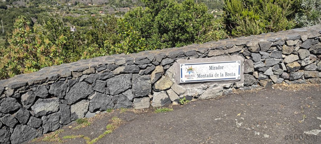

+-
2 km
1 mi
'CyclOSM | Map data: ©, OpenStreetMap contributors'
Montaña de Breña567 m altitude
67 m prominence
5.90 km isolation
RangesMid-Atlantic Islands - North Atlantic Islands
Countries/regionsSpain - Islas Canarias
Distance0.07 km up0.07 km down
Elevation8 m gain8 m loss
Time
0h01 up
0h06 other
0h01 down
0h08 total
Trailhead559 m altitude28.6321660, -17.7823610
RouteA 20-meter long walk up the stairs from the parking area leads directly to the summit and viewpoint.
LinksGPX trail
  • Mid-Atlantic Islands 2024
  • « Montaña Quemada
  • Pico Ruivo »

Mountain Ranges

Anatolia
Central Anatolia
Pontic Mountains
Southeast Anatolia
Taurus Mountains
Western Anatolia
Andes
Puna de Atacama
Atlas Mountains
High Atlas
Northwestern Atlas
Central America Ranges
Costa Rica-Panama Ranges
Central Central America
East China
Taiwan
Eastern Europe Ranges
Southeast Baltic Plains
Iberian Peninsula
Cordillera Cantabrica
Castile Ranges
Portugal-Galicia
Pyrenees
Intermountain West
Great Basin Ranges
Korea-Amur Area
Taebaek Sanmae
Malay Archipelago
Java
Nusa Tengarra
Sulawesi
Sumatra
Mid-Atlantic Islands
North Atlantic Islands
Mongolia Ranges
Altai
Gobi Desert Ranges
Hangay Mountains
Northwest Europe
Great Britain
North France-West Rhine Area
Pacific Ranges
Cascade Range
Northwest U.S. Coast Ranges
Sierra Nevada
Central and Southern California Ranges
Philippines
Central Philippines
Luzon
Mindanao
Southeast Asia
Malay Peninsula
Southeast South America
Pampas
Sierras de Cordoba
Southern Africa
Malawi Highlands
West Africa Mountains
Bight of Benin
Cameroon Mountains
Guinea Highlands

Countries / regions

Algeria
Ain Guezzam
Ain Salah
Aïn Témouchent
El Bayadh
Ghardaïa
Oran
Ouargla
Saïda
Sidi Bel Abbès
Tamanrasset
Argentina
Catamarca
Ciudad Autónoma de Buenos Aires
Córdoba
Jujuy
Salta
Tucumán
Belgium
Brussels Capital Region
Flemish Region
Cameroon
Southwest
China
Taiwan
Costa Rica
Alajuela
Cartago
Guanacaste
Heredia
Limón
San José
Czechia
Prague
Denmark
Greenland
France
Hauts-de-France
Occitania
Germany
Berlin
Niedersachsen
Indonesia
Bali
Jambi
Jawa Tengah
Jawa Timur
Nusa Tenggara Barat
Sulawesi Tengah
Sulawesi Utara
Sumatera Barat
Lithuania
Vilnius County
Mongolia
Bayankhongor
Govi-Altai
Khovd
Omnogovi
Ovorkhangai
Ulan Bator
Zavkhan
Morocco
Béni Mellal-Khénifra
Drâa-Tafilalet
Fez-Meknes
Marrakesh-Safi
Souss-Massa
Tangier-Tetouan-Al Hoceima
Mozambique
Zambezia
Netherlands
Gelderland
Noord-Holland
Zeeland
Nicaragua
Chinandega
Managua
Masaya
Rivas
Philippines
Bicol Region (V)
Cagayan Valley (II)
Calabarzon (IV-A)
Central Luzon (III)
Cordillera Administrative Region
Davao Region
Metro Manila
Soccsksargen (XII)
Western Visayas (VI)
Poland
Greater Poland Voivodeship
Masovian Voivodeship
Portugal
Castelo Branco
Leiria
Lisbon
Madeira
Santarém
Qatar
Ad-Dawhah
São Tomé and Príncipe
São Tomé Province
Sierra Leone
Northern Province
Western Area
Singapore
South Korea
Gyeongsangnam-do
Seoul
Spain
Aragón
Asturias
Castilla-La Mancha
Castilla y León
Catalonia
Islas Canarias
Switzerland
Zürich
Turkey
Antalya
Bitlis
Erzincan
Hakkâri
Igdir
Isparta
Kahraman Maras
Muğla
United Kingdom
England
Scotland
United States
California
Delaware
Florida
Maryland
Nevada
New Jersey
New York
Pennsylvania
South Carolina
Utah

TRIPS

2024
Southern Africa 2024
Mid-Atlantic Islands 2024
North America 2024
Anatolia 2024
Korea-Amur Area 2024
East China 2024
2023
Mongolia Ranges 2023
Philippines 2023
West Africa III 2023
West Africa II 2023
Iberian Peninsula 2023
West Africa 2023
Central America 2023
2022
Andes 2022
Northwest Europe 2022
Malay Archipelago III 2022
Malay Archipelago II 2022
Anatolia Mountains 2022
Iberian Peninsula 2022
Atlas Mountains 2022
North France-West Rhine Area 2022

archaeology (3) climb (157) food (2) hike (155) p30 (17) p50 (4) p100 (24) p300 (12) p600 (17) p1000 (11) p1500 (76) ribu (10) sight (46) summary (16) trig (44) ultra (76)

1 591 km walked, 121 298 m climbed

©2025 p600.org | WordPress Theme by Superbthemes.com
Menu
p600.org
  • home
  • map
  • trips
  • about