Skip to content
Menu
p600.org
  • home
  • map
  • trips
  • about
p600.org

Pico Ruivo East Peak

hike | 2024-04-06

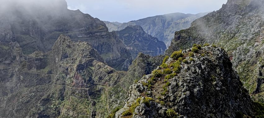
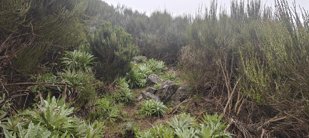
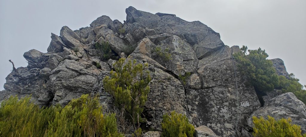
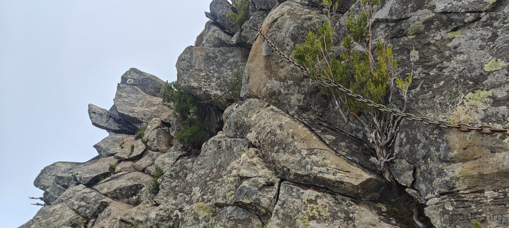
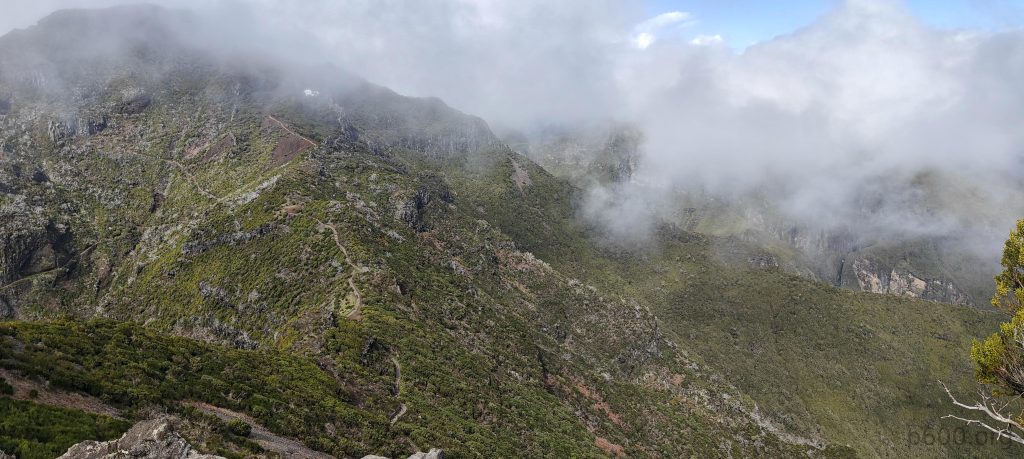
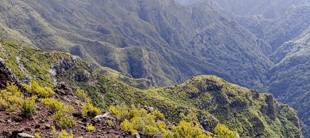
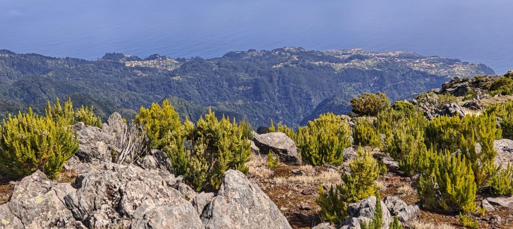
As I trudged with hundreds of tourists to Pico Ruivo, I kept wondering how to shake up this monotonous routine. Then, out of nowhere, I spotted a narrow trail leading to the Pico Ruivo East Peak. It was barely visible through the bushes, but it was definitely a trail—clearly used occasionally by the adventurous. The climb was a bit steep, followed by a short scramble that, to my surprise, had chains for safety.

Despite being overgrown, the trail is still the best route for climbing.
A few scrambling sections are unexpectedly secured with chains, adding a bit of safety to your climbing adventure—always a pleasant surprise.
The crux of the short hike.
The view from the summit.
Paved trail to Pico Ruivo
Views from the summit
As the clouds clear, Pico Ruivo emerges.
The Madeira Island Eastern Mountains Massif Special Protection Area is a rugged, breathtaking region known for its unique biodiversity and dramatic terrain.
A vibrant green ridge runs parallel in the northwest.

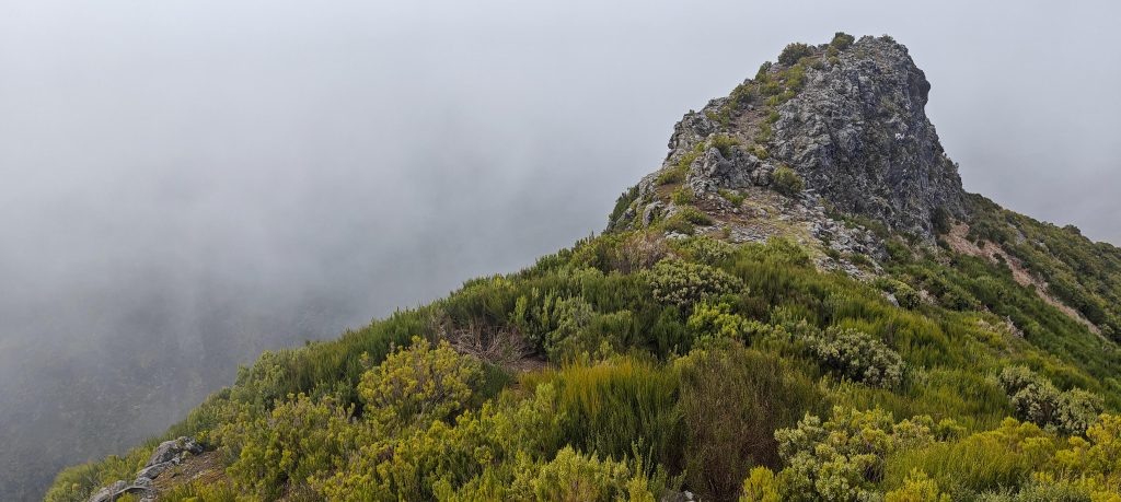
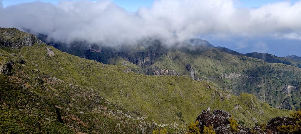
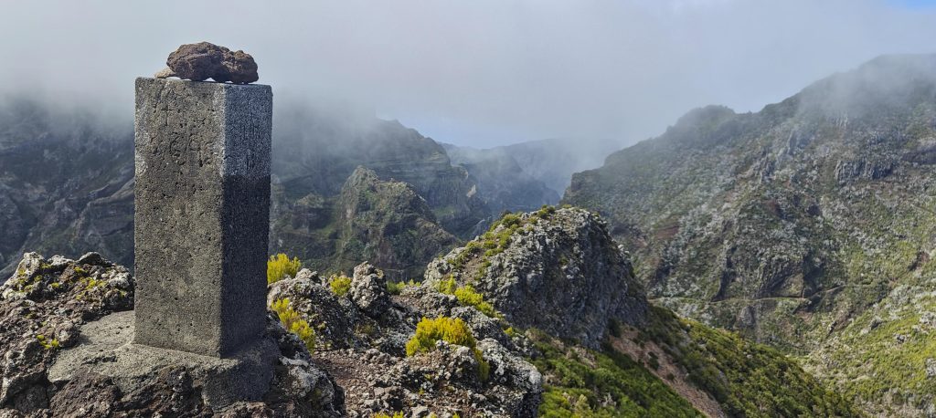
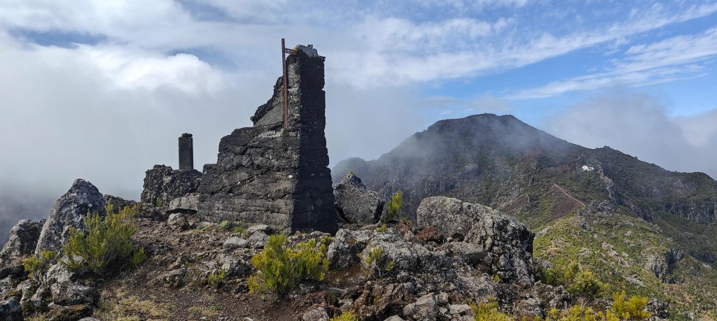
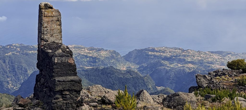
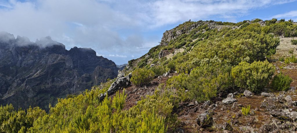
Finally, I spotted the trig pillar, likely marking the high point. With the clouds gone, I enjoyed clear views in one direction, then walked to another side of the ridge to find yet more stunning vistas. There were remnants of some construction—similar to what I’d seen at the summit—sitting right next to the trig pillar.

A sturdy concrete trig pillar marks the summit,
There are remnants of some larger constructions, possibly from an older or grander trig pillar.
A similar structure sits 120 meters to the northeast, suggesting a connection or pattern in these intriguing remnants
Behind a coastal cliff lies Ponta Delgada, with the village of Lombada visible to the left and Boa Ventura to the right.
The summit is remarkably flat, presenting a broad plateau.
Ponta de São Lourenço is the easternmost tip of Madeira, where rugged cliffs meet the Atlantic Ocean
The area boasts impressive steep green scenery.
A glance back at the summit.

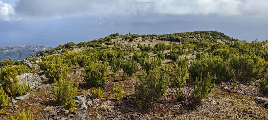
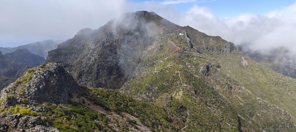
After double-checking the map, I realized I didn’t need to retrace my steps—the trail actually traverses the ridge and ends near the parking lot. I took this trail and quickly found my way back to the official Pico Ruivo path. Interestingly, when I climbed the smaller Pico Ruivo East Summit P60 peak, it wasn’t in the Peakbagger database! So I added it, a nice bonus for bagging the last Portuguese ultra-prominent peak. Then I headed toward Pico Ruivo do Paul da Serra, ready for more adventure. However, Pico do Remal came first, throwing in a surprise peak before I got to my intended destination.


Pico Ruivo East Peak1780 m altitude
70 m prominence
RangesMid-Atlantic Islands - North Atlantic Islands
Countries/regionsPortugal - Madeira
Distance0.40 km up1.40 km down
Elevation74 m gain192 m loss
Time
0h15 up
0h05 other
0h25 down
0h45 total
Trailhead1705 m altitude32.7615020, -16.9334100
RouteOn the way down from Pico Ruivo, I took a barely visible fork to the right from the main trail. This steep, overgrown trail led up to a ridge, where a few easy scrambling steps were protected by chains. After reaching the summit, I traversed the peak and descended on the opposite side, briefly rejoining the paved Pico Ruivo trail.
DifficultiesA few simple scrambling steps are secured with a chain.
LinksGPX trail
  • Mid-Atlantic Islands 2024
  • « Pico Ruivo
  • Pico do Remal »

Mountain Ranges

Anatolia
Central Anatolia
Pontic Mountains
Southeast Anatolia
Taurus Mountains
Western Anatolia
Andes
Puna de Atacama
Atlas Mountains
High Atlas
Northwestern Atlas
Central America Ranges
Costa Rica-Panama Ranges
Central Central America
East China
Taiwan
Eastern Europe Ranges
Southeast Baltic Plains
Iberian Peninsula
Cordillera Cantabrica
Castile Ranges
Portugal-Galicia
Pyrenees
Intermountain West
Great Basin Ranges
Korea-Amur Area
Taebaek Sanmae
Malay Archipelago
Java
Nusa Tengarra
Sulawesi
Sumatra
Mid-Atlantic Islands
North Atlantic Islands
Mongolia Ranges
Altai
Gobi Desert Ranges
Hangay Mountains
Northwest Europe
Great Britain
North France-West Rhine Area
Pacific Ranges
Cascade Range
Northwest U.S. Coast Ranges
Sierra Nevada
Central and Southern California Ranges
Philippines
Central Philippines
Luzon
Mindanao
Southeast Asia
Malay Peninsula
Southeast South America
Pampas
Sierras de Cordoba
Southern Africa
Malawi Highlands
West Africa Mountains
Bight of Benin
Cameroon Mountains
Guinea Highlands

Countries / regions

Algeria
Ain Guezzam
Ain Salah
Aïn Témouchent
El Bayadh
Ghardaïa
Oran
Ouargla
Saïda
Sidi Bel Abbès
Tamanrasset
Argentina
Catamarca
Ciudad Autónoma de Buenos Aires
Córdoba
Jujuy
Salta
Tucumán
Belgium
Brussels Capital Region
Flemish Region
Cameroon
Southwest
China
Taiwan
Costa Rica
Alajuela
Cartago
Guanacaste
Heredia
Limón
San José
Czechia
Prague
Denmark
Greenland
France
Hauts-de-France
Occitania
Germany
Berlin
Niedersachsen
Indonesia
Bali
Jambi
Jawa Tengah
Jawa Timur
Nusa Tenggara Barat
Sulawesi Tengah
Sulawesi Utara
Sumatera Barat
Lithuania
Vilnius County
Mongolia
Bayankhongor
Govi-Altai
Khovd
Omnogovi
Ovorkhangai
Ulan Bator
Zavkhan
Morocco
Béni Mellal-Khénifra
Drâa-Tafilalet
Fez-Meknes
Marrakesh-Safi
Souss-Massa
Tangier-Tetouan-Al Hoceima
Mozambique
Zambezia
Netherlands
Gelderland
Noord-Holland
Zeeland
Nicaragua
Chinandega
Managua
Masaya
Rivas
Philippines
Bicol Region (V)
Cagayan Valley (II)
Calabarzon (IV-A)
Central Luzon (III)
Cordillera Administrative Region
Davao Region
Metro Manila
Soccsksargen (XII)
Western Visayas (VI)
Poland
Greater Poland Voivodeship
Masovian Voivodeship
Portugal
Castelo Branco
Leiria
Lisbon
Madeira
Santarém
Qatar
Ad-Dawhah
São Tomé and Príncipe
São Tomé Province
Sierra Leone
Northern Province
Western Area
Singapore
South Korea
Gyeongsangnam-do
Seoul
Spain
Aragón
Asturias
Castilla-La Mancha
Castilla y León
Catalonia
Islas Canarias
Switzerland
Zürich
Turkey
Antalya
Bitlis
Erzincan
Hakkâri
Igdir
Isparta
Kahraman Maras
Muğla
United Kingdom
England
Scotland
United States
California
Delaware
Florida
Maryland
Nevada
New Jersey
New York
Pennsylvania
South Carolina
Utah

TRIPS

2024
Southern Africa 2024
Mid-Atlantic Islands 2024
North America 2024
Anatolia 2024
Korea-Amur Area 2024
East China 2024
2023
Mongolia Ranges 2023
Philippines 2023
West Africa III 2023
West Africa II 2023
Iberian Peninsula 2023
West Africa 2023
Central America 2023
2022
Andes 2022
Northwest Europe 2022
Malay Archipelago III 2022
Malay Archipelago II 2022
Anatolia Mountains 2022
Iberian Peninsula 2022
Atlas Mountains 2022
North France-West Rhine Area 2022

archaeology (3) climb (157) food (2) hike (155) p30 (17) p50 (4) p100 (24) p300 (12) p600 (17) p1000 (11) p1500 (76) ribu (10) sight (46) summary (16) trig (44) ultra (76)

1 591 km walked, 121 298 m climbed

©2025 p600.org | WordPress Theme by Superbthemes.com