Skip to content
Menu
p600.org
  • home
  • map
  • trips
  • about
p600.org

Pico Ruivo do Paul da Serra

hike | 2024-04-06

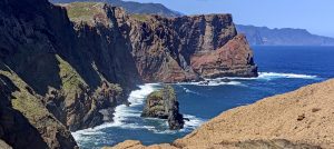
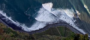
As I drove down from the island highpoint towards Santana, I saw a lot of cars lining up for this dead-end road. No problem, though—I’d already climbed it earlier that morning. From there, I took the scenic northside route to Ponta Delgada, where the old coast road caught my eye. It’s often closed to cars but would make an amazing hiking trail along the dramatic north coast. In Ponta Delgada, I couldn’t resist a detour to check out two miradores. Both stops were totally worth it—I watched massive waves crash into small sea stacks. Quite the spectacle!

Calheta village is a picturesque coastal spot in Madeira, boasting scenic views.

Next, I headed to São Vicente, where Google Maps suggested I drive straight up toward my peak. Sounds easy, but there’s a catch: the road is unpaved, and I’d definitely violate my rental car insurance. From experience, I know these twisty forest roads tend to go from bumpy to wrecked real fast. So, I ditched that plan and checked the map, only to find that the road southeast is closed until April 30. Just great. Time to switch gears and explore the rest of the north coast, hit the northernmost tourist spots, then maybe venture to the westernmost points before driving to Pico Ruivo do Paul da Serra.

Southwest coast

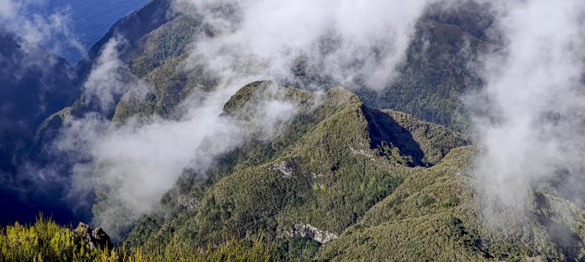
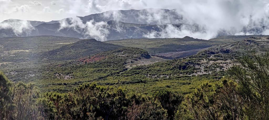
I drove around the island in an anti-clockwise direction, then climbed by car to the summit plateau, where I found an impressive stretch of road running surprisingly straight. I half-expected to hit a tunnel; roads in the mountains aren’t usually this direct. Oh, and on the way, I spotted Pico do Remal 1319m P147—just begging for a quick hike.

The trail to Pico Ruivo do Paul da Serra winds through a forested landscape that feels more like the Canadian wilderness than a subtropical island in the mid-Atlantic.

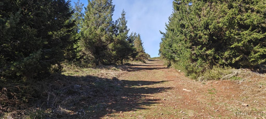
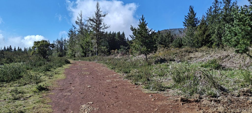
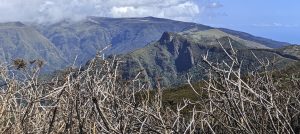
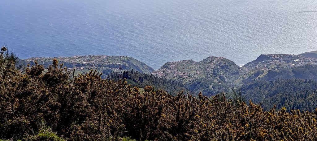
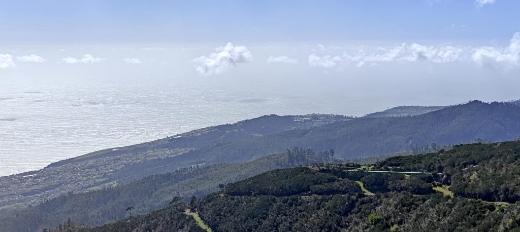
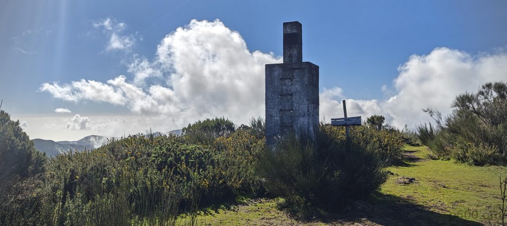
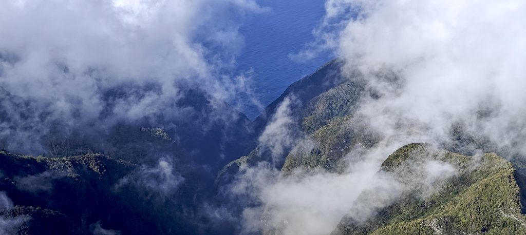
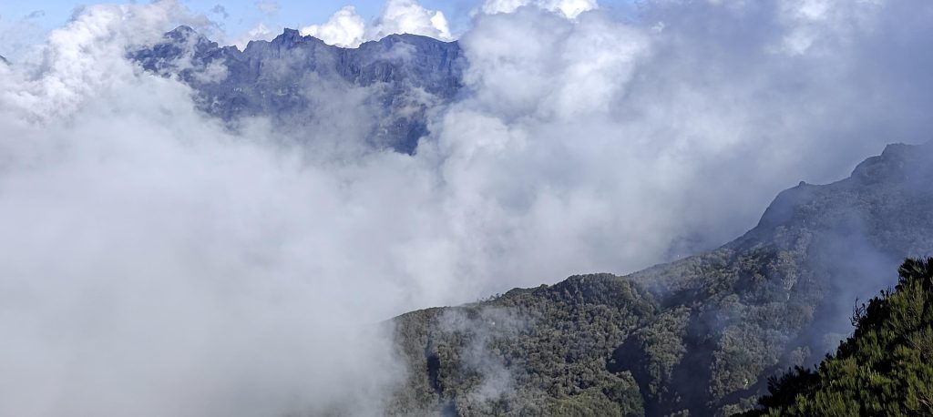
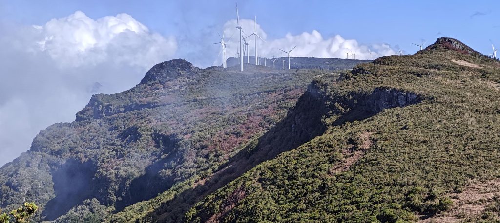
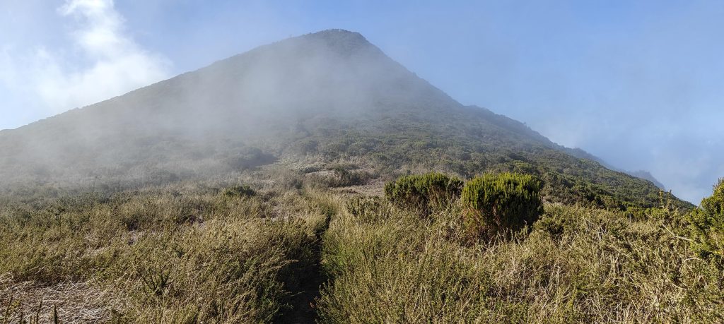
Finally, I drove the remaining kilometers to my target, parked in the dedicated roadside lot, and decided not to bother changing into hiking shoes. I just walked toward the summit on one of the trails. The landscape felt more like a Canadian forest at first—but that didn’t last long. Once I got into the open, it was clearly Madeira again. The climb was quick, and I found the trig pillar at the top. I have to say, Portugal is a paradise for trig pillar hunters. I think this was my third or fourth today. With the peak bagged, I checked out the viewpoints in all directions, and the one looking toward São Vicente stood out the most.

A Portuguese-style trig pillar stands proudly on a few-meter-high pedestal.
I wasn’t the only one peakbagging today; looks like I’ve got some company at the top.
The panoramas were partly lost in the clouds.
The “Madeira Island Central Mountainous Massif Special Area of Conservation”—yeah, that’s a mouthful—sounds like it’s trying to win an award for longest name.
Wind turbines line the southeast edge of the ridge.
Looking back at the peak on the way down.

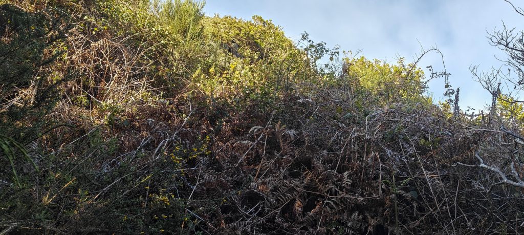
On the way down, I took a detour to check out P30 to the southeast. I approached from three different directions, but each time, I hit dense, thorny bushes. So, I gave up.

The thicket of bushes en route to southeast P30 made me think twice, so I decided to give it a miss today.

It seems my Portuguese P600 list is nearing the end, maybe with just a couple more peaks left. It’s a shame because I really enjoy this country. I might need to lower my prominence targets to P500 or P300. Back at the car, I started driving toward my hotel, but along the way, I noticed two easier targets: Pico do Galo and Pico da Torre. Looks like my peak-bagging day wasn’t quite over yet.


Pico Ruivo do Paul da Serra1649 m altitude
642 m prominence
9.20 km isolation
RangesMid-Atlantic Islands - North Atlantic Islands
Countries/regionsPortugal - Madeira
Distance1.10 km up1.40 km down
Elevation87 m gain87 m loss
Time
0h20 up
0h05 other
0h25 down
0h50 total
Trailhead1562 m altitude32.7699720, -17.0780270
RouteI parked in the lot and took a wide, gradual path, probably part of the forest fire protection system, then followed a shorter, steeper trail to the summit. On the way down, I made a small loop to check out another P30, but the bushes were too thick.
DifficultiesThe north route is an unpaved forest track, not ideal for a small rental car, and the southeast route was closed, so my only option was to take the southwest route.
LinksGPX trail
  • Mid-Atlantic Islands 2024
  • « Pico do Remal
  • Pico do Galo »

Mountain Ranges

Anatolia
Central Anatolia
Pontic Mountains
Southeast Anatolia
Taurus Mountains
Western Anatolia
Andes
Puna de Atacama
Atlas Mountains
High Atlas
Northwestern Atlas
Central America Ranges
Costa Rica-Panama Ranges
Central Central America
East China
Taiwan
Eastern Europe Ranges
Southeast Baltic Plains
Iberian Peninsula
Cordillera Cantabrica
Castile Ranges
Portugal-Galicia
Pyrenees
Intermountain West
Great Basin Ranges
Korea-Amur Area
Taebaek Sanmae
Malay Archipelago
Java
Nusa Tengarra
Sulawesi
Sumatra
Mid-Atlantic Islands
North Atlantic Islands
Mongolia Ranges
Altai
Gobi Desert Ranges
Hangay Mountains
Northwest Europe
Great Britain
North France-West Rhine Area
Pacific Ranges
Cascade Range
Northwest U.S. Coast Ranges
Sierra Nevada
Central and Southern California Ranges
Philippines
Central Philippines
Luzon
Mindanao
Southeast Asia
Malay Peninsula
Southeast South America
Pampas
Sierras de Cordoba
Southern Africa
Malawi Highlands
West Africa Mountains
Bight of Benin
Cameroon Mountains
Guinea Highlands

Countries / regions

Algeria
Ain Guezzam
Ain Salah
Aïn Témouchent
El Bayadh
Ghardaïa
Oran
Ouargla
Saïda
Sidi Bel Abbès
Tamanrasset
Argentina
Catamarca
Ciudad Autónoma de Buenos Aires
Córdoba
Jujuy
Salta
Tucumán
Belgium
Brussels Capital Region
Flemish Region
Cameroon
Southwest
China
Taiwan
Costa Rica
Alajuela
Cartago
Guanacaste
Heredia
Limón
San José
Czechia
Prague
Denmark
Greenland
France
Hauts-de-France
Occitania
Germany
Berlin
Niedersachsen
Indonesia
Bali
Jambi
Jawa Tengah
Jawa Timur
Nusa Tenggara Barat
Sulawesi Tengah
Sulawesi Utara
Sumatera Barat
Lithuania
Vilnius County
Mongolia
Bayankhongor
Govi-Altai
Khovd
Omnogovi
Ovorkhangai
Ulan Bator
Zavkhan
Morocco
Béni Mellal-Khénifra
Drâa-Tafilalet
Fez-Meknes
Marrakesh-Safi
Souss-Massa
Tangier-Tetouan-Al Hoceima
Mozambique
Zambezia
Netherlands
Gelderland
Noord-Holland
Zeeland
Nicaragua
Chinandega
Managua
Masaya
Rivas
Philippines
Bicol Region (V)
Cagayan Valley (II)
Calabarzon (IV-A)
Central Luzon (III)
Cordillera Administrative Region
Davao Region
Metro Manila
Soccsksargen (XII)
Western Visayas (VI)
Poland
Greater Poland Voivodeship
Masovian Voivodeship
Portugal
Castelo Branco
Leiria
Lisbon
Madeira
Santarém
Qatar
Ad-Dawhah
São Tomé and Príncipe
São Tomé Province
Sierra Leone
Northern Province
Western Area
Singapore
South Korea
Gyeongsangnam-do
Seoul
Spain
Aragón
Asturias
Castilla-La Mancha
Castilla y León
Catalonia
Islas Canarias
Switzerland
Zürich
Turkey
Antalya
Bitlis
Erzincan
Hakkâri
Igdir
Isparta
Kahraman Maras
Muğla
United Kingdom
England
Scotland
United States
California
Delaware
Florida
Maryland
Nevada
New Jersey
New York
Pennsylvania
South Carolina
Utah

TRIPS

2024
Southern Africa 2024
Mid-Atlantic Islands 2024
North America 2024
Anatolia 2024
Korea-Amur Area 2024
East China 2024
2023
Mongolia Ranges 2023
Philippines 2023
West Africa III 2023
West Africa II 2023
Iberian Peninsula 2023
West Africa 2023
Central America 2023
2022
Andes 2022
Northwest Europe 2022
Malay Archipelago III 2022
Malay Archipelago II 2022
Anatolia Mountains 2022
Iberian Peninsula 2022
Atlas Mountains 2022
North France-West Rhine Area 2022

archaeology (3) climb (157) food (2) hike (155) p30 (17) p50 (4) p100 (24) p300 (12) p600 (17) p1000 (11) p1500 (76) ribu (10) sight (46) summary (16) trig (44) ultra (76)

1 591 km walked, 121 298 m climbed

©2025 p600.org | WordPress Theme by Superbthemes.com