Skip to content
Menu
p600.org
  • home
  • map
  • trips
  • about
p600.org

Mozambique’s Only Ultra: Serra Namuli

hike | 2024-09-28

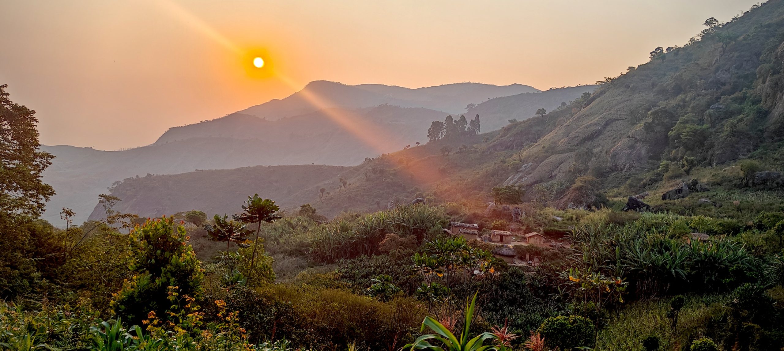
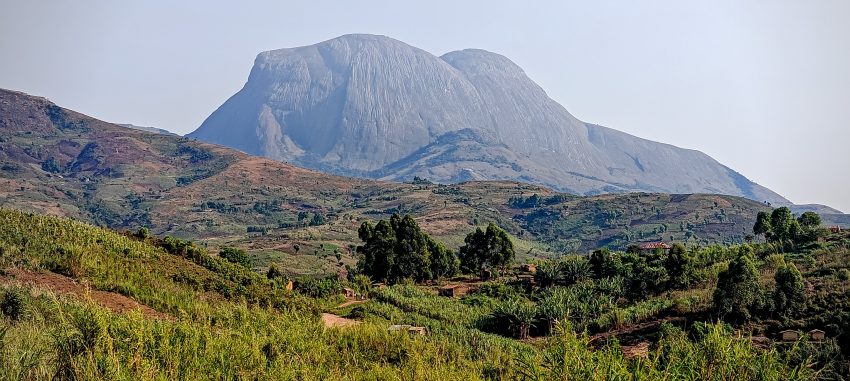
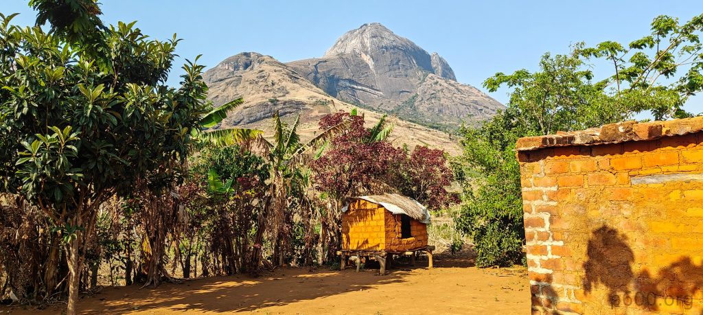
Mozambique has only one Ultra-prominent peak, and that red dot on the map? Yep, that’s “Piercing Eye” — or at least that’s how it felt staring at it. Time to switch it to green. The 1757-meter prominence is solid on its own, but that 158 km isolation? A sweet little bonus. Our guide Cotxane mentioned the mountain holds special significance for Mozambicans. It’s said that when people die, their souls from all corners of the country make their way to Serra Namuli to wait for whatever the almighty has planned next. Apparently, even the dead get oriented — they’re buried facing the peak.

Cleared for takeoff..

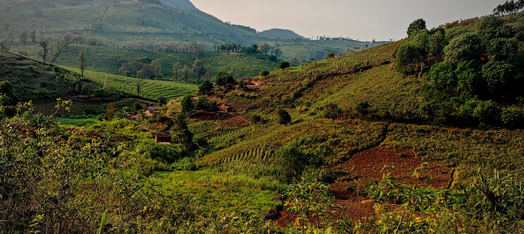
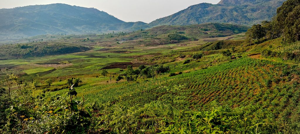
After breakfast at our accommodation in the nearest village, Gurúè, we set off toward the trailhead in Capatcha. The hotel was basic but totally fine—no WiFi, but cold beer was always available, thanks to the ever-watchful guard. The approximately 32 km of unpaved road wasn’t too bad overall, though a few rough patches definitely required high clearance. Some of the steeper sections had been reinforced with concrete.

On the way up, locals flagged down our car, and a lively discussion began between them, our driver, and Cotxane. On the way back we learned what it was all about — the locals had recently paved a short stretch of road and were worried we’d wreck it. Luckily, our driver was careful. We didn’t.

The summit and the route from the village of Capatcha.
Turns out there are queens not just in Europe — and this one holds the mountain.

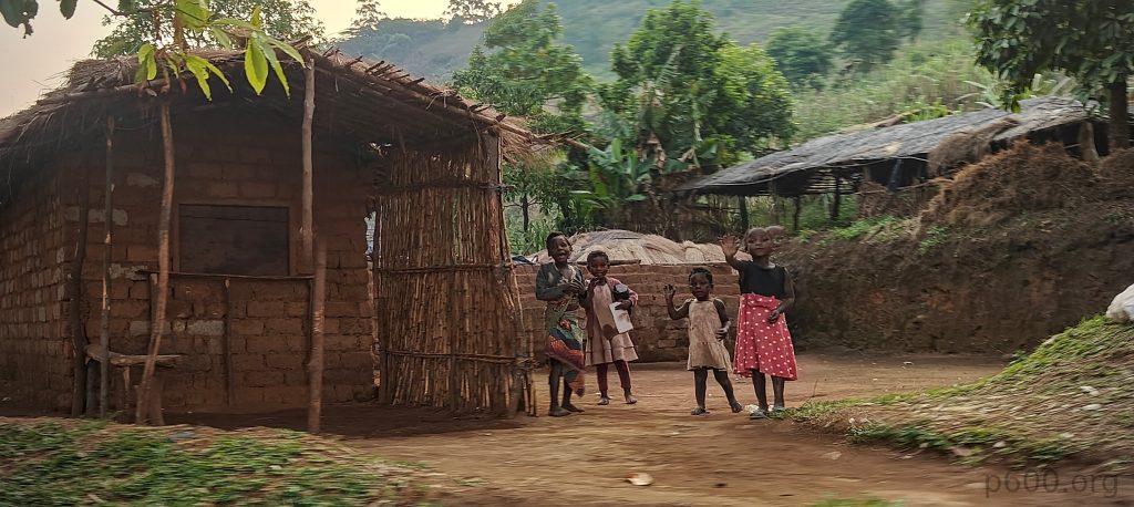
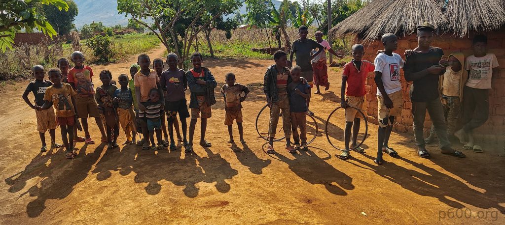
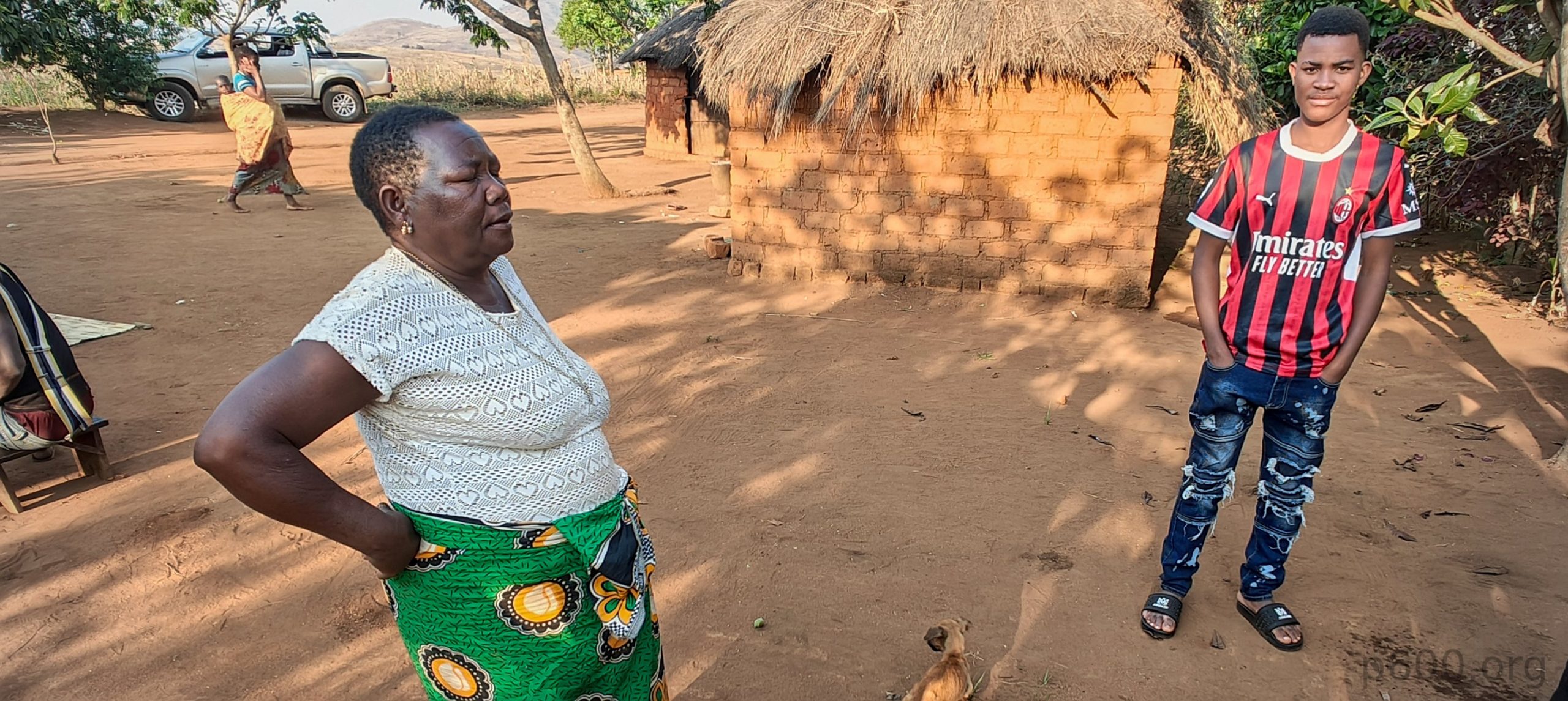
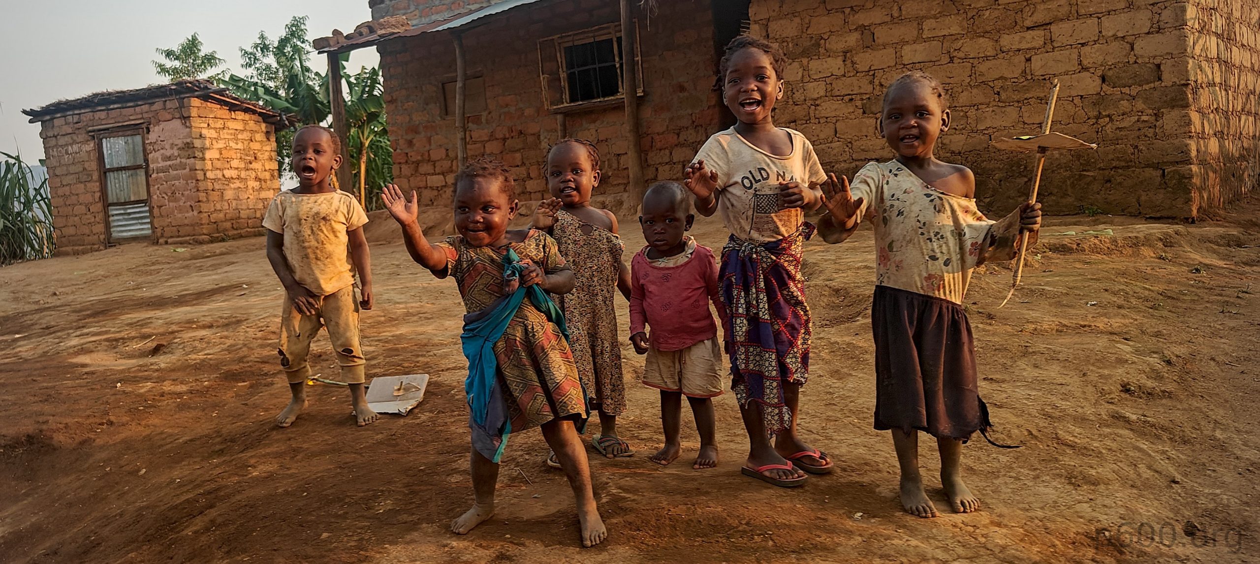
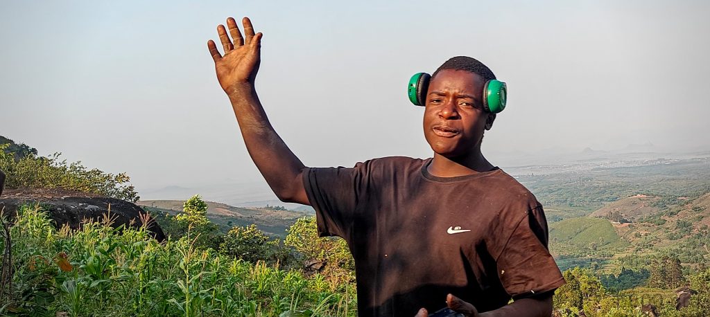
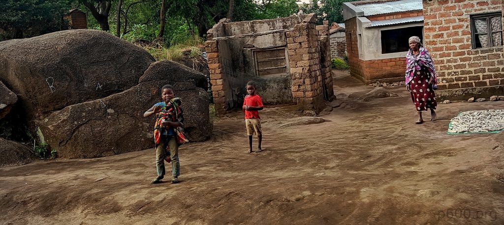
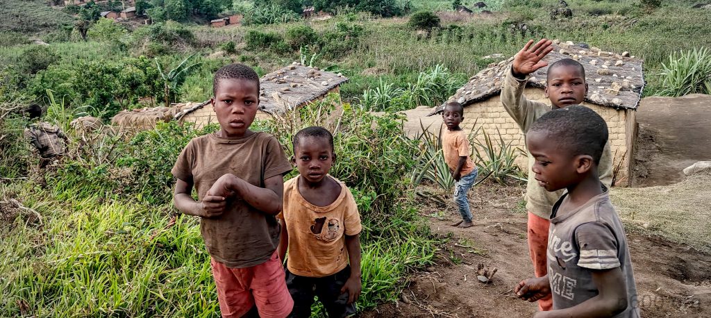
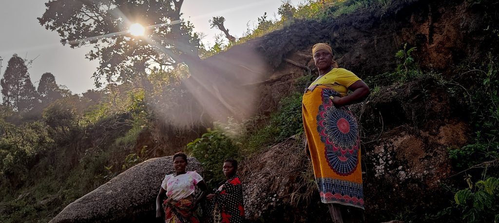
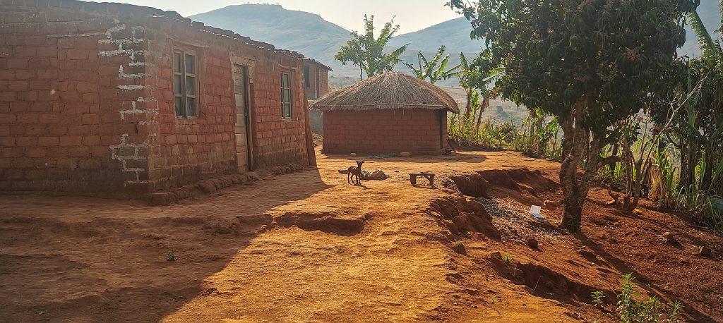
We parked near one of the homes in Capatcha, northeast of the summit. Greeted by polite kids and friendly locals, we made our way to meet the local queen. Yes — before any steps are taken uphill, there’s a process. Every climber must be blessed by her. Cotxane brought gifts, including a live chicken and some cash. The queen apologized — a villager had passed away the night before, and the blessing ceremony couldn’t be performed immediately. But she promised to do the ritual later that evening and gave us the go-ahead. Green light: on.

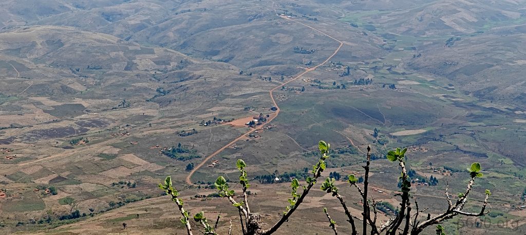
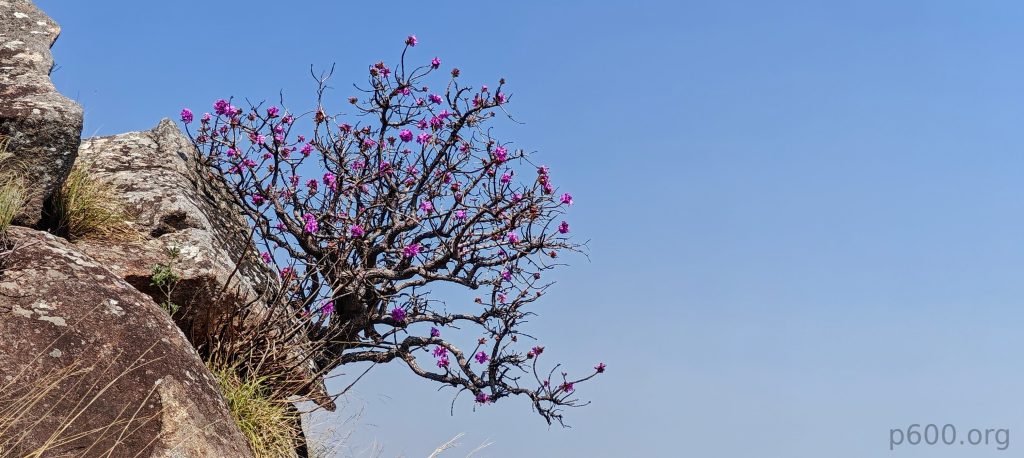
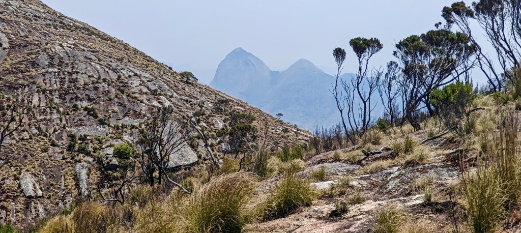
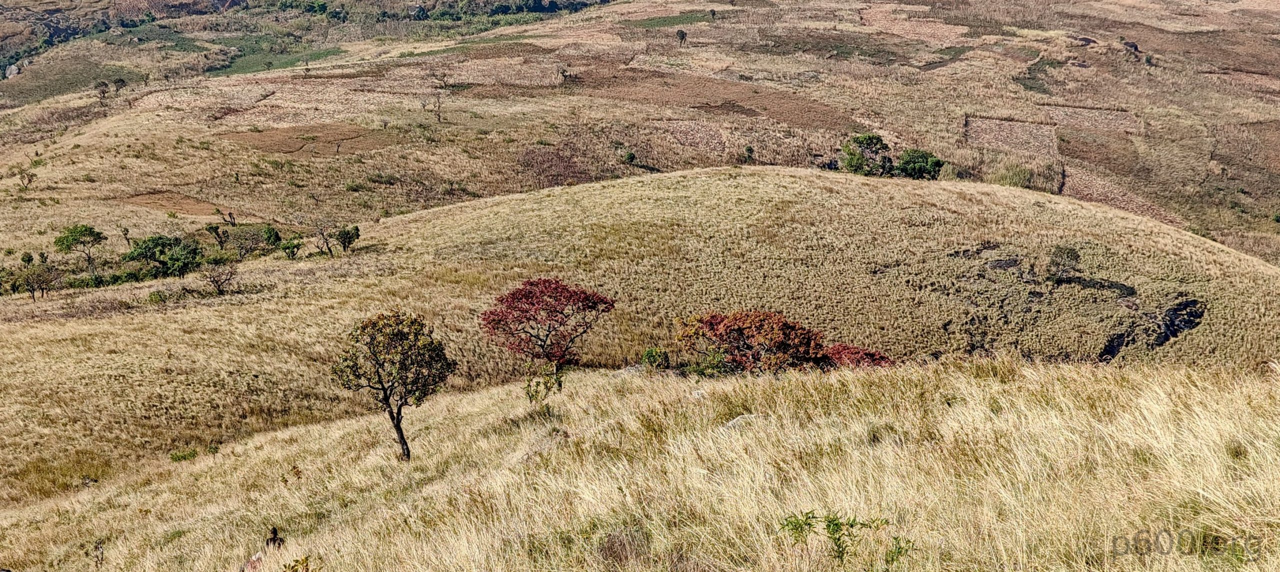
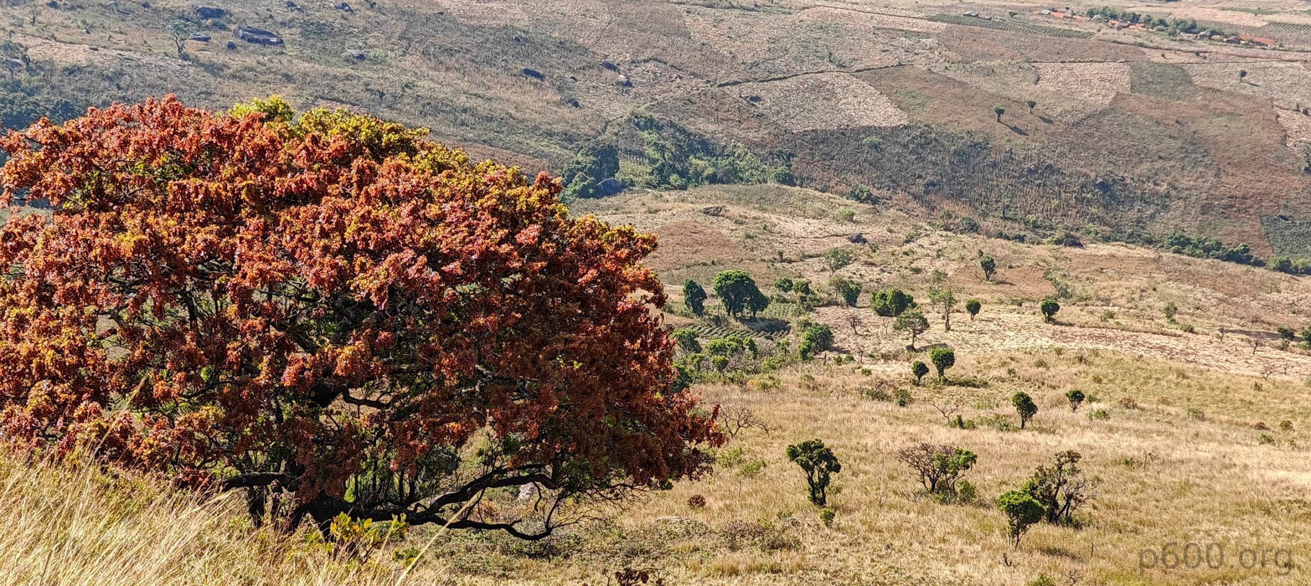
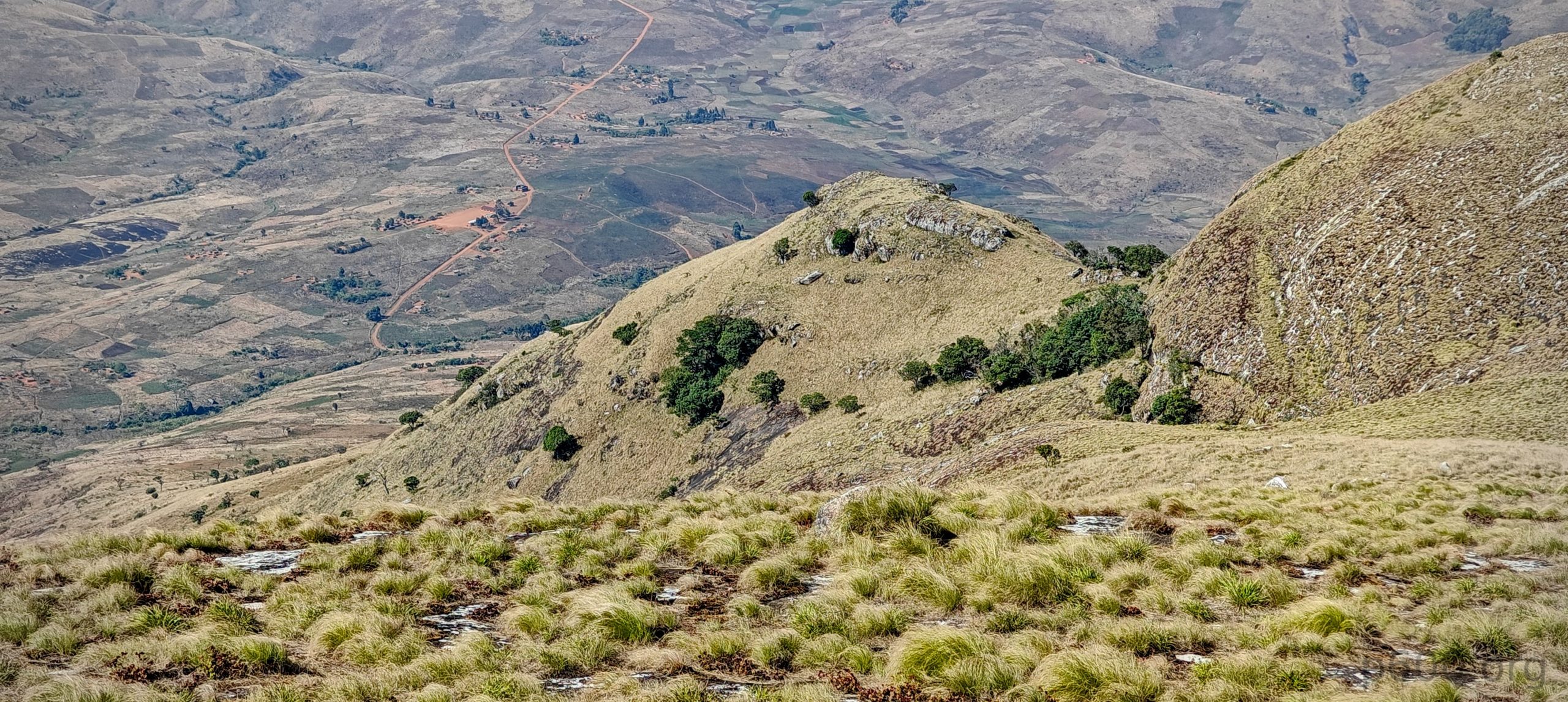
The hike started on a grassy track across farmland. High grass in places made it hard to see your footing, but the trail climbed gradually and was pretty easy to follow. It starts clearly, then turns grassy and tussocky before the granite slabs begin. We followed the ridge, then skirted a few small bumps. At one point we stopped at a special tree — apparently a wishing tree. I wished to get to the summit. Looked like it worked.

Last section before the summit. Recommended footwear: hooves or sticky feet.

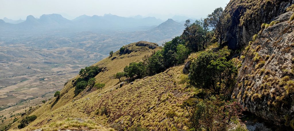
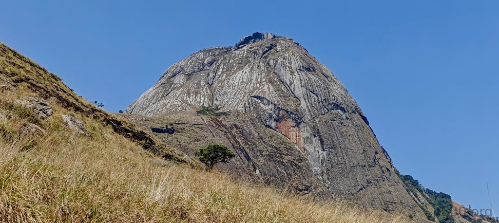
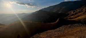
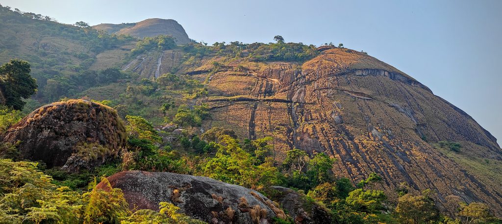
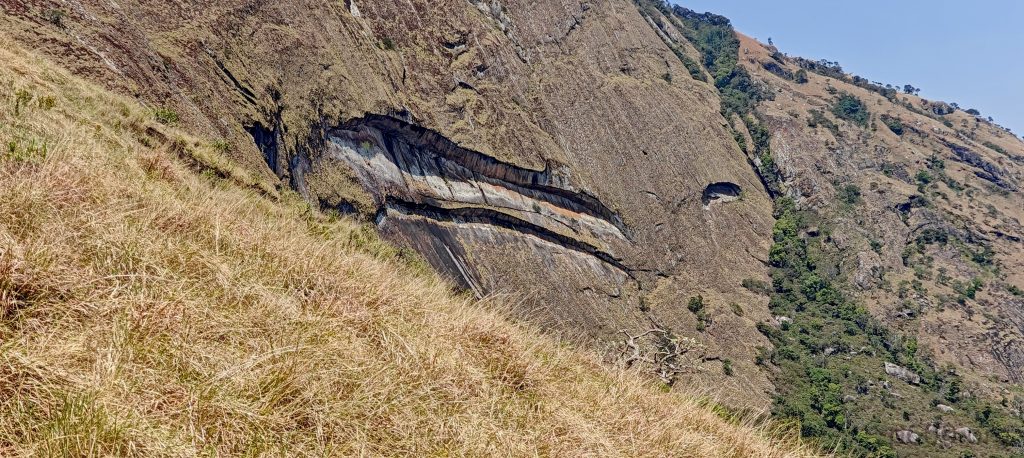
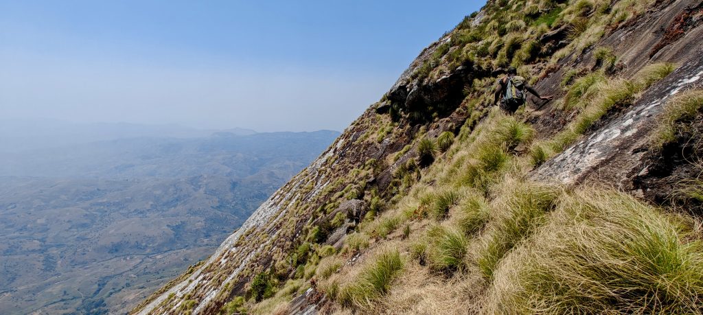
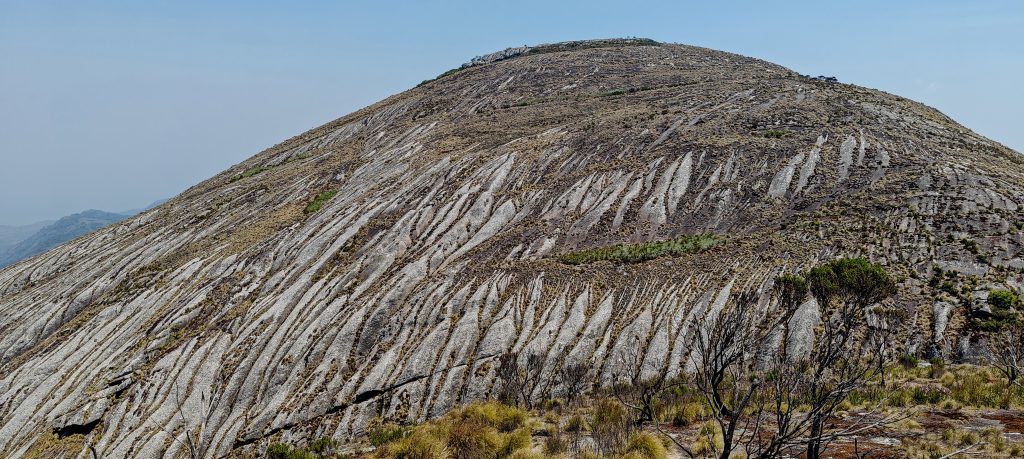
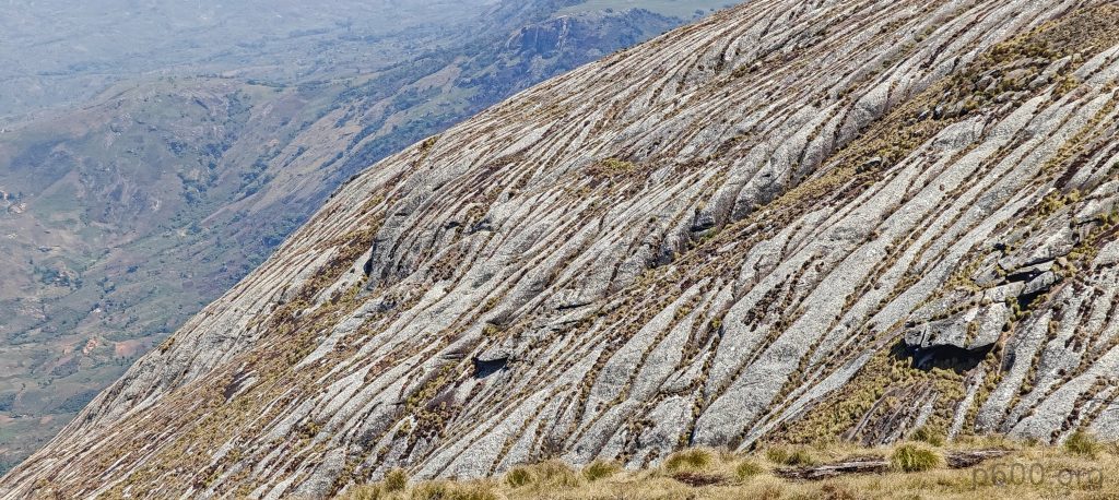
The fun part came next: angled granite slabs, about 30–45 degrees, mossy, and of course, zero protection. Going up wasn’t terrible — always some tufts of grass or a gap or crack to wedge your foot into. The problem would be going down. A slip could send one sliding 50, 100, or even the full 300 meters. The locals, of course, were skipping around like it was a park. This is their rabbit hunting zone, after all.

Near the end of the slab section, we hit a proper Class 4 step. Nothing wildly exposed, but it demanded some creative movement—a semi-chimney maneuver with a hanging tree trunk in one hand. The trunk, wedged into a cleft, was the local version of a climbing rope. It felt surprisingly secure, and while not exactly graceful, it did the job. Once past that, the angle eased, the granite slabs mellowed out, and the summit came into view.

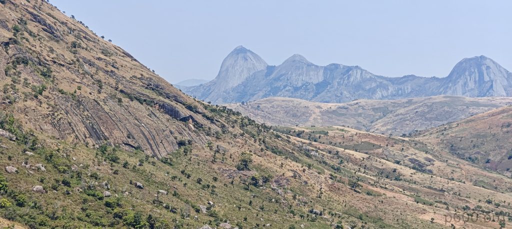
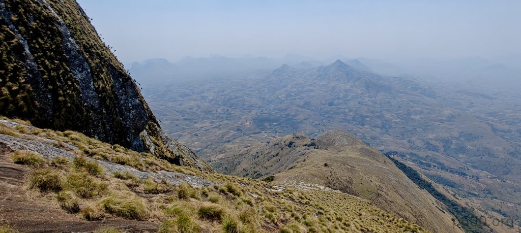
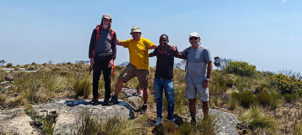
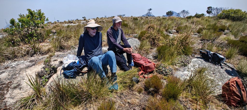
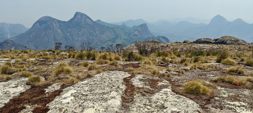
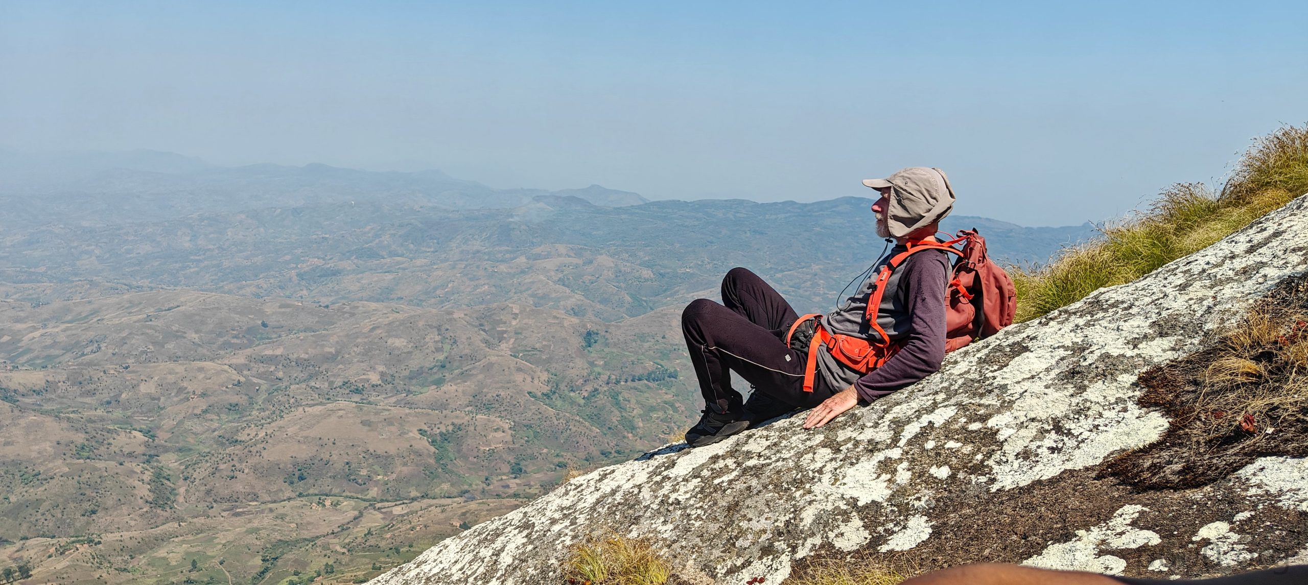
The final hundred meters were a mellow walk across more granite slabs. A few minutes later, we were all at the top — time for snacks, drinks, and catching our breath. Clear skies, sweeping views in every direction, and impressive surrounding peaks made the effort worth it. Rob, as usual, pulled out his hand level to check nearby summits for any contenders.

Rob, me, Cotxane, Alistair on the summit.
John and Rob.
Finally sitting on something that isn’t trying to throw you off — just a friendly, almost horizontal rock.
Rob and Alistair descending.

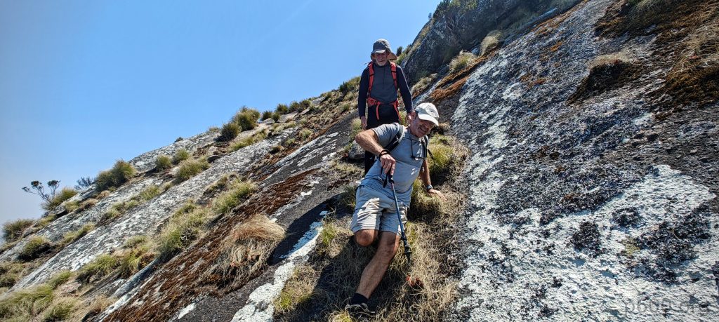
Time to head down. I wasn’t exactly looking forward to the slab section in reverse. Going down always brings its own type of “fun.” At the hanging tree, I relied fully on its questionable support. Without it, those few steps would’ve been dodgy. Then came the mossy slab section. I tested every descent technique known to humankind: facing forward, backward, sideways, on all fours, on two legs, possibly inventing new ones along the way. Somehow, we all made it. I whispered a thank you to the magic tree on the way back.

Our morning gift to the queen: a chicken — sadly, this time, in a pot.

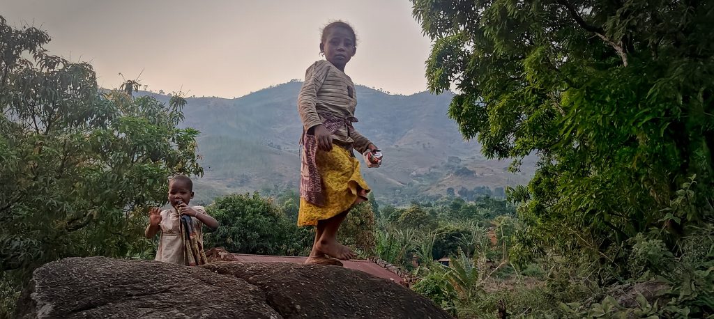
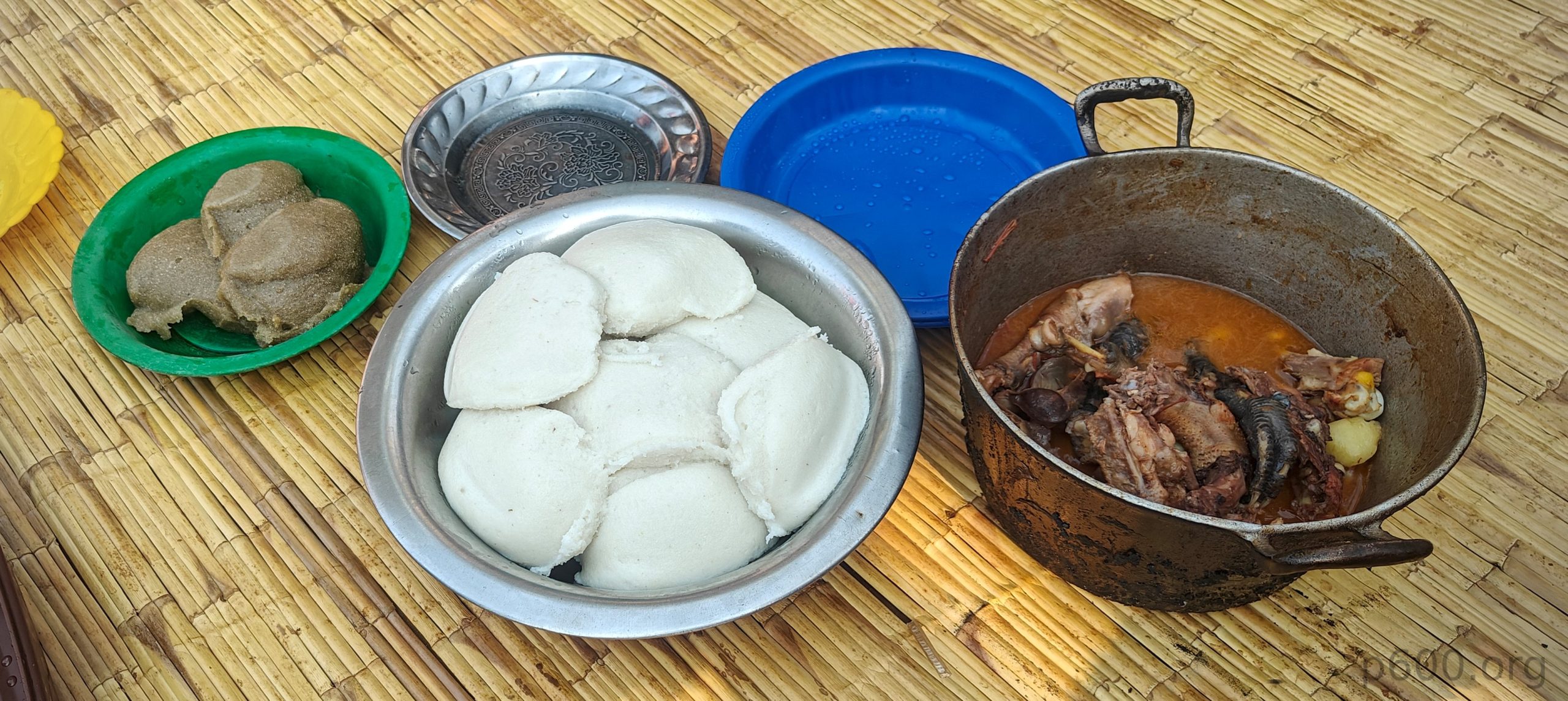
The final walk to the queen’s house was relaxed — just a stroll through the grass. She greeted us warmly and invited us to lunch: a stew made with the same chicken from earlier. The return drive on the unpaved road went smoothly. Back at our accommodation, dinner was surprisingly good — home-cooked by the owners and served on golden plates with matching golden cuttlery. What more could a peakbagger ask for after a day on granite? Hot food, cold beer, and a place to sit that isn’t tilted at 45 degrees. Mozambique’s one and only Ultra? Done. Next, we’re heading to Malawi to take on Sapitwa Peak.

A warm farewell from the children,

Serra Namuli2419 m altitude
1757 m prominence
156.80 km isolation
RangesSouthern Africa - Malawi Highlands
Countries/regionsMozambique - Zambezia
Distance4.60 km up4.60 km down
Elevation1193 m gain1193 m loss
Time
3h10 up
0,h30 other
3h00 down
6h40 total
Trailhead1225 m altitude-15.3358970, 37.0829120
RouteBegin in Capatcha village; parking is available near the queen’s house. A traditional blessing by the mountain queen is customary but may be skipped. The trail starts on gradual grassy slopes through farmland—easy walking, though high grass can obscure footing. After about 90 minutes, the path turns into steep granite slabs (30–40°), mossy and exposed, with little protection—dangerous when wet. A short Class 4 scramble follows, aided by a hanging tree trunk. The final stretch is a gentle walk to a broad summit with panoramic views. Descend the same way.
DifficultiesSteep unprotected slabs (30–40°) near the summit — dangerous when wet. One short Class 4 scramble with a hanging tree trunk. Unpaved approach road (32 km) can be tough in the wet season — high clearance needed.
LinksGPX trail
  • « Anatolia 2024

Mountain Ranges

Anatolia
Central Anatolia
Pontic Mountains
Southeast Anatolia
Taurus Mountains
Western Anatolia
Andes
Puna de Atacama
Atlas Mountains
High Atlas
Northwestern Atlas
Central America Ranges
Costa Rica-Panama Ranges
Central Central America
East China
Taiwan
Eastern Europe Ranges
Southeast Baltic Plains
Iberian Peninsula
Cordillera Cantabrica
Castile Ranges
Portugal-Galicia
Pyrenees
Intermountain West
Great Basin Ranges
Korea-Amur Area
Taebaek Sanmae
Malay Archipelago
Java
Nusa Tengarra
Sulawesi
Sumatra
Mid-Atlantic Islands
North Atlantic Islands
Mongolia Ranges
Altai
Gobi Desert Ranges
Hangay Mountains
Northwest Europe
Great Britain
North France-West Rhine Area
Pacific Ranges
Cascade Range
Northwest U.S. Coast Ranges
Sierra Nevada
Central and Southern California Ranges
Philippines
Central Philippines
Luzon
Mindanao
Southeast Asia
Malay Peninsula
Southeast South America
Pampas
Sierras de Cordoba
Southern Africa
Malawi Highlands
West Africa Mountains
Bight of Benin
Cameroon Mountains
Guinea Highlands

Countries / regions

Algeria
Ain Guezzam
Ain Salah
Aïn Témouchent
El Bayadh
Ghardaïa
Oran
Ouargla
Saïda
Sidi Bel Abbès
Tamanrasset
Argentina
Catamarca
Ciudad Autónoma de Buenos Aires
Córdoba
Jujuy
Salta
Tucumán
Belgium
Brussels Capital Region
Flemish Region
Cameroon
Southwest
China
Taiwan
Costa Rica
Alajuela
Cartago
Guanacaste
Heredia
Limón
San José
Czechia
Prague
Denmark
Greenland
France
Hauts-de-France
Occitania
Germany
Berlin
Niedersachsen
Indonesia
Bali
Jambi
Jawa Tengah
Jawa Timur
Nusa Tenggara Barat
Sulawesi Tengah
Sulawesi Utara
Sumatera Barat
Lithuania
Vilnius County
Mongolia
Bayankhongor
Govi-Altai
Khovd
Omnogovi
Ovorkhangai
Ulan Bator
Zavkhan
Morocco
Béni Mellal-Khénifra
Drâa-Tafilalet
Fez-Meknes
Marrakesh-Safi
Souss-Massa
Tangier-Tetouan-Al Hoceima
Mozambique
Zambezia
Netherlands
Gelderland
Noord-Holland
Zeeland
Nicaragua
Chinandega
Managua
Masaya
Rivas
Philippines
Bicol Region (V)
Cagayan Valley (II)
Calabarzon (IV-A)
Central Luzon (III)
Cordillera Administrative Region
Davao Region
Metro Manila
Soccsksargen (XII)
Western Visayas (VI)
Poland
Greater Poland Voivodeship
Masovian Voivodeship
Portugal
Castelo Branco
Leiria
Lisbon
Madeira
Santarém
Qatar
Ad-Dawhah
São Tomé and Príncipe
São Tomé Province
Sierra Leone
Northern Province
Western Area
Singapore
South Korea
Gyeongsangnam-do
Seoul
Spain
Aragón
Asturias
Castilla-La Mancha
Castilla y León
Catalonia
Islas Canarias
Switzerland
Zürich
Turkey
Antalya
Bitlis
Erzincan
Hakkâri
Igdir
Isparta
Kahraman Maras
Muğla
United Kingdom
England
Scotland
United States
California
Delaware
Florida
Maryland
Nevada
New Jersey
New York
Pennsylvania
South Carolina
Utah

TRIPS

2024
Southern Africa 2024
Mid-Atlantic Islands 2024
North America 2024
Anatolia 2024
Korea-Amur Area 2024
East China 2024
2023
Mongolia Ranges 2023
Philippines 2023
West Africa III 2023
West Africa II 2023
Iberian Peninsula 2023
West Africa 2023
Central America 2023
2022
Andes 2022
Northwest Europe 2022
Malay Archipelago III 2022
Malay Archipelago II 2022
Anatolia Mountains 2022
Iberian Peninsula 2022
Atlas Mountains 2022
North France-West Rhine Area 2022

archaeology (3) climb (157) food (2) hike (155) p30 (17) p50 (4) p100 (24) p300 (12) p600 (17) p1000 (11) p1500 (76) ribu (10) sight (46) summary (16) trig (44) ultra (76)

1 591 km walked, 121 298 m climbed

©2025 p600.org | WordPress Theme by Superbthemes.com