Skip to content
Menu
p600.org
  • home
  • map
  • trips
  • about
p600.org

Uludaz

hike | 2024-07-20

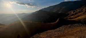
I land in Gaziantep after 3 a.m. By 4 a.m., Rob and I are at the airport—our third reunion on this trip. At 9 a.m., it’s not just Rob and me, but our car stopping near the summit of Uludaz, another ultra-prominent mountain in Turkey.

The summit offers sweeping views of distant peaks fading into the horizon.

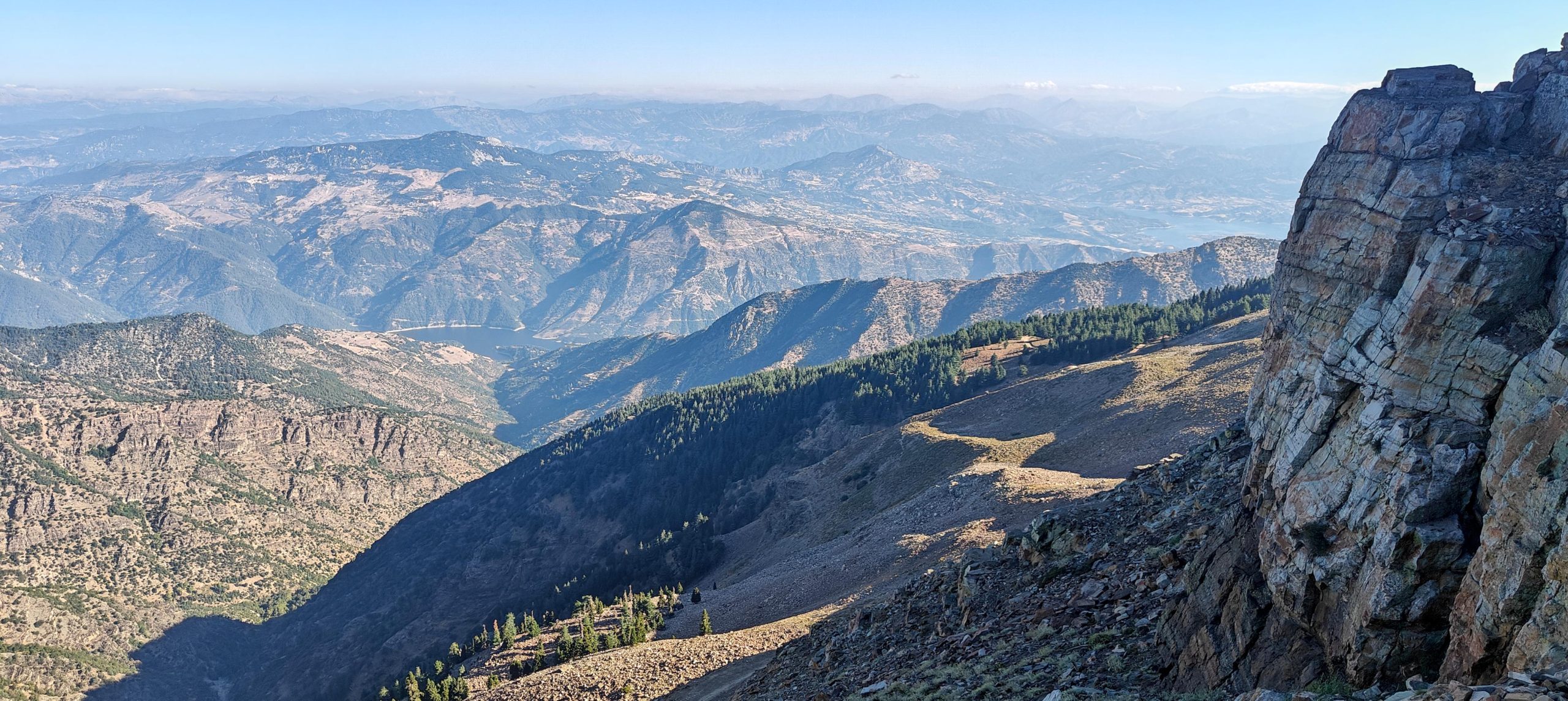
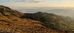
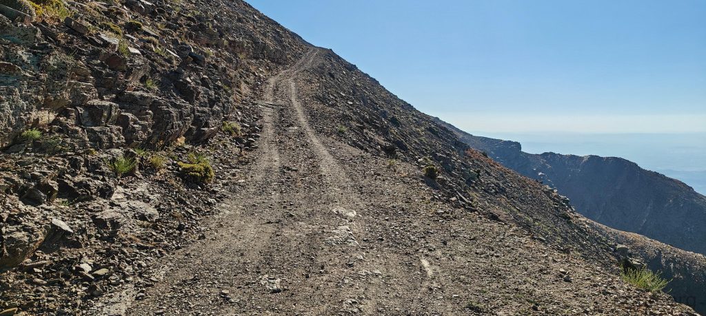
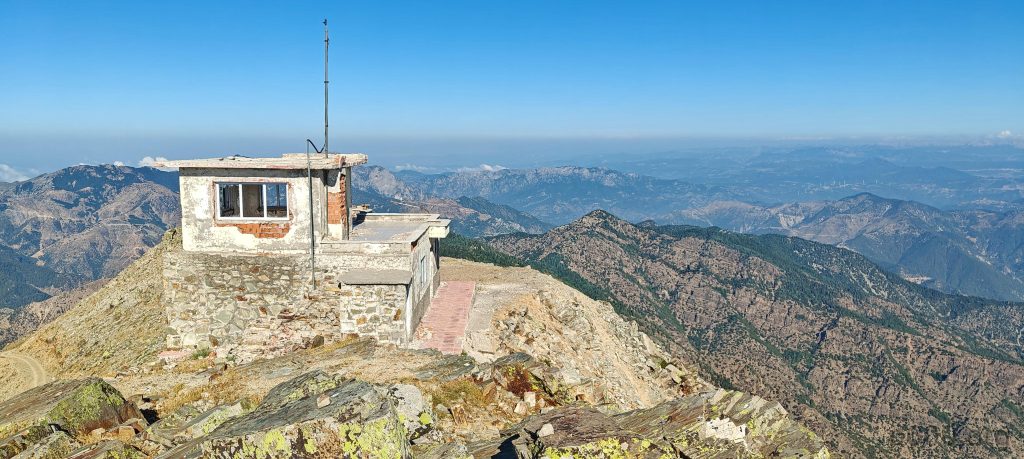
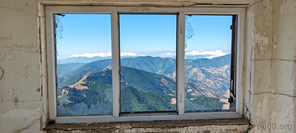
We park a little lower, at one of the switchbacks. It’s windy but clear, and we take a quick ten-minute walk to the summit. The place is swarming with ladybugs—because why not? They’re everywhere, making the windy walk feel a little less lonely. There’s an abandoned watchtower up top, though a rocky outcrop a few dozen meters east is actually higher.

The road is passable for our car, but walking seems like a more enjoyable option.
I always wonder why these bugs choose summits as their hangout spots.
Rob, using his handlevel, investigates the altitude of Dudl Dağı, 16 km southeast, and after some time confirms it’s lower.
It’s likely an old firefighters’ watchtower.

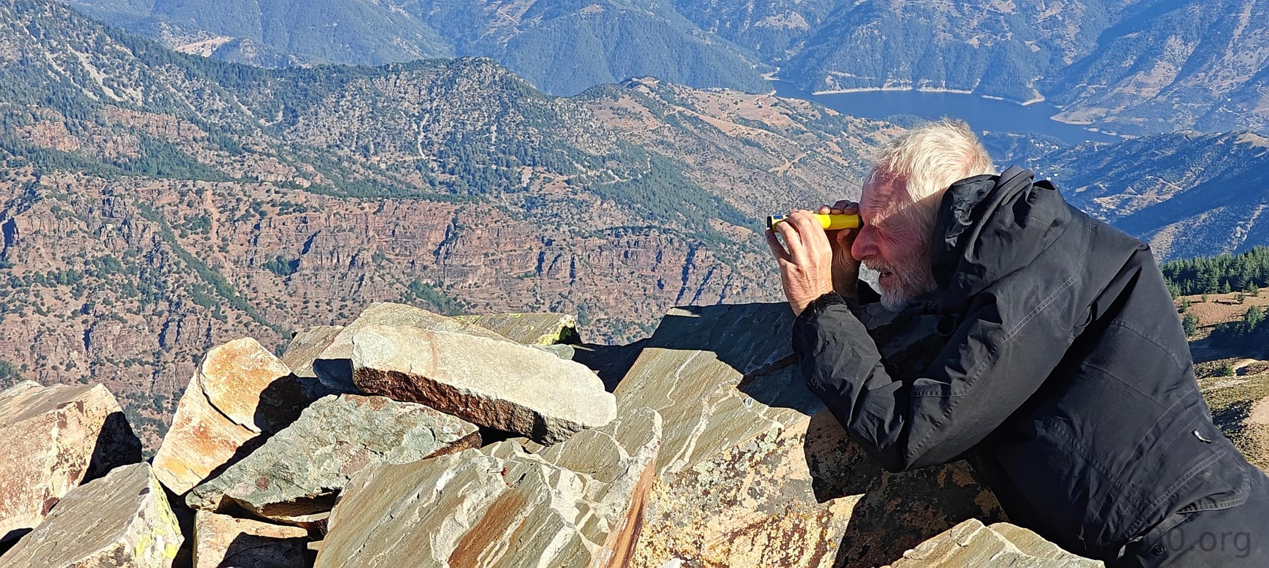
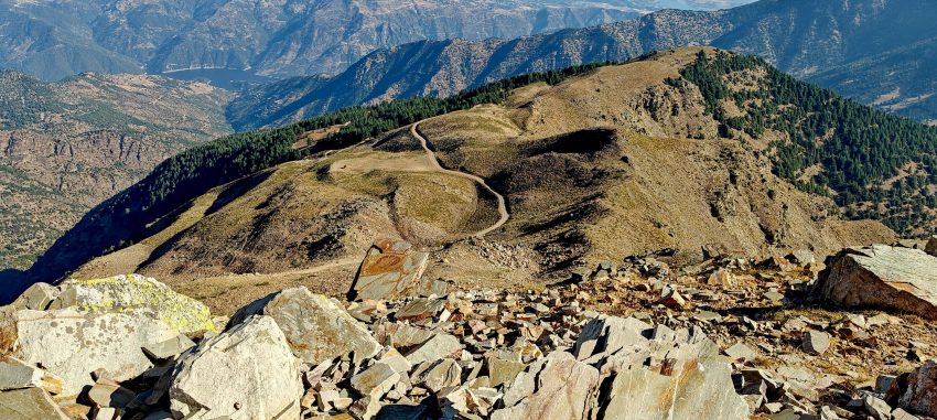
In the distance, southeast, we spot another peak of similar height about 14 kilometers away. Naturally, Rob pulls out his handlevel to investigate, battling the wind while I check the maps. We both confirm the peak is slightly lower. Funny thing, though—many maps incorrectly list it as 2,448 meters instead of 2,248. Classic cartography.

Dudl Dağı, located 16 km southeast, is lower.
The views in all directions are excellent.

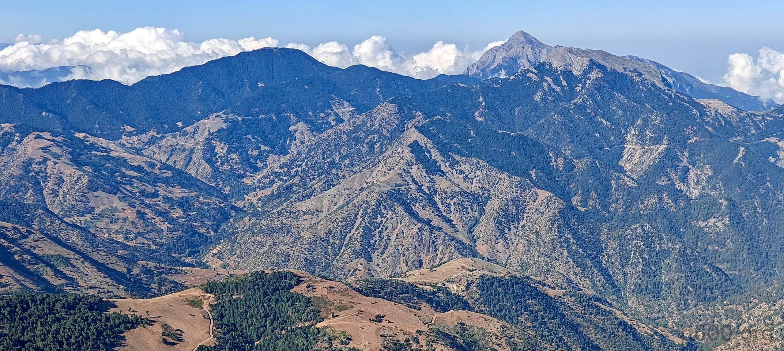
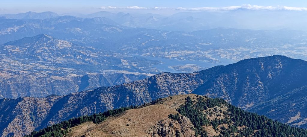
Rob also notices some maps show a “Teleferico,” possibly meaning the peak was once accessible by cable car—maybe it still is, maybe not. We also find out driving to that peak would take 3 hours and 30 minutes (hiking might be faster). We decide to skip it and head toward Kahramanmaraş (like I’ll ever remember that name). Near the city, we spot two bonus peaks: Ahirdaği at 1,830m (P312) and Ahir Dağı at 2,345m (P940). Both seem easy to reach, at least on map. Tomorrow, we’ll try to reach the top of Killi Tepe.


Uludaz2233 m altitude
1720 m prominence
44.42 km isolation
RangesAnatolia - Central Anatolia
Countries/regionsTurkey - Kahraman Maras
Distance0.80 km up0.80 km down
Elevation142 m gain142 m loss
Time
0h12 up
0h10 other
0h10 down
0h32 total
Trailhead2090 m altitude37.4489020, 36.6507040
RouteWe park at a switchback and walk less than a kilometer on the road. A short, easy, few steps scramble takes us to the summit, and we retrace our steps back down.
DifficultiesWe made it with our basic SUV, but a vehicle with higher clearance would have made the drive much more comfortable.
LinksGPX trail
  • Anatolia 2024
  • « Engizek Dağı - Attempt
  • Killi Tepe »

Mountain Ranges

Anatolia
Central Anatolia
Pontic Mountains
Southeast Anatolia
Taurus Mountains
Western Anatolia
Andes
Puna de Atacama
Atlas Mountains
High Atlas
Northwestern Atlas
Central America Ranges
Costa Rica-Panama Ranges
Central Central America
East China
Taiwan
Eastern Europe Ranges
Southeast Baltic Plains
Iberian Peninsula
Cordillera Cantabrica
Castile Ranges
Portugal-Galicia
Pyrenees
Intermountain West
Great Basin Ranges
Korea-Amur Area
Taebaek Sanmae
Malay Archipelago
Java
Nusa Tengarra
Sulawesi
Sumatra
Mid-Atlantic Islands
North Atlantic Islands
Mongolia Ranges
Altai
Gobi Desert Ranges
Hangay Mountains
Northwest Europe
Great Britain
North France-West Rhine Area
Pacific Ranges
Cascade Range
Northwest U.S. Coast Ranges
Sierra Nevada
Central and Southern California Ranges
Philippines
Central Philippines
Luzon
Mindanao
Southeast Asia
Malay Peninsula
Southeast South America
Pampas
Sierras de Cordoba
Southern Africa
Malawi Highlands
West Africa Mountains
Bight of Benin
Cameroon Mountains
Guinea Highlands

Countries / regions

Algeria
Ain Guezzam
Ain Salah
Aïn Témouchent
El Bayadh
Ghardaïa
Oran
Ouargla
Saïda
Sidi Bel Abbès
Tamanrasset
Argentina
Catamarca
Ciudad Autónoma de Buenos Aires
Córdoba
Jujuy
Salta
Tucumán
Belgium
Brussels Capital Region
Flemish Region
Cameroon
Southwest
China
Taiwan
Costa Rica
Alajuela
Cartago
Guanacaste
Heredia
Limón
San José
Czechia
Prague
Denmark
Greenland
France
Hauts-de-France
Occitania
Germany
Berlin
Niedersachsen
Indonesia
Bali
Jambi
Jawa Tengah
Jawa Timur
Nusa Tenggara Barat
Sulawesi Tengah
Sulawesi Utara
Sumatera Barat
Lithuania
Vilnius County
Mongolia
Bayankhongor
Govi-Altai
Khovd
Omnogovi
Ovorkhangai
Ulan Bator
Zavkhan
Morocco
Béni Mellal-Khénifra
Drâa-Tafilalet
Fez-Meknes
Marrakesh-Safi
Souss-Massa
Tangier-Tetouan-Al Hoceima
Mozambique
Zambezia
Netherlands
Gelderland
Noord-Holland
Zeeland
Nicaragua
Chinandega
Managua
Masaya
Rivas
Philippines
Bicol Region (V)
Cagayan Valley (II)
Calabarzon (IV-A)
Central Luzon (III)
Cordillera Administrative Region
Davao Region
Metro Manila
Soccsksargen (XII)
Western Visayas (VI)
Poland
Greater Poland Voivodeship
Masovian Voivodeship
Portugal
Castelo Branco
Leiria
Lisbon
Madeira
Santarém
Qatar
Ad-Dawhah
São Tomé and Príncipe
São Tomé Province
Sierra Leone
Northern Province
Western Area
Singapore
South Korea
Gyeongsangnam-do
Seoul
Spain
Aragón
Asturias
Castilla-La Mancha
Castilla y León
Catalonia
Islas Canarias
Switzerland
Zürich
Turkey
Antalya
Bitlis
Erzincan
Hakkâri
Igdir
Isparta
Kahraman Maras
Muğla
United Kingdom
England
Scotland
United States
California
Delaware
Florida
Maryland
Nevada
New Jersey
New York
Pennsylvania
South Carolina
Utah

TRIPS

2024
Southern Africa 2024
Mid-Atlantic Islands 2024
North America 2024
Anatolia 2024
Korea-Amur Area 2024
East China 2024
2023
Mongolia Ranges 2023
Philippines 2023
West Africa III 2023
West Africa II 2023
Iberian Peninsula 2023
West Africa 2023
Central America 2023
2022
Andes 2022
Northwest Europe 2022
Malay Archipelago III 2022
Malay Archipelago II 2022
Anatolia Mountains 2022
Iberian Peninsula 2022
Atlas Mountains 2022
North France-West Rhine Area 2022

archaeology (3) climb (157) food (2) hike (155) p30 (17) p50 (4) p100 (24) p300 (12) p600 (17) p1000 (11) p1500 (76) ribu (10) sight (46) summary (16) trig (44) ultra (76)

1 591 km walked, 121 298 m climbed

©2025 p600.org | WordPress Theme by Superbthemes.com