Skip to content
Menu
p600.org
  • home
  • map
  • trips
  • about
p600.org

Akbaba Tepesi

hike | 2024-07-18

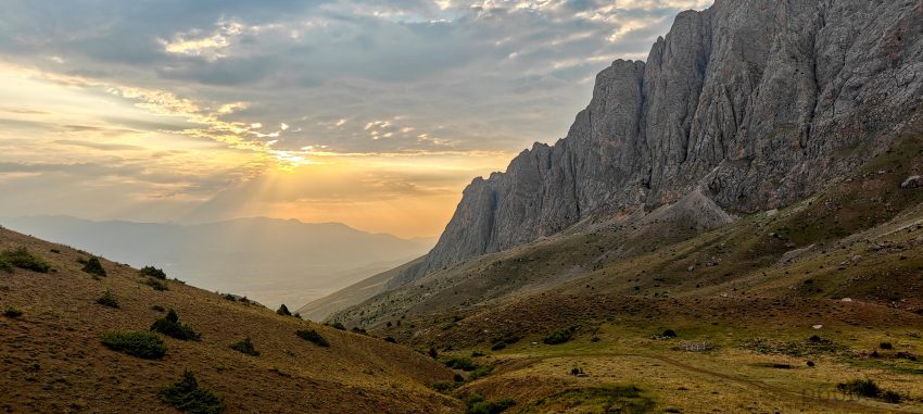
Before climbing, we need acclimatization, so after a big climb, we need something opposite. We have three more days before our flight from Igdir. We mock up a plan, adding one more ultra-prominent peak to our itinerary. We drive to Erzincan, a city at the base of Akbaba Tepesi mountain. It’s a long drive, taking most of the day, and in the evening, we meet up with Rob again. While we climbed Mount Ararat, he bagged a few Ribus near Erzurum and Erzincan and Kackar Dağı, an ultra in the very northeast of the country.

This is our team driving to the trailhead, not filming a car advertisement, ready for adventure.

The next morning, we start before sunrise due to many unknowns. We don’t know how far we can drive toward the trailhead, what kind of road it will be, or the trail conditions. We even wonder if we’ll find the trail. The only thing we know is that our overpriced local guide promised to climb with us. Later, we find out he climbed this peak for the first time from the side we proposed. Actually, we end up guiding instead of being guided. No problem at all, we love hiking unguided. Adam, still recovering from an altitude-related incident on Ararat, decides to skip the hike and wait for us at the hotel.

The other side of the valley impresses with its breathtaking views.
The valley’s end looms ahead, signaling the final stretch of our drive.
Looking back.
Dave tackles the first slope while our guides lag in the background, with the car parked at the flattening.

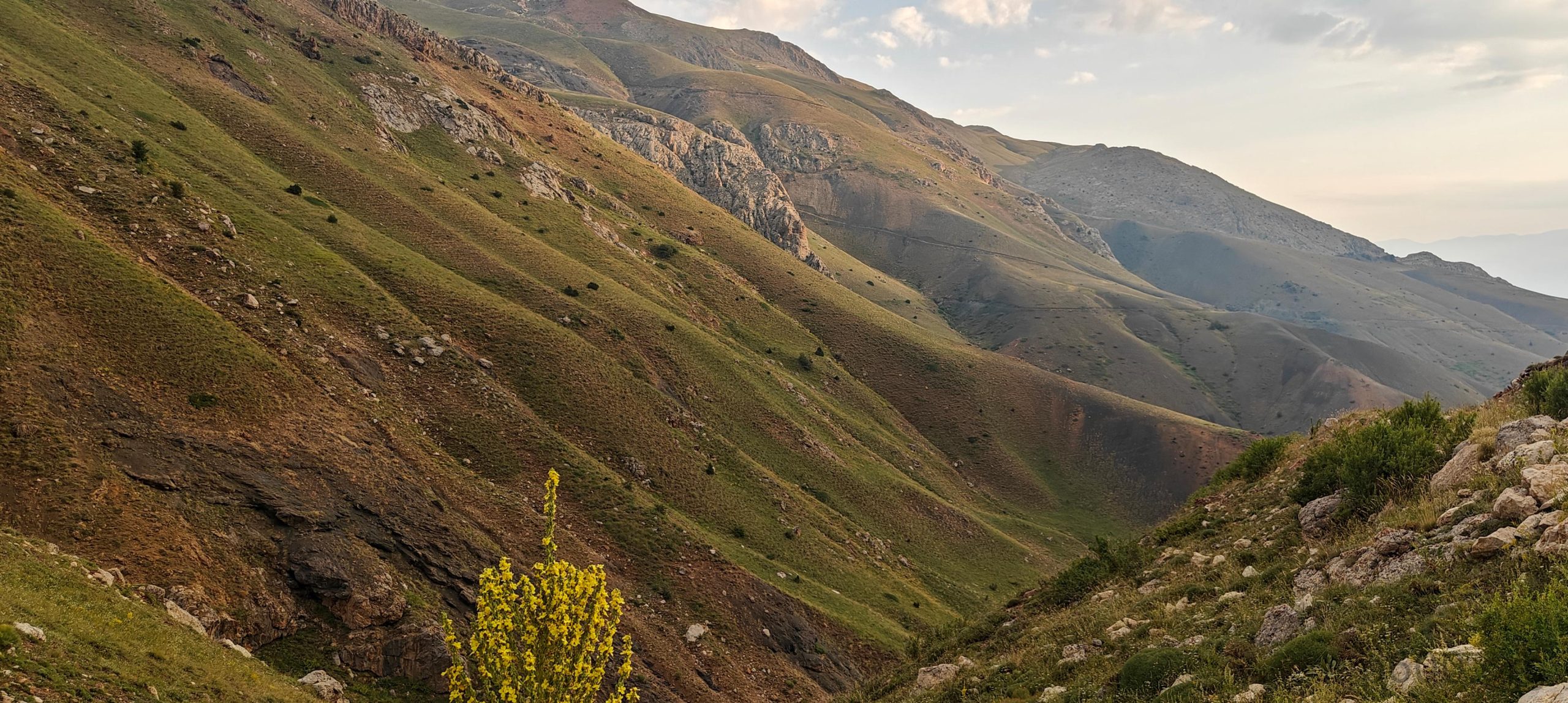
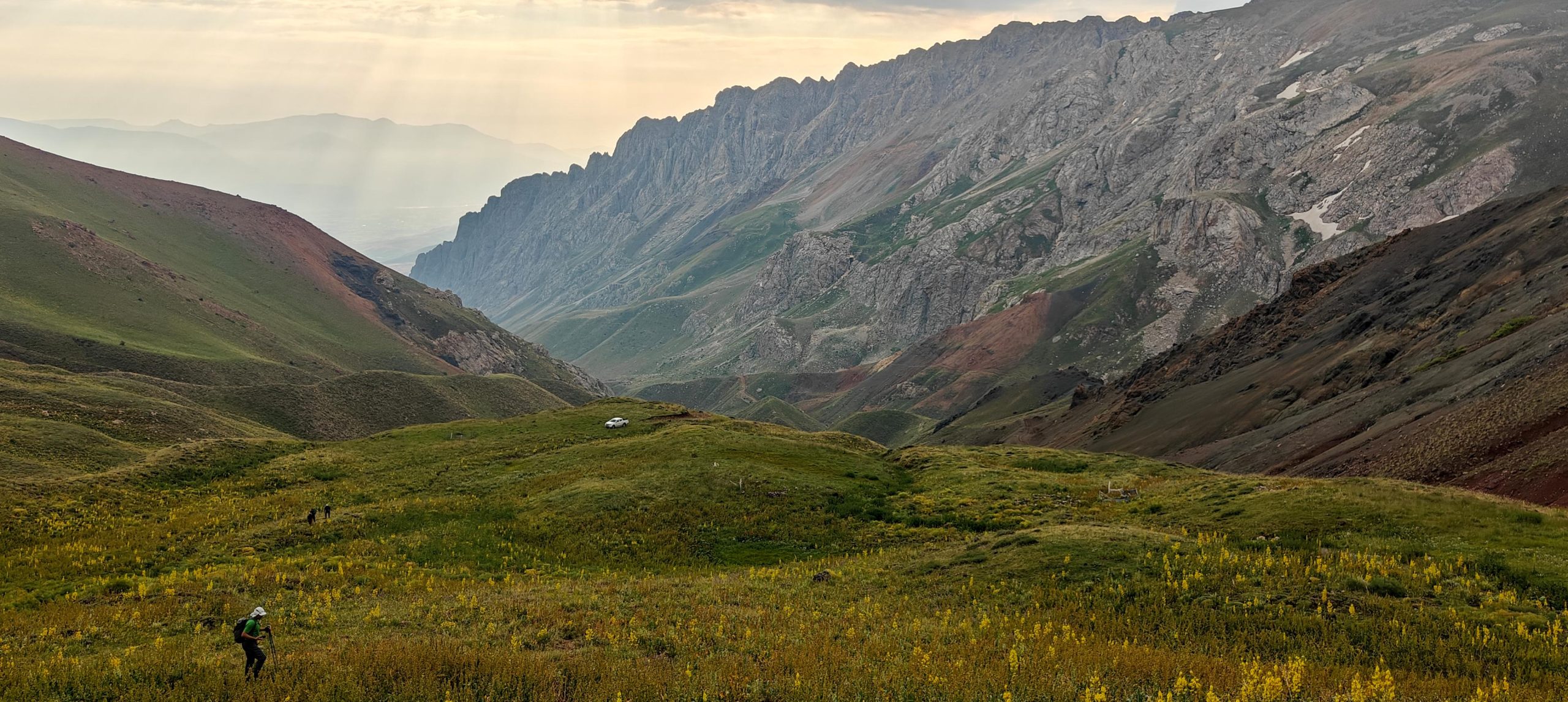
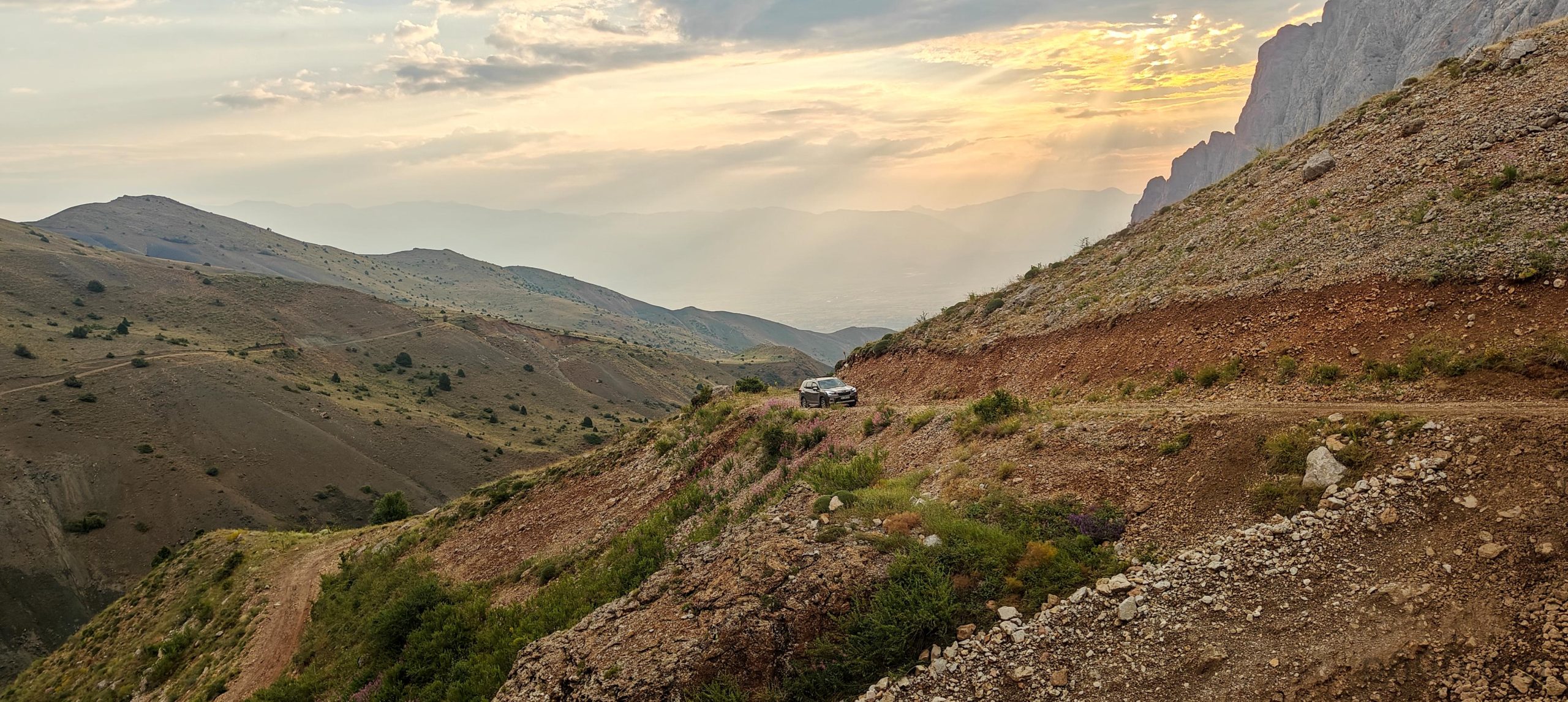
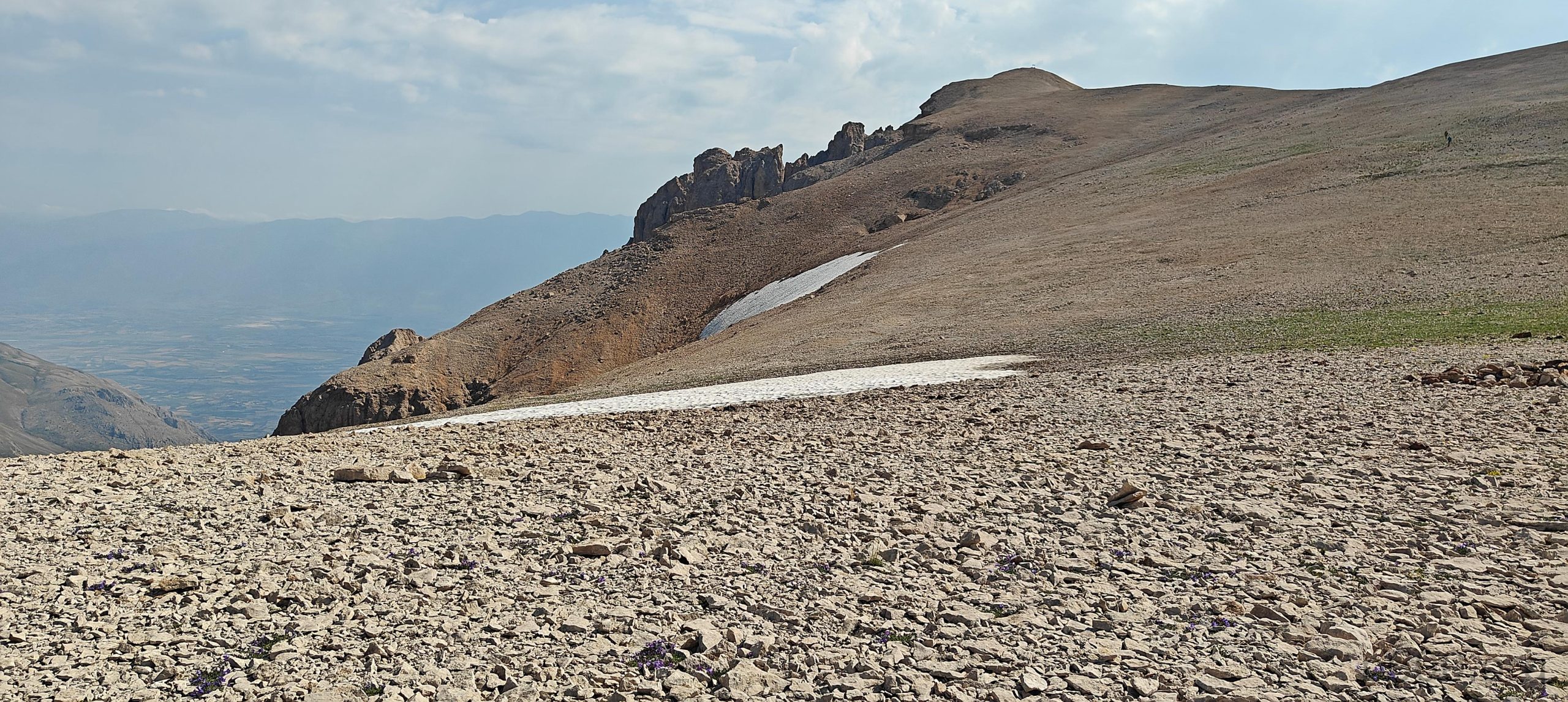
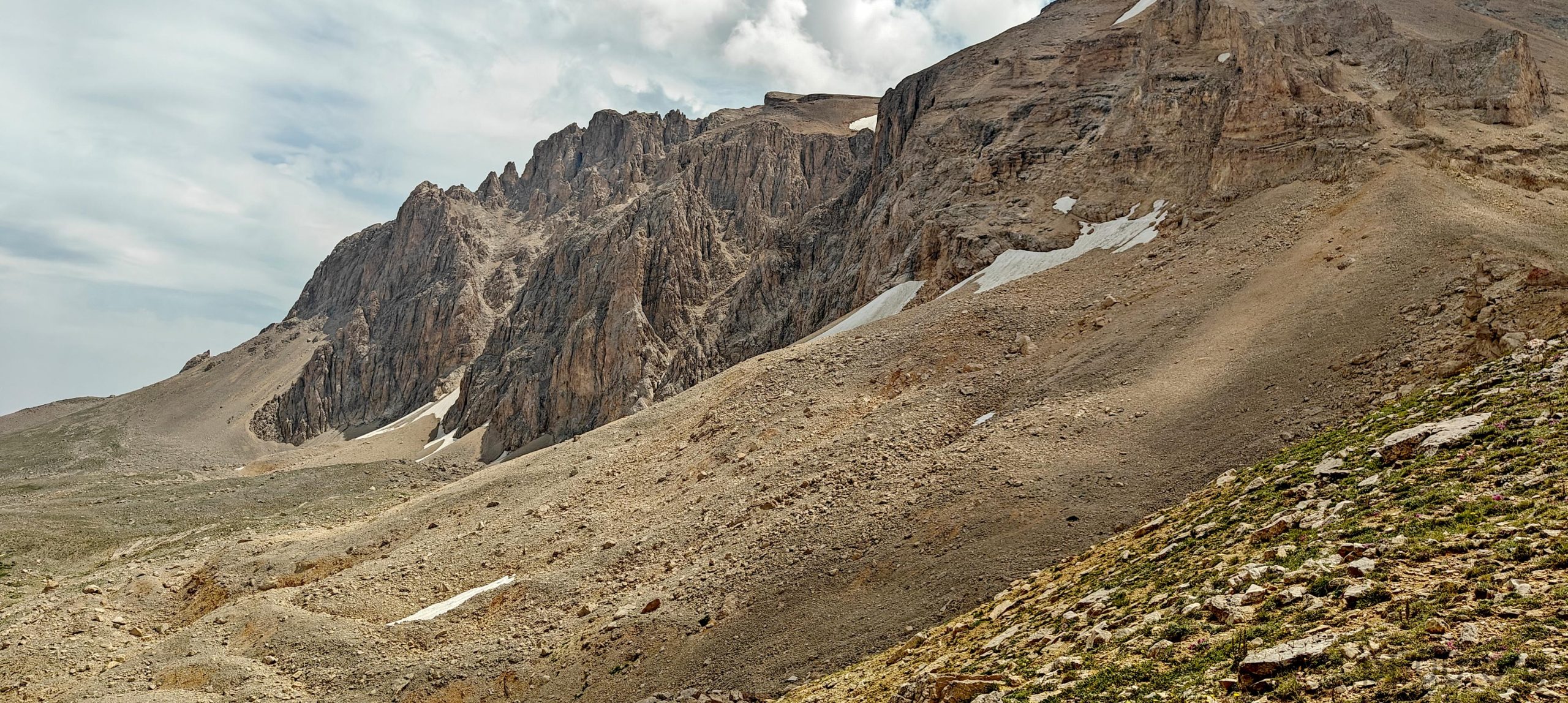
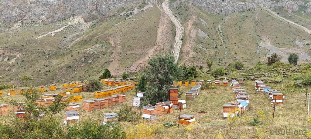
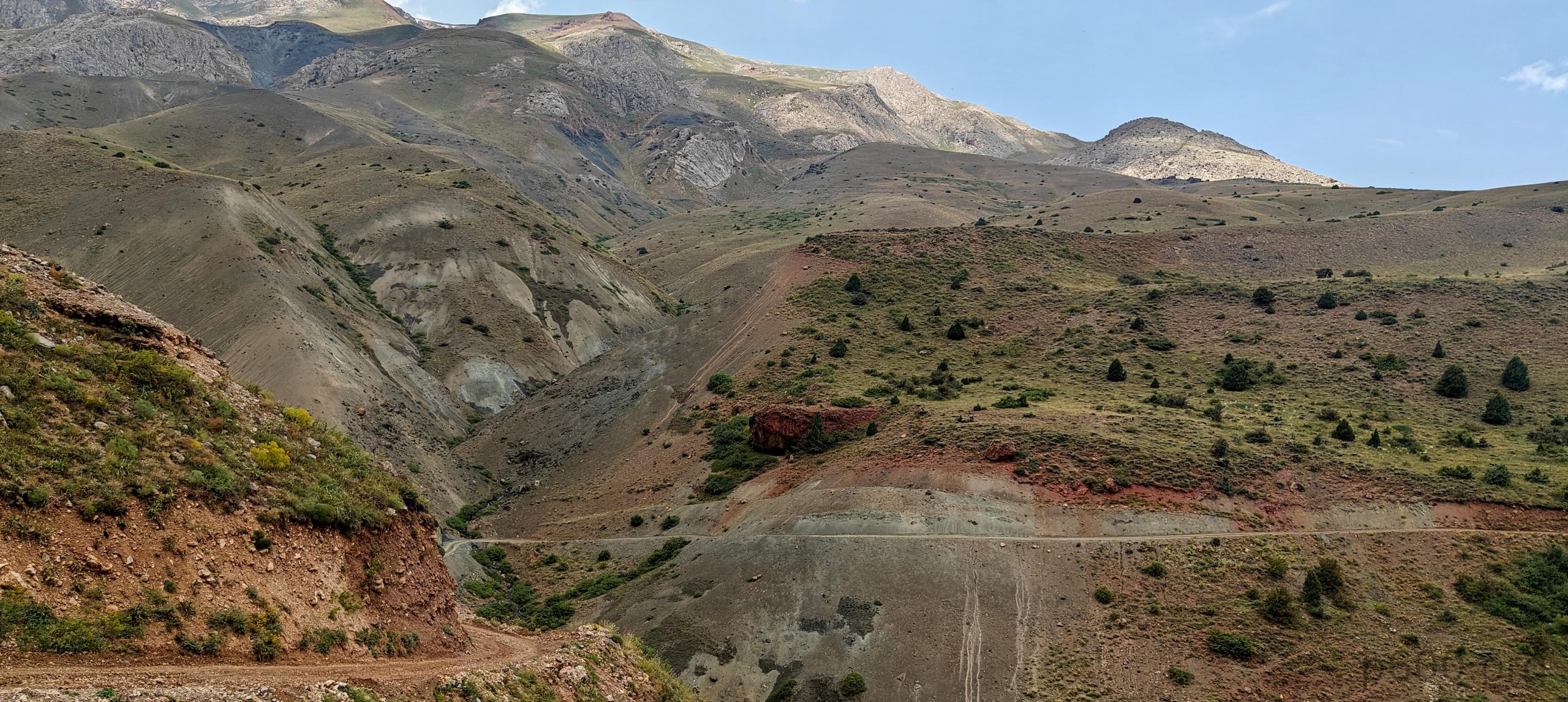
We go with two cars: a Subaru Forester and a Mitsubishi L200. Both are very capable, but I hear the Subaru scraping rocks at one of the stream crossings. The Mitsubishi has no issues due to its higher clearance.The Subaru stops approx one kilometer before the trailhead, and we all continue with the Mitsubishi. We arrive at a flattening, park, change, and soon start the hike. The first slope is steeper; later, we walk on a bumpy plateau, but this segment is very gradual. We move quite fast, stopping for water only at the base before the steep scree section. Local guides and drivers follow us a few hundred meters behind.

After the first steep slope, we enjoy an easy walk on gradual grassy hills.
The first good view of Akbaba Tepesi summit.
The entire valley we drove through is visible from here.
A few small patches of snow dot the plateau.
An impressive peak rises to the south.
Most of the trail runs parallel to the edge of the cliff in the distance.
Climbing steep scree is unpleasant as usual.
The rough surface to the south.

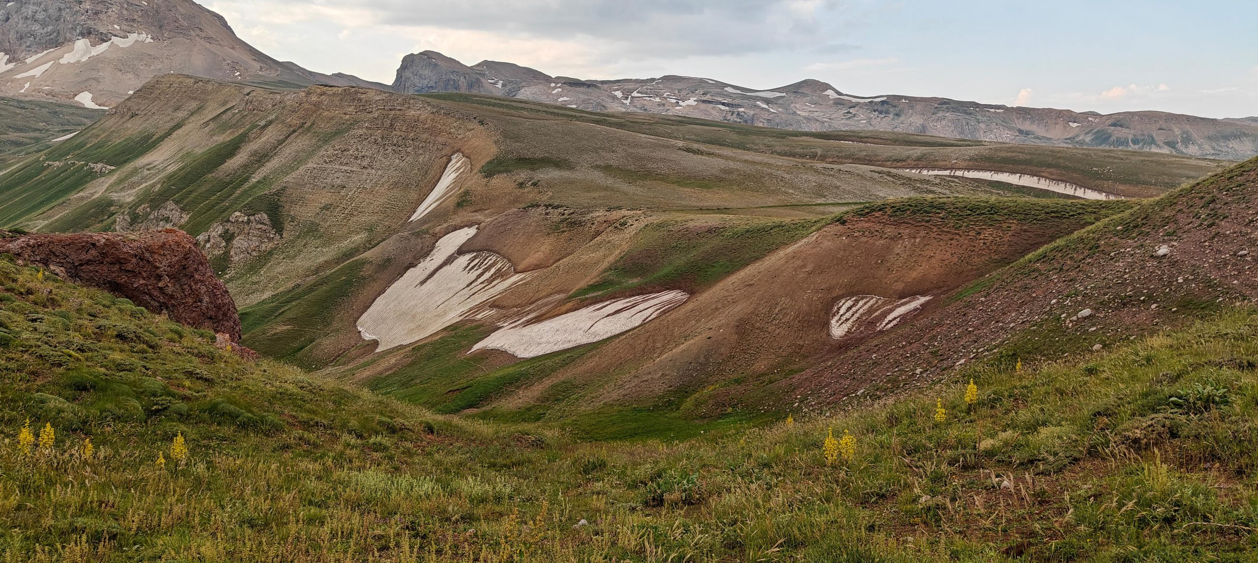
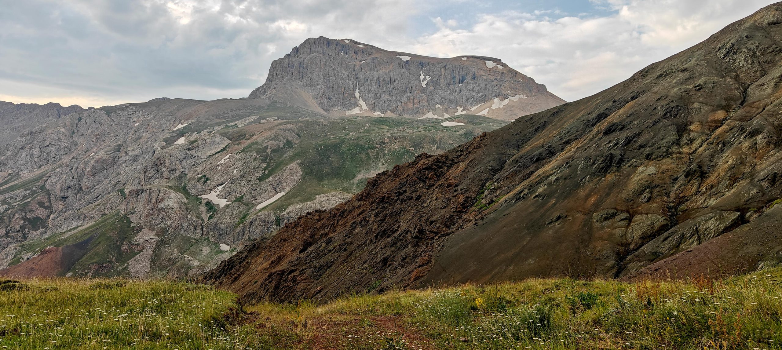
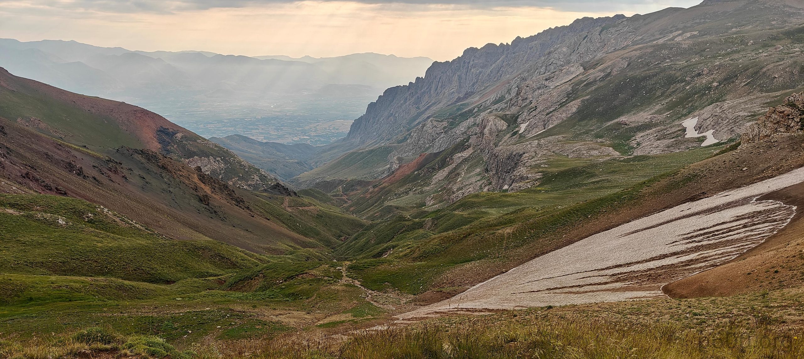
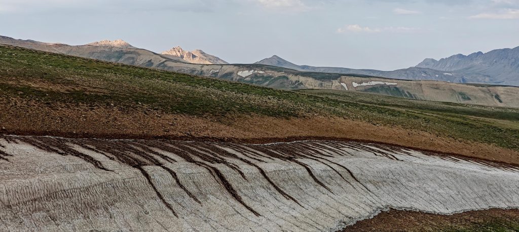
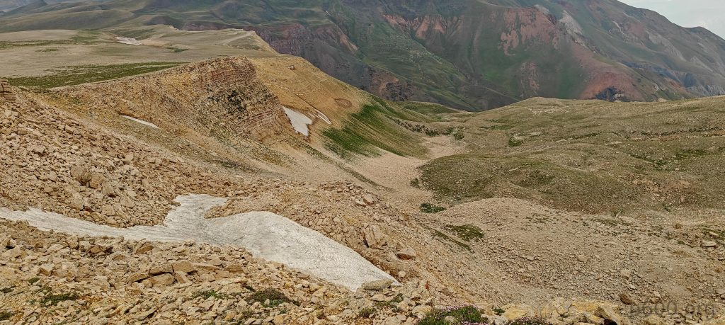
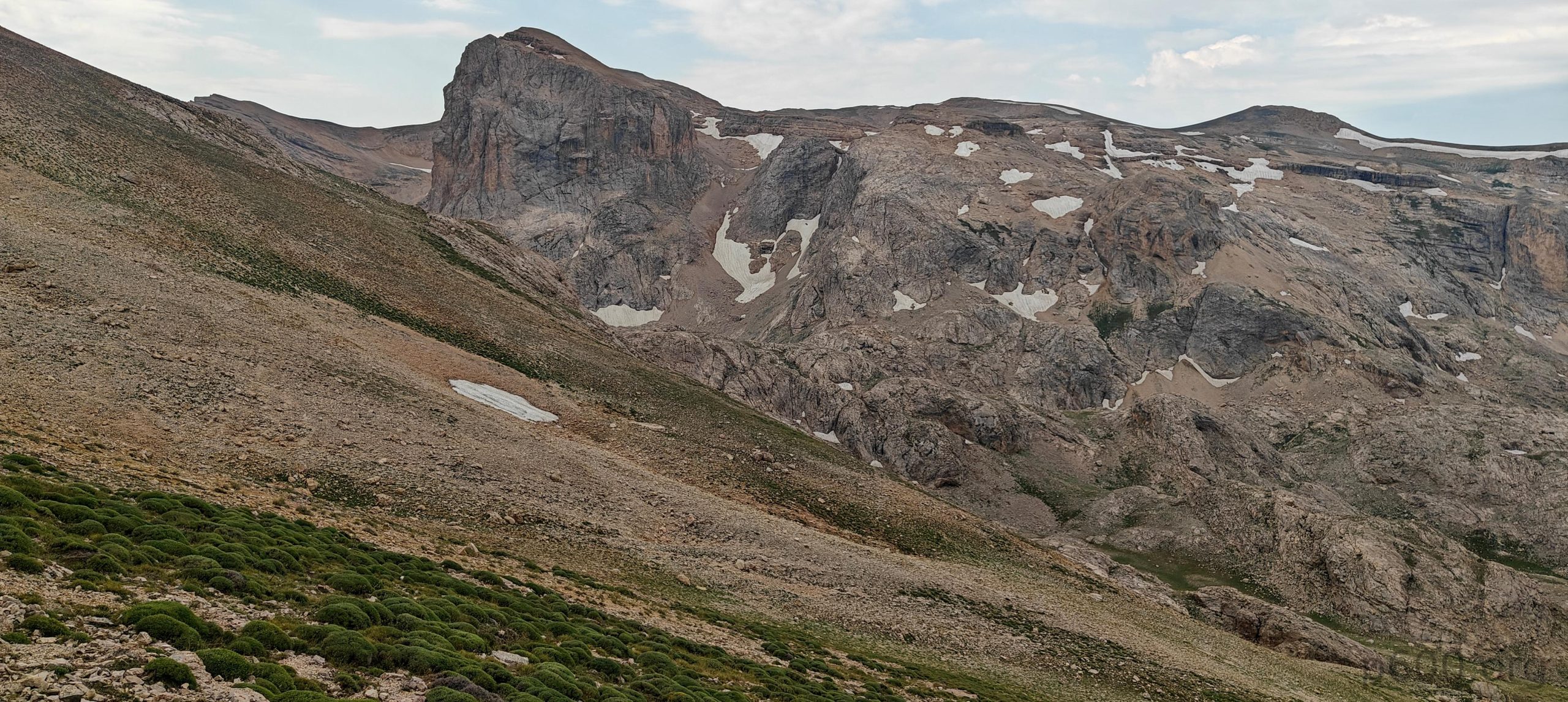
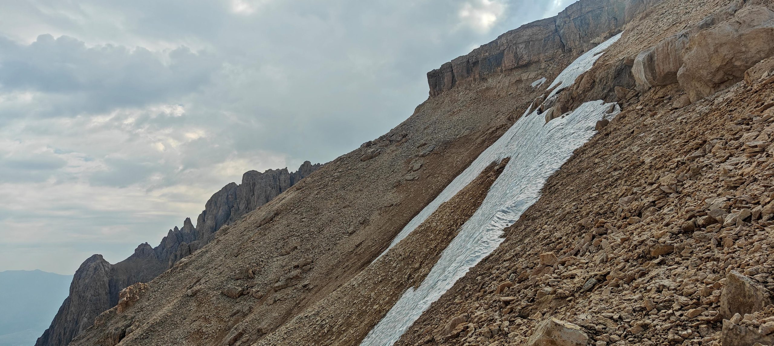
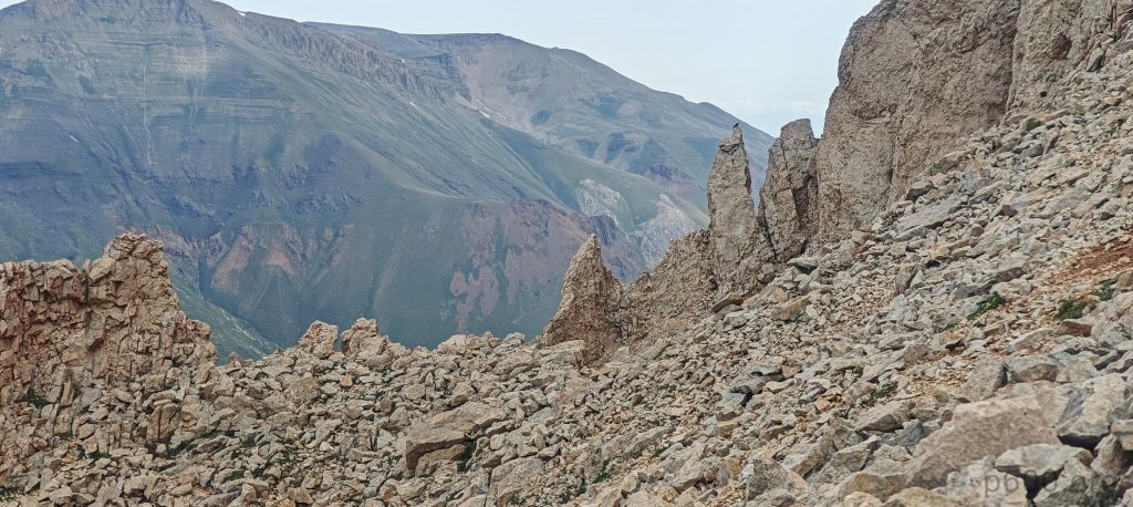
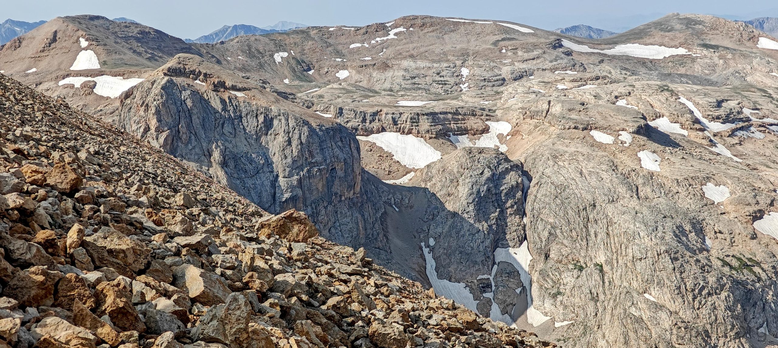
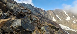
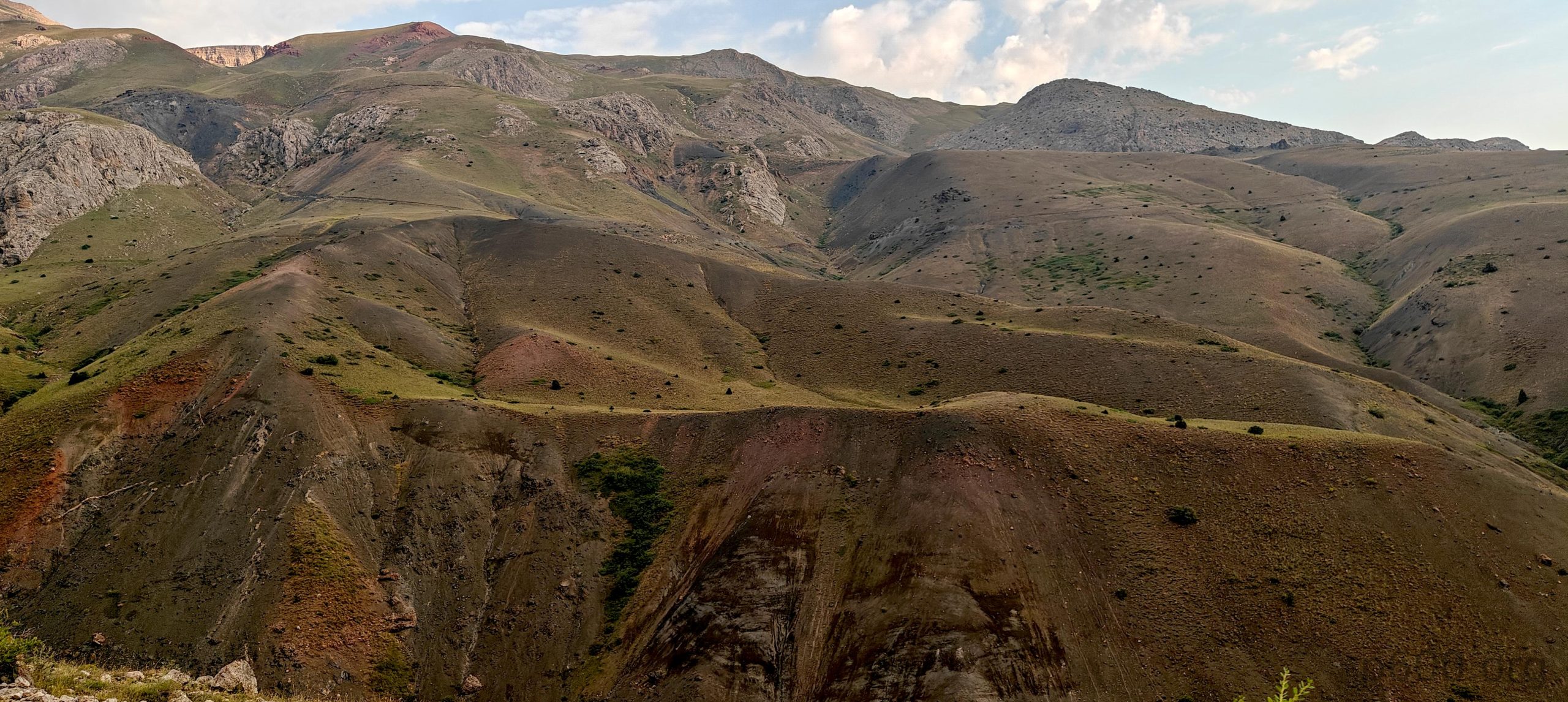
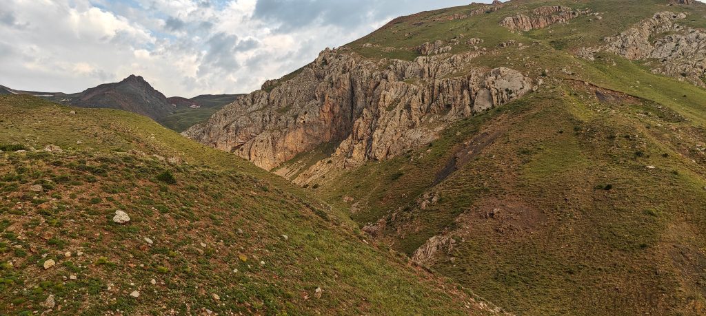
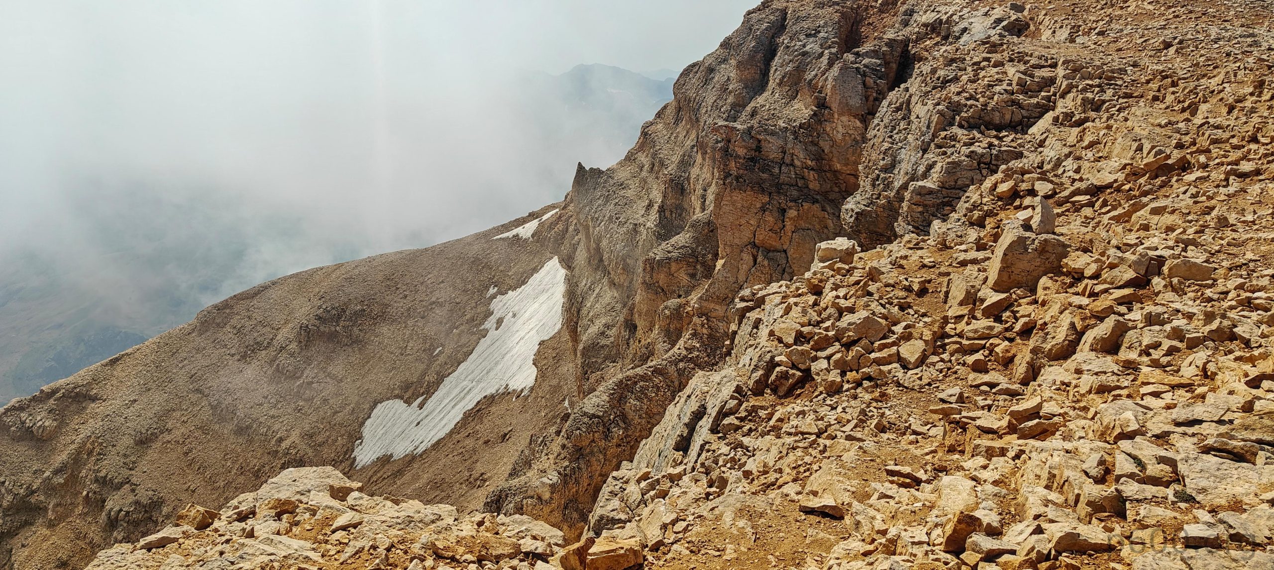
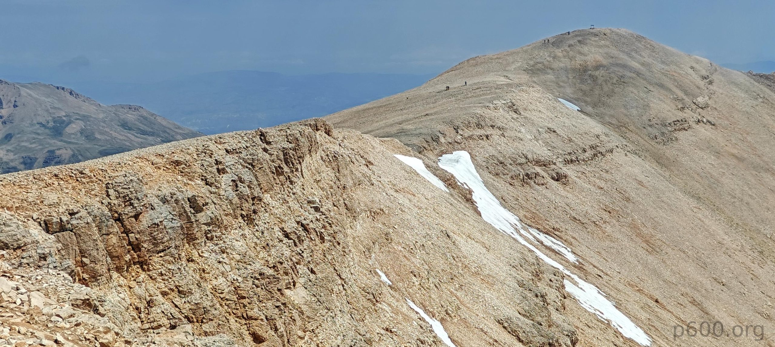
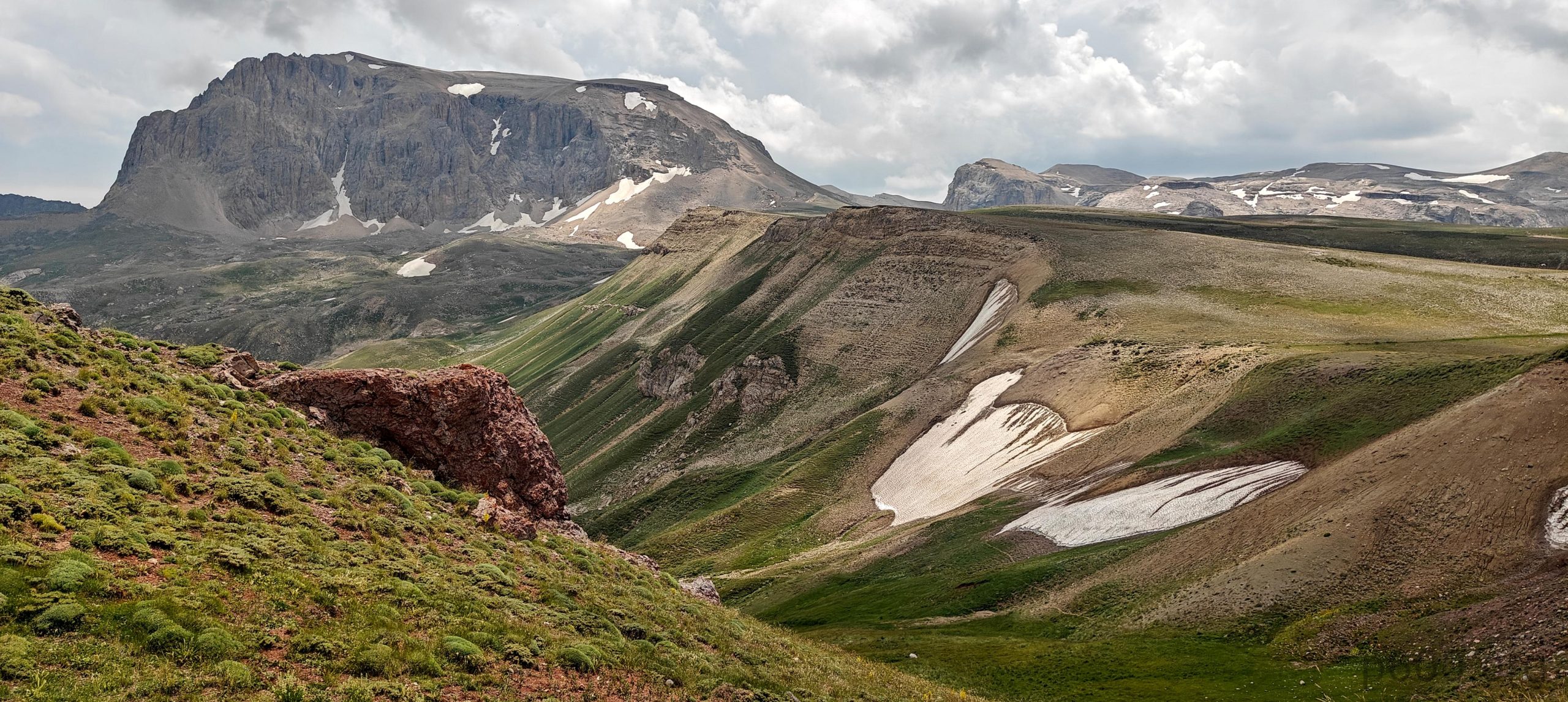
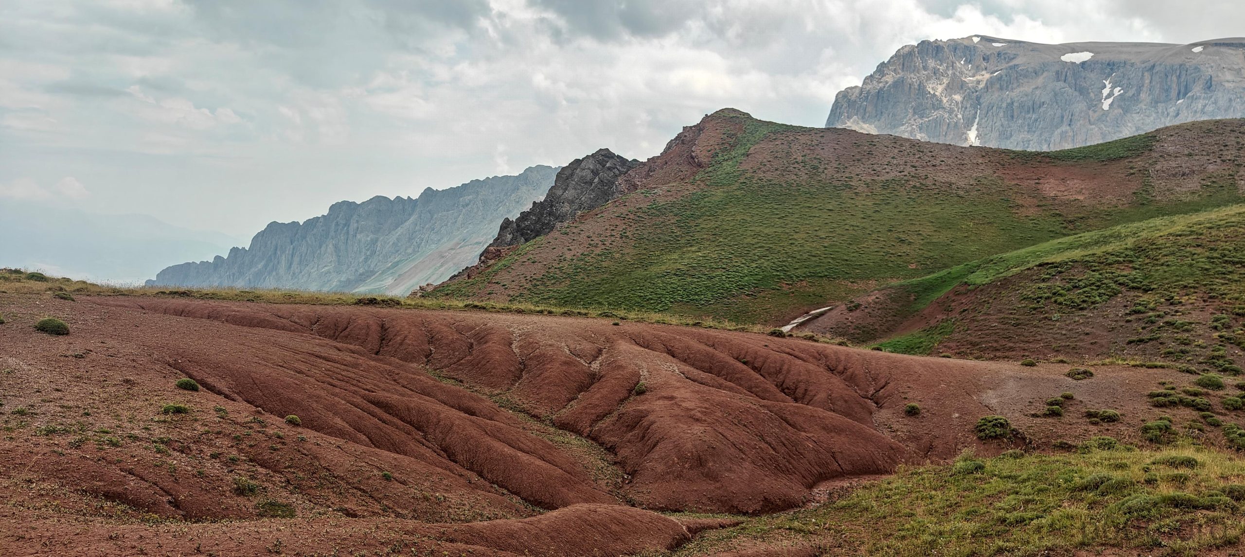
The steep scree section is tough, especially if the barely visible trail is ignored. We each choose our own path. Steven and I move to the left, scrambling rocks, which look more stable and appealing than the loose scree. This section is not very long, maybe a couple of hundred vertical meters. Once we climb to the edge of the summit plateau, it becomes an easy walk again.

The summit, visible from the edge of the plateau.
Views to the east.
The lower south bump looks easy.
The north side cliffs from summit.
The view to the east.
The summit is marked with a plate that says “Munzur Akbaba Zirve 3449”.
From left to right: me, Dave, Steven, and Rob.

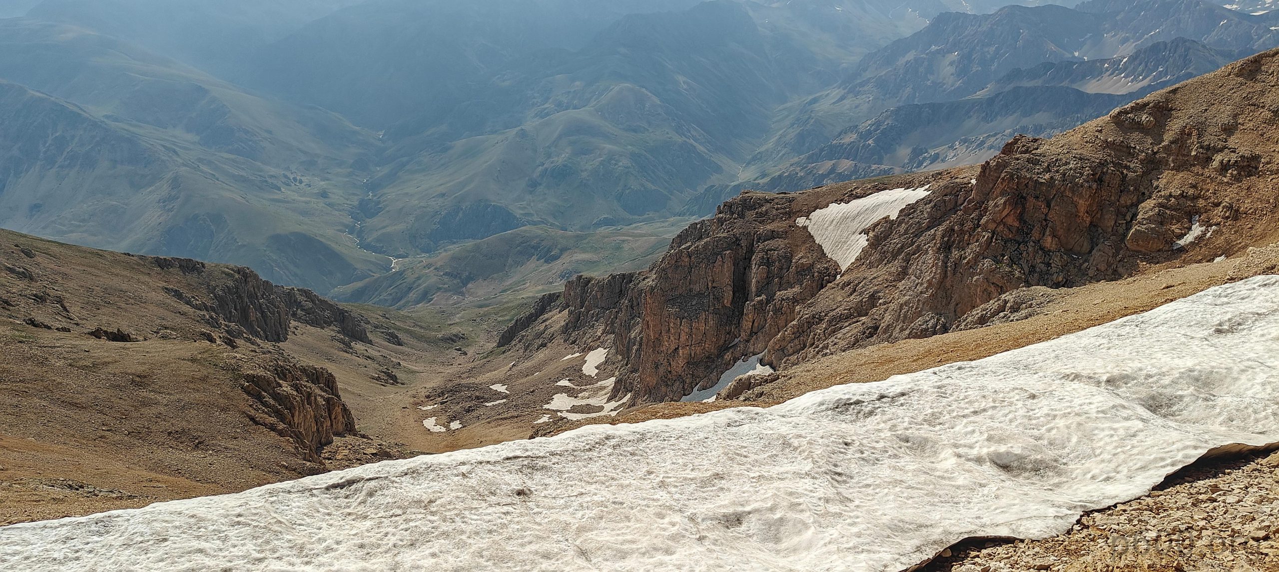
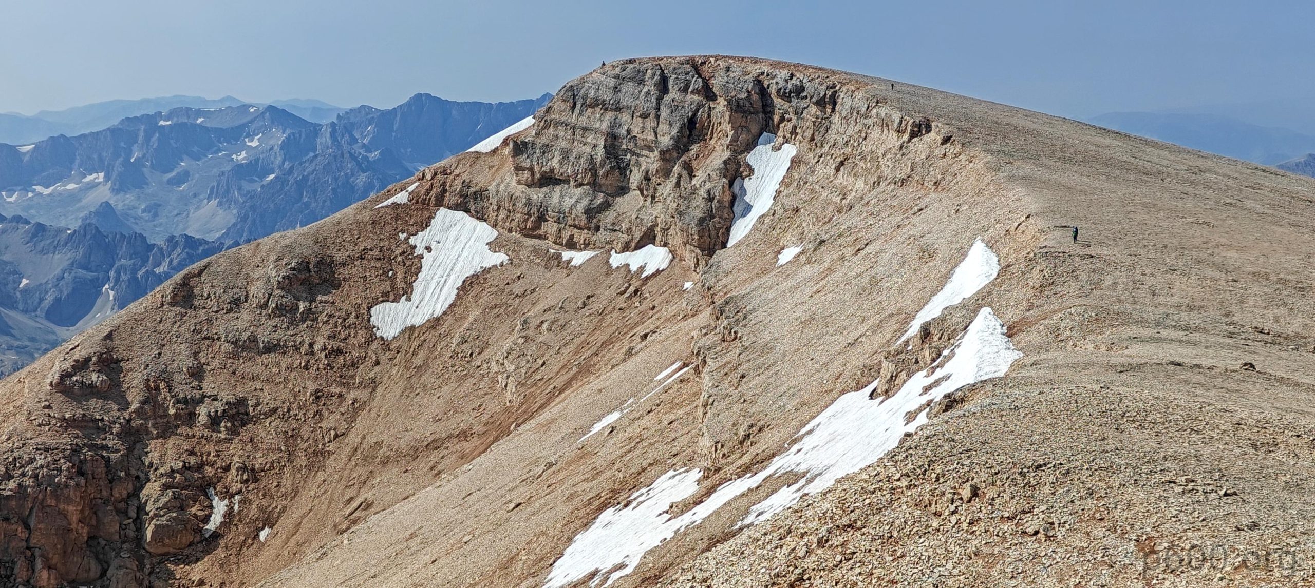
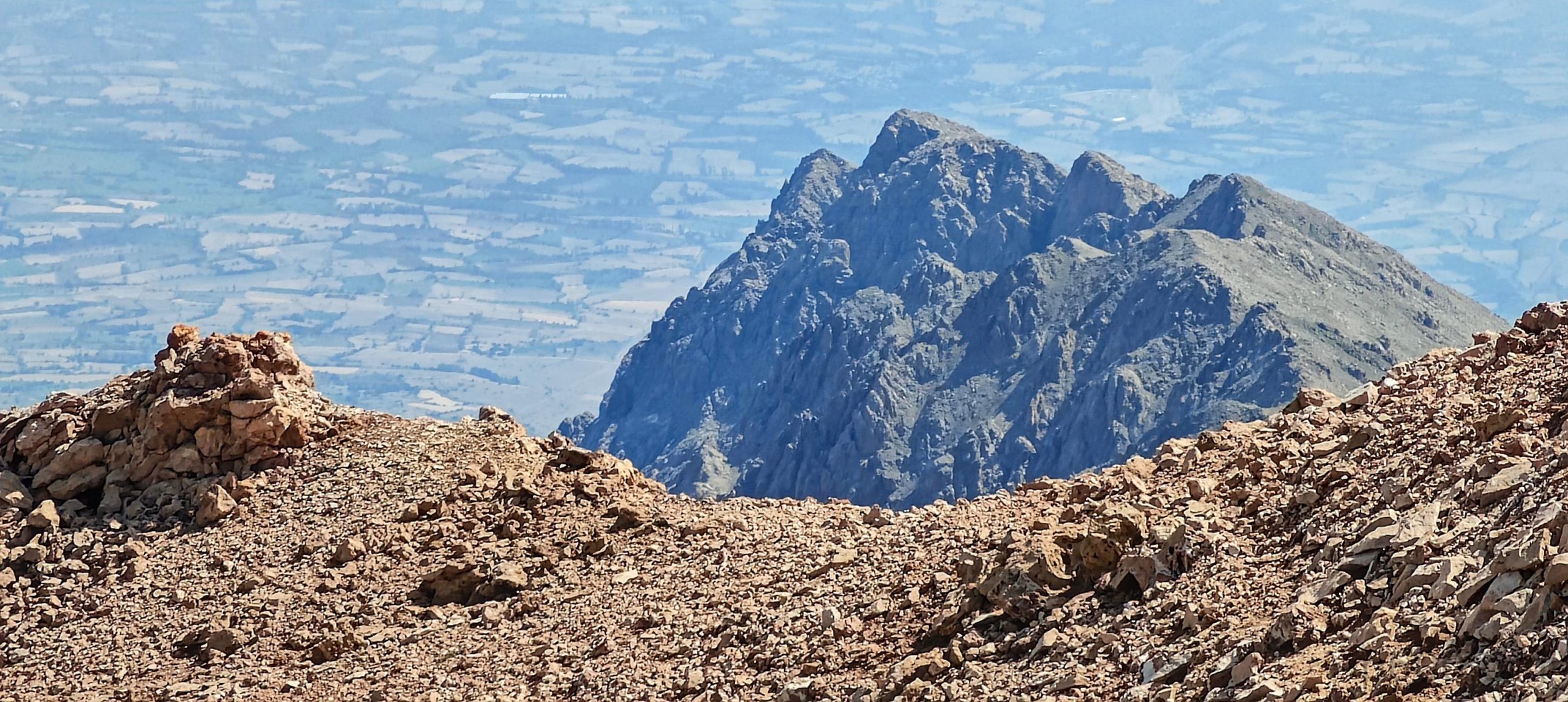
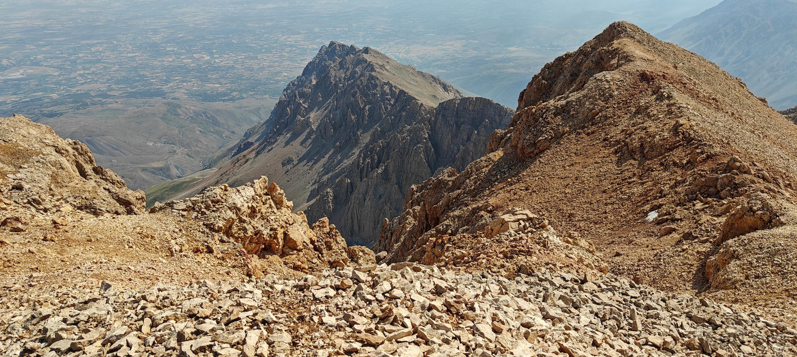
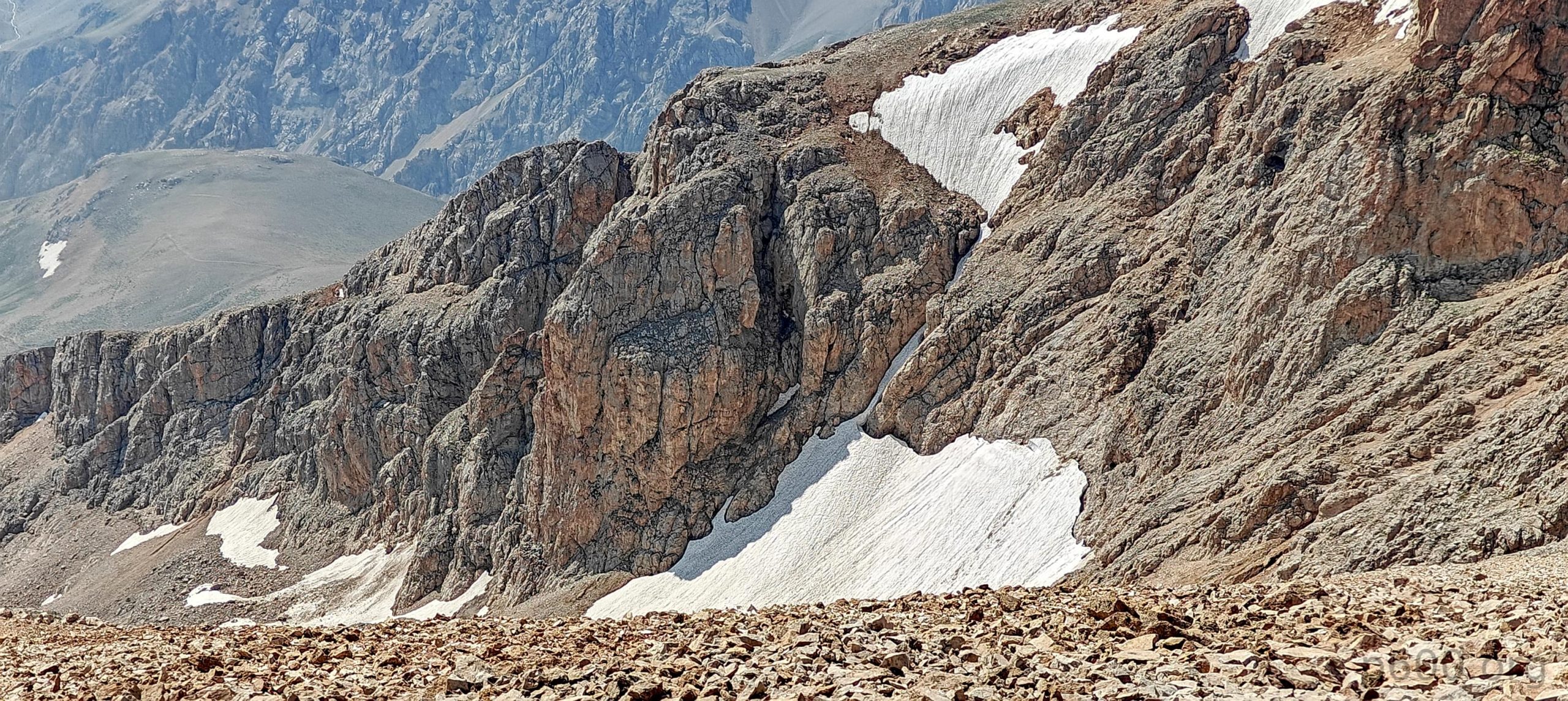
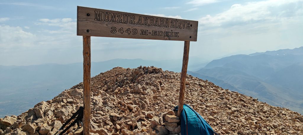
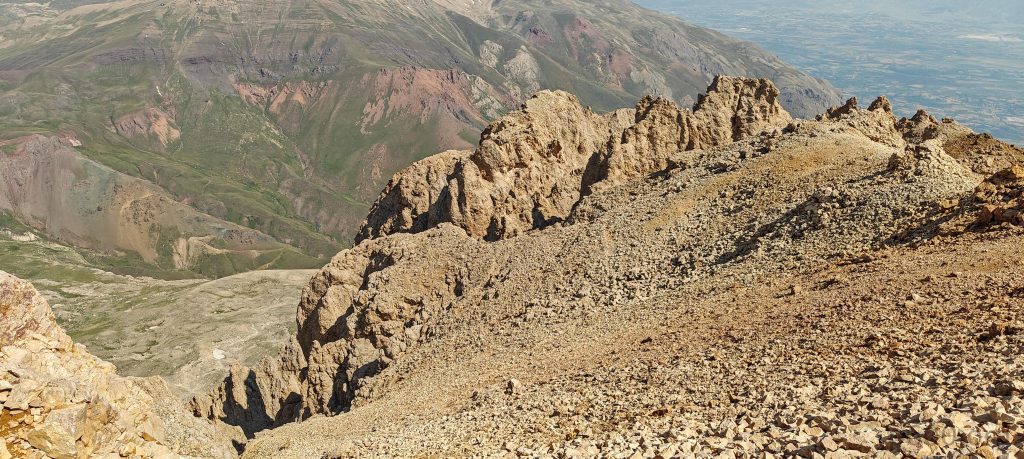
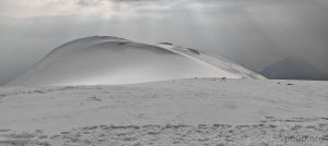
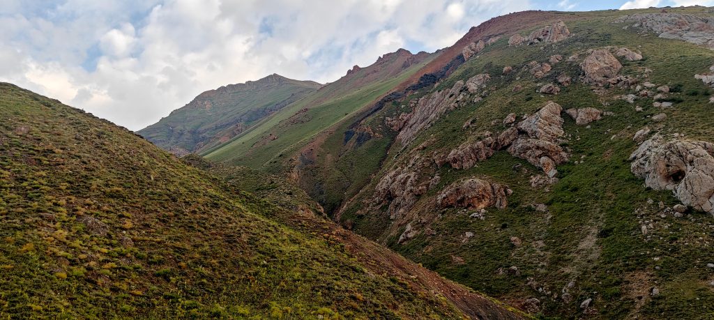
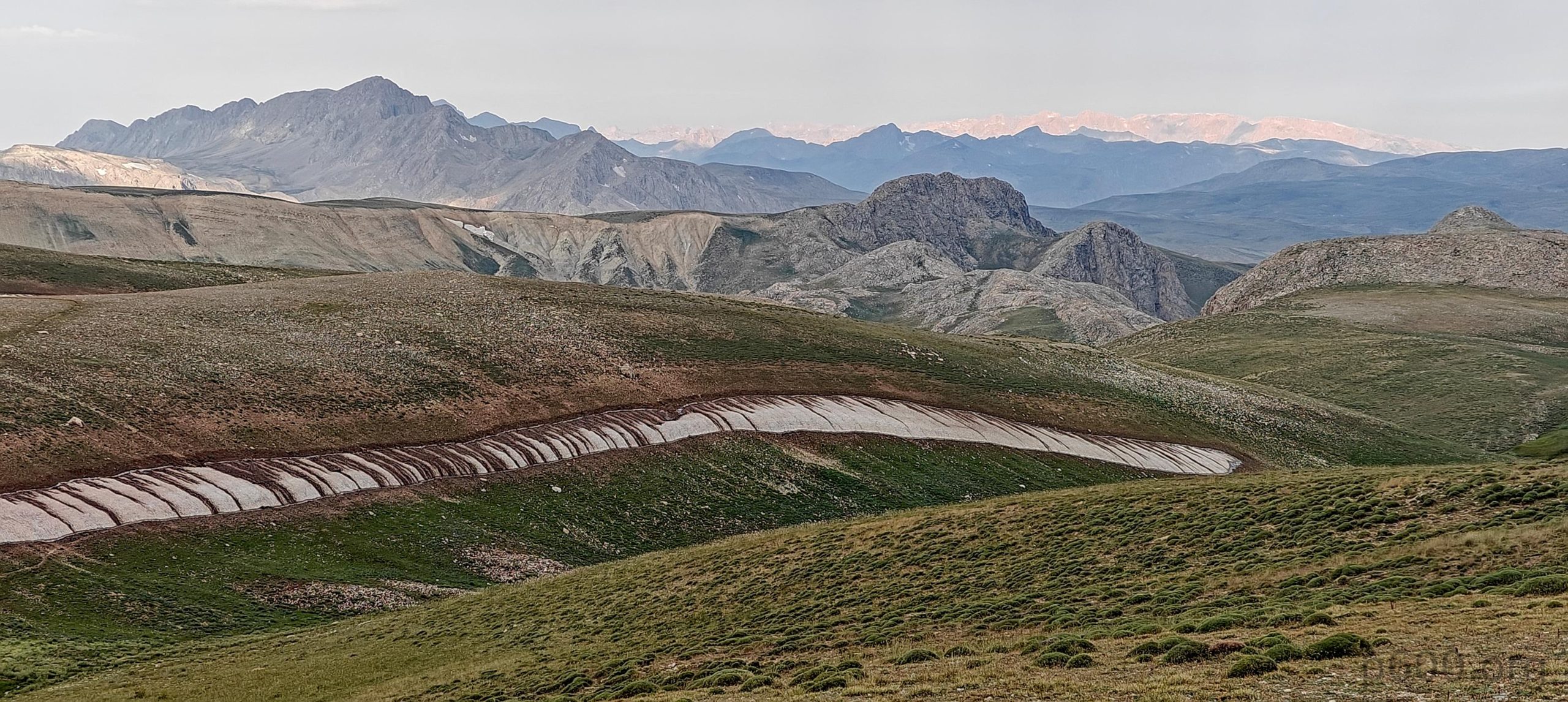
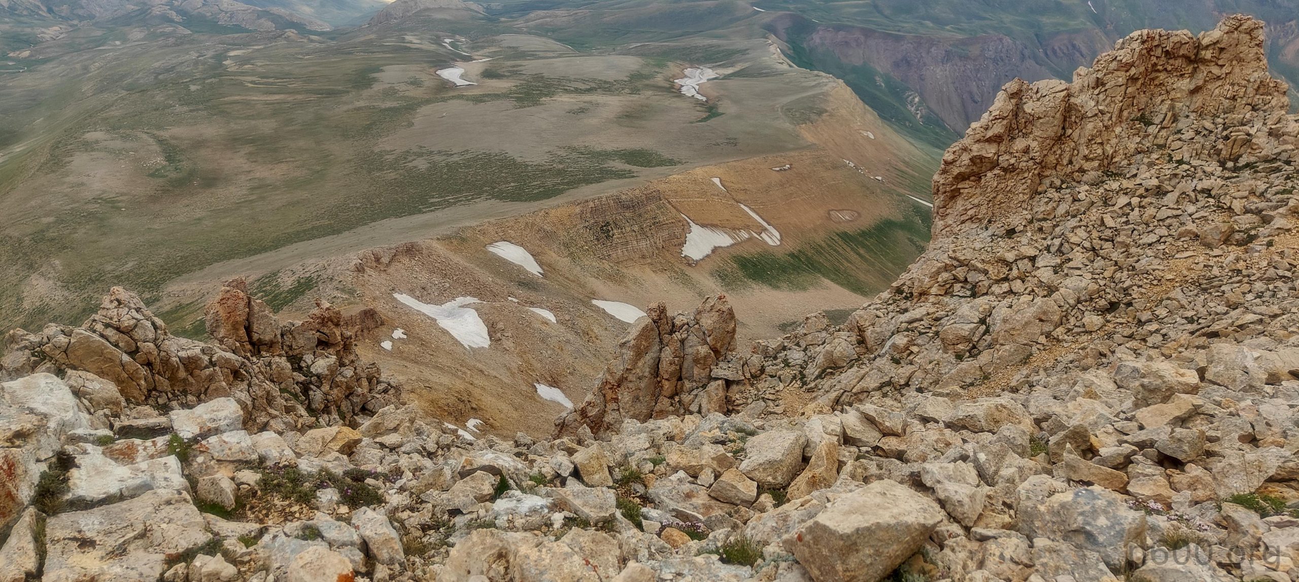
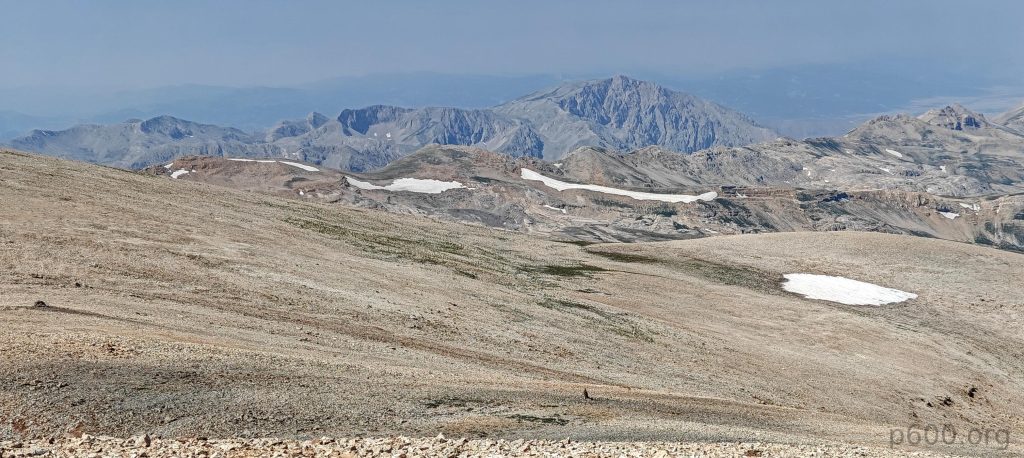
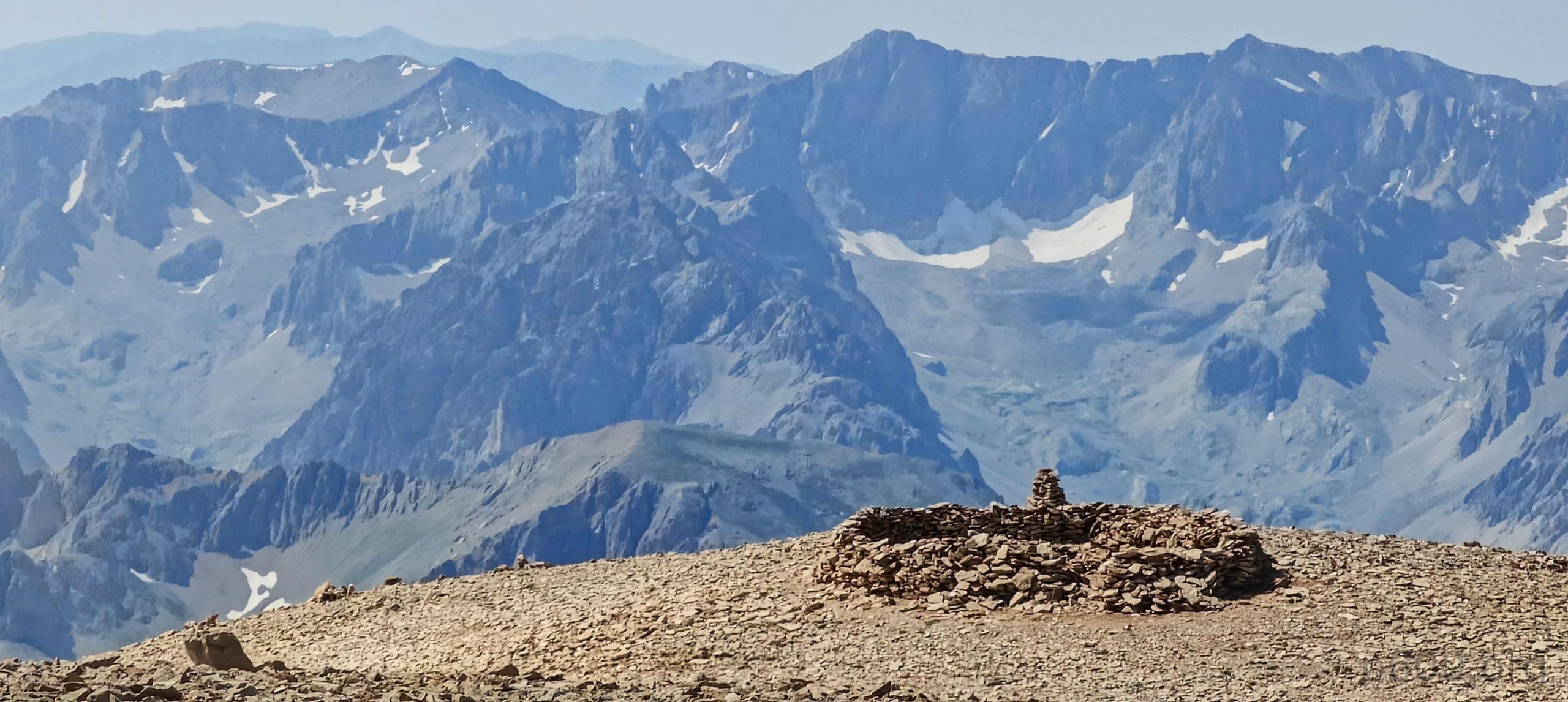
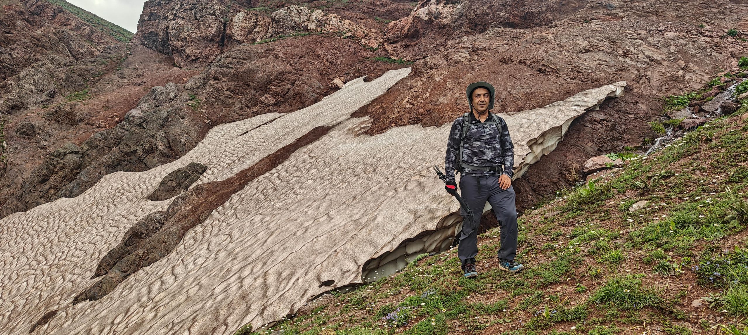
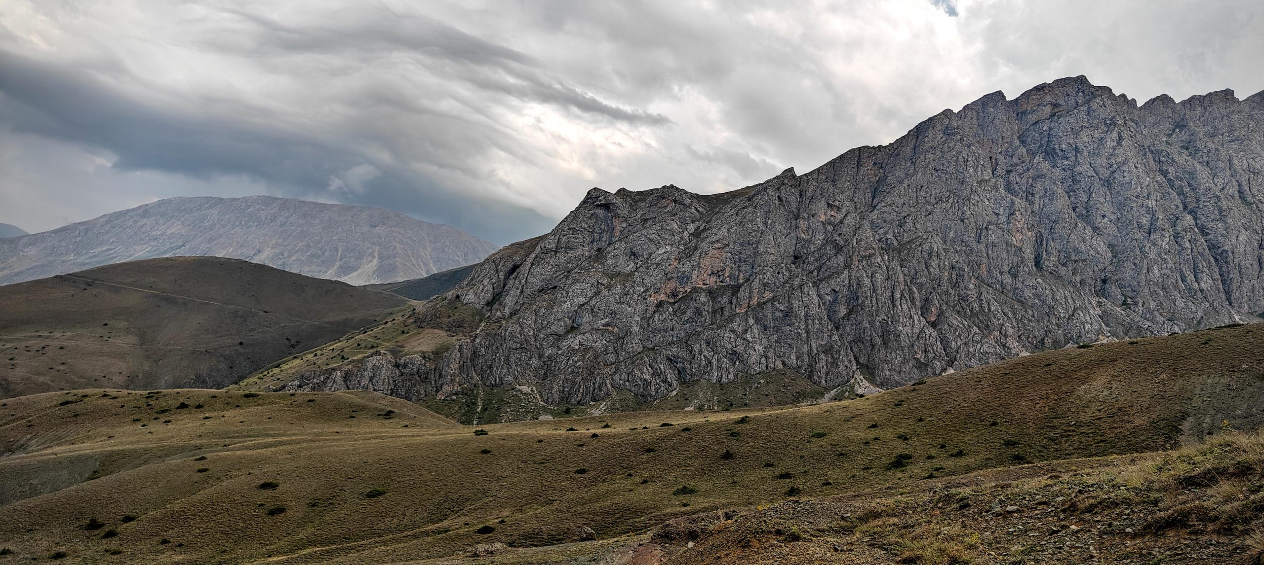
Ten more minutes, and we reach the highest point at the end of the plateau. Rob, Dave, and Steve visit the slightly lower south peak first. The views are nice, the cliffs interesting, and the smaller nearby peaks look great. The summit is marked with a wooden plate, but the name on it is slightly different. We spend a quarter-hour at the summit and then start our descent. I detour to the lower south summit and catch up with everyone at the edge of the plateau. The descent on loose scree is annoying but not hard, and we get back to the car at a fast pace, catching a few drops of rain.

The lower peak in the northwest, Ergan Dağı, stands at 3327m with a prominence of 492m, being the highest point we Rob was allowed to go to in 201.
Views from the summit.
On the way to the lower south peak.
The true summit view from the south peak.
Stone wind shields at the south summit.
Looking back after descending the steep scree section.
The Akbaba Tepesi summit block.
A very colorful hike.
Sabri, our driver, made it to the summit too. Nice touch!.
A few bee farms dot the route.
The access route is in quite good shape, recently flattened, though high clearance 4wd is essential.
We descended just in time, with stormy clouds starting to accumulate as we reached the paved roads.

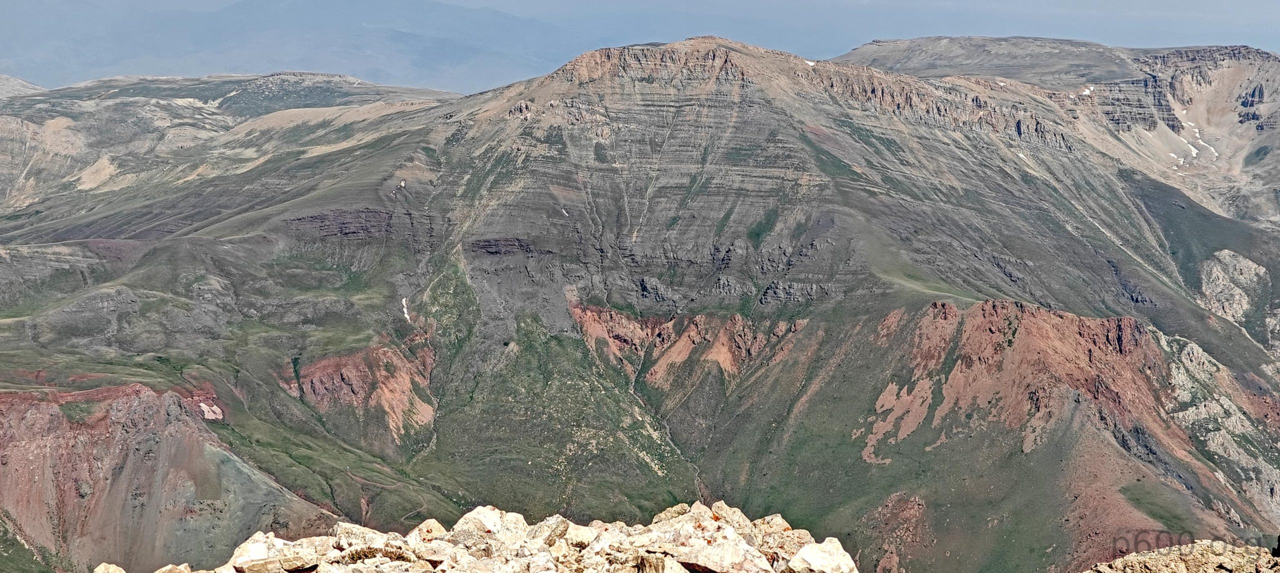
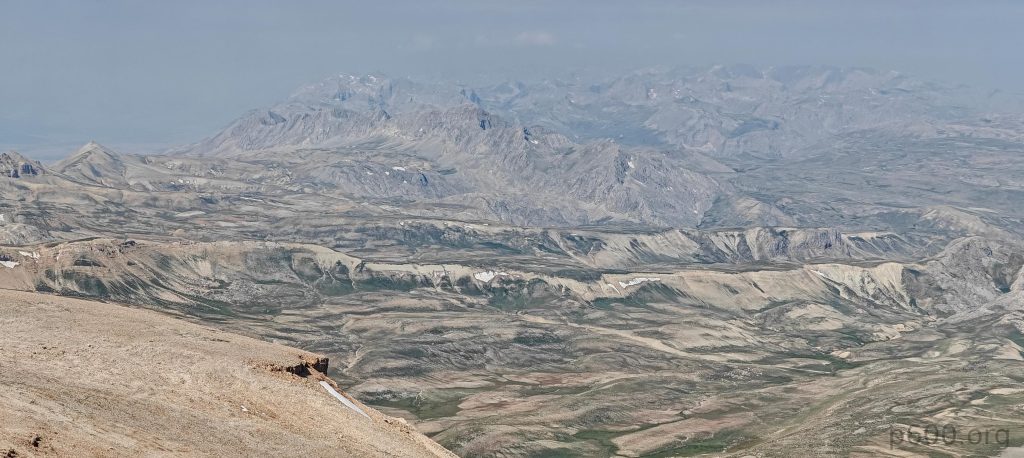
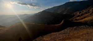
What a great day and beautiful valley with an interesting short hike. Not so long ago, this valley and a few nearby areas were closed to the public due to terrorism risks. While walking down, we agree with Sabri to drive us tomorrow morning to the base of Kesis Dağı, another ultra-prominent peak before our afternoon flight home from Erzincan to Istanbul. A superb bonus to the bonus. Here we say goodbye to Rob, who already climbed Kesis Dağı a few years ago and is now driving towards Gaziantep for a few Ribu hikes. I’ll meet him again in Gaziantep in a few days.

Steven’s account of our hike can be found here


Akbaba Tepesi3457 m altitude
1509 m prominence
30.32 km isolation
RangesAnatolia - Southeast Anatolia
Countries/regionsTurkey - Erzincan
Distance4.70 km up5.30 km down
Elevation828 m gain828 m loss
Time
3h00 up
0h15 other
2h00 down
5h15 total
Trailhead2727 m altitude39.5525320, 39.5148890
RouteWe start at a small flattening where we parked. We then climb the first steeper grassy slope to a huge plateau with a few hills to pass, and walk towards the peak base. The route is mostly easy. Occasionally, we follow some trails, though they are not necessary. The last steep slope to the summit consists of a couple of hundred meters of loose scree with light trails and switchbacks that are best not lost. Each of our team finds their own path. Steven and I contour next to rocks on the left, preferring scrambling to scree climbing. We pass a small rock band in the middle. Once on the ridge, the terrain changes dramatically, revealing a huge flattish summit plateau. I go straight to the summit. After a short break, we descend. I detour to the lower south summit and later join the team on the scree slope. The rest of the route is the same as the ascent.
DifficultiesSteep loose scree slope to reach the summit plateau
LinksGPX trail
  • Anatolia 2024
  • « Mount Ararat
  • Kesis Dağı »

Mountain Ranges

Anatolia
Central Anatolia
Pontic Mountains
Southeast Anatolia
Taurus Mountains
Western Anatolia
Andes
Puna de Atacama
Atlas Mountains
High Atlas
Northwestern Atlas
Central America Ranges
Costa Rica-Panama Ranges
Central Central America
East China
Taiwan
Eastern Europe Ranges
Southeast Baltic Plains
Iberian Peninsula
Cordillera Cantabrica
Castile Ranges
Portugal-Galicia
Pyrenees
Intermountain West
Great Basin Ranges
Korea-Amur Area
Taebaek Sanmae
Malay Archipelago
Java
Nusa Tengarra
Sulawesi
Sumatra
Mid-Atlantic Islands
North Atlantic Islands
Mongolia Ranges
Altai
Gobi Desert Ranges
Hangay Mountains
Northwest Europe
Great Britain
North France-West Rhine Area
Pacific Ranges
Cascade Range
Northwest U.S. Coast Ranges
Sierra Nevada
Central and Southern California Ranges
Philippines
Central Philippines
Luzon
Mindanao
Southeast Asia
Malay Peninsula
Southeast South America
Pampas
Sierras de Cordoba
Southern Africa
Malawi Highlands
West Africa Mountains
Bight of Benin
Cameroon Mountains
Guinea Highlands

Countries / regions

Algeria
Ain Guezzam
Ain Salah
Aïn Témouchent
El Bayadh
Ghardaïa
Oran
Ouargla
Saïda
Sidi Bel Abbès
Tamanrasset
Argentina
Catamarca
Ciudad Autónoma de Buenos Aires
Córdoba
Jujuy
Salta
Tucumán
Belgium
Brussels Capital Region
Flemish Region
Cameroon
Southwest
China
Taiwan
Costa Rica
Alajuela
Cartago
Guanacaste
Heredia
Limón
San José
Czechia
Prague
Denmark
Greenland
France
Hauts-de-France
Occitania
Germany
Berlin
Niedersachsen
Indonesia
Bali
Jambi
Jawa Tengah
Jawa Timur
Nusa Tenggara Barat
Sulawesi Tengah
Sulawesi Utara
Sumatera Barat
Lithuania
Vilnius County
Mongolia
Bayankhongor
Govi-Altai
Khovd
Omnogovi
Ovorkhangai
Ulan Bator
Zavkhan
Morocco
Béni Mellal-Khénifra
Drâa-Tafilalet
Fez-Meknes
Marrakesh-Safi
Souss-Massa
Tangier-Tetouan-Al Hoceima
Mozambique
Zambezia
Netherlands
Gelderland
Noord-Holland
Zeeland
Nicaragua
Chinandega
Managua
Masaya
Rivas
Philippines
Bicol Region (V)
Cagayan Valley (II)
Calabarzon (IV-A)
Central Luzon (III)
Cordillera Administrative Region
Davao Region
Metro Manila
Soccsksargen (XII)
Western Visayas (VI)
Poland
Greater Poland Voivodeship
Masovian Voivodeship
Portugal
Castelo Branco
Leiria
Lisbon
Madeira
Santarém
Qatar
Ad-Dawhah
São Tomé and Príncipe
São Tomé Province
Sierra Leone
Northern Province
Western Area
Singapore
South Korea
Gyeongsangnam-do
Seoul
Spain
Aragón
Asturias
Castilla-La Mancha
Castilla y León
Catalonia
Islas Canarias
Switzerland
Zürich
Turkey
Antalya
Bitlis
Erzincan
Hakkâri
Igdir
Isparta
Kahraman Maras
Muğla
United Kingdom
England
Scotland
United States
California
Delaware
Florida
Maryland
Nevada
New Jersey
New York
Pennsylvania
South Carolina
Utah

TRIPS

2024
Southern Africa 2024
Mid-Atlantic Islands 2024
North America 2024
Anatolia 2024
Korea-Amur Area 2024
East China 2024
2023
Mongolia Ranges 2023
Philippines 2023
West Africa III 2023
West Africa II 2023
Iberian Peninsula 2023
West Africa 2023
Central America 2023
2022
Andes 2022
Northwest Europe 2022
Malay Archipelago III 2022
Malay Archipelago II 2022
Anatolia Mountains 2022
Iberian Peninsula 2022
Atlas Mountains 2022
North France-West Rhine Area 2022

archaeology (3) climb (157) food (2) hike (155) p30 (17) p50 (4) p100 (24) p300 (12) p600 (17) p1000 (11) p1500 (76) ribu (10) sight (46) summary (16) trig (44) ultra (76)

1 591 km walked, 121 298 m climbed

©2025 p600.org | WordPress Theme by Superbthemes.com