Skip to content
Menu
p600.org
  • home
  • map
  • trips
  • about
p600.org

Suphan Dağı

hike | 2024-07-13

Suphan Dağı stands tall at over 4000 meters, with a prominence exceeding 2000 meters and an isolation of more than 150 kilometers. This mountain isn’t just interesting to climb; it’s practically irresistible. With its proximity to Mount Ararat, it’s the perfect candidate for an acclimatization climb. We’ve already had a taste of acclimatization on Kara Dağ and Mor Dağı, but you can never have too much of it. Our itinerary looks like this:

  • Day 1: Long drive from Yüksekova to the Suphan Dağı camp at 2 503 meters.
  • Day 2: Summit at 4058 meters, descend, and drive to the Doğubayazıt hotel.
A flock of sheep causes a traffic jam near the trailhead.
The flat campsite offers spectacular views of Lake Van.
Suphan Dağı and our campsite bask in the late afternoon sun.
From the camp, Smaller Lake Arin and Lake Van lounge in the background.

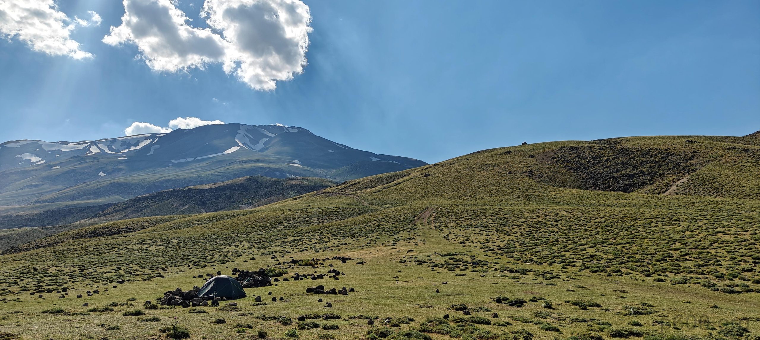
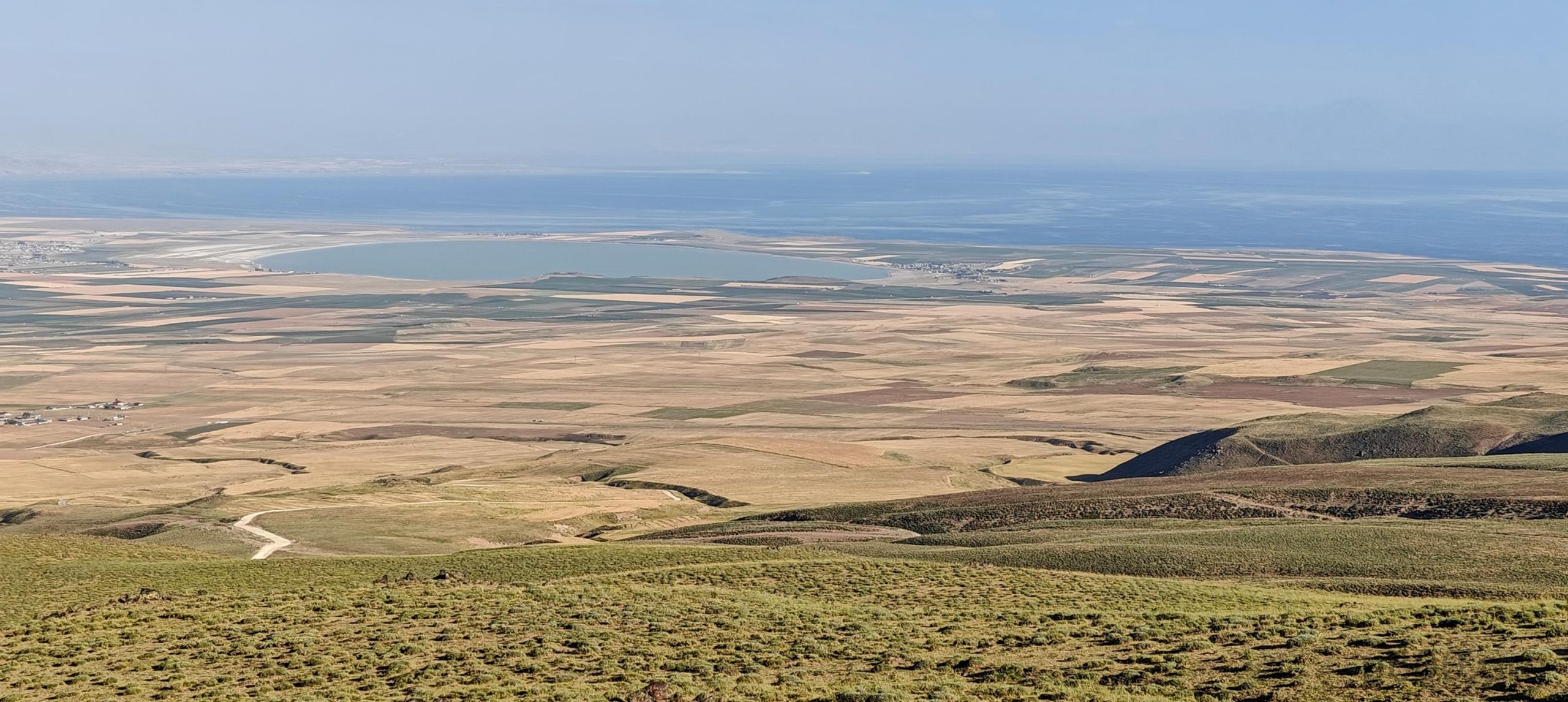
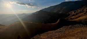
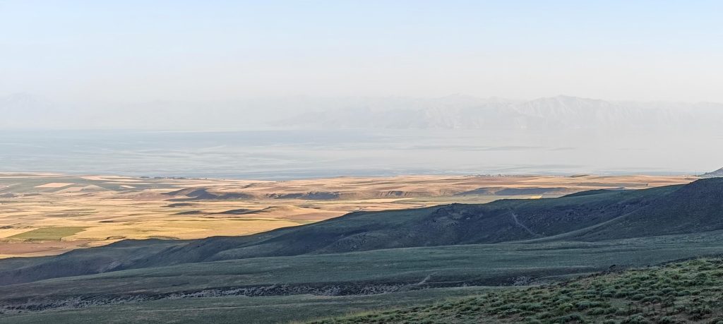
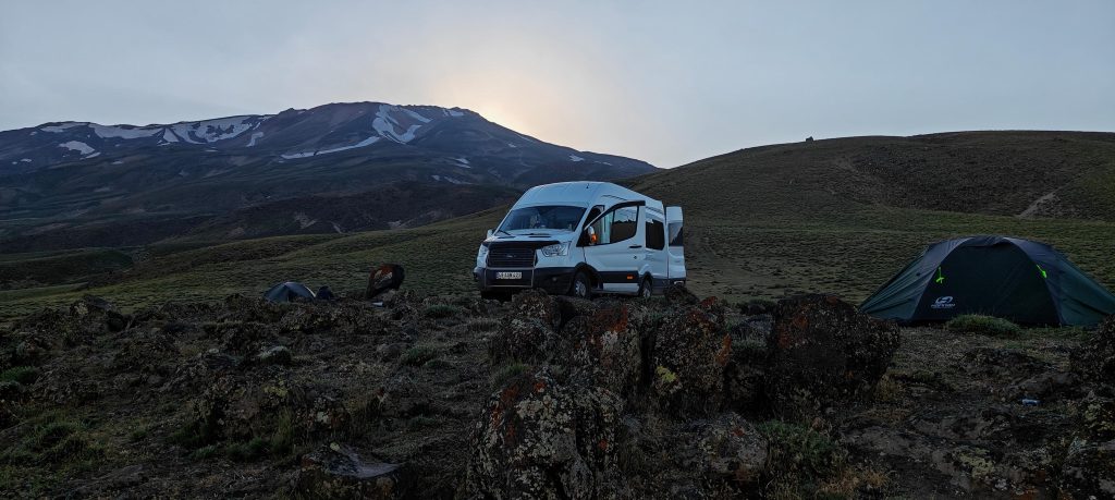
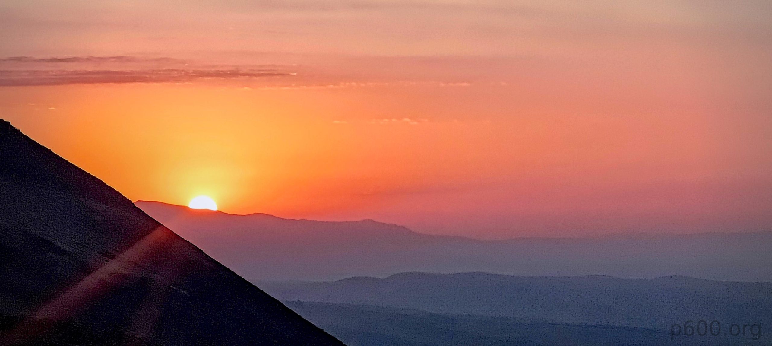
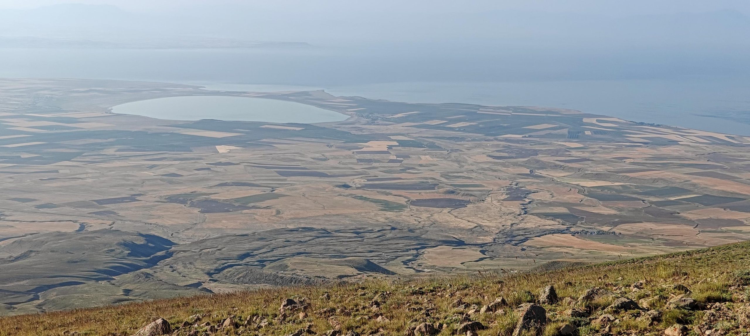
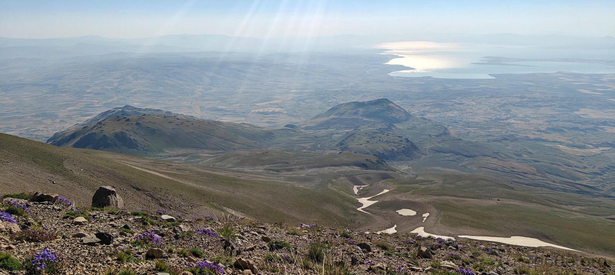
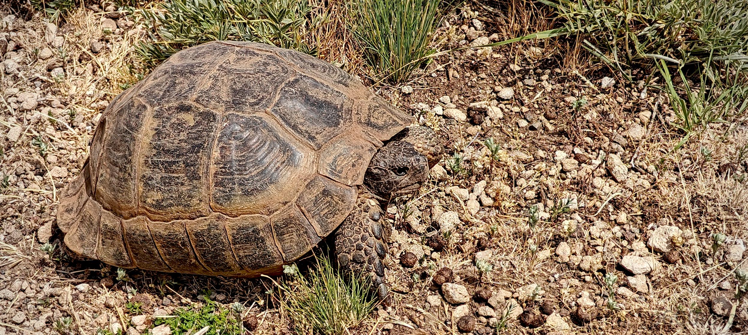
Camping is on a nice, big, flat-ish field with time-to-time-good internet reception—because who doesn’t love mixing nature with a touch of Wi-Fi? I could squeeze in some work again, lucky me. We arrived late afternoon, just in time to enjoy a meal and relax. Recep whipped up some delicious köfte for us, which was great, if you’re into that kind of thing. At night, I could hear tortoises roaming around the tent; a few even made a guest appearance in the evening. The evening view of Lake Van? Absolutely spectacular—no filters needed.

The west plateau stretches out while our minibus relaxes at the camp.
Local shepherds expertly herd sheep and goats around our camp.

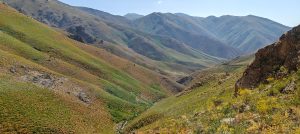
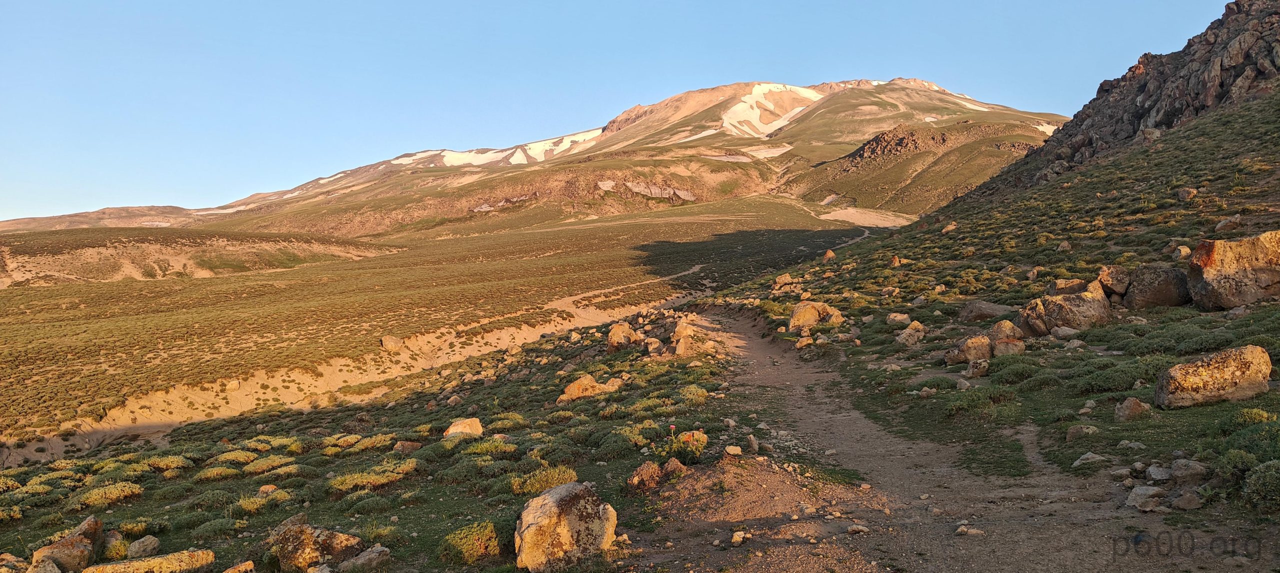
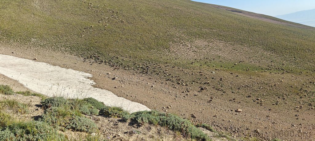
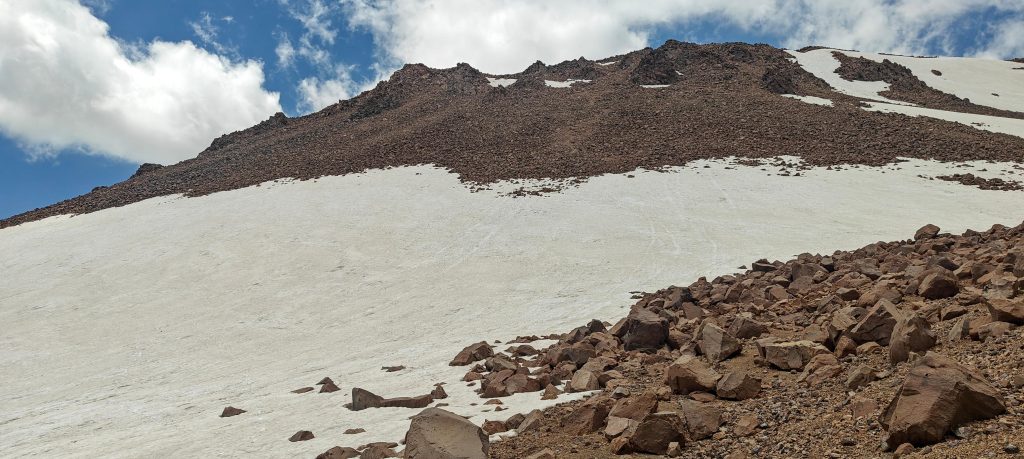
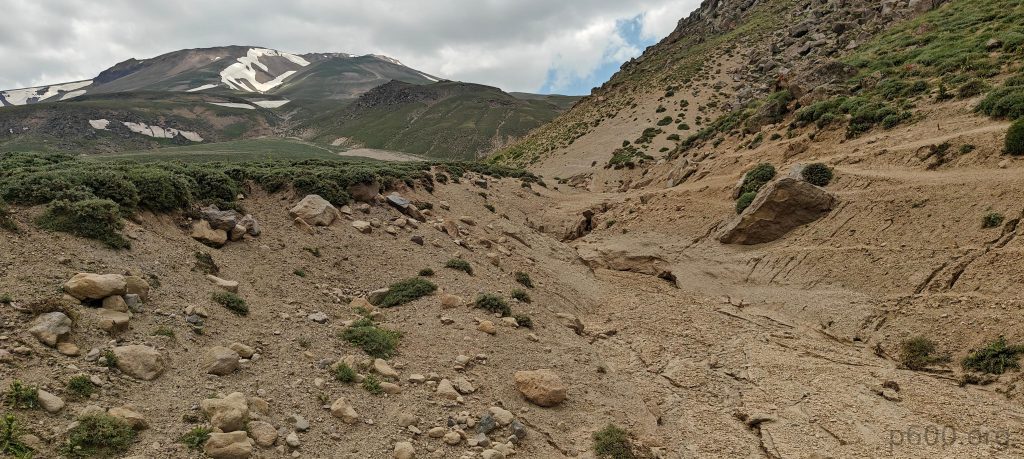
Recep suggested starting at 2 or even 1 a.m., but we all agreed that daylight hikes are the way to go. Sunrise at the camp is just as nice as on the summit—trust us. So, getting up before dawn, we packed up, had a quick breakfast, and began our hike toward the steeper slopes at 5am. The first few hundred vertical meters are on a wide and very gradual trail. Later, we hit a steeper slope covered in snow in a few small stretches, but snow is avoidable.

We have breakfast and start hiking with the first sunlight, pretending we’re morning people.
Suphan Dağı and the wide trail leading toward it glow in the morning light.
The first steeper slope with old snow clings on.
Recep and Steven lead the way, followed by Dave plodding up the gradual slopes.
Lake Arin (Arin Gölü, Gola Arîn) in Bitlis, Turkey, sits just east of Adilcevaz, barely separated from the vast Lake Van by a slender strip of alluvial deposits.
The gullies hold quite a bit of snow.
Our route stretches all the way from the camp, with Lake Van lounging in the background.
The summit is to the right, but first, we need to cross a half-kilometer plateau.

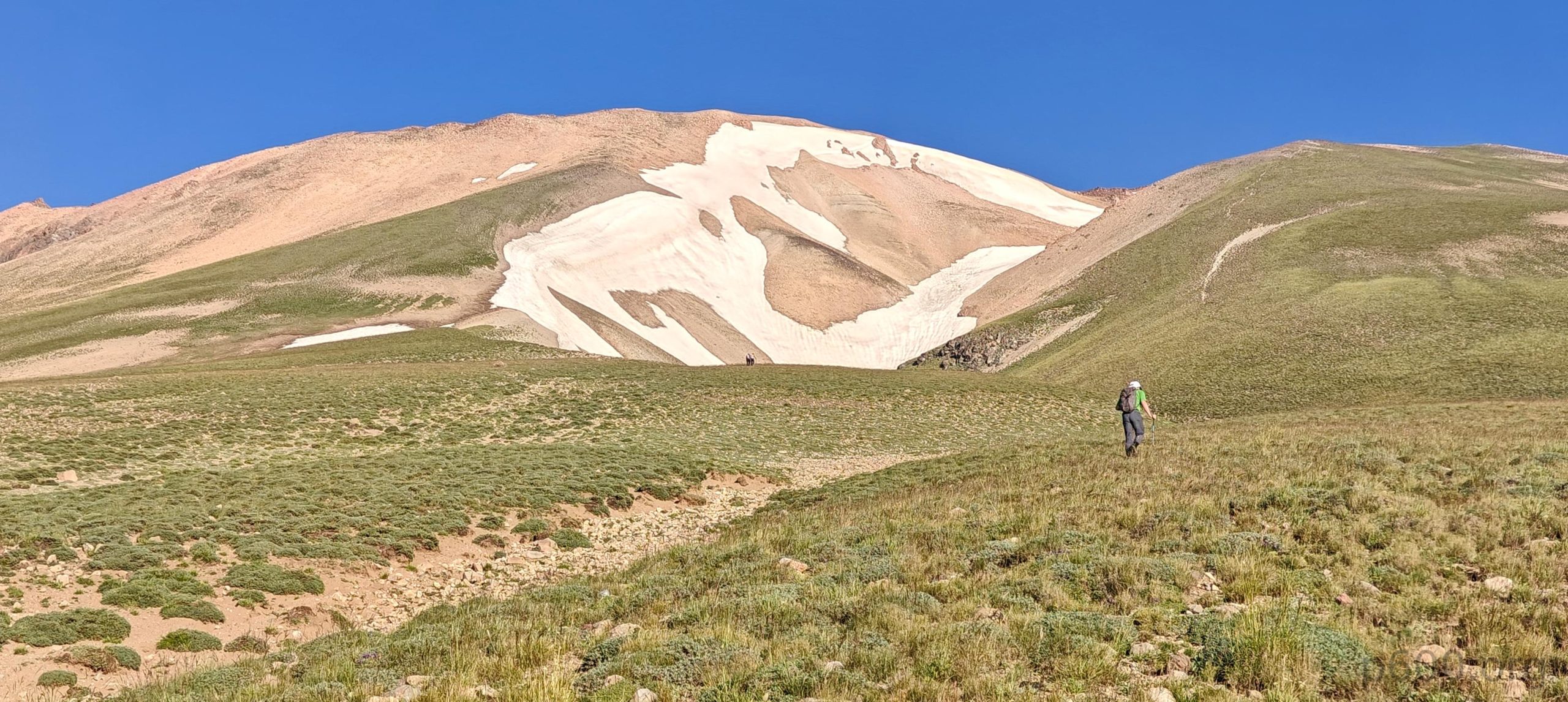
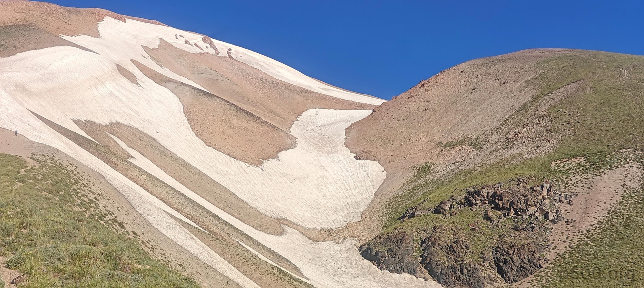
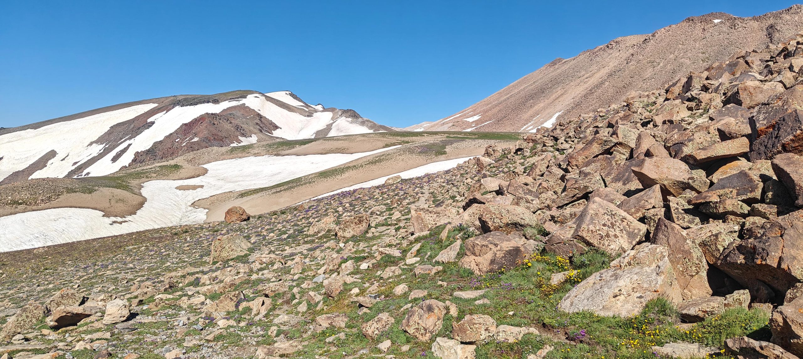
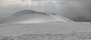
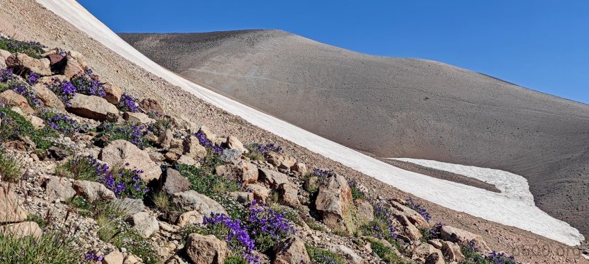
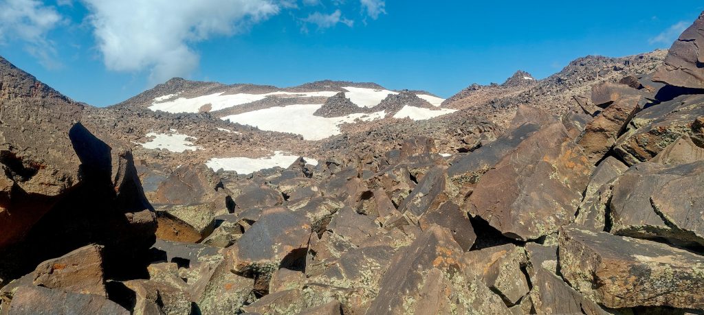
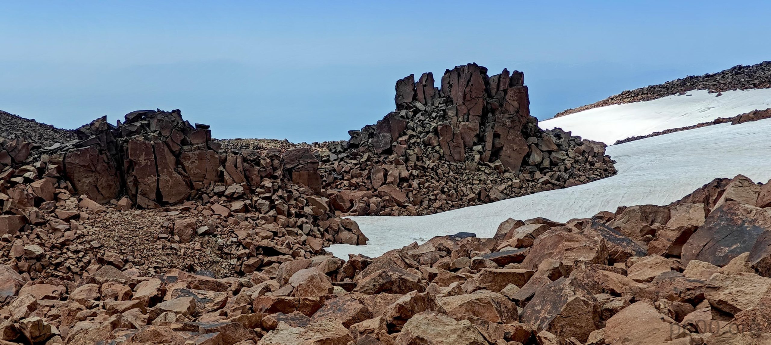
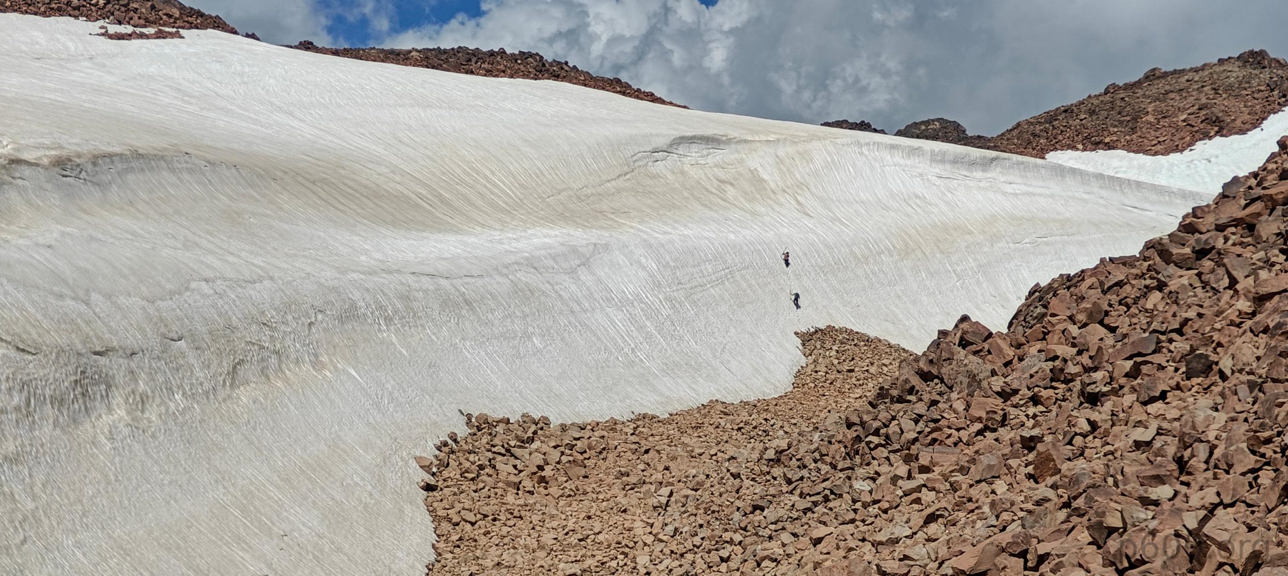
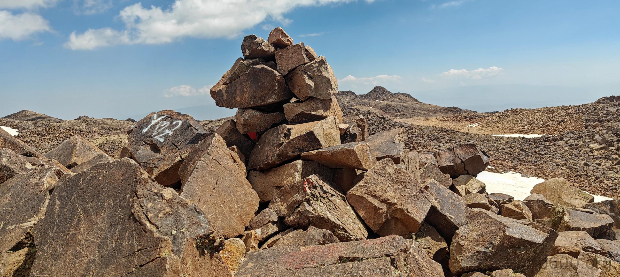
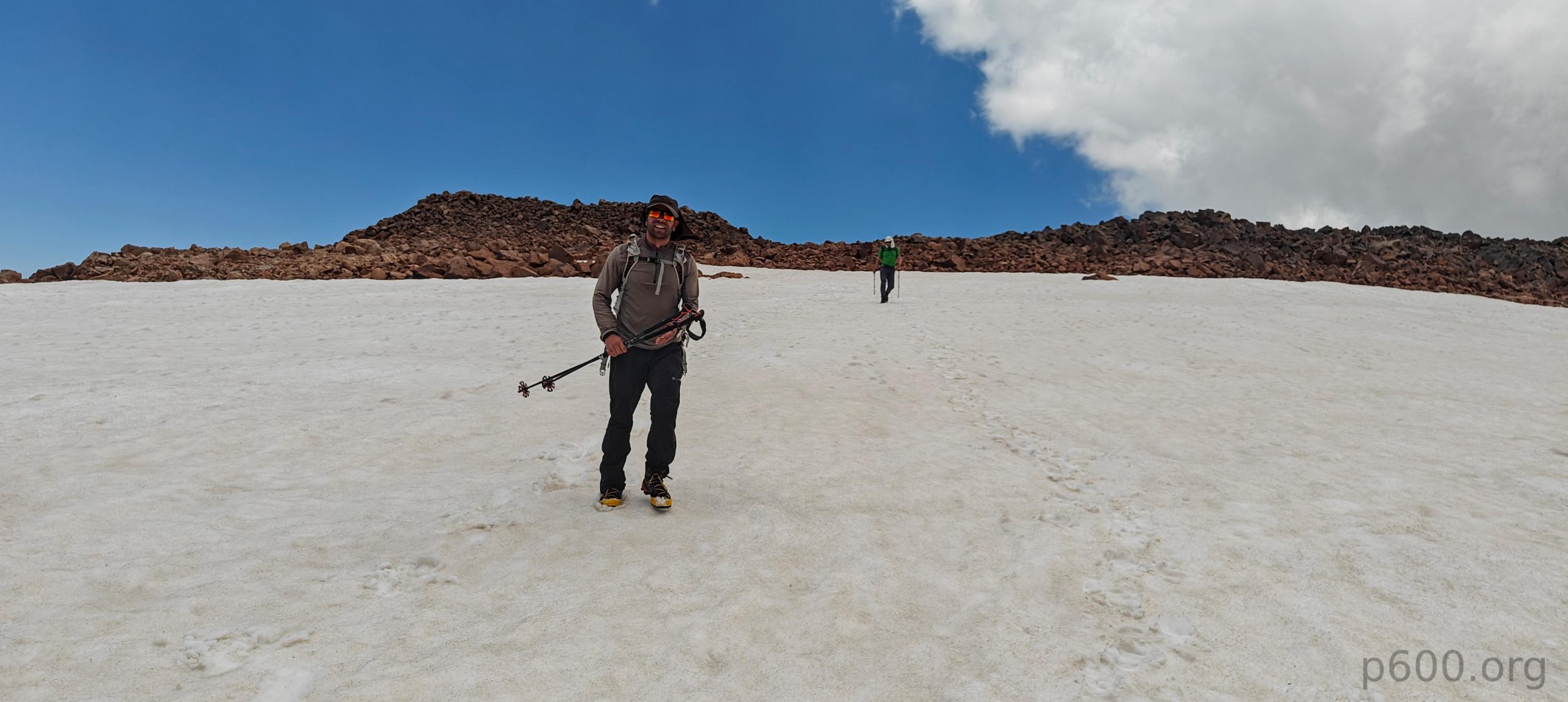
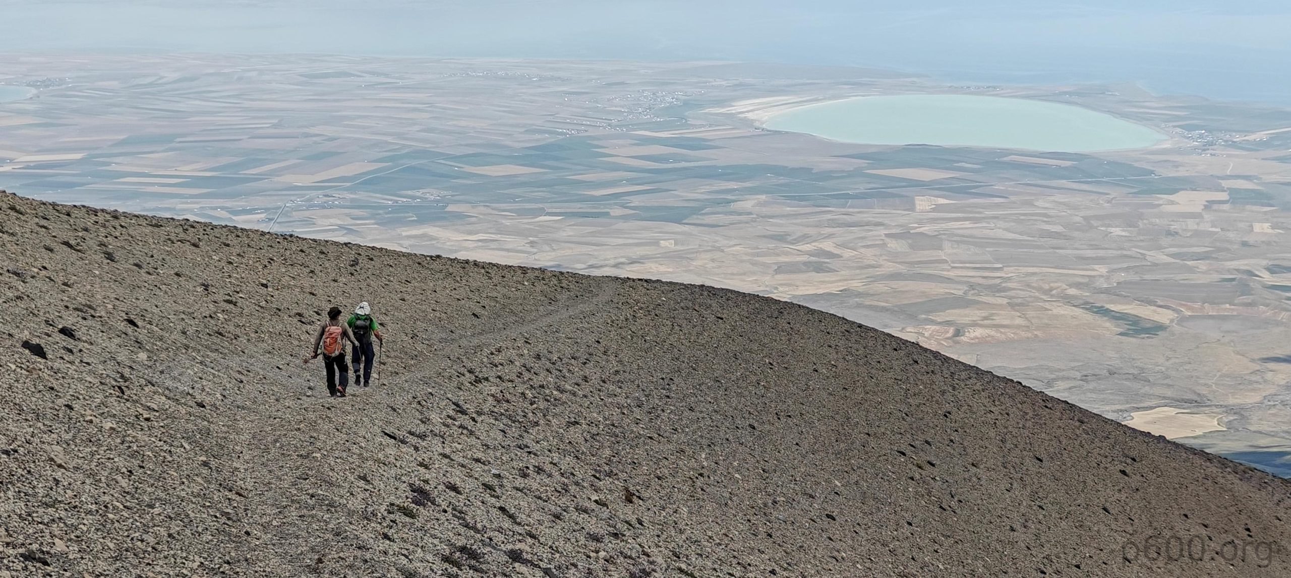
Before the summit bump, there’s a nice flat field. After crossing it, we encounter a steep, unavoidable snowfield. Okay, maybe it’s avoidable, but walking on the snow seems more appealing than the alternatives. The snow is soft, so we skip crampons (which we conveniently left at camp, another reason to skip them). After the snowfields, there’s a steep, loose scree slope, and, as expected, this terrain is tough. There’s sort of a light trail, though we’re often losing and finding it again. Relief finally comes when we reach the edge of the summit plateau, but it’s only a relief in terms of steepness. Reaching the lower northeast summit is quite the challenge. The surface is covered with boulders the size of fridge and piano, and some of them move.

The summit bump, a couple of hundred meters high and made of loose talus steep slopes, waits beyond the snowfields we need to cross first.
The summit plateau is extremely rough and full of huge boulders, making movement frustratingly slow.

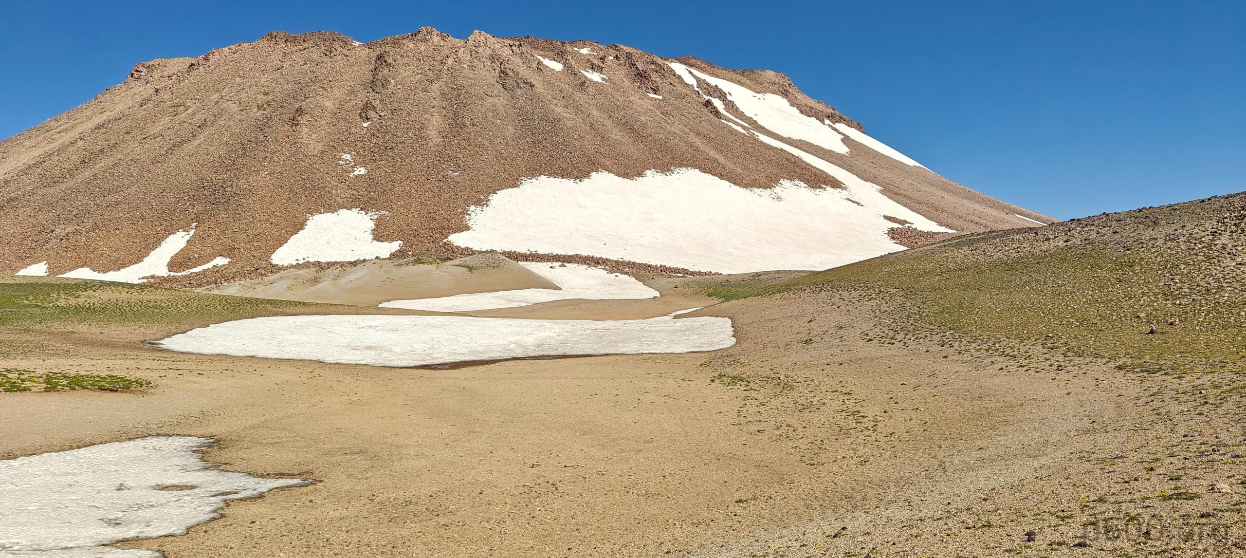
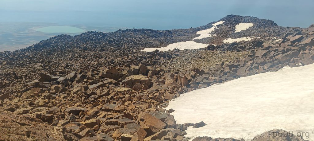
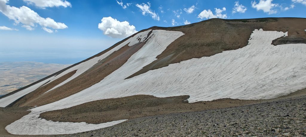
After a short break at the lower summit, we look forward to reaching the true summit in the southwest. It looks quite challenging—half a mile on this surface will be tough and slow. But in the end, it was surprisingly easy. About a third of the path was covered in snow, which made for easy walking, and the west side of the plateau is less rough, more flat, with smaller rocks. So, after fifteen or twenty minutes, I reach the true high point. Dave and Recep come little later; they tried a shortcut and climbed a snow wall.

Interesting rock formations near the summit stand like nature’s sculptures.
Recep (up) and Dave (lower) attempt to shortcut the snowfield by scaling a snow wall, while I walk around and reach the true summit almost ten minutes earlier :).
The rocky summit plateau showcases the lower northeast summit in the background, from which we journeyed.
A metallic Turkish flag flutters on the lawn almost like an Apollo mission flag.
The view directly south from the summit tempts us to descend, but we ultimately decide to retrace our steps on the loose talus slope.
The true summit features a cairn alongside an ascent register box and a metal Turkish flag.
Dave and I stand on the summit while Recep works his magic behind the camera.

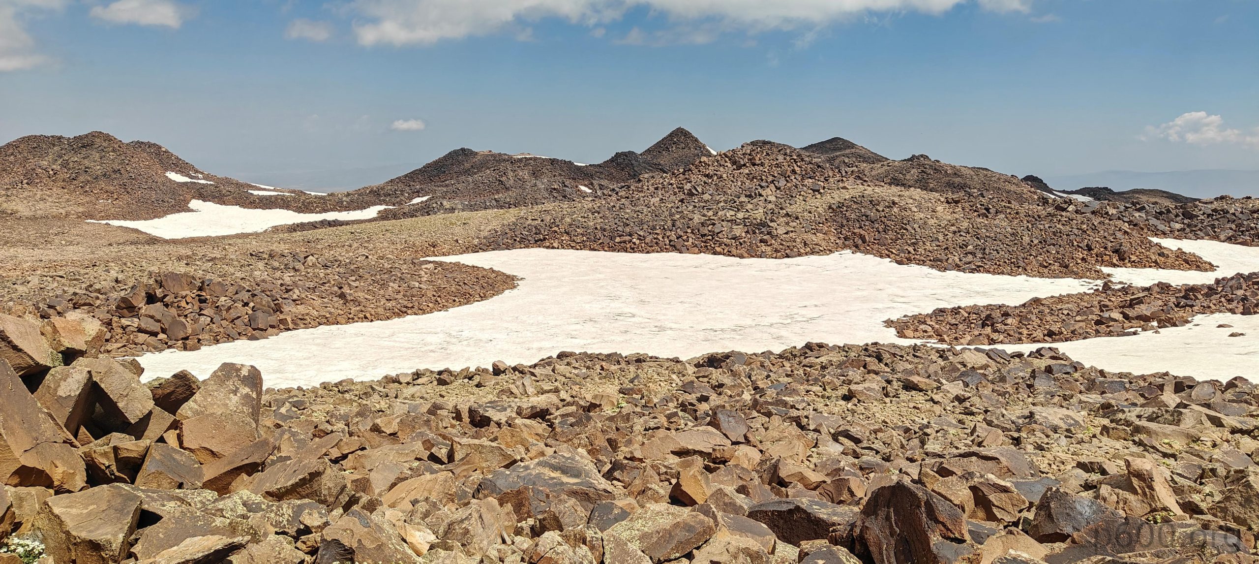
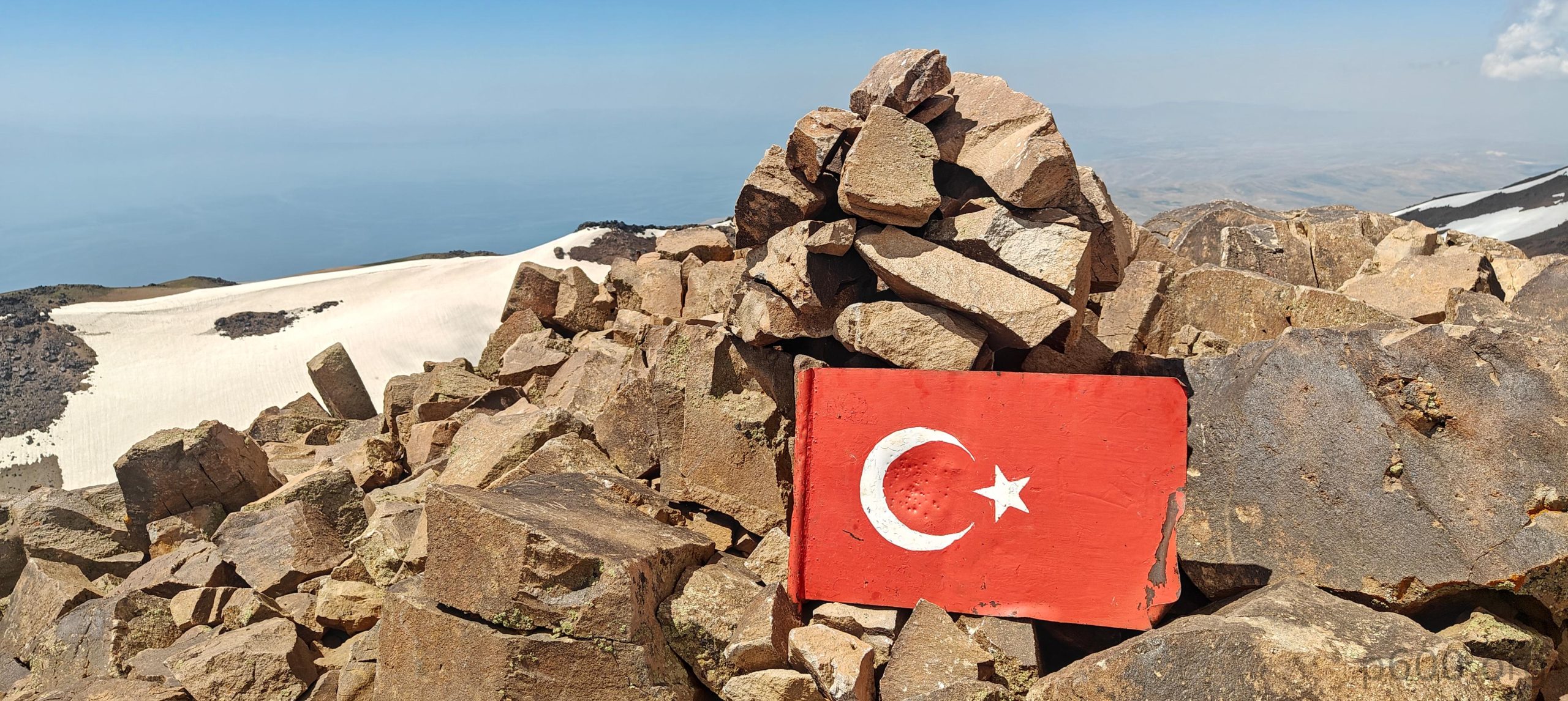
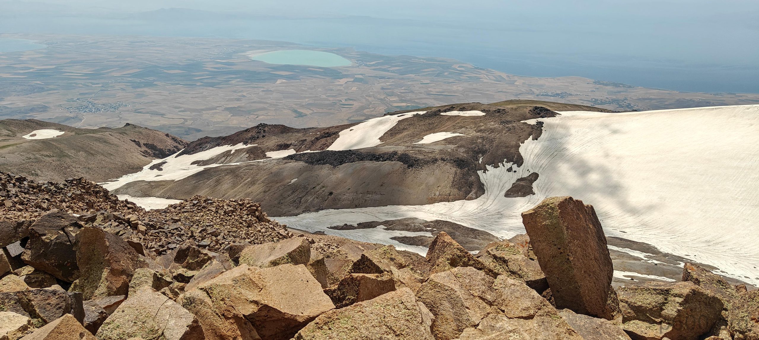
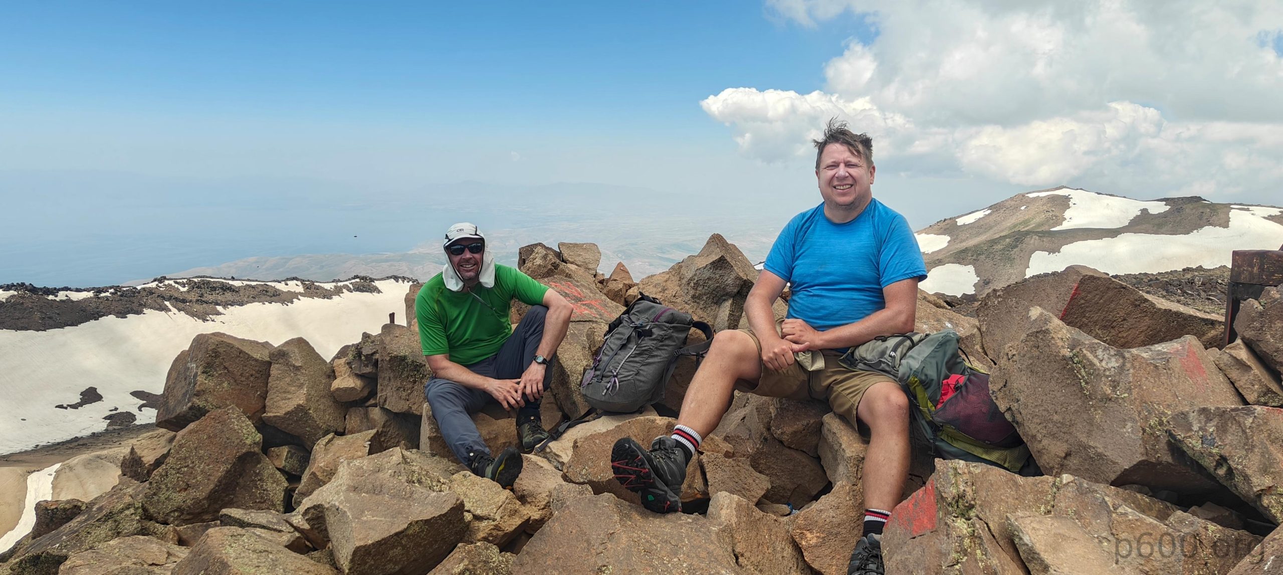
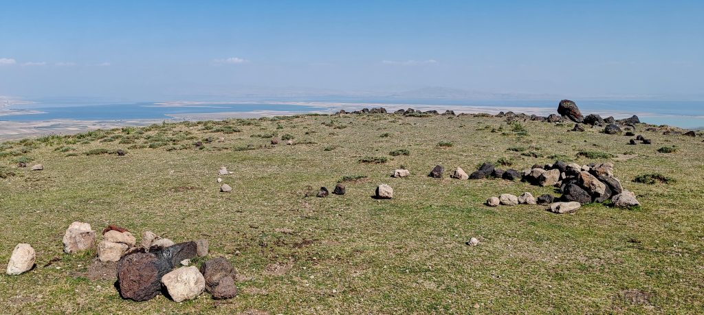
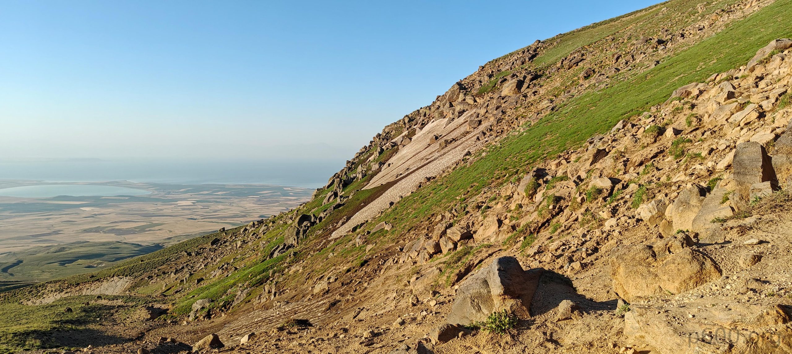
The true summit is marked with a Turkish flag, an ascent log box, and a cairn. For all three of us, this is our first ascent to the true summit. Recep had visited the lower northeast summit many times but never made it here until now. Congratulations on reaching the true high point! 🙂 We have good visibility of the lower northeast summit and even the lower northwest summit. Lake Van is visible in the distance, along with a few more peaks in the mist. One good thing about volcanoes is that it’s pretty obvious that this is the highest one in the vicinity.

Several gullies at the summit plateau are filled with snow.
The snow is actually a bonus, as moving on it is faster than traversing the rough, rocky surface.

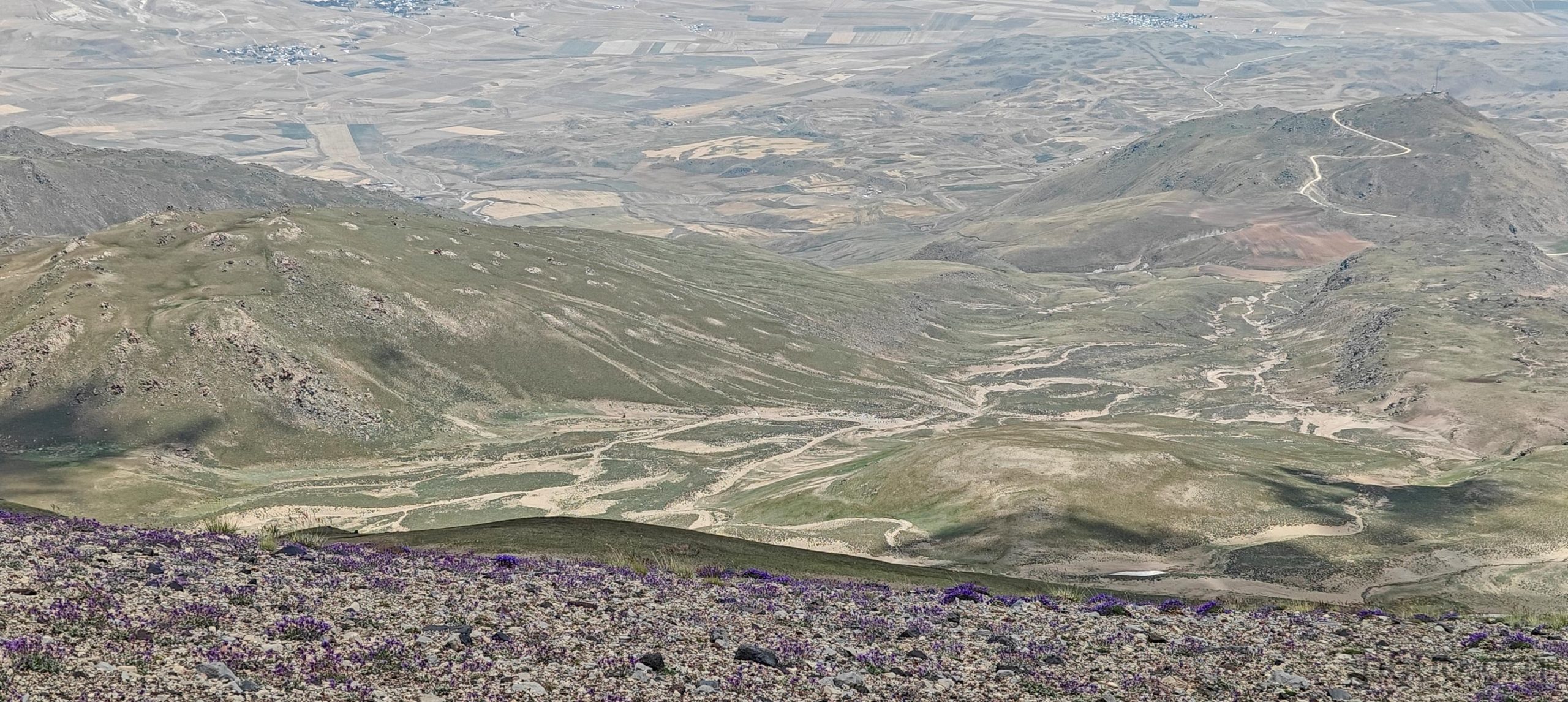
Steven and Adam decided to descend in a straight line south, expecting to make good time walking on the snow in the gully. After evaluating the slope and having a short discussion, we decided to retrace our steps back to the edge of the plateau where we climbed up and use the same trail on the scree to go down. It was a good decision, mainly because we later took a different ridge to descend, parallel to the one we came up. This trail was brilliant, with soft sand that made for a very fast descent. You could easily run down it. I think we went down in less than half the time it took us to climb up.

On the way down, Recep suggests taking the parallel ridge on the sandy express trail.
Recep and Dave stand with soda Lake Arin in the background
Walking on the sand is easy, giving us plenty of time to take in the views.
Water erosion etches its mark on the landscape, with Suphan Dağı towering in the background.
A standard cooled watermelon awaits us after the descent.

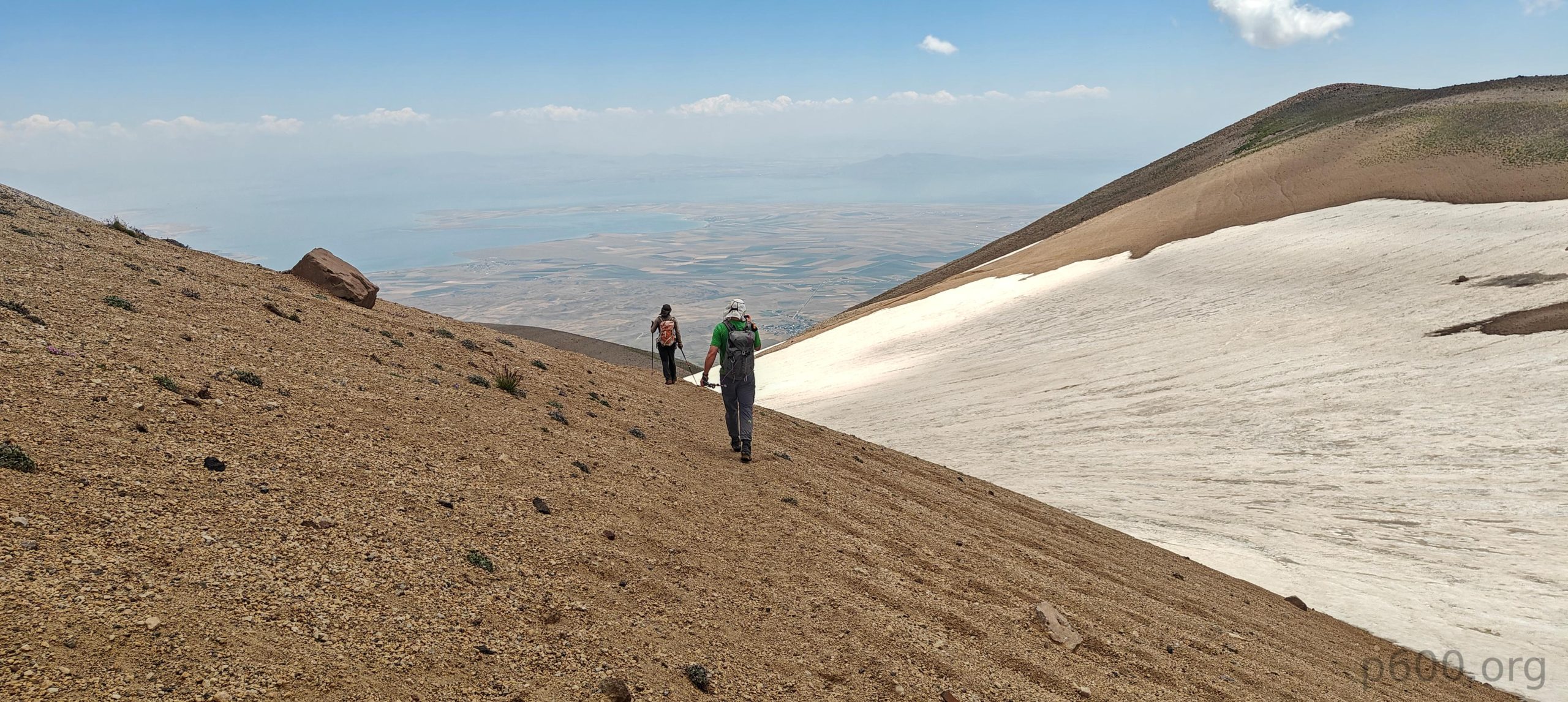
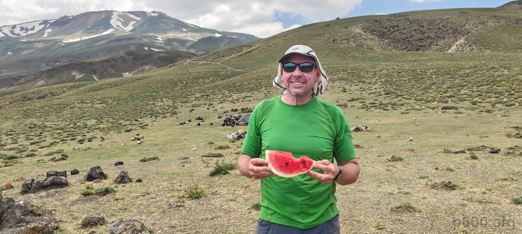
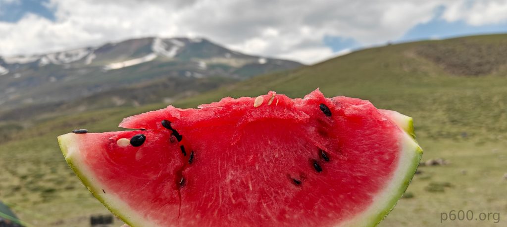
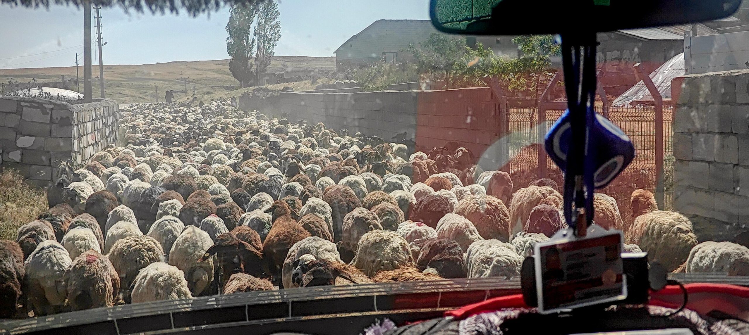
Back at camp, we found Steven and Adam—and, thankfully, another chilled watermelon. It was a memorable hike, with interesting landscapes higher up—a truly unforgettable day. We packed up the remaining tents and started the long drive toward Doğubayazıt, the city at the base of Mount Ararat. We made a quick stop in Erciş for a late lunch. I feel like we’re prepared and ready for the tallest free-standing mountain hike.

The Greek tortoise, also known as the spur-thighed or Moorish tortoise, is a member of the Testudinidae family, known for its impressive lifespan of over 125 years.

Steven’s account of our hike can be found here


Suphan Dağı4058 m altitude
2189 m prominence
151.16 km isolation
RangesAnatolia - Southeast Anatolia
Countries/regionsTurkey - Bitlis
Distance7.90 km up7.50 km down
Elevation1654 m gain1654 m loss
Time
4h40 up
0h20 other
2h20 down
7h20 total
Trailhead2503 m altitude38.9165680, 42.8961520
RouteStart with an easy walk on a wide trail that leads to switchbacks on a steeper slope, with a few short stretches covered in snow. Reach an upper plateau before tackling a 250-meter talus wall. This section is steep, with loose rocks and a trail that's more imagined than real. Cross a snow field that becomes quite steep higher up. The summit plateau is rocky and chaotic, with boulder fields. Reaching the lower Northeast summit is challenging, but continue to the true summit, which is 1-2 meters higher and 800 meters to the Southwest. Crossing the summit plateau is easier, mainly over snow fields. Return across the snow fields to where you entered the plateau. Descend the talus wall, cross a small snowfield, and take a parallel ridge more to the north. This is one of the best descent trails, mostly sandy, allowing for a quick descent.
DifficultiesThere are a few avoidable patches of snow on the trail. Before the summit, there's a steep, loose scree slope. The summit plateau is made of huge boulders, some of which are unstable and move.
LinksGPX trail
  • Anatolia 2024
  • « Mor Dağı
  • Mount Ararat »

Mountain Ranges

Anatolia
Central Anatolia
Pontic Mountains
Southeast Anatolia
Taurus Mountains
Western Anatolia
Andes
Puna de Atacama
Atlas Mountains
High Atlas
Northwestern Atlas
Central America Ranges
Costa Rica-Panama Ranges
Central Central America
East China
Taiwan
Eastern Europe Ranges
Southeast Baltic Plains
Iberian Peninsula
Cordillera Cantabrica
Castile Ranges
Portugal-Galicia
Pyrenees
Intermountain West
Great Basin Ranges
Korea-Amur Area
Taebaek Sanmae
Malay Archipelago
Java
Nusa Tengarra
Sulawesi
Sumatra
Mid-Atlantic Islands
North Atlantic Islands
Mongolia Ranges
Altai
Gobi Desert Ranges
Hangay Mountains
Northwest Europe
Great Britain
North France-West Rhine Area
Pacific Ranges
Cascade Range
Northwest U.S. Coast Ranges
Sierra Nevada
Central and Southern California Ranges
Philippines
Central Philippines
Luzon
Mindanao
Southeast Asia
Malay Peninsula
Southeast South America
Pampas
Sierras de Cordoba
Southern Africa
Malawi Highlands
West Africa Mountains
Bight of Benin
Cameroon Mountains
Guinea Highlands

Countries / regions

Algeria
Ain Guezzam
Ain Salah
Aïn Témouchent
El Bayadh
Ghardaïa
Oran
Ouargla
Saïda
Sidi Bel Abbès
Tamanrasset
Argentina
Catamarca
Ciudad Autónoma de Buenos Aires
Córdoba
Jujuy
Salta
Tucumán
Belgium
Brussels Capital Region
Flemish Region
Cameroon
Southwest
China
Taiwan
Costa Rica
Alajuela
Cartago
Guanacaste
Heredia
Limón
San José
Czechia
Prague
Denmark
Greenland
France
Hauts-de-France
Occitania
Germany
Berlin
Niedersachsen
Indonesia
Bali
Jambi
Jawa Tengah
Jawa Timur
Nusa Tenggara Barat
Sulawesi Tengah
Sulawesi Utara
Sumatera Barat
Lithuania
Vilnius County
Mongolia
Bayankhongor
Govi-Altai
Khovd
Omnogovi
Ovorkhangai
Ulan Bator
Zavkhan
Morocco
Béni Mellal-Khénifra
Drâa-Tafilalet
Fez-Meknes
Marrakesh-Safi
Souss-Massa
Tangier-Tetouan-Al Hoceima
Mozambique
Zambezia
Netherlands
Gelderland
Noord-Holland
Zeeland
Nicaragua
Chinandega
Managua
Masaya
Rivas
Philippines
Bicol Region (V)
Cagayan Valley (II)
Calabarzon (IV-A)
Central Luzon (III)
Cordillera Administrative Region
Davao Region
Metro Manila
Soccsksargen (XII)
Western Visayas (VI)
Poland
Greater Poland Voivodeship
Masovian Voivodeship
Portugal
Castelo Branco
Leiria
Lisbon
Madeira
Santarém
Qatar
Ad-Dawhah
São Tomé and Príncipe
São Tomé Province
Sierra Leone
Northern Province
Western Area
Singapore
South Korea
Gyeongsangnam-do
Seoul
Spain
Aragón
Asturias
Castilla-La Mancha
Castilla y León
Catalonia
Islas Canarias
Switzerland
Zürich
Turkey
Antalya
Bitlis
Erzincan
Hakkâri
Igdir
Isparta
Kahraman Maras
Muğla
United Kingdom
England
Scotland
United States
California
Delaware
Florida
Maryland
Nevada
New Jersey
New York
Pennsylvania
South Carolina
Utah

TRIPS

2024
Southern Africa 2024
Mid-Atlantic Islands 2024
North America 2024
Anatolia 2024
Korea-Amur Area 2024
East China 2024
2023
Mongolia Ranges 2023
Philippines 2023
West Africa III 2023
West Africa II 2023
Iberian Peninsula 2023
West Africa 2023
Central America 2023
2022
Andes 2022
Northwest Europe 2022
Malay Archipelago III 2022
Malay Archipelago II 2022
Anatolia Mountains 2022
Iberian Peninsula 2022
Atlas Mountains 2022
North France-West Rhine Area 2022

archaeology (3) climb (157) food (2) hike (155) p30 (17) p50 (4) p100 (24) p300 (12) p600 (17) p1000 (11) p1500 (76) ribu (10) sight (46) summary (16) trig (44) ultra (76)

1 591 km walked, 121 298 m climbed

©2025 p600.org | WordPress Theme by Superbthemes.com