Skip to content
Menu
p600.org
  • home
  • map
  • trips
  • about
p600.org

Yushan

hike | 2024-03-18

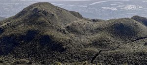
Island highpoint, a top 100 prominence peak and one of the dozen ultra-prominent peaks starting with the letter Y, boasts over 1800km of isolation—a real monster peak for peak baggers. Here we are in Taiwan, at the Youshan trailhead, late afternoon, with reservations at the lower hut, teeming with friendly hikers eager to assist us through the maze of rules.

Every person in the hut receives a warm pink cover and matching pink mattress, turning the space into a cozy, monochromatic haven.

We park the car by the street, not far from the hut, gear loaded with crampons, ice axes, and helmets. A chat with a descending team convinces us to repack in the morning, opting only for helmets and microspikes, just in case. We obtained gas from a local shop for our gas stove, and that evening, we cooked a couple of curry packs brought by Denise and Richard from the UK. Sleeping gear is provided and looks good, but I have a habit of sleeping in my personal sleeping bag over the comfortable mattresses and warm pink coverings.

The image lays out the Yushan hike, clearly a ridge-runner’s dream.
Monkeys and bears join forces in an unlikely yet alarmingly dangerous alliance.

In a bold move, we tossed our permits into the post box at the snoozing police office
A stately stone marks the entrance to the national park

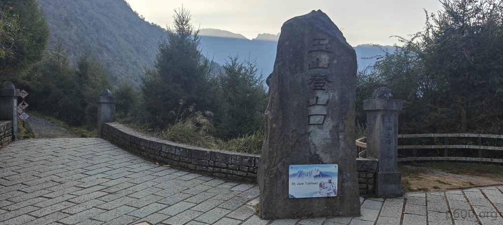
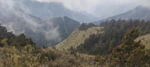
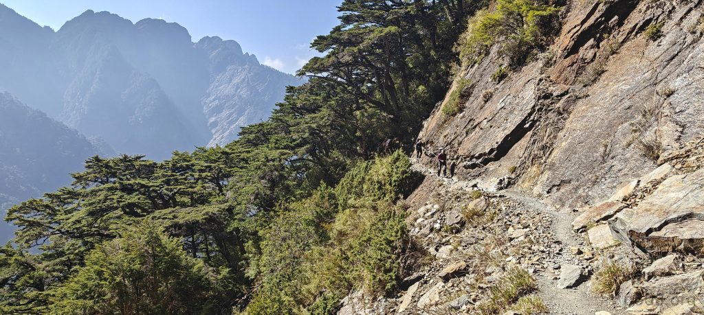
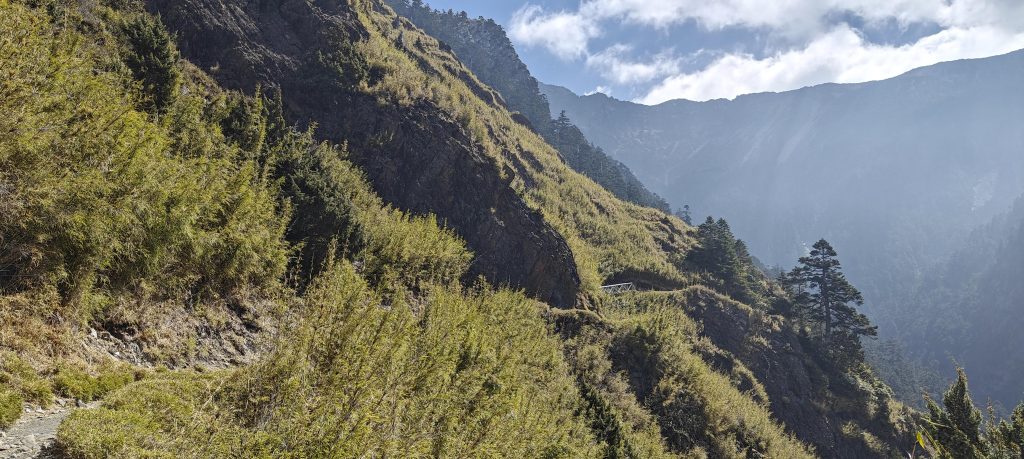
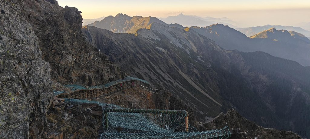
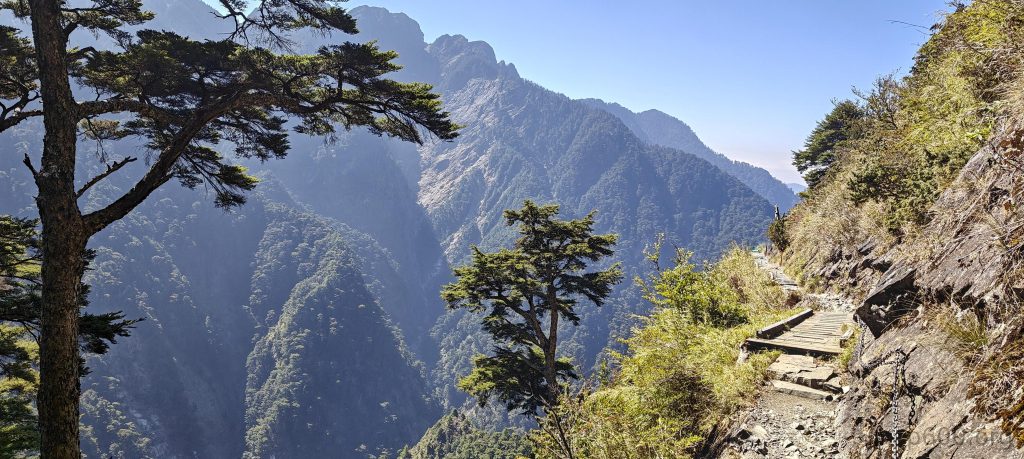
An early rise, a short walk to the park gates, and a series of instructions. We quietly deposit one of the many papers into the police post box to save time and avoid language barriers. Registration at the park office is straightforward, and we board the shuttle bus to the trailhead, joined by fellow hikers. After a brief ride and a slight ascent, we stand before a large stone marking the trailhead, the sun rising over the remote ridges. The well-maintained trail traverses the ridge, offering breathtaking views and occasional drop-offs to keep us on our toes.

The pastel hues of the sunrise grow brighter
Denise and Richard stride confidently on the trail.
More views unfold across the surrounding ridges.
Traversing the trail impresses from time to time
The White-whiskered Laughingthrush (Garrulax morrisonianus) is known for its sociable behavior, often found in noisy groups that can be heard before they are seen due to their loud and melodious calls. The ‘laughing’ part of its name comes from the distinctive call that sounds like laughter, which is a characteristic feature of the laughingthrushes.
Every single bridge, stairs, or path segment boasts its own ID, altitude, coordinates, and related specifications—impressive attention to detail in the wilderness.
We uncovered three out of ten (presumably) survey markers, turning our hike into a spontaneous treasure hunt.
The forest blankets the valley below.

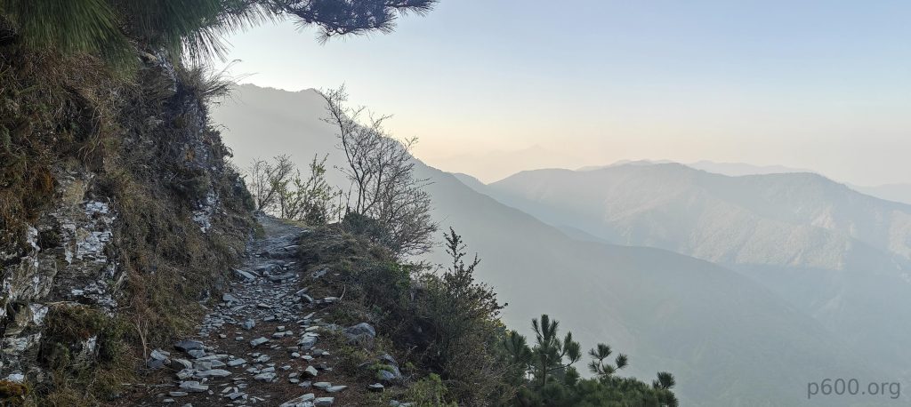
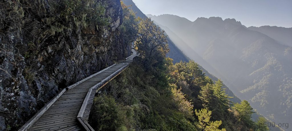
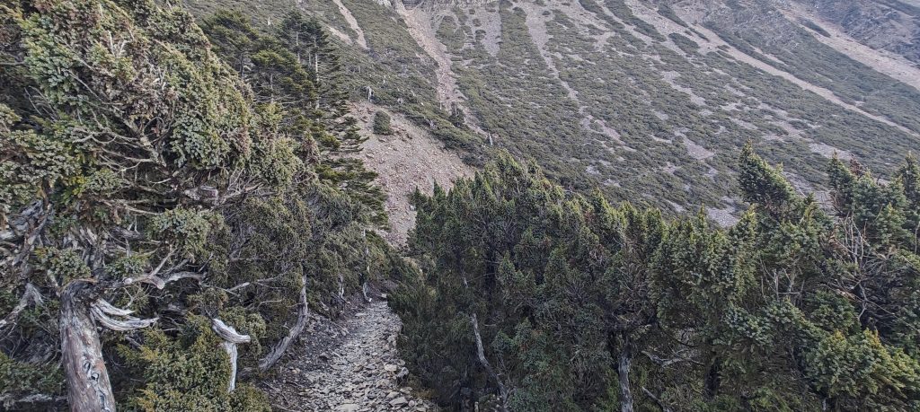
The trail proves to be a gradual ascent, punctuated by a few switchback sections. Despite the steady climb of over 800 meters to the hut, the journey feels surprisingly effortless. Along the way, we encounter several stop stations, restrooms, and informative posters detailing the local flora, fauna, and geology—a thoughtful touch appreciated by all.

While traversing, you’re graced with a drop to the right that’s almost always there
We march into the dwarf bamboo’s territory.

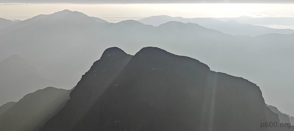
Arriving at the hut around 11 am, we find ourselves with ample time to spare. One option on the table is to tackle the ascent of Youshan today and save other activities for tomorrow. However, after a brief 20-minute break to mull it over, we ultimately decide to stick to our original plan and aim for an early morning summit tomorrow. Today’s agenda remains unchanged: a visit to the Yushan – Xifeng (West peak), just as we had initially intended. Setting off before 1 pm, we embark on the approximately 4.4 km round trip journey to the Yushan – Xifeng.

After navigating a labyrinthine ordering process, I finally secured my dinner, a victory meal that tastes of patience and perseverance.

Returning to the hut just in time for dinner, our appetites are piqued by the promising spread before us. However, ordering proves to be a bit of a challenge. After several failed attempts, we finally manage to secure some bowls, making slow but steady progress. Eventually, at 17:29, plates of food are finally in our hands. One looks slightly different, leading us to suspect it might be chicken, while the other two appear to be pork. Despite some parts being more suited for experienced eaters, overall, the meal is satisfying, and we find ourselves fueled up and ready for the adventures that lie ahead.

Even in Taiwan, a sunset remains a sunset, painting the sky with a palette of colors that seems to say, “Nice, isn’t it?”

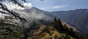
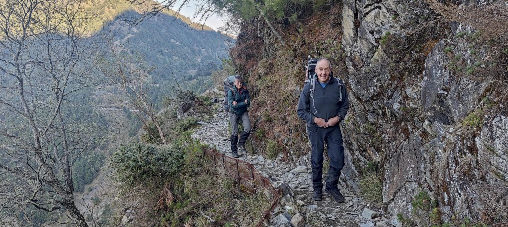
The next morning, we rise early, fuel up, and begin our hike to the summit. The well-marked trail leads us up with switchbacks, gradually revealing stunning views as we approach the crowded summit. The summit is bustling, with a memorable moment as a local gentleman proposes to his partner amidst the scenic backdrop. After taking in the views, Denise and Rcihard opt to visit the East Summit while others head back to the hut.

Indeed, the sunrise, playing the role of sunset’s counterpart
The trail is secured with chains at critical points, offering a helping hand exactly when you start questioning your mountain-goat abilities.

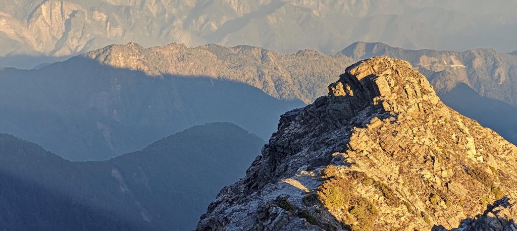
In the wee hours of the morning, while many were already beginning their ascent at 2 am, we opted for a slightly later start, rising at 4:30 am to prepare for our hike. By 5 am, fueled by breakfast, we set off on the trail once more. As expected, the path remains well-marked and maintained, guiding us steadily upward with its familiar switchbacks. With the first light of dawn, we spot climbers ahead of us, nearing the summit. Despite our later start, the distance between us and them diminishes rapidly—a testament, perhaps, to the natural ebb and flow of mountain trails.

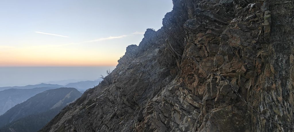
Eventually, we encounter a section that requires a little scrambling. Thankfully, all precarious spots are fortified with sturdy chains for added support, ensuring even the less experienced hikers stay on track. A hundred-meter corridor is fully covered, an extra precaution to prevent anyone from straying off the path. Before reaching the summit, we face another brief scramble, but soon enough, we find ourselves amidst the bustling crowd at the peak.

The Youshan south ridge stretches ahead, presumably guiding us to the coveted south summit at its terminu
Silhouettes of other peaks stand out in the morning light.
There’s a small sunlit bump about fifty meters away to the northwest.

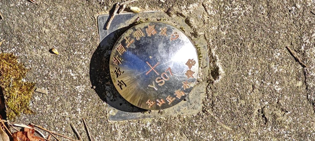
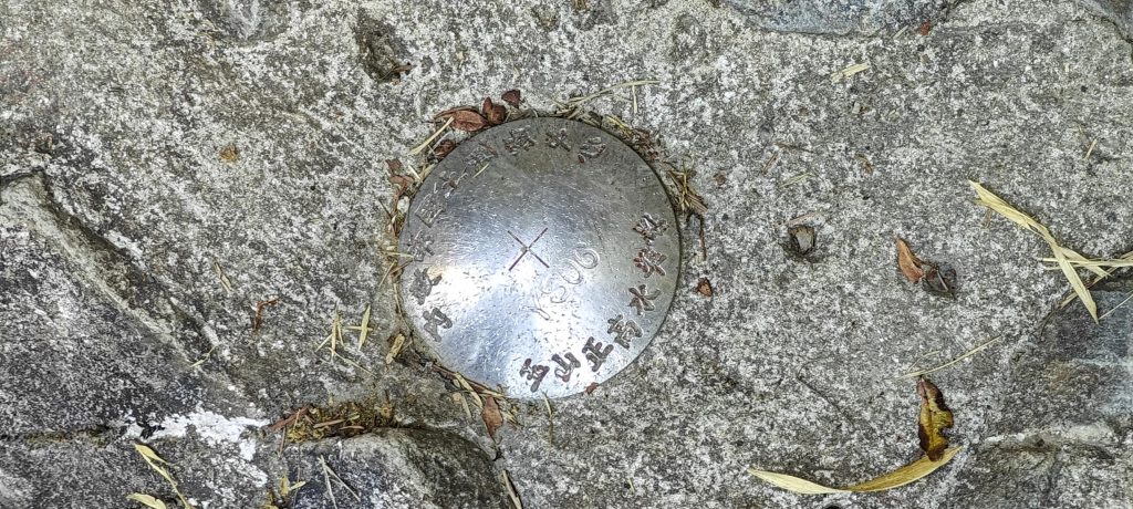
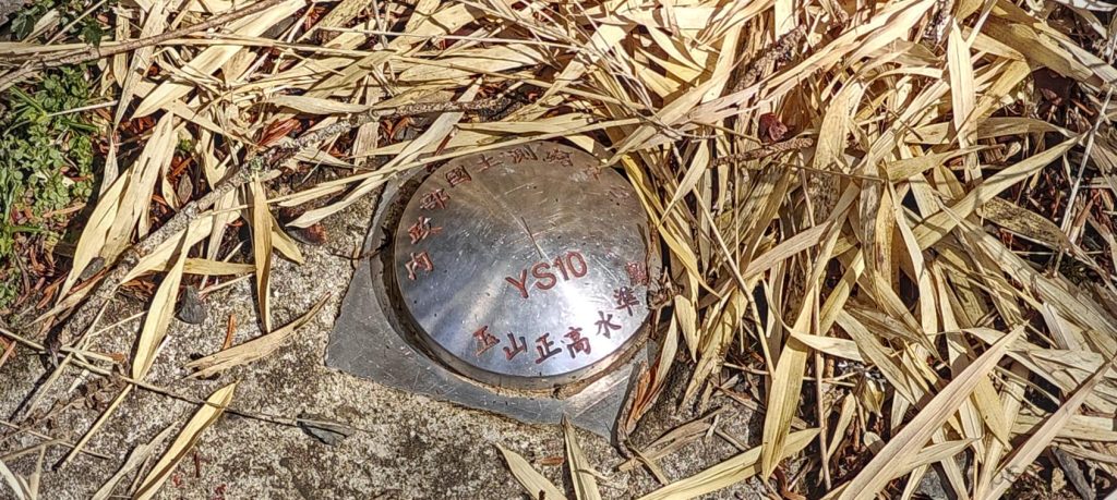
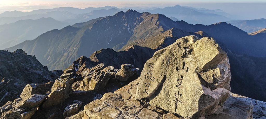
At the summit, a stone marker proudly displays the peak’s name and altitude, attracting quite a few visitors. However, the most captivating sight unfolds before us—a local gentleman, with trembling hands, produces a ring box and bends down on one knee to propose to his beloved. Though we couldn’t discern their words from afar, the palpable emotion in the air suggests that it was a deeply moving moment for all witnesses. As the couple embraces amidst cheers and applause, it’s safe to assume that the proposal was met with a resounding “yes.”

A guy proposing to a girl at the country’s highest point—truly, isn’t it a heart-touching scene set against a backdrop of breathtaking heights?
The highpoint is marked by a stone with a carved inscription.
Finally, after a lengthy wait, I secured my coveted slot for the summit photo.

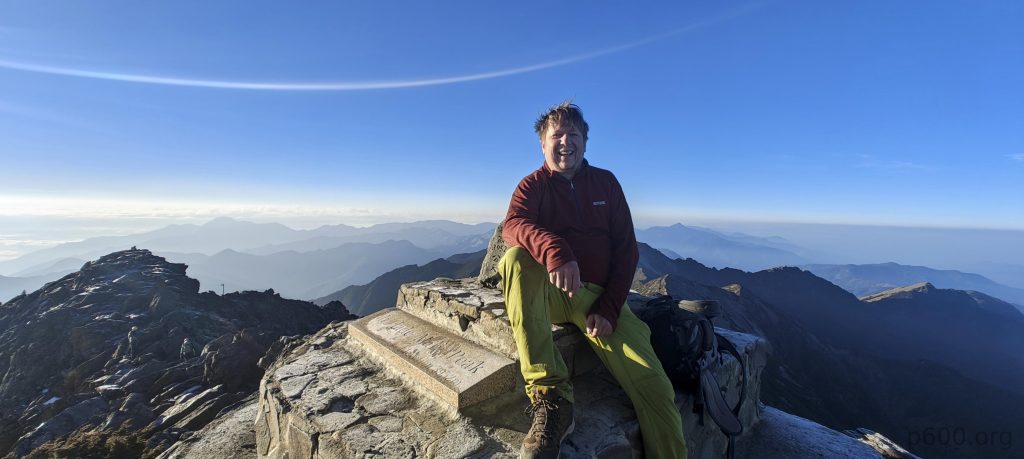
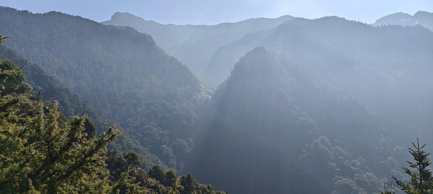
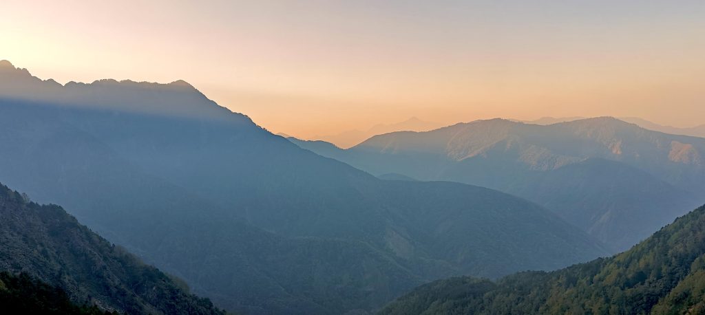
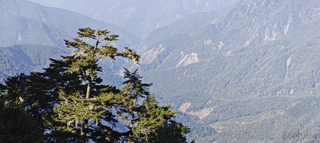
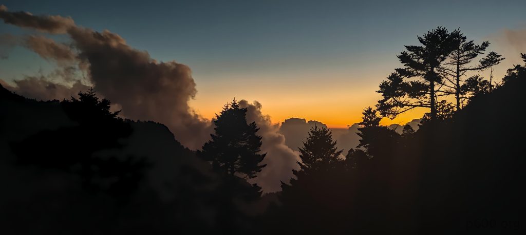
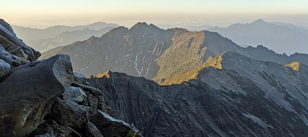
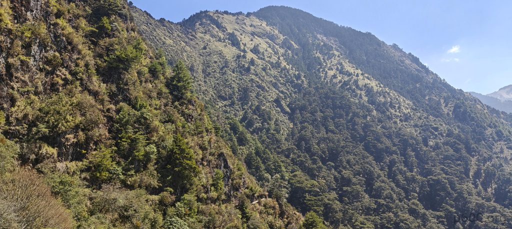
The morning unveils breathtaking views all around, with the Yushan – Xifeng (West Peak), Youshan – Beifeng (North Peak), Yushan – Dongfeng (East Peak) and Yushan – Nánfēng (South Peak) clearly visible in the crisp, clear air. It’s fortunate that we postponed the summit to today, as the vistas are undoubtedly superior. While it’s not always a given, I remain convinced that if you have the opportunity to climb in the evening, seize it rather than leaving it for tomorrow.

As Denise and Richard set off to explore the Yushan – Dongfeng, I choose to head back to the hut. The descent is smooth and uneventful, with no remarkable incidents to mention except for a delightful encounter with a deer grazing just a meter from the trail—a serene moment amidst the mountain tranquility.

This is likely Youshan’s north ridge and north summit
Behold the Youshan shade pyramid, an enigmatic structure casting its geometric shadow over the landscape.
A 100-meter stretch of trail is cleverly shielded from falling rocks and winds by a tunnel-like structure
The trail winds its way down, weaving through a picturesque landscape adorned with dwarf pines.

Feeling a bit restless sitting on the hut bench, I decide to send a message to Denise before embarking on a walk back to the car. As I make my way down, I notice several teams ascending while a few others descend. Three hours later, I reach the trailhead and consider myself fortunate to find a shuttle bus with an available seat. After paying the fare of 100 NTW, I board the bus and within a quarter hour, we arrive at our destination.

Ah, the soup of “everything” at the hut—a culinary adventure where every spoonful is a surprise,
Long traversing trails are a rarity, yet Youshan boasts at least 8.5 kilometers of them.
Glancing back at the Yushan – Xifeng view one final time before strolling to the shuttle bus and embarking on the journey back to the car

A few hours pass before Denise and Richard finally show up. While we’re not in a rush, it’s been emphasized to us multiple times that park roads close at 17:00. With 1-2 hours of driving ahead of us to exit the park, we know we mustn’t dawdle.

Arriving at the Sun Moon Lake resort hotel, we’re pleased to find that we’ve made it in time. We even have enough time to enjoy a meal at a local restaurant. It’s been a nice day, filled with memorable events, and the highlight—conquering the island’s highpoint. Tomorrow, we set our sights on Xueshan, yet another ultra prominent mountain with a rare letter in its name—X.


Yushan3951 m altitude
3951 m prominence
1814.66 km isolation
RangesEast China - Taiwan
Countries/regionsChina - Taiwan
Distance12.30 km up11.20 km down
Elevation1504 m gain1504 m loss
Time
6h00 up
18h00 other
5h00 down
29h00 total
Trailhead2637 m altitude23.4758330, 120.8999160
RouteThe route starts with a gradual trail from the trailhead to the hut, transitioning to a steeper ascent toward the summit. Throughout, the trail maintains good width and clear markings, with signage every few hundred meters. The descent retraces the same trail.
DifficultiesTo overcome permit difficulties, we enlisted assistance from a local tour operator whose contact details are outlined in the trip overview report.
LinksGPX trail
  • East China 2024
  • « Yushan - Xifeng
  • Xueshan »

Mountain Ranges

Anatolia
Central Anatolia
Pontic Mountains
Southeast Anatolia
Taurus Mountains
Western Anatolia
Andes
Puna de Atacama
Atlas Mountains
High Atlas
Northwestern Atlas
Central America Ranges
Costa Rica-Panama Ranges
Central Central America
East China
Taiwan
Eastern Europe Ranges
Southeast Baltic Plains
Iberian Peninsula
Cordillera Cantabrica
Castile Ranges
Portugal-Galicia
Pyrenees
Intermountain West
Great Basin Ranges
Korea-Amur Area
Taebaek Sanmae
Malay Archipelago
Java
Nusa Tengarra
Sulawesi
Sumatra
Mid-Atlantic Islands
North Atlantic Islands
Mongolia Ranges
Altai
Gobi Desert Ranges
Hangay Mountains
Northwest Europe
Great Britain
North France-West Rhine Area
Pacific Ranges
Cascade Range
Northwest U.S. Coast Ranges
Sierra Nevada
Central and Southern California Ranges
Philippines
Central Philippines
Luzon
Mindanao
Southeast Asia
Malay Peninsula
Southeast South America
Pampas
Sierras de Cordoba
Southern Africa
Malawi Highlands
West Africa Mountains
Bight of Benin
Cameroon Mountains
Guinea Highlands

Countries / regions

Algeria
Ain Guezzam
Ain Salah
Aïn Témouchent
El Bayadh
Ghardaïa
Oran
Ouargla
Saïda
Sidi Bel Abbès
Tamanrasset
Argentina
Catamarca
Ciudad Autónoma de Buenos Aires
Córdoba
Jujuy
Salta
Tucumán
Belgium
Brussels Capital Region
Flemish Region
Cameroon
Southwest
China
Taiwan
Costa Rica
Alajuela
Cartago
Guanacaste
Heredia
Limón
San José
Czechia
Prague
Denmark
Greenland
France
Hauts-de-France
Occitania
Germany
Berlin
Niedersachsen
Indonesia
Bali
Jambi
Jawa Tengah
Jawa Timur
Nusa Tenggara Barat
Sulawesi Tengah
Sulawesi Utara
Sumatera Barat
Lithuania
Vilnius County
Mongolia
Bayankhongor
Govi-Altai
Khovd
Omnogovi
Ovorkhangai
Ulan Bator
Zavkhan
Morocco
Béni Mellal-Khénifra
Drâa-Tafilalet
Fez-Meknes
Marrakesh-Safi
Souss-Massa
Tangier-Tetouan-Al Hoceima
Mozambique
Zambezia
Netherlands
Gelderland
Noord-Holland
Zeeland
Nicaragua
Chinandega
Managua
Masaya
Rivas
Philippines
Bicol Region (V)
Cagayan Valley (II)
Calabarzon (IV-A)
Central Luzon (III)
Cordillera Administrative Region
Davao Region
Metro Manila
Soccsksargen (XII)
Western Visayas (VI)
Poland
Greater Poland Voivodeship
Masovian Voivodeship
Portugal
Castelo Branco
Leiria
Lisbon
Madeira
Santarém
Qatar
Ad-Dawhah
São Tomé and Príncipe
São Tomé Province
Sierra Leone
Northern Province
Western Area
Singapore
South Korea
Gyeongsangnam-do
Seoul
Spain
Aragón
Asturias
Castilla-La Mancha
Castilla y León
Catalonia
Islas Canarias
Switzerland
Zürich
Turkey
Antalya
Bitlis
Erzincan
Hakkâri
Igdir
Isparta
Kahraman Maras
Muğla
United Kingdom
England
Scotland
United States
California
Delaware
Florida
Maryland
Nevada
New Jersey
New York
Pennsylvania
South Carolina
Utah

TRIPS

2024
Southern Africa 2024
Mid-Atlantic Islands 2024
North America 2024
Anatolia 2024
Korea-Amur Area 2024
East China 2024
2023
Mongolia Ranges 2023
Philippines 2023
West Africa III 2023
West Africa II 2023
Iberian Peninsula 2023
West Africa 2023
Central America 2023
2022
Andes 2022
Northwest Europe 2022
Malay Archipelago III 2022
Malay Archipelago II 2022
Anatolia Mountains 2022
Iberian Peninsula 2022
Atlas Mountains 2022
North France-West Rhine Area 2022

archaeology (3) climb (157) food (2) hike (155) p30 (17) p50 (4) p100 (24) p300 (12) p600 (17) p1000 (11) p1500 (76) ribu (10) sight (46) summary (16) trig (44) ultra (76)

1 591 km walked, 121 298 m climbed

©2025 p600.org | WordPress Theme by Superbthemes.com