Skip to content
Menu
p600.org
  • home
  • map
  • trips
  • about
p600.org

Yushan – Xifeng

hike | 2024-03-17

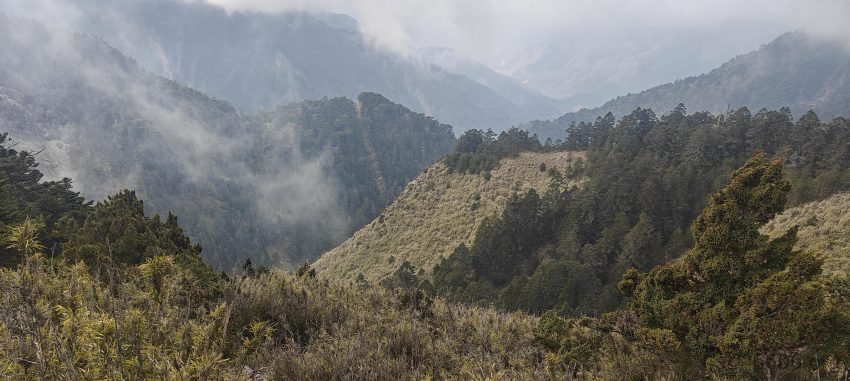
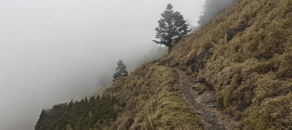
We arrive at Paiyun Lodge by 11 am, pondering whether to tackle Yushan today or delay it until tomorrow. Given the cloud-swathed scenery, aiming for the summit today hardly seems wise. After some thought, we agree to proceed with our original plan and explore the West Summit, saving Yushan’s peak for an early morning attempt. We lighten our load of non-essential gear at the lodge and set off on a 2.2 -kilometer hike to Yushan – Xifeng. The path begins somewhat challenging but quickly becomes more navigable.

The trail has its steep moments, yet clouds take center stage, generously hiding the views.
I’m honing my skills in portrait photography.

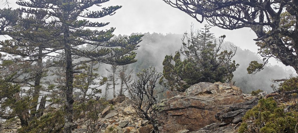
We reach the official summit, marked for all to see, but a nagging feeling tells us it’s not the true high point. Soon after, we spot another outcrop, seemingly at a similar height. Richard whips out his hand level; it’s slightly lower. A short walk of 30 meters brings us to another bump, this one shrouded in bushes. We measure again, finding it nearly matches the official summit’s height. But the quest doesn’t end there. Another 20 meters on, two small bumps flank the trail. Using Denise as a human yardstick—a method as scientific as it gets—Richard deduces the true high point is right here, on the trail’s slope side. Voila, mystery solved.

At the peak, we bump into a handful of locals, stumble upon the summit marker, and then trek down to a quaint shrine just a notch below.
Between 1895 and 1945, during their occupation of Taiwan, the Japanese built roads through the mountains and erected Shinto shrines on peaks like Mt. Jade and Mt. Snow to honor Amaterasu, the Sun Goddess. This initiative was part of a broader strategy to promote a ‘Japanized’ education and make use of the island’s virgin forests. However, after Taiwan was reclaimed by Chinese rule in 1945, these symbols of Japanese spirituality, including the shrine on Mt. Jade West Peak, were dismantled. In a nod to history, the Yushan National Park Headquarters later reconstructed the shrine on the main peak’s flank. This wooden shrine, resurrected without the use of a single nail, preserves its elegantly rustic Japanese architecture, standing as a testament to traditional craftsmanship amidst the natural beauty of the mountain.
Ah, so it’s a close-up of wood, not rocks — because clearly, we all mistake those two all the time.
Richard and I tackled another P50 bump near the Paiyun Lodge, cheekily dubbing it Paiyun Lodge Peak.

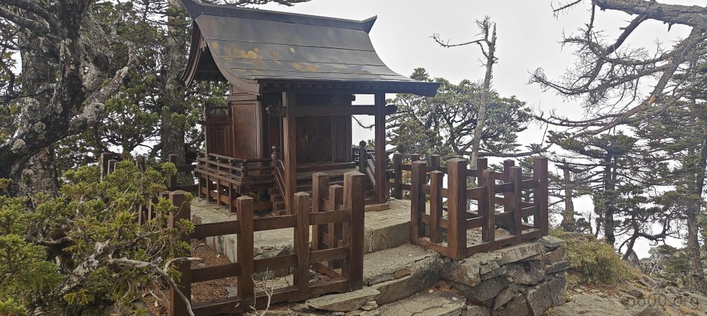
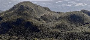
In our adventure, we came across a Japanese shrine perched slightly lower and about two hundred meters from the highpoint, where the sight of old telephone line remnants intrigued us. Returning from this discovery, Richard and I, still hungry for adventure, decided to tackle an unnamed P60. This quest led us up a steep, bushy slope to a saddle where we left our bags, pondering our next move. Choosing left, we reached the summit, where Richard, with his dependable hand level, confirmed we were indeed at the highpoint, eliminating the need for further exploration. Carefully descending, we lingered briefly, waiting for tourists to blend back into the bush, ensuring our emergence went unnoticed. Moments later, we were back at the hut, rejoining Denise. The dinner before us looked tantalizing, but ordering it was a battle of wits and patience, taking several attempts to get it right. We’re all excited for tomorrow morning’s climb to Yushan, ready for the adventure ahead.


Yushan - Xifeng3519 m altitude
110 m prominence
2.40 km isolation
RangesEast China - Taiwan
Countries/regionsChina - Taiwan
Distance2.10 km up2.10 km down
Elevation364 m gain364 m loss
Time
2h00 up
0h10 other
1h50 down
4h00 total
Trailhead3344 m altitude23.4664720, 120.9498880
RouteInitially, the trail presents a rough challenge but later transitions into a well-maintained and level path, making for an easier journey.
DifficultiesTaking a detour to Paiyun Lodge Peak requires some light bushwhacking through the underbrush.
LinksGPX trail
  • East China 2024
  • « Mongolia Ranges 2023
  • Yushan »

Mountain Ranges

Anatolia
Central Anatolia
Pontic Mountains
Southeast Anatolia
Taurus Mountains
Western Anatolia
Andes
Puna de Atacama
Atlas Mountains
High Atlas
Northwestern Atlas
Central America Ranges
Costa Rica-Panama Ranges
Central Central America
East China
Taiwan
Eastern Europe Ranges
Southeast Baltic Plains
Iberian Peninsula
Cordillera Cantabrica
Castile Ranges
Portugal-Galicia
Pyrenees
Intermountain West
Great Basin Ranges
Korea-Amur Area
Taebaek Sanmae
Malay Archipelago
Java
Nusa Tengarra
Sulawesi
Sumatra
Mid-Atlantic Islands
North Atlantic Islands
Mongolia Ranges
Altai
Gobi Desert Ranges
Hangay Mountains
Northwest Europe
Great Britain
North France-West Rhine Area
Pacific Ranges
Cascade Range
Northwest U.S. Coast Ranges
Sierra Nevada
Central and Southern California Ranges
Philippines
Central Philippines
Luzon
Mindanao
Southeast Asia
Malay Peninsula
Southeast South America
Pampas
Sierras de Cordoba
Southern Africa
Malawi Highlands
West Africa Mountains
Bight of Benin
Cameroon Mountains
Guinea Highlands

Countries / regions

Algeria
Ain Guezzam
Ain Salah
Aïn Témouchent
El Bayadh
Ghardaïa
Oran
Ouargla
Saïda
Sidi Bel Abbès
Tamanrasset
Argentina
Catamarca
Ciudad Autónoma de Buenos Aires
Córdoba
Jujuy
Salta
Tucumán
Belgium
Brussels Capital Region
Flemish Region
Cameroon
Southwest
China
Taiwan
Costa Rica
Alajuela
Cartago
Guanacaste
Heredia
Limón
San José
Czechia
Prague
Denmark
Greenland
France
Hauts-de-France
Occitania
Germany
Berlin
Niedersachsen
Indonesia
Bali
Jambi
Jawa Tengah
Jawa Timur
Nusa Tenggara Barat
Sulawesi Tengah
Sulawesi Utara
Sumatera Barat
Lithuania
Vilnius County
Mongolia
Bayankhongor
Govi-Altai
Khovd
Omnogovi
Ovorkhangai
Ulan Bator
Zavkhan
Morocco
Béni Mellal-Khénifra
Drâa-Tafilalet
Fez-Meknes
Marrakesh-Safi
Souss-Massa
Tangier-Tetouan-Al Hoceima
Mozambique
Zambezia
Netherlands
Gelderland
Noord-Holland
Zeeland
Nicaragua
Chinandega
Managua
Masaya
Rivas
Philippines
Bicol Region (V)
Cagayan Valley (II)
Calabarzon (IV-A)
Central Luzon (III)
Cordillera Administrative Region
Davao Region
Metro Manila
Soccsksargen (XII)
Western Visayas (VI)
Poland
Greater Poland Voivodeship
Masovian Voivodeship
Portugal
Castelo Branco
Leiria
Lisbon
Madeira
Santarém
Qatar
Ad-Dawhah
São Tomé and Príncipe
São Tomé Province
Sierra Leone
Northern Province
Western Area
Singapore
South Korea
Gyeongsangnam-do
Seoul
Spain
Aragón
Asturias
Castilla-La Mancha
Castilla y León
Catalonia
Islas Canarias
Switzerland
Zürich
Turkey
Antalya
Bitlis
Erzincan
Hakkâri
Igdir
Isparta
Kahraman Maras
Muğla
United Kingdom
England
Scotland
United States
California
Delaware
Florida
Maryland
Nevada
New Jersey
New York
Pennsylvania
South Carolina
Utah

TRIPS

2024
Southern Africa 2024
Mid-Atlantic Islands 2024
North America 2024
Anatolia 2024
Korea-Amur Area 2024
East China 2024
2023
Mongolia Ranges 2023
Philippines 2023
West Africa III 2023
West Africa II 2023
Iberian Peninsula 2023
West Africa 2023
Central America 2023
2022
Andes 2022
Northwest Europe 2022
Malay Archipelago III 2022
Malay Archipelago II 2022
Anatolia Mountains 2022
Iberian Peninsula 2022
Atlas Mountains 2022
North France-West Rhine Area 2022

archaeology (3) climb (157) food (2) hike (155) p30 (17) p50 (4) p100 (24) p300 (12) p600 (17) p1000 (11) p1500 (76) ribu (10) sight (46) summary (16) trig (44) ultra (76)

1 591 km walked, 121 298 m climbed

©2025 p600.org | WordPress Theme by Superbthemes.com