Skip to content
Menu
p600.org
  • home
  • map
  • trips
  • about
p600.org

Peak 2366m, Buyant

hike | 2023-06-25

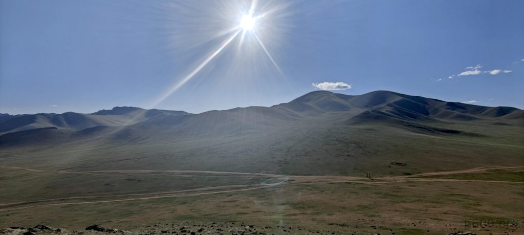
What a splendid day, in every sense imaginable—the sky’s blue hue, the successful ascent of Otgon Tenger Uul, and the overall triumph of our expedition. There’s more, of course. As we drive out of the valley, veering left just before the national park gates, our car flexes its off-road muscles in low gear. We park on a ridge, a stone’s throw from the summit, signaling it’s time to proceed on foot.

A colorful hill surrounds us, offering a picturesque view.
Multiple car tracks are a common sight.
The summit features a few scattered rocks along the ridge, which presents one steep side and one gradual slope.
Green valleys signal the presence of rivers.
Some rivers have visible water flowing through them.
After maximizing our car’s capabilities, we left it parked close to the summit.
Summit ridge
Rob nears the summit.

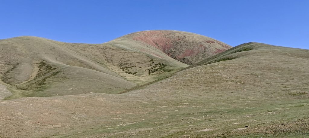
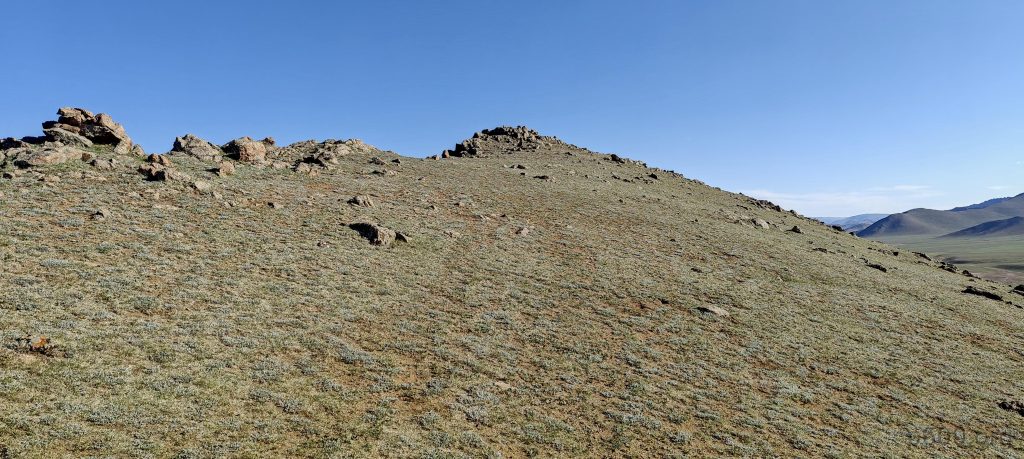
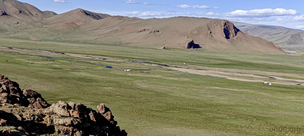
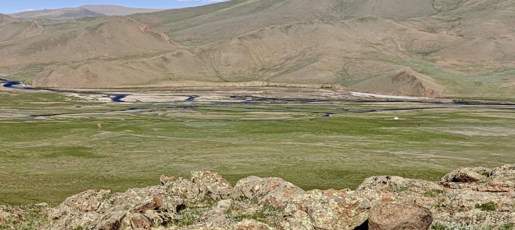
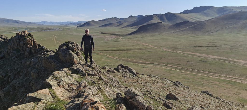
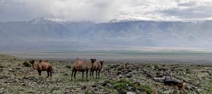
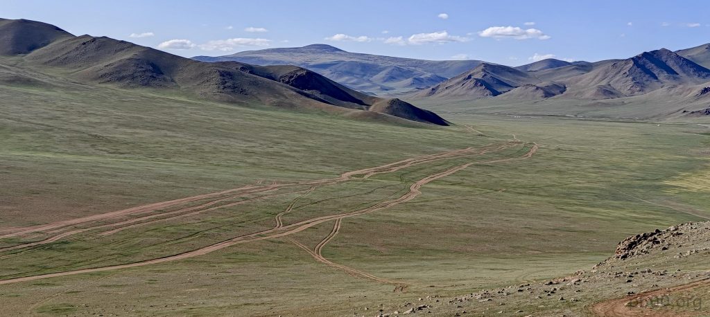
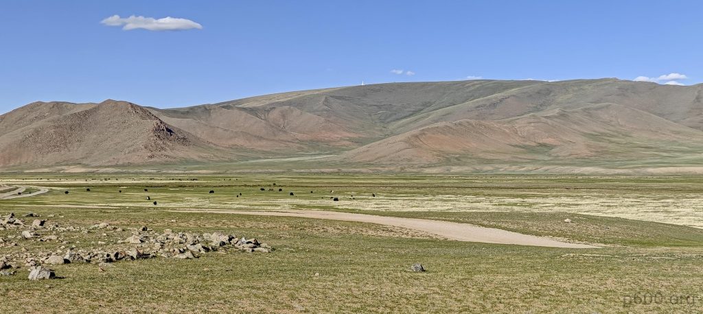
The summit itself is unremarkable, yet the view it offers—spanning the valley towards Otgon city—is truly breathtaking, showcasing a lush river valley. On the opposite side of the ridge lies a steep cliff, presenting a stark contrast to our side’s gradual ascent. This same valley, which we navigated to reach and depart from Otgon Tenger Uul, provides a scenic journey that’s rewarding even for those who don’t climb.

We approached from the left side, coming around the corner.
Nice blue skies
The tarbagan marmot (Marmota sibirica)
The corsac fox (Vulpes corsac), also known simply as a corsac.
Yaks are another common sight on this trip.
Did they land here already, or are they about to make their grand entrance? Perhaps this spot is a favorite UFO landing site.
Numerous yaks
A typical yurt settlement with the summit of Otgon Tenger Uul rising in the background.
Our camping spot is south of Otgon city.

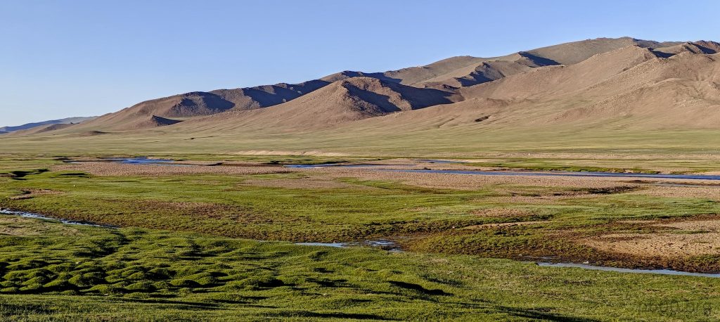
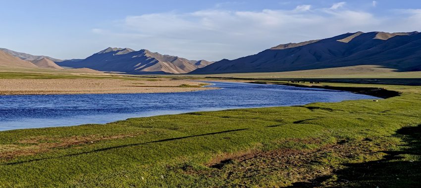
After a brisk two-minute hike, we’re back in the car, descending and driving a bit further, bypassing Otgon city and camping along the coast of the Buyant-gol river. This very river begins in the snows of Otgon Tenger Uul. Relaxed with our mission accomplished, we enjoy a pleasant dinner, a good night’s sleep, and tomorrow we head back to Ulaanbaatar. Our minds are already visualizing future hikes in Phou Bia in Laos, followed by adventures in Cambodia and Thailand.

…”Time to Say Goodbye by Sarah Brightman”

Peak 2366m, Buyant2366 m altitude
48 m prominence
RangesMongolia Ranges - Hangay Mountains
Countries/regionsMongolia - Zavkhan
Distance0.20 km up0.10 km down
Elevation14 m gain14 m loss
Time
0h02 up
0h02 other
0h02 down
0h06 total
Trailhead2359 m altitude47.5162220, 97.8038880
LinksGPX trail
  • Mongolia Ranges 2023
  • « Otgon Tenger Uul
  • Horse Statue Museum »

Mountain Ranges

Anatolia
Central Anatolia
Pontic Mountains
Southeast Anatolia
Taurus Mountains
Western Anatolia
Andes
Puna de Atacama
Atlas Mountains
High Atlas
Northwestern Atlas
Central America Ranges
Costa Rica-Panama Ranges
Central Central America
East China
Taiwan
Eastern Europe Ranges
Southeast Baltic Plains
Iberian Peninsula
Cordillera Cantabrica
Castile Ranges
Portugal-Galicia
Pyrenees
Intermountain West
Great Basin Ranges
Korea-Amur Area
Taebaek Sanmae
Malay Archipelago
Java
Nusa Tengarra
Sulawesi
Sumatra
Mid-Atlantic Islands
North Atlantic Islands
Mongolia Ranges
Altai
Gobi Desert Ranges
Hangay Mountains
Northwest Europe
Great Britain
North France-West Rhine Area
Pacific Ranges
Cascade Range
Northwest U.S. Coast Ranges
Sierra Nevada
Central and Southern California Ranges
Philippines
Central Philippines
Luzon
Mindanao
Southeast Asia
Malay Peninsula
Southeast South America
Pampas
Sierras de Cordoba
Southern Africa
Malawi Highlands
West Africa Mountains
Bight of Benin
Cameroon Mountains
Guinea Highlands

Countries / regions

Algeria
Ain Guezzam
Ain Salah
Aïn Témouchent
El Bayadh
Ghardaïa
Oran
Ouargla
Saïda
Sidi Bel Abbès
Tamanrasset
Argentina
Catamarca
Ciudad Autónoma de Buenos Aires
Córdoba
Jujuy
Salta
Tucumán
Belgium
Brussels Capital Region
Flemish Region
Cameroon
Southwest
China
Taiwan
Costa Rica
Alajuela
Cartago
Guanacaste
Heredia
Limón
San José
Czechia
Prague
Denmark
Greenland
France
Hauts-de-France
Occitania
Germany
Berlin
Niedersachsen
Indonesia
Bali
Jambi
Jawa Tengah
Jawa Timur
Nusa Tenggara Barat
Sulawesi Tengah
Sulawesi Utara
Sumatera Barat
Lithuania
Vilnius County
Mongolia
Bayankhongor
Govi-Altai
Khovd
Omnogovi
Ovorkhangai
Ulan Bator
Zavkhan
Morocco
Béni Mellal-Khénifra
Drâa-Tafilalet
Fez-Meknes
Marrakesh-Safi
Souss-Massa
Tangier-Tetouan-Al Hoceima
Mozambique
Zambezia
Netherlands
Gelderland
Noord-Holland
Zeeland
Nicaragua
Chinandega
Managua
Masaya
Rivas
Philippines
Bicol Region (V)
Cagayan Valley (II)
Calabarzon (IV-A)
Central Luzon (III)
Cordillera Administrative Region
Davao Region
Metro Manila
Soccsksargen (XII)
Western Visayas (VI)
Poland
Greater Poland Voivodeship
Masovian Voivodeship
Portugal
Castelo Branco
Leiria
Lisbon
Madeira
Santarém
Qatar
Ad-Dawhah
São Tomé and Príncipe
São Tomé Province
Sierra Leone
Northern Province
Western Area
Singapore
South Korea
Gyeongsangnam-do
Seoul
Spain
Aragón
Asturias
Castilla-La Mancha
Castilla y León
Catalonia
Islas Canarias
Switzerland
Zürich
Turkey
Antalya
Bitlis
Erzincan
Hakkâri
Igdir
Isparta
Kahraman Maras
Muğla
United Kingdom
England
Scotland
United States
California
Delaware
Florida
Maryland
Nevada
New Jersey
New York
Pennsylvania
South Carolina
Utah

TRIPS

2024
Southern Africa 2024
Mid-Atlantic Islands 2024
North America 2024
Anatolia 2024
Korea-Amur Area 2024
East China 2024
2023
Mongolia Ranges 2023
Philippines 2023
West Africa III 2023
West Africa II 2023
Iberian Peninsula 2023
West Africa 2023
Central America 2023
2022
Andes 2022
Northwest Europe 2022
Malay Archipelago III 2022
Malay Archipelago II 2022
Anatolia Mountains 2022
Iberian Peninsula 2022
Atlas Mountains 2022
North France-West Rhine Area 2022

archaeology (3) climb (157) food (2) hike (155) p30 (17) p50 (4) p100 (24) p300 (12) p600 (17) p1000 (11) p1500 (76) ribu (10) sight (46) summary (16) trig (44) ultra (76)

1 591 km walked, 121 298 m climbed

©2025 p600.org | WordPress Theme by Superbthemes.com