Skip to content
Menu
p600.org
  • home
  • map
  • trips
  • about
p600.org

Arc Dome

hike | 2024-06-23

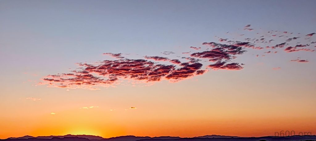
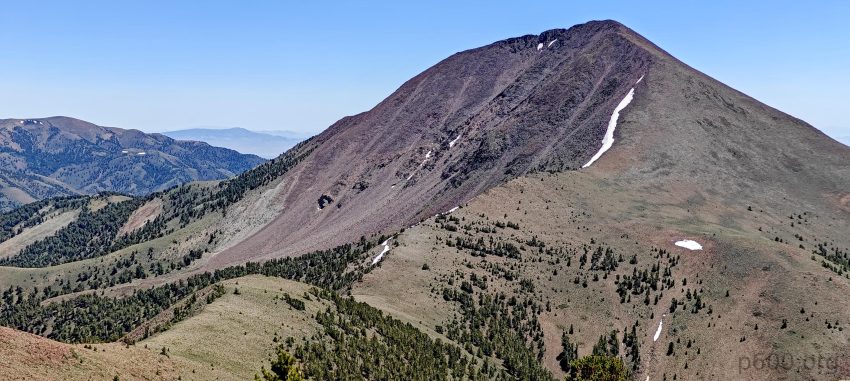
Arc Dome was on my to-do list last November, but too much snow and limited time got in the way. This time, I was determined to tackle it and add another ultra-prominent peak to my list. After finally hiking Arc Dome, I can say it’s a fantastic trek with lots of open space and stunning views. The wide landscapes and the feeling of solitude made the hike memorable, proving it was worth every effort.

When I saw the temporary slippery road sign, I didn’t get it at first; later, I spotted millions of crickets covering the road.
The walk starts in the lovely leafy forest.

At the trailhead, I unexpectedly ran into two other peakbaggers, Iris Ma and Tom Grundy. Even though we didn’t know each other, it was amusing to find out we shared the same hobby. They had already hiked to the summit the day before and were now packing up, getting ready to leave. It’s always interesting to see how small the world can feel, even in the vastness of the great outdoors.

The trail is gradual and very well defined.
Looking back at the basin from where I came.
Later, on the plateau, I walk a few kilometers along the old road, with two tracks as evidence.

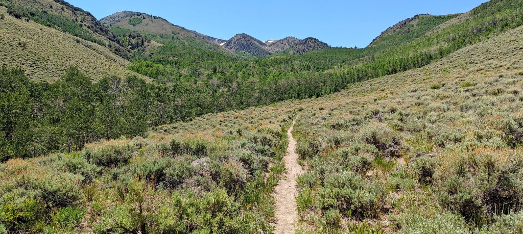
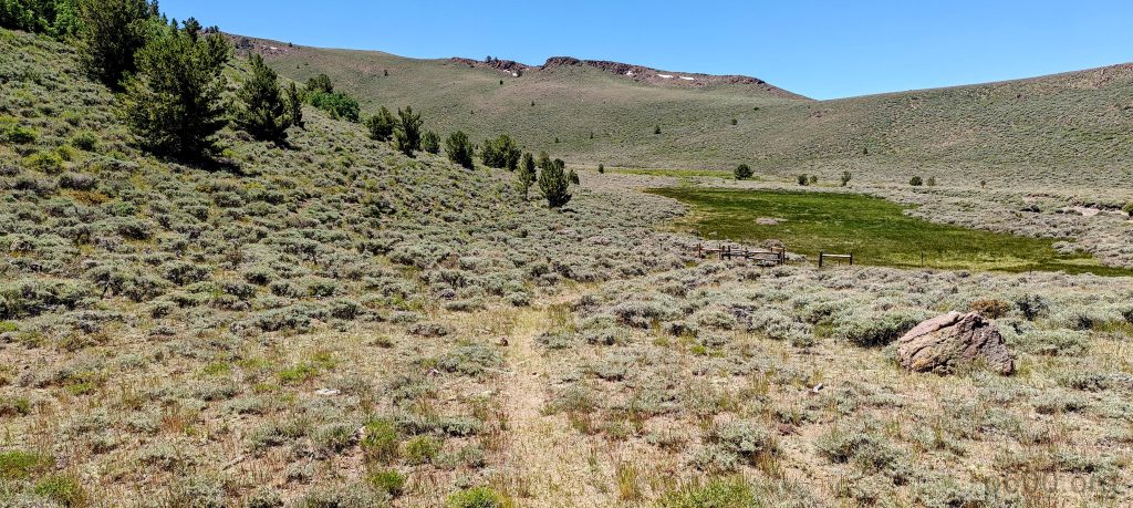
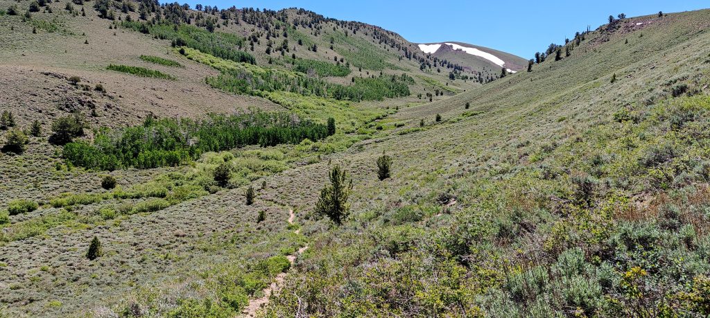
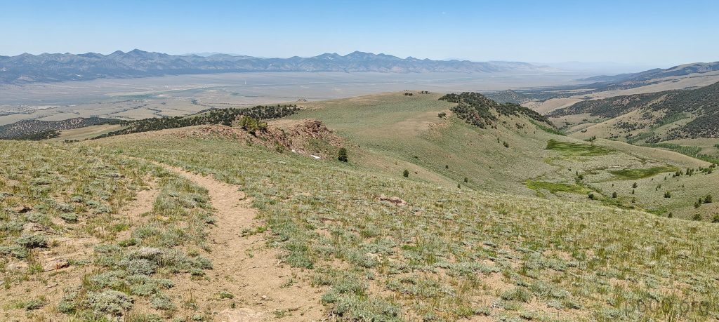
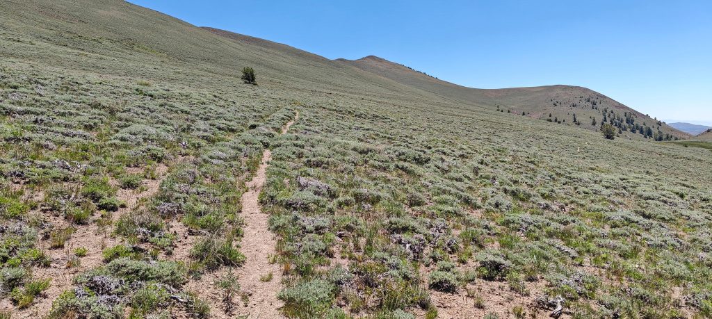
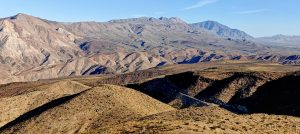
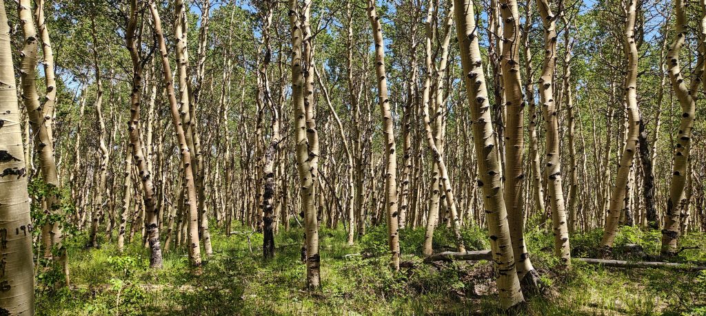
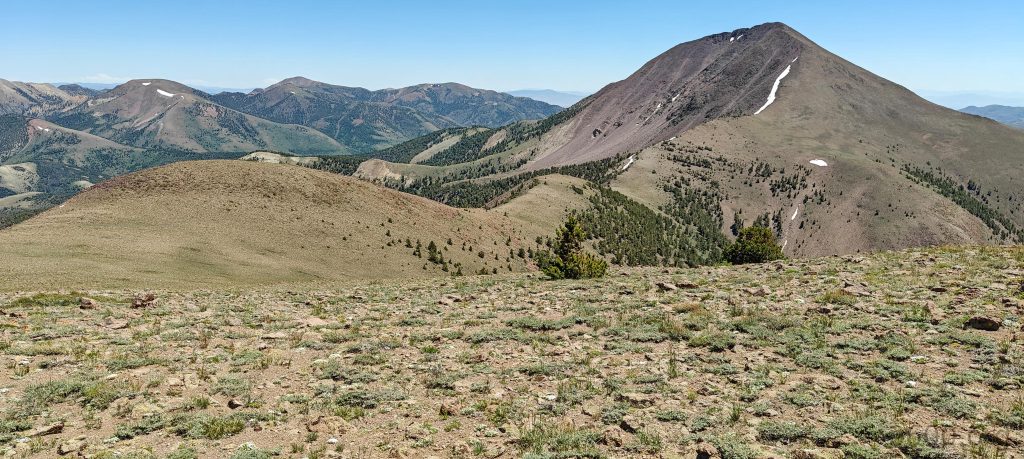
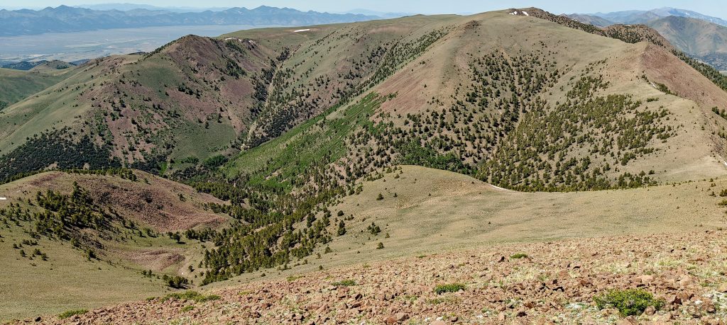
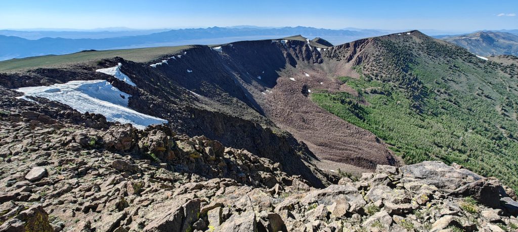
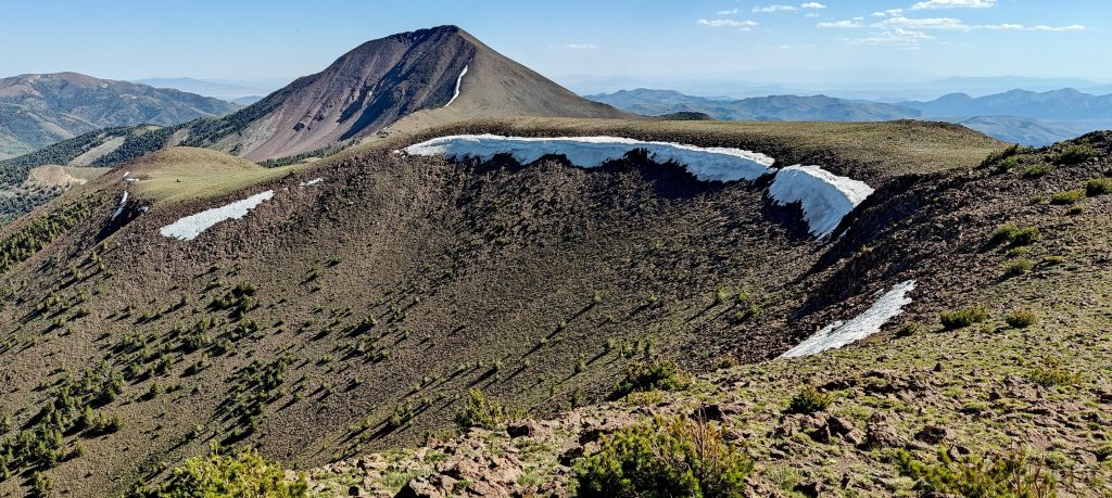
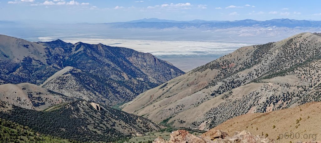
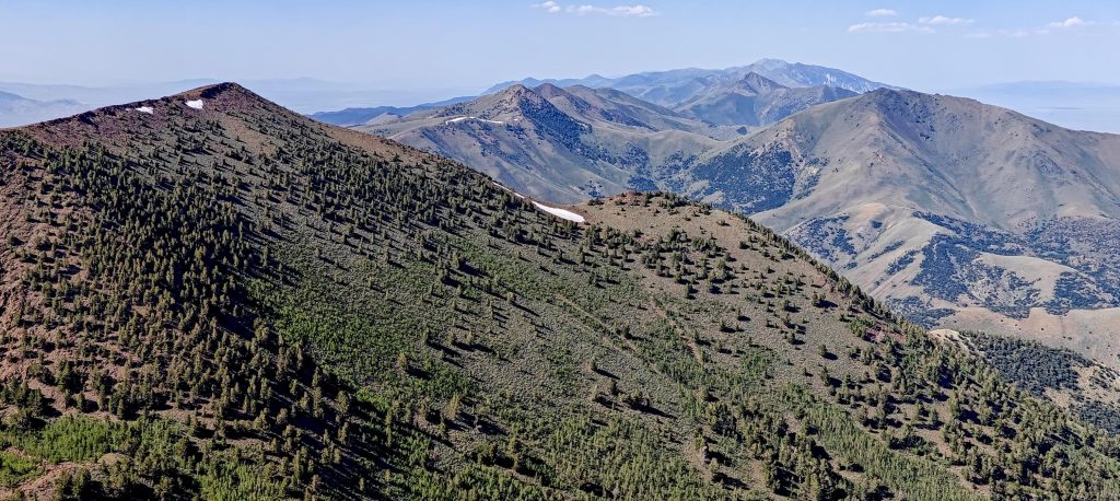
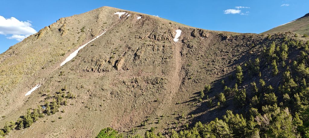
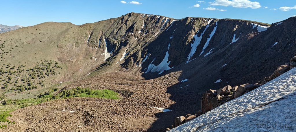
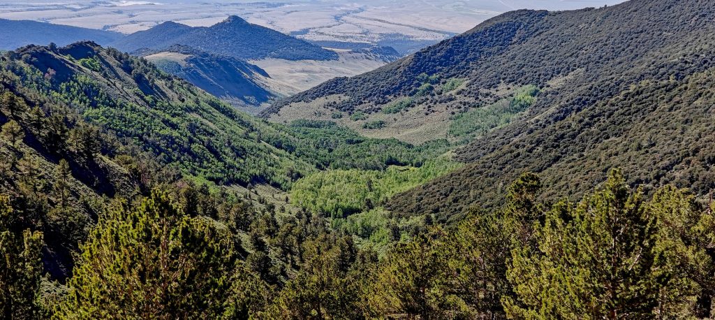
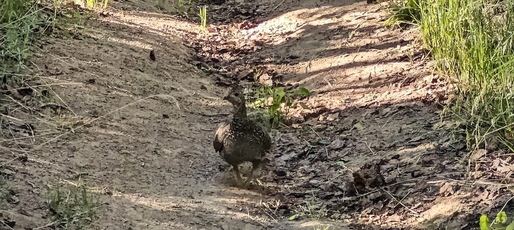
I start my hike in the cool shade of the forest, enjoying the peaceful surroundings. As I go on, the trail leads me to the bald slopes and a vast plateau, where the path resembles an old road, making it easy to walk. I climb up to the North Arc Dome summit plateau, then descend two hundred meters to a saddle between North Arc Dome and Arc Dome. From the saddle, there’s another three hundred fifty meter ascent to the summit.

I spotted wild horses roaming freely in the distance.
Views from the lower North Arc Dome peak.
This is also the spot where, after a lengthy walk, I first catch sight of the Arc Dome summit.
Looking back at North Arc Dome slopes.
Final climb onto the summit slope.
North Arc Dome consists of a vast plateau spanning a few square kilometers, surrounded by valleys.

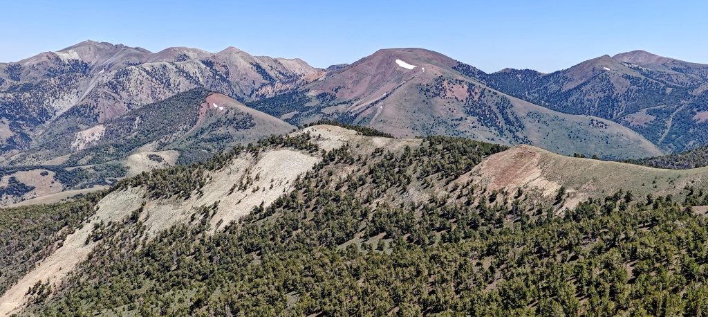
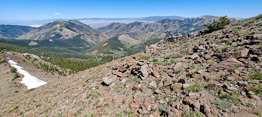
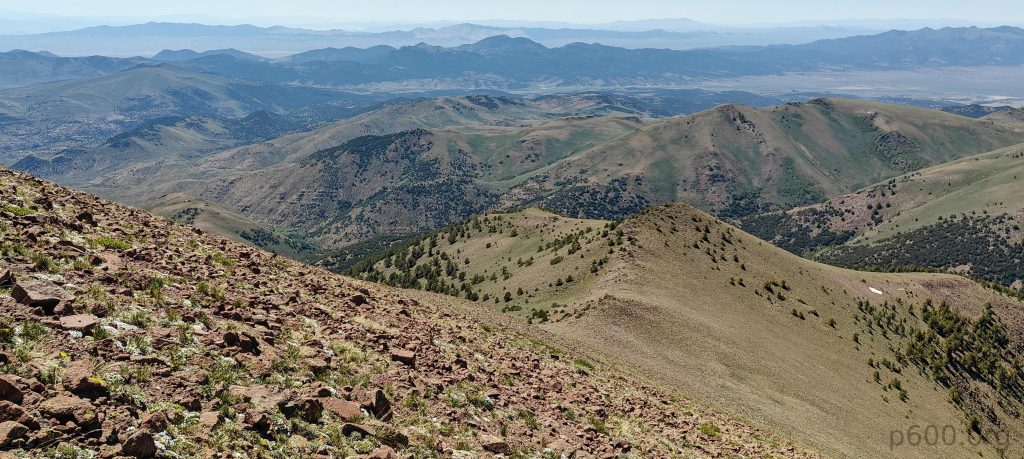
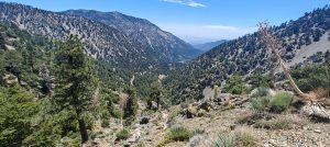
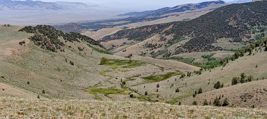
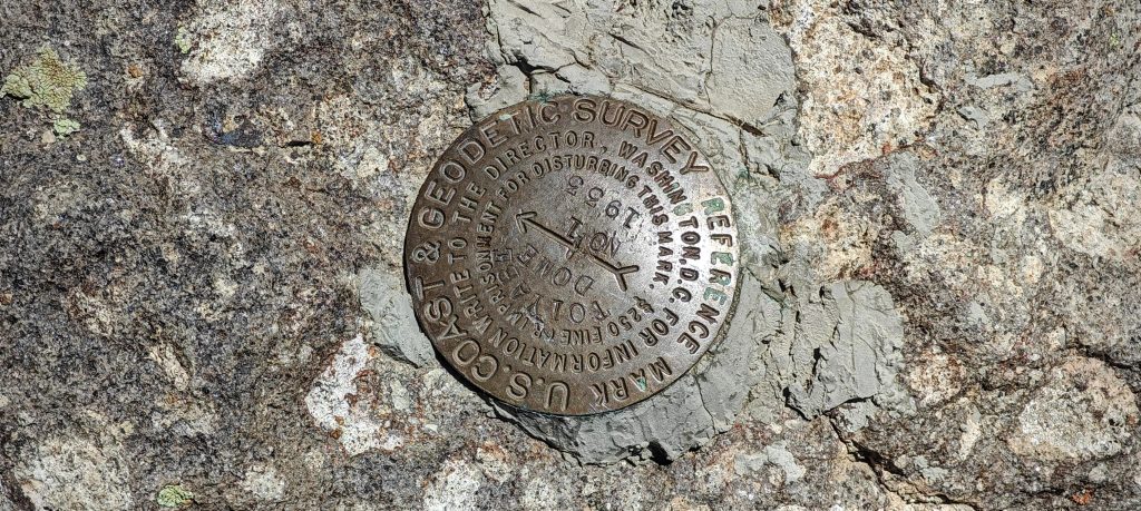
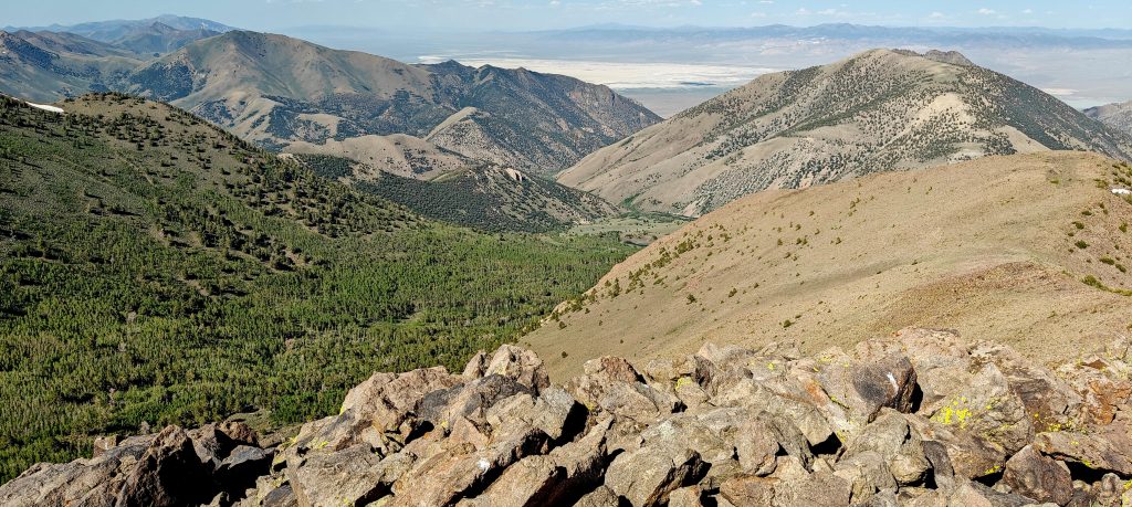
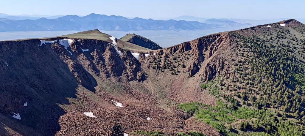
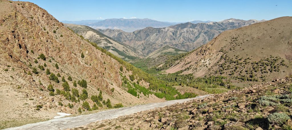
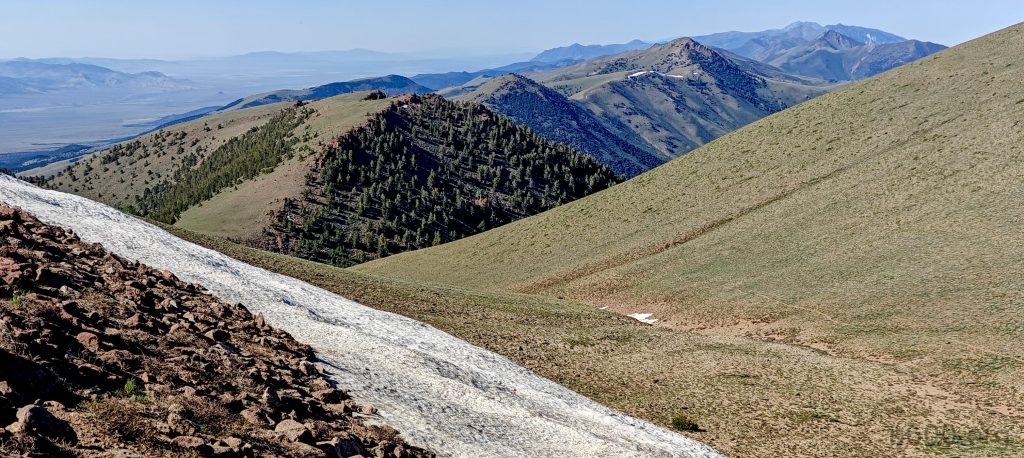
The summit is marked with a benchmark, offering remote views all around. After savoring a traditional apple, I start down the same path. At the first fork, I turn right, aiming for a loop. The trail is pleasant, with a few short re-ascents of about fifty meters. It then becomes a wide, gradual path with stunning valley views. Lower down, there are a few short, wet sections, but they’re manageable.

The summit is rocky and bare, marked with a benchmark.
On the return journey, I take a detour off-trail to North Arc Dome and admire the nice eastern cliffs.
A green forest lies on the east side of the ridge.
Looking back at the Arc Dome from the peak of North Arc Dome.
That must be Alkali Flat in the distance.
On the return, I chose a different east trail.
A few patches of snow do not pose a problem.
And a final glimpse of the North Arc Dome summit before I descend.
An easy, gradual trail down gives me the chance to admire the green valley instead of focusing on my steps.
Greater Sage-Grouse (Centrocercus urophasianus) guarding the trail.

Arc Dome was my last Nevada ultra, leaving no more Nevada ultras for me to climb. Whether that’s good or bad, I can’t say, but it means adjusting my goals. To keep climbing peaks in Nevada (and I definitely want to), I’ll need to lower my prominence criteria to around 1000 meters. With that decision made, I get back in the car and start driving toward my next adventure: Mount San Antonio, near Los Angeles.

And one more Nevada desert-like sunset.

Arc Dome3588 m altitude
1589 m prominence
37.11 km isolation
Ranges Intermountain West- Great Basin Ranges
Countries/regionsUnited States - Nevada
Distance12.00 km up11.00 km down
Elevation940 m gain940 m loss
Time
3h20 up
0h15 other
2h20 down
5h55 total
Trailhead2648 m altitude38.9001240, -117.3764290
RouteI park at the campground at Stewart Creek Trailhead and meet Iris and Tom, fellow peakbaggers who summited Arc Dome. I start my hike in the leafy forest, gradually ascending to the first plateau. Crossing it on old road tracks, I then face a steeper climb to the second North Arc Dome peak plateau. After crossing this, I descend a couple of hundred meters before making the final ascent to the summit, which is marked with a benchmark and offers nice distant views. On the way back, I choose the east trail to make a loop. There are a few patches of avoidable snow and two short fifty-meter re-ascents. The descent along the green valley is very pleasant. Lower down, it gets a bit wet, but it's not a big issue.
LinksGPX trail
  • North America 2024
  • « Wheeler Peak
  • Mount San Antonio »

Mountain Ranges

Anatolia
Central Anatolia
Pontic Mountains
Southeast Anatolia
Taurus Mountains
Western Anatolia
Andes
Puna de Atacama
Atlas Mountains
High Atlas
Northwestern Atlas
Central America Ranges
Costa Rica-Panama Ranges
Central Central America
East China
Taiwan
Eastern Europe Ranges
Southeast Baltic Plains
Iberian Peninsula
Cordillera Cantabrica
Castile Ranges
Portugal-Galicia
Pyrenees
Intermountain West
Great Basin Ranges
Korea-Amur Area
Taebaek Sanmae
Malay Archipelago
Java
Nusa Tengarra
Sulawesi
Sumatra
Mid-Atlantic Islands
North Atlantic Islands
Mongolia Ranges
Altai
Gobi Desert Ranges
Hangay Mountains
Northwest Europe
Great Britain
North France-West Rhine Area
Pacific Ranges
Cascade Range
Northwest U.S. Coast Ranges
Sierra Nevada
Central and Southern California Ranges
Philippines
Central Philippines
Luzon
Mindanao
Southeast Asia
Malay Peninsula
Southeast South America
Pampas
Sierras de Cordoba
Southern Africa
Malawi Highlands
West Africa Mountains
Bight of Benin
Cameroon Mountains
Guinea Highlands

Countries / regions

Algeria
Ain Guezzam
Ain Salah
Aïn Témouchent
El Bayadh
Ghardaïa
Oran
Ouargla
Saïda
Sidi Bel Abbès
Tamanrasset
Argentina
Catamarca
Ciudad Autónoma de Buenos Aires
Córdoba
Jujuy
Salta
Tucumán
Belgium
Brussels Capital Region
Flemish Region
Cameroon
Southwest
China
Taiwan
Costa Rica
Alajuela
Cartago
Guanacaste
Heredia
Limón
San José
Czechia
Prague
Denmark
Greenland
France
Hauts-de-France
Occitania
Germany
Berlin
Niedersachsen
Indonesia
Bali
Jambi
Jawa Tengah
Jawa Timur
Nusa Tenggara Barat
Sulawesi Tengah
Sulawesi Utara
Sumatera Barat
Lithuania
Vilnius County
Mongolia
Bayankhongor
Govi-Altai
Khovd
Omnogovi
Ovorkhangai
Ulan Bator
Zavkhan
Morocco
Béni Mellal-Khénifra
Drâa-Tafilalet
Fez-Meknes
Marrakesh-Safi
Souss-Massa
Tangier-Tetouan-Al Hoceima
Mozambique
Zambezia
Netherlands
Gelderland
Noord-Holland
Zeeland
Nicaragua
Chinandega
Managua
Masaya
Rivas
Philippines
Bicol Region (V)
Cagayan Valley (II)
Calabarzon (IV-A)
Central Luzon (III)
Cordillera Administrative Region
Davao Region
Metro Manila
Soccsksargen (XII)
Western Visayas (VI)
Poland
Greater Poland Voivodeship
Masovian Voivodeship
Portugal
Castelo Branco
Leiria
Lisbon
Madeira
Santarém
Qatar
Ad-Dawhah
São Tomé and Príncipe
São Tomé Province
Sierra Leone
Northern Province
Western Area
Singapore
South Korea
Gyeongsangnam-do
Seoul
Spain
Aragón
Asturias
Castilla-La Mancha
Castilla y León
Catalonia
Islas Canarias
Switzerland
Zürich
Turkey
Antalya
Bitlis
Erzincan
Hakkâri
Igdir
Isparta
Kahraman Maras
Muğla
United Kingdom
England
Scotland
United States
California
Delaware
Florida
Maryland
Nevada
New Jersey
New York
Pennsylvania
South Carolina
Utah

TRIPS

2024
Southern Africa 2024
Mid-Atlantic Islands 2024
North America 2024
Anatolia 2024
Korea-Amur Area 2024
East China 2024
2023
Mongolia Ranges 2023
Philippines 2023
West Africa III 2023
West Africa II 2023
Iberian Peninsula 2023
West Africa 2023
Central America 2023
2022
Andes 2022
Northwest Europe 2022
Malay Archipelago III 2022
Malay Archipelago II 2022
Anatolia Mountains 2022
Iberian Peninsula 2022
Atlas Mountains 2022
North France-West Rhine Area 2022

archaeology (3) climb (157) food (2) hike (155) p30 (17) p50 (4) p100 (24) p300 (12) p600 (17) p1000 (11) p1500 (76) ribu (10) sight (46) summary (16) trig (44) ultra (76)

1 591 km walked, 121 298 m climbed

©2025 p600.org | WordPress Theme by Superbthemes.com