Skip to content
Menu
p600.org
  • home
  • map
  • trips
  • about
p600.org

Wheeler Peak

hike | 2024-06-22

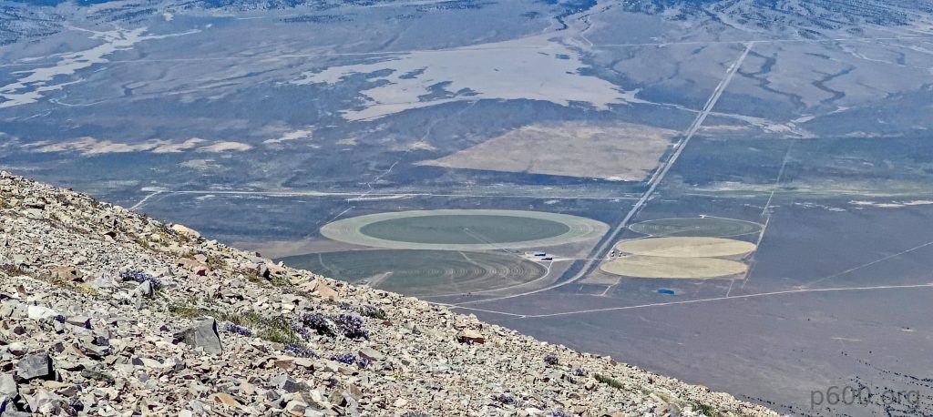
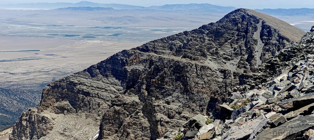
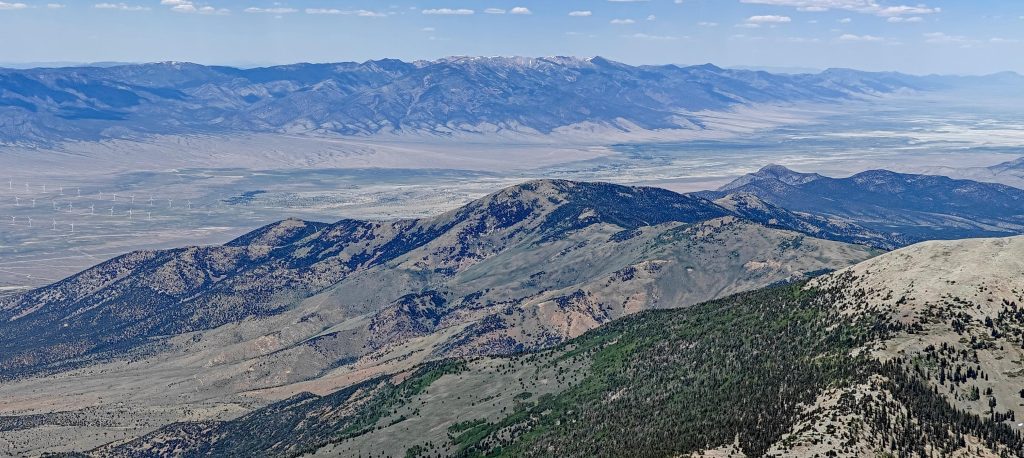
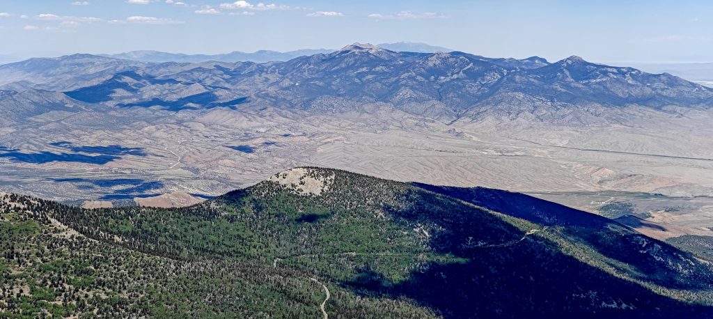
There are 455 peaks in the world with 300 km or more isolation, and Wheeler Peak is one of them. It boasts over 2000 meters of prominence, nearly reaching 4000 meters, and features on at least 60 different peak lists. That’s the reward you get after climbing this majestic peak. But wait, there’s more! It also offers stunning views of the Great Basin National Park. Someone mentioned it’s the least visited national park in the country due to its remoteness. Maybe. I found the time and a way to get there; I believe everyone else can too. Totally worth it.

The closer I drive, the clearer I see the peak barely dusted with snow.
Even the summit is snow-free, with the trail barely crossing one tiny patch near the top.

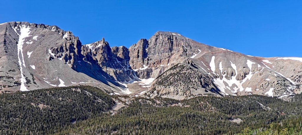
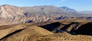
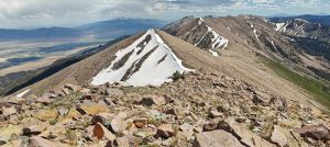
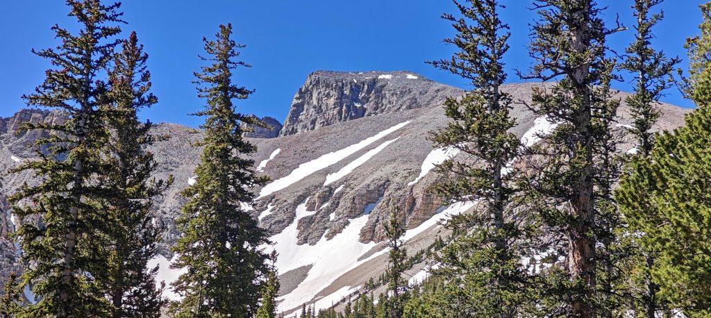
The biggest risk with this peak was the early-season snow. I approached from the west, circled around to the north side, and finally came in from the east. This gave me a nearly 360-degree view of the peak. The west-north side was snow-covered, but once I saw it from the north-east, I relaxed. It became obvious that the peak was doable today. A few small patches of snow on the ridge shouldn’t pose any serious issues.

A very nice and informative sign stands at the trailhead, detailing distances in miles and kilometers, elevation gain in feet and meters, and estimated time—because apparently, we need all the metrics.
Stella Lake and Wheeler Peak lie ahead.s
Irrigation systems and wind farms spread across the landscape.
The ridge ascends gradually, with switchbacks tackling the steeper sections.
A few guys scramble straight from the parking lot through talus fields.

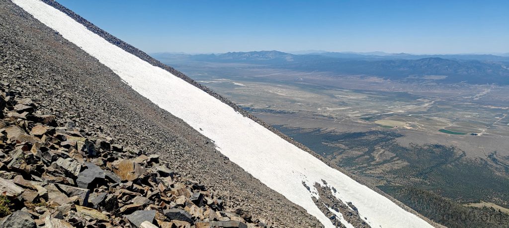
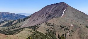
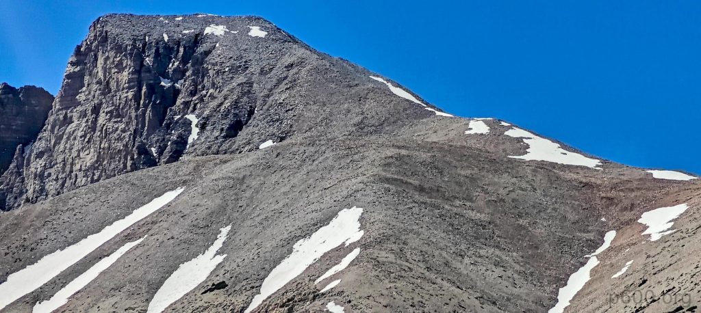
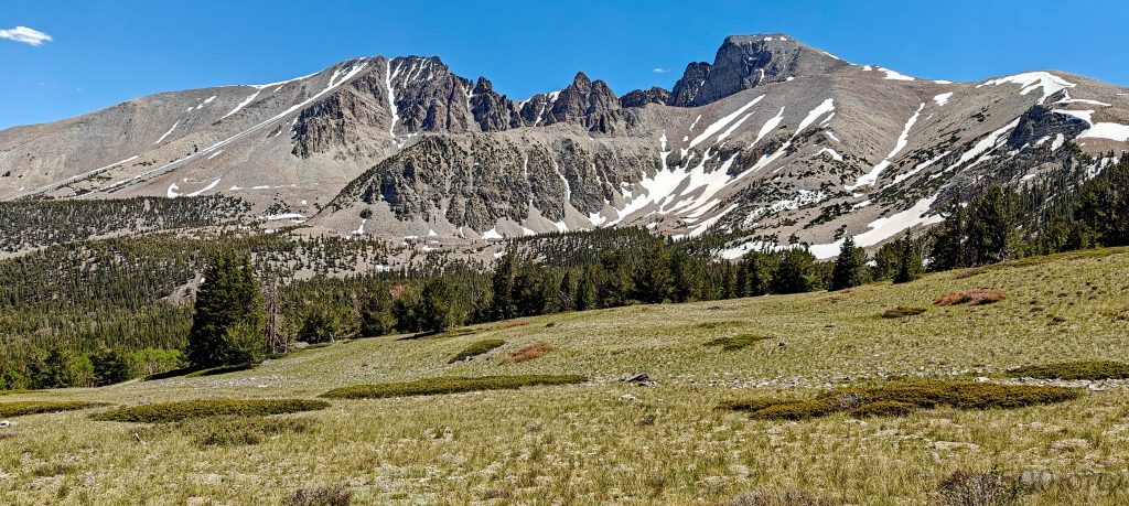
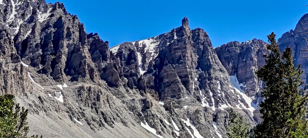
The steeper sections might approach a 30.5-degree incline (measured from a photo).
Doso Doyabi stands at 3891m, proudly flaunting its P137 peak status.

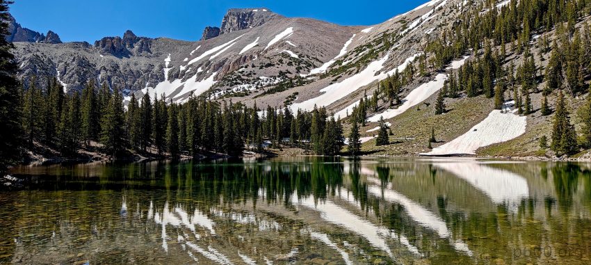
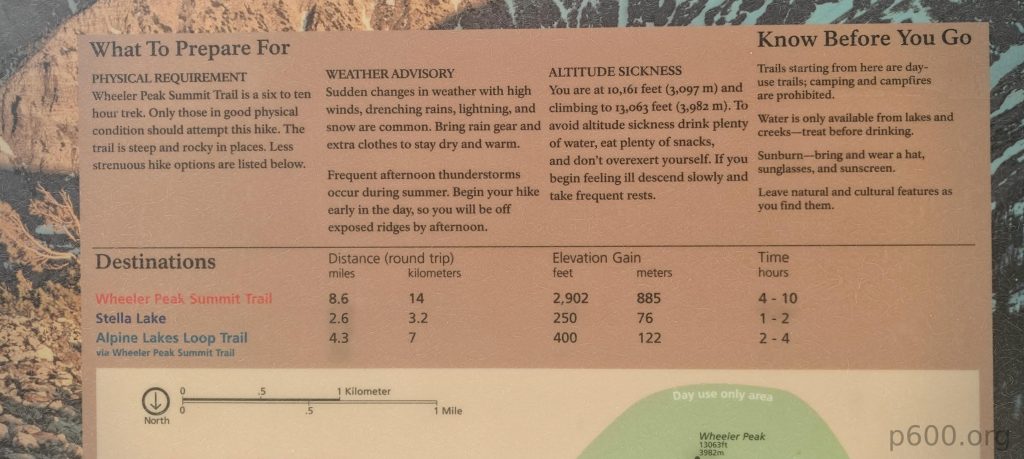
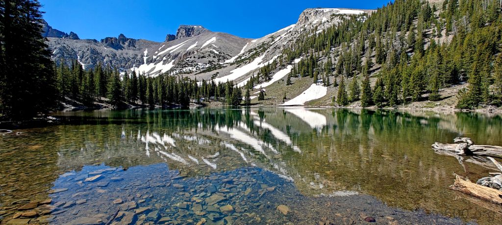
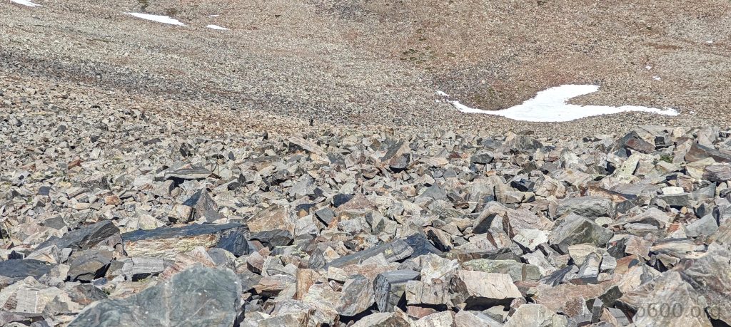
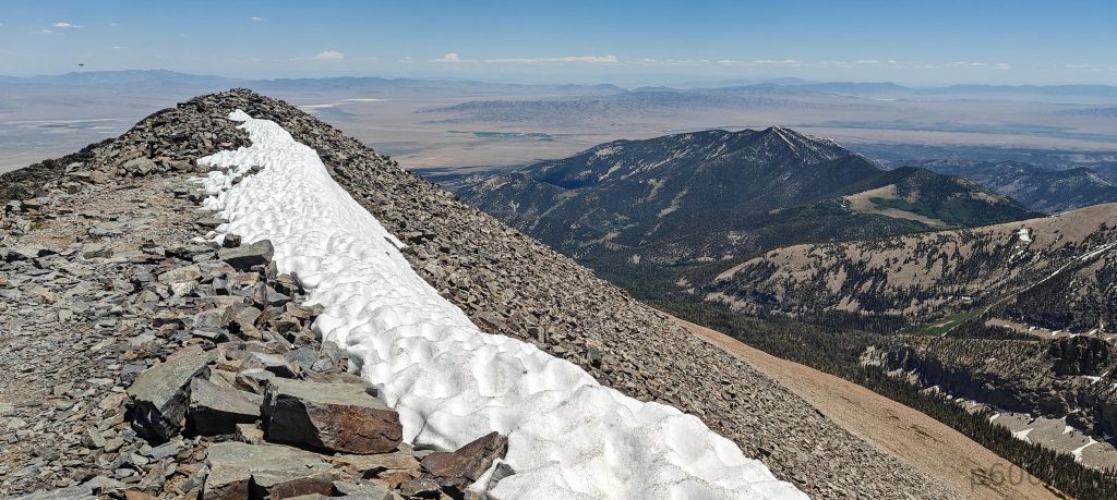
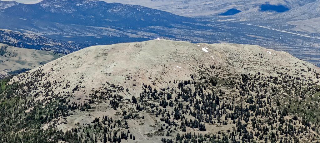
I left my car at the Summit Trailhead parking lot, resorting to roadside parking since it was full. The flat, well-marked trail initially led me to a scenic detour at the lake. After retracing my steps a few hundred meters, I continued up the steeper slopes with switchbacks. Quite a few people were hiking today, some slower, some faster. A few guys impressively tackled the talus fields directly, though I’m not sure what it gained them. Near the summit, a few people were scooting on their butts to avoid the snow, some were anxiously wondering how they’d get down, while others, like me, walked straight through the well-packed snow. The snow patch was no more than 5 meters in length, with solid footholds.

A benchmark sits at the summit.
The only glacier in Nevada looks a bit, well, Nevadish.
Tiny snow lines trace the very summit.

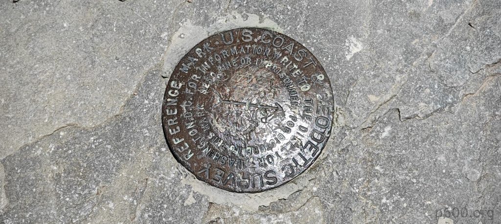
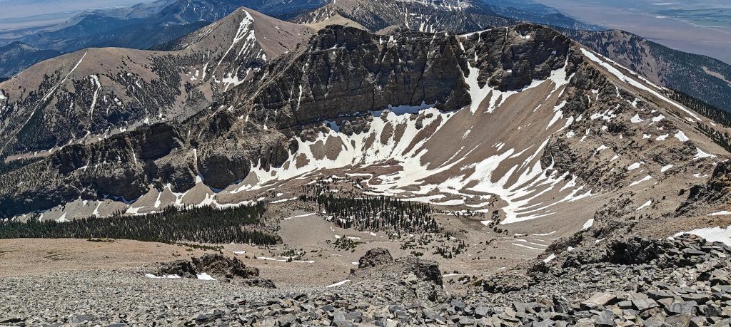
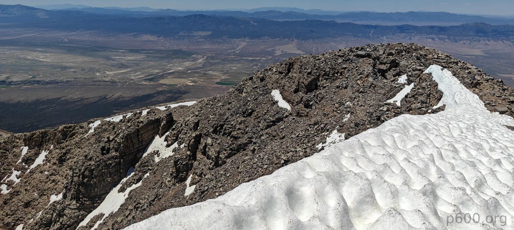
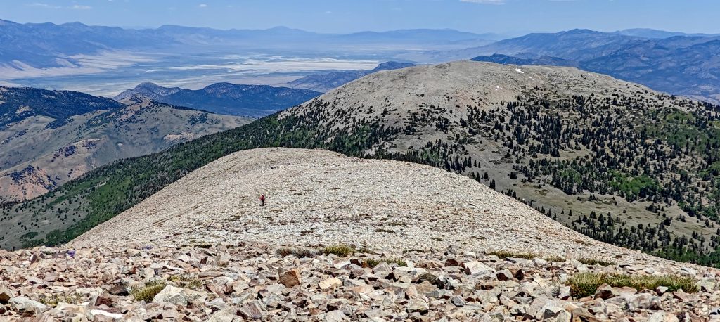
The summit is marked with a benchmark. Looking around, it’s obvious why the Great Basin is grand. Just below, I see Nevada’s only glacier with trees growing in it and a few white snow patches on the side. After a traditional apple break and five more minutes enjoying the views, I start descending the same trail. Though shortcuts are tempting, I decide to stick to park rules—otherwise, why have them?

Views from the summit reveal the surrounding ranges.
Someone is signaling with a “sun bunny” from Bald Mountain summit.
On descent, I glance back one more time at Wheeler Peak.
Pinnacle viewed from the parking lot.
Stella Lake reflections.

This is my 8th ultra on the trip—who would have expected that? So far, all my snow condition predictions have been spot on. Let’s see how it goes at Arc Dome. Looking at my calendar, it’s clear I need to start heading towards LA airport.


Wheeler Peak3982 m altitude
2306 m prominence
373.02 km isolation
Ranges Intermountain West- Great Basin Ranges
Countries/regionsUnited States - Nevada
Distance7.70 km up7.70 km down
Elevation871 m gain871 m loss
Time
3h00 up
0h10 other
2h00 down
5h10 total
Trailhead3109 m altitude39.0172580, -114.3034040
RouteFrom the parking it is
DifficultiesThe trail gradually winds through a forest, leading to Stella Lake. Before the lake, the trail forks, and I take the easy path through the sparse forest for a few kilometers. The trail remains good but becomes steeper. The unmarked summit offers wind shelters and a panoramic view of North Schell and Ibapah Peaks in the distance, with a benchmark a few meters away. I descend the same path.
LinksGPX trail
  • North America 2024
  • « North Schell Peak
  • Arc Dome »

Mountain Ranges

Anatolia
Central Anatolia
Pontic Mountains
Southeast Anatolia
Taurus Mountains
Western Anatolia
Andes
Puna de Atacama
Atlas Mountains
High Atlas
Northwestern Atlas
Central America Ranges
Costa Rica-Panama Ranges
Central Central America
East China
Taiwan
Eastern Europe Ranges
Southeast Baltic Plains
Iberian Peninsula
Cordillera Cantabrica
Castile Ranges
Portugal-Galicia
Pyrenees
Intermountain West
Great Basin Ranges
Korea-Amur Area
Taebaek Sanmae
Malay Archipelago
Java
Nusa Tengarra
Sulawesi
Sumatra
Mid-Atlantic Islands
North Atlantic Islands
Mongolia Ranges
Altai
Gobi Desert Ranges
Hangay Mountains
Northwest Europe
Great Britain
North France-West Rhine Area
Pacific Ranges
Cascade Range
Northwest U.S. Coast Ranges
Sierra Nevada
Central and Southern California Ranges
Philippines
Central Philippines
Luzon
Mindanao
Southeast Asia
Malay Peninsula
Southeast South America
Pampas
Sierras de Cordoba
Southern Africa
Malawi Highlands
West Africa Mountains
Bight of Benin
Cameroon Mountains
Guinea Highlands

Countries / regions

Algeria
Ain Guezzam
Ain Salah
Aïn Témouchent
El Bayadh
Ghardaïa
Oran
Ouargla
Saïda
Sidi Bel Abbès
Tamanrasset
Argentina
Catamarca
Ciudad Autónoma de Buenos Aires
Córdoba
Jujuy
Salta
Tucumán
Belgium
Brussels Capital Region
Flemish Region
Cameroon
Southwest
China
Taiwan
Costa Rica
Alajuela
Cartago
Guanacaste
Heredia
Limón
San José
Czechia
Prague
Denmark
Greenland
France
Hauts-de-France
Occitania
Germany
Berlin
Niedersachsen
Indonesia
Bali
Jambi
Jawa Tengah
Jawa Timur
Nusa Tenggara Barat
Sulawesi Tengah
Sulawesi Utara
Sumatera Barat
Lithuania
Vilnius County
Mongolia
Bayankhongor
Govi-Altai
Khovd
Omnogovi
Ovorkhangai
Ulan Bator
Zavkhan
Morocco
Béni Mellal-Khénifra
Drâa-Tafilalet
Fez-Meknes
Marrakesh-Safi
Souss-Massa
Tangier-Tetouan-Al Hoceima
Mozambique
Zambezia
Netherlands
Gelderland
Noord-Holland
Zeeland
Nicaragua
Chinandega
Managua
Masaya
Rivas
Philippines
Bicol Region (V)
Cagayan Valley (II)
Calabarzon (IV-A)
Central Luzon (III)
Cordillera Administrative Region
Davao Region
Metro Manila
Soccsksargen (XII)
Western Visayas (VI)
Poland
Greater Poland Voivodeship
Masovian Voivodeship
Portugal
Castelo Branco
Leiria
Lisbon
Madeira
Santarém
Qatar
Ad-Dawhah
São Tomé and Príncipe
São Tomé Province
Sierra Leone
Northern Province
Western Area
Singapore
South Korea
Gyeongsangnam-do
Seoul
Spain
Aragón
Asturias
Castilla-La Mancha
Castilla y León
Catalonia
Islas Canarias
Switzerland
Zürich
Turkey
Antalya
Bitlis
Erzincan
Hakkâri
Igdir
Isparta
Kahraman Maras
Muğla
United Kingdom
England
Scotland
United States
California
Delaware
Florida
Maryland
Nevada
New Jersey
New York
Pennsylvania
South Carolina
Utah

TRIPS

2024
Southern Africa 2024
Mid-Atlantic Islands 2024
North America 2024
Anatolia 2024
Korea-Amur Area 2024
East China 2024
2023
Mongolia Ranges 2023
Philippines 2023
West Africa III 2023
West Africa II 2023
Iberian Peninsula 2023
West Africa 2023
Central America 2023
2022
Andes 2022
Northwest Europe 2022
Malay Archipelago III 2022
Malay Archipelago II 2022
Anatolia Mountains 2022
Iberian Peninsula 2022
Atlas Mountains 2022
North France-West Rhine Area 2022

archaeology (3) climb (157) food (2) hike (155) p30 (17) p50 (4) p100 (24) p300 (12) p600 (17) p1000 (11) p1500 (76) ribu (10) sight (46) summary (16) trig (44) ultra (76)

1 591 km walked, 121 298 m climbed

©2025 p600.org | WordPress Theme by Superbthemes.com