Skip to content
Menu
p600.org
  • home
  • map
  • trips
  • about
p600.org

Lassen Peak

hike | 2024-06-15

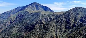
At this season Lassen Peak is a bit of a lottery. It is high enough and far north enough to be covered in snow in mid-June. After reading some month-old reports, I concluded it was worth trying. It was still unclear how high I could drive or how much of the national park road would be open.

Driving south of the peak, I looked into it and got upset seeing so much snow on the slopes. At the park gates, I asked about conditions and got a vague answer. They didn’t even know where exactly the road was closed. Essentially, they said, “We don’t know anything, give us $35.” I paid $35 for a week-long permit, though I was only there for a day. I asked if I could sell the ticket when exiting. The ticket seller told me, “Please don’t do it.” Still not clear why not to sell a 6-day ticket to someone else.

Roadside snow lingers – a few meters remind of winter’s grip.
The real thrill of the hike came on two wheels.

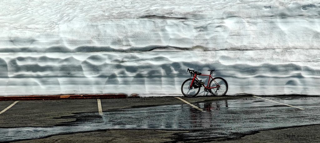
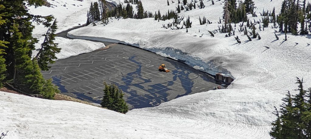
Today’s target is Lassen Peak. I’m determined to bag it, so I drive up and almost reach the Lassen Peak Trailhead Parking when I hit a barrier. I leave the car at Bumpass Hell parking at 40.46598, -121.51454 at an altitude of 2496 meters.

The reddish tinge to the snow might be snow algae.
Strapped on microspikes for added security, although the soft snow offered decent grip on its own.
Lower trail has patchy snow cover.
The trail is interspersed with short, easy-to-cross snowfields.

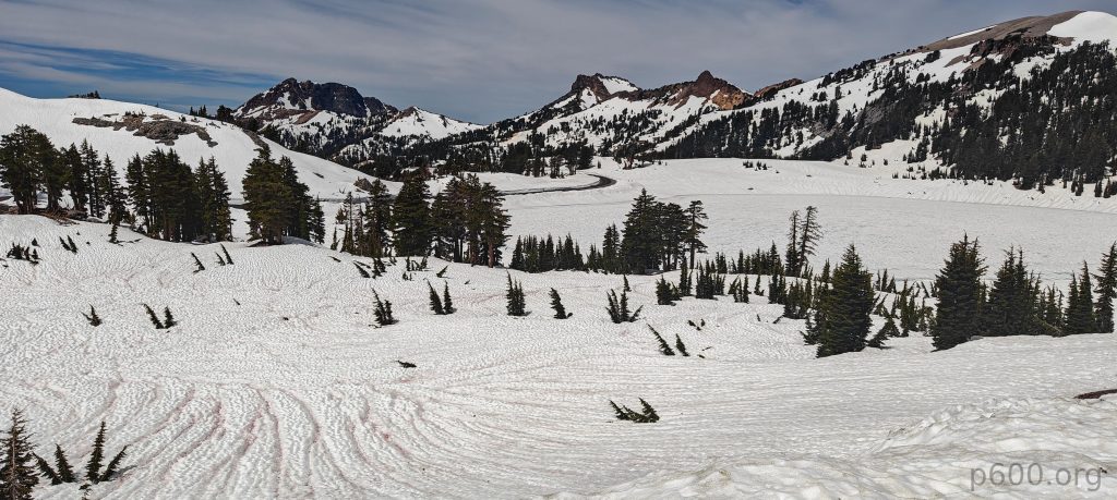
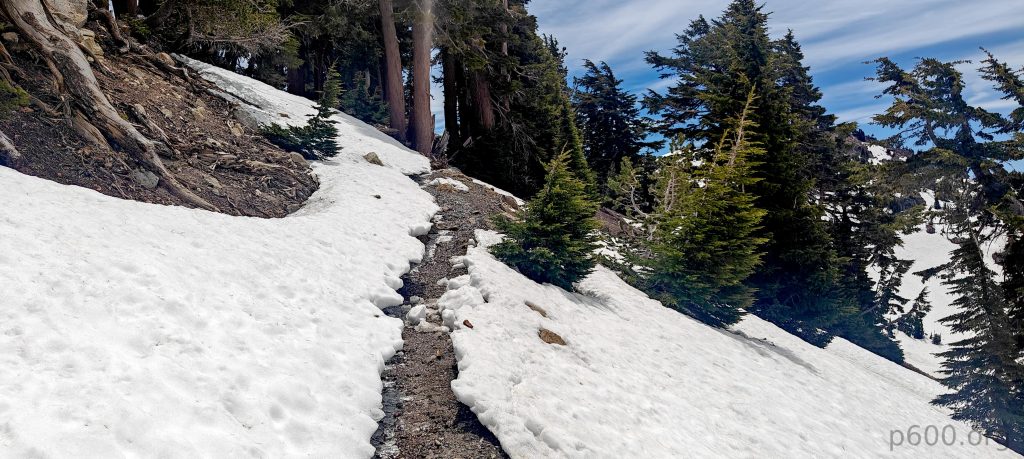
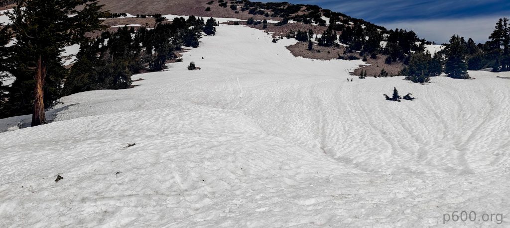
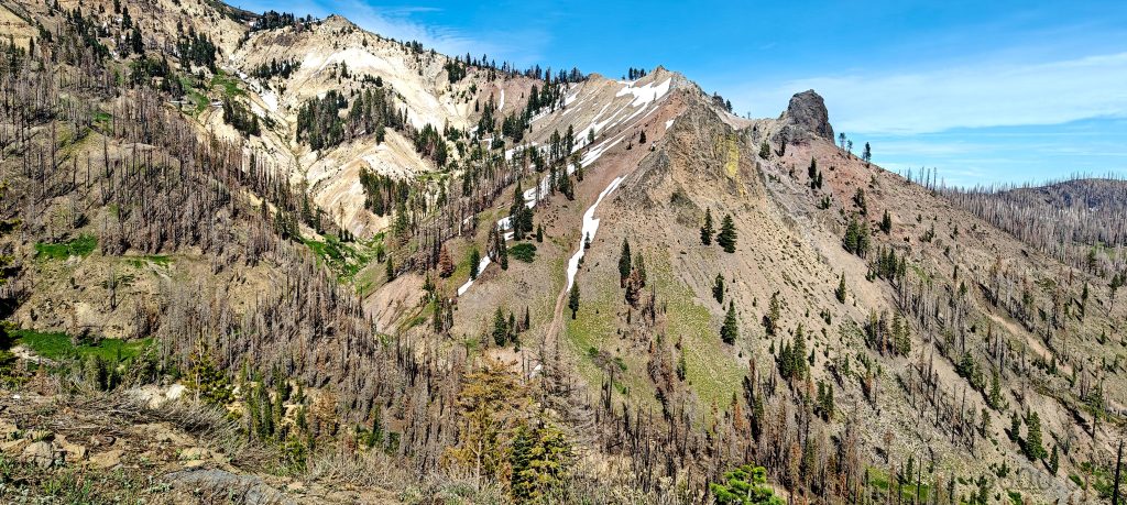
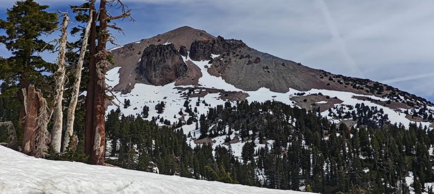
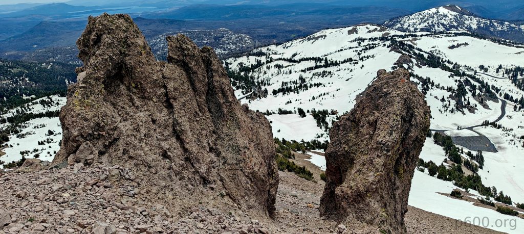
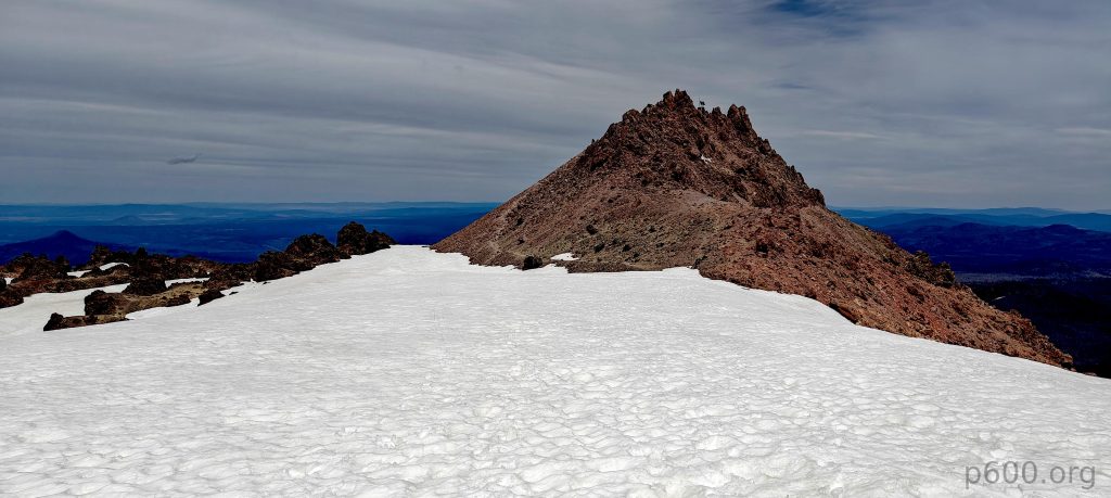
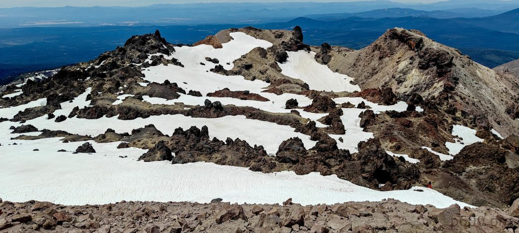
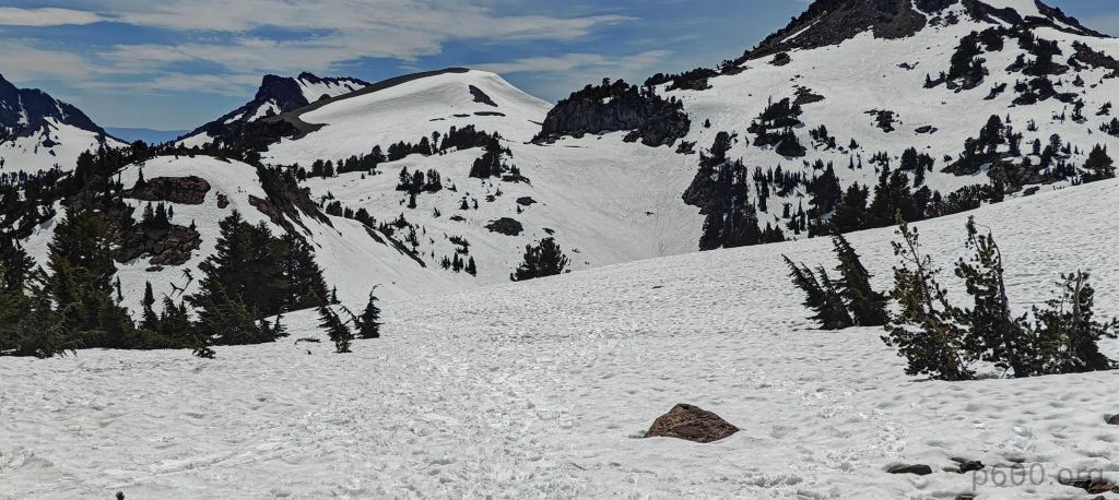
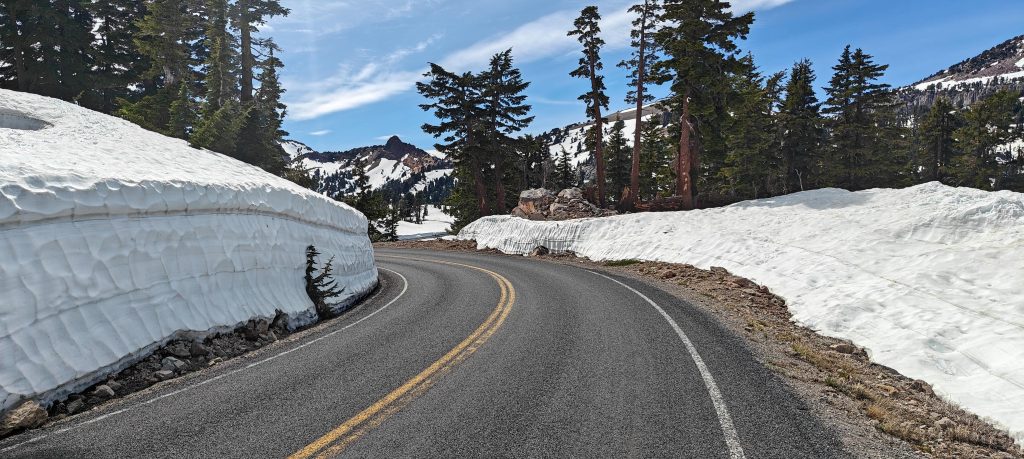
Walking 1-2 miles on a clean, snow-free paved road around small Lake Helen, I see thin ice not worth a shortcut. The sides of the road still have a few meters of snow. At the Lassen Peak Trailhead parking, I step onto snow and try to follow the GPS trail. Following GPS trail on soft snow is unpleasant, and at some moment, I give up and simply climb the snow slope straight in the direction I need. The first steep, snow-covered slope and finding the trail on a few more snow-covered switchbacks are the crux of the hike.

Higher switchbacks clear of snow.
Skiers streak down a remaining ribbon of snow.
Nearing the summit saddle.

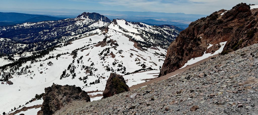
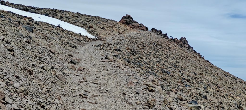
Easy, gradual switchbacks lead to a steeper slope, then finish straight to the summit. Some people are skiing down the remaining snow in the gully. At the small top saddle, I meet more skiers preparing to descend. Nice.

Majestic Mount Shasta dominates the horizon.
Summit in sight, just a few dozen meters to go.
A nearby benchmark marks the high point.
Gazing out, Mount Shasta continues to anchor the expansive panorama.

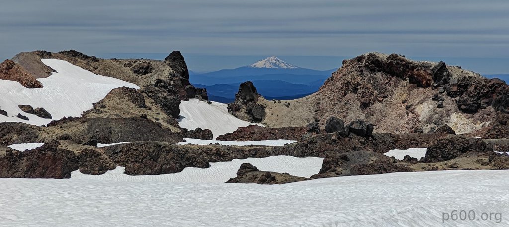
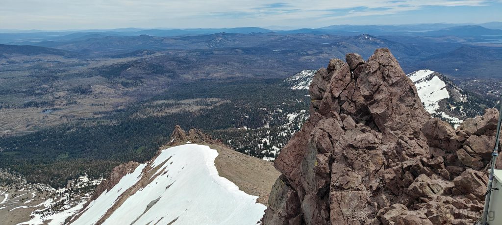
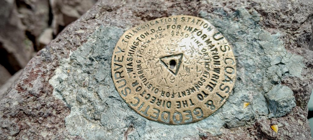
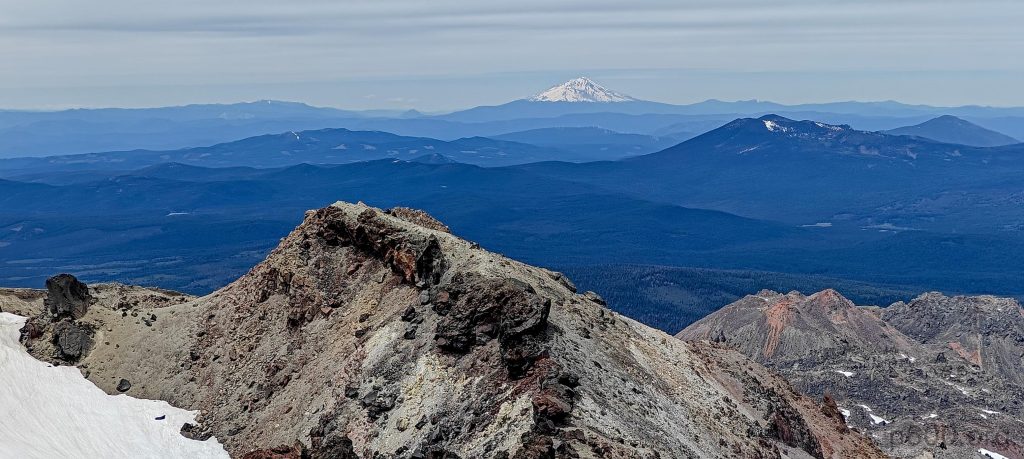
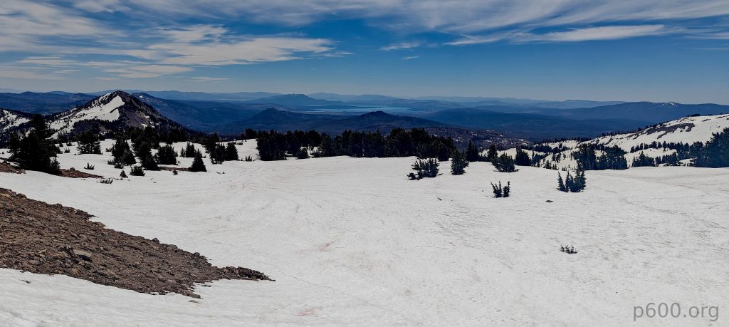
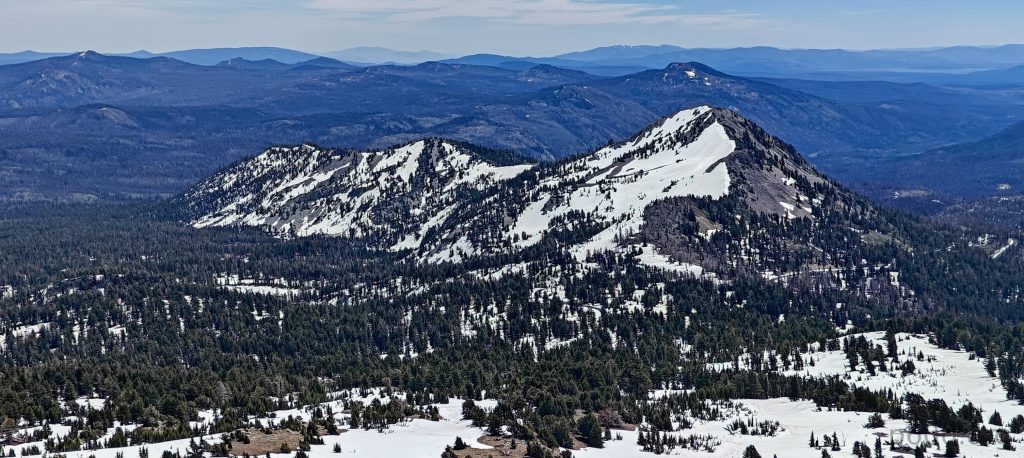
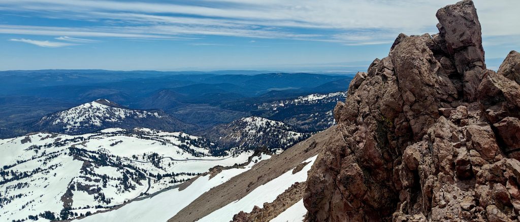
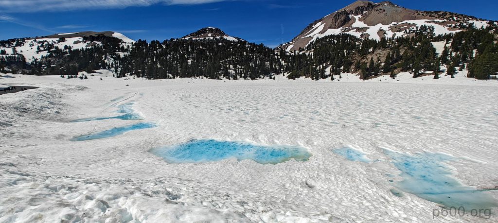
The summit outcrop is easily identifiable, with a benchmark a few meters away. Three locals with harnesses and skis came from the northeast side, claiming it was tough. Maybe it is. I enjoy dominating snow-covered Shasta views. Impressive.

Mount Lassen’s crater remains blanketed in snow.
Looks like I’m not the only one enjoying the summit! A friendly chipmunk is keeping me company, although he seems uninterested in sharing my apple.

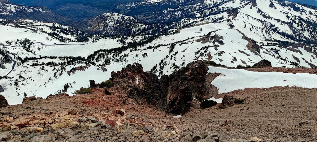
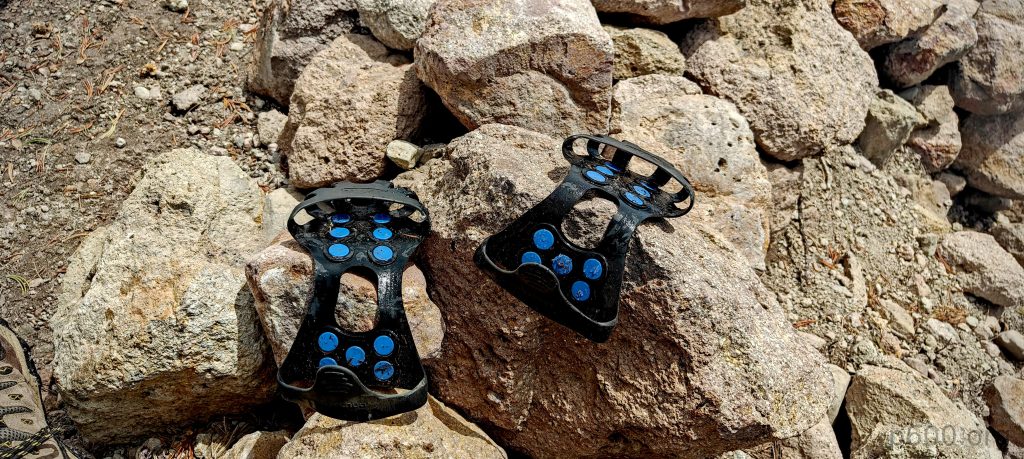
After the traditional apple, I head down the same trail. On the way up, I used microspikes, but mainly because I had them; otherwise, it was possible to skip them. The crux on the descent is the same slope near the parking lot. Everything else is a straightforward walk.

Forget ice skating! Lake Helen’s skimpy ice sheet is more like a slushy surprise.
Mad Max is alive and well.

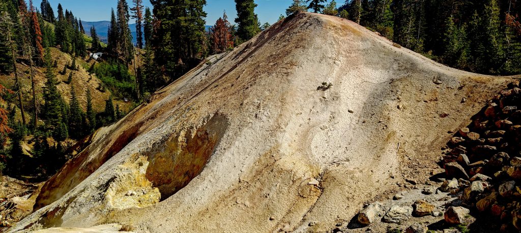
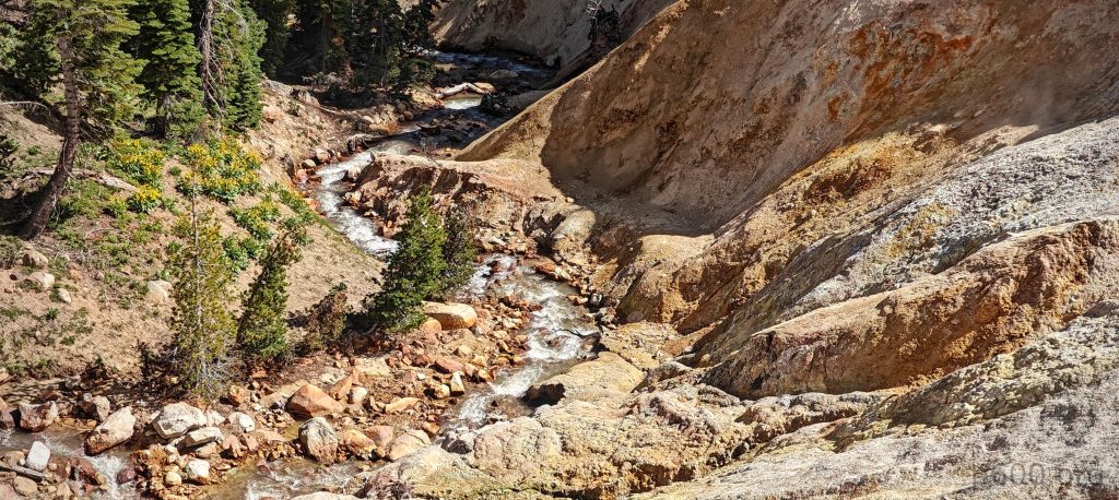
When driving down, I make a short stop at Sulphur Works. I didn’t expect to find an active volcano with hot springs. Boiling water and steam go from the ground. The last eruption was in 1914. Interesting. Ok, next peak on my list – Mount Eddy. Lower, but because of trees and forest, it may be less accessible. I will see tomorrow.

Churning volcanic springs bubble with geothermal fury.
West Sulphur Creek
Sulphur Works

Lassen Peak3187 m altitude
1594 m prominence
114.86 km isolation
RangesPacific Ranges - Cascade Range
Countries/regionsUnited States - California
Distance5.60 km up5.60 km down
Elevation691 m gain691 m loss
Time
2h10 up
0h10 other
1h40 down
4h00 total
Trailhead2496 m altitude40.4659240, -121.5145510
RouteThe Lassen Peak Trail begins at the Bumpass Hell Parking area (2489m) with a paved road (18 minutes) lined by residual snow. The initial trail section is snow-covered with a steep slope, requiring microspikes (not critical due to soft snow). The trail transitions to mostly clear with scattered patches (avoidable) as skiers descend from a lower peak. The summit features a well-defined outcrop with a nearby benchmark and offers stunning views of snow-capped Mt. Shasta. Descend via the same route.
DifficultiesFinding route on lower snow-covered sections
LinksGPX trail
  • North America 2024
  • « Telescope Peak
  • Mount Eddy »

Mountain Ranges

Anatolia
Central Anatolia
Pontic Mountains
Southeast Anatolia
Taurus Mountains
Western Anatolia
Andes
Puna de Atacama
Atlas Mountains
High Atlas
Northwestern Atlas
Central America Ranges
Costa Rica-Panama Ranges
Central Central America
East China
Taiwan
Eastern Europe Ranges
Southeast Baltic Plains
Iberian Peninsula
Cordillera Cantabrica
Castile Ranges
Portugal-Galicia
Pyrenees
Intermountain West
Great Basin Ranges
Korea-Amur Area
Taebaek Sanmae
Malay Archipelago
Java
Nusa Tengarra
Sulawesi
Sumatra
Mid-Atlantic Islands
North Atlantic Islands
Mongolia Ranges
Altai
Gobi Desert Ranges
Hangay Mountains
Northwest Europe
Great Britain
North France-West Rhine Area
Pacific Ranges
Cascade Range
Northwest U.S. Coast Ranges
Sierra Nevada
Central and Southern California Ranges
Philippines
Central Philippines
Luzon
Mindanao
Southeast Asia
Malay Peninsula
Southeast South America
Pampas
Sierras de Cordoba
Southern Africa
Malawi Highlands
West Africa Mountains
Bight of Benin
Cameroon Mountains
Guinea Highlands

Countries / regions

Algeria
Ain Guezzam
Ain Salah
Aïn Témouchent
El Bayadh
Ghardaïa
Oran
Ouargla
Saïda
Sidi Bel Abbès
Tamanrasset
Argentina
Catamarca
Ciudad Autónoma de Buenos Aires
Córdoba
Jujuy
Salta
Tucumán
Belgium
Brussels Capital Region
Flemish Region
Cameroon
Southwest
China
Taiwan
Costa Rica
Alajuela
Cartago
Guanacaste
Heredia
Limón
San José
Czechia
Prague
Denmark
Greenland
France
Hauts-de-France
Occitania
Germany
Berlin
Niedersachsen
Indonesia
Bali
Jambi
Jawa Tengah
Jawa Timur
Nusa Tenggara Barat
Sulawesi Tengah
Sulawesi Utara
Sumatera Barat
Lithuania
Vilnius County
Mongolia
Bayankhongor
Govi-Altai
Khovd
Omnogovi
Ovorkhangai
Ulan Bator
Zavkhan
Morocco
Béni Mellal-Khénifra
Drâa-Tafilalet
Fez-Meknes
Marrakesh-Safi
Souss-Massa
Tangier-Tetouan-Al Hoceima
Mozambique
Zambezia
Netherlands
Gelderland
Noord-Holland
Zeeland
Nicaragua
Chinandega
Managua
Masaya
Rivas
Philippines
Bicol Region (V)
Cagayan Valley (II)
Calabarzon (IV-A)
Central Luzon (III)
Cordillera Administrative Region
Davao Region
Metro Manila
Soccsksargen (XII)
Western Visayas (VI)
Poland
Greater Poland Voivodeship
Masovian Voivodeship
Portugal
Castelo Branco
Leiria
Lisbon
Madeira
Santarém
Qatar
Ad-Dawhah
São Tomé and Príncipe
São Tomé Province
Sierra Leone
Northern Province
Western Area
Singapore
South Korea
Gyeongsangnam-do
Seoul
Spain
Aragón
Asturias
Castilla-La Mancha
Castilla y León
Catalonia
Islas Canarias
Switzerland
Zürich
Turkey
Antalya
Bitlis
Erzincan
Hakkâri
Igdir
Isparta
Kahraman Maras
Muğla
United Kingdom
England
Scotland
United States
California
Delaware
Florida
Maryland
Nevada
New Jersey
New York
Pennsylvania
South Carolina
Utah

TRIPS

2024
Southern Africa 2024
Mid-Atlantic Islands 2024
North America 2024
Anatolia 2024
Korea-Amur Area 2024
East China 2024
2023
Mongolia Ranges 2023
Philippines 2023
West Africa III 2023
West Africa II 2023
Iberian Peninsula 2023
West Africa 2023
Central America 2023
2022
Andes 2022
Northwest Europe 2022
Malay Archipelago III 2022
Malay Archipelago II 2022
Anatolia Mountains 2022
Iberian Peninsula 2022
Atlas Mountains 2022
North France-West Rhine Area 2022

archaeology (3) climb (157) food (2) hike (155) p30 (17) p50 (4) p100 (24) p300 (12) p600 (17) p1000 (11) p1500 (76) ribu (10) sight (46) summary (16) trig (44) ultra (76)

1 591 km walked, 121 298 m climbed

©2025 p600.org | WordPress Theme by Superbthemes.com