Skip to content
Menu
p600.org
  • home
  • map
  • trips
  • about
p600.org

Montaña de las Palmas

hike | 2024-04-03

I landed right on schedule and promptly rejected the notion of shelling out fifty euros for a taxi, choosing a public bus instead. After a mere 15-minute wait and an expenditure of just 1.65 EUR, I arrived in Telde. Upon finding my accommodation, I engaged in a brief conversation with the hostel owner. It soon became evident that I had a few hours to spare before dinner. My options were straightforward: stay idle in my room or go for an adventure. Opting for the latter, I checked a map and found that Montaña de las Palmas, marked as P130, was only a few kilometers away. Eagerly, I set off directly towards it.

Ironically, the peak appeared deceptively lower from a distance, clearly mocking our perception of elevation.
Hey hey!
Hiking this peak seems like the norm.

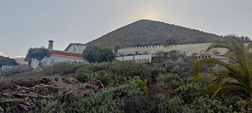
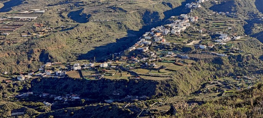
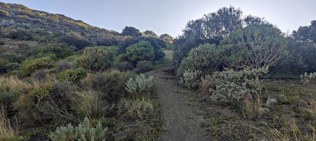
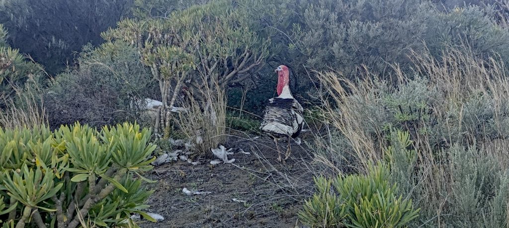
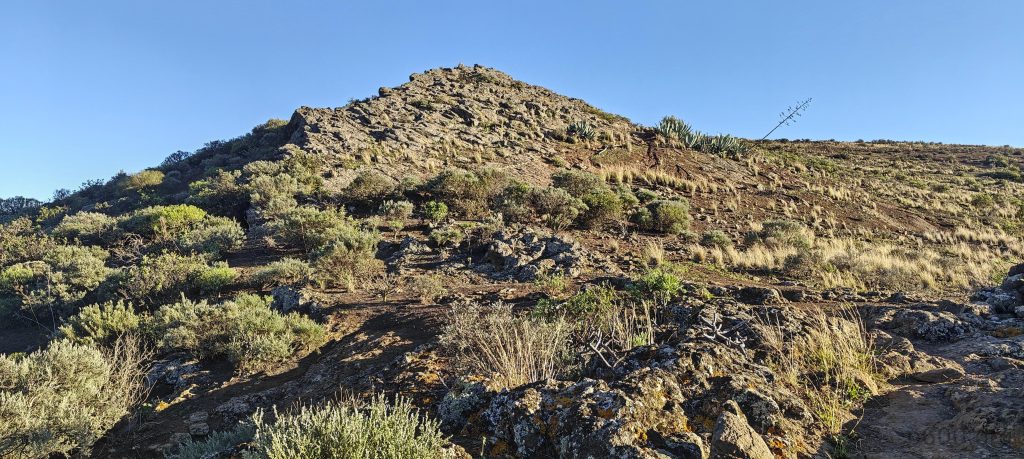
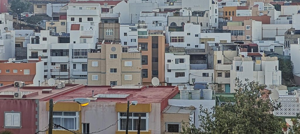
Most of the walk is on city streets, complete with sidewalks. About a kilometer from the peak, the side road ends, and shortly after, the main road does too. The path then weaves through local farms and past shelters with barking dogs. Near the summit, there’s a rocky section a few dozen meters high that I chose to climb. However, for those less inclined to scramble, it’s possible to bypass this by detouring about twenty meters to either side.

The trail up is quite good and even the turkeys from the nearby farm seem to appreciate it.
Pico de Bandama stands proudly with its volcanic crater on the parallel ridge.
Telde
Somewhere just a bit behind, the true highpoint hides.
The ocean is bustling with quite a few boats.
The summit is marked by a wooden cross.

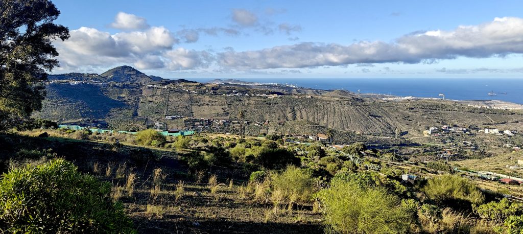
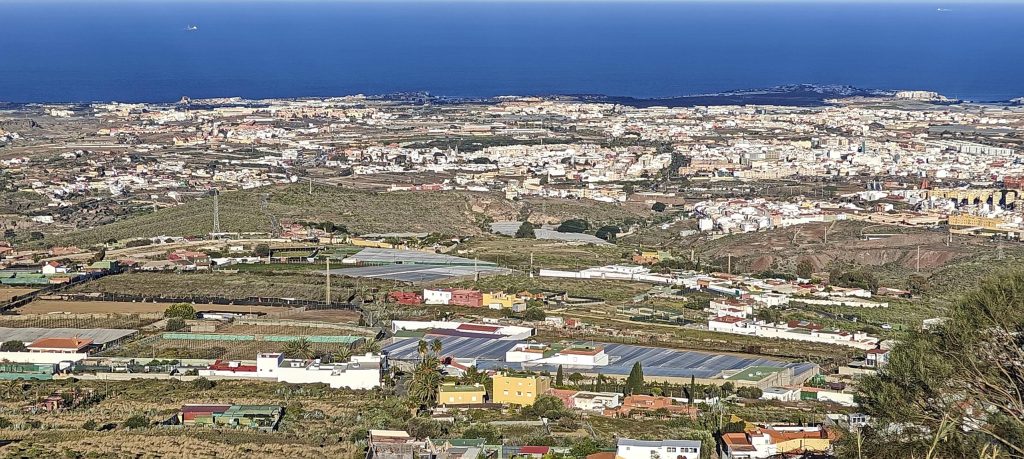
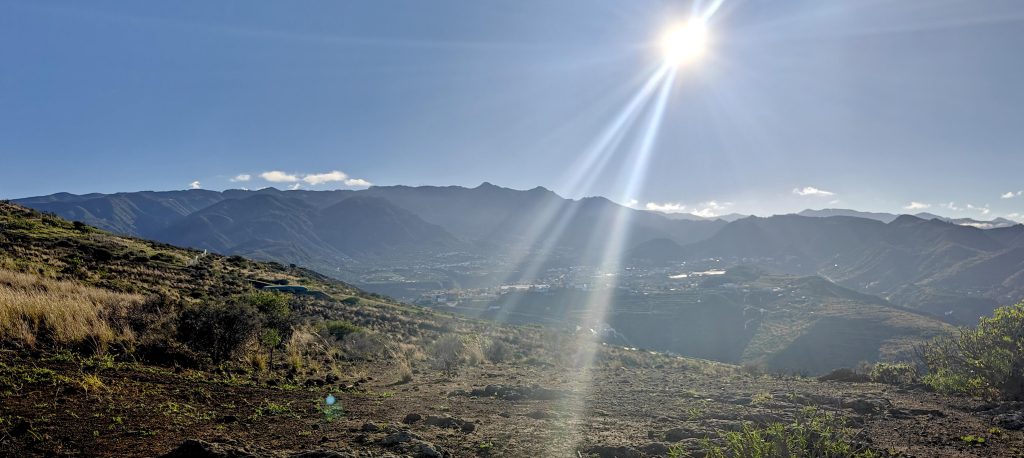
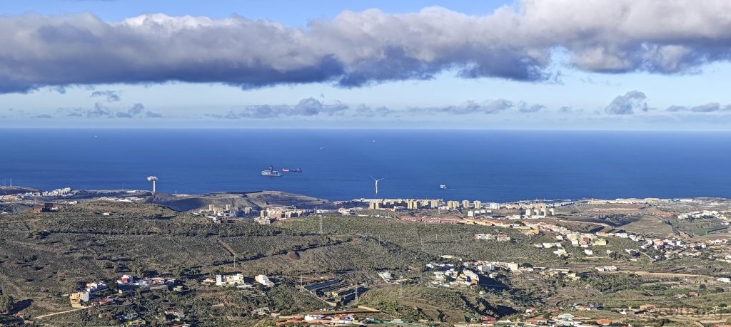
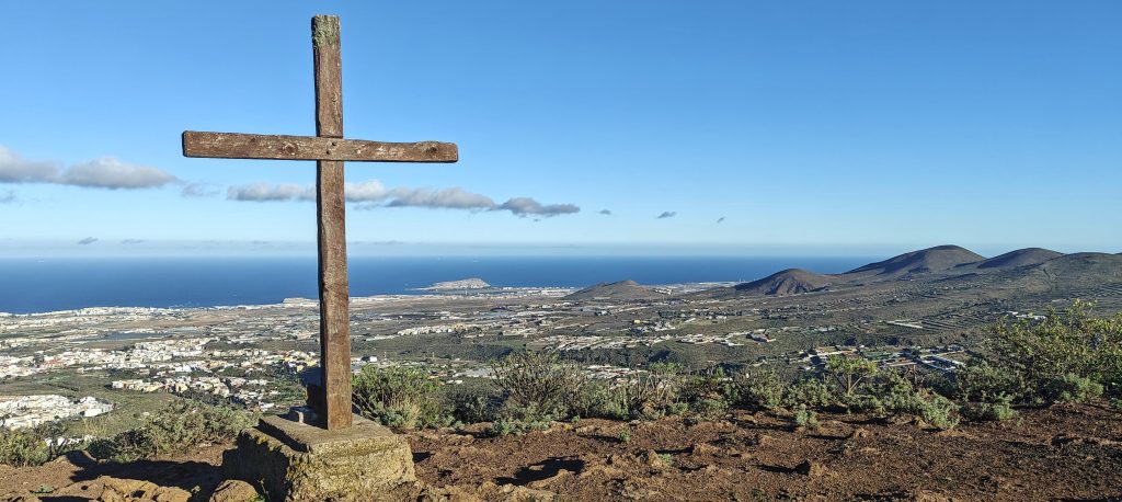
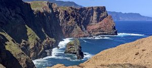
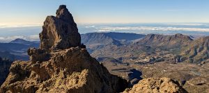
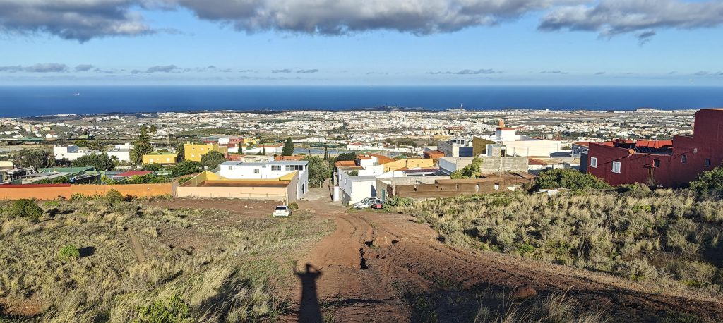
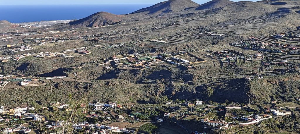
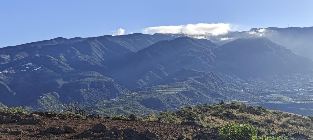
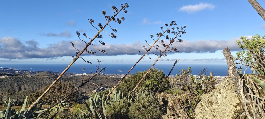
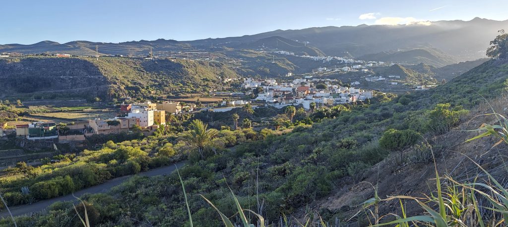
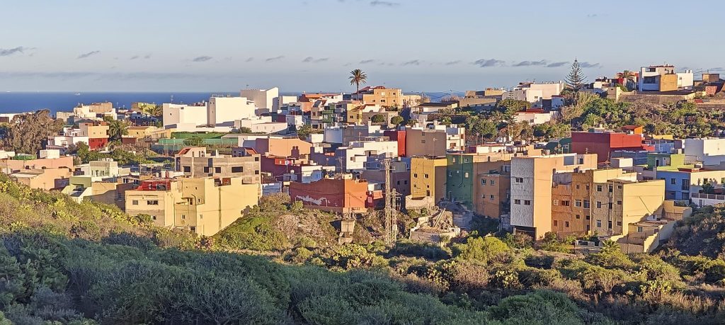
Summit is marked with wooden cross, nice views coloured by suset. Good visibility to all directions. El Morrón de la Agujereada somwhere in the west, Atantic ocean somwhere to the east, Telde city in the east too, farm fields inthe north and south.

The view to the southeast.
A few clouds linger at the highpoint, hopefully taking the hint to clear out for a brighter tomorrow.
I scrambled up these basic rocks, though it’s entirely possible to skirt around and avoid the scramble—your choice, really.
The valley near Telde
A bridge spans the Barranco Real de Telde.
The houses are quite colorful.
Car from the last century rests among the cacti.

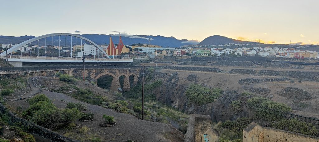
Visiting this accessible peak was definitely worthwhile. After descending back to Telde, I consulted the map for restaurants and chose one from the many options. And wow—the sardines were exceptional, the burrata with beetroots was outstanding, and it was hands down the best tataki I’ve ever had. Casa Mario truly impressed, and I trust Mario will continue to serve up fantastic meals. It was a perfect day, and I’m eagerly anticipating tomorrow’s climb to Gran Canaria’s highest point, El Morrón de la Agujereada.


Montaña de las Palmas560 m altitude
130 m prominence
4.47 km isolation
RangesMid-Atlantic Islands - North Atlantic Islands
Countries/regionsSpain - Islas Canarias
Distance4.50 km up4.50 km down
Elevation408 m gain408 m loss
Time
1h00 up
0h15 other
0h55 down
2h10 total
Trailhead151 m altitude27.9965830, -15.4179720
RouteStarting from Telde city, the route follows a paved road with a sidewalk that becomes less visible about one kilometer before the summit, eventually transitioning into a trail. Near the summit, there is an easy scramble that can be bypassed. The descent follows the same path back to the city.
LinksGPX trail
  • Mid-Atlantic Islands 2024
  • « Frankfurt to Las Palmas
  • El Morrón de la Agujereada »

Mountain Ranges

Anatolia
Central Anatolia
Pontic Mountains
Southeast Anatolia
Taurus Mountains
Western Anatolia
Andes
Puna de Atacama
Atlas Mountains
High Atlas
Northwestern Atlas
Central America Ranges
Costa Rica-Panama Ranges
Central Central America
East China
Taiwan
Eastern Europe Ranges
Southeast Baltic Plains
Iberian Peninsula
Cordillera Cantabrica
Castile Ranges
Portugal-Galicia
Pyrenees
Intermountain West
Great Basin Ranges
Korea-Amur Area
Taebaek Sanmae
Malay Archipelago
Java
Nusa Tengarra
Sulawesi
Sumatra
Mid-Atlantic Islands
North Atlantic Islands
Mongolia Ranges
Altai
Gobi Desert Ranges
Hangay Mountains
Northwest Europe
Great Britain
North France-West Rhine Area
Pacific Ranges
Cascade Range
Northwest U.S. Coast Ranges
Sierra Nevada
Central and Southern California Ranges
Philippines
Central Philippines
Luzon
Mindanao
Southeast Asia
Malay Peninsula
Southeast South America
Pampas
Sierras de Cordoba
Southern Africa
Malawi Highlands
West Africa Mountains
Bight of Benin
Cameroon Mountains
Guinea Highlands

Countries / regions

Algeria
Ain Guezzam
Ain Salah
Aïn Témouchent
El Bayadh
Ghardaïa
Oran
Ouargla
Saïda
Sidi Bel Abbès
Tamanrasset
Argentina
Catamarca
Ciudad Autónoma de Buenos Aires
Córdoba
Jujuy
Salta
Tucumán
Belgium
Brussels Capital Region
Flemish Region
Cameroon
Southwest
China
Taiwan
Costa Rica
Alajuela
Cartago
Guanacaste
Heredia
Limón
San José
Czechia
Prague
Denmark
Greenland
France
Hauts-de-France
Occitania
Germany
Berlin
Niedersachsen
Indonesia
Bali
Jambi
Jawa Tengah
Jawa Timur
Nusa Tenggara Barat
Sulawesi Tengah
Sulawesi Utara
Sumatera Barat
Lithuania
Vilnius County
Mongolia
Bayankhongor
Govi-Altai
Khovd
Omnogovi
Ovorkhangai
Ulan Bator
Zavkhan
Morocco
Béni Mellal-Khénifra
Drâa-Tafilalet
Fez-Meknes
Marrakesh-Safi
Souss-Massa
Tangier-Tetouan-Al Hoceima
Mozambique
Zambezia
Netherlands
Gelderland
Noord-Holland
Zeeland
Nicaragua
Chinandega
Managua
Masaya
Rivas
Philippines
Bicol Region (V)
Cagayan Valley (II)
Calabarzon (IV-A)
Central Luzon (III)
Cordillera Administrative Region
Davao Region
Metro Manila
Soccsksargen (XII)
Western Visayas (VI)
Poland
Greater Poland Voivodeship
Masovian Voivodeship
Portugal
Castelo Branco
Leiria
Lisbon
Madeira
Santarém
Qatar
Ad-Dawhah
São Tomé and Príncipe
São Tomé Province
Sierra Leone
Northern Province
Western Area
Singapore
South Korea
Gyeongsangnam-do
Seoul
Spain
Aragón
Asturias
Castilla-La Mancha
Castilla y León
Catalonia
Islas Canarias
Switzerland
Zürich
Turkey
Antalya
Bitlis
Erzincan
Hakkâri
Igdir
Isparta
Kahraman Maras
Muğla
United Kingdom
England
Scotland
United States
California
Delaware
Florida
Maryland
Nevada
New Jersey
New York
Pennsylvania
South Carolina
Utah

TRIPS

2024
Southern Africa 2024
Mid-Atlantic Islands 2024
North America 2024
Anatolia 2024
Korea-Amur Area 2024
East China 2024
2023
Mongolia Ranges 2023
Philippines 2023
West Africa III 2023
West Africa II 2023
Iberian Peninsula 2023
West Africa 2023
Central America 2023
2022
Andes 2022
Northwest Europe 2022
Malay Archipelago III 2022
Malay Archipelago II 2022
Anatolia Mountains 2022
Iberian Peninsula 2022
Atlas Mountains 2022
North France-West Rhine Area 2022

archaeology (3) climb (157) food (2) hike (155) p30 (17) p50 (4) p100 (24) p300 (12) p600 (17) p1000 (11) p1500 (76) ribu (10) sight (46) summary (16) trig (44) ultra (76)

1 591 km walked, 121 298 m climbed

©2025 p600.org | WordPress Theme by Superbthemes.com