Skip to content
Menu
p600.org
  • home
  • map
  • trips
  • about
p600.org

Pico Ruivo

hike | 2024-04-06

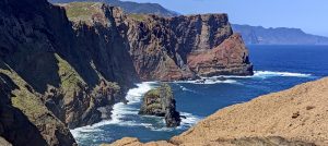
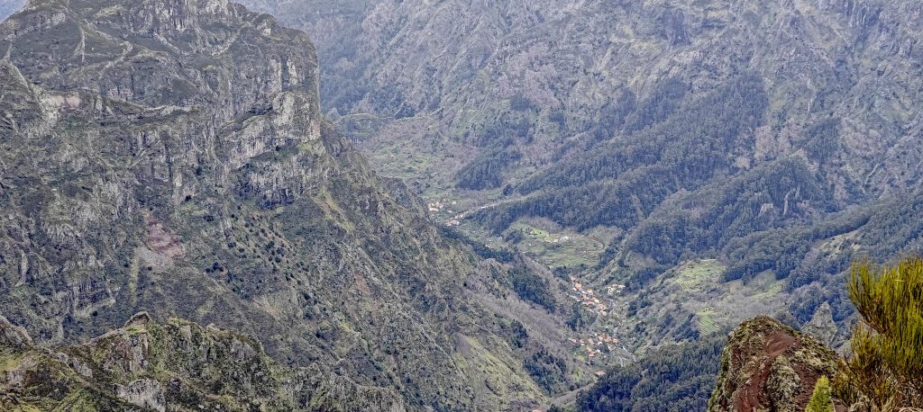
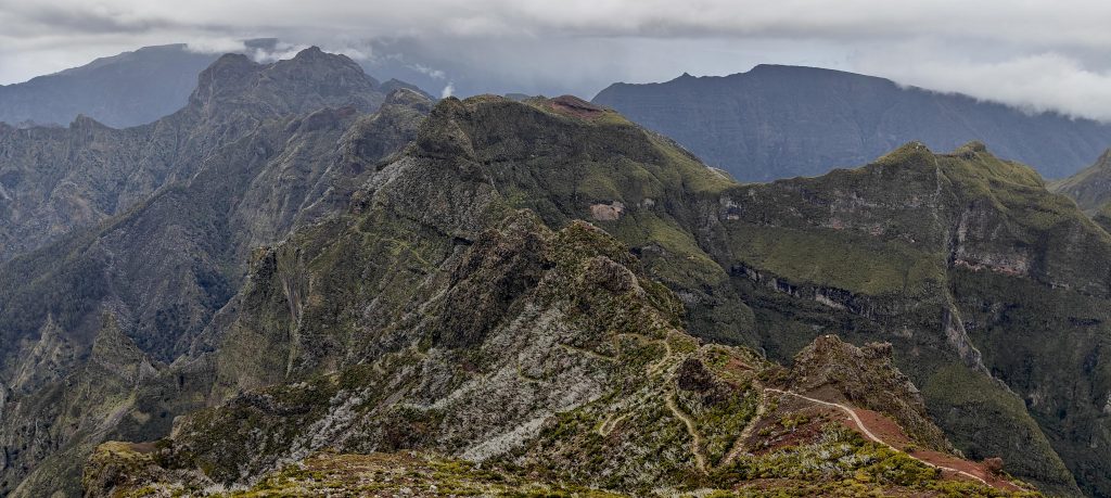
La Palma’s Roque de los Muchachos was cool, but now I’m all about Pico Ruivo in Madeira, Portugal. This peak is the island’s highest, with ultra-prominence and nearly 450 km of isolation. It’s clearly captured my interest. After a bumpy landing, a good dinner, and a comfortable night’s sleep, I had a hearty breakfast before heading to the Pico Ruivo east parking lot. It’s about a 45-minute drive along small, winding roads from Santa Cruz.

The trailhead kicks off with a stone-paved path that leads all the way up to the summit.
Ponta de São Lourenço and Ilhéu do Farol Island are visible in the distance.

There are a few cars in the parking lot, but it’s not crowded. I change into my hiking shoes and start heading up the trail. I’m the only one wearing shorts and a T-shirt—it’s about 10 degrees Celsius, and I’m moving, so it feels fine. I don’t understand why some folks are bundled up in winter clothes, with hats, scarves, and gloves. It’s not like we’re trekking through a blizzard.

The lush, green-covered cliffs offer a picturesque view.
Ribeira do Porco flows with Boa Ventura village on the left bank and Arco de São Jorge on the right.
There are a few shelters along the way.
A valley along the way to the summit.

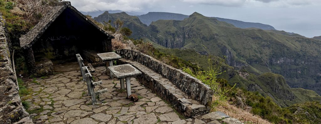
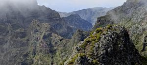
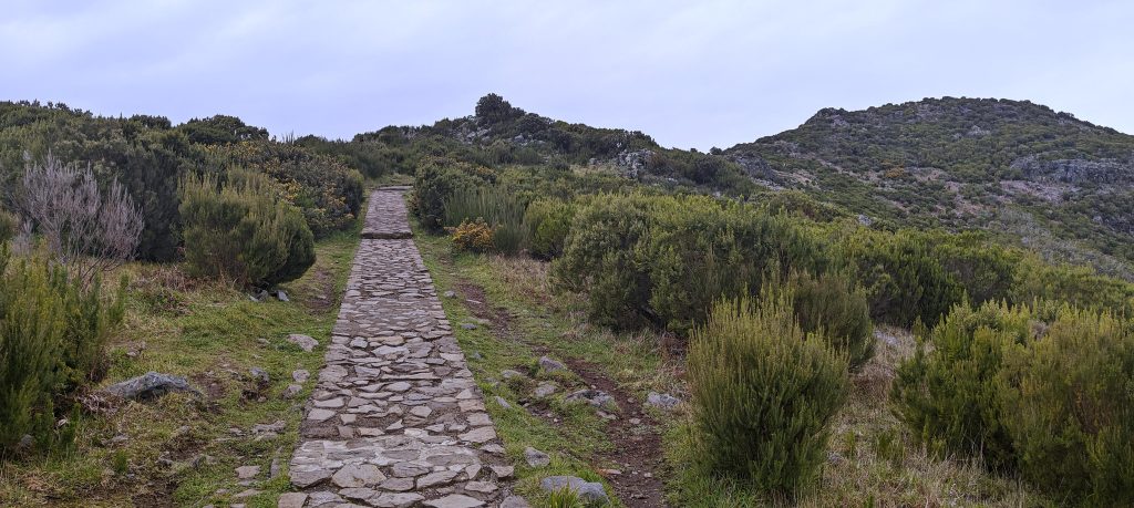
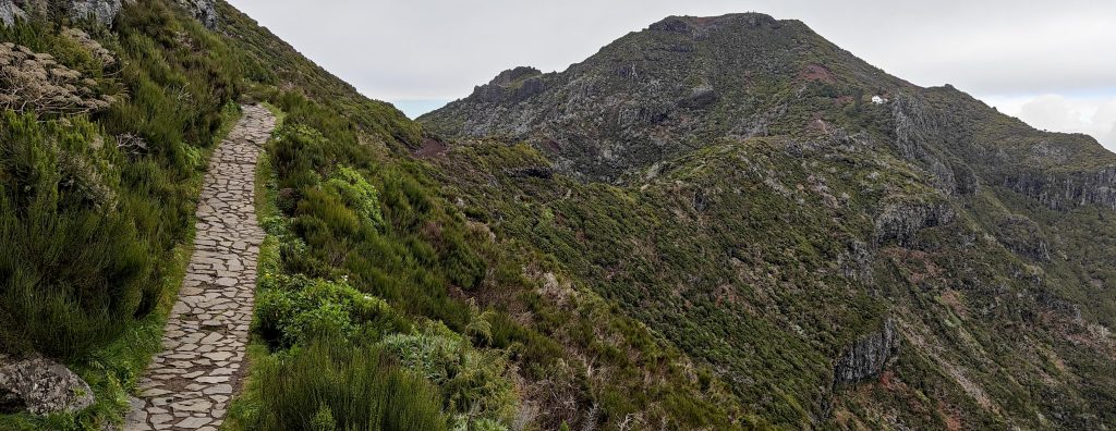
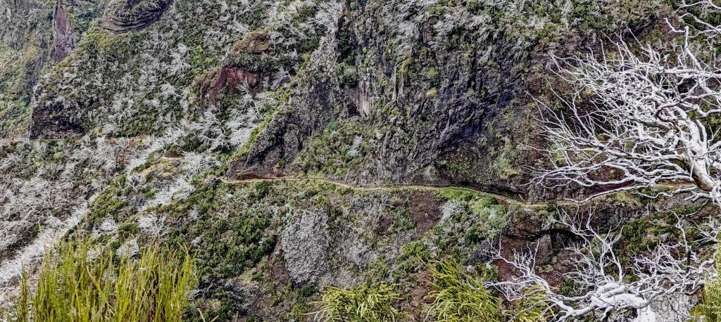
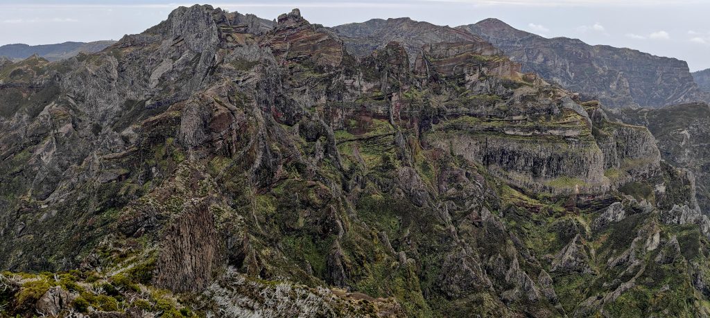
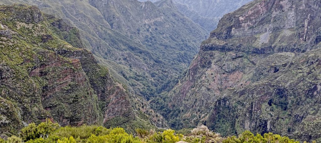
The trail is gradual and paved— even better maintained than the one at Jiri-san. I count climbers in tens: ten, twenty, thirty. I probably passed 200 people on the trail. There are a few small descents and ascents, but I finally reach the hut. I keep walking, and ten minutes later, I’m at the summit.

The summit is finally visible.
The south trail is impressive.
Pico Ruivo is just a few hundred meters away.
Casa de Abrigo do Pico Ruivo is a mountain refuge near the summit, offering a cozy pit stop for weary hikers.

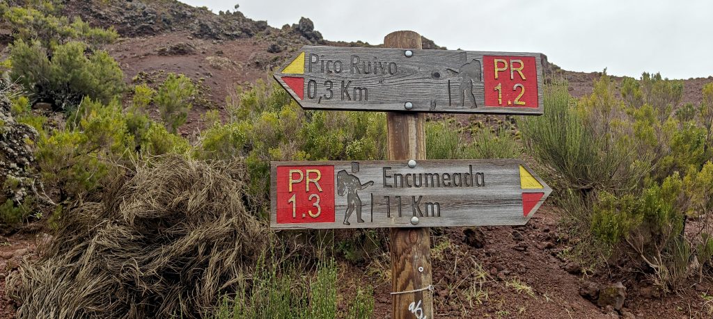
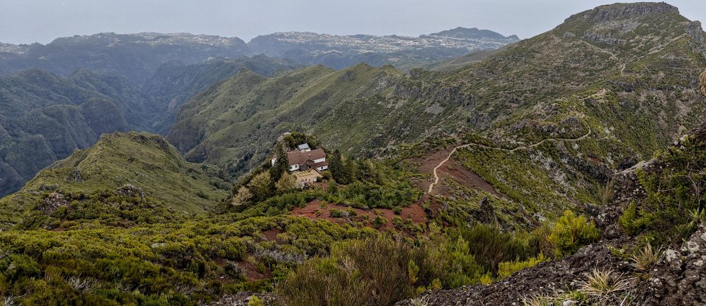
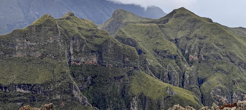
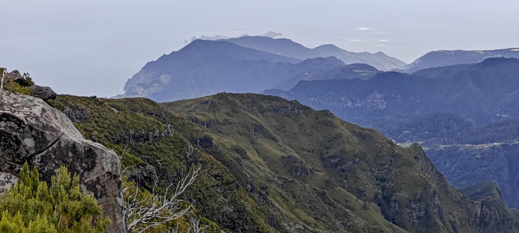
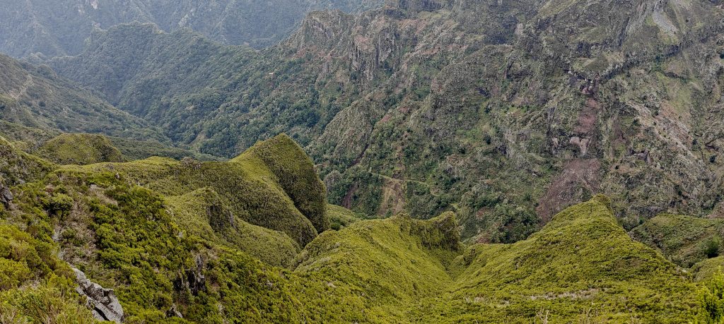
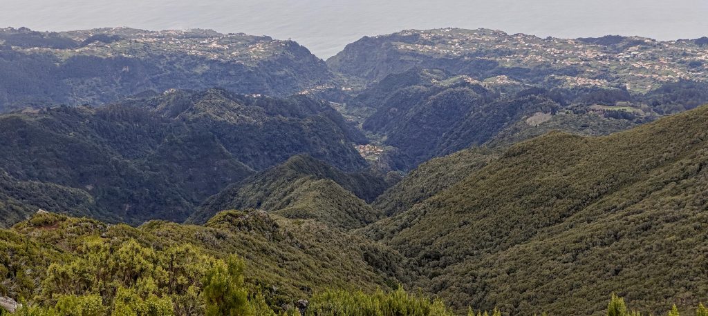
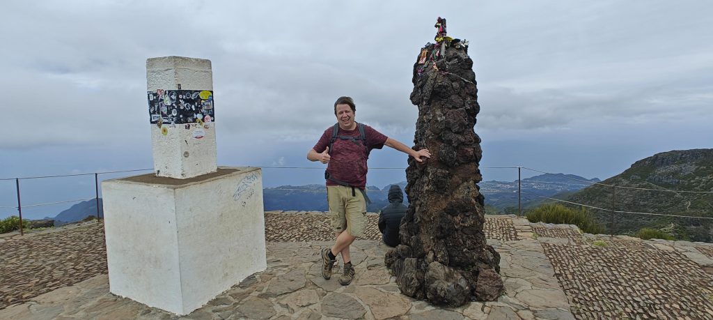
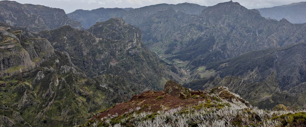
It’s hard to take a photo without other people getting in the frame, but I finally manage to get a clear shot. After a quick detour to some scenic viewpoints, I head back down the same path I took to the summit. But then, at coordinates 32.76137, -16.93472, I spot a trail that leads to the Pico Ruivo East Summit. Given that it’s a new path to explore, of course, I decide to check it out.

The summit trig pillar and marker stand tall, marking the peak, while I stand beside them.
These mountains have style, showcasing sharp ridges and dramatic cliffs with an air of effortless cool.
The west ridge impresses with its dramatic drop-offs.
One of the deep valleys stretches out below.
A striking pinnacle stands out at one of the saddles.
Deep canyons carve through the landscape.
Half of the trail is visible from here.
The view from the summit stretches far.
From above, the west ridge and west trail.
A rock with a hole punches through the landscape, as if nature couldn’t resist making its own abstract art.
Clouds rolled in, shrouding the landscape in a misty veil.

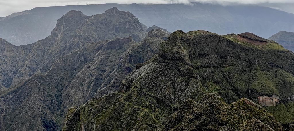
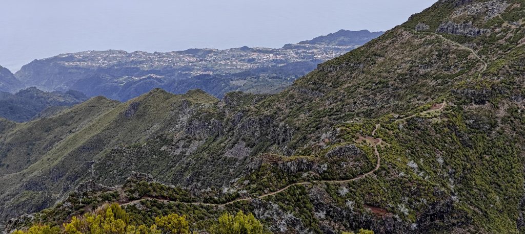
After the surprise of Pico Ruivo East Summit, I head back to the parking lot. Pico Ruivo was my last Spanish-Portuguese ultra-prominent peak, which feels like a milestone. But I’m not done yet. My next goal is to visit one of the few remaining Portuguese P600 peaks—Pico Ruivo do Paul da Serra. However, before I get there, I have another unexpected detour in mind—Pico do Remal.


Pico Ruivo1862 m altitude
1862 m prominence
449.82 km isolation
RangesMid-Atlantic Islands - North Atlantic Islands
Countries/regionsPortugal - Madeira
Distance2.80 km up1.40 km down
Elevation356 m gain356 m loss
Time
0h45 up
0h10 other
0h15 down
1h10 total
Trailhead1674 m altitude32.7652220, -16.9206940
RouteThe paved trail from the parking lot leads gradually to the summit, with stairs on the steeper sections. The descent follows the same route, but I detour to the East Peak before heading back to the car.
DifficultiesA crowd of people makes it hard to move without bumping into someone.
LinksGPX trail
  • Mid-Atlantic Islands 2024
  • « Montaña de Breña
  • Pico Ruivo East Peak »

Mountain Ranges

Anatolia
Central Anatolia
Pontic Mountains
Southeast Anatolia
Taurus Mountains
Western Anatolia
Andes
Puna de Atacama
Atlas Mountains
High Atlas
Northwestern Atlas
Central America Ranges
Costa Rica-Panama Ranges
Central Central America
East China
Taiwan
Eastern Europe Ranges
Southeast Baltic Plains
Iberian Peninsula
Cordillera Cantabrica
Castile Ranges
Portugal-Galicia
Pyrenees
Intermountain West
Great Basin Ranges
Korea-Amur Area
Taebaek Sanmae
Malay Archipelago
Java
Nusa Tengarra
Sulawesi
Sumatra
Mid-Atlantic Islands
North Atlantic Islands
Mongolia Ranges
Altai
Gobi Desert Ranges
Hangay Mountains
Northwest Europe
Great Britain
North France-West Rhine Area
Pacific Ranges
Cascade Range
Northwest U.S. Coast Ranges
Sierra Nevada
Central and Southern California Ranges
Philippines
Central Philippines
Luzon
Mindanao
Southeast Asia
Malay Peninsula
Southeast South America
Pampas
Sierras de Cordoba
Southern Africa
Malawi Highlands
West Africa Mountains
Bight of Benin
Cameroon Mountains
Guinea Highlands

Countries / regions

Algeria
Ain Guezzam
Ain Salah
Aïn Témouchent
El Bayadh
Ghardaïa
Oran
Ouargla
Saïda
Sidi Bel Abbès
Tamanrasset
Argentina
Catamarca
Ciudad Autónoma de Buenos Aires
Córdoba
Jujuy
Salta
Tucumán
Belgium
Brussels Capital Region
Flemish Region
Cameroon
Southwest
China
Taiwan
Costa Rica
Alajuela
Cartago
Guanacaste
Heredia
Limón
San José
Czechia
Prague
Denmark
Greenland
France
Hauts-de-France
Occitania
Germany
Berlin
Niedersachsen
Indonesia
Bali
Jambi
Jawa Tengah
Jawa Timur
Nusa Tenggara Barat
Sulawesi Tengah
Sulawesi Utara
Sumatera Barat
Lithuania
Vilnius County
Mongolia
Bayankhongor
Govi-Altai
Khovd
Omnogovi
Ovorkhangai
Ulan Bator
Zavkhan
Morocco
Béni Mellal-Khénifra
Drâa-Tafilalet
Fez-Meknes
Marrakesh-Safi
Souss-Massa
Tangier-Tetouan-Al Hoceima
Mozambique
Zambezia
Netherlands
Gelderland
Noord-Holland
Zeeland
Nicaragua
Chinandega
Managua
Masaya
Rivas
Philippines
Bicol Region (V)
Cagayan Valley (II)
Calabarzon (IV-A)
Central Luzon (III)
Cordillera Administrative Region
Davao Region
Metro Manila
Soccsksargen (XII)
Western Visayas (VI)
Poland
Greater Poland Voivodeship
Masovian Voivodeship
Portugal
Castelo Branco
Leiria
Lisbon
Madeira
Santarém
Qatar
Ad-Dawhah
São Tomé and Príncipe
São Tomé Province
Sierra Leone
Northern Province
Western Area
Singapore
South Korea
Gyeongsangnam-do
Seoul
Spain
Aragón
Asturias
Castilla-La Mancha
Castilla y León
Catalonia
Islas Canarias
Switzerland
Zürich
Turkey
Antalya
Bitlis
Erzincan
Hakkâri
Igdir
Isparta
Kahraman Maras
Muğla
United Kingdom
England
Scotland
United States
California
Delaware
Florida
Maryland
Nevada
New Jersey
New York
Pennsylvania
South Carolina
Utah

TRIPS

2024
Southern Africa 2024
Mid-Atlantic Islands 2024
North America 2024
Anatolia 2024
Korea-Amur Area 2024
East China 2024
2023
Mongolia Ranges 2023
Philippines 2023
West Africa III 2023
West Africa II 2023
Iberian Peninsula 2023
West Africa 2023
Central America 2023
2022
Andes 2022
Northwest Europe 2022
Malay Archipelago III 2022
Malay Archipelago II 2022
Anatolia Mountains 2022
Iberian Peninsula 2022
Atlas Mountains 2022
North France-West Rhine Area 2022

archaeology (3) climb (157) food (2) hike (155) p30 (17) p50 (4) p100 (24) p300 (12) p600 (17) p1000 (11) p1500 (76) ribu (10) sight (46) summary (16) trig (44) ultra (76)

1 591 km walked, 121 298 m climbed

©2025 p600.org | WordPress Theme by Superbthemes.com