Skip to content
Menu
p600.org
  • home
  • map
  • trips
  • about
p600.org

Roque de los Muchachos

hike | 2024-04-04

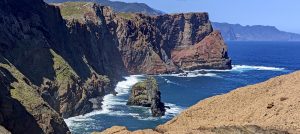
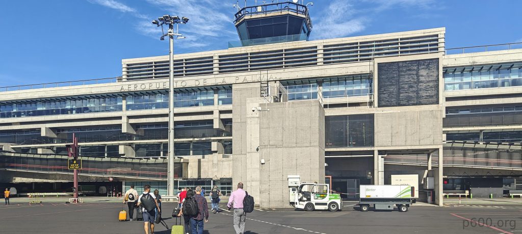
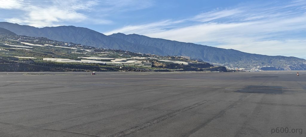
After a successful and memorable climb to Gran Canaria’s true high point, El Morrón de la Agujereada we stop at a restaurant chosen by Aron. After enjoying great food, we head to the airport. Our flight to La Palma is on time, and all procedures go smoothly. It takes a few minutes to disembark and another ten to rent a car. After five more minutes to locate it in the garage, we’re finally on our way to Roque de los Muchachos, our second ultra-prominent peak and island high point of the day.

La Palma Airport may not be sprawling, but it’s certainly efficient, proving once again that size isn’t everything.
Ninety minutes later, we encounter astronomical observatories perched atop the mountain.

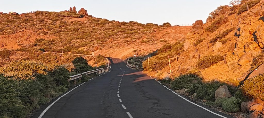
After an hour and thirty minutes, we come across a barrier at the base of the astronomical observatory. Though the road seems partially closed, a sign below specifies its closure from 19:00 to 8:00. Despite our ability to drive a few more kilometers, for academic and scientific reasons, we opt to park the car next to the few others and trek up. Rob’s report mentions the “last mile,” though it appears to differ from the British standard mile. Ultimately, we walk approximately 4 kilometers to reach the summit, following a paved road the entire way.

The Cherenkov Telescope Array stands as a testament to human ingenuity, with MAGIC (Major Atmospheric Gamma Imaging Cherenkov) serving as a prime example of its grandeur.
MAGIC captures particle showers emitted by gamma rays, utilizing Cherenkov radiation— the dim light released by charged particles within these showers.

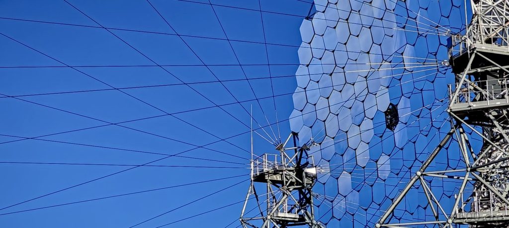
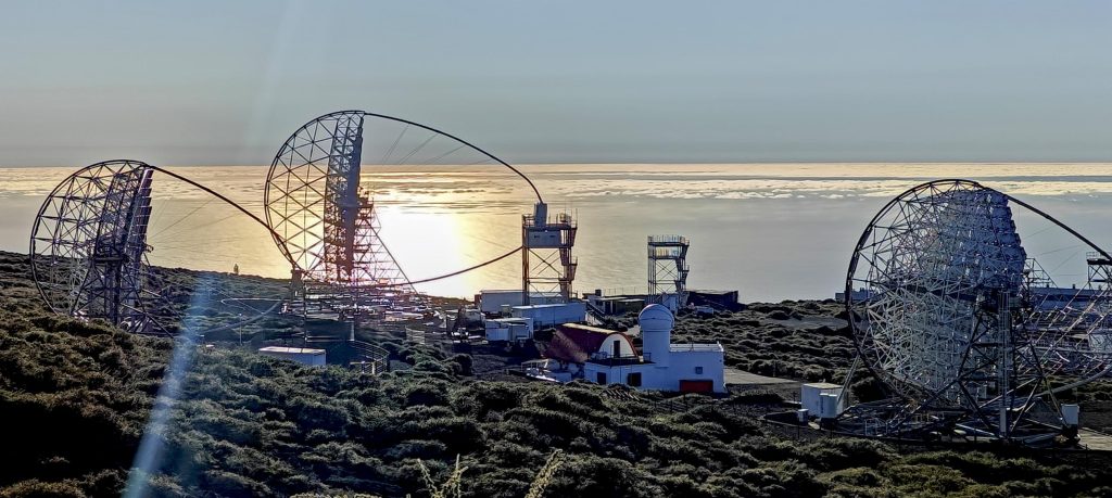
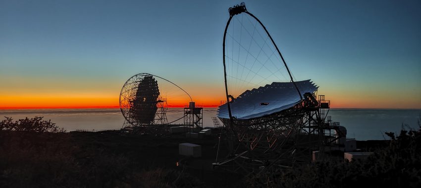
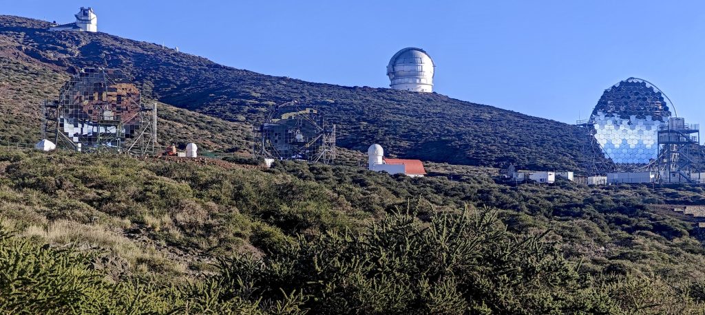
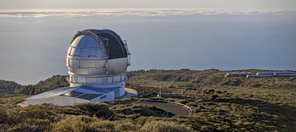
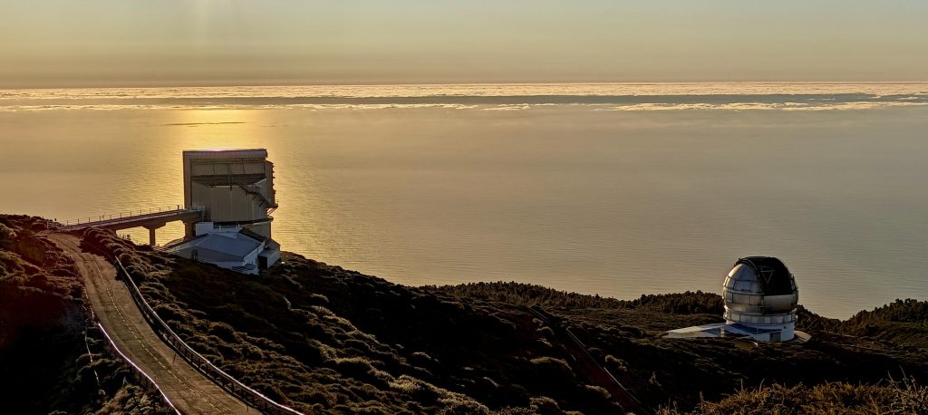
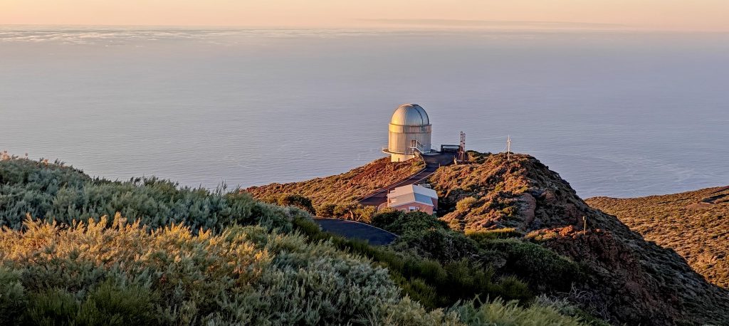
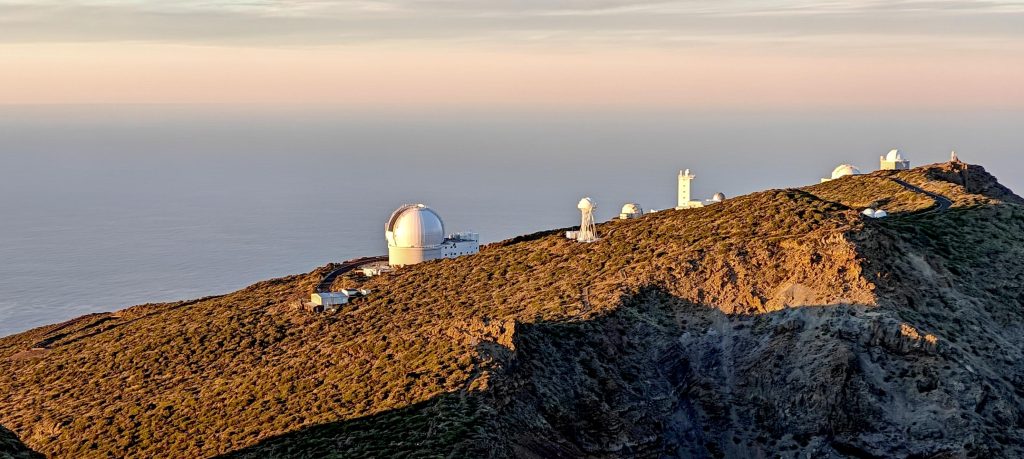
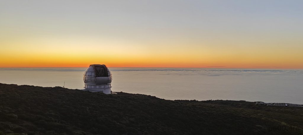
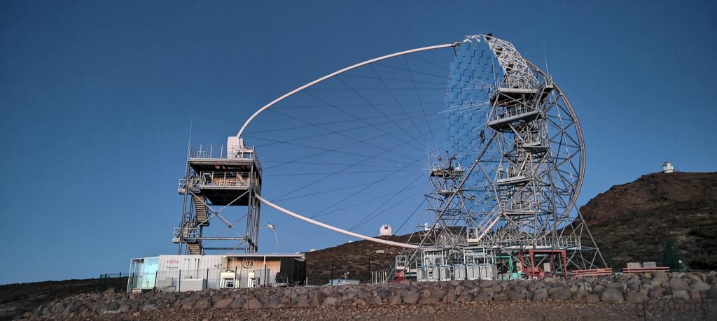
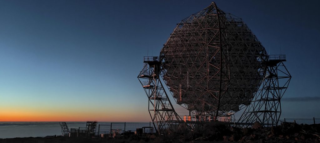
The views are superbly interesting, mainly due to the astronomical observatories. An array of telescopes, including the MAGIC Cherenkov Telescope Array, Italy’s Galileo National Telescope, and several other towers, illuminates the skyline. It’s awe-inspiring—I remember first learning about these observatories as a kid, deeply interested in astronomy. That’s when I built my first DIY telescope using optics from binoculars and reading glasses. It worked surprisingly well; I could distinguish the mountains on the moon and observe sunspots with superb clarity. But the idea of seeing with a reflector larger than 10 meters still blows my mind. Just imagine the countless things you could see with it…

La Palma boasts a rich astronomical heritage and a profound reverence for this “giga-distance-one-photon” science. Since 1988, the island has had the Sky Law in place, recognizing its exceptional astronomical observing conditions. Among its primary aims is the preservation of sky quality by regulating outdoor lighting. Respect for the cosmos runs deep here.

The Gran Telescopio Canarias, at 10.4 meters, is the largest single-aperture optical telescope, with the nearby 2.56-meter Nordic Optical Telescope.
Italy’s Galileo National Telescope, standing at 3.58 meters, neighbors the Gran Telescopio Canarias.

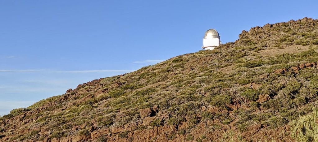
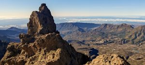
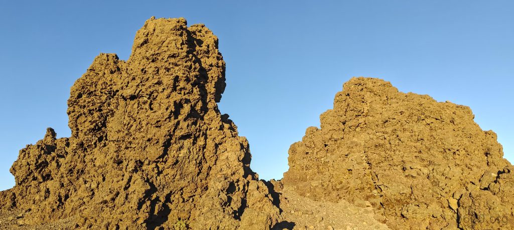
Returning to the mountains, despite this peak being among the 400 P2000 mountains globally, it’s accessible by car. So, 99 percent of visitors reach it by car or bus. It’s strange, but this time we’re the exception. We walked 4 km to the few pinnacles at the summit. One is obviously higher than the others, maybe around 5 meters tall, with a few handholds and steps. Nothing too complicated.

The true high point is just a few meters away, easily reachable with a simple scramble.

The biggest issue for us is the dozen tourists. They’re waiting for the sunset, content to declare they’ve reached the high point from the touristic viewpoint. It’s fully understandable; they’re not peakbaggers. Otherwise, they’d stand next to us, step over the small fence, and quickly scramble to at least touch the high point. Some would attempt to get their heads above the high point, and the smartest and most experienced climbers would aim to step on top of the pinnacle. We’re somewhere in between—I’m happy to touch and put my head above the high point. We wait for the non-peakbaggers to disperse, but soon it becomes boring, so we scramble up the pinnacle despite multiple observers.

The summit offers captivating evening views.
Nordic Optical Telescope
The Carlsberg Meridian Telescope conducted high-precision optical astrometry from May 1984 to September 2013. Next to is is the Dutch Open Telescope, an optical solar telescope.
Small pinnacles mark the true high point of Roque de los Muchachos, where we were surprised to find pockets of snow in the shaded areas.
John stands against the backdrop of the setting sun.
Clouds blanket the ocean below the horizon.
The Cherenkov Telescope Array stands poised, just before commencing operations.
An eerie, robotic sensation permeates the air.
Once more, an impressive sight.

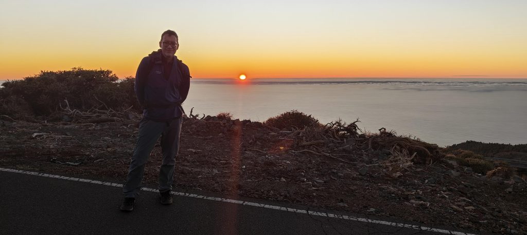
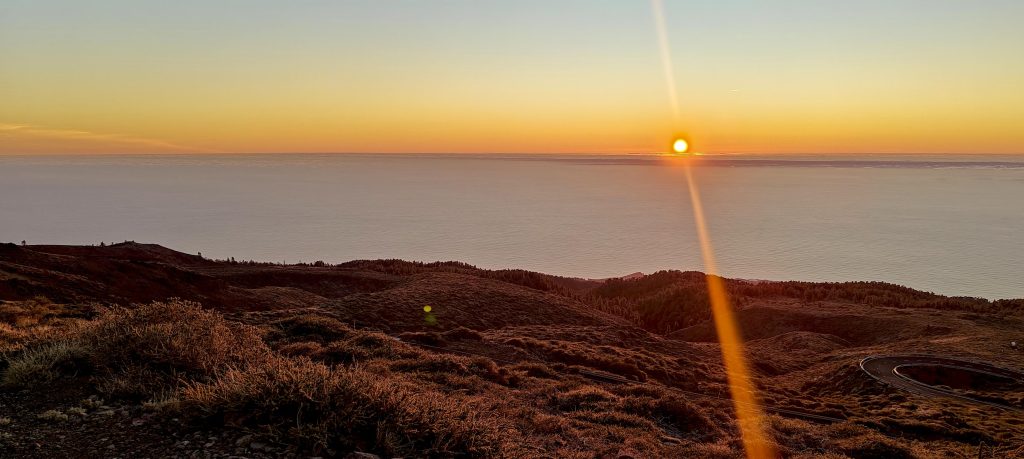
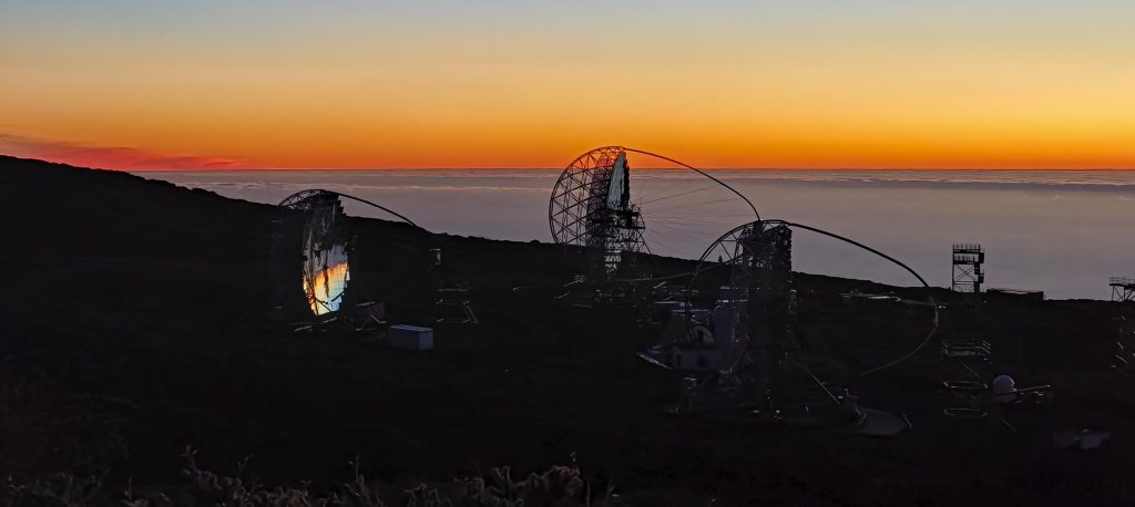
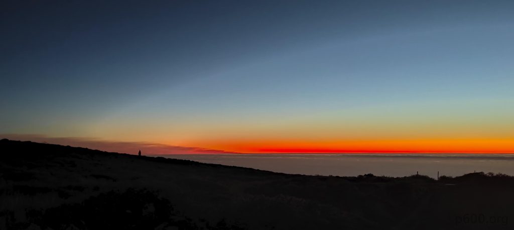
It’s been a double beautiful day; in the morning, we had a memorable climb and bagged El Morrón de la Agujereada. Now, we’re repeating the same on a different island just a few hundred kilometers away. Two ultras in one day—730 ultras a year… Oops, stop dreaming, back to reality. On the way down, we’re treated to an amazing sunset, but what truly amazed me were the astronomers and their gear. Gear awaken like robots, swiftly targeting points in the deep universe, collecting terabytes of data for further analysis. A few bytes may provide clues for professors, students, or even AI, leading to new discoveries. But I’m dreaming again…

A crimson line marks the horizon at sunset.

We need to head back to the hotel and find some snacks. We weren’t sure if we’d succeed in the evening, so we booked afternoon flights for the next day. But now that it’s done, John booked another morning flight, while I stick with the same one. After dropping him off at the airport in the morning, I’ll try to find a short hike. Peaks like Montaña Quemada look exactly like what I’m looking for.


Roque de los Muchachos2428 m altitude
2428 m prominence
128.64 km isolation
RangesMid-Atlantic Islands - North Atlantic Islands
Countries/regionsSpain - Islas Canarias
Distance4.50 km up3.50 km down
Elevation313 m gain313 m loss
Time
0h50 up
0h20 other
0h40 down
1h50 total
Trailhead2149 m altitude28.7646110, -17.8941940
RoutePark near a building and walk along the paved road all the way to the top. A few hundred meters before the summit, there's an official, marked shortcut trail. While waiting for the right moment, I also visited a nearby viewpoint in the southeast. Return via the same route just before it gets dark.
DifficultiesFind a moment when there are no tourists or park rangers around to reach the true high point.
LinksGPX trail
  • Mid-Atlantic Islands 2024
  • « El Morrón de la Agujereada
  • Montaña Quemada »

Mountain Ranges

Anatolia
Central Anatolia
Pontic Mountains
Southeast Anatolia
Taurus Mountains
Western Anatolia
Andes
Puna de Atacama
Atlas Mountains
High Atlas
Northwestern Atlas
Central America Ranges
Costa Rica-Panama Ranges
Central Central America
East China
Taiwan
Eastern Europe Ranges
Southeast Baltic Plains
Iberian Peninsula
Cordillera Cantabrica
Castile Ranges
Portugal-Galicia
Pyrenees
Intermountain West
Great Basin Ranges
Korea-Amur Area
Taebaek Sanmae
Malay Archipelago
Java
Nusa Tengarra
Sulawesi
Sumatra
Mid-Atlantic Islands
North Atlantic Islands
Mongolia Ranges
Altai
Gobi Desert Ranges
Hangay Mountains
Northwest Europe
Great Britain
North France-West Rhine Area
Pacific Ranges
Cascade Range
Northwest U.S. Coast Ranges
Sierra Nevada
Central and Southern California Ranges
Philippines
Central Philippines
Luzon
Mindanao
Southeast Asia
Malay Peninsula
Southeast South America
Pampas
Sierras de Cordoba
Southern Africa
Malawi Highlands
West Africa Mountains
Bight of Benin
Cameroon Mountains
Guinea Highlands

Countries / regions

Algeria
Ain Guezzam
Ain Salah
Aïn Témouchent
El Bayadh
Ghardaïa
Oran
Ouargla
Saïda
Sidi Bel Abbès
Tamanrasset
Argentina
Catamarca
Ciudad Autónoma de Buenos Aires
Córdoba
Jujuy
Salta
Tucumán
Belgium
Brussels Capital Region
Flemish Region
Cameroon
Southwest
China
Taiwan
Costa Rica
Alajuela
Cartago
Guanacaste
Heredia
Limón
San José
Czechia
Prague
Denmark
Greenland
France
Hauts-de-France
Occitania
Germany
Berlin
Niedersachsen
Indonesia
Bali
Jambi
Jawa Tengah
Jawa Timur
Nusa Tenggara Barat
Sulawesi Tengah
Sulawesi Utara
Sumatera Barat
Lithuania
Vilnius County
Mongolia
Bayankhongor
Govi-Altai
Khovd
Omnogovi
Ovorkhangai
Ulan Bator
Zavkhan
Morocco
Béni Mellal-Khénifra
Drâa-Tafilalet
Fez-Meknes
Marrakesh-Safi
Souss-Massa
Tangier-Tetouan-Al Hoceima
Mozambique
Zambezia
Netherlands
Gelderland
Noord-Holland
Zeeland
Nicaragua
Chinandega
Managua
Masaya
Rivas
Philippines
Bicol Region (V)
Cagayan Valley (II)
Calabarzon (IV-A)
Central Luzon (III)
Cordillera Administrative Region
Davao Region
Metro Manila
Soccsksargen (XII)
Western Visayas (VI)
Poland
Greater Poland Voivodeship
Masovian Voivodeship
Portugal
Castelo Branco
Leiria
Lisbon
Madeira
Santarém
Qatar
Ad-Dawhah
São Tomé and Príncipe
São Tomé Province
Sierra Leone
Northern Province
Western Area
Singapore
South Korea
Gyeongsangnam-do
Seoul
Spain
Aragón
Asturias
Castilla-La Mancha
Castilla y León
Catalonia
Islas Canarias
Switzerland
Zürich
Turkey
Antalya
Bitlis
Erzincan
Hakkâri
Igdir
Isparta
Kahraman Maras
Muğla
United Kingdom
England
Scotland
United States
California
Delaware
Florida
Maryland
Nevada
New Jersey
New York
Pennsylvania
South Carolina
Utah

TRIPS

2024
Southern Africa 2024
Mid-Atlantic Islands 2024
North America 2024
Anatolia 2024
Korea-Amur Area 2024
East China 2024
2023
Mongolia Ranges 2023
Philippines 2023
West Africa III 2023
West Africa II 2023
Iberian Peninsula 2023
West Africa 2023
Central America 2023
2022
Andes 2022
Northwest Europe 2022
Malay Archipelago III 2022
Malay Archipelago II 2022
Anatolia Mountains 2022
Iberian Peninsula 2022
Atlas Mountains 2022
North France-West Rhine Area 2022

archaeology (3) climb (157) food (2) hike (155) p30 (17) p50 (4) p100 (24) p300 (12) p600 (17) p1000 (11) p1500 (76) ribu (10) sight (46) summary (16) trig (44) ultra (76)

1 591 km walked, 121 298 m climbed

©2025 p600.org | WordPress Theme by Superbthemes.com