Skip to content
Menu
p600.org
  • home
  • map
  • trips
  • about
p600.org

Pico do Castanho

hike | 2024-04-07

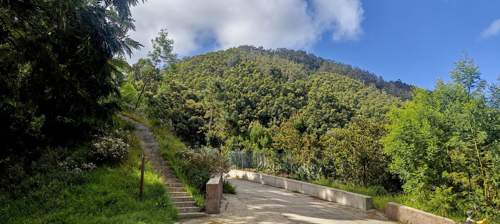
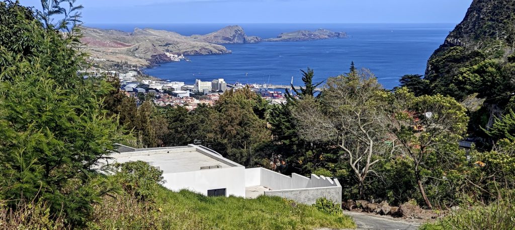
Looking for a peaceful alternative to Pico do Furado’s hustle and bustle? A relaxing drive on winding Madeiran roads (don’t worry, the switchbacks are manageable!) leads me to the Pico do Castanho trailhead. This cozy parking lot, sized for a small adventure crew (think 3-4 cars!), welcomes me with open asphalt. Looking back, I see the peak in the trees. It doesn’t look high, and it isn’t. Just a couple hundred meters of vertical ascent. Shoes laced up, and i’m off to explore Pico do Castanho!

The trail starts right there, in front of the ‘big’ hill I see from the parking lot. Good news, the climb starts with some friendly stairs

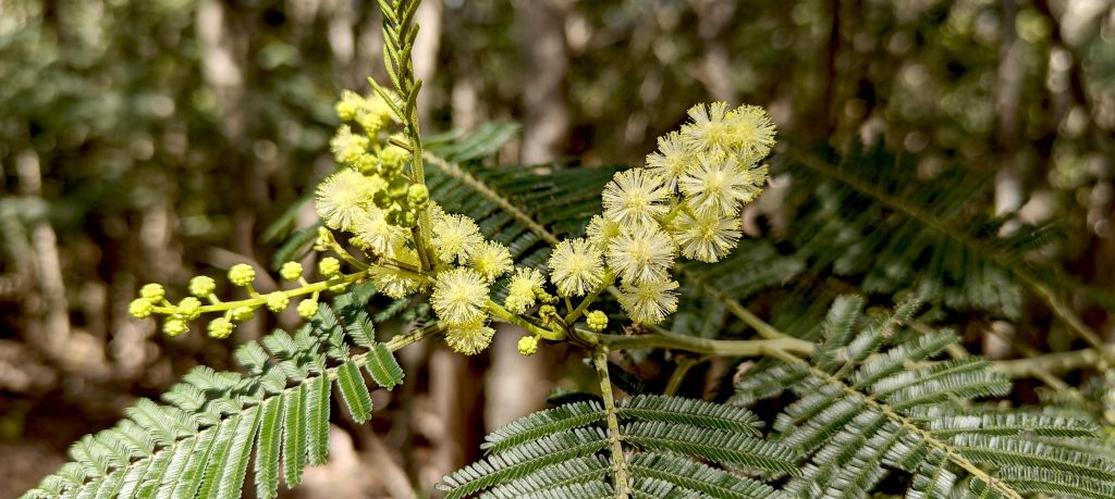
Surprise! Unlike the well-documented Pico do Furado, Pico do Castanho seems to be a hidden gem among peakbaggers. While I braced myself for some bushwhacking, the trail unfolded before me – well-maintained and cleverly designed with switchbacks to ease the climb. Dotting the route were a few simple shelters or perhaps even old farmhouses, their surrounding fruit trees bursting with life.

Get ready for a leg workout! The trail climbs steadily, but don’t be discouraged – those micro switchbacks will help you conquer the incline.
And for the steeper sections, fear not, trusty handrails are there to lend a helping hand!
The dense forest gives way to a rare opening, offering a glimpse of the path ahead.
Hold on a sec, did my eyes deceive me? Swear I just spotted a black wattle (Acacia mearnsii) on the way up. Now, this Aussie import shouldn’t be chilling in Madeira!
Suddenly, a break in the trees! A hidden view of Cabo São Vicente with Pico do Furado shimmers in the distance – my morning reward!.

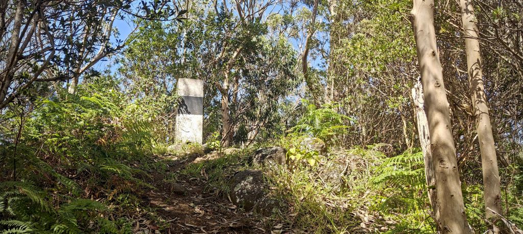
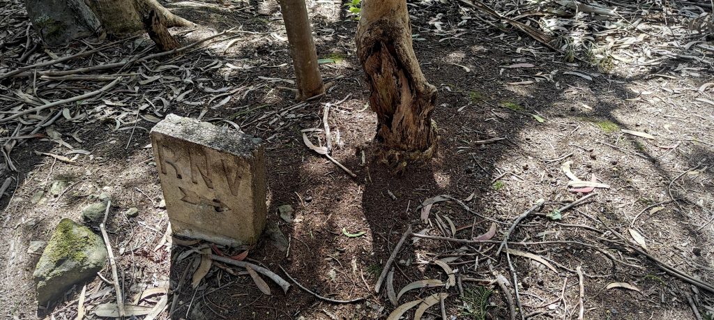
Engrossed in conversation with Ingrid on the phone, I nearly miss the summit! Thankfully, the usual black and white trig pillar stands out, marking the peak. My phone GPS shows an altitude of 624m, but I know satellite readings aren’t always perfect. Since I have a topographical map, I head towards the bump, about 220m to the north. Reaching it, my GPS shows 619m elevation, but matching the peakbagger location. Dense forest blocks any view, and without a hand level, I can’t definitively say which is higher.

Intriguingly, even though the topographical map shows the same elevation for both peaks, two factors nudge me towards the south bump as the true high point. First, the presence of the trusty trig pillar – a indicator, although not absolute, of the highest point. Second, my GPS, despite its potential for margin of error, consistently reads a slightly higher elevation for the south bump. On the return trip, another measurement confirms 624m for the south peak. These arguments might not be flawless, but with limited tools, quantity becomes quality! Two imperfect pieces of evidence feel more persuasive than blindly following the peakbagger app. Therefore, I’m crowning the south bump the victor, even though I’ve bagged both!

Just past the hidden view, a lone trig pillar greet me – a curious relic from surveying days.
The trail reaches its peak, but don’t get your hopes up for a grand vista.
Etched on a nearby rock is a curious symbol – RNV with an arrow. Beats a dead end, right?
The descent offers a final farewell to Cabo São Vicente with Pico do Furado.

Pico do Castanho, interestingly enough, translates to “Brown Peak.” While the name might conjure images of a more barren landscape, I found it to be a vibrantly green and thoroughly enjoyable hike. Two things made it particularly special: having the entire trail to myself and the fact that, to date, no other peakbagers seems to have documented it online. I’m confident I have enough daylight left to tackle at least three more peaks: Pico da Coroa, Penha d’Águia, and finally, Pico do Facho.


Pico do Castanho626 m altitude
251 m prominence
15.41 km isolation
RangesMid-Atlantic Islands - North Atlantic Islands
Countries/regionsPortugal - Madeira
Distance1.20 km up1.80 km down
Elevation269 m gain269 m loss
Time
0h40 up
0h05 other
0h40 down
1h25 total
Trailhead396 m altitude32.7365830, -16.7641380
RouteConcrete steps lead up from the parking lot, but these soon give way to a steeper trail. Thankfully, micro switchbacks make the climb more manageable. Reaching the top, the path flattens out to a pleasant walk through the forest. Unlike typical Madeiran hikes, this route offered the welcome bonus of shade for the entire journey! The descent followed the same route.
LinksGPX trail
  • Mid-Atlantic Islands 2024
  • « Pico do Furado
  • Pico da Coroa »

Mountain Ranges

Anatolia
Central Anatolia
Pontic Mountains
Southeast Anatolia
Taurus Mountains
Western Anatolia
Andes
Puna de Atacama
Atlas Mountains
High Atlas
Northwestern Atlas
Central America Ranges
Costa Rica-Panama Ranges
Central Central America
East China
Taiwan
Eastern Europe Ranges
Southeast Baltic Plains
Iberian Peninsula
Cordillera Cantabrica
Castile Ranges
Portugal-Galicia
Pyrenees
Intermountain West
Great Basin Ranges
Korea-Amur Area
Taebaek Sanmae
Malay Archipelago
Java
Nusa Tengarra
Sulawesi
Sumatra
Mid-Atlantic Islands
North Atlantic Islands
Mongolia Ranges
Altai
Gobi Desert Ranges
Hangay Mountains
Northwest Europe
Great Britain
North France-West Rhine Area
Pacific Ranges
Cascade Range
Northwest U.S. Coast Ranges
Sierra Nevada
Central and Southern California Ranges
Philippines
Central Philippines
Luzon
Mindanao
Southeast Asia
Malay Peninsula
Southeast South America
Pampas
Sierras de Cordoba
Southern Africa
Malawi Highlands
West Africa Mountains
Bight of Benin
Cameroon Mountains
Guinea Highlands

Countries / regions

Algeria
Ain Guezzam
Ain Salah
Aïn Témouchent
El Bayadh
Ghardaïa
Oran
Ouargla
Saïda
Sidi Bel Abbès
Tamanrasset
Argentina
Catamarca
Ciudad Autónoma de Buenos Aires
Córdoba
Jujuy
Salta
Tucumán
Belgium
Brussels Capital Region
Flemish Region
Cameroon
Southwest
China
Taiwan
Costa Rica
Alajuela
Cartago
Guanacaste
Heredia
Limón
San José
Czechia
Prague
Denmark
Greenland
France
Hauts-de-France
Occitania
Germany
Berlin
Niedersachsen
Indonesia
Bali
Jambi
Jawa Tengah
Jawa Timur
Nusa Tenggara Barat
Sulawesi Tengah
Sulawesi Utara
Sumatera Barat
Lithuania
Vilnius County
Mongolia
Bayankhongor
Govi-Altai
Khovd
Omnogovi
Ovorkhangai
Ulan Bator
Zavkhan
Morocco
Béni Mellal-Khénifra
Drâa-Tafilalet
Fez-Meknes
Marrakesh-Safi
Souss-Massa
Tangier-Tetouan-Al Hoceima
Mozambique
Zambezia
Netherlands
Gelderland
Noord-Holland
Zeeland
Nicaragua
Chinandega
Managua
Masaya
Rivas
Philippines
Bicol Region (V)
Cagayan Valley (II)
Calabarzon (IV-A)
Central Luzon (III)
Cordillera Administrative Region
Davao Region
Metro Manila
Soccsksargen (XII)
Western Visayas (VI)
Poland
Greater Poland Voivodeship
Masovian Voivodeship
Portugal
Castelo Branco
Leiria
Lisbon
Madeira
Santarém
Qatar
Ad-Dawhah
São Tomé and Príncipe
São Tomé Province
Sierra Leone
Northern Province
Western Area
Singapore
South Korea
Gyeongsangnam-do
Seoul
Spain
Aragón
Asturias
Castilla-La Mancha
Castilla y León
Catalonia
Islas Canarias
Switzerland
Zürich
Turkey
Antalya
Bitlis
Erzincan
Hakkâri
Igdir
Isparta
Kahraman Maras
Muğla
United Kingdom
England
Scotland
United States
California
Delaware
Florida
Maryland
Nevada
New Jersey
New York
Pennsylvania
South Carolina
Utah

TRIPS

2024
Southern Africa 2024
Mid-Atlantic Islands 2024
North America 2024
Anatolia 2024
Korea-Amur Area 2024
East China 2024
2023
Mongolia Ranges 2023
Philippines 2023
West Africa III 2023
West Africa II 2023
Iberian Peninsula 2023
West Africa 2023
Central America 2023
2022
Andes 2022
Northwest Europe 2022
Malay Archipelago III 2022
Malay Archipelago II 2022
Anatolia Mountains 2022
Iberian Peninsula 2022
Atlas Mountains 2022
North France-West Rhine Area 2022

archaeology (3) climb (157) food (2) hike (155) p30 (17) p50 (4) p100 (24) p300 (12) p600 (17) p1000 (11) p1500 (76) ribu (10) sight (46) summary (16) trig (44) ultra (76)

1 591 km walked, 121 298 m climbed

©2025 p600.org | WordPress Theme by Superbthemes.com