Skip to content
Menu
p600.org
  • home
  • map
  • trips
  • about
p600.org

Kesis Dağı

hike | 2024-07-19

After climbing Akbaba Tepesi, we realized Sabri, one of our drivers, wasn’t just good company—he’s also an avid hiker. He joined us on the ascent, slower but determined, earning a well-deserved pat on the back. On the way down, I asked if he’d drive us to Kessi Dagi the next morning before our flight. He agreed, and just like that, we had a plan.

The next morning, we met Sabri at the hotel and headed off toward another ultra-prominent peak. Sabri suggested approaching from the south, but a quick map check showed it was the long, scenic route—great for a leisurely day, but we had a plane to catch. We needed to be back at Erzincan airport by 2 pm. The northern route offered two options: the shorter, eastward path, possibly still under construction (it’s been a work-in-progress for a decade), or the longer, westward road, likely paved. We rolled the dice on the shorter option. Despite some construction, we made it through.

The landscape oddly resembles Scotland, with a few unexpectedly scenic lakes.

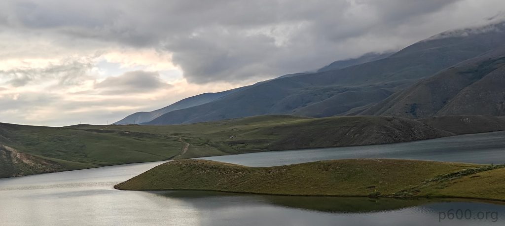
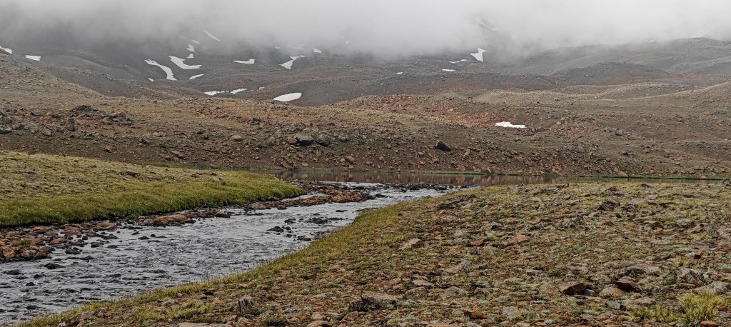
The road to the trailhead was in decent shape, recently flattened, but a high-clearance vehicle was crucial for creek crossings. Without it, you’d be adding a few extra kilometers to your hike—a delightful surprise, no doubt.

We park by a small lake that just happens to have a charming waterfall.
The summit hides in the clouds. Upper lake on the way.

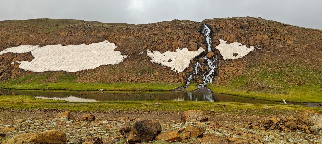
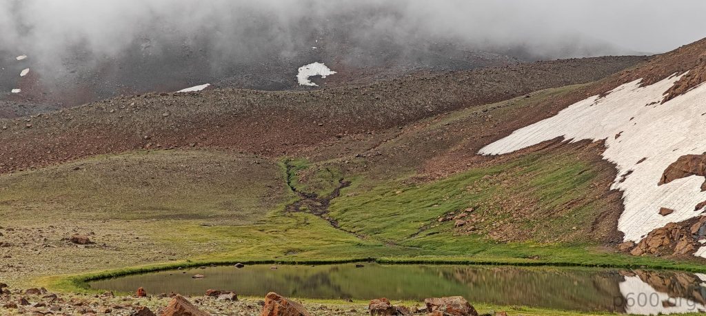
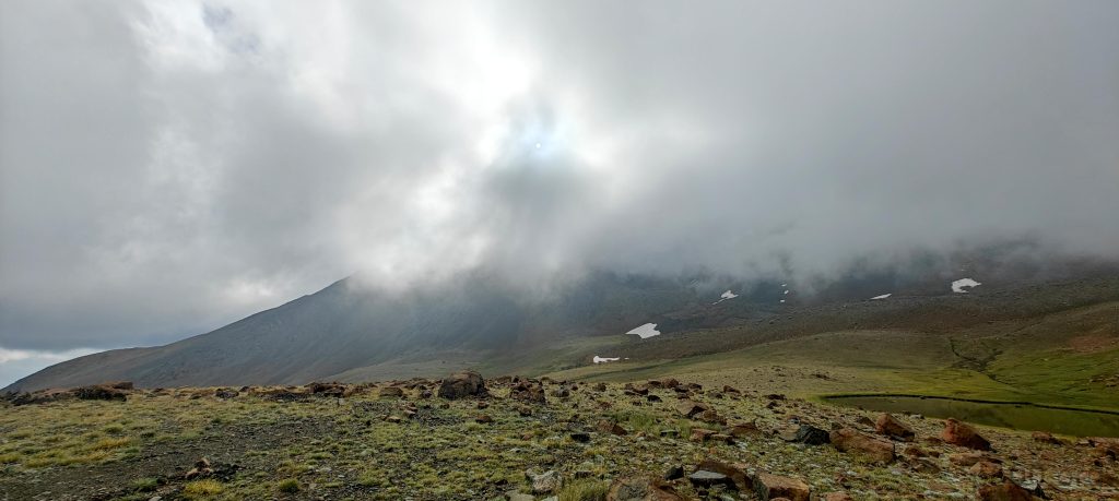
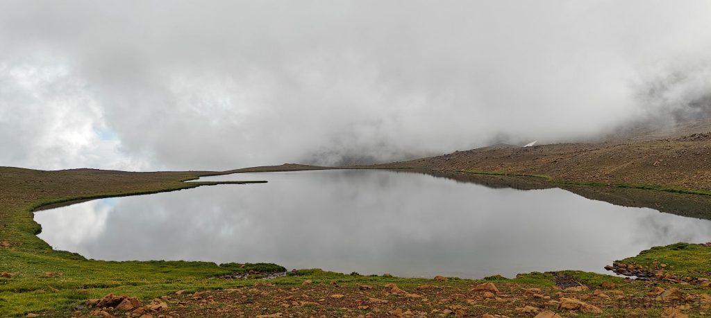
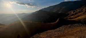
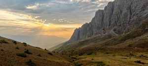
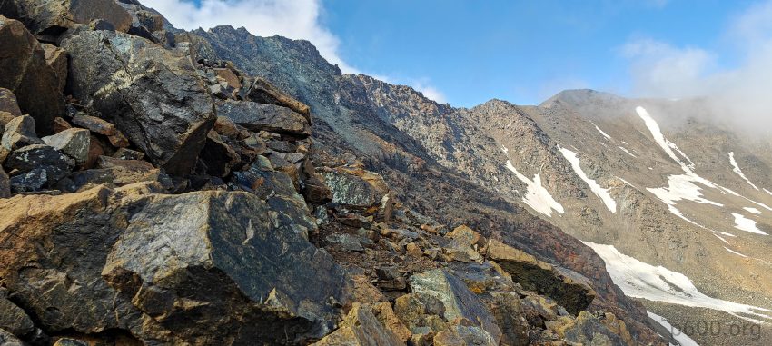
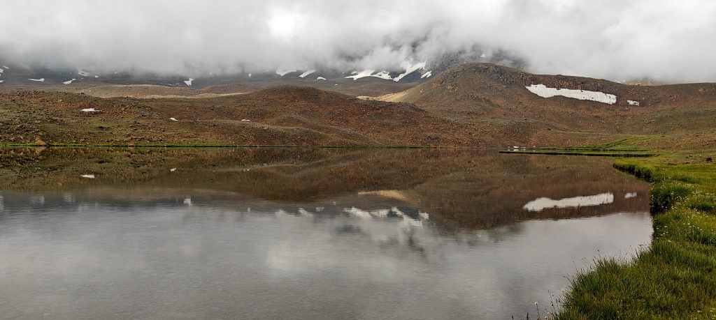
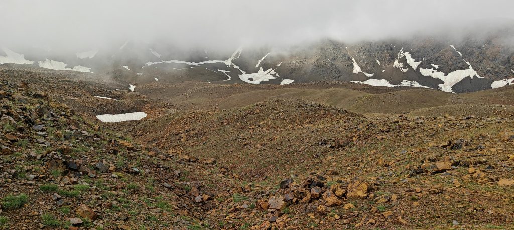
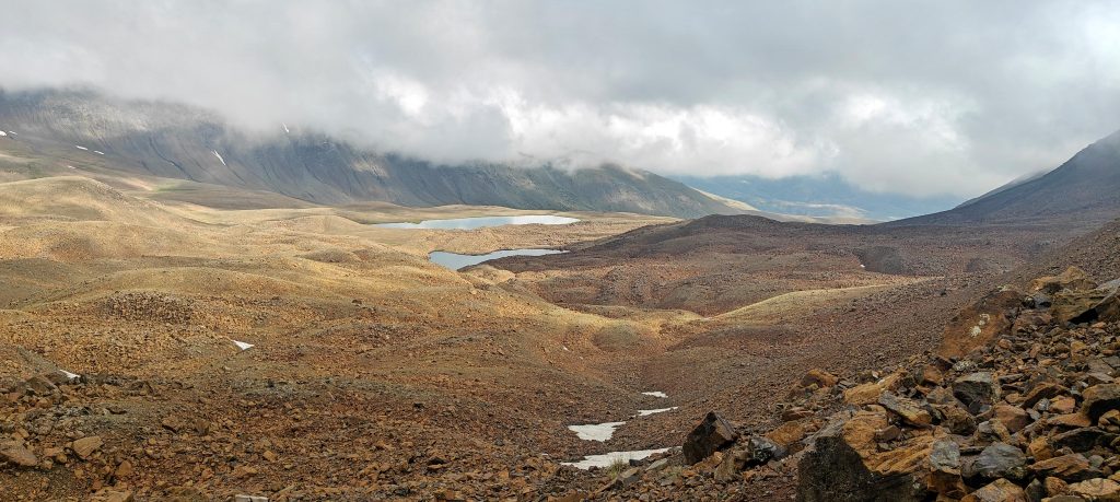
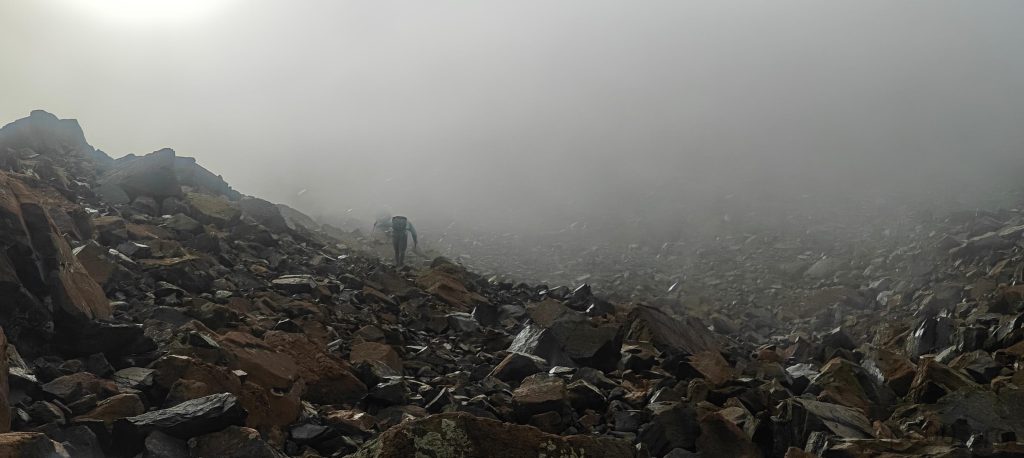
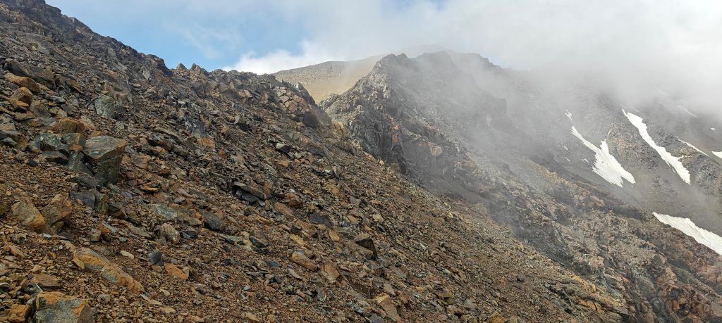
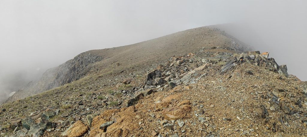
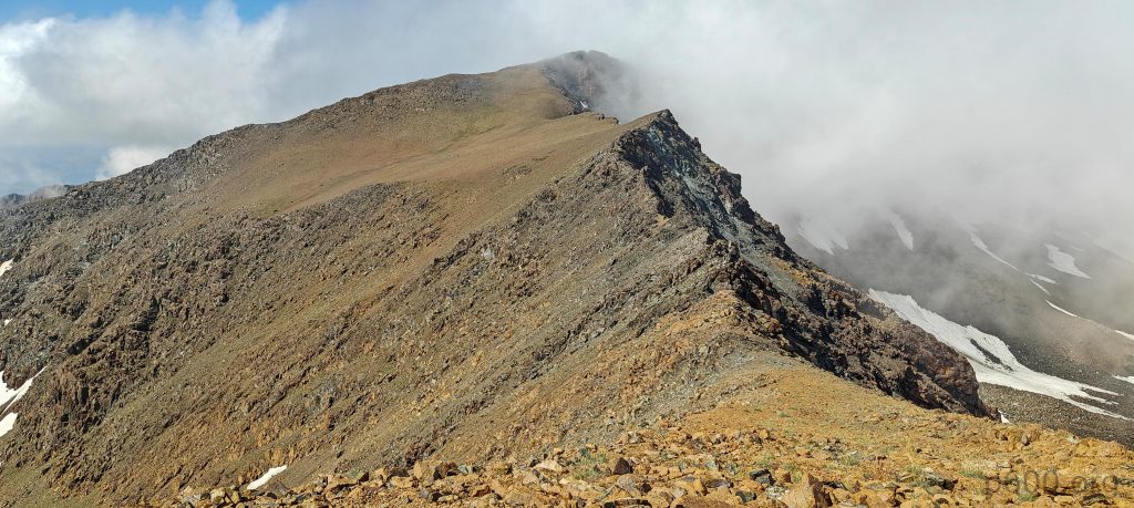
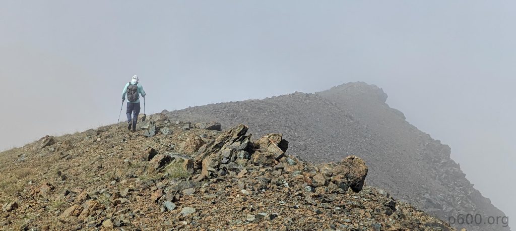
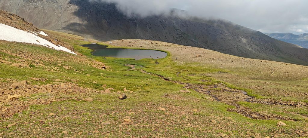
We parked near a picturesque lake with a waterfall, geared up, and started hiking. The initial slopes were a breeze, leading us to an upper lake, which we circled on the right. Then, the terrain got serious—rocky, rugged, and enough descents and re-ascents to slow us down considerably. We found a faint trail, which helped on the loose terrain. A few hundred meters later, we hit the ridge and finally got some sunshine. The ridge walk was a pleasant, gradual climb over grassy terrain.

The view from the trailhead stretches toward the summit slopes.
We pass the upper lake on the right side on the way up and from the opposite side on the way down.
The plateau isn’t as flat as you’d hope, more like a rugged rocky field with endless micro ups and downs.
From the steep summit slope, you can spot two upper lakes and the rugged plateau below.
Dave’s on a moon mission—sorry, I meant he’s en route to Kesis Dağı.
We’re finally approaching the ridge.
Looking down from the ridge.
The ridge view near the summit.
The wooden summit plate reads “Esence Dağı 3549m (EDKIK),” a name quite different from what’s on the maps.
The summit photo features Dave, Steven, and me.

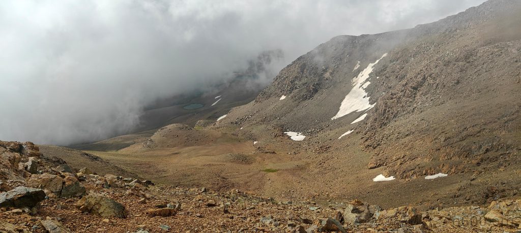
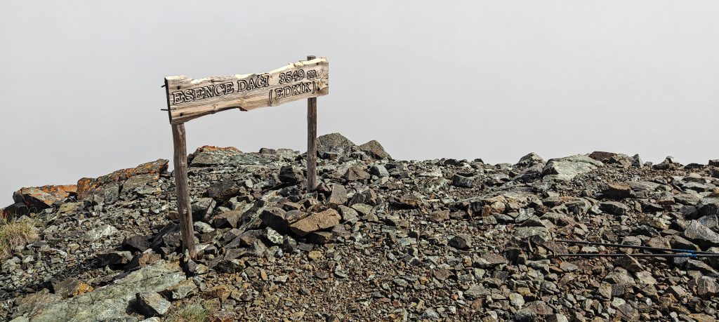
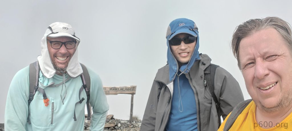
At the summit, we found a wooden plate with a name Esence Dağı 3549m —a bit of unexpected trivia. We snapped our usual selfie, enjoyed an apple, and started our descent. On the rugged plateau, we took a shortcut to the right, heading straight to the car, where Sabri and Adam were waiting. Adam wisely skipped this peak after some altitude issues on Ararat—probably for the best.

The skies clear just enough to reveal the ridge.
Steven and Dave are on the ridge.
We’re back at the trailhead lake,

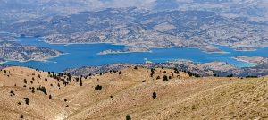
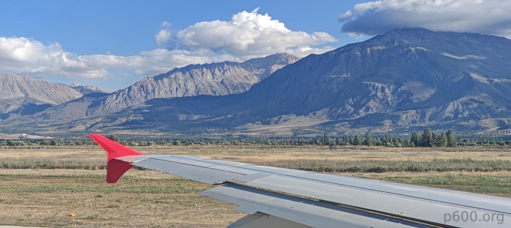
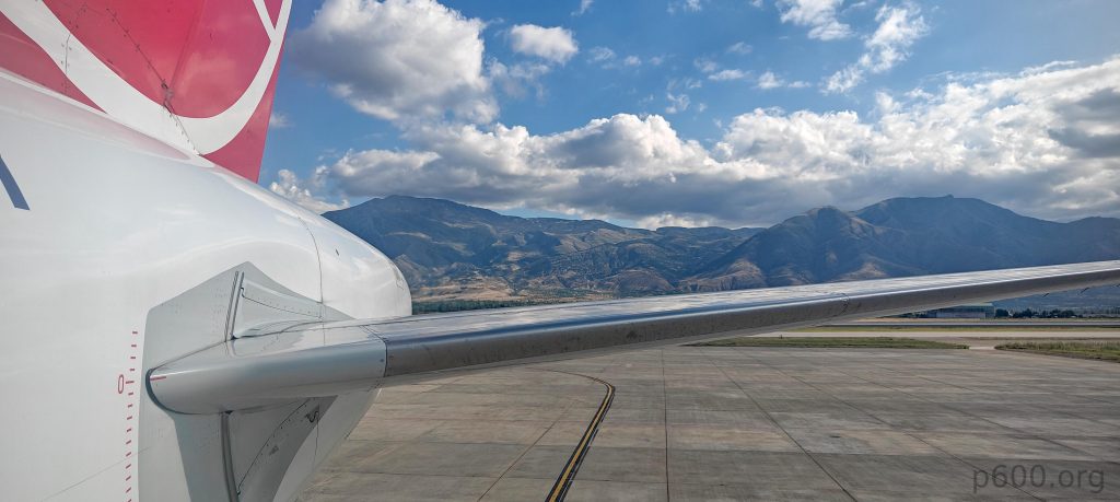
It was a fantastic day, another ultra-prominent peak added to our list. This one was fifty meters taller than Akbaba Tepesi, with a solid 142 km of isolation. We drove back to Erzincan airport, taking a longer but well-paved road on Sabri’s suggestion. It was the right call. We arrived at the airport with plenty of time to relax before our flight. For Dave, this was his last planned peak in Turkey before heading to Kazakhstan for Gora Belukha. Steven and Adam were off to Norway for more peaks, while I was bound for Istanbul. Ironically, I’d almost fly back to Gaziantep to meet Rob for another climb—Uludaz and Killi Tepe. The world’s both small and vast when you’re a peakbagger!

Erzincan Airport is nestled amid impressive mountains.
The Istanbul Airport domestic flights table is impressively long, showcasing a multitude of morning flights alone.

Steven’s account of our hike can be found here.


Kesis Dağı3546 m altitude
1559 m prominence
142.14 km isolation
RangesAnatolia - Pontic Mountains
Countries/regionsTurkey - Erzincan
Distance3.60 km up3.40 km down
Elevation770 m gain770 m loss
Time
1h50 up
0h10 other
1h00 down
3h00 total
Trailhead2924 m altitude39.8074750, 39.7557420
RoutePark at the end of the road near a lake with a waterfall at an elevation of 2925 m. The road is manageable but requires a high-clearance vehicle for the stream crossing. Begin the hike by ascending to the ridge and heading right around the larger lake. The terrain beyond the lake is rough with lava rocks, making route finding challenging. Climb a steep, rocky slope to the ridge, following a faint trail. Once on the ridge, it’s an easy, gradual walk to the summit, marked by a stone wind shelter and a sign labeled Esence Dagi. Descend via the same route, navigating right of the lake to return to the car.
DifficultiesLoose rocks on the summit plateau slope.
LinksGPX trail
  • Anatolia 2024
  • « Akbaba Tepesi
  • Ahirdaği »

Mountain Ranges

Anatolia
Central Anatolia
Pontic Mountains
Southeast Anatolia
Taurus Mountains
Western Anatolia
Andes
Puna de Atacama
Atlas Mountains
High Atlas
Northwestern Atlas
Central America Ranges
Costa Rica-Panama Ranges
Central Central America
East China
Taiwan
Eastern Europe Ranges
Southeast Baltic Plains
Iberian Peninsula
Cordillera Cantabrica
Castile Ranges
Portugal-Galicia
Pyrenees
Intermountain West
Great Basin Ranges
Korea-Amur Area
Taebaek Sanmae
Malay Archipelago
Java
Nusa Tengarra
Sulawesi
Sumatra
Mid-Atlantic Islands
North Atlantic Islands
Mongolia Ranges
Altai
Gobi Desert Ranges
Hangay Mountains
Northwest Europe
Great Britain
North France-West Rhine Area
Pacific Ranges
Cascade Range
Northwest U.S. Coast Ranges
Sierra Nevada
Central and Southern California Ranges
Philippines
Central Philippines
Luzon
Mindanao
Southeast Asia
Malay Peninsula
Southeast South America
Pampas
Sierras de Cordoba
Southern Africa
Malawi Highlands
West Africa Mountains
Bight of Benin
Cameroon Mountains
Guinea Highlands

Countries / regions

Algeria
Ain Guezzam
Ain Salah
Aïn Témouchent
El Bayadh
Ghardaïa
Oran
Ouargla
Saïda
Sidi Bel Abbès
Tamanrasset
Argentina
Catamarca
Ciudad Autónoma de Buenos Aires
Córdoba
Jujuy
Salta
Tucumán
Belgium
Brussels Capital Region
Flemish Region
Cameroon
Southwest
China
Taiwan
Costa Rica
Alajuela
Cartago
Guanacaste
Heredia
Limón
San José
Czechia
Prague
Denmark
Greenland
France
Hauts-de-France
Occitania
Germany
Berlin
Niedersachsen
Indonesia
Bali
Jambi
Jawa Tengah
Jawa Timur
Nusa Tenggara Barat
Sulawesi Tengah
Sulawesi Utara
Sumatera Barat
Lithuania
Vilnius County
Mongolia
Bayankhongor
Govi-Altai
Khovd
Omnogovi
Ovorkhangai
Ulan Bator
Zavkhan
Morocco
Béni Mellal-Khénifra
Drâa-Tafilalet
Fez-Meknes
Marrakesh-Safi
Souss-Massa
Tangier-Tetouan-Al Hoceima
Mozambique
Zambezia
Netherlands
Gelderland
Noord-Holland
Zeeland
Nicaragua
Chinandega
Managua
Masaya
Rivas
Philippines
Bicol Region (V)
Cagayan Valley (II)
Calabarzon (IV-A)
Central Luzon (III)
Cordillera Administrative Region
Davao Region
Metro Manila
Soccsksargen (XII)
Western Visayas (VI)
Poland
Greater Poland Voivodeship
Masovian Voivodeship
Portugal
Castelo Branco
Leiria
Lisbon
Madeira
Santarém
Qatar
Ad-Dawhah
São Tomé and Príncipe
São Tomé Province
Sierra Leone
Northern Province
Western Area
Singapore
South Korea
Gyeongsangnam-do
Seoul
Spain
Aragón
Asturias
Castilla-La Mancha
Castilla y León
Catalonia
Islas Canarias
Switzerland
Zürich
Turkey
Antalya
Bitlis
Erzincan
Hakkâri
Igdir
Isparta
Kahraman Maras
Muğla
United Kingdom
England
Scotland
United States
California
Delaware
Florida
Maryland
Nevada
New Jersey
New York
Pennsylvania
South Carolina
Utah

TRIPS

2024
Southern Africa 2024
Mid-Atlantic Islands 2024
North America 2024
Anatolia 2024
Korea-Amur Area 2024
East China 2024
2023
Mongolia Ranges 2023
Philippines 2023
West Africa III 2023
West Africa II 2023
Iberian Peninsula 2023
West Africa 2023
Central America 2023
2022
Andes 2022
Northwest Europe 2022
Malay Archipelago III 2022
Malay Archipelago II 2022
Anatolia Mountains 2022
Iberian Peninsula 2022
Atlas Mountains 2022
North France-West Rhine Area 2022

archaeology (3) climb (157) food (2) hike (155) p30 (17) p50 (4) p100 (24) p300 (12) p600 (17) p1000 (11) p1500 (76) ribu (10) sight (46) summary (16) trig (44) ultra (76)

1 591 km walked, 121 298 m climbed

©2025 p600.org | WordPress Theme by Superbthemes.com