Skip to content
Menu
p600.org
  • home
  • map
  • trips
  • about
p600.org

Kizlar Sivrisi

hike | 2022-09-21
3070 m altitude, 1966 m prominence, 369.54 km isolation

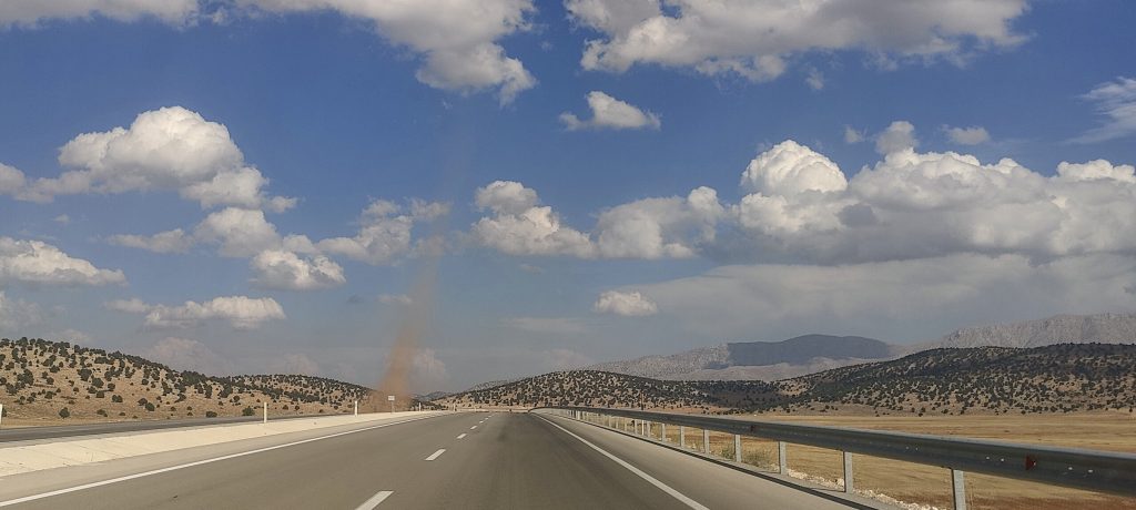
I get up with the sun, drive for a few hours. The last few kilometers are a good gravel road. I drive to the refuge, but I see that a road of similar quality goes further. I drive another kilometer or so and stop at a crossroads. I can see the path marked on the map and decide not to drive in the future on and start climbing.

Slopes are not very steep

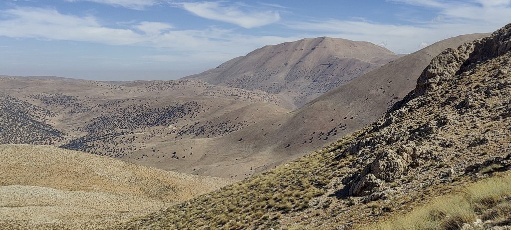
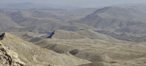
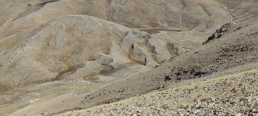
A slightly steeper slope at first, followed by a rather large but not steep stony field. I sometimes lose the trail, but it is not very necessary. I just walk towards the ridge I plan to climb to the top. I get to the ridge and see two options. The first option is to follow the map trail, but it is not actually visible. The second option is to follow kind of visible trail, but it is not on the map. I choose the second option.

I’m approaching the meadows towards the steep mountain wall
I can see the road, perhaps a closer approach was possible
I go around the steep wall from the left, towards the sloping ridge

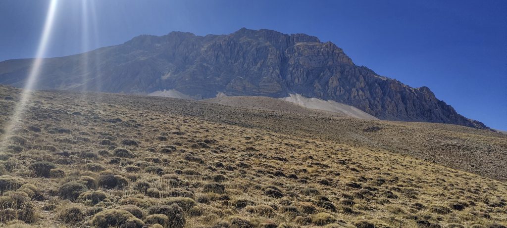
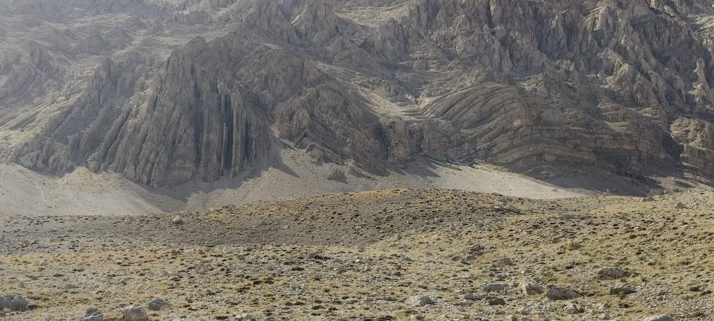
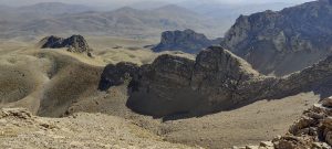
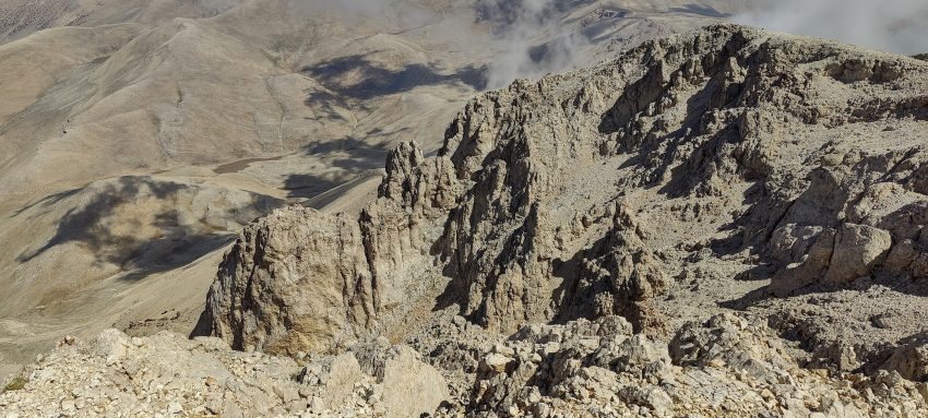
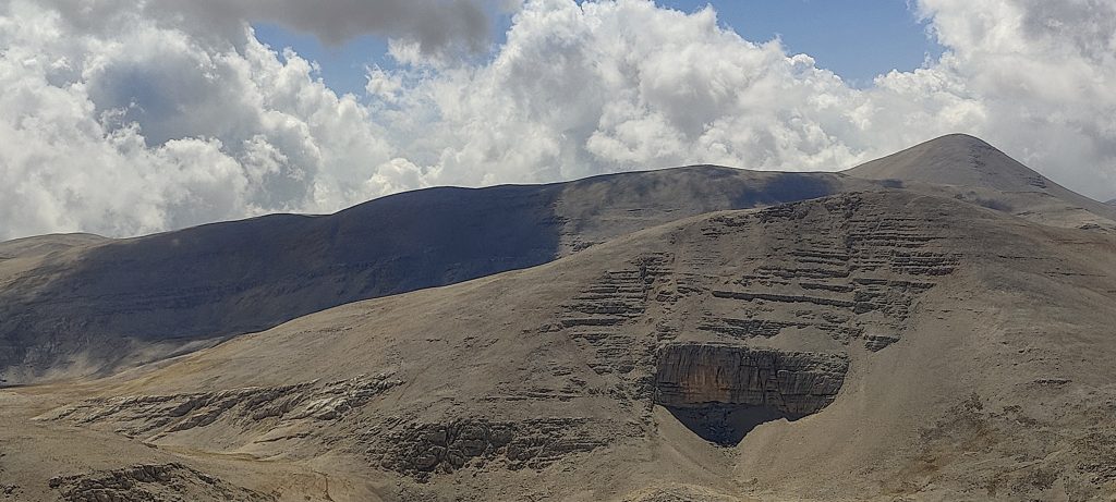
Several hundred vertical metres of steep stony slope. Every now and then a cairn marks the trail, giving me hope that I’m on the right track. It’s steep, with rocks sliding out from underfoot. I think it will be hard to climb down.

Fairly steep stony slope
Clouds are gathering on the other side of the mountain, but it’s clear above me
The last steps to the top of the ridge

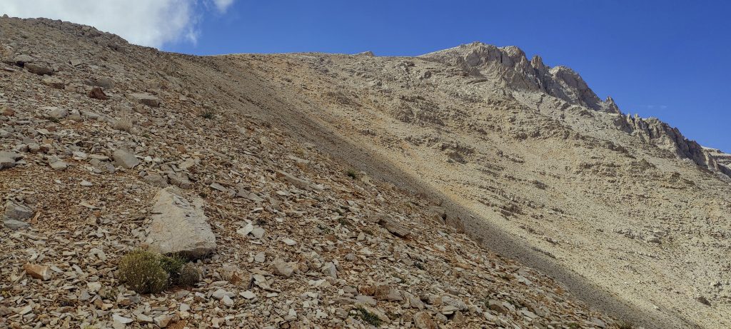
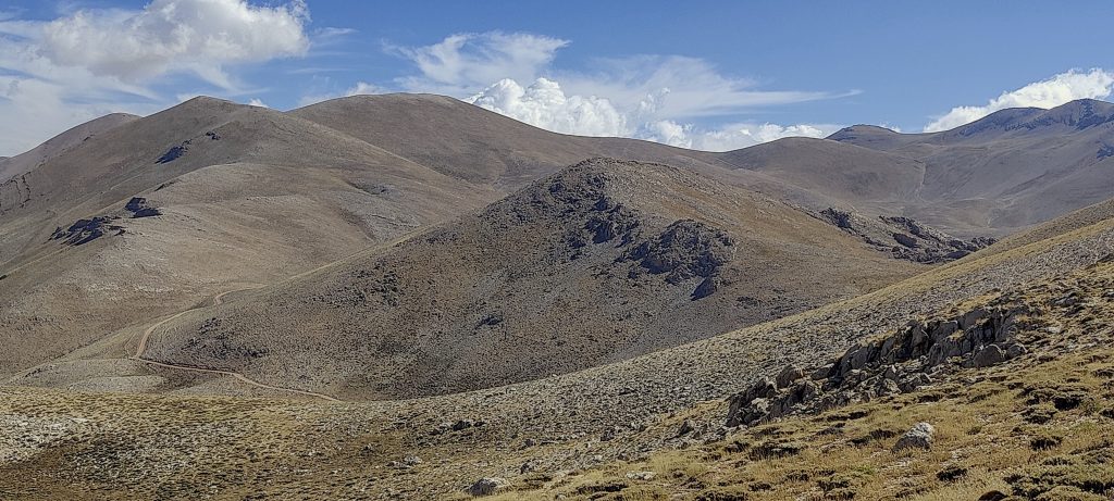
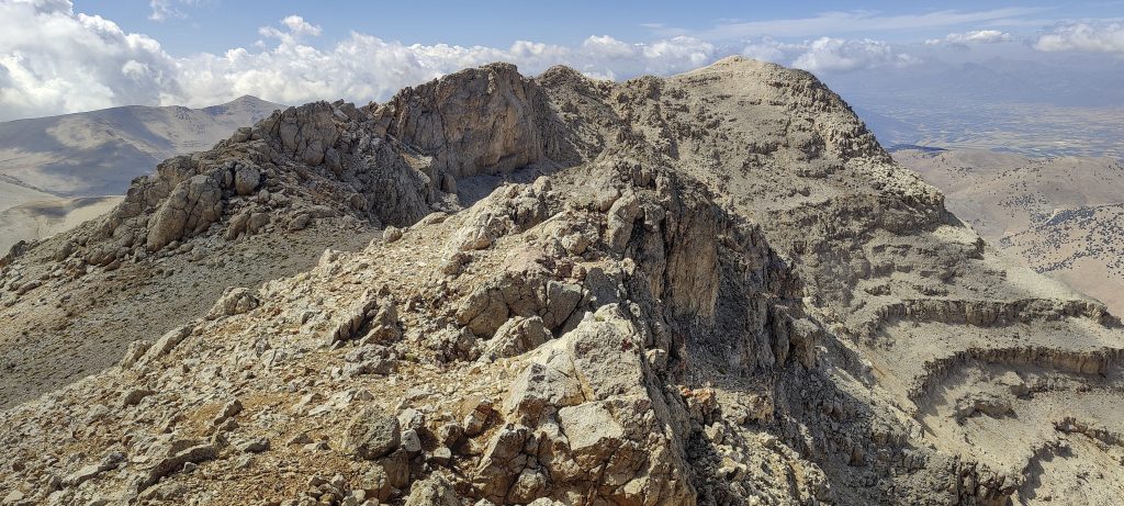
The top of the ridge is flat. Easy and comfortable. There is also a marked trail. I reach the false summit at the beginning, and after a few minutes I climb to the highest point

The top of the ridge is flat
False peak
View back
The clouds seem to be leaning against the mountain, not floating any closer

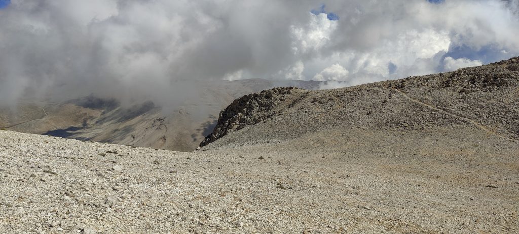
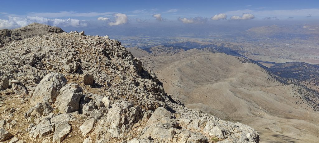
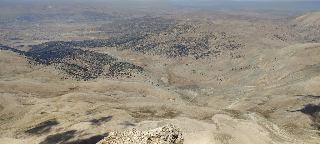
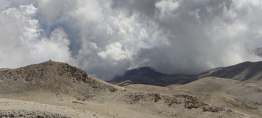
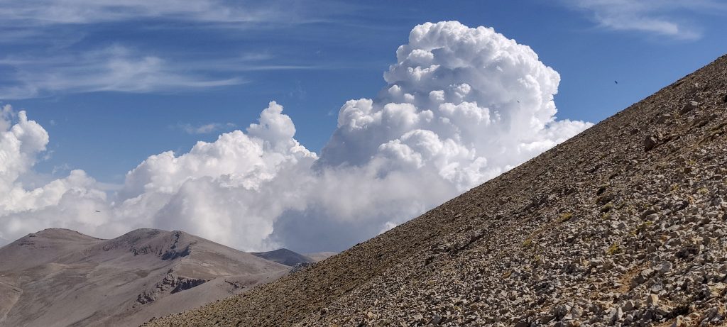
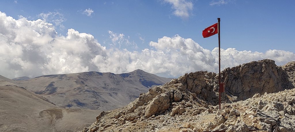
The flag flies at the summit. The clouds never inflated, great views. A few minutes and I’m climbing down on a similar route. This time I try to follow the Gaia map trail, avoiding the steep descent down the rocky slope. It works, although I have to traverse a few hundred metres without a trail, but it’s still more comfortable and easier.

The Turkish flag flies at the top
Views from the top
One more view from the top
Honey is an important product in Turkey (as elsewhere)
On the way back, I observe a small tornado

The second ultra peak of this trip. Great, I’m heading back to the hotel, I’ll still have time to jump in to the sea.


Kizlar Sivrisi 3070 m altitude
1966 m prominence
369.54 km isolation
Ranges Asia - Anatolia - Western Anatolia
Countries/regions Turkey - Antalya
Distance 3.90 km up 3.00 km down
Elevation 1022 m gain 1022 m loss
Time
2h20 up
0h10 other
1h40 down
4h10 total
Trailhead 2047 m altitude 36.6208610, 30.1058330
Difficulties

steep scree

Links GPX trail
  •  Anatolia Mountains 2022
  • « Geyik Daglari
  • Ancient city of Side »

Mountain Ranges

Anatolia
Taurus Mountains
Western Anatolia
Andes
Puna de Atacama
Atlas Mountains
High Atlas
Northwestern Atlas
Central America Ranges
Costa Rica-Panama Ranges
Central Central America
Eastern Europe Ranges
Southeast Baltic Plains
Iberian Peninsula
Cordillera Cantabrica
Castile Ranges
Portugal-Galicia
Pyrenees
Malay Archipelago
Java
Nusa Tengarra
Sulawesi
Sumatra
Northwest Europe
Great Britain
North France-West Rhine Area
Southeast South America
Pampas
Sierras de Cordoba
West Africa Mountains
Bight of Benin
Cameroon Mountains

Countries / regions

Algeria
Ain Guezzam
Ain Salah
Aïn Témouchent
El Bayadh
Ghardaïa
Oran
Ouargla
Saïda
Sidi Bel Abbès
Tamanrasset
Argentina
Catamarca
Ciudad Autónoma de Buenos Aires
Córdoba
Jujuy
Salta
Tucumán
Belgium
Flemish Region
Brussels Capital Region
Cameroon
Southwest
Costa Rica
Alajuela
Cartago
Guanacaste
Heredia
Limón
San José
Czechia
Prague
Denmark
Greenland
France
Hauts-de-France
Germany
Berlin
Niedersachsen
Indonesia
Bali
Jambi
Jawa Tengah
Jawa Timur
Nusa Tenggara Barat
Sulawesi Tengah
Sulawesi Utara
Sumatera Barat
Lithuania
Vilnius County
Morocco
Béni Mellal-Khénifra
Drâa-Tafilalet
Fez-Meknes
Marrakesh-Safi
Souss-Massa
Tangier-Tetouan-Al Hoceima
Netherlands
Gelderland
Noord-Holland
Nicaragua
Chinandega
Managua
Masaya
Rivas
Poland
Greater Poland Voivodeship
Masovian Voivodeship
Portugal
Castelo Branco
Leiria
Lisbon
Santarém
São Tomé and Príncipe
São Tomé Province
Spain
Aragón
Asturias
Castilla-La Mancha
Castilla y León
Switzerland
Zürich
Turkey
Antalya
Isparta
Muğla
United Kingdom
England
Scotland
United States
Delaware
Florida
Georgia
Maryland
New Jersey
New York
North Carolina
South Carolina
Pennsylvania
Virginia

TRIPS

2023
West Africa 2023 II
Iberian Peninsula 2023
West Africa 2023
Central America 2023
2022
Andes 2022
Northwest Europe 2022
Malay Archipelago III 2022
Malay Archipelago II 2022
Anatolia Mountains 2022
Iberian Peninsula 2022
Atlas Mountains 2022

archaeology (3) climb (69) food (2) hike (68) p30 (3) p100 (9) p300 (8) p600 (13) p1000 (5) p1500 (34) ribu (4) sight (34) summary (11) ultra (34)

839 km walked, 65 247 m climbed

©2023 p600.org | WordPress Theme by Superbthemes.com