Skip to content
Menu
p600.org
  • home
  • map
  • trips
  • about
p600.org

Xueshan

hike | 2024-03-19

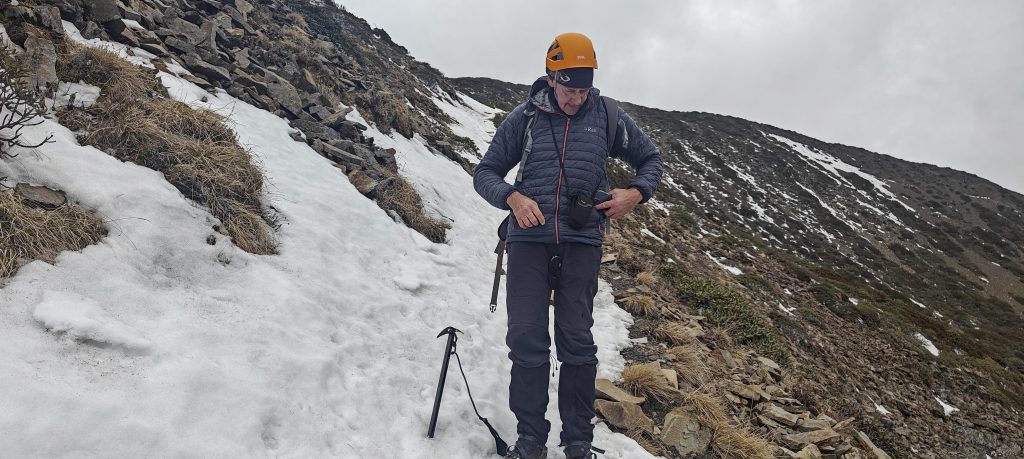
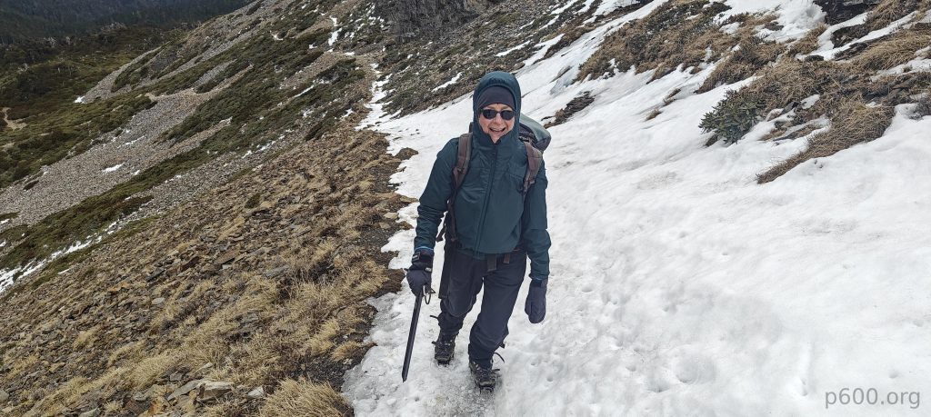
Pairing Xueshan peak with another Taiwanese giant, Yushan, feels like an unwritten rule; skipping one just seems wrong. Naturally, we planned to summit both peaks. Xueshan, also known as Snow Mountain, welcomed us with some old hard snow on the trail close to the summit. Securing permits turned out smoother than expected, despite a labyrinth of rules that could confuse even the most seasoned hiker. Navigating the bureaucratic wilderness, we emerged victorious, permits in hand. While some may opt for a marathon day-hike, we questioned, “What’s the rush?” Especially for those eager to fully appreciate its beauty. Choosing a two-night stay in the hut proved wise, blending adventure with the perfect amount of leisure. On the summit, we found a hard old snow-covered trail instead of the expected light dusting.

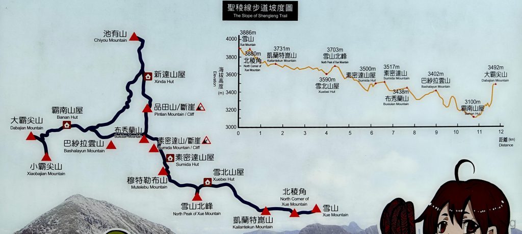
  • Day 1 kicked off with a climb from the parking area at 2150 meters up to the lower hut at 2550 meters, a gentle introduction to our adventure.
  • Day 2 pushed us further, as we ascended to the summit at 3886 meters, then made our descent back to the hut at 2550 meters, marking the day with a mix of exhilaration and exhaustion.
  • Day 3 brought our journey full circle, with a descent back to the parking area at 2150 meters.
The trail schema at the trailhead barely aligns with our data, but such is life, apparently.

We arrive at the park gates, promptly pay the entrance fee, and drive a few more kilometers to where the road ends. This marks the moment for changing, repacking, and a brief debate on the necessity of crampons and ice axes. Given our indecision, we opt to bring them along—better safe than sorry, as nobody wants to find themselves in need of crampons miles away from them. After a valuable half-hour of preparation, we start our journey on an easy, wide trail leading to the lower hut, reaching our destination just in time for dinner as dusk sets in.

We arrive at the hut just before dinner to discover we’re the only ones who ordered food, while everyone else whips up meals with their personal stoves—so much for blending in.
Dinner consists of vegetables, rice, and chicken, and after indulging, we’re welcomed into the dormitory rooms—talk about hospitality!
Starting before sunrise, a few hundred meters higher, we find ourselves above the clouds—a classic plot twist.
We catch our first nice views of nearby peaks.
The view before reaching the easy East summit.

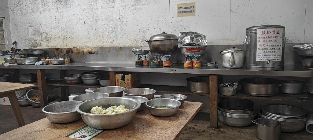
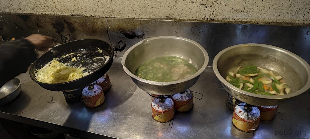
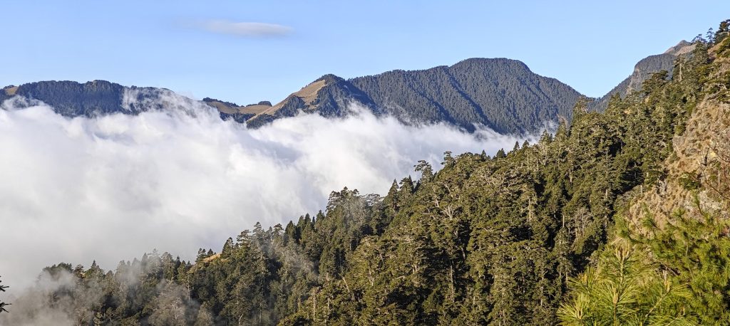
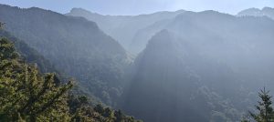
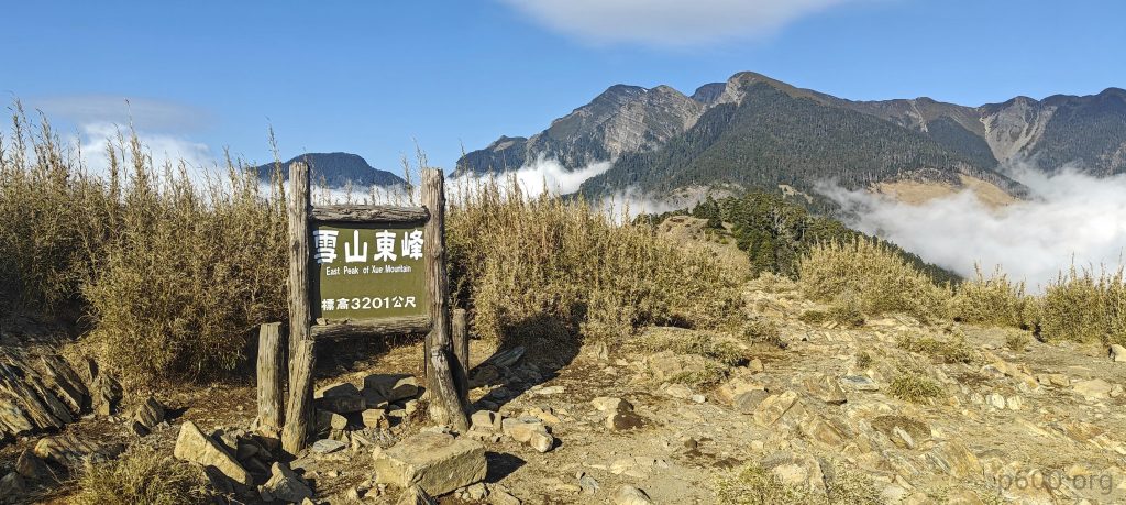
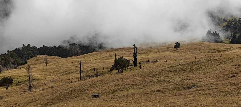
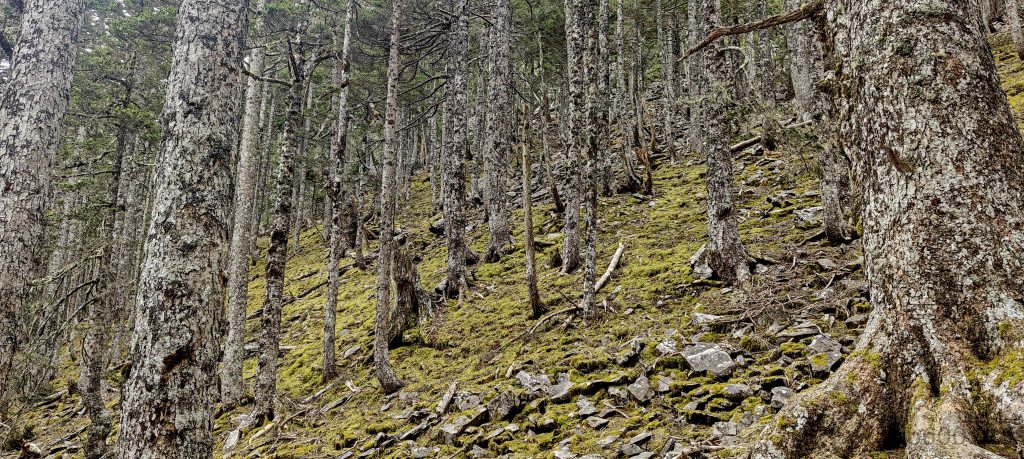
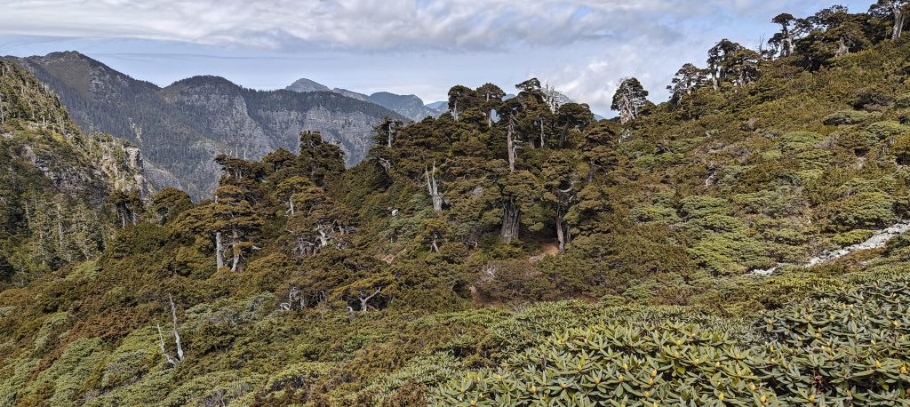
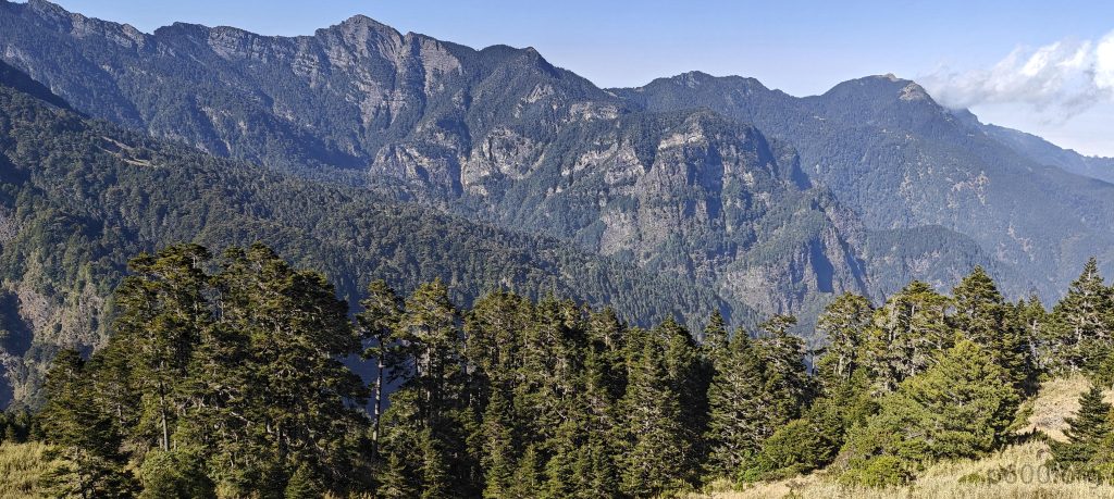
Waking up at 4:30 am, we skip the offer of a prepared breakfast, opting instead for hot water. Porridge and coffee suit us just fine. By 5:00 am, we’re geared up and on the move. The trail snakes back into the forest, easy and gradual, leading us to some sort of picnic area before it takes us on a bit steeper climb to the east summit. The path gets rougher but remains manageable. Beyond the east summit, we make our way up to the 369 hut on the ridge, the route mostly traversing open grassy fields. The 369 hut is currently closed, under renovation, but a few tents are pitched nearby for those opting to sleep closer to the summit—a tempting option, perhaps.

The East summit is a 20-meter bump, possible to avoid, but who can refuse the chance to reach P20—clearly, not us.
Our first glimpse of the summit reveals the leftmost peak in the photo, adorned with little snow patches—nature’s version of minimalistic art.
A parallel ridge rises above the clouds.
Turns out the man with the fridge is here; I thought he was climbing Kilimanjaro—oh, wait, those are just white plastic boxes.
At some point, near the East peak, one can spot two monorail stations and a helipad—an impressive infrastructure that not every serious city can boast.
We navigate through bamboo grass fields.
The Formosan Serow, a native goat-antelope of Taiwan, thrives in solitude among the mountains, showcasing agility and strength with sharp horns for climbing, dining on treetop delicacies, and maintaining the biodiversity of places like the Black Forest, all while being fashionably protected.
In the Black Forest, ancient Taiwan White Fir trees, some over a century old, engage in a quaint form of arboreal social distancing known as “crown shyness,” ensuring even in the densest shade, every leaf gets its moment in the sun.

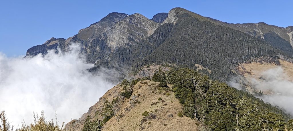
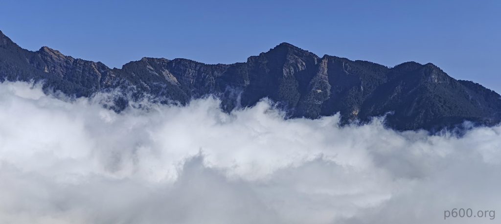
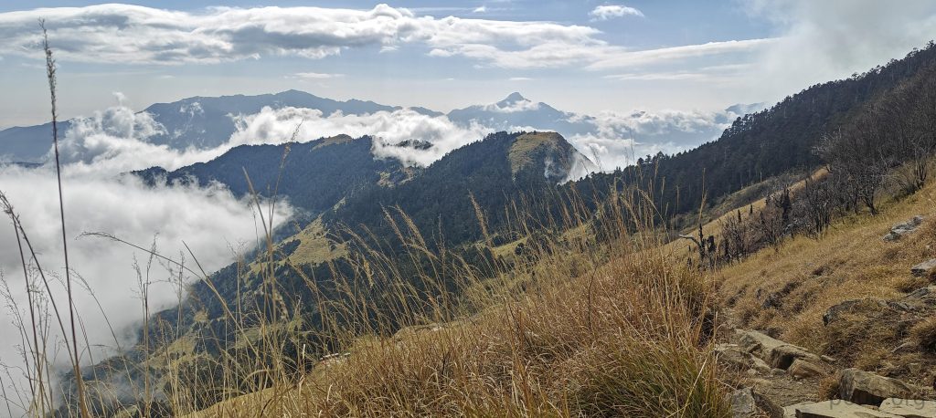
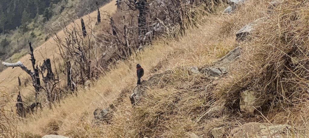
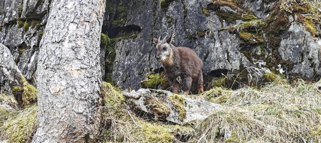
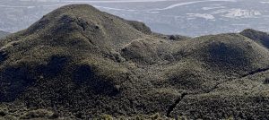
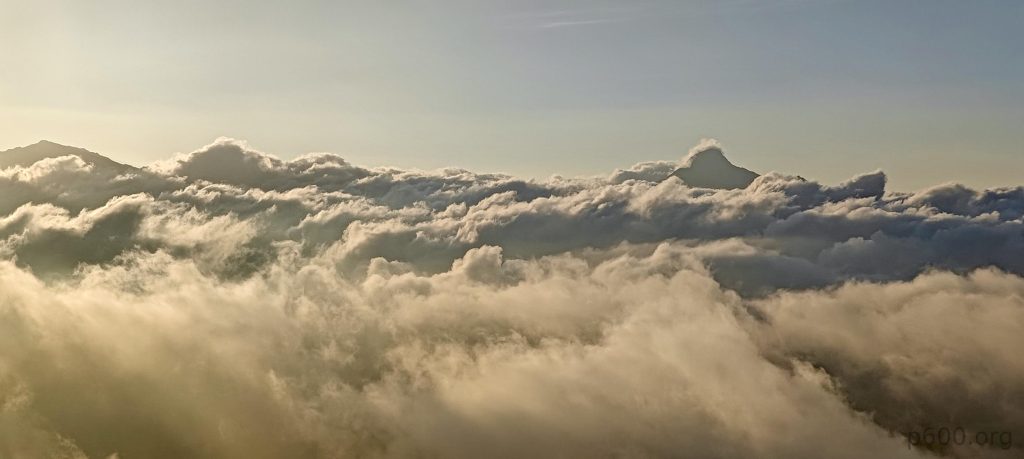
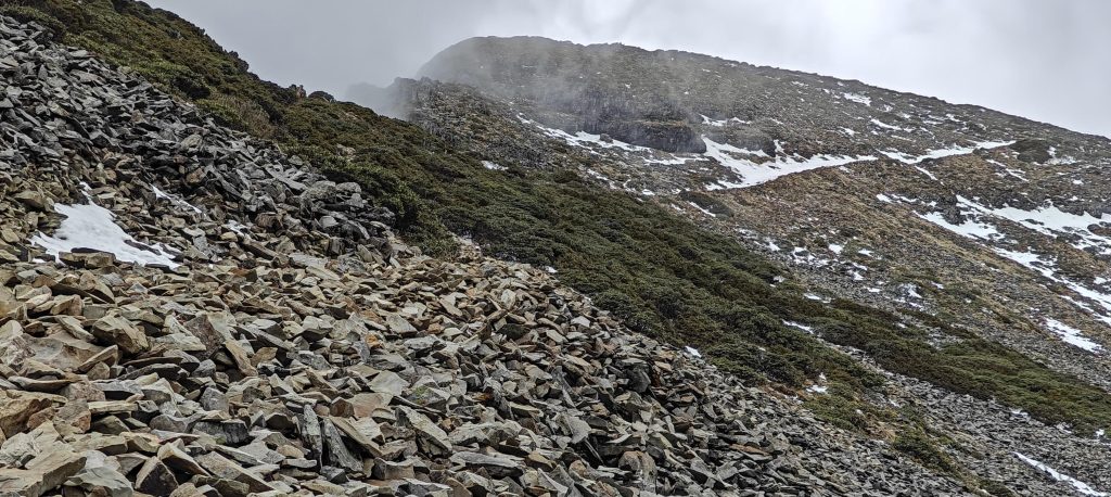
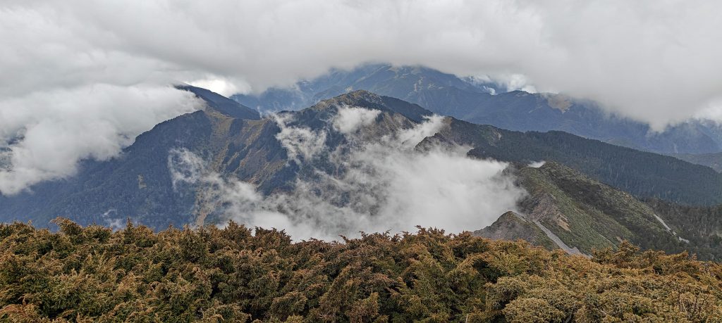
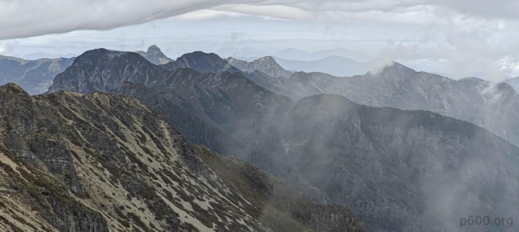
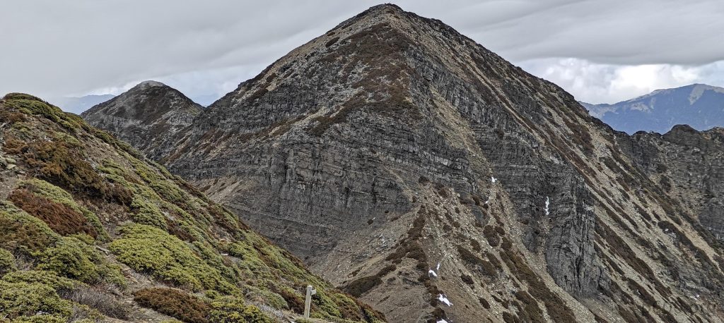
Beyond the higher hut, we tackle steep grassy slopes in the Black Forest, where the trail then levels out, becoming gradual and easygoing. The path zigzags, straightens, and then zigzags again. Reaching the upper valley, we finally catch sight of the summit alongside its lesser companion. Sporadic patches of snow dot the trail, but we’re unfazed, having braced ourselves for a much snowier landscape.

Little lower BeiLingjiao Mountain, standing at 3882 meters with a prominence of 69 meters, modestly makes its mark on the landscape, almost whispering, “Yes, I’m here too.”
The main peak trail, dressed in a layer of hard-packed snow, leaves us guessing about the challenge it might pose.
At some point, we strap on crampons and grasp ice axes, not out of necessity but for speed and, well, since we lugged them all this way, why not put them to good use?
Richard, making his mark on the snow.
Denise steps onto the ice with unwavering steadiness, as if every patch is a familiar friend.
The view on the way up offers a stunning visual feast.
BeiLingjiao Mountain, standing at 3882 meters with a prominence of 69, and the saddle between its main summit.
From the summit, the views stretch out in a panoramic spectacle.
The summit marker, a mute witness to our accomplishment, stands firm as Denise captures a photo of Richard and me.
I’m sharing my apple with the birds, a simple act of kindness.

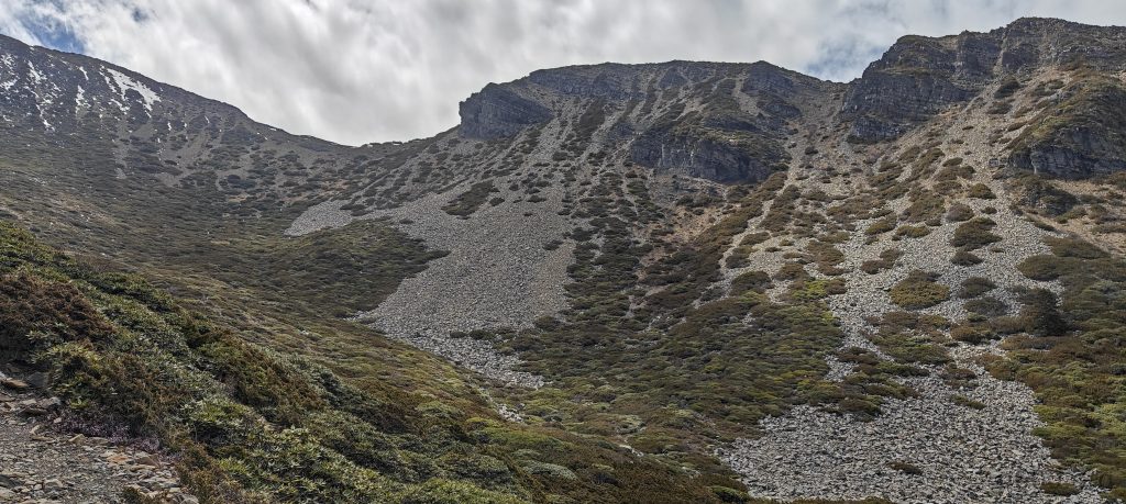
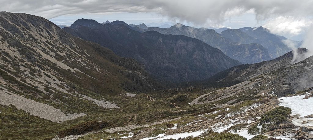
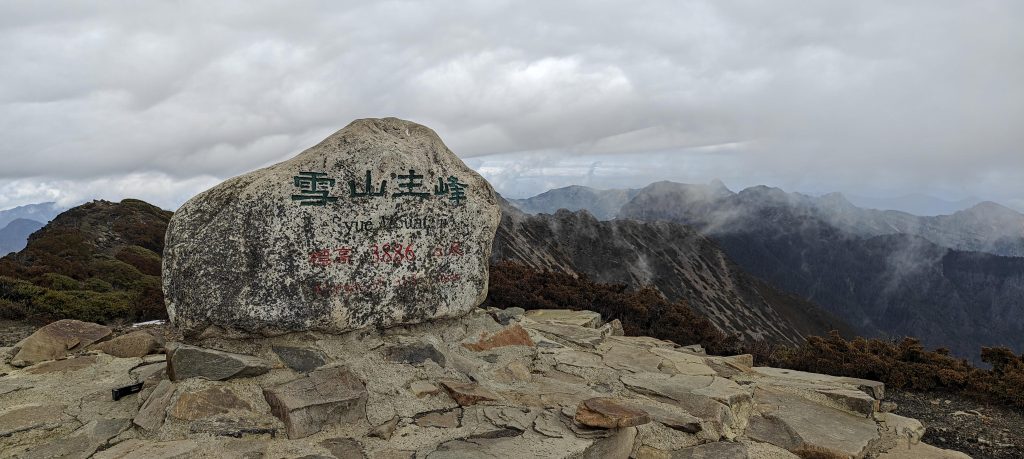
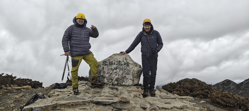
Upon reaching the summit, we discover a marker stone adorned with writings. After a quick selfie, Richard wastes no time, rushing to use the hand level before clouds obscure our view. Rumors swirl of a nearby peak potentially surpassing our current elevation. Within moments, Richard confidently declares our perch as the highest. To cement our certainty, he decides to detour to the neighboring summit for confirmation. Denise and I opt to remain, retracing our steps back the way we came. Richard, on the other hand, embarks on a longer return journey via the North trail, a route that may add an extra hour or two to his hike.

As BeiLingjiao Mountain beckons from a mere 500 meters away, Richard opts for a detour, while Denise and I decide to retrace our steps, each path woven with its own tale.
In a vision test of landscape and detail, can you spot Richard on the ridge?
The pine forest, with its whispering needles and sturdy trunks, paints a serene portrait of nature’s quiet grandeur.
Climbing the East summit once more, i spend half an hour in contemplation, observing the ridges.
Clouds meander through the valleys below, casting a dreamlike veil over the landscape,
Perfect day, serene sway, nature’s play.

We return to the hut just before dinner, with Richard joining us two hours later. All is well as we enjoy our meal, sipping tea before heading to sleep. The day proved incredibly challenging, with the trail seeming much longer than anticipated. Nevertheless, we climbed both ultra prominent peaks, marking our Taiwan leg of the trip a success. Tomorrow morning, after breakfast, we’ll descend a few hundred meters to the car and drive towards Qixingshan.


Xueshan3885 m altitude
1937 m prominence
104.84 km isolation
RangesEast China - Taiwan
Countries/regionsChina - Taiwan
Distance11.00 km up11.00 km down
Elevation1736 m gain1736 m loss
Time
6h10 up
30h00 other
5h10 down
41h20 total
Trailhead2148 m altitude24.3855830, 121.2991660
LinksGPX trail
  • East China 2024
  • « Yushan
  • Qixingshan »

Mountain Ranges

Anatolia
Central Anatolia
Pontic Mountains
Southeast Anatolia
Taurus Mountains
Western Anatolia
Andes
Puna de Atacama
Atlas Mountains
High Atlas
Northwestern Atlas
Central America Ranges
Costa Rica-Panama Ranges
Central Central America
East China
Taiwan
Eastern Europe Ranges
Southeast Baltic Plains
Iberian Peninsula
Cordillera Cantabrica
Castile Ranges
Portugal-Galicia
Pyrenees
Intermountain West
Great Basin Ranges
Korea-Amur Area
Taebaek Sanmae
Malay Archipelago
Java
Nusa Tengarra
Sulawesi
Sumatra
Mid-Atlantic Islands
North Atlantic Islands
Mongolia Ranges
Altai
Gobi Desert Ranges
Hangay Mountains
Northwest Europe
Great Britain
North France-West Rhine Area
Pacific Ranges
Cascade Range
Northwest U.S. Coast Ranges
Sierra Nevada
Central and Southern California Ranges
Philippines
Central Philippines
Luzon
Mindanao
Southeast Asia
Malay Peninsula
Southeast South America
Pampas
Sierras de Cordoba
Southern Africa
Malawi Highlands
West Africa Mountains
Bight of Benin
Cameroon Mountains
Guinea Highlands

Countries / regions

Algeria
Ain Guezzam
Ain Salah
Aïn Témouchent
El Bayadh
Ghardaïa
Oran
Ouargla
Saïda
Sidi Bel Abbès
Tamanrasset
Argentina
Catamarca
Ciudad Autónoma de Buenos Aires
Córdoba
Jujuy
Salta
Tucumán
Belgium
Brussels Capital Region
Flemish Region
Cameroon
Southwest
China
Taiwan
Costa Rica
Alajuela
Cartago
Guanacaste
Heredia
Limón
San José
Czechia
Prague
Denmark
Greenland
France
Hauts-de-France
Occitania
Germany
Berlin
Niedersachsen
Indonesia
Bali
Jambi
Jawa Tengah
Jawa Timur
Nusa Tenggara Barat
Sulawesi Tengah
Sulawesi Utara
Sumatera Barat
Lithuania
Vilnius County
Mongolia
Bayankhongor
Govi-Altai
Khovd
Omnogovi
Ovorkhangai
Ulan Bator
Zavkhan
Morocco
Béni Mellal-Khénifra
Drâa-Tafilalet
Fez-Meknes
Marrakesh-Safi
Souss-Massa
Tangier-Tetouan-Al Hoceima
Mozambique
Zambezia
Netherlands
Gelderland
Noord-Holland
Zeeland
Nicaragua
Chinandega
Managua
Masaya
Rivas
Philippines
Bicol Region (V)
Cagayan Valley (II)
Calabarzon (IV-A)
Central Luzon (III)
Cordillera Administrative Region
Davao Region
Metro Manila
Soccsksargen (XII)
Western Visayas (VI)
Poland
Greater Poland Voivodeship
Masovian Voivodeship
Portugal
Castelo Branco
Leiria
Lisbon
Madeira
Santarém
Qatar
Ad-Dawhah
São Tomé and Príncipe
São Tomé Province
Sierra Leone
Northern Province
Western Area
Singapore
South Korea
Gyeongsangnam-do
Seoul
Spain
Aragón
Asturias
Castilla-La Mancha
Castilla y León
Catalonia
Islas Canarias
Switzerland
Zürich
Turkey
Antalya
Bitlis
Erzincan
Hakkâri
Igdir
Isparta
Kahraman Maras
Muğla
United Kingdom
England
Scotland
United States
California
Delaware
Florida
Maryland
Nevada
New Jersey
New York
Pennsylvania
South Carolina
Utah

TRIPS

2024
Southern Africa 2024
Mid-Atlantic Islands 2024
North America 2024
Anatolia 2024
Korea-Amur Area 2024
East China 2024
2023
Mongolia Ranges 2023
Philippines 2023
West Africa III 2023
West Africa II 2023
Iberian Peninsula 2023
West Africa 2023
Central America 2023
2022
Andes 2022
Northwest Europe 2022
Malay Archipelago III 2022
Malay Archipelago II 2022
Anatolia Mountains 2022
Iberian Peninsula 2022
Atlas Mountains 2022
North France-West Rhine Area 2022

archaeology (3) climb (157) food (2) hike (155) p30 (17) p50 (4) p100 (24) p300 (12) p600 (17) p1000 (11) p1500 (76) ribu (10) sight (46) summary (16) trig (44) ultra (76)

1 591 km walked, 121 298 m climbed

©2025 p600.org | WordPress Theme by Superbthemes.com