Skip to content
Menu
p600.org
  • home
  • map
  • trips
  • about
p600.org

Gunung Agung

hike | 2022-10-10

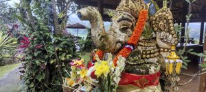
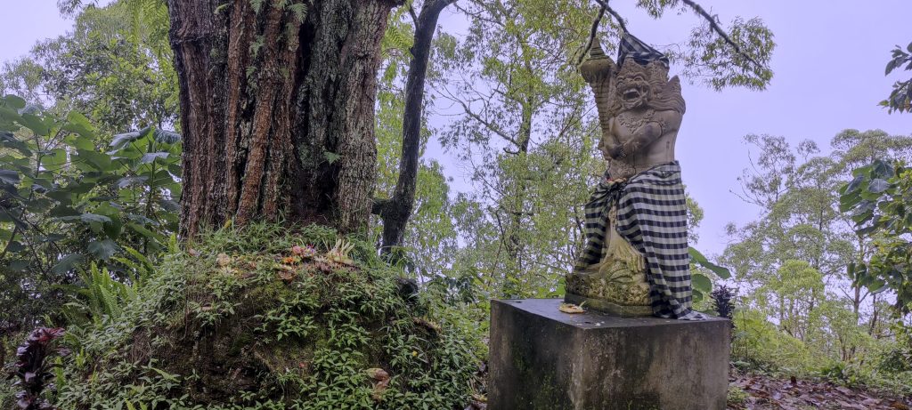
We get up at 1am, drive to the trailhead, where a local guide is waiting for us. The trail starts at a temple. We climb 330 steps. The local guide is praying and burning incense. After ten minutes, we pass the temple building on the left and start climbing an easy, well-maintained path. We pass several groups of hikers and soon reach the forest boundary. A rare but beautiful phenomenon is when a couple of clients are accompanied by a female guide instead of a male guide.

The moon is so light, almost like a daytime hike.
Moonlit clouds and villages below
Remote thunders

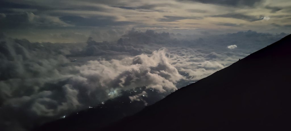
A few hundred meters away from us, on a parallel ridge, I notice some lights. I wonder which path they are climbing, so I check the map. To my great surprise, I see that they are on the right trail and we are not. Uhh. I ask the guide how we are going to get to the top. He points his hand to the ridge and says the summit is there. We explain to the guide the importance of the summit. He tells us about the view of the sunrise on the ridge. We have to announce that we will climb to the summit with or without him. The guide offers to pay him 200 000 rupees (about 12 euros) in return for his promise to accompany us to the actual summit. We don’t argue; we agree and continue.

The rising sun illuminates more sky.

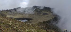
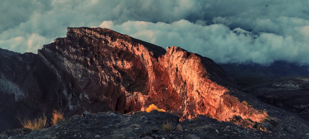
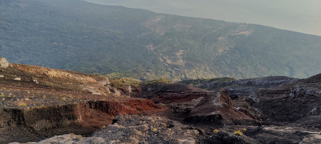
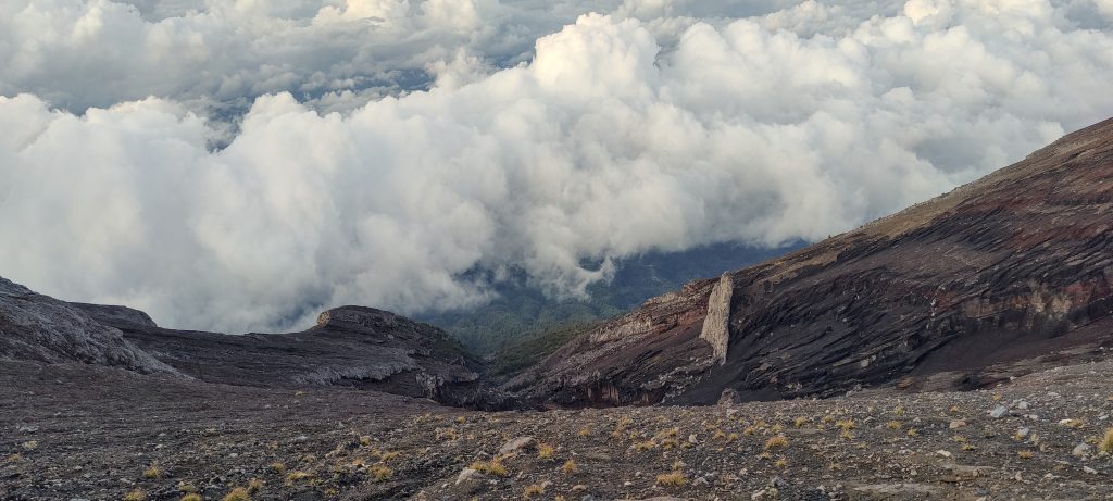
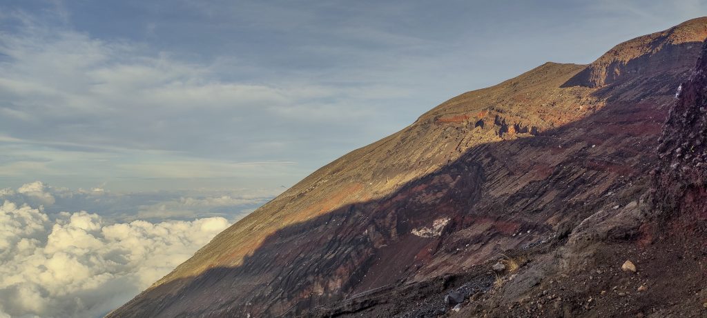
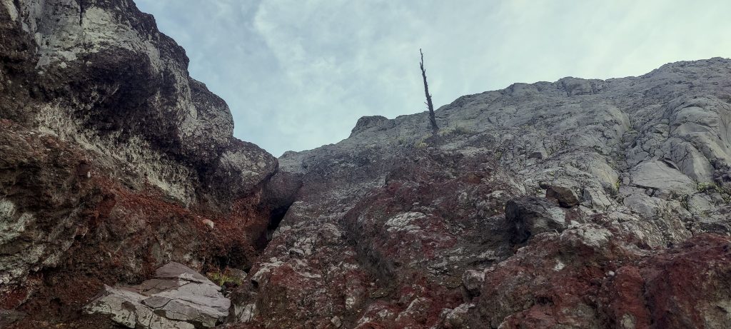
We have to descend about 80 meters. Then we traverse through the rocks towards the adjacent path. It’s easy, although a few short sections are quite steep and dangerous. Once we reach the right trail, we climb up the steep slope to the edge of the crater, and from here it is a few hundred meters of easy walking towards the summit.

Dave is already at the top.
Top marker
Spectacular colors
Interesting forms
Pastel colors hypnotize.

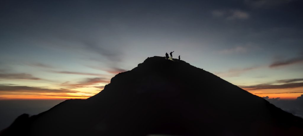
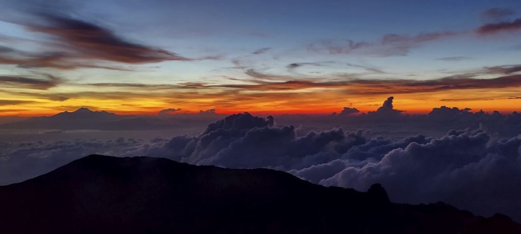
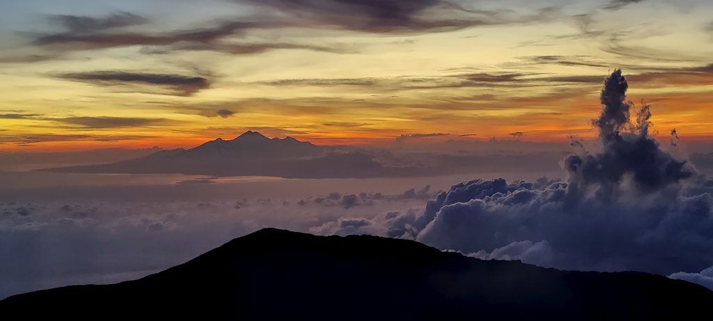
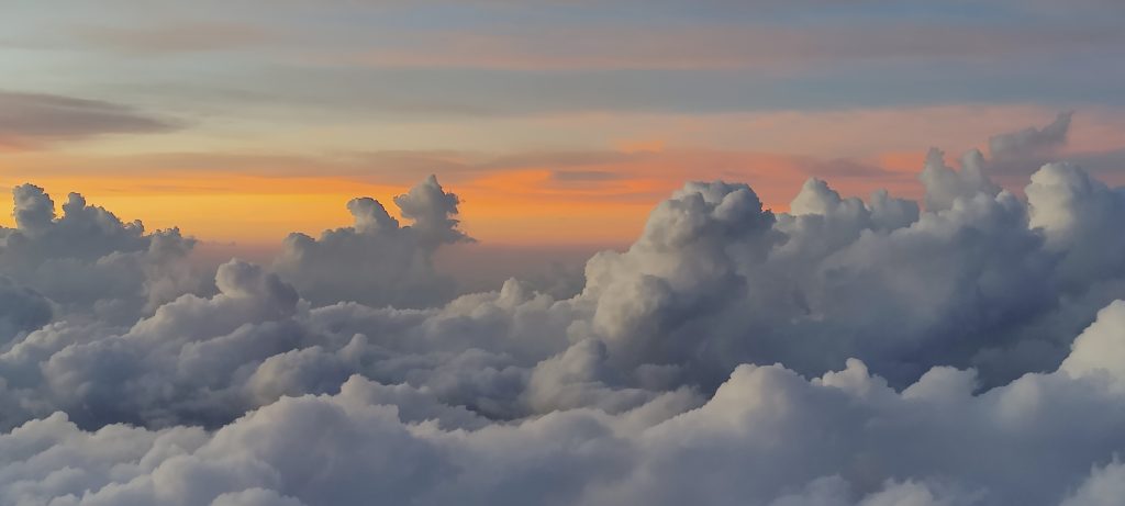
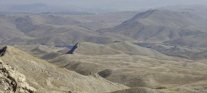
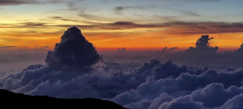
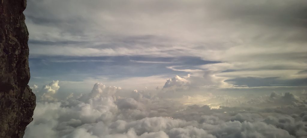
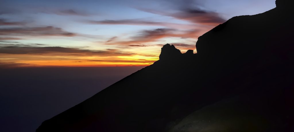
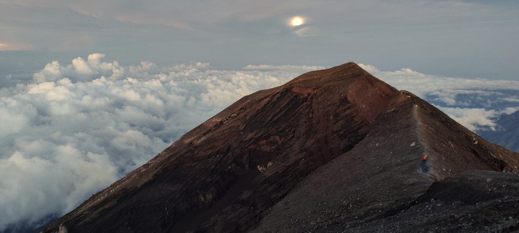
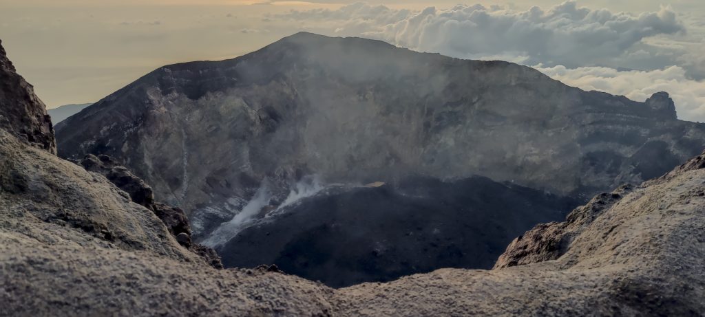
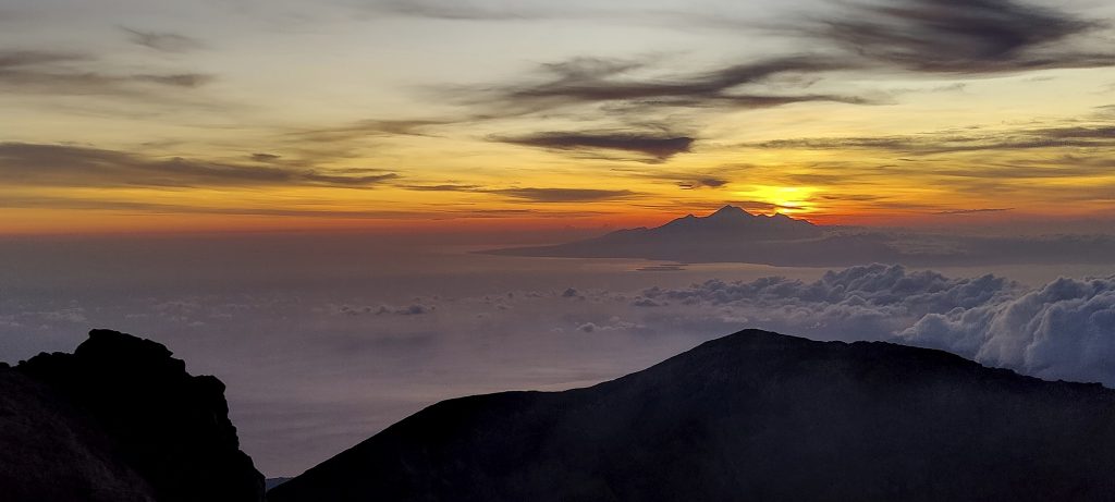
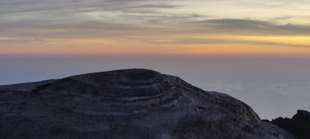
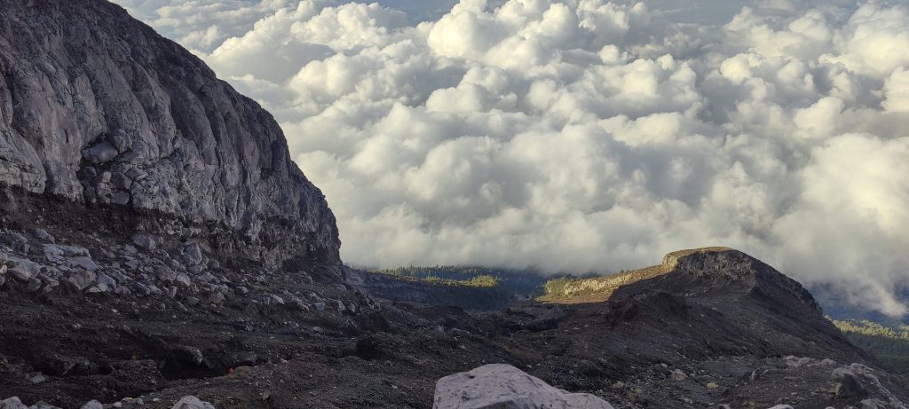
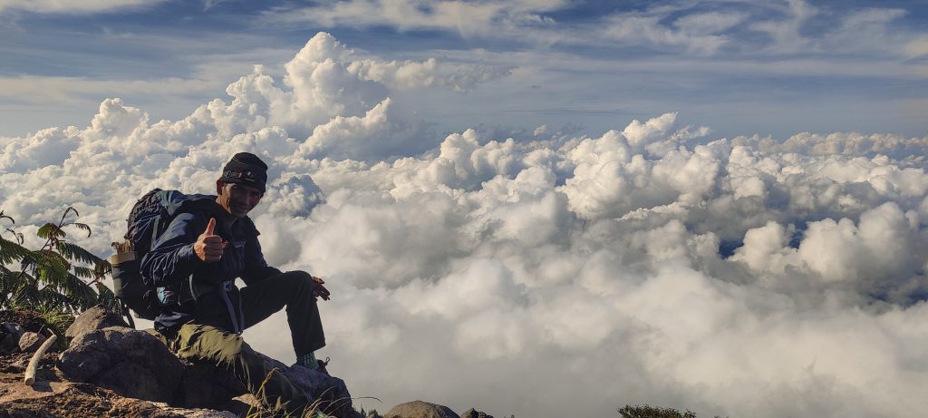
We reach the summit a quarter of an hour before dawn, with spectacular colors and even more spectacular cloud shapes. The bottom of the crater is in shadow, but as time passes, the shapes become more apparent. In the distance, the island of Lombok and Gunung Rinjani are rising from it. A few more hikers gather to greet the sun.

The rim of the crater is illuminated by the first rays of sunlight.
More climbers are approaching, with a bright moon in the background.
Smoke billows from the bottom of the crater.
Lombok island with Gunung Rinjani
View from top
Slope from the saddle
Steep slopes on the way down
Our route up and down
On the way down
It’s strange to see the trunks of the trees near the top
On the way down
Our guide
Indian-rhododendron?
Interesting sculptures at the trailhead

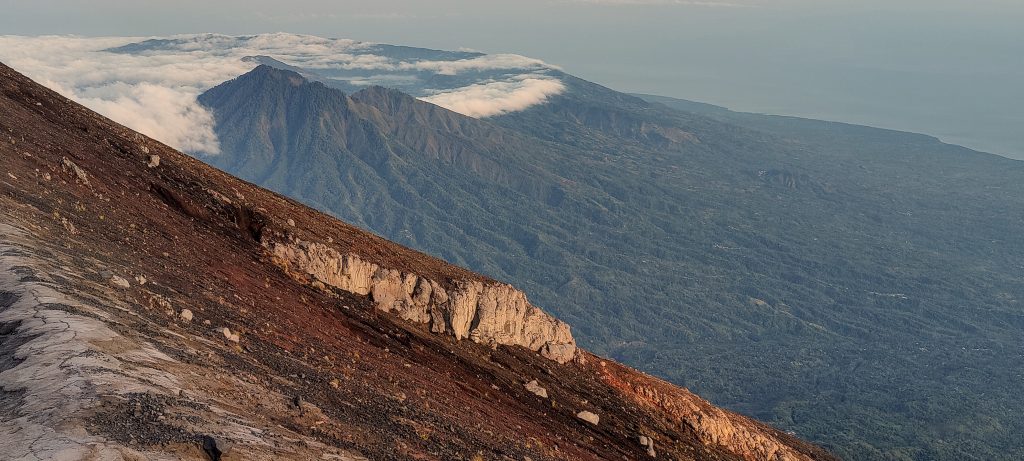
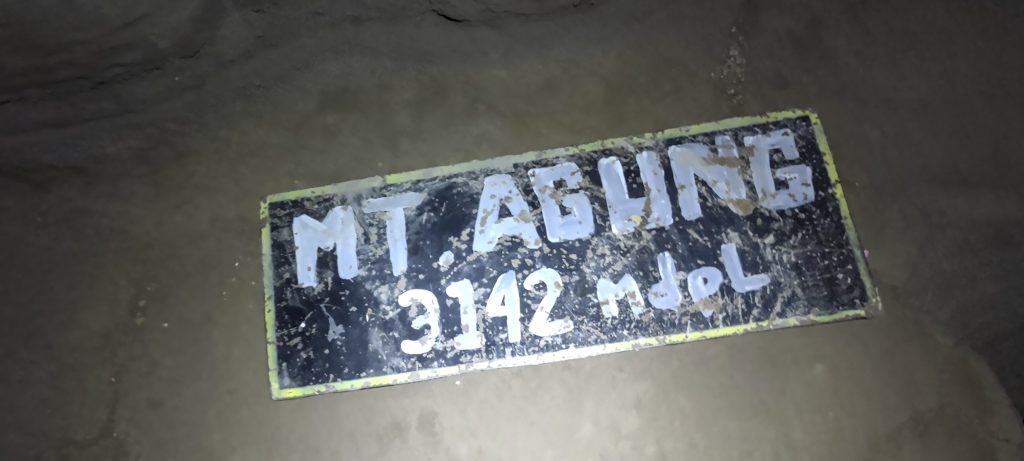
At sunrise, we descend. Following the same path, we quickly reach the car. The guide tells us that his wife also takes clients up the mountain. This is the same guide we passed on the way up. The day started with great views, another one of the world’s TOP 100 ultra peaks. We drive towards the ferry (slow and uncomfortable) that will take us to Lombok Island, and the next day we climb Gunung Rinjani.

Dave and myself at the trailhead
Dave and myself at the top

Gunung Agung3031 m altitude
3031 m prominence
103.98 km isolation
RangesAsia - Malay Archipelago - Nusa Tengarra
Countries/regionsIndonesia - Bali
Distance4.20 km up4.30 km down
Elevation1499 m gain1499 m loss
Time
4h25 up
0h20 other
4h10 down
8h55 total
Trailhead1531 m altitude-8.3706660, 115.5031380
Difficulties<p style="color: #252525;">Few places require an exposed traverse, but it is likely possible to avoid it if the real summit is climbed from the beginning.</p>
LinksGPX trail
  • Malay Archipelago II 2022
  • « Anatolia Mountains 2022
  • Bali »

Mountain Ranges

Anatolia
Central Anatolia
Pontic Mountains
Southeast Anatolia
Taurus Mountains
Western Anatolia
Andes
Puna de Atacama
Atlas Mountains
High Atlas
Northwestern Atlas
Central America Ranges
Costa Rica-Panama Ranges
Central Central America
East China
Taiwan
Eastern Europe Ranges
Southeast Baltic Plains
Iberian Peninsula
Cordillera Cantabrica
Castile Ranges
Portugal-Galicia
Pyrenees
Intermountain West
Great Basin Ranges
Korea-Amur Area
Taebaek Sanmae
Malay Archipelago
Java
Nusa Tengarra
Sulawesi
Sumatra
Mid-Atlantic Islands
North Atlantic Islands
Mongolia Ranges
Altai
Gobi Desert Ranges
Hangay Mountains
Northwest Europe
Great Britain
North France-West Rhine Area
Pacific Ranges
Cascade Range
Northwest U.S. Coast Ranges
Sierra Nevada
Central and Southern California Ranges
Philippines
Central Philippines
Luzon
Mindanao
Southeast Asia
Malay Peninsula
Southeast South America
Pampas
Sierras de Cordoba
Southern Africa
Malawi Highlands
West Africa Mountains
Bight of Benin
Cameroon Mountains
Guinea Highlands

Countries / regions

Algeria
Ain Guezzam
Ain Salah
Aïn Témouchent
El Bayadh
Ghardaïa
Oran
Ouargla
Saïda
Sidi Bel Abbès
Tamanrasset
Argentina
Catamarca
Ciudad Autónoma de Buenos Aires
Córdoba
Jujuy
Salta
Tucumán
Belgium
Brussels Capital Region
Flemish Region
Cameroon
Southwest
China
Taiwan
Costa Rica
Alajuela
Cartago
Guanacaste
Heredia
Limón
San José
Czechia
Prague
Denmark
Greenland
France
Hauts-de-France
Occitania
Germany
Berlin
Niedersachsen
Indonesia
Bali
Jambi
Jawa Tengah
Jawa Timur
Nusa Tenggara Barat
Sulawesi Tengah
Sulawesi Utara
Sumatera Barat
Lithuania
Vilnius County
Mongolia
Bayankhongor
Govi-Altai
Khovd
Omnogovi
Ovorkhangai
Ulan Bator
Zavkhan
Morocco
Béni Mellal-Khénifra
Drâa-Tafilalet
Fez-Meknes
Marrakesh-Safi
Souss-Massa
Tangier-Tetouan-Al Hoceima
Mozambique
Zambezia
Netherlands
Gelderland
Noord-Holland
Zeeland
Nicaragua
Chinandega
Managua
Masaya
Rivas
Philippines
Bicol Region (V)
Cagayan Valley (II)
Calabarzon (IV-A)
Central Luzon (III)
Cordillera Administrative Region
Davao Region
Metro Manila
Soccsksargen (XII)
Western Visayas (VI)
Poland
Greater Poland Voivodeship
Masovian Voivodeship
Portugal
Castelo Branco
Leiria
Lisbon
Madeira
Santarém
Qatar
Ad-Dawhah
São Tomé and Príncipe
São Tomé Province
Sierra Leone
Northern Province
Western Area
Singapore
South Korea
Gyeongsangnam-do
Seoul
Spain
Aragón
Asturias
Castilla-La Mancha
Castilla y León
Catalonia
Islas Canarias
Switzerland
Zürich
Turkey
Antalya
Bitlis
Erzincan
Hakkâri
Igdir
Isparta
Kahraman Maras
Muğla
United Kingdom
England
Scotland
United States
California
Delaware
Florida
Maryland
Nevada
New Jersey
New York
Pennsylvania
South Carolina
Utah

TRIPS

2024
Southern Africa 2024
Mid-Atlantic Islands 2024
North America 2024
Anatolia 2024
Korea-Amur Area 2024
East China 2024
2023
Mongolia Ranges 2023
Philippines 2023
West Africa III 2023
West Africa II 2023
Iberian Peninsula 2023
West Africa 2023
Central America 2023
2022
Andes 2022
Northwest Europe 2022
Malay Archipelago III 2022
Malay Archipelago II 2022
Anatolia Mountains 2022
Iberian Peninsula 2022
Atlas Mountains 2022
North France-West Rhine Area 2022

archaeology (3) climb (157) food (2) hike (155) p30 (17) p50 (4) p100 (24) p300 (12) p600 (17) p1000 (11) p1500 (76) ribu (10) sight (46) summary (16) trig (44) ultra (76)

1 591 km walked, 121 298 m climbed

©2025 p600.org | WordPress Theme by Superbthemes.com