Skip to content
Menu
p600.org
  • home
  • map
  • trips
  • about
p600.org

Baatar Khairkhan

hike | 2023-06-20

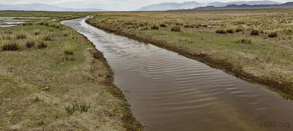
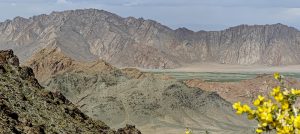
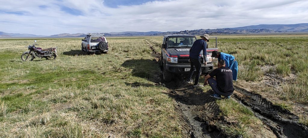
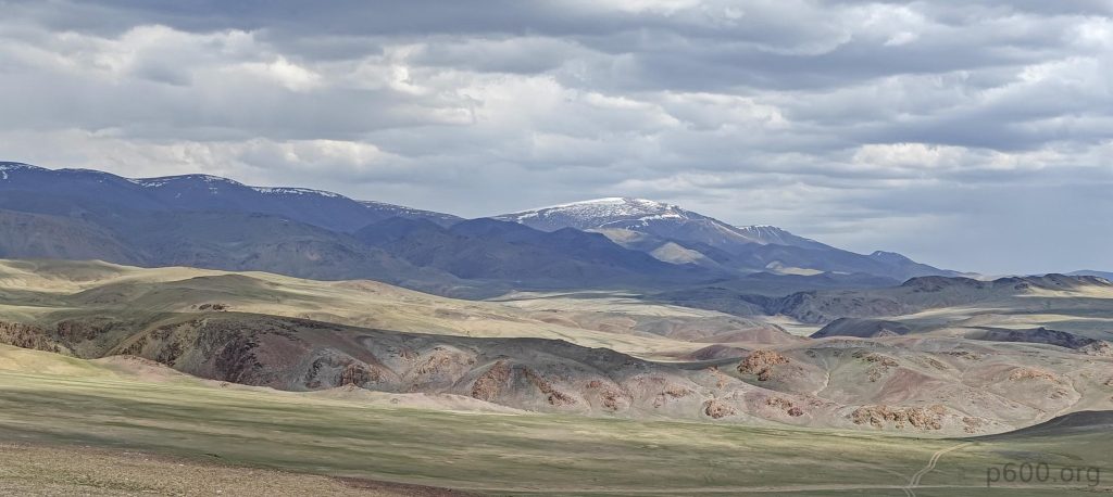
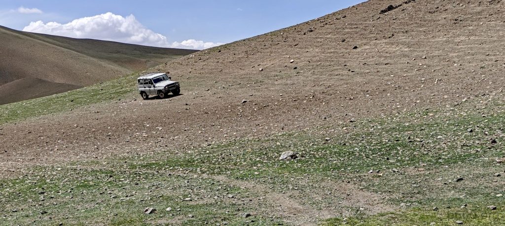
From the majestic vista of Bumbag Khairkhan Uul, with its snow-capped peak beckoning, we set our sights south towards the quaint village of Tsetseg, where, in a display of unwavering tradition, we indulge in our daily ice cream fix. Post-village bliss, we hit a road that’s surprisingly decent until, of course, it decides to give up on us, leaving us stranded in a field where the tracks are more suggestions than actual paths. Our drive then takes a dramatic turn from promising to pitiful as our car decides it’s had enough, coming to a stubborn halt. Stepping out, we’re greeted by the sight of our wheels making futile attempts to escape the clutches of what appears to be a very modest mud trap. Little did we know, our car was on a mission to become one with the earth.

We are stuck in slippery mud; it’s not very deep but, unfortunately, it’s enough to prevent us from getting out.

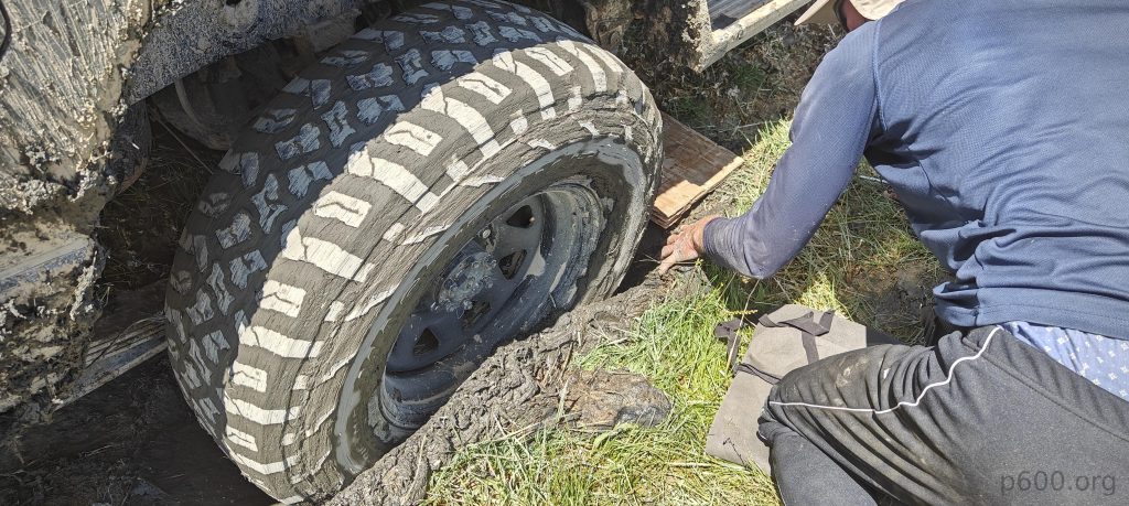
After a fruitless search for stones and random trash to shove under the wheels, it hits us: Avis Mongolia, in a plot twist no one saw coming, blessed us with a 2WD chariot despite our dreams of a 4WD steed, requested six months prior. Obviously, a 4WD would’ve scoffed at the mud and carried us to safety with ease.

Several hours of digging and despair later, we concoct a plan: I’ll trek back twelve kilometers to civilization for help while Rob plays in the mud, crafting a makeshift road to freedom. As fate would have it, a motorcyclist appears like a mirage, agreeing to ferry me to the village, thereby saving me from a marathon walk.

I filled the petrol tank for the guy who drove me twelve kilometers to the nearest village.
Four of us are working on getting the two cars out of the mud.

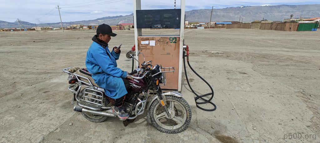
In the village, finding help was as easy as spilling tea, which we promptly did at our rescuer’s home, prepping for the grand extraction mission. However, our bubble of optimism bursts at the mention of a rope. Our climbing ropes seem laughably inadequate for the task, prompting a wild goose chase that ends at a mine, where we secure a metal tow cable.

Armed with our newfound hope, we return to find Rob, who, armed with an ice axe, has valiantly moved the car dozen of meters. Upon our triumphant arrival, our rescue vehicle also gets stuck, because why not? The scene is now four men, a motorbike, and two stubborn cars, all playing in the mud, but the locals’ chill vibe is contagious, giving us a second wind.

The good man who comes to help us also ends up stuck in the same mud.

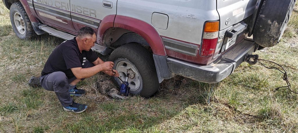
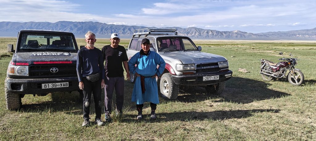
We rally, gathering stones and grass like it’s a craft project, placing them under the wheels while Rob plays mud-spa with the tires. Despite the looming threat of déjà vu, our team, led by our Mongolian savior, miraculously frees both cars from the mud’s clutches. Instead of financial gratitude, our heroes opt for a selfie, proving that sometimes, the best currency is a shared memory! We owe them many thanks!

And finally, i snap a photo of Rob with the two brave Mongolians.

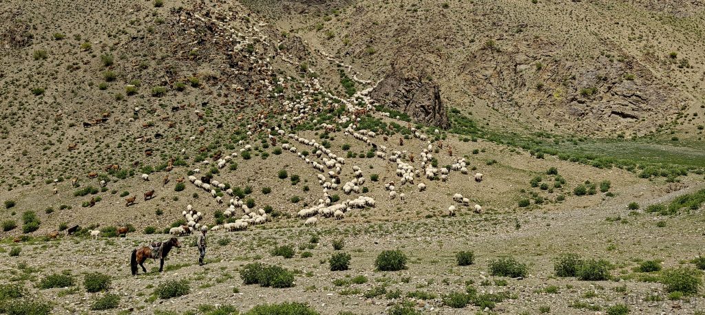
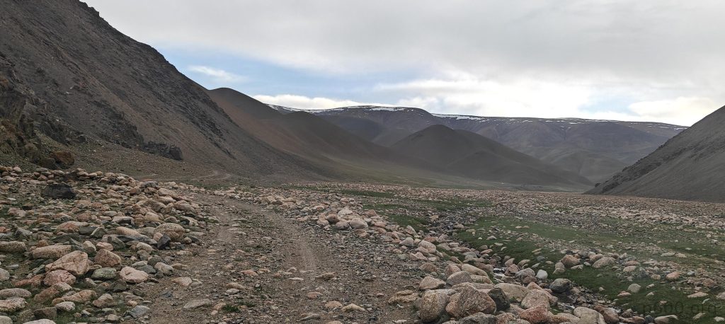
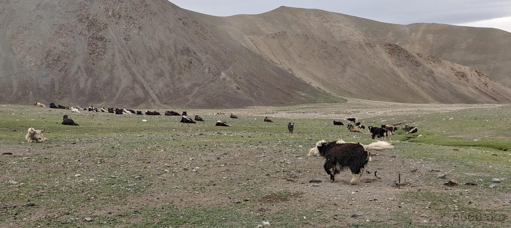
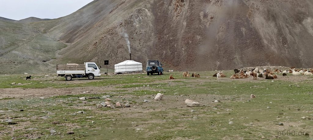
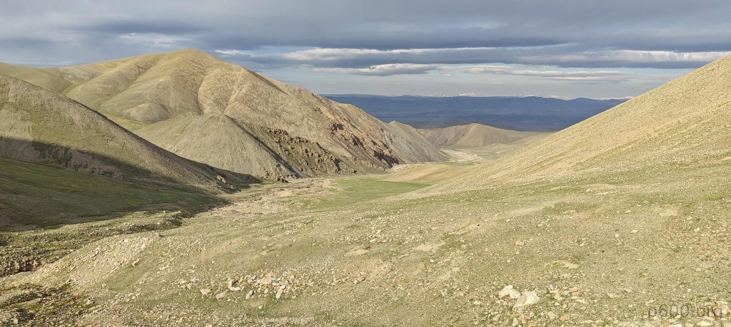
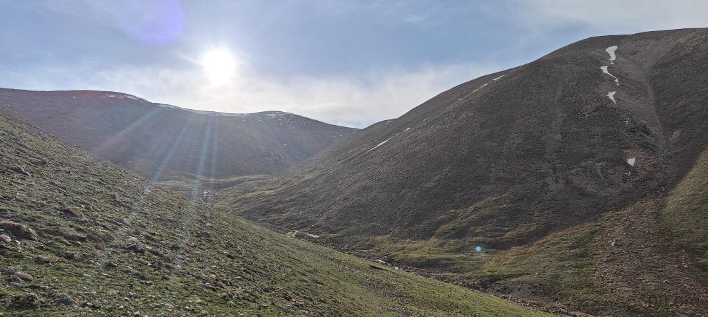
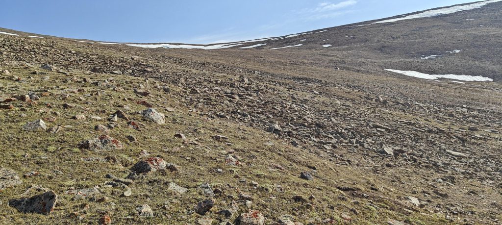
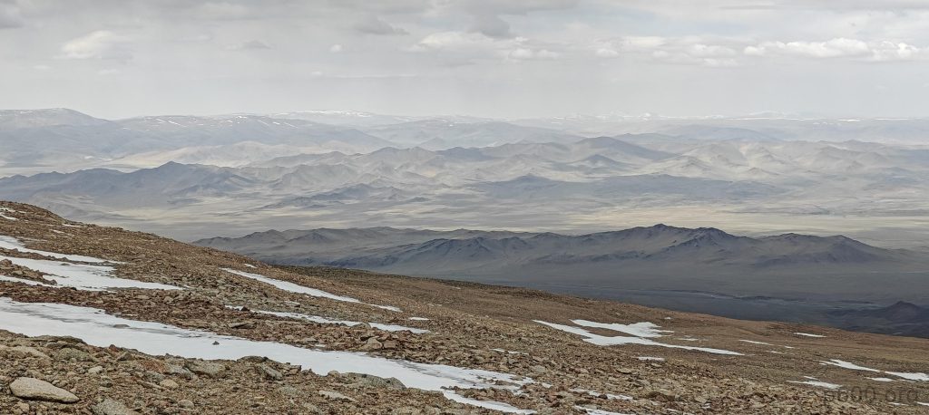
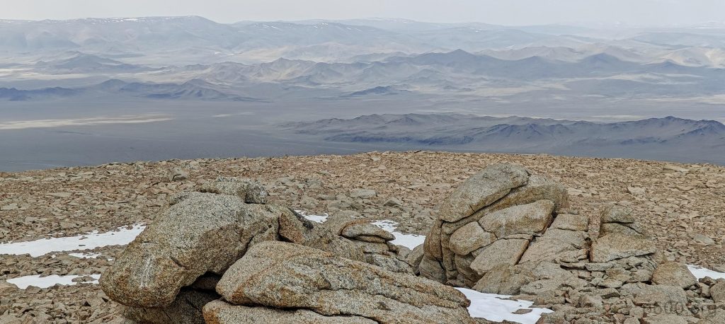
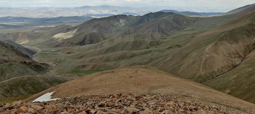
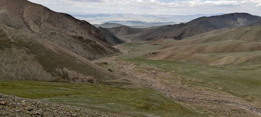
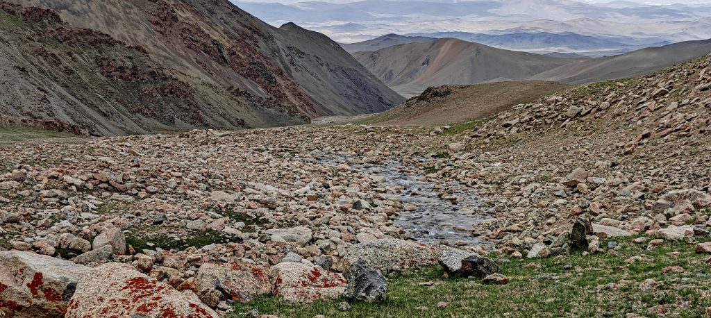
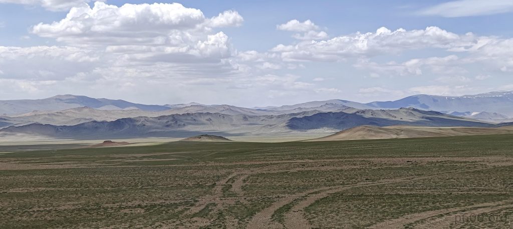
Post-adventure, we find a camping spot and, come morning, continue our journey to the Baatar Khairkhan trailhead, where stunning vistas greet us. The trek involves passing yurts, yaks, and eventually stopping as the path dares us to proceed further.

As we approach the trailhead, the summit comes into view ahead.
Yaks are grazing along the way.
There are a few households not so far away from where we left our car.
We climb gradual slopes in the morning sunlight.
We navigate gradual slopes, occasionally finding the trail, but generally, the terrain is easy.
Most of the climb is towards the east, so the low morning sun shines in our eyes.
Rob on the one of the slopes
On the summit plateau, we recognize a few patches of snow, previously seen from our camp at Bumbag Khairkhan Uul.
An interesting finding.
The snow is soft, barely supporting our weight.
The summit and a snow dome are not so far away.
The views from the summit are breathtaking.
The snow at the dome is quite well packed; it’s not ice but firm snow. It’s easy to step on and walk across, no need for crampons.

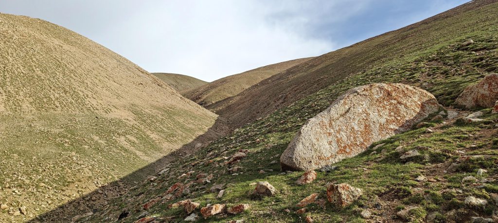
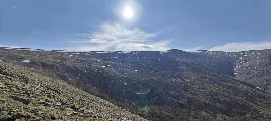
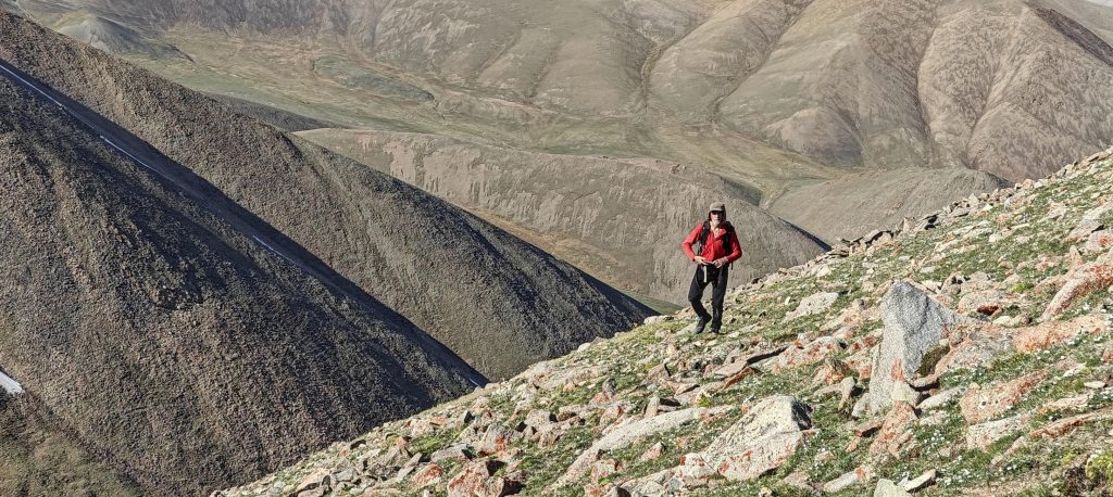
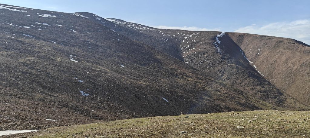
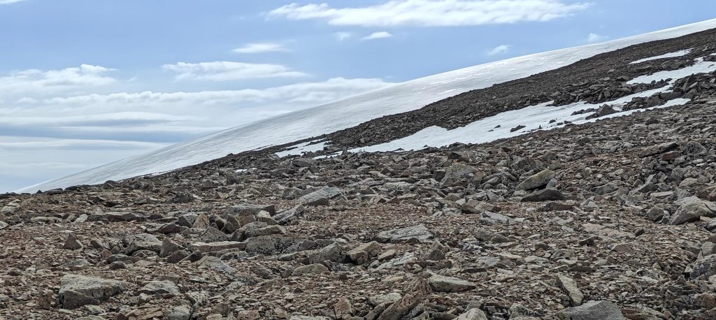
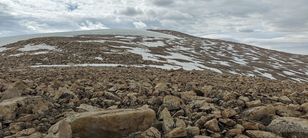
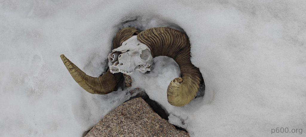
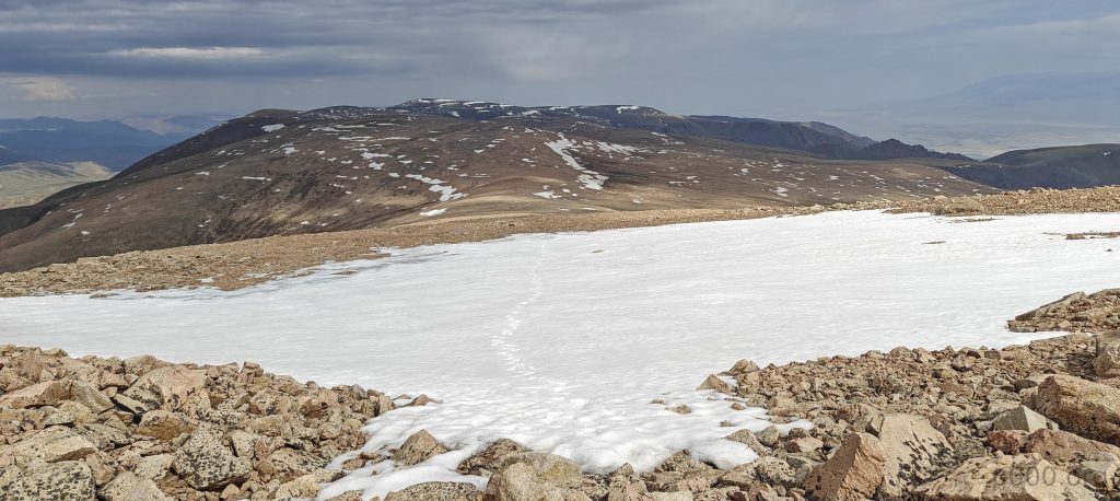
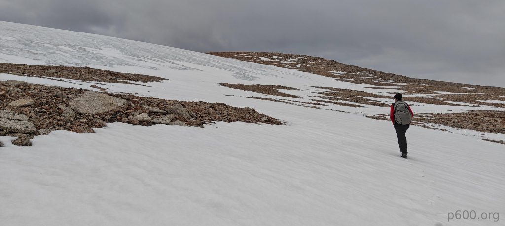
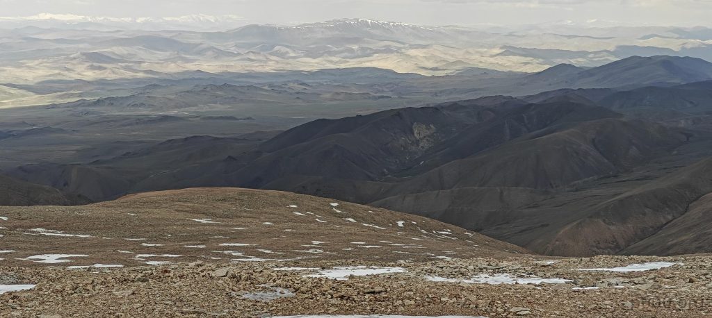
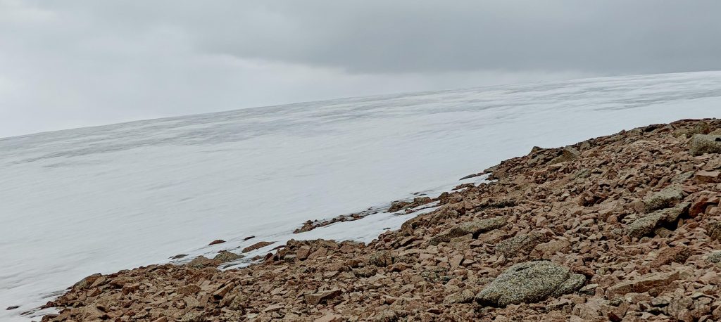
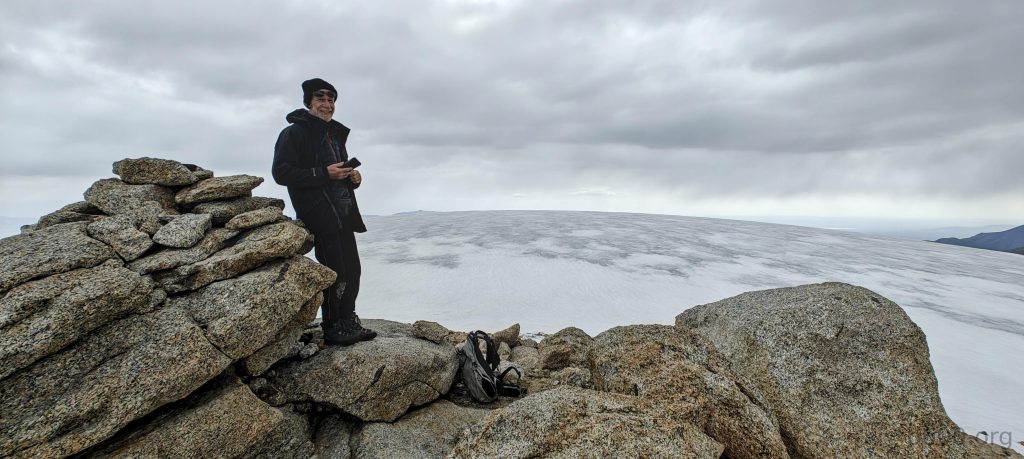
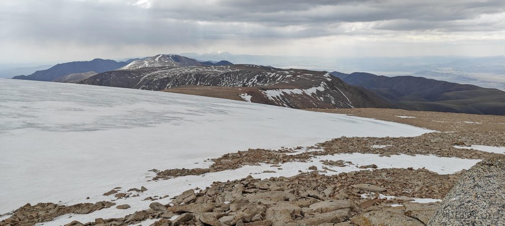
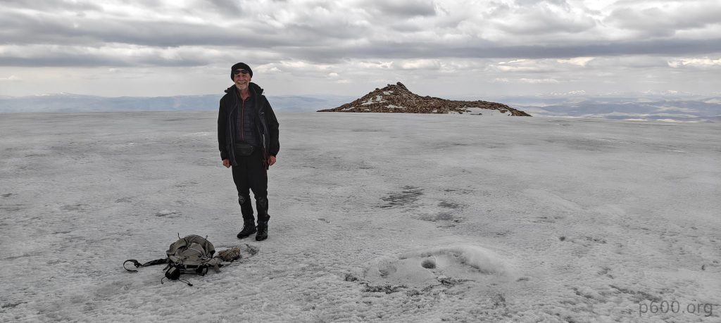
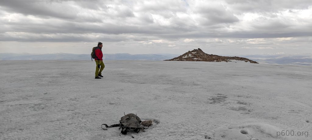
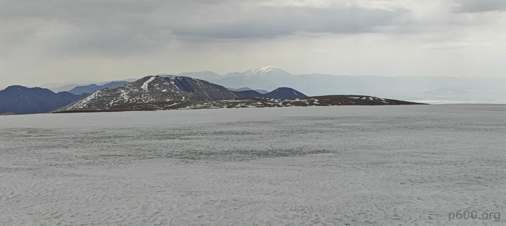
The peak is basically just a humble stack of rocks, a few meters tall. My hunch? Back in the day, both this so-called summit and the nearby snow dome were decked out in a winter coat all year round, which probably means the real top spot was about a football field and a half northeast from where we stood. After snapping a few pics for the ‘Gram, we trotted over to the snow dome and checked it out. The snow was solid, firm enough not to swallow us whole. Definitely not glacier territory, but it’s got this eternal winter vibe going on, sticking around through the seasons. The real head-scratcher was trying to figure out the highpoint of this snowy flatland—it’s pretty vast and as flat as a pancake. After a quick breather, we were back on our feet, this time cutting corners and bee-lining it straight for the car, navigating down one of the ridges like pros.

Rob stands on the true summit.
From the summit, the south ridge extends out, leading to a few more peaks.
Summit rocks tower above, with infinite valleys sprawling below.
Rob and I pose at the lower snow dome, the true summit rising in the background.
There’s one more lower peak to the northwest.
On the way down, we follow the ridge directly to the car.
We are back, near the trailhead.
Stream near the car.
There are more cars on the route back.

This episode marks another Ultra peak conquered in our saga, an adventure that was surprisingly straightforward and enjoyable, perhaps one of the most laid-back peaks we’ve encountered on this journey.

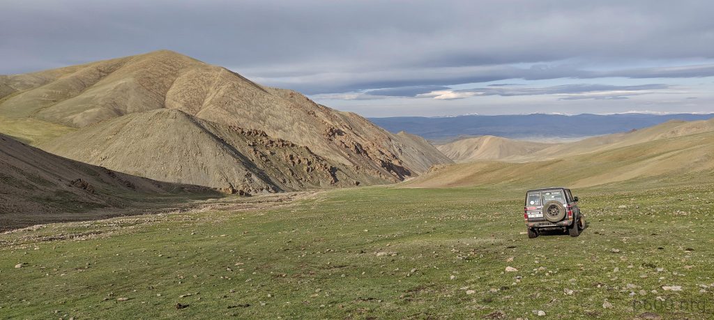
Our next chapter takes us towards Altan Hohiy, but as fate would have it, the sandy terrain had other plans for us. Our journey quickly turned into a choose-your-own-adventure, with a labyrinth of car tracks guiding us through a desert maze. It was here that we discovered our secret weapon—a two-meter-long wooden stick. This unlikely hero became the key to escaping our sandy predicament. We affectionately named it our “amulet of success” and decided it earned a permanent spot in our car for future challenges.

With our newfound confidence, we reassessed our situation. Despite our initial resolve, the allure of Altan Hohiy paled in comparison to the call of Jargalant Khairkhan. After a brief moment of contemplation, we chose to redirect our adventure towards this new destination, ready to face whatever lay ahead with our trusty wooden amulet by our side.

Venice of Mongolia, water-covered road
It’s one of the rare occasions to see a shepherd with a horse; more often, they use motorcycles.

+-
2 km
1 mi
'CyclOSM | Map data: ©, OpenStreetMap contributors'
Baatar Khairkhan3984 m altitude
1541 m prominence
71.63 km isolation
RangesMongolia Ranges - Altai
Countries/regionsKhovd - Mongolia
Distance5.30 km up4.30 km down
Elevation953 m gain953 m loss
Time
3h00 up
0h10 other
2h00 down
5h10 total
Trailhead3030 m altitude46.9759440, 92.6766660
RouteDuring the ascent to the summit plateau, the route was marked by gradual slopes with occasional snow patches that could be easily bypassed. For the return journey, a detour was made to explore the lower snow dome before taking a direct route back to the car, navigating along one of the ridges for guidance.
DifficultiesTo access the trailhead's parking point, a vehicle with high clearance is crucial. Parking at a farther distance merely lengthens the hike, which remains manageable.
LinksGPX trail
  • Mongolia Ranges 2023
  • « Bumbag Khairkhan Uul
  • Jast »

Mountain Ranges

Anatolia
Central Anatolia
Pontic Mountains
Southeast Anatolia
Taurus Mountains
Western Anatolia
Andes
Puna de Atacama
Atlas Mountains
High Atlas
Northwestern Atlas
Central America Ranges
Costa Rica-Panama Ranges
Central Central America
East China
Taiwan
Eastern Europe Ranges
Southeast Baltic Plains
Iberian Peninsula
Cordillera Cantabrica
Castile Ranges
Portugal-Galicia
Pyrenees
Intermountain West
Great Basin Ranges
Korea-Amur Area
Taebaek Sanmae
Malay Archipelago
Java
Nusa Tengarra
Sulawesi
Sumatra
Mid-Atlantic Islands
North Atlantic Islands
Mongolia Ranges
Altai
Gobi Desert Ranges
Hangay Mountains
Northwest Europe
Great Britain
North France-West Rhine Area
Pacific Ranges
Cascade Range
Northwest U.S. Coast Ranges
Sierra Nevada
Central and Southern California Ranges
Philippines
Central Philippines
Luzon
Mindanao
Southeast Asia
Malay Peninsula
Southeast South America
Pampas
Sierras de Cordoba
Southern Africa
Malawi Highlands
West Africa Mountains
Bight of Benin
Cameroon Mountains
Guinea Highlands

Countries / regions

Algeria
Ain Guezzam
Ain Salah
Aïn Témouchent
El Bayadh
Ghardaïa
Oran
Ouargla
Saïda
Sidi Bel Abbès
Tamanrasset
Argentina
Catamarca
Ciudad Autónoma de Buenos Aires
Córdoba
Jujuy
Salta
Tucumán
Belgium
Brussels Capital Region
Flemish Region
Cameroon
Southwest
China
Taiwan
Costa Rica
Alajuela
Cartago
Guanacaste
Heredia
Limón
San José
Czechia
Prague
Denmark
Greenland
France
Hauts-de-France
Occitania
Germany
Berlin
Niedersachsen
Indonesia
Bali
Jambi
Jawa Tengah
Jawa Timur
Nusa Tenggara Barat
Sulawesi Tengah
Sulawesi Utara
Sumatera Barat
Lithuania
Vilnius County
Mongolia
Bayankhongor
Govi-Altai
Khovd
Omnogovi
Ovorkhangai
Ulan Bator
Zavkhan
Morocco
Béni Mellal-Khénifra
Drâa-Tafilalet
Fez-Meknes
Marrakesh-Safi
Souss-Massa
Tangier-Tetouan-Al Hoceima
Mozambique
Zambezia
Netherlands
Gelderland
Noord-Holland
Zeeland
Nicaragua
Chinandega
Managua
Masaya
Rivas
Philippines
Bicol Region (V)
Cagayan Valley (II)
Calabarzon (IV-A)
Central Luzon (III)
Cordillera Administrative Region
Davao Region
Metro Manila
Soccsksargen (XII)
Western Visayas (VI)
Poland
Greater Poland Voivodeship
Masovian Voivodeship
Portugal
Castelo Branco
Leiria
Lisbon
Madeira
Santarém
Qatar
Ad-Dawhah
São Tomé and Príncipe
São Tomé Province
Sierra Leone
Northern Province
Western Area
Singapore
South Korea
Gyeongsangnam-do
Seoul
Spain
Aragón
Asturias
Castilla-La Mancha
Castilla y León
Catalonia
Islas Canarias
Switzerland
Zürich
Turkey
Antalya
Bitlis
Erzincan
Hakkâri
Igdir
Isparta
Kahraman Maras
Muğla
United Kingdom
England
Scotland
United States
California
Delaware
Florida
Maryland
Nevada
New Jersey
New York
Pennsylvania
South Carolina
Utah

TRIPS

2024
Southern Africa 2024
Mid-Atlantic Islands 2024
North America 2024
Anatolia 2024
Korea-Amur Area 2024
East China 2024
2023
Mongolia Ranges 2023
Philippines 2023
West Africa III 2023
West Africa II 2023
Iberian Peninsula 2023
West Africa 2023
Central America 2023
2022
Andes 2022
Northwest Europe 2022
Malay Archipelago III 2022
Malay Archipelago II 2022
Anatolia Mountains 2022
Iberian Peninsula 2022
Atlas Mountains 2022
North France-West Rhine Area 2022

archaeology (3) climb (157) food (2) hike (155) p30 (17) p50 (4) p100 (24) p300 (12) p600 (17) p1000 (11) p1500 (76) ribu (10) sight (46) summary (16) trig (44) ultra (76)

1 591 km walked, 121 298 m climbed

©2025 p600.org | WordPress Theme by Superbthemes.com
Menu
p600.org
  • home
  • map
  • trips
  • about