Skip to content
Menu
p600.org
  • home
  • map
  • trips
  • about
p600.org

Bumbag Khairkhan Uul

hike | 2023-06-18

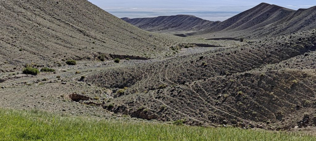
Rob and I set off towards yet another mystery peak, armed with the summit’s coordinates but clueless about the base’s whereabouts. The maps hint at a bumpy twenty-kilometer detour off-road, the ease of which remains a coin toss.

We approach the camel farm situated at the mountain’s base
Several double-humped camels graze freely

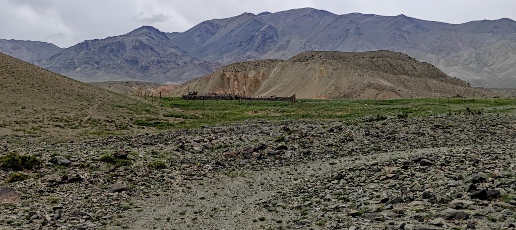
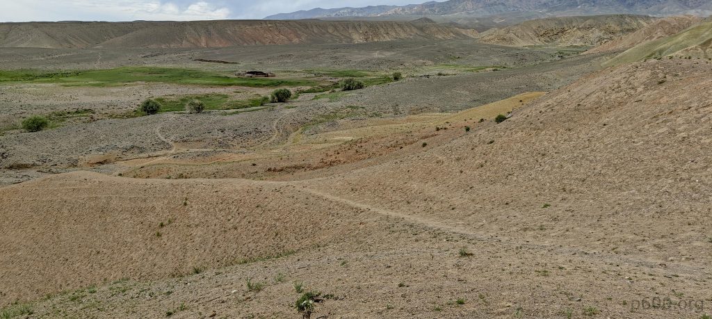
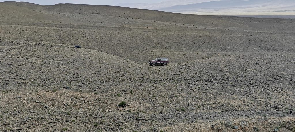
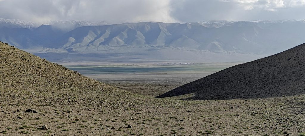
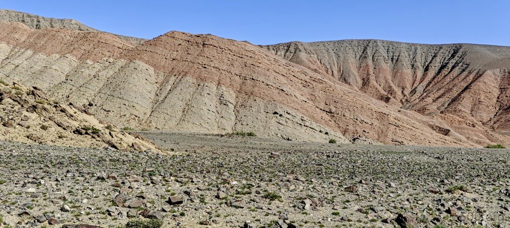
Slicing through the steppes, we aim straight for the base, but our initial pivot towards the ridge fizzles out, forcing a northwest detour in pursuit of elusive car tracks. These tracks vanish as quickly as they appear, sending us on a wild goose chase until a glimmer of hope leads us seven kilometers closer to our target via a path that could generously be described as “challenging.”

Almost a rainbow on the ground
Camels in the farm turn their attention to us
The landscapes around us are awash with vibrant colours.
Baatar Khairkhan – our summit for day after comes into view
Our summit for tomorrow awaits us

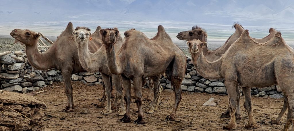
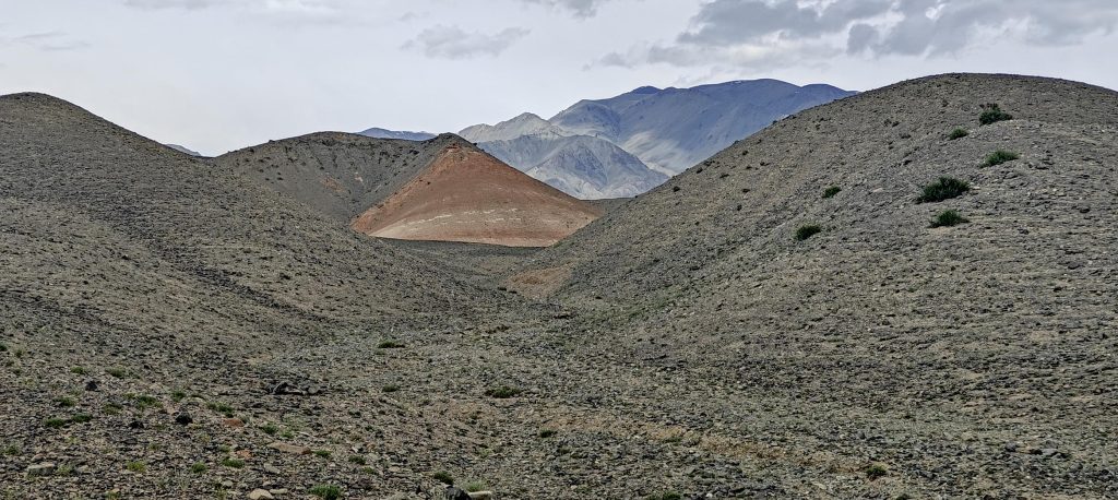
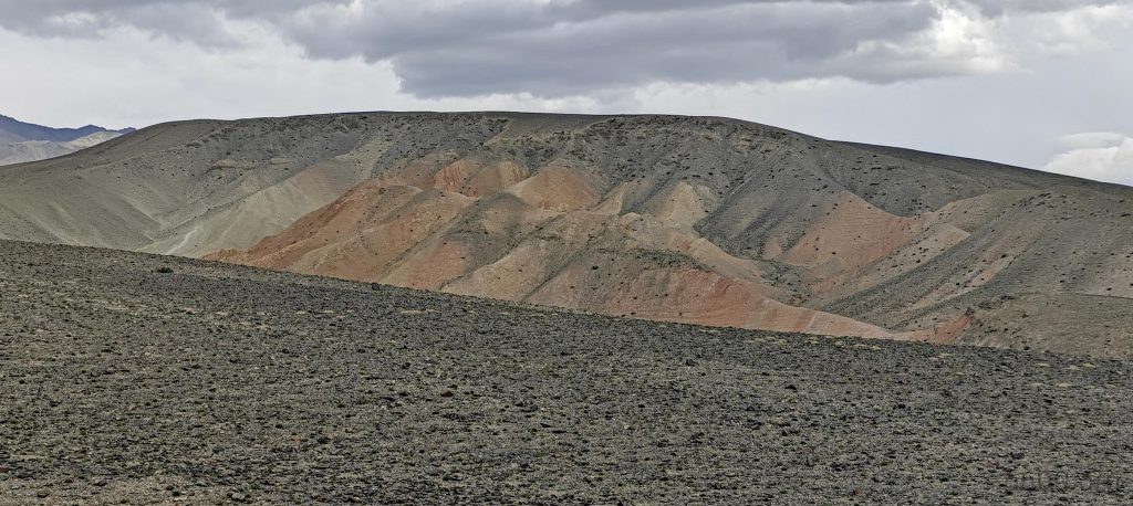
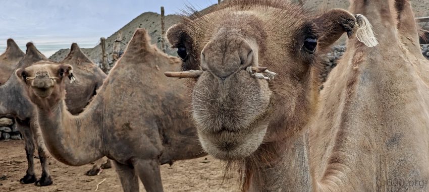
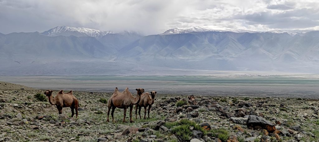
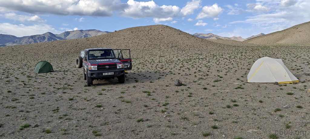
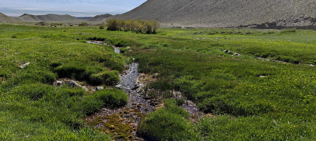
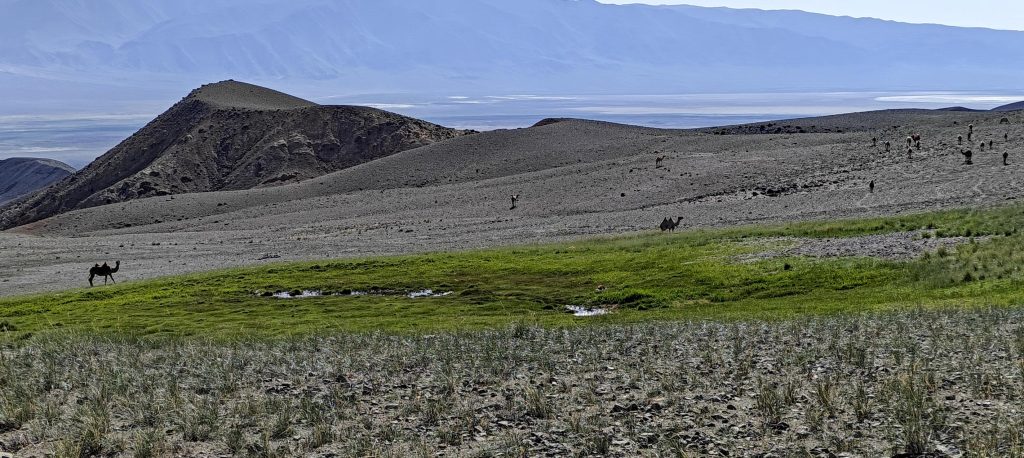
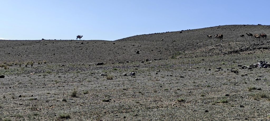
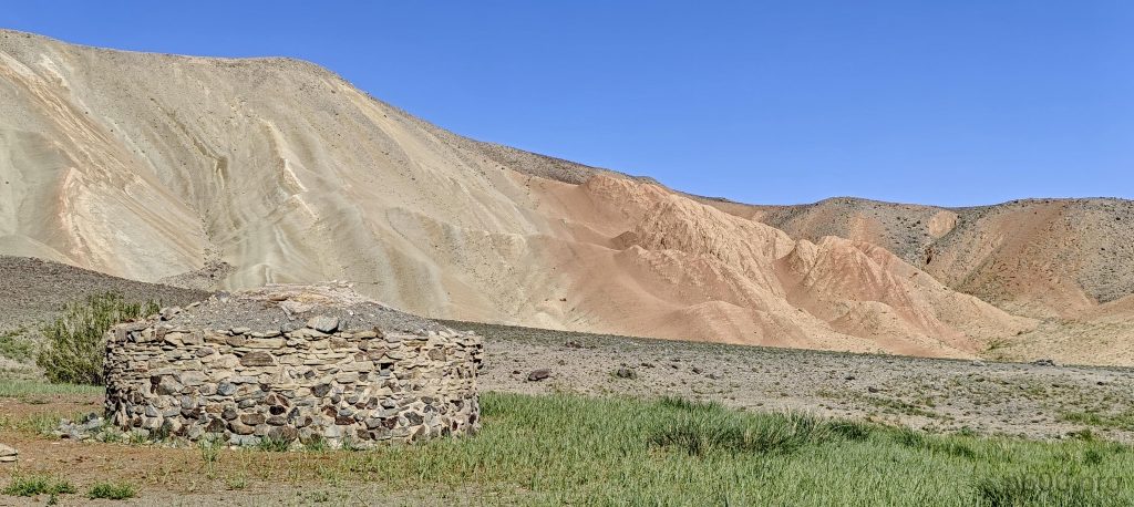
Arriving at a camel farm, it becomes blatantly obvious that these double-humped Bactrian camels won’t be guiding us up the mountain. After a bit of backtracking, we luck out with a spot of internet access. But then, as if on cue, the wind crashes our party, completely wrecking my tent and forcing me into a snug overnight stay in the car.

Our campsite is now set up
The Baatar Khairkhan range appears quite cloudy as evening falls
The Baatar Khairkhan range appears much friendlier in the morning

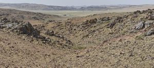
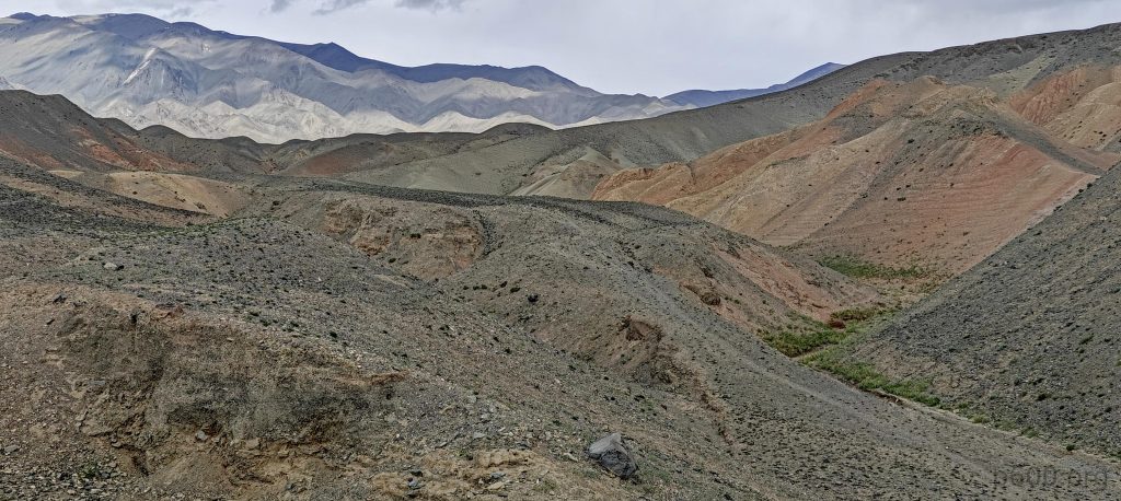
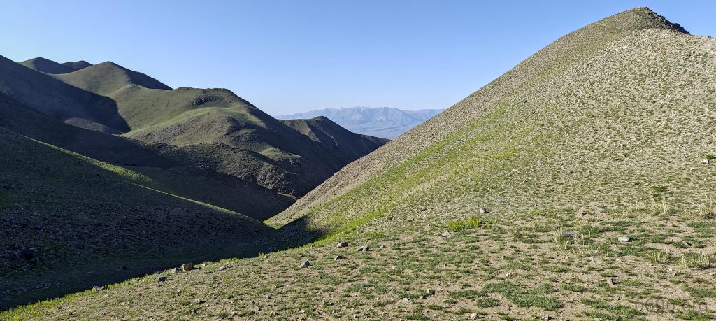
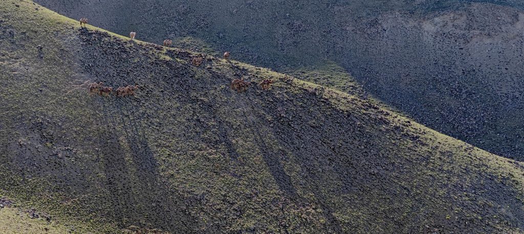
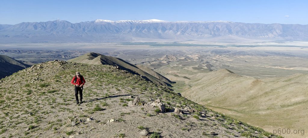
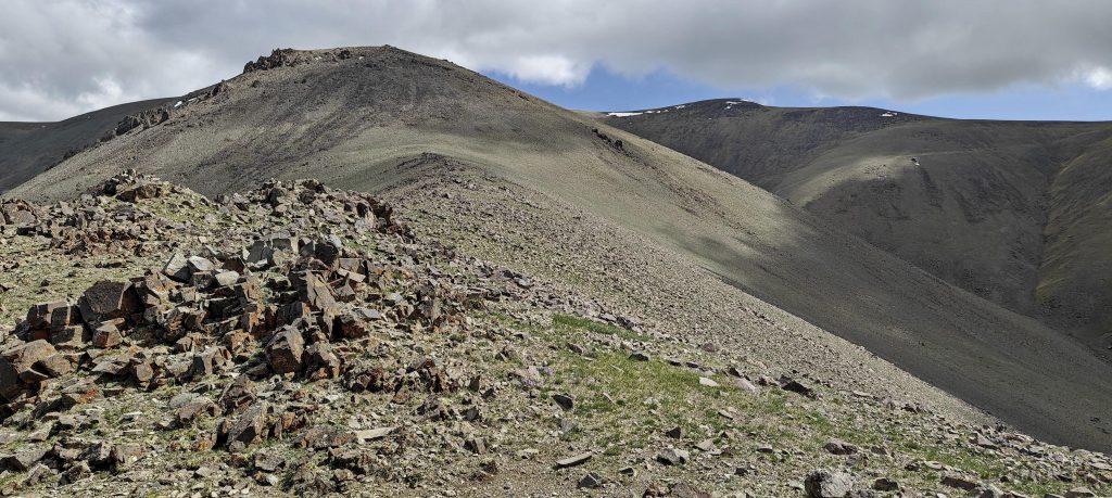
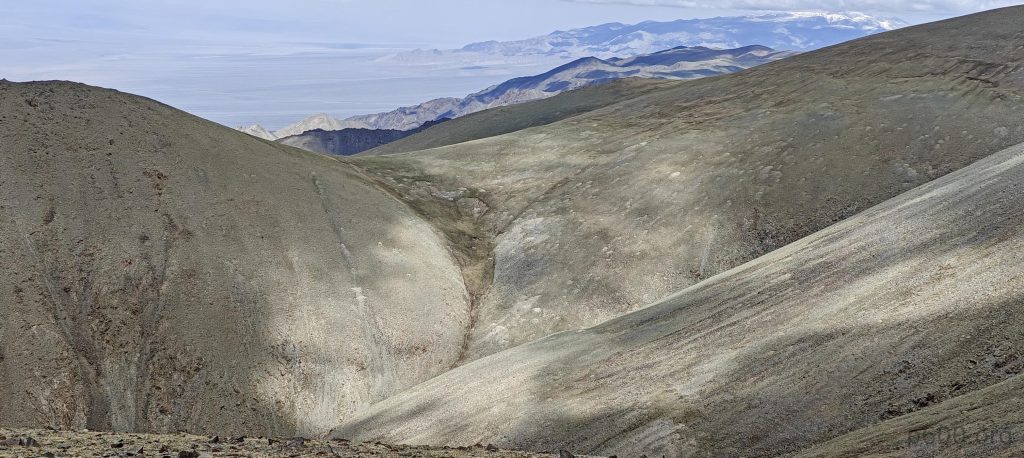
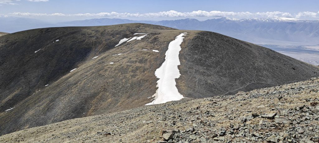
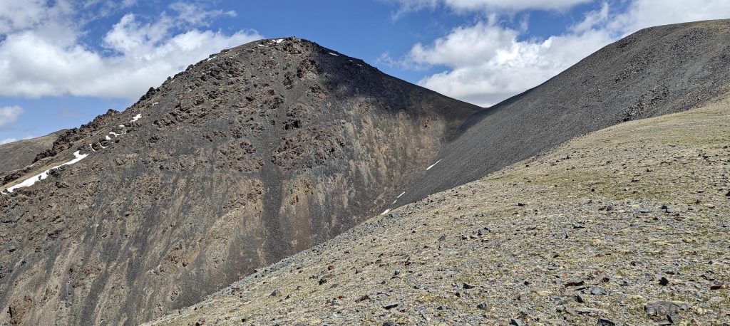
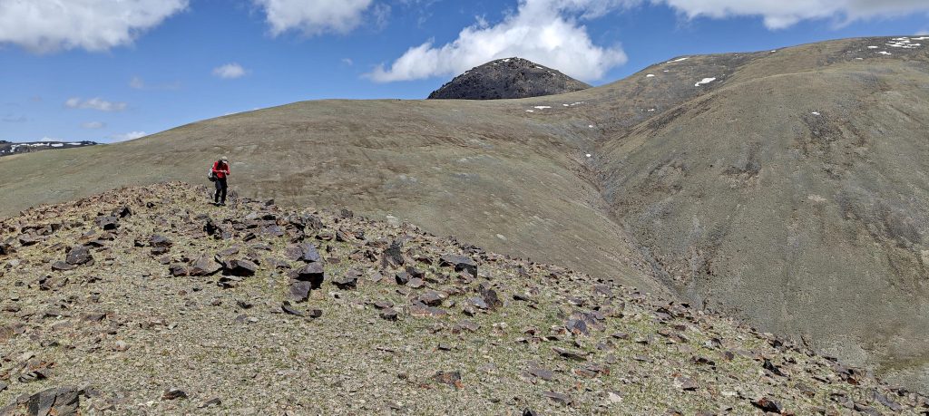
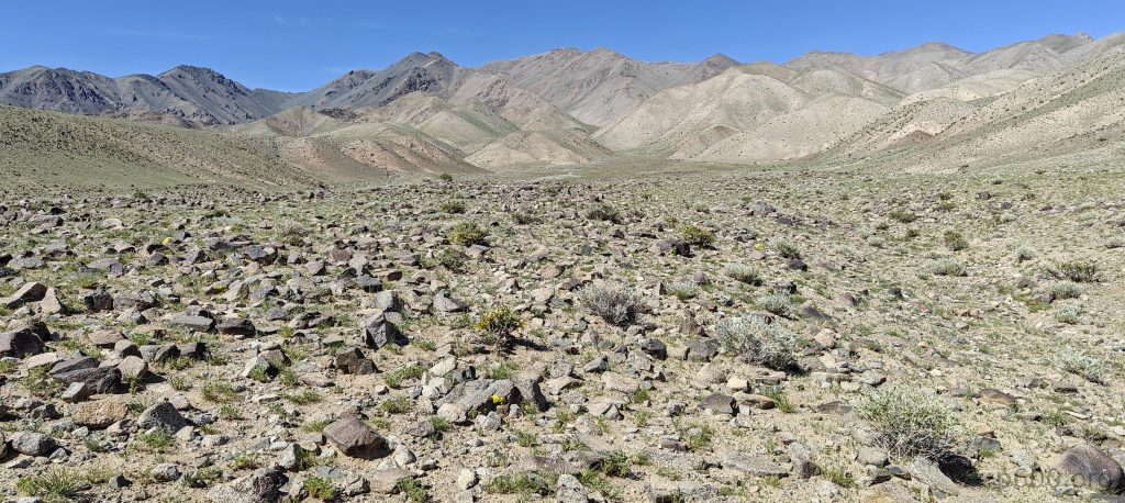
Post a speedy breakfast, Rob and I embark on our ascent, choosing the left-hand ridge. The start is idyllic, with grassy slopes and wild camels gracing us with their presence, debunking my flat-earth-camel theory. Soon, the terrain turns into a blockbuster set with giant boulders that seem to teeter just for the thrill. Despite the adrenaline, we press on.

Gradual slopes at the begining
I am a bit surprised to see camels at high altitudes, and I hope they are less surprised to see us

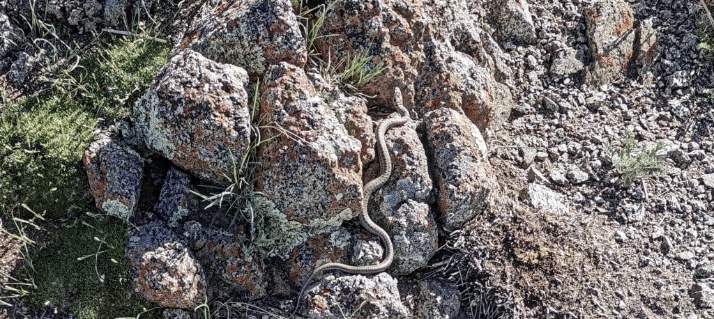
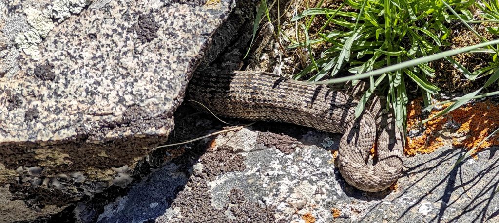
In a less dramatic moment, I encounter a meter-long snake that decides it wants nothing to do with us. Richard, IDs it as a Pit Viper—a charmingly venomous high-altitude resident. Spotting another, larger one on the descent, I conclude it’s not just rocks and breathtaking views up here.

I spot the Halys Pit Viper (Gloydius halys) twice; the first, a small one about a meter long, and the second, a larger one possibly over a meter long.
On our way down, we spot a second Halys Pit Viper (Gloydius halys), which is large and possibly extends beyond a meter in length.
We plan to climb snow covered Baatar Khairkhan in two days
Looking down at the valleys, spotting the dry lakes below
The views from the ridge are spectacular
Looking back, the ridge appears formidable
Rob stands on the ridge’s bump

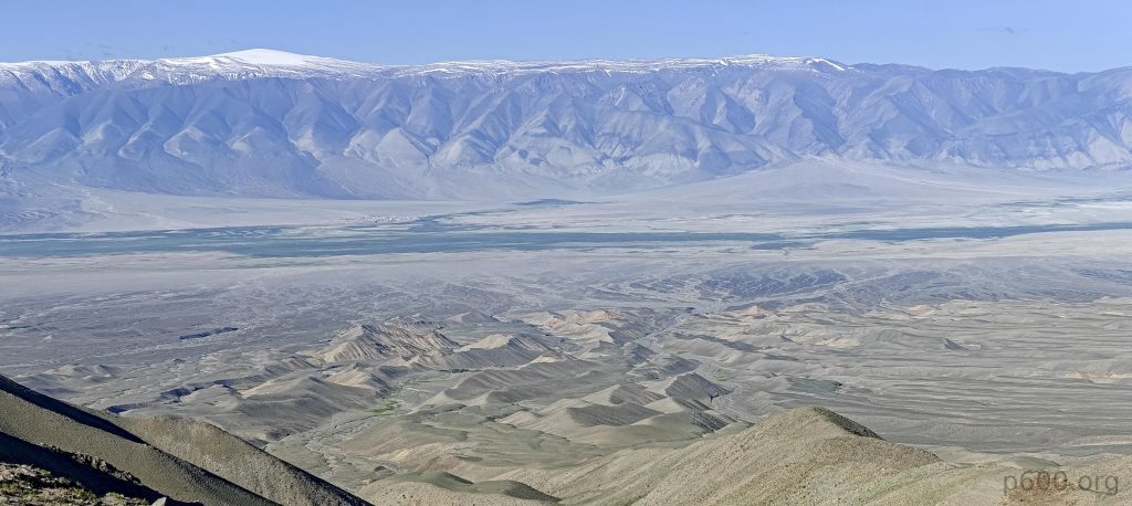
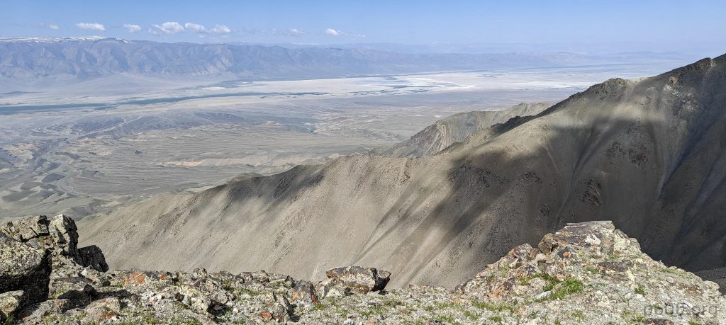
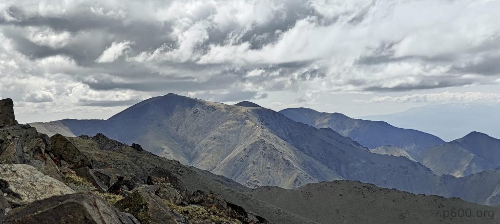
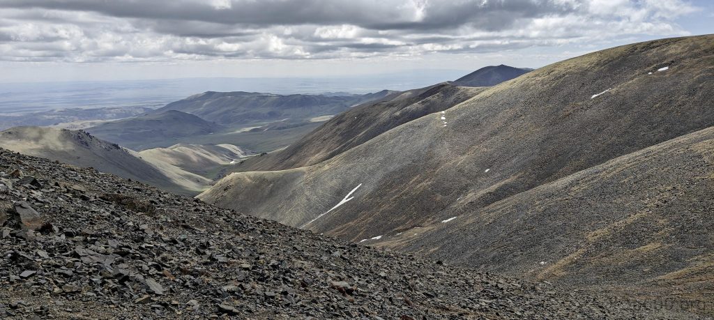
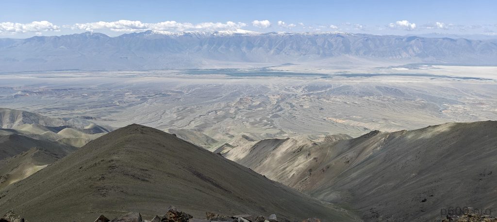
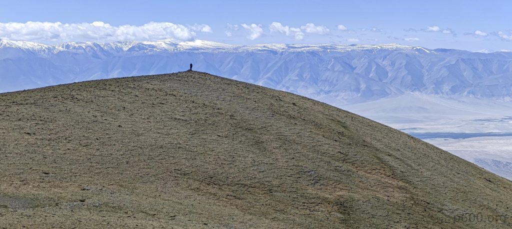
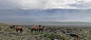
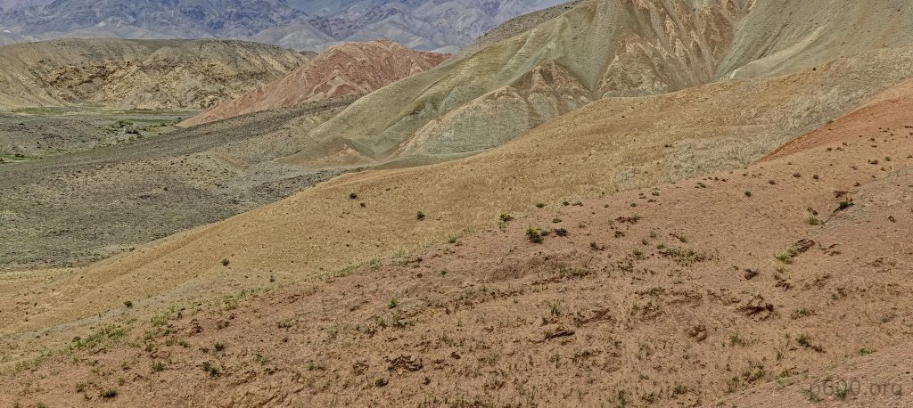
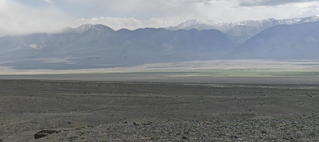
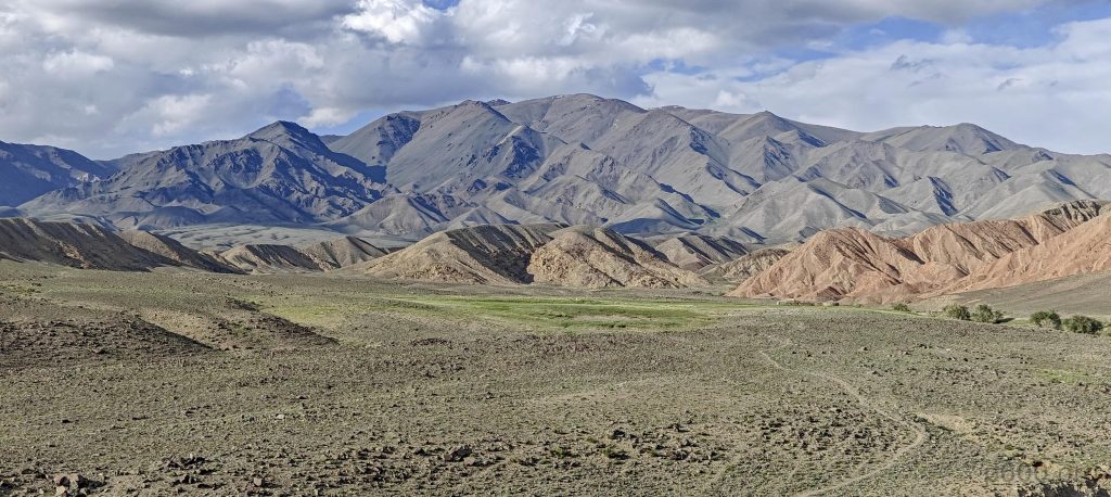
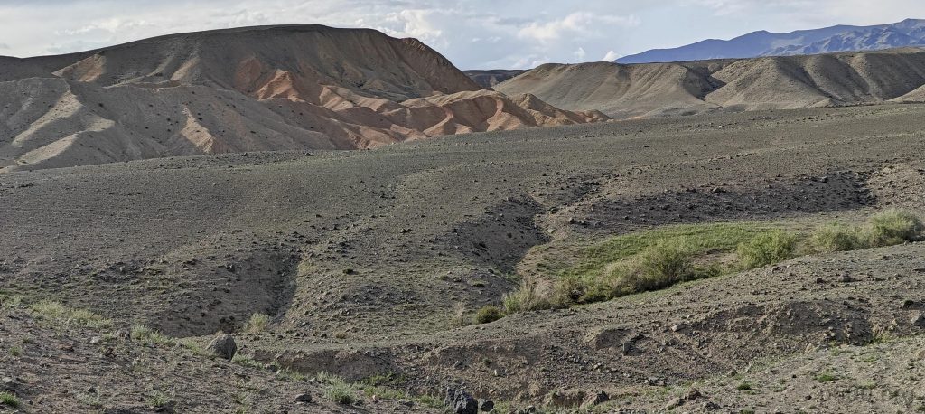
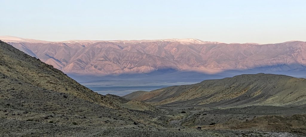
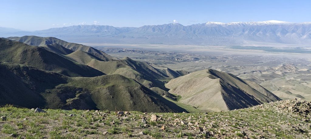
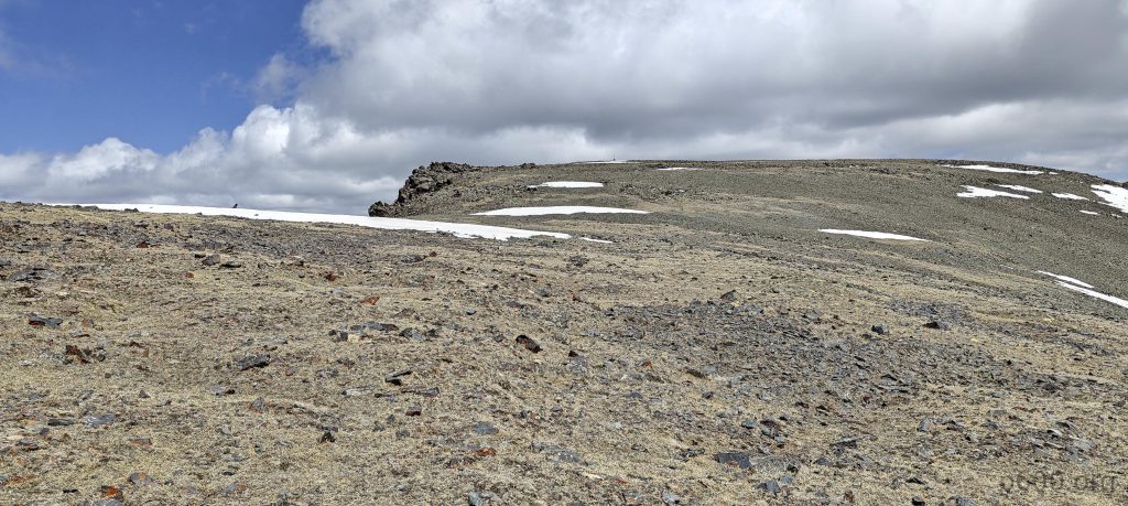
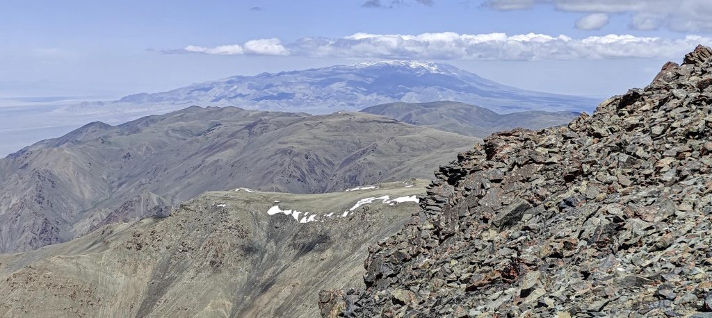
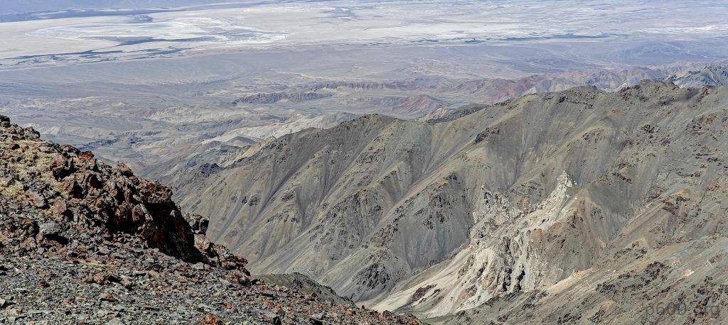
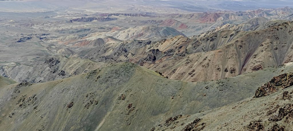
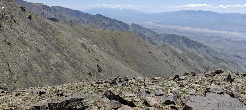
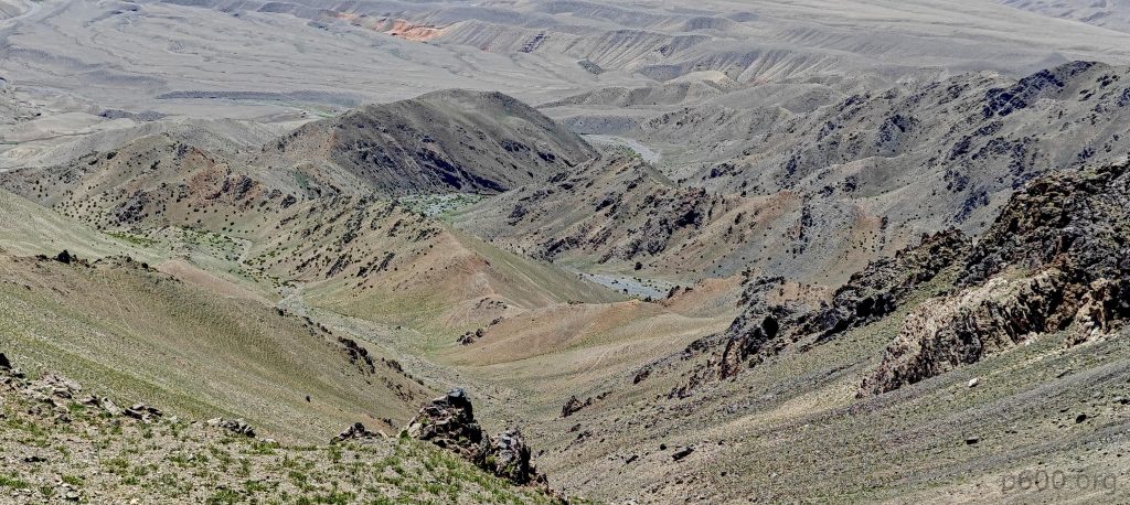
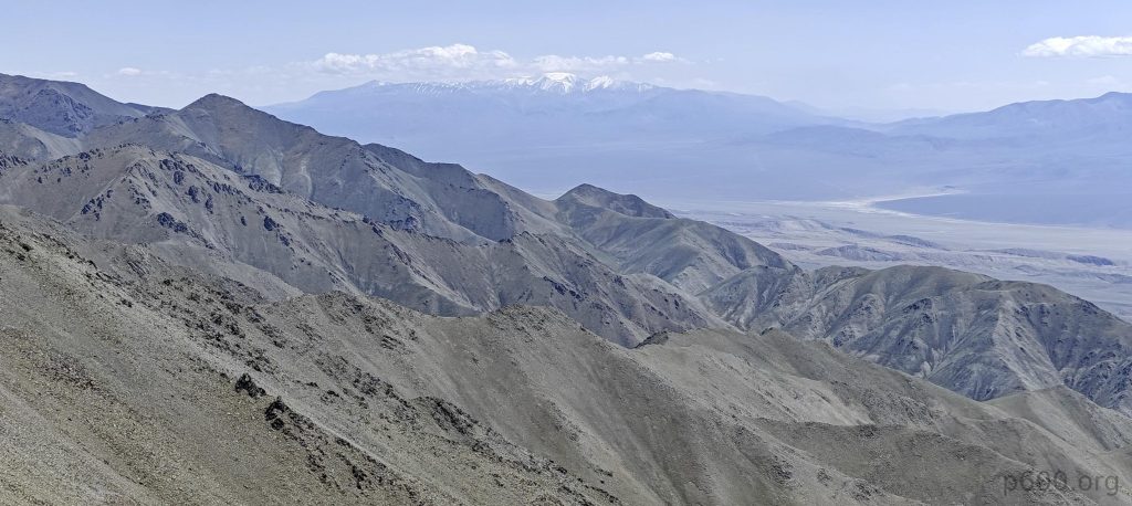
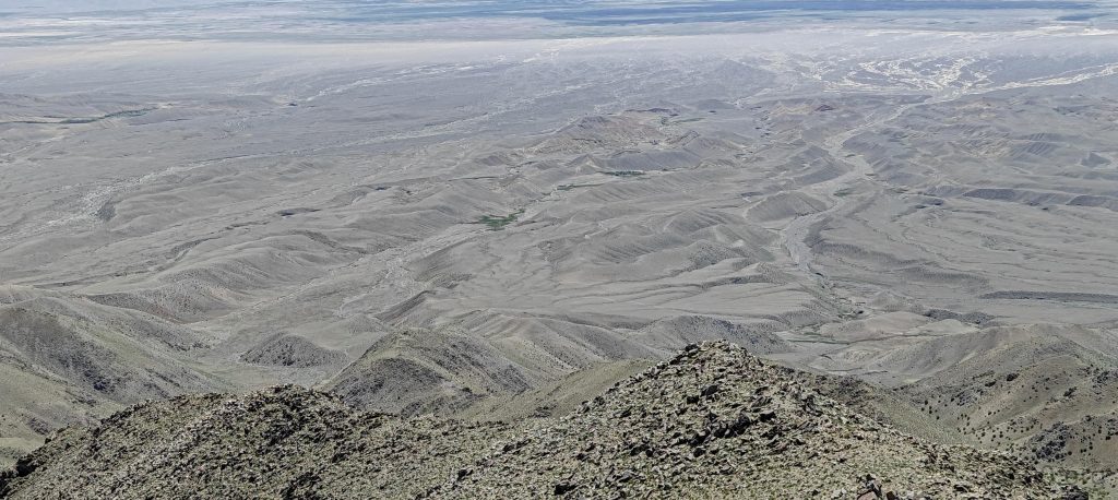
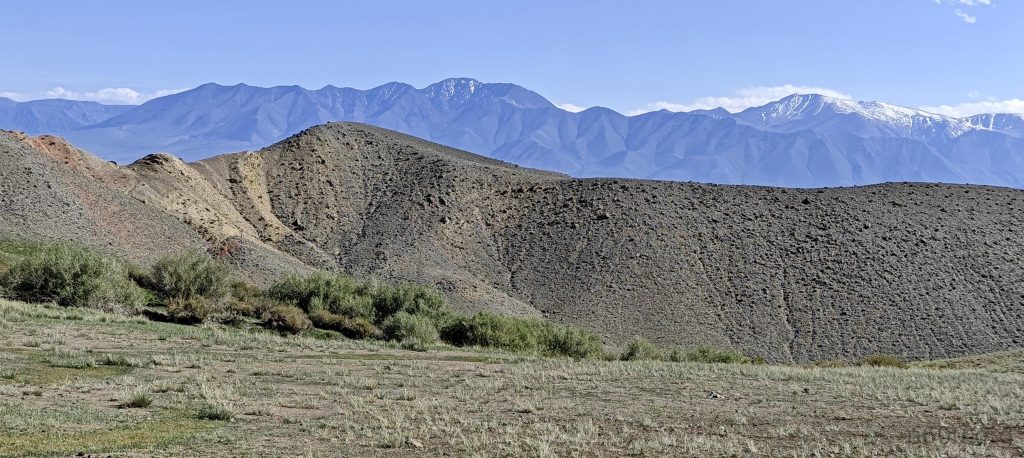
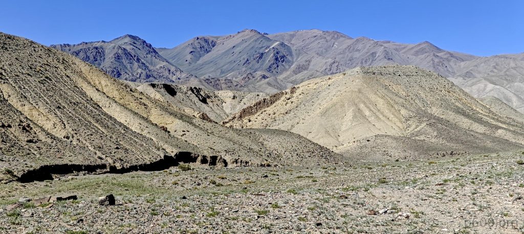
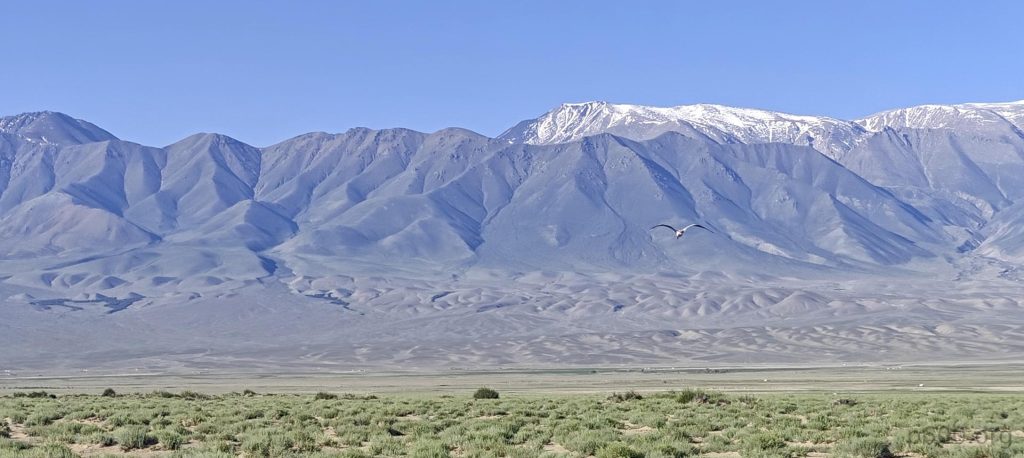
Speaking of views, they’re nothing short of spectacular. Baatar Khairkhan plays peek-a-boo in the distance, snow-capped and majestic, part of our grand plan. Dodging snow patches like pros, we power through to the summit. The climb, a solid seven-hour testament to our will, ends with us at the peak, basking in victory.

There is a bit of snow at the top, but it is possible to avoid it
The summit plateau spreads out before us
We are likely looking at the Jargalant Khairkhan range
Views down
Rob and I sit next to the summit cairn
Lower summit
The landscapes around us are once again bursting with color.

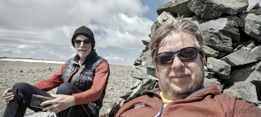
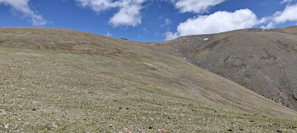
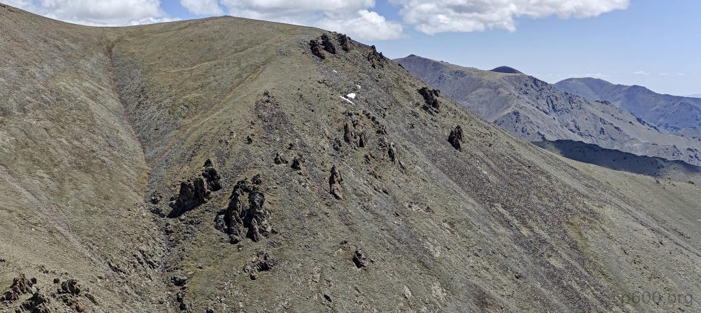
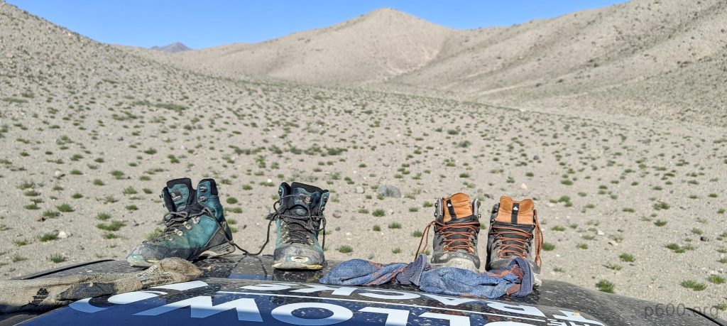
After celebrating with an apple—because that’s how we roll—we begin our descent on a hopefully less boulder-infested ridge. The journey back is a mix of ‘ahh’ moments and ‘ugh’ sections, but we make it back to the car in five and a half hours, ready for another night under the stars.

Likely, the natural container for the flower is rich in minerals.
We return to the mountain base.
A lush, green valley unfolds alongside the stream
As usual, there are plenty of birds around.
That’s it… On to the next one!

Thirteen hours later, we’re celebrating our fifth Ultra peak, a feat that seemed optimistic at best this morning. Overcoming today’s buffet of uncertainties feels like a win. Tomorrow, we set our sights on Baatar Khairkhan, because why stop now?


Bumbag Khairkhan Uul3470 m altitude
1806 m prominence
38.40 km isolation
RangesMongolia Ranges - Altai
Countries/regionsKhovd - Mongolia
Distance13.70 km up13.50 km down
Elevation2059 m gain2059 m loss
Time
7h05 up
0h15 other
5h35 down
12h55 total
Trailhead1410 m altitude47.1974160, 92.9429720
RouteFollowing the stream, our path is initially adorned with verdant, grassy expanses before leading us to ascend the Left hand ridge, marked by gradual slopes. Nearing the summit, we navigate through a field of unavoidable boulders, only to find the summit plateau offering a reprieve with its straightforward terrain. Opting for the Right hand ridge on our descent, we encounter a route of similar difficulty, though it offers a slightly shorter journey back.
DifficultiesLarge boulders in the vicinity of the summit plateau are susceptible to movement. Proceed with caution in this area.
LinksGPX trail
  • Mongolia Ranges 2023
  • « Peak 1727m, Taishir
  • Baatar Khairkhan »

Mountain Ranges

Anatolia
Central Anatolia
Pontic Mountains
Southeast Anatolia
Taurus Mountains
Western Anatolia
Andes
Puna de Atacama
Atlas Mountains
High Atlas
Northwestern Atlas
Central America Ranges
Costa Rica-Panama Ranges
Central Central America
East China
Taiwan
Eastern Europe Ranges
Southeast Baltic Plains
Iberian Peninsula
Cordillera Cantabrica
Castile Ranges
Portugal-Galicia
Pyrenees
Intermountain West
Great Basin Ranges
Korea-Amur Area
Taebaek Sanmae
Malay Archipelago
Java
Nusa Tengarra
Sulawesi
Sumatra
Mid-Atlantic Islands
North Atlantic Islands
Mongolia Ranges
Altai
Gobi Desert Ranges
Hangay Mountains
Northwest Europe
Great Britain
North France-West Rhine Area
Pacific Ranges
Cascade Range
Northwest U.S. Coast Ranges
Sierra Nevada
Central and Southern California Ranges
Philippines
Central Philippines
Luzon
Mindanao
Southeast Asia
Malay Peninsula
Southeast South America
Pampas
Sierras de Cordoba
Southern Africa
Malawi Highlands
West Africa Mountains
Bight of Benin
Cameroon Mountains
Guinea Highlands

Countries / regions

Algeria
Ain Guezzam
Ain Salah
Aïn Témouchent
El Bayadh
Ghardaïa
Oran
Ouargla
Saïda
Sidi Bel Abbès
Tamanrasset
Argentina
Catamarca
Ciudad Autónoma de Buenos Aires
Córdoba
Jujuy
Salta
Tucumán
Belgium
Brussels Capital Region
Flemish Region
Cameroon
Southwest
China
Taiwan
Costa Rica
Alajuela
Cartago
Guanacaste
Heredia
Limón
San José
Czechia
Prague
Denmark
Greenland
France
Hauts-de-France
Occitania
Germany
Berlin
Niedersachsen
Indonesia
Bali
Jambi
Jawa Tengah
Jawa Timur
Nusa Tenggara Barat
Sulawesi Tengah
Sulawesi Utara
Sumatera Barat
Lithuania
Vilnius County
Mongolia
Bayankhongor
Govi-Altai
Khovd
Omnogovi
Ovorkhangai
Ulan Bator
Zavkhan
Morocco
Béni Mellal-Khénifra
Drâa-Tafilalet
Fez-Meknes
Marrakesh-Safi
Souss-Massa
Tangier-Tetouan-Al Hoceima
Mozambique
Zambezia
Netherlands
Gelderland
Noord-Holland
Zeeland
Nicaragua
Chinandega
Managua
Masaya
Rivas
Philippines
Bicol Region (V)
Cagayan Valley (II)
Calabarzon (IV-A)
Central Luzon (III)
Cordillera Administrative Region
Davao Region
Metro Manila
Soccsksargen (XII)
Western Visayas (VI)
Poland
Greater Poland Voivodeship
Masovian Voivodeship
Portugal
Castelo Branco
Leiria
Lisbon
Madeira
Santarém
Qatar
Ad-Dawhah
São Tomé and Príncipe
São Tomé Province
Sierra Leone
Northern Province
Western Area
Singapore
South Korea
Gyeongsangnam-do
Seoul
Spain
Aragón
Asturias
Castilla-La Mancha
Castilla y León
Catalonia
Islas Canarias
Switzerland
Zürich
Turkey
Antalya
Bitlis
Erzincan
Hakkâri
Igdir
Isparta
Kahraman Maras
Muğla
United Kingdom
England
Scotland
United States
California
Delaware
Florida
Maryland
Nevada
New Jersey
New York
Pennsylvania
South Carolina
Utah

TRIPS

2024
Southern Africa 2024
Mid-Atlantic Islands 2024
North America 2024
Anatolia 2024
Korea-Amur Area 2024
East China 2024
2023
Mongolia Ranges 2023
Philippines 2023
West Africa III 2023
West Africa II 2023
Iberian Peninsula 2023
West Africa 2023
Central America 2023
2022
Andes 2022
Northwest Europe 2022
Malay Archipelago III 2022
Malay Archipelago II 2022
Anatolia Mountains 2022
Iberian Peninsula 2022
Atlas Mountains 2022
North France-West Rhine Area 2022

archaeology (3) climb (157) food (2) hike (155) p30 (17) p50 (4) p100 (24) p300 (12) p600 (17) p1000 (11) p1500 (76) ribu (10) sight (46) summary (16) trig (44) ultra (76)

1 591 km walked, 121 298 m climbed

©2025 p600.org | WordPress Theme by Superbthemes.com