Skip to content
Menu
p600.org
  • home
  • map
  • trips
  • about
p600.org

Otgon Tenger Uul

hike | 2023-06-25

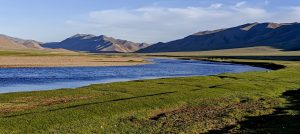
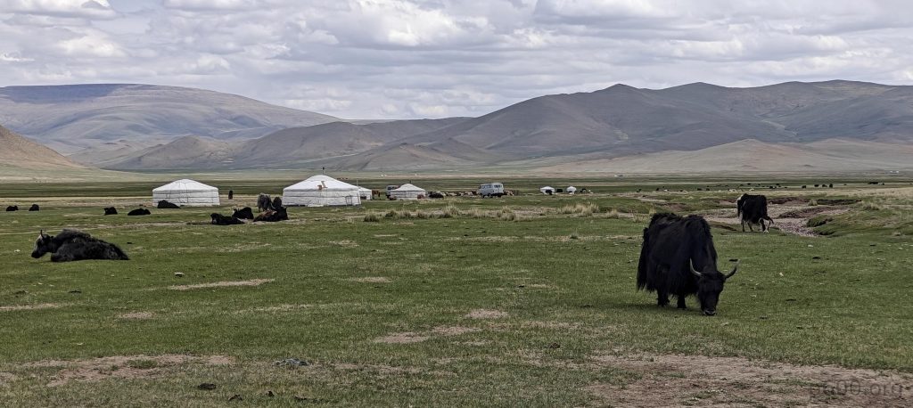
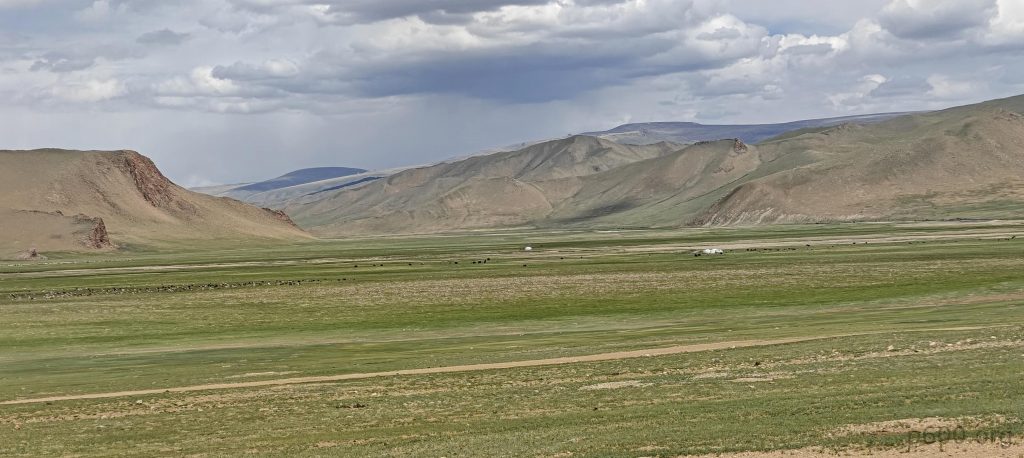
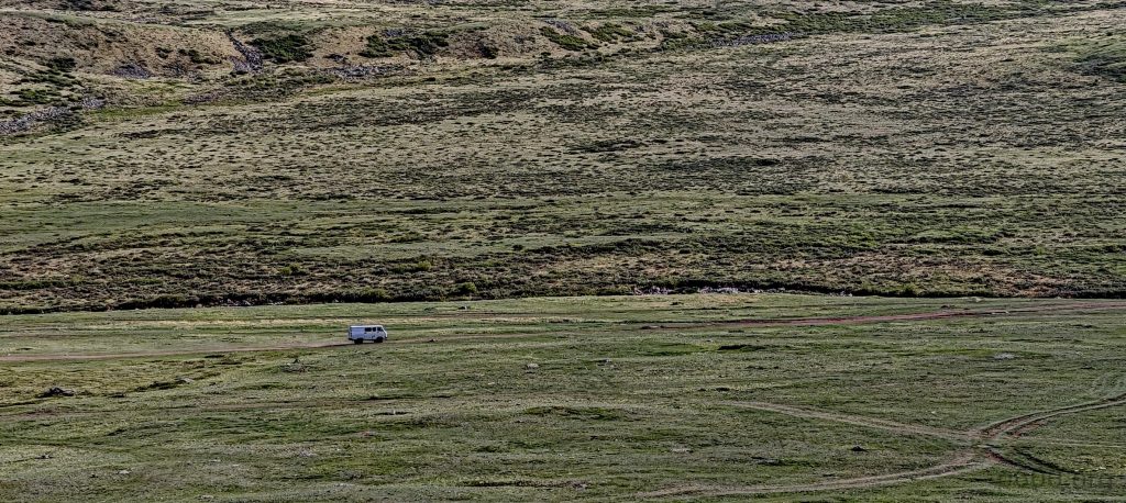
Bidding farewell to the echoes of Jargalant Khairkhan, we diverted towards the mighty Otgon Tenger Uul, a beacon for adventurers. The quaint town of Otgon served as our gateway, leading us to a picturesque valley where the Buiant-gol River shimmered like a turquoise ribbon. Bustling with tourist activity, the area was a clear indicator of this peak’s popularity.

Yaks grazing near yurts welcome us to the steppes
Driving to the road’s end, a common occurrence for us, we get our first stunning glimpse of Otgon Tenger Uul.
The park, frequented by explorers, surprises us with its smooth roads.
Passing through the iconic park gates and steppes dotted with traditional white yurts.
It’s where streams play tag before joining the big league in the valley.

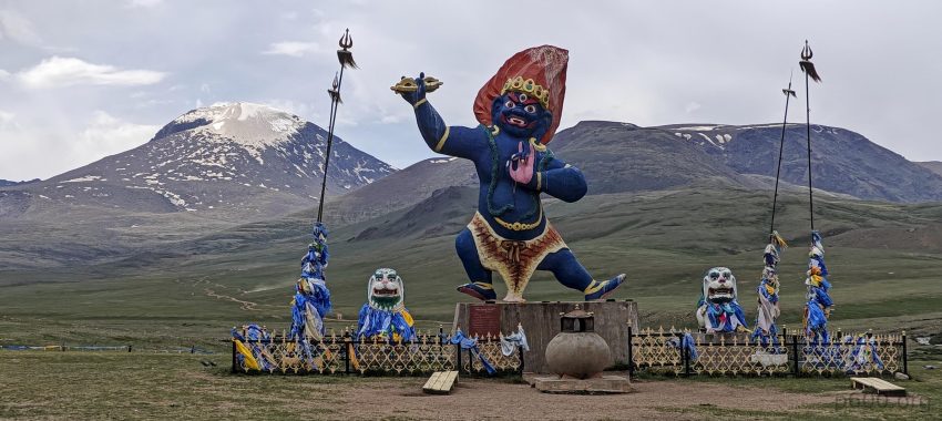
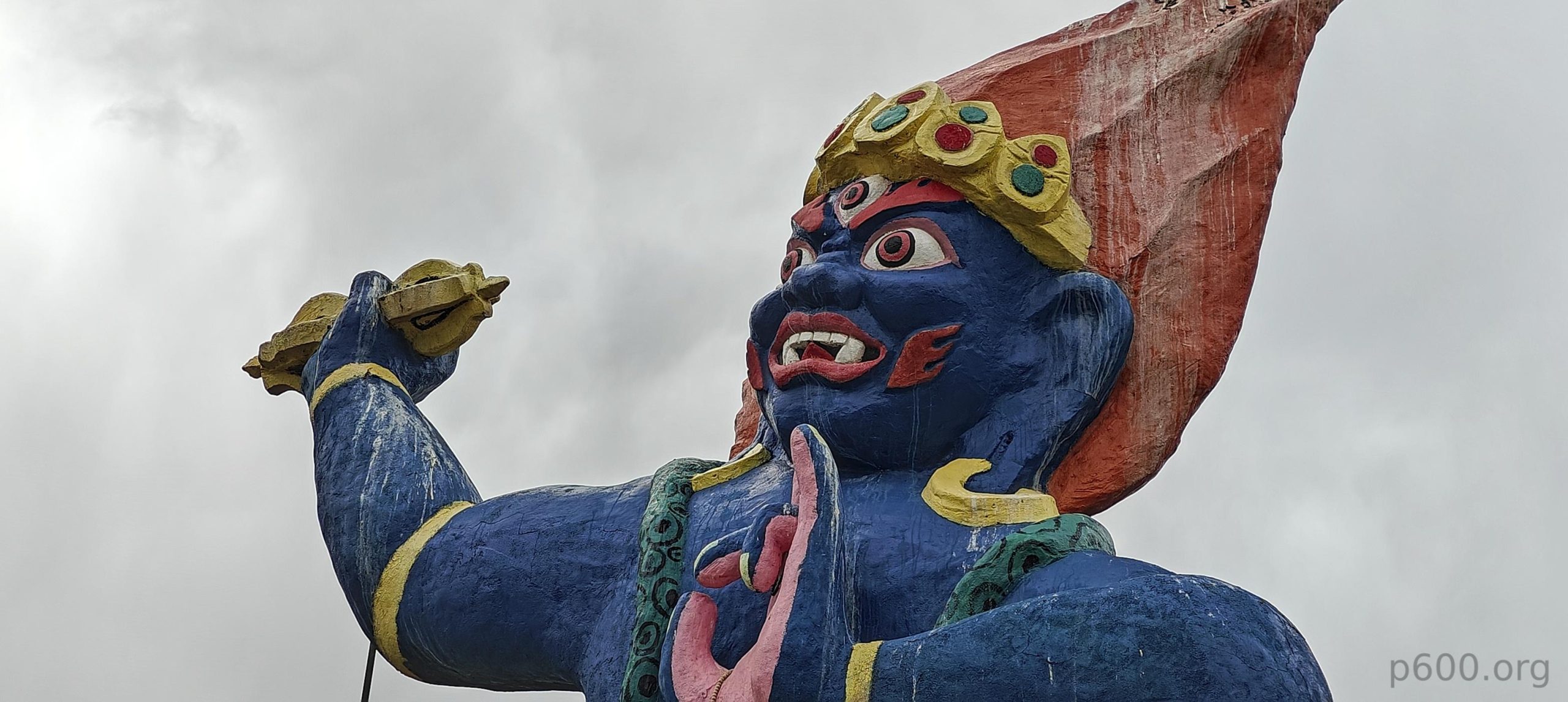
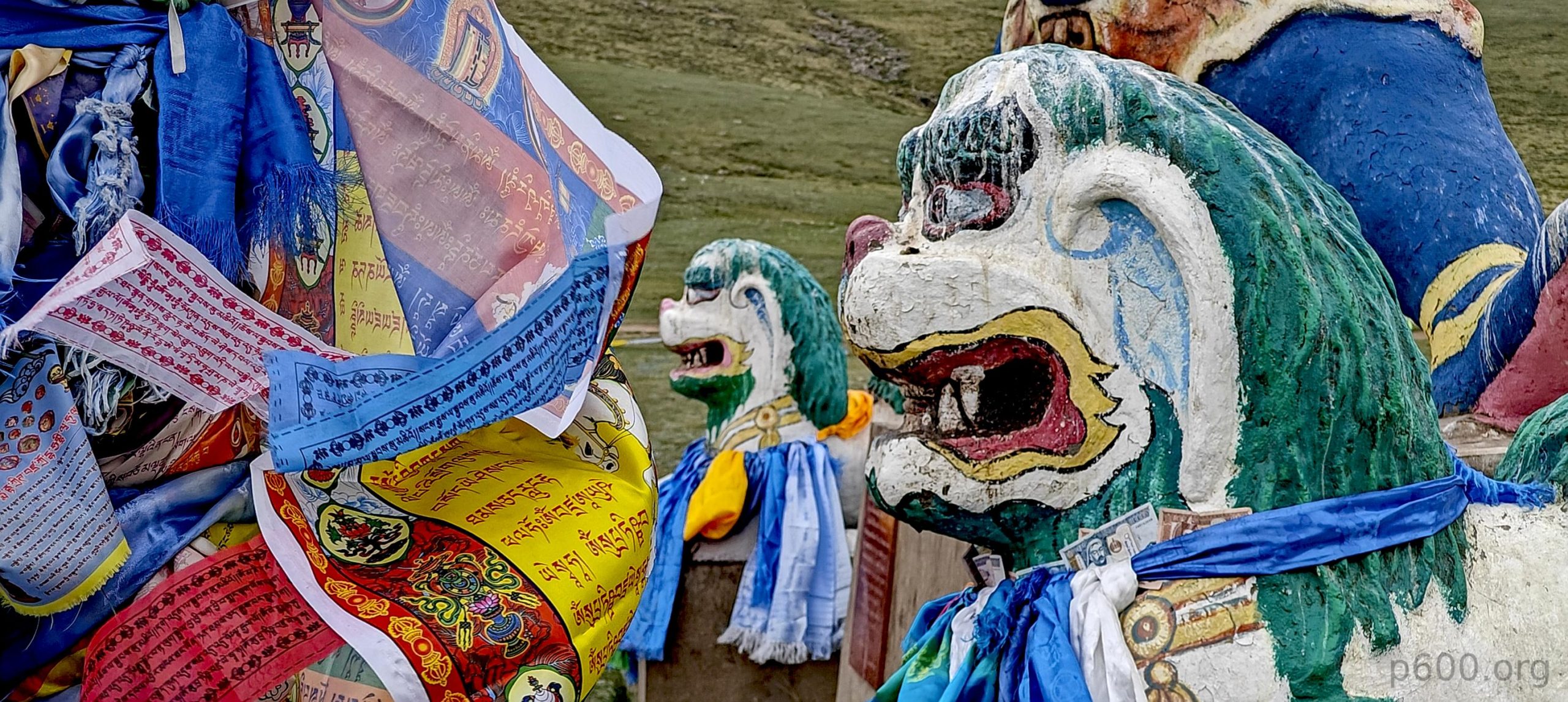
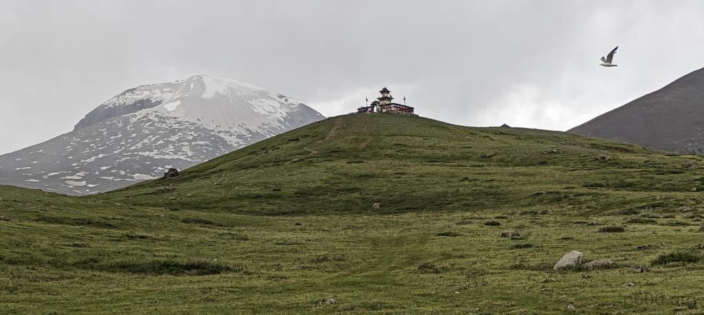
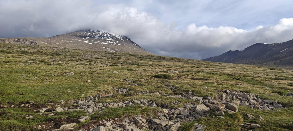
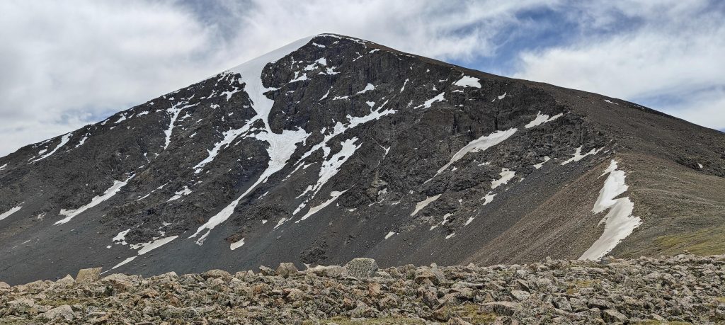
Before embarking on our ascent, we paused at an impressive Buddhist shrine featuring the imposing figure of Ochir Vana, a symbol of strength and wisdom. Standing tall beneath the snow-capped peak, he offered a silent source of encouragement against the climb’s uncertainties, particularly the anticipated ice and snow at the summit.

And there’s Protector Deity Ochir Vana, standing tall, an offering to the adventurous spirits.
Where the road meets its limit, stands a temple.
The prayer wheels are spun by practitioners in a clockwise direction. It is thought that each spinning of the wheel has the same effect as reciting the mantras or sutras.

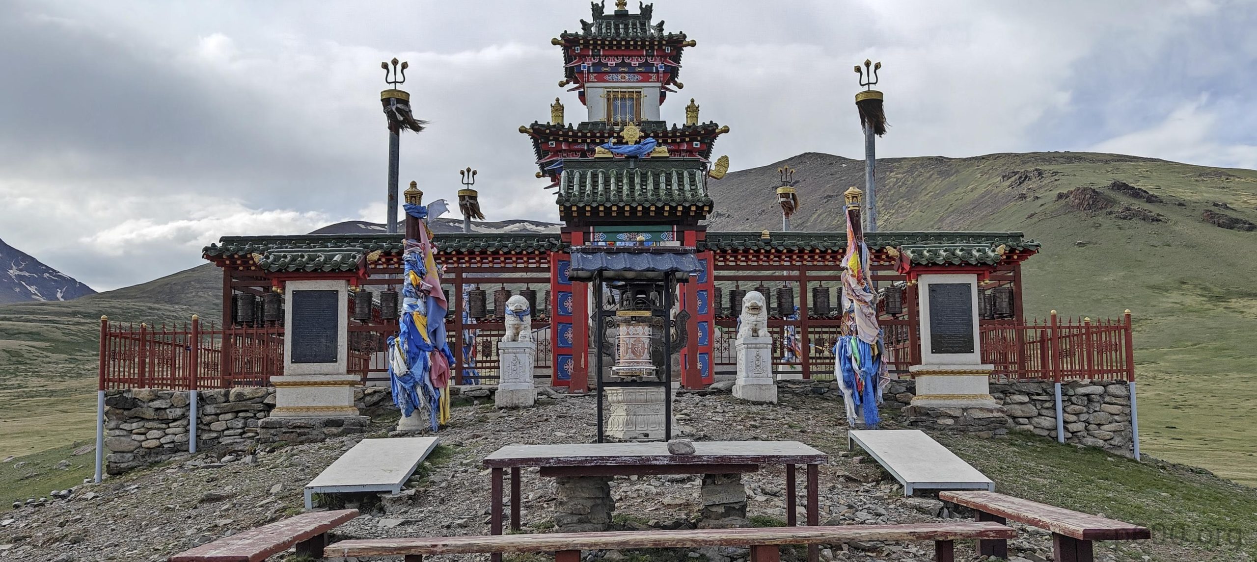
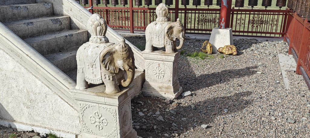
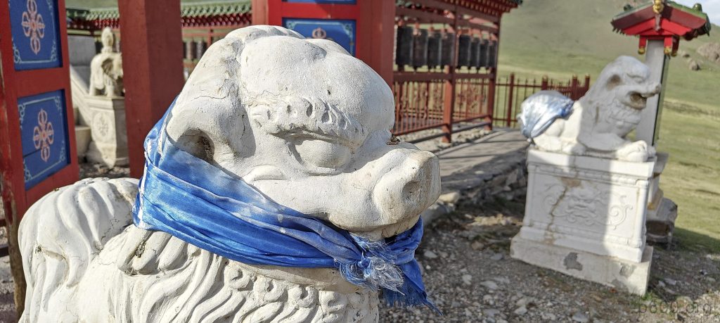
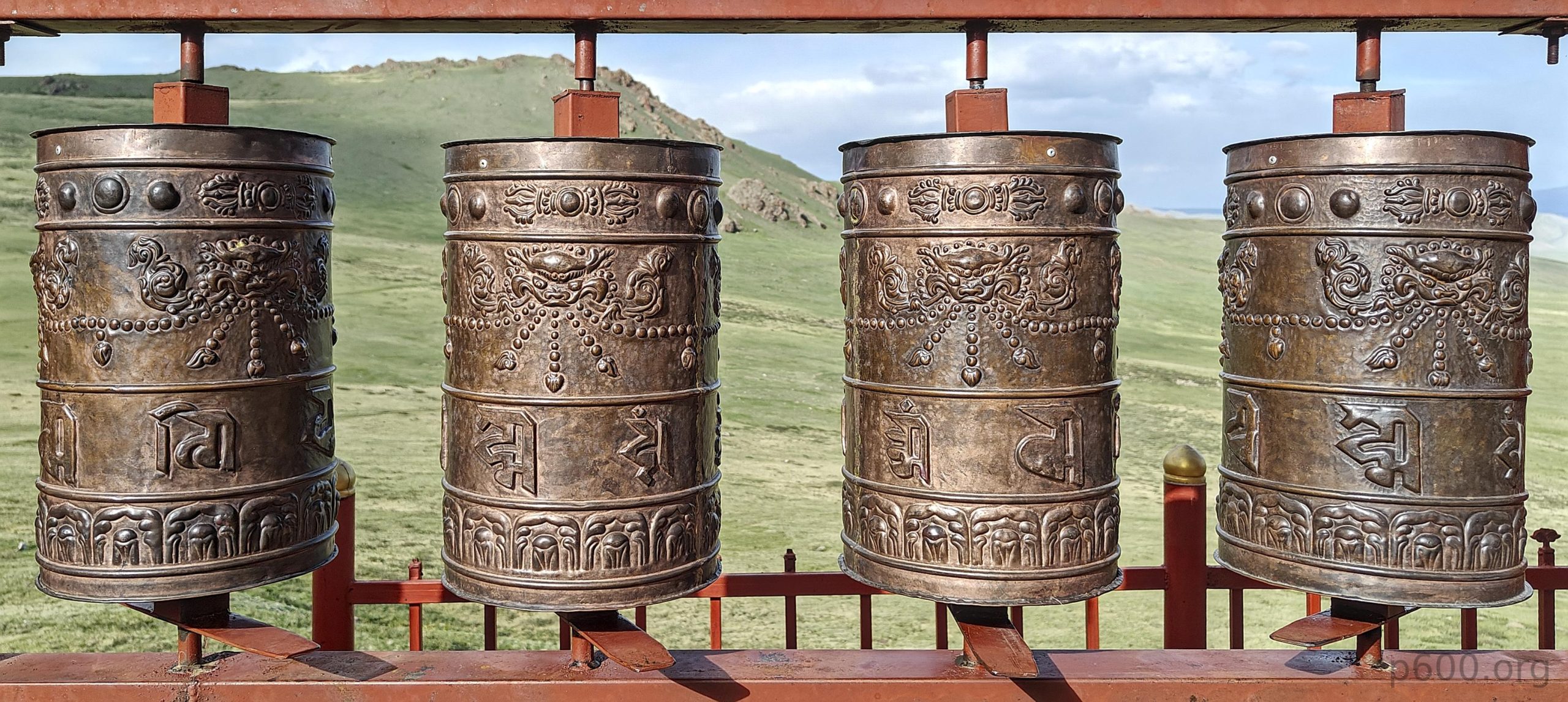
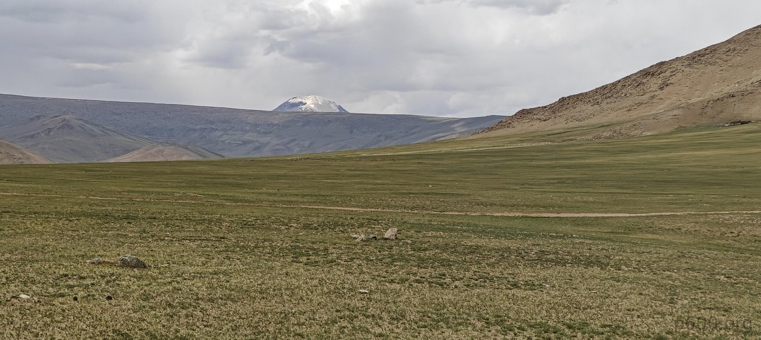
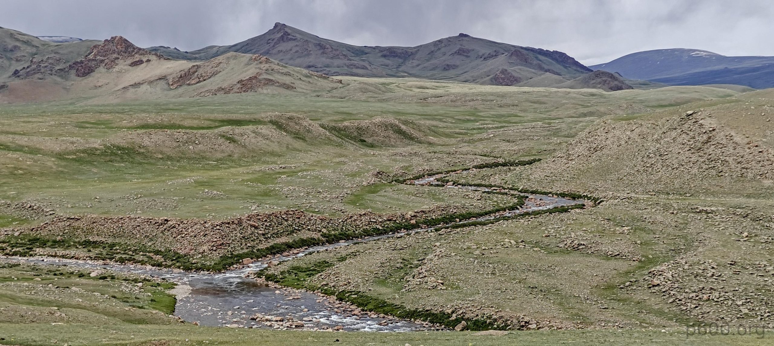
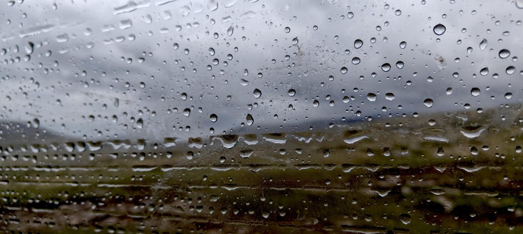
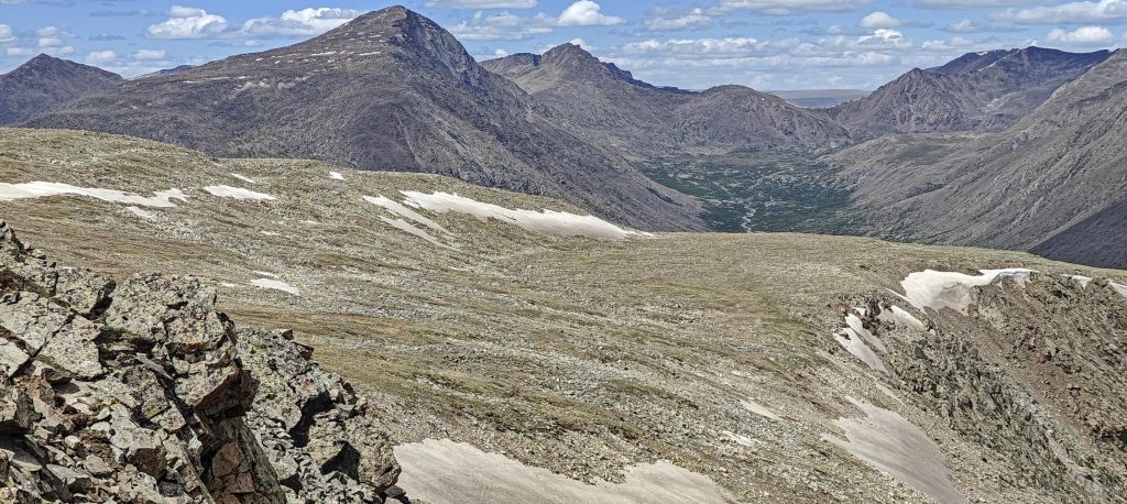
Reaching the end of the paved road, a serene temple greeted us, its prayer wheels spinning and echoing mantras across the valley. A gentle rain began to fall, but it couldn’t dampen the scene’s raw beauty. In one direction, Otgon Tenger Uul dominated the landscape, its snow-clad slopes beckoning and challenging us in equal measure. In stark contrast, an old car, carving its path across a stream, left tracks whispering of an untold journey.

Otgon Tenger Uul overseeing our path like a silent guardian.
Evening brings a drizzle to the valley

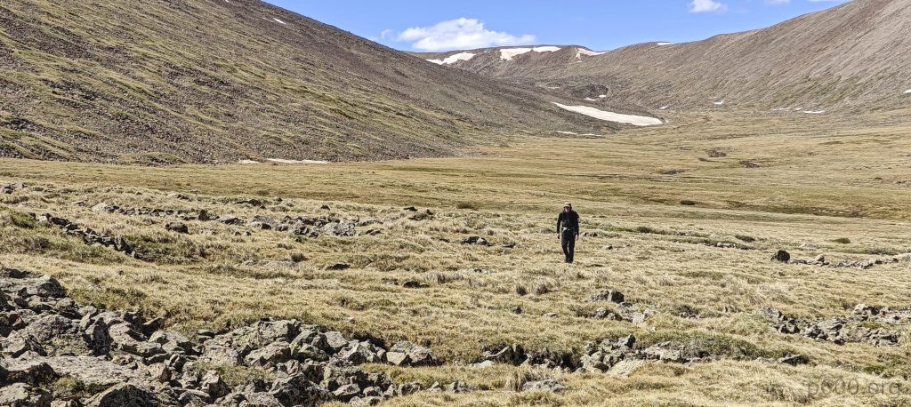
Inspired by the car’s adventurous spirit, we followed suit, fording the river ourselves. While adding a kilometer to our trek, the reward was undeniable – an idyllic campsite, offering a perfect blend of solitude and scenic charm. As darkness descended upon the valley, anticipation for the upcoming hike thrummed through us. Hoping for clear skies, we settled into camp, eager to conquer the mountain the next day.

Trusty old cars—surprisingly adept on these rugged terrains.
Considering the cold water; getting stuck mid-way would be far from ideal.
The landscape’s spruced up with bright orange Asian globeflowers (Trollius asiaticus), turning ‘nice’ into ‘wow’.
While mornings are a gamble of clouds and hopeful sunshine.

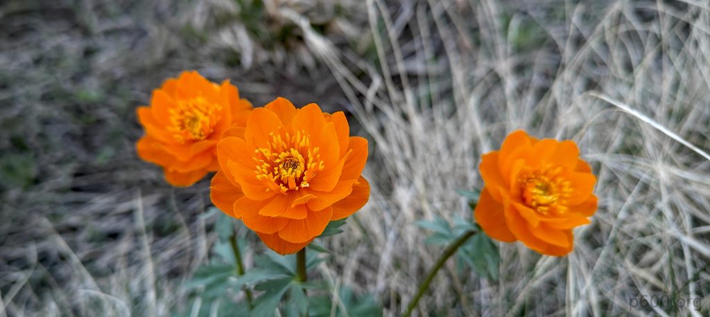
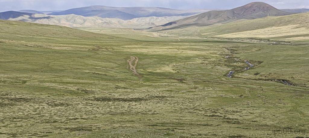
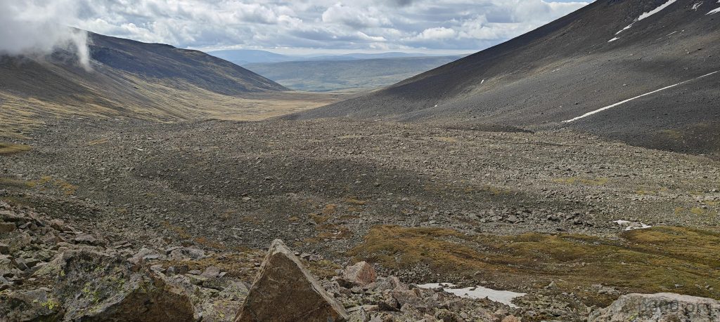
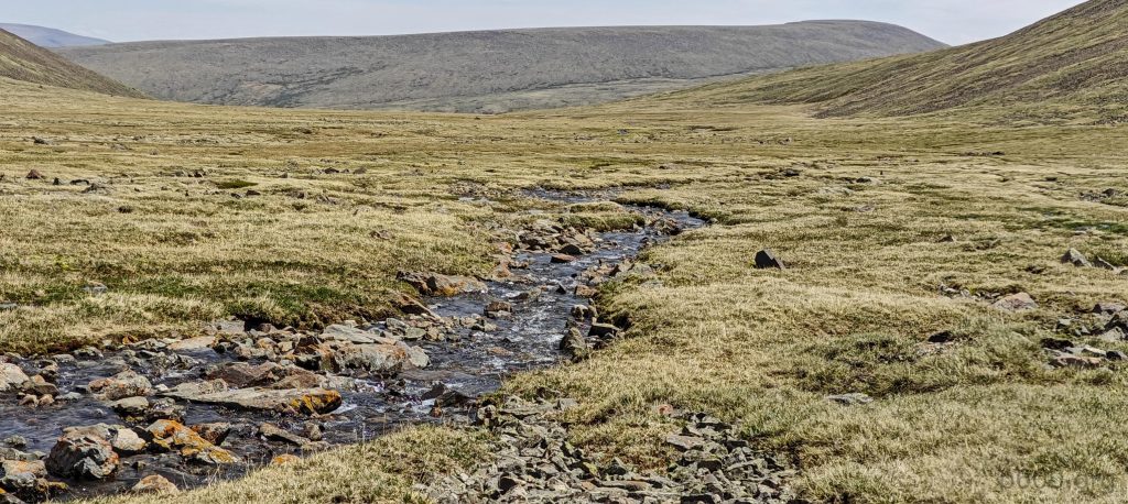
At dawn, we embarked on our journey, meandering through peaceful pastures. The terrain changed as we approached and began to climb a seemingly modest incline. But appearances can be deceiving – this “small” slope soon revealed its true nature, a challenging array of treacherous rocks testing our resolve. Opting for a strategic retreat, we took a shortcut back to the valley’s secure and stable path. Here, the constant babble of a friendly stream became our companion.

The higher we go, the more the landscape shows off with stone-filled scenes and plateaus that could make a painter weep.
And just when you think you’ve seen it all, there are those elusive lakes playing hide and seek on the other side of the ridge.
We used this ridge on the way up.
As we encounter the permanent snow, we gear up with crampons, instantly i start feeling like seasoned mountaineering pros…
Rob on the hard packed snow.

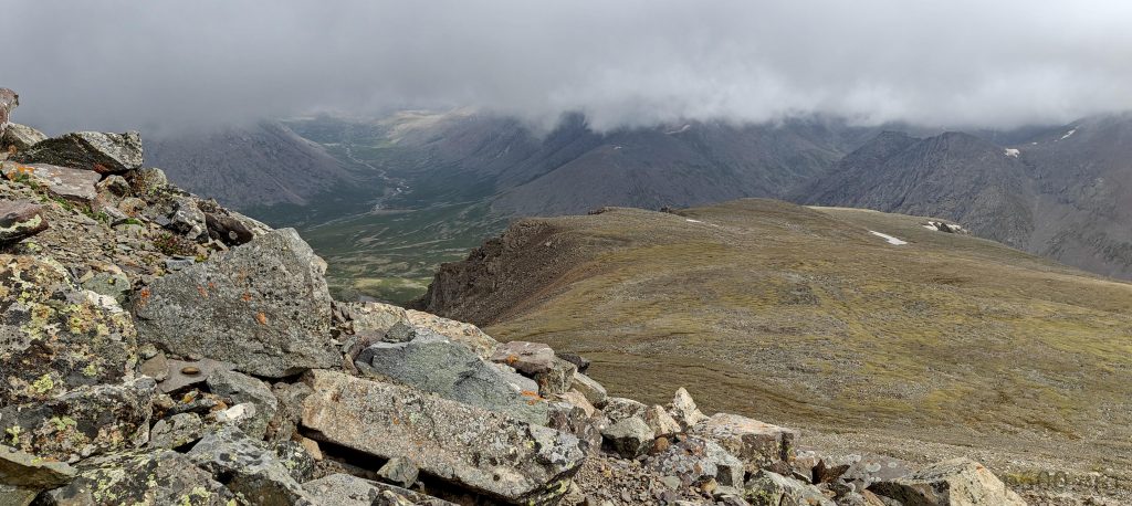
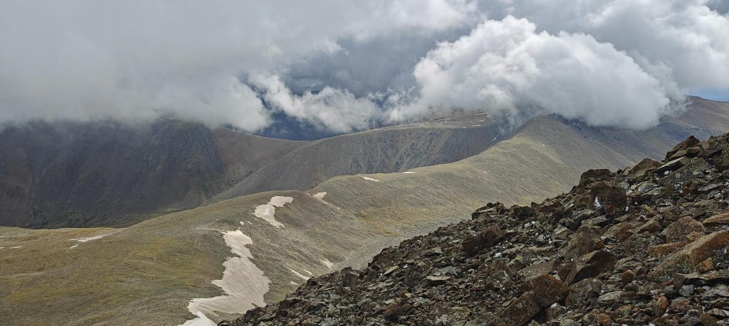
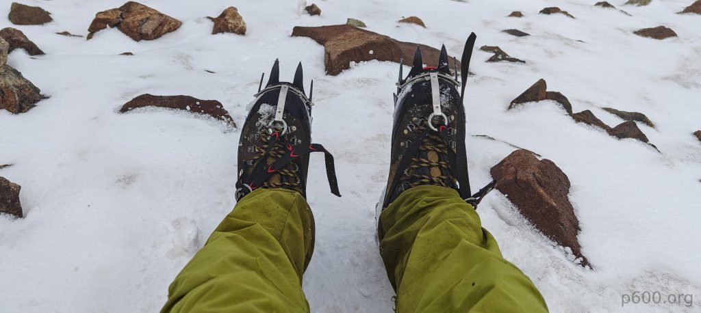
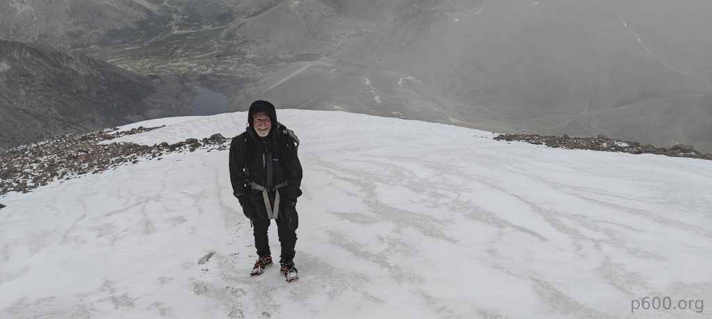
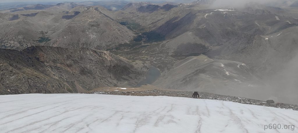
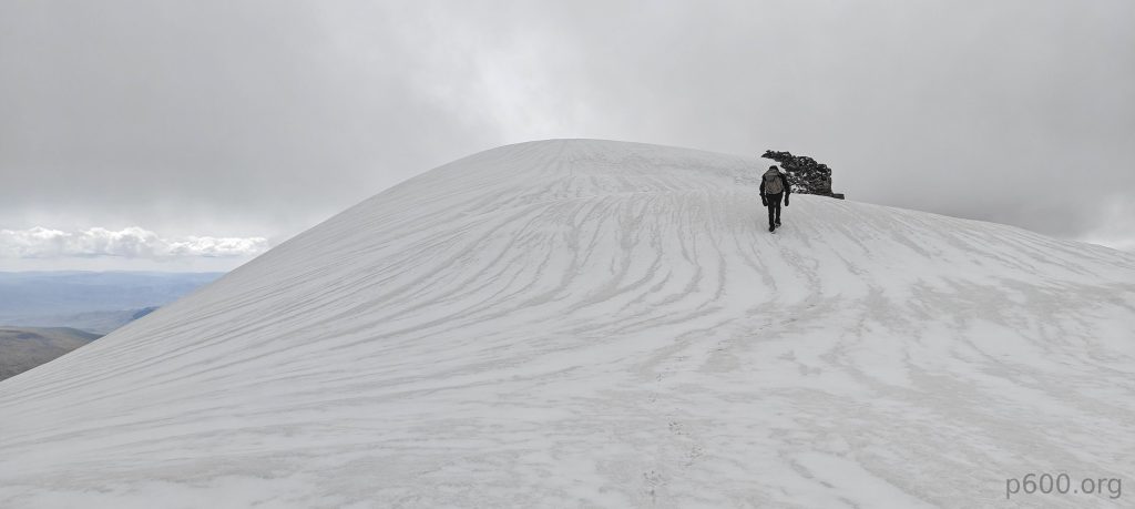
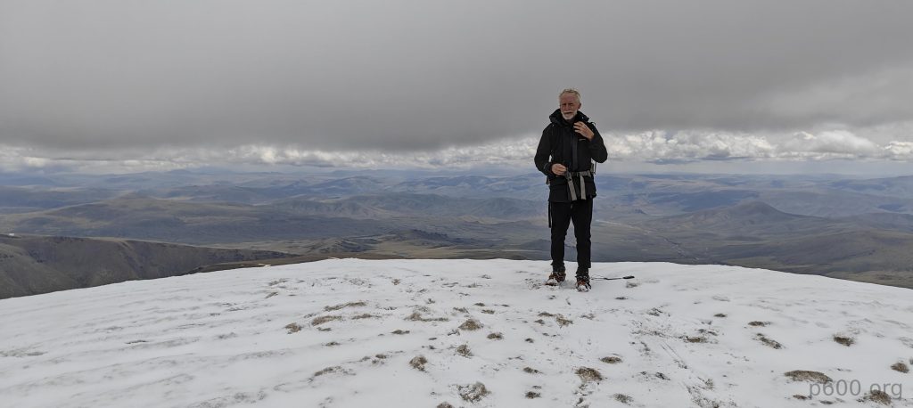
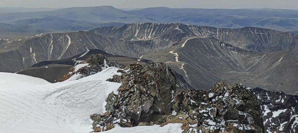
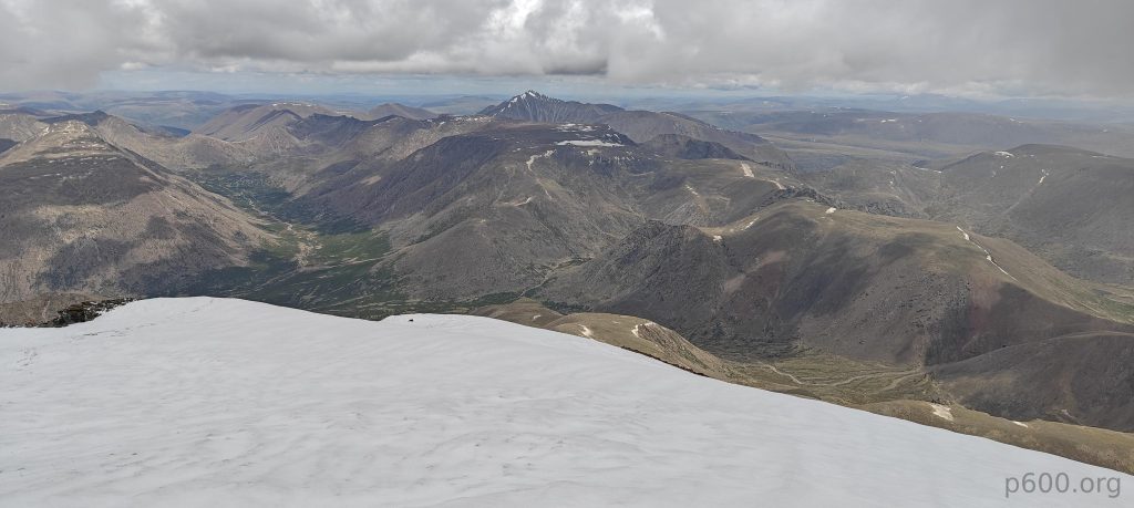
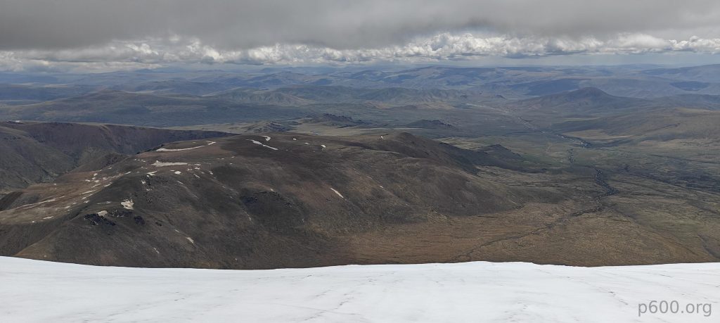
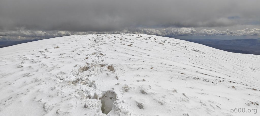
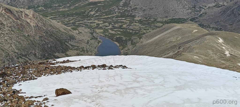
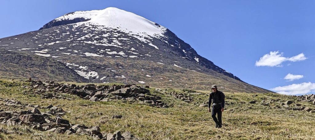
Our concerns about formidable summit snow proved unfounded. In reality, a manageable half-kilometer stretch of well-packed snow awaited us, not the treacherous glacier terrain we envisioned. Equipped with crampons for better grip, we confidently trudged towards the summit. As if celebrating our ascent, the clouds graciously parted, revealing breathtaking panoramic views from the top. After soaking in the landscape, we descended, carrying the exhilaration of reaching the summit and the memory of the incredible vistas.

Every step towards the summit is a postcard moment.
A few meters from the top.
At the top.
Another side of the peak.
Summit rocks.
Summit.
Heading down

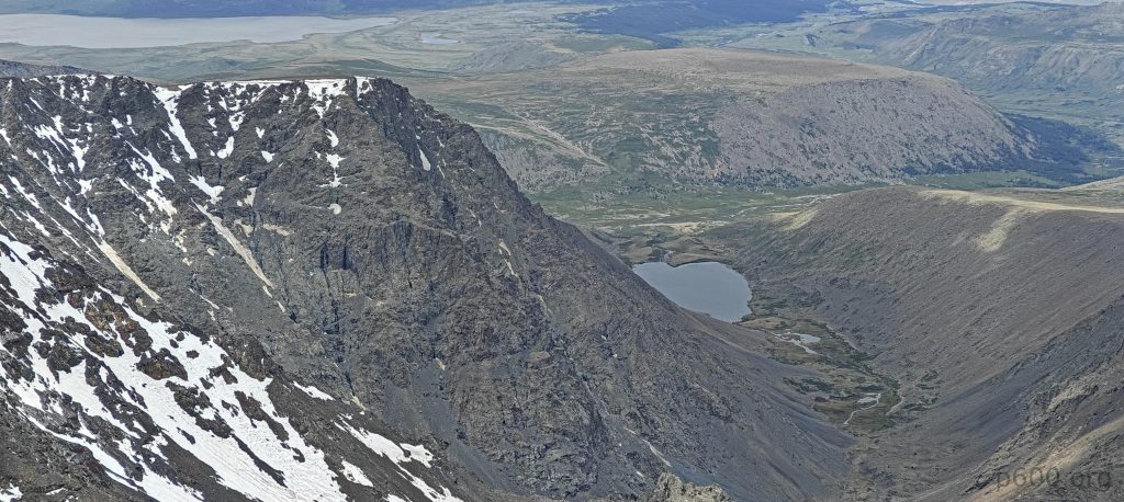
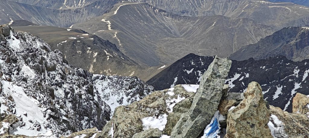
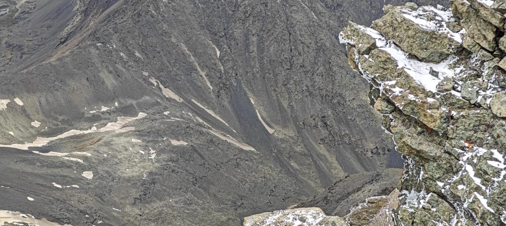
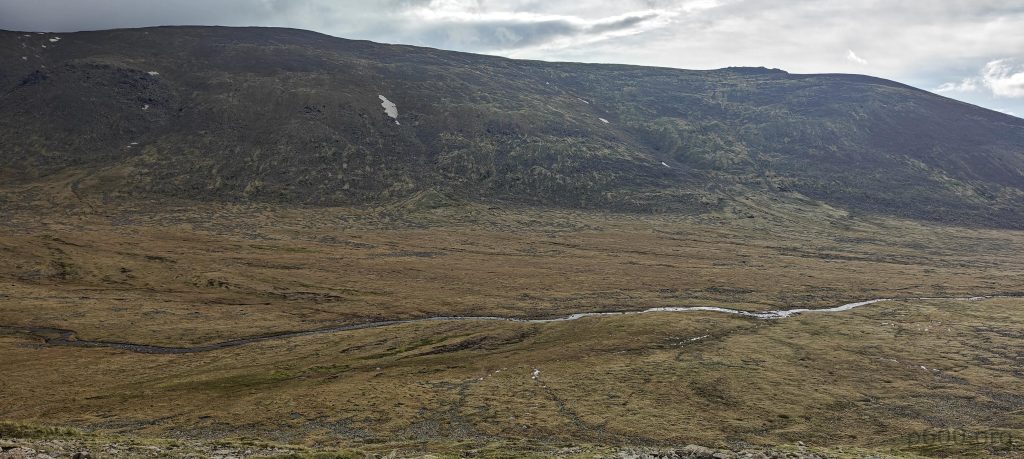
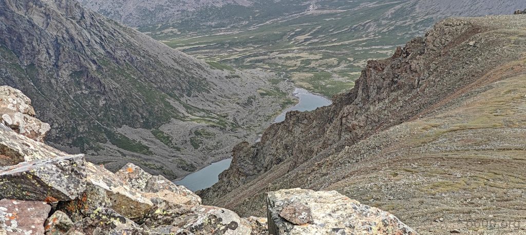
Navigating the rocky slope, we encountered a few particularly steep sections where loose stones threatened to turn our descent into a skid. But careful steps and strategic zigzags ensured a safe path down. Reaching the saddle, we opted for a detour, leading us to a “virtual” grassy path – a gentler, more navigable section along a stream that guided us back to the car.

Descending, the pyramid-shaped summit waves goodbye.
On the ridge, our camp is to the right.
Very nice landscapes surround us.

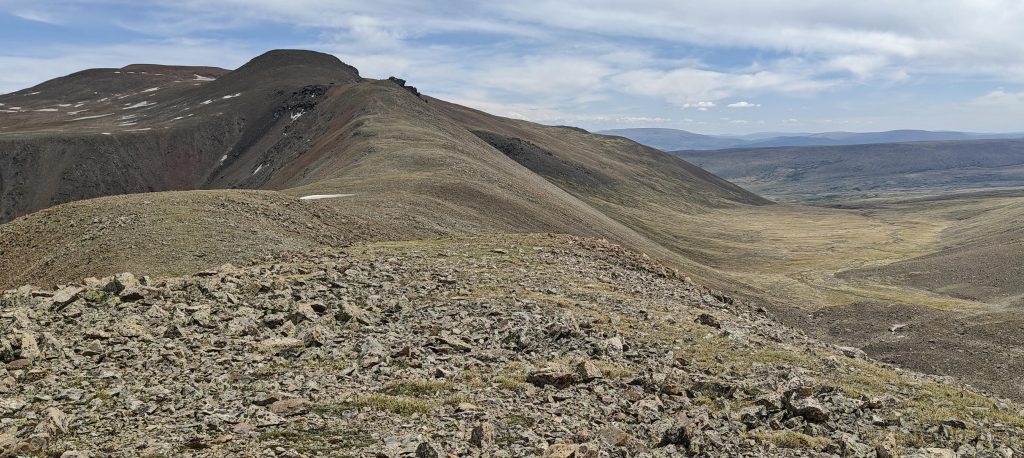
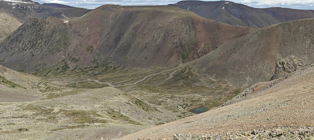
Our descent is a leisurely stroll along a stream, winding through a basin
Otgon Tenger Uul, you’ve been amazing.

Otgon Tenger Uul marked the grand finale of our Mongolian ultra-peak adventure, and what a triumph it was! Honestly, I hadn’t anticipated bagging so many peaks. While hope remained, the inherent uncertainties of mountain climbing made my initial optimism seem a bit far-fetched. However, sometimes the sun shines in unexpected ways, and this trip personified that. Fantastic weather and proximity to each mountain base enabled us to complete all challenges, resulting in a total of eight ascended ultra peaks, with no other peak-baggers in sight – a resounding success!

The anticipation for new adventures thrums in our veins as we drive towards Ulaanbaatar. A brief stopover at the Horse Statue Museum provided a fascinating glimpse into the country’s deep-rooted connection to these majestic creatures, leaving a lasting impression. Looking ahead, we’re eager to tackle the upcoming peaks in Laos, Cambodia, and Thailand. New challenges and breathtaking highs await us, and we’re determined to summit them all. Here’s to hoping the Swoutheast Asia peaks offer the same sense of accomplishment and reward as those we encountered in Mongolia!


Otgon Tenger Uul4010 m altitude
2269 m prominence
319.95 km isolation
RangesMongolia Ranges - Hangay Mountains
Countries/regionsMongolia - Zavkhan
Distance7.90 km up7.60 km down
Elevation1118 m gain1118 m loss
Time
5h20 up
0h10 other
3h40 down
9h10 total
Trailhead2892 m altitude47.5834720, 97.5962220
RouteThe route began with a gentle slope from camp, transitioning into a rockier section. Opting for safety, we descended and followed a stream to a ridge at the valley's end. The final ascent involved a steeper slope, with the last few hundred meters consisting of well-packed, permanent snow (not glacier), requiring crampons. The descent mirrored the ascent, with a minor deviation after the saddle leading back to the stream and then directly across a grassy surface to the camp.
Difficultiesrocky and steeper final slope
LinksGPX trail
  • Mongolia Ranges 2023
  • « Altai City
  • Peak 2366m, Buyant »

Mountain Ranges

Anatolia
Central Anatolia
Pontic Mountains
Southeast Anatolia
Taurus Mountains
Western Anatolia
Andes
Puna de Atacama
Atlas Mountains
High Atlas
Northwestern Atlas
Central America Ranges
Costa Rica-Panama Ranges
Central Central America
East China
Taiwan
Eastern Europe Ranges
Southeast Baltic Plains
Iberian Peninsula
Cordillera Cantabrica
Castile Ranges
Portugal-Galicia
Pyrenees
Intermountain West
Great Basin Ranges
Korea-Amur Area
Taebaek Sanmae
Malay Archipelago
Java
Nusa Tengarra
Sulawesi
Sumatra
Mid-Atlantic Islands
North Atlantic Islands
Mongolia Ranges
Altai
Gobi Desert Ranges
Hangay Mountains
Northwest Europe
Great Britain
North France-West Rhine Area
Pacific Ranges
Cascade Range
Northwest U.S. Coast Ranges
Sierra Nevada
Central and Southern California Ranges
Philippines
Central Philippines
Luzon
Mindanao
Southeast Asia
Malay Peninsula
Southeast South America
Pampas
Sierras de Cordoba
Southern Africa
Malawi Highlands
West Africa Mountains
Bight of Benin
Cameroon Mountains
Guinea Highlands

Countries / regions

Algeria
Ain Guezzam
Ain Salah
Aïn Témouchent
El Bayadh
Ghardaïa
Oran
Ouargla
Saïda
Sidi Bel Abbès
Tamanrasset
Argentina
Catamarca
Ciudad Autónoma de Buenos Aires
Córdoba
Jujuy
Salta
Tucumán
Belgium
Brussels Capital Region
Flemish Region
Cameroon
Southwest
China
Taiwan
Costa Rica
Alajuela
Cartago
Guanacaste
Heredia
Limón
San José
Czechia
Prague
Denmark
Greenland
France
Hauts-de-France
Occitania
Germany
Berlin
Niedersachsen
Indonesia
Bali
Jambi
Jawa Tengah
Jawa Timur
Nusa Tenggara Barat
Sulawesi Tengah
Sulawesi Utara
Sumatera Barat
Lithuania
Vilnius County
Mongolia
Bayankhongor
Govi-Altai
Khovd
Omnogovi
Ovorkhangai
Ulan Bator
Zavkhan
Morocco
Béni Mellal-Khénifra
Drâa-Tafilalet
Fez-Meknes
Marrakesh-Safi
Souss-Massa
Tangier-Tetouan-Al Hoceima
Mozambique
Zambezia
Netherlands
Gelderland
Noord-Holland
Zeeland
Nicaragua
Chinandega
Managua
Masaya
Rivas
Philippines
Bicol Region (V)
Cagayan Valley (II)
Calabarzon (IV-A)
Central Luzon (III)
Cordillera Administrative Region
Davao Region
Metro Manila
Soccsksargen (XII)
Western Visayas (VI)
Poland
Greater Poland Voivodeship
Masovian Voivodeship
Portugal
Castelo Branco
Leiria
Lisbon
Madeira
Santarém
Qatar
Ad-Dawhah
São Tomé and Príncipe
São Tomé Province
Sierra Leone
Northern Province
Western Area
Singapore
South Korea
Gyeongsangnam-do
Seoul
Spain
Aragón
Asturias
Castilla-La Mancha
Castilla y León
Catalonia
Islas Canarias
Switzerland
Zürich
Turkey
Antalya
Bitlis
Erzincan
Hakkâri
Igdir
Isparta
Kahraman Maras
Muğla
United Kingdom
England
Scotland
United States
California
Delaware
Florida
Maryland
Nevada
New Jersey
New York
Pennsylvania
South Carolina
Utah

TRIPS

2024
Southern Africa 2024
Mid-Atlantic Islands 2024
North America 2024
Anatolia 2024
Korea-Amur Area 2024
East China 2024
2023
Mongolia Ranges 2023
Philippines 2023
West Africa III 2023
West Africa II 2023
Iberian Peninsula 2023
West Africa 2023
Central America 2023
2022
Andes 2022
Northwest Europe 2022
Malay Archipelago III 2022
Malay Archipelago II 2022
Anatolia Mountains 2022
Iberian Peninsula 2022
Atlas Mountains 2022
North France-West Rhine Area 2022

archaeology (3) climb (157) food (2) hike (155) p30 (17) p50 (4) p100 (24) p300 (12) p600 (17) p1000 (11) p1500 (76) ribu (10) sight (46) summary (16) trig (44) ultra (76)

1 591 km walked, 121 298 m climbed

©2025 p600.org | WordPress Theme by Superbthemes.com