Běleč was the fifth summit of the day and one of the cleaner stops in the sequence. At 712 m with 210 m of prominence, it has enough independence to matter, and after the slightly fussier summit reading on Říčej it was refreshing to reach a top that proved straightforward on the ground. I managed to drive close to the forest edge before a traffic restriction stopped further progress, which left a short out-and-back of about 2.30 km on foot. That was all Běleč needed: a clean, repeatable line and a summit with enough substance to stand on its own.
I managed to drive much closer to the mountain than I had expected. The road in was good, but near the forest edge there was a sign prohibiting traffic, so I stopped there and continued on foot. That left me with a short out-and-back of about 2.30 km in total, using the forest road that runs almost all the way to the top. In a multi-peak day, that kind of access matters. Běleč was not the sort of summit that needed a grand approach to justify itself. It only needed a clean, repeatable line and enough topographic substance to stand on its own. It had both.
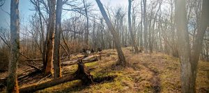
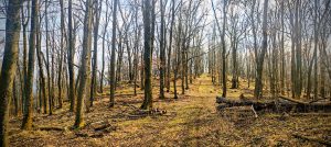
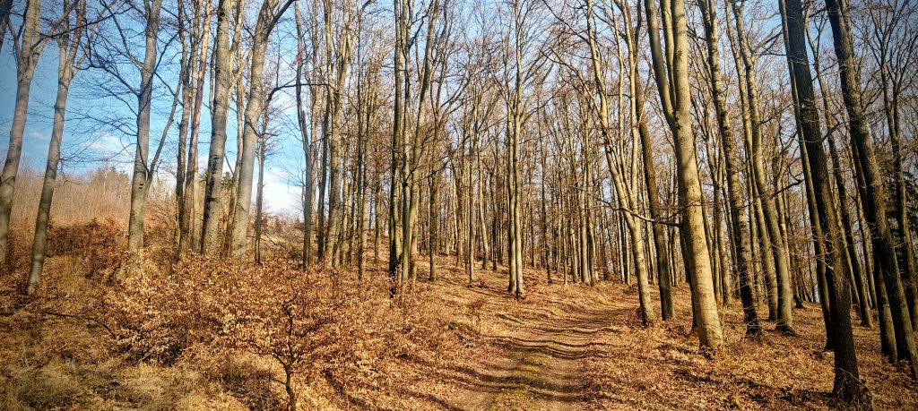
The walk up was easy and pleasant in the way short forest P100s sometimes are when they do not try to be anything more elaborate. The route climbed through quiet woodland on a broad road, with planted pines in places and leafless deciduous trees giving the hill a more open feel than a summer ascent probably would. Underfoot it was dry and straightforward. Conditions were mild and dry, so nothing in the weather complicated the outing. There was no navigational puzzle on the ascent. I simply followed the road upward and let the mountain reduce itself to what mattered: the final few metres around the summit area.
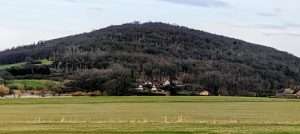
One small detail did improve the walk. Somewhere near the route I heard the unmistakable harsh call of pheasants, an oddly lowland sound for a peak visit but perfectly suited to this part of western Bohemia, where fields, villages, and wooded ridges interlock tightly. Běleč rises above Mezihoří, Malechov, and the folds of country around Švihov rather than above any dramatic mountain basin. That is part of its character. It is a locally dominant hill, not a scenic giant, and its prominence explains its collecting value better than its elevation does.
Near the top, the summit area briefly looked as if it might produce another small high-point puzzle. From one angle, a nearby point by the geometric marker seemed just as high or perhaps even slightly higher than the signed summit area. On the ground, though, that doubt faded quickly. After checking both spots, the signed top felt like the real apex, or at least close enough that there was no practical summit problem left to solve. That was a welcome change from some of the day’s earlier hills. Běleč may be wooded, but it does not hide its identity too stubbornly.
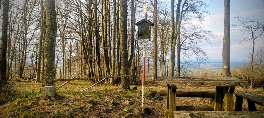
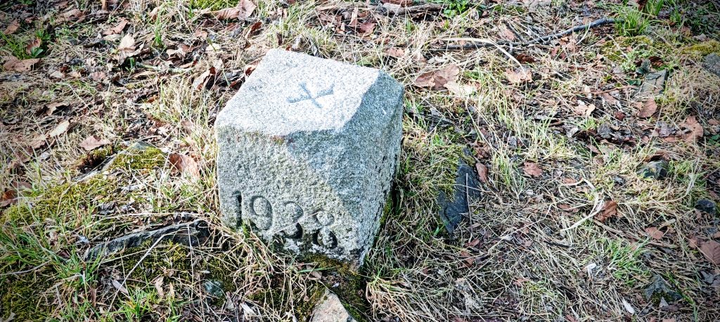
The summit itself was better equipped than I had expected. There was a red-and-white painted post, a register box, a picnic table, a birdhouse, a small stone pile, and an older concrete survey marker dated 1938. The summit sign gives the elevation as 711.6 m, while Peakbagger lists the mountain at 712 m with 210 m of clean prominence. That combination of a clearly presented summit, an older survey relic, and just enough infrastructure gave the top an identity that many short forest peaks never quite manage. It felt like a summit that had been noticed for a long time, not just a contour bump that happened to meet a list threshold. Partial views filtered through the trees were enough to remind me that Běleč stands distinctly above its surroundings, even if this is not a hill of wide open panoramas.
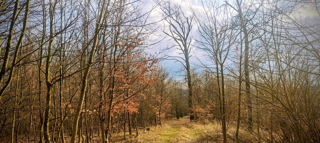
The descent was by exactly the same route. There was no reason to invent a loop where the direct line already worked perfectly. On the way back I noticed darker clouds beginning to gather to the west, enough to make me think briefly about whether the day might shut down early with rain. In the end Běleč still did what I needed it to do. It took just under 33 minutes car to car, stayed simple underfoot, and added a proper P100 with a convincing summit setup to the middle of the day. As peak 5 of 8, that was ideal. It was not the most scenic hill of the sequence, and it did not need to be. What mattered was that it had real topographic value, easy access on foot once the driving stopped, and a summit that felt like a summit instead of an argument.
Range: Europe / Eastern Europe Ranges / Bohemian Ranges / Böhmerwald
Administrative regions: Plzeň Region, Czech Republic
List / category: Czech P100 (Peakbagger rank #99); Prague P100 (Peakbagger rank #284)
Approx. timing: 15:58 start / 16:15 summit area / 16:16 descent / 16:31 finish (CET)
Trailhead / parking: roadside stop at the forest-edge traffic restriction, approx. 49.474235, 13.229502
Highest recorded GPS point: 712.8 m at 49.477287, 13.240964
Terrain: good forest access road, dry woodland, planted conifers mixed with leafless deciduous forest, brief summit wandering
Sections: forest-edge parking to summit on the road, then the same line back
Difficulty: very easy short forest walk
Useful to know: on this visit the drive-in was stopped by a no-traffic sign near the forest; from there the road gave a very straightforward walk almost to the top; the summit area has multiple markers, but I found the signed top to feel like the practical high point