Doubrava was the third summit on my eight-peak day and one of those objectives whose value comes less from raw altitude than from clean topographic independence. At 727 meters it is not a giant, but with 199 meters of prominence and 8.57 kilometers of isolation it earns its place on the Czech P100s and stands apart more convincingly than plenty of higher wooded hills. That made it worth a stop in its own right rather than just a convenient bump on the way to something better, which is how humans usually mistreat short summit walks.
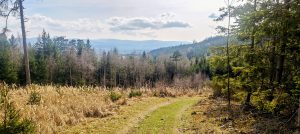
What helped even more was that I could drive much higher on the mountain than expected. The access road from the south was in decent condition on this visit and I did not see any prohibitory signs, so I continued upward and parked at the GPX start point just below the upper summit area. That reduced the outing to a very compact on-foot round of 1.45 kilometers, with only 54 meters of ascent. From the car I followed an easy path north along the wooded crest. Navigation was simple and the whole route was highly repeatable, provided the upper road remains accessible in the same way.
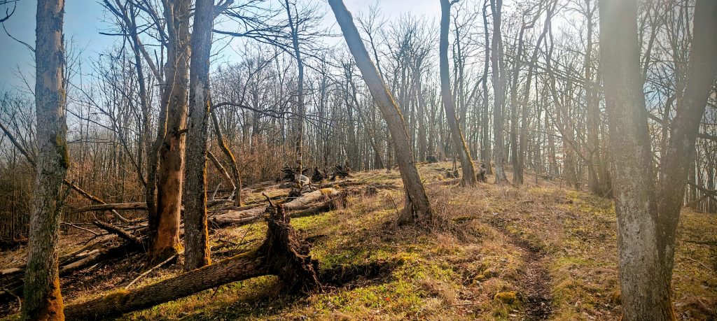
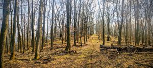
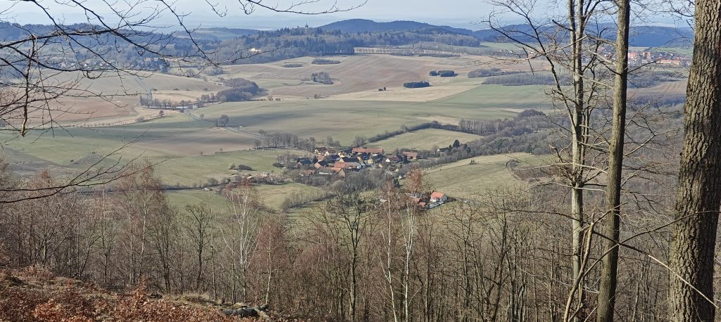
Even with such a short approach, Doubrava felt more open than the map first suggests. The summit ridge is wooded, but in mid-March the leafless trees left plenty of room for views into the surrounding countryside. Through the trunks I could look out across villages, fields, and rounded hills between the Plzeň and Klatovy area, and the hill’s independence made those views feel earned rather than accidental. The ground also had the bonus of early spring detail, with hepatica flowers growing along the path. It was a small thing, but on a short peak like this, details matter.
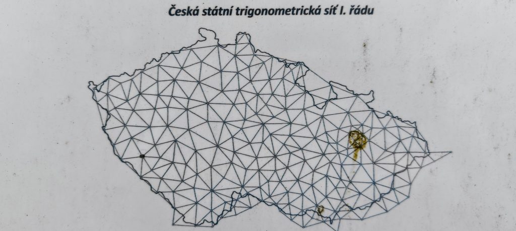
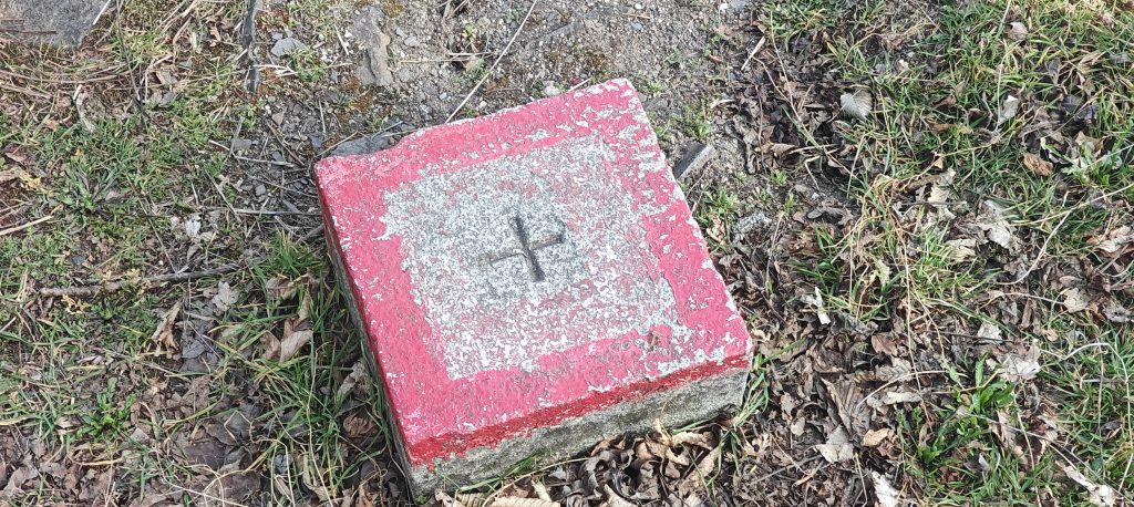
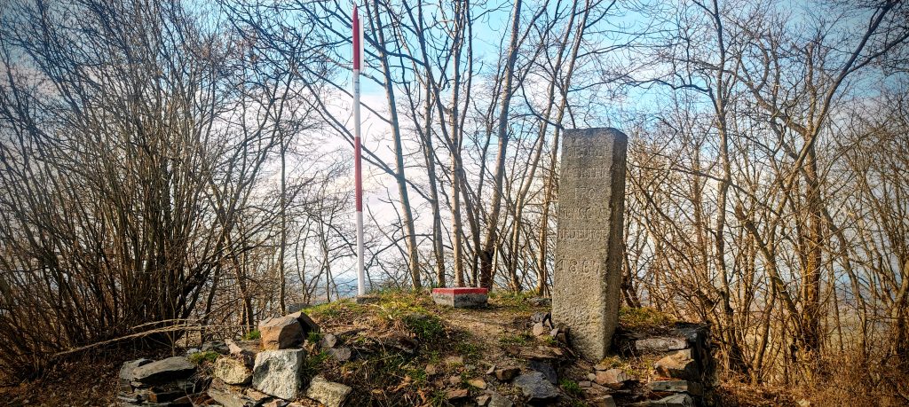
Near the top, Doubrava becomes far more distinctive than a standard forest P100. There is a fenced antenna installation, a picnic table, a paragliding launch just below the crest, and most interestingly a cluster of survey markers that gives the summit area a proper identity. The red-and-white mast, the red-painted concrete trig block with its cross, and the older stone pillar all show that this top had geodetic importance long before it acquired any value as a list summit. I used the close-up marker photo rather than the larger information board, but the small diagram is enough to point toward a broader Czech context: trig points like these belong to the long-established national triangulation framework used to anchor mapping and cadastral control across the country. Doubrava is not just a summit with hardware on it. It is a summit that was measured seriously.
From a peakbagging perspective, though, the summit is not perfectly tidy. The mapped summit is by the survey markers, and that is the obvious practical summit reference. On the ground, however, the triangulation setup appears to sit on a slightly artificial rise, while the highest natural ground seems to be just beyond it, a little farther north. The difference looked tiny, and there is no dramatic split-summit problem here, but it was enough for me to treat the natural high point as the actual summit while still noting that the mapped and survey-marked point remains the conventional top. In other words, this is exactly the kind of summit where a non-peakbagger would shrug and a peakbagger would spend two extra minutes wandering around in a small radius trying to satisfy both terrain and cartography.
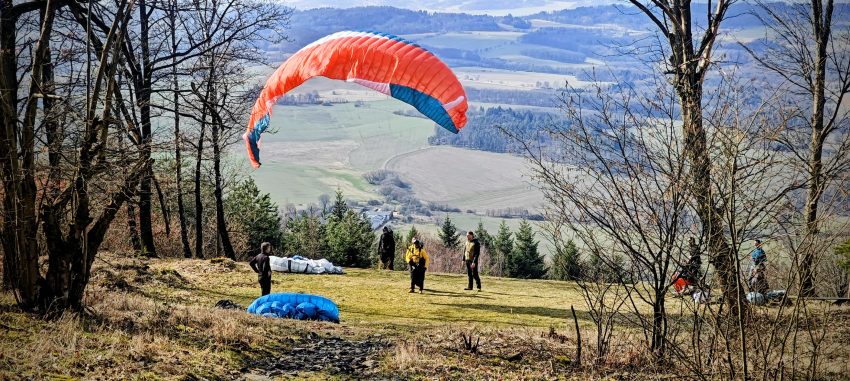
Below the summit cluster, the open grassy slope explained the number of parked cars. Doubrava also serves as a paragliding launch, and that opening gives the hill its best immediate outlook. It is a nice contrast with the summit itself: the top is defined by survey infrastructure and partial tree-filtered views, while the slope just below is where the landscape opens properly. When I was there, pilots were using the launch, which added an unexpected bit of life to what might otherwise have been a very short tick.
I returned by nearly the same line, and the whole outing took 27 minutes. As the third peak of eight, Doubrava worked extremely well. It was efficient without feeling empty, easy without feeling pointless, and specific enough to stay memorable. Plenty of short summits vanish from memory as soon as the log entry is done. Doubrava does not. Its place on the Czech P100s gives it objective value, the survey cluster gives it character, and the slight tension between the mapped summit and the natural high point gives it just enough summit logic to keep the visit interesting.
Range: Bohemian Ranges / Böhmerwald (Peakbagger hierarchy)
Administrative regions: Plzeň Region, Czech Republic
Time up: 12 min 20 sec to highest recorded GPS point
Time down: 14 min 40 sec from highest recorded GPS point to finish
Approx. timing: 15:24 start / 15:36 highest recorded GPS point / 15:51 finish
Trailhead / parking: GPX start point on the upper access road below the summit area, 49.436206, 13.203547
Highest recorded GPS point: 727.1 m at approx. 49.432065, 13.202959
Terrain: upper access road to the parking point, then easy footpath on a wooded crest, short summit wandering around the survey markers and natural top, and open grassy ground by the paragliding launch
Difficulty: very easy walk; no technical difficulty
Useful to know: the upper access road was passable and unsigned on this visit, but that may change; the north-side line shown on the map looked more like a path than a usable road; the mapped summit is by the survey markers, but the highest natural ground appears to be a short distance farther north