Bambule was the last summit of my eight-peak day, and by then the logic had narrowed to something very simple: finish cleanly, find the actual high point, and do not let fatigue or fading light turn the final stop into a lazy near-miss. On paper Bambule is modest, at 661 m with 136 m of prominence and about 9.78 km of isolation. In practice that is enough to make it a real P100 objective rather than just another wooded fold in western Bohemia. It also works well as a closing peak. After a day of short Czech summits with varying degrees of summit ambiguity, Bambule offered one last compact outing, this time in the evening half-light above Strašice, with the sort of summit logic that still mattered even when the route itself was barely a kilometer long.
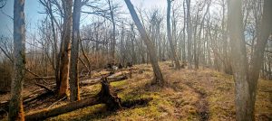
I left the main road and drove a little way into the forest on the north side of the hill, parking at a convenient stopping point on the upper track. That cut the outing down to roughly 1.00 km in total. The start was not elegant. Instead of committing immediately to the better line, I tried to go more directly through a young spruce plantation, which was an unimpressive idea even before adding the fact that dusk was already closing in. The young trees were awkward enough to make the opening feel worse than the mountain deserved. Fortunately that did not last. Near the top I picked up a much better path, and once on the ridge the route became straightforward and pleasantly repeatable.
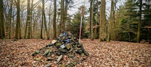
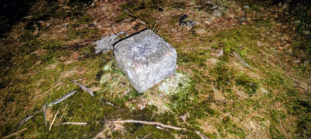
The summit area is the kind of place where it pays to stay alert for another half minute rather than accept the first vaguely summit-like feature and leave too early. Along the ridge I first came to a small stony area that might have passed for the top if I had been in a hurry. It was not the top. The true summit lay about 30 meters farther on, where the highest ground was marked by a rough pile of stones and rock fragments. On the ground it felt clearly higher and more convincing than the earlier spot. Bambule is wooded, but it is not one of those maddening broad forest domes where the natural apex refuses to identify itself at all. Here the practical summit logic was good enough: check the first candidate, continue a little farther, and the better top becomes obvious.
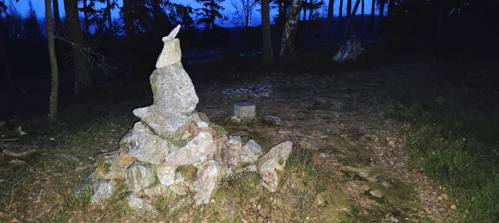
One small detail made the summit area more distinctive than the bare statistics suggest. About 30 meters from the true summit there was a small flat patch with an old concrete trig block, the sort of minor survey remnant that does not prove the natural high point by itself but does give the crest a little more identity. That spacing mattered. The trig point area and the true summit were close enough to belong to the same small summit zone, but not so close that they felt interchangeable. The topographic map and the ground agreed well enough to keep the visit satisfying: this was not a grand summit, but it was a proper one.
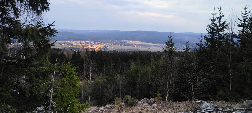
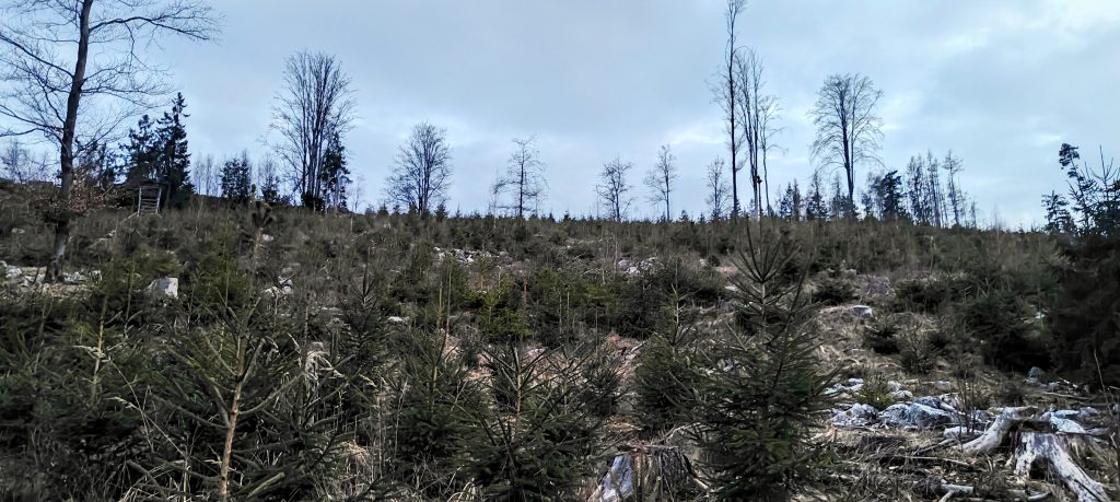
Bambule is mostly a forest summit, so the value of the outing was never going to be in big summit panoramas. Still, the hill sits clearly above the surrounding country between Mýto, Strašice, and the wooded uplands east of the D5 corridor, and just below the crest there was an opening with a good evening view toward Strašice and the wider low ridges beyond. That view worked especially well this late in the day. The town lights and the dim blue sky gave the mountain a stronger final impression than the summit itself could manage from inside the trees. It was a useful reminder that some small P100s earn their place not through dramatic altitude but through local position, a clean prominence line, and one or two grounded details that make them stick in the memory.
The descent was better than the ascent because I corrected the obvious mistake. Rather than forcing my way back through the young spruce again, I followed the path down and then turned left along the fence line, which let me avoid most of the worst plantation thrashing. By then it was nearly dark, but the ground outside the worst section was much better than the opening had implied. Car to car, the outing took just under 18 minutes, with a little under 10 minutes to my highest recorded GPS point and a little over 8 minutes back down. That made Bambule exactly what it needed to be as peak 8 of 8: short, efficient, slightly scrappy at the start, but fully worth doing properly. It is not a mountain that wins on altitude or scenery alone. Its value lies in being a real P100 with a clear true summit, a quick repeatable route if approached sensibly, and enough evening atmosphere to give the day a proper finish.
Range: Europe / Eastern Europe Ranges / Bohemian Ranges / Böhmerwald
Administrative regions: Plzeň Region, Czech Republic
List / category: Prague P100; 100 m-prominence summit
Approx. timing: 18:32 start / 18:42 highest recorded GPS point / 18:50 finish (CET)
Trailhead / parking: upper forest-road stopping point on the north side of the hill, approx. 49.752623, 13.744910
Summit coordinates: approx. 49.750000, 13.742000
Highest recorded GPS point: 659.3 m at 49.750181, 13.742579
Terrain: short forest approach, young spruce plantation at the start, better summit-ridge path, mossy summit ground, brief path-and-fence-line descent
Sections: short rough start through young conifers, better ridge path to the summit area, brief check of the true summit and nearby trig block, then descent by the ridge path and fence line
Difficulty: very easy short forest walk with mild route-choice and summit-identification issues
Useful to know: the first direct line through the young spruce was the worst part of the outing and unnecessary; the true summit is about 30 m beyond the first plausible stony spot; a small trig block sits nearby but does not appear to be the natural high point