Chmelník was only the second summit of the day, but it immediately felt like a proper hike rather than a short hill crossing. On paper this was a short traverse, just over 3.1 km with 221 metres of ascent and only about an hour on foot. In practice it turned into a compact, very likeable hill crossing, with a broad summit area, several competing top points, a few open views, early spring details on the ground, and just enough small summit confusion to keep GPS honest. In practice it turned into a compact and very likeable hill crossing, with a broad summit area, several competing top points, a few open views, and just enough summit ambiguity to make terrain judgment more useful than GPS alone..
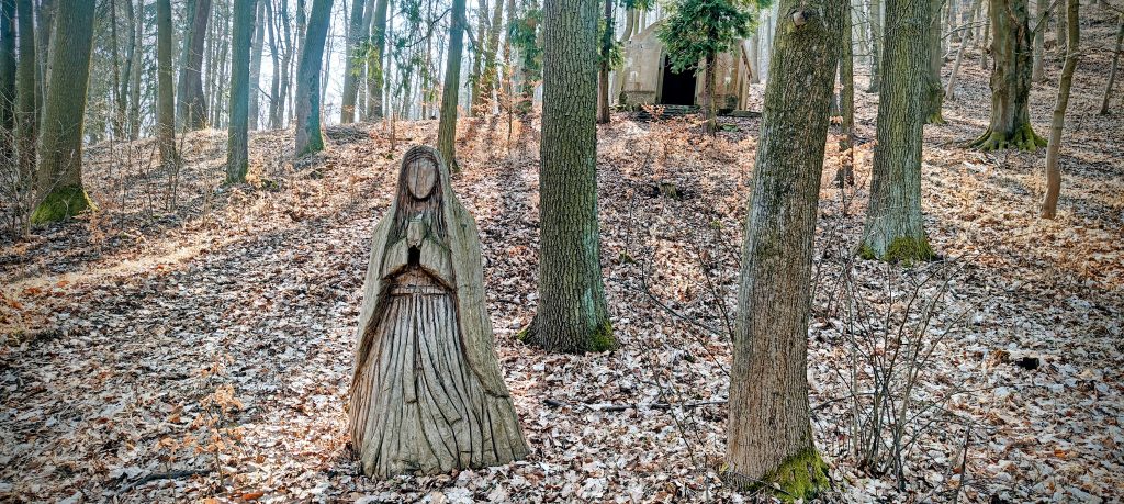
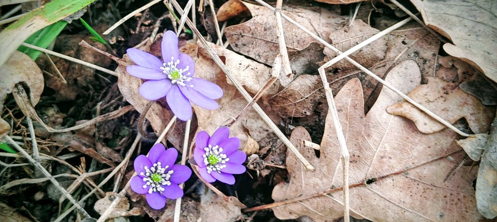
I started at 11:53 from the east side of Chmelník, at about 291 metres above sea level, after finishing the previous hike on Děčínský Sněžník and repositioning for this next climb. The start was straightforward, and the route rose into dry woodland on decent forest paths and tracks. The whole hill had that early March look where winter had mostly stepped aside but spring was still negotiating the paperwork: pale grass, bare trees, dry leaf litter, filtered sunlight, and here and there the first signs that the forest floor was waking up. Near the base of the mountain, on the way up, there was also a carved wooden woman beside the path, an unexpected detail that gave the lower slopes a bit of character before the climb properly settled into the forest.
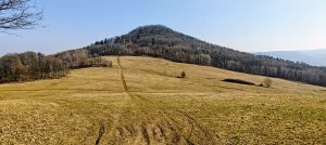
The ascent was never long enough to become tedious, but it was long enough to feel earned. Chmelník is not a dramatic mountain, and it does not pretend to be one. What it does have is a broad wooded top that makes the walk more interesting than the numbers suggest. The route gradually worked onto the upper ridge, where the hill stopped behaving like a single neat summit and started spreading itself out into several bumps. That matters here, because the summit area is not a simple one-point affair.
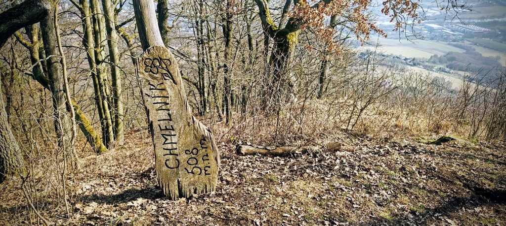
The summit area spreads across several wooded bumps, with a lower north top, a central highpoint that felt correct on the ground, and a western bump that briefly produced a misleading GPS reading. The official summit height is 508 m, which fits the general story nicely: Chmelník is broad enough, wooded enough, and subtle enough that the exact highest spot is a matter of terrain and judgment more than screen worship. The western top was not the highest. The central highpoint looked right. The GPS, as usual, joined the discussion with confidence and limited value.
The lowest of the three summit-area bumps held a scatter of rough stones, but the true summit was much more memorable. There was a grave at the top, and right beside it a Czech group of four was having a picnic in one of the best spots on the hill. It was an unusual little summit scene, half quiet memorial, half sunny lunch stop, and somehow it worked. This main top had some of the nicest views on the route, with a set of attractive summit markers close to the picnic place.
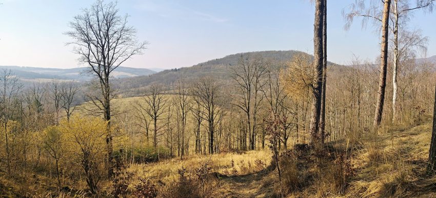
The summit itself is broad and partly wooded rather than sharply defined, but the main top still feels like the real place to stop. The best viewpoints are concentrated around the summit picnic area and nearby openings, where breaks in the trees give wider views than the exact highest spot alone would suggest. Instead of one formal lookout, Chmelník offers a series of fragments: meadows, tree gaps, neighbouring ridges, and then fuller looks down into the wider landscape.
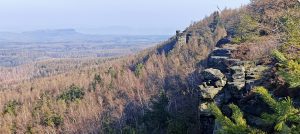
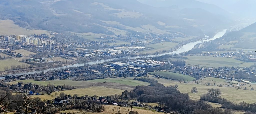
One of the better openings looked out over the Elbe valley below, where fields, scattered buildings, village edges and industrial areas sat side by side in the usual northern Bohemian truce between scenery and infrastructure. It was a good reminder that Chmelník stands in a very real landscape, not in some abstract contour model. Below the hill were the valley settlements and working lowlands; beyond them, the wider folds of the terrain rose again toward the surrounding hills.
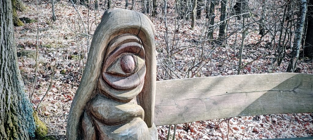
Closer to the western saddle, after stepping down the steeper slope toward the base of the hill, there was another picnic area with an open view across meadows and nearby slopes, plus a grill and seating. It was not far from the saddle at all, and it felt less like part of the summit and more like a separate stopping place on the way out. A carved wooden figure beside one of the benches added a slightly odd, memorable touch, which suited the hill quite well. Chmelník does not overwhelm. Its character comes from a handful of small details rather than from one dramatic summit feature.
In wider context, Chmelník sits among the lower hills west of Děčín, in a landscape that can look modest on the map and much richer on foot. It is easy for a summit like this to get overshadowed by bigger names nearby, especially when Děčínský Sněžník is in the same day. But that contrast actually helps. After a more obvious mountain, a hill like Chmelník sharpens attention again. The scale becomes smaller, the details matter more, and the route feels more local and more textured. The open slopes, picnic clearings, broad wooded top and glimpses into the Elbe corridor gave this hike far more character than its short statistics might suggest.
I reached the highest part of the summit area at around 12:38, roughly 45 minutes after starting. From there the descent to the western saddle was short and efficient. The full track ended at 12:54 at about 374 metres elevation, because this report covers only the Chmelník segment. The western saddle naturally became both the end of this traverse and the starting point for the walk on to Lotarův vrch. The western saddle is therefore both the end of this hike report and the natural starting point of the next one, which continued on toward Lotarův vrch. That also explains the shape of the route: it works best as a traverse inside a multi-peak day, although repeating it as an out-and-back from the eastern parking spot would be perfectly reasonable.
What stayed with me most was not one dramatic summit moment but the hill’s overall character. Chmelník was short, quiet, and more characterful than its modest statistics suggest. It had a broad summit with just enough ambiguity to be interesting, useful picnic spots, a couple of genuinely good viewpoints, and the kind of early spring atmosphere that makes even a one-hour hill feel distinct. As a second peak of an eight-peak day, it did exactly what I wanted: it kept the rhythm of the day moving while still being worth remembering on its own.
Approx. timing: 11:53 start, 12:38 summit area/highpoint, 12:54 finish at western saddle
Trailhead / parking: east-side parking/start at 50.756355, 14.173946
Highest recorded GPS point: 513.9 m at 50.754763, 14.158519
Terrain: forest tracks and paths, dry leaf-covered woodland, short steeper climb to the summit ridge, minor summit wandering between several bumps
Route: east-side parking → Chmelník summit ridge → main highpoint → western saddle toward Lotarův vrch
Sections: parking to summit area about 45 min; summit ridge and descent to western saddle about 15 to 16 min
Difficulty: short and easy to moderate; only minor summit-top ambiguity
Useful to know: The summit area has several bumps. My waypoints marked a lower north top at 505 m, the main highpoint at 509 m, and a western bump where the GPS briefly showed 510 m even though it was visibly lower. The rough stones were on the lowest bump, not on the main summit. The best views come from the summit picnic area and nearby clearings rather than from the exact highest point, and this track/report ends at the western saddle where the next hike begins.