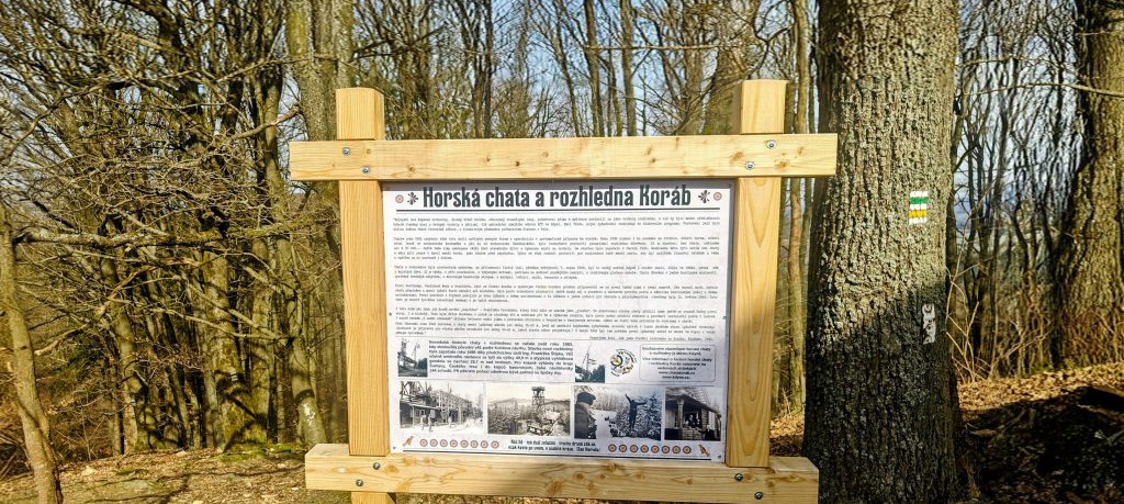
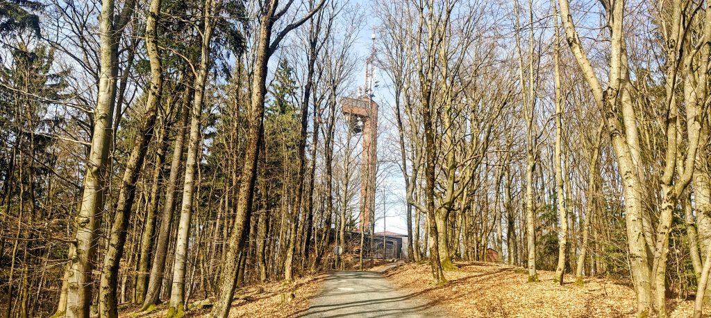
Koráb was the first summit of the day after the drive down from Prague, and it made sense as an opener. At 776 m with 240 m of prominence, its importance lies more in independence than in absolute height. What makes it especially worth doing carefully is the summit structure: the tower and restaurant sit on the developed western bump, while the true natural high point lies farther east on the same ridge. I started from a roadside pullout high on the access road above Kdyně, which kept the outing short and straightforward from the start.
I started from a roadside pullout high on the access road above Kdyně, already well up the mountain. From there the outing was short and efficient: 4.05 km in total and 50 minutes moving time. The first stretch followed a paved road through mixed forest, easy walking with only mild ups and downs. Nothing about Koráb pretends to be remote. Cars were coming and going, other people were out walking, and it was obvious that plenty of visitors treat this as a quick local destination rather than a summit to be hunted carefully. That is not a flaw, just the character of the mountain. The practical challenge here is not effort but summit logic.
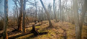
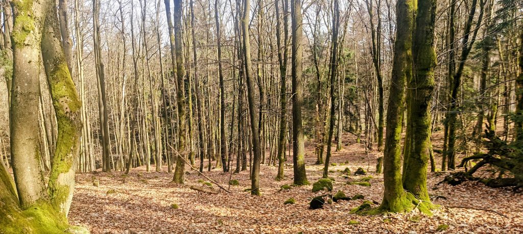
I left the paved line before the developed top and headed first for the eastern bump, which was the true summit objective. That decision mattered. If I had just continued to the obvious tower area, I would have reached the public face of Koráb but not the point I actually came for. The forest track to the eastern top was straightforward in dry conditions, and the last part felt quieter and more mountain-like than the approach road below. The summit itself was subdued rather than dramatic: a forested high point with a fire ring and no grand marker announcing that this was the place. In a way that suited the hill. Koráb keeps its real summit understated and leaves the tower, restaurant, and traffic to the neighboring bump.
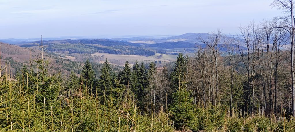
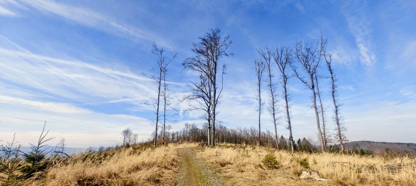
The upper mountain had clearly seen a lot of forestry work, which helped the outing more than it hurt it. Even though the true summit itself was still mostly enclosed, nearby openings gave me enough of the wider landscape to keep the ridge from feeling closed in. Bare March trees, dry leaf litter, patches of spruce, and a pale blue sky with high cloud made it a fast, easy walk rather than a muddy spring grind. From the cutover sections there were decent views over the rolling hills of western Bohemia, with Kdyně below and a scatter of rounded forested ridges beyond. Koráb does not win on alpine drama, but it does stand apart enough to feel like a real summit and not just a nameless rise above town.
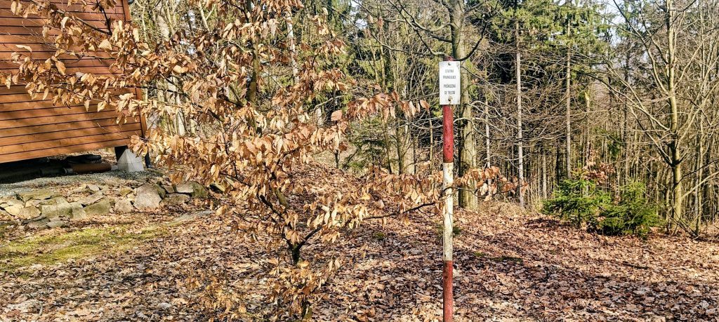
After tagging the eastern high point I retraced my steps along the ridge and continued toward the better-known summit area. This part made the structure of Koráb clearer. There was a lower middle bump, then the western side with the tower, restaurant, upper parking, and the usual signs of a summit that many people experience from the convenient end. I found the red-and-white bent triangulation pole near this developed area, but I skipped the tower itself to save time for the rest of the day’s peaks. That was the right choice. Koráb was only the first stop, and the mountain had already given me the main thing I wanted: the true summit first, then the public summit second.
That contrast is what made Koráb memorable. Most visitors will know the tower side, but the peakbagging interest lies in the short ridge that separates the public summit from the true one. The descent was as simple as the approach, and as the first stop of the day Koráb was efficient, accessible, and just complex enough in summit layout to be worth noting carefully.
List / category: Czech P100 (Peakbagger rank #68); Prague P100 (Peakbagger rank #222)
Approx. timing: 12:04 start / 12:29 true summit / about 12:39 tower-triangulation area / 12:54 finish (CET)
Trailhead / parking: roadside pullout on the upper access road to Koráb, approx. 49.403908, 13.072004
Highest recorded GPS point: 779.9 m near 49.395836, 13.075177 (GPS-only reading, higher than the mapped summit elevation)
Terrain: paved access road, good forest tracks, short summit-side dirt path, dry leaf-covered forest, logged openings
Sections: access road to ridge junction and eastern true summit about 25 min; return across the ridge to the developed tower area about 10 min; easy walk back to the car about 15 min
Difficulty: easy walking; the main difficulty is identifying the true summit rather than the tower side
Useful to know: you can drive much higher than the main road and probably close to the tower area, but the eastern bump is the summit that matters for a peakbagger.