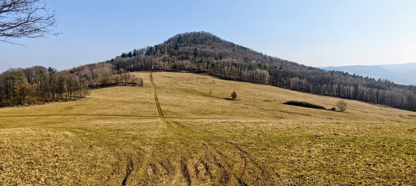
Lotarův vrch was the third peak of my eight-summit day, and also the point where the day settled into a pleasant rhythm instead of just collecting names. After Chmelník, this was a short, practical wooded hill with a real summit, a few good views, and enough character to justify the detour. It was a short, practical, slightly scruffy hill with a real summit, a few good views, and just enough character to justify leaving the obvious roads behind. That turned out to be more than enough. On a very bright early spring afternoon, with warm sun, light wind and excellent visibility, I crossed over from the Chmelník saddle and I had the whole hill entirely to myself.
The Lotarův vrch segment began around 12:54 from the saddle below Chmelník. Although the wider outing used the same east-side parking as the previous hike, this specific section starts naturally from the low point between the two hills and heads west toward Lotarův vrch. The total segment came to 4.1 km, with 101 m of ascent and 242 m of descent, so on paper this is a very manageable link-up. On the ground it felt even shorter, mainly because the first part was open, sunny, and visually rewarding.
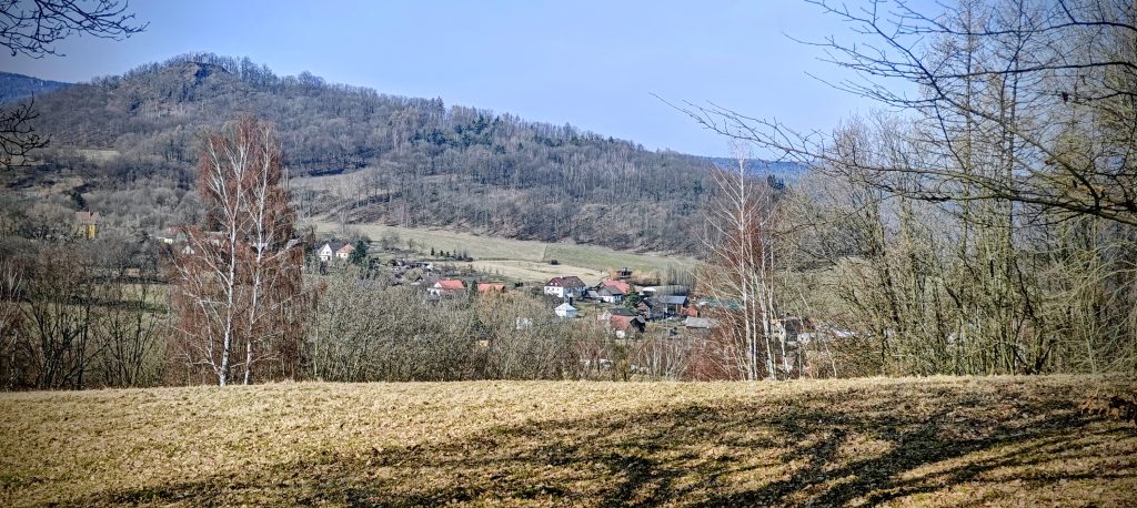
Almost immediately after leaving the saddle, I crossed a meadow where the view opened beautifully back toward Chmelník. The hill I had just climbed looked surprisingly good from this angle, with the scattered buildings below it and one old-looking structure in the meadow-side setting that seemed half abandoned, half still in occasional use. There were wheel ruts cutting the grass, so somebody clearly comes through now and then, even if the place looks like it belongs to a more patient century.
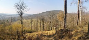
From the meadow, the route turned into the woods. There was no grand official-feeling trail here, but there were enough signs of passage to keep things simple: a faint path in places, open deciduous forest, and terrain that never became annoying. In summer this would probably be a pleasantly shaded little climb. In early March it was better still, because the bare trees let in the sun and the forest floor was easy to read. The ascent itself took only about half an hour from the saddle. My summit photo is timestamped around 13:20, which matches the feel of the climb: short, direct, and without much opportunity for self-pity.
The summit of Lotarův vrch is forested, but it is not vague. That matters. Some wooded tops try very hard to become philosophical discussions about contour lines, local bumps and GPS error. Lotarův vrch does not entirely avoid that problem, because it sits close in both distance and height to Chmelník, and my phone GPS was not exactly a court-certified survey instrument. Still, on the hill itself the top feels obvious enough. The key feature is a large stone cairn, roughly human-sized, standing in the trees like a small woodland monument assembled by someone who had time, patience, and a mildly suspicious relationship with gravity.
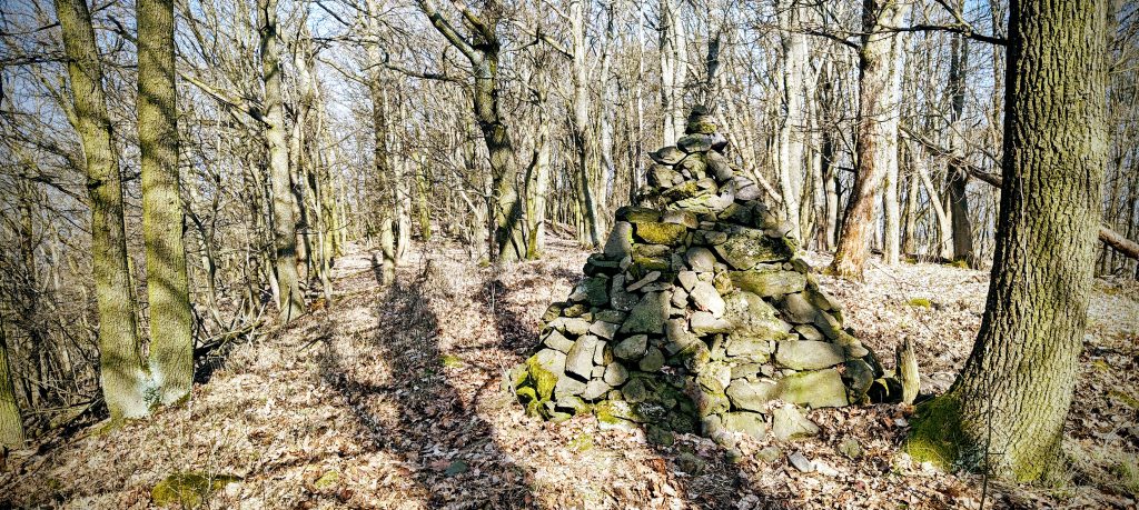
The official summit elevation is 509 m, and my highest recorded GPS point overshot that a bit, which is normal enough for a consumer device on a forested hill. What matters more is that the summit place is distinct, the stop is worthwhile, and there are no obviously higher nearby mounds within the immediate summit area trying to steal the title. Visibility from the top itself was only moderate because of the trees, but that suited the hill. Lotarův vrch is not a grandstand mountain. It is a quiet local summit that works through mood, shape, and position rather than through one theatrical summit platform.
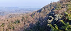
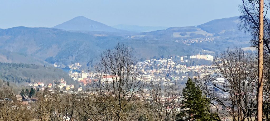
That said, the surroundings do give it more personality than the forested summit alone would suggest. The route sits in the uplands west of Děčín and close to the Czech-German border, in a landscape of rounded ridges, meadows, villages, and bits of industry showing through in the distance. The contrast is one of the better things here. One minute I was on a calm wooded top with no one around at all, and a little later the views opened toward a much busier world: Děčín spread below with its built-up slopes and a noticeably industrial edge, including cranes and urban clutter that made the summit feel even quieter by comparison.
I went down by a more direct line instead of carefully hunting for the most official option. That introduced a short stretch of light bushwhacking, though only because I chose to cut the corner. It was not a fight. The forest was open enough that I could descend practically straight from the summit without much trouble, and in a more conservative mood it would probably be easy enough to stay on forest roads for most or all of this section. Either way, this is not a difficult hill. The only real decision is how neat you want your line to look later on the map.
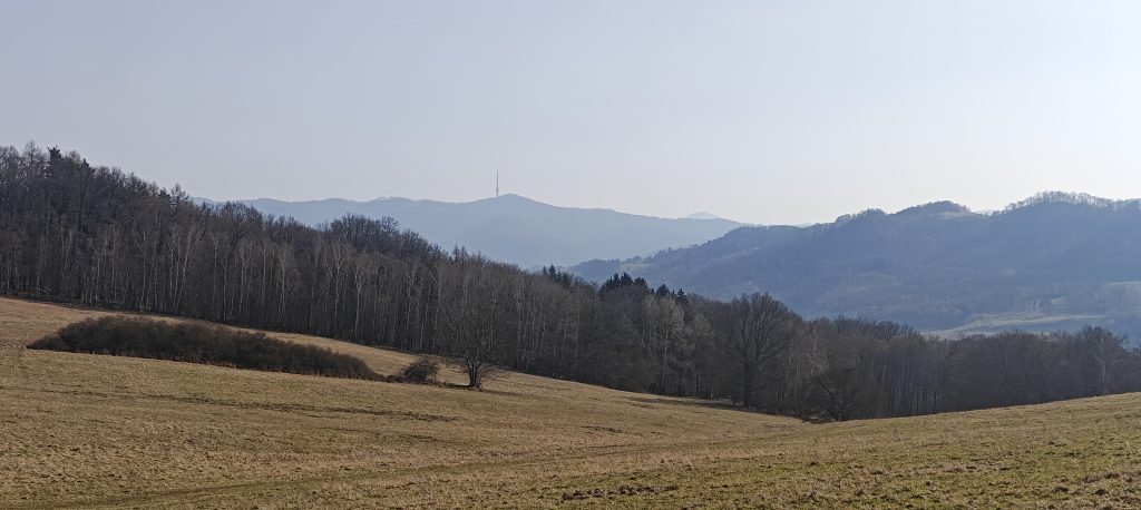
Lower down, the woods loosened back into open ground. The afternoon light was excellent by then, giving the meadows that dry golden early-spring colour that makes even a small hill look better behaved than it really is. A distant transmitter stood out on one skyline, and the broad folds of the surrounding ridges kept the descent visually open. I still did not meet a single person.
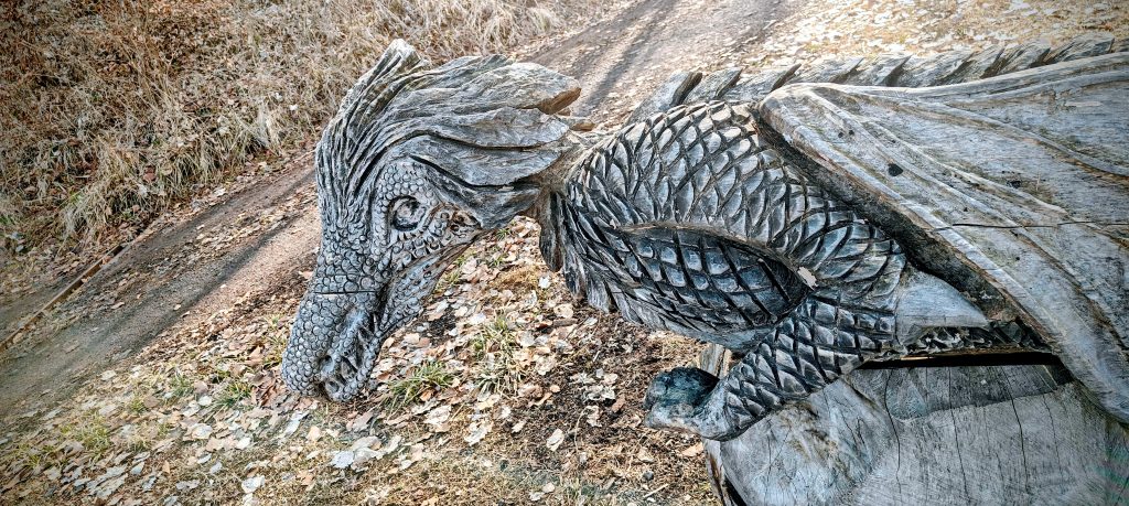
Near the end, the route produced one of those small, unnecessary but welcome details that tend to stick in memory longer than they logically should: a carved wooden dragon by the roadside. It had nothing to do with summit purity, prominence, or the usual peak-bagging paperwork. Which, frankly, improved it.
I finished back at the same east-side parking around 13:08. In total, the Lotarův vrch segment took 1:13:49, with 1:10:38 moving time. That makes it an easy hill to underestimate, especially when it sits next to a more obvious neighbour and inside a longer multi-peak day. But as a short stand-alone section, it worked very well: a clean transition from Chmelník, a pleasant meadow approach, an unmistakable cairned summit, a quiet forest atmosphere, and a descent with enough open views to stop the whole thing from becoming just another walk through trees. Not every hill needs to perform. Some just need to be worth the detour. Lotarův vrch was.
Approx. timing: start from Chmelník saddle 12:54, summit around 13:20 to 13:23, descent shortly after, finish around 13:08
Trailhead / parking: same east-side parking as for the Chmelník hike, at 50.756355, 14.173946; this specific segment itself began from the Chmelník saddle and ended back at the same parking
Highest recorded GPS point: 512 m (consumer GPS reading; official summit elevation 509 m)
Terrain: meadow crossing, faint paths, open deciduous forest, leaf-covered ground, short off-path shortcut on descent, forest tracks toward the finish
Route: Chmelník saddle -> meadow crossing -> wooded ascent to Lotarův vrch summit cairn -> direct eastward descent with a short shortcut -> return to the same east-side parking
Sections: saddle to meadow and lower slope about 10 minutes; ascent through forest to summit about 20 minutes; summit stop very short; descent to parking roughly 45 minutes with a few photo stops
Difficulty: easy overall; navigation straightforward in good conditions, with only a mild off-path section if taking shortcuts
Useful to know: the summit is forested but distinct thanks to the cairn; views are better on the approach and descent than from the actual top; if you want a cleaner line than mine, forest roads likely reduce or remove the light bushwhacking