Stramchyně was the seventh summit of the day, reached straight after nearby Tuhošť and just before the final stop on Bambule. On paper Stramchyně is modest: 543 m, with 119 m of prominence and about 2.67 km of isolation. In practice that is enough to make it a real P100 objective rather than just another unnamed fold in the woods south of Plzeň. Its nearest higher neighbor is Tuhošť to the southwest, which made the pairing especially neat. After one short Czech P100 with a surprisingly distinctive summit, the next one turned out to have its own character as well.
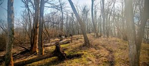
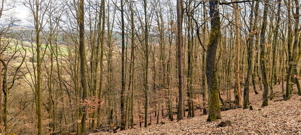
I had originally expected to leave the car by the main road and walk more of the approach. Instead I ended up driving farther in than planned, first along a small track, then across a meadow, and finally onto the forest road on the east side of the hill. In dry conditions I probably could have pushed higher, but by then the practical thing was to stop where I already was and take the remaining distance on foot. That left a very short outing of about 1.40 km in total. The opening section followed the forest road through quiet mixed woodland with old pines, some larch, and leafless deciduous trees. Roe deer were moving through the forest, which helped the mountain feel less like a checkbox and more like an actual place, even if the route itself was brief and straightforward.
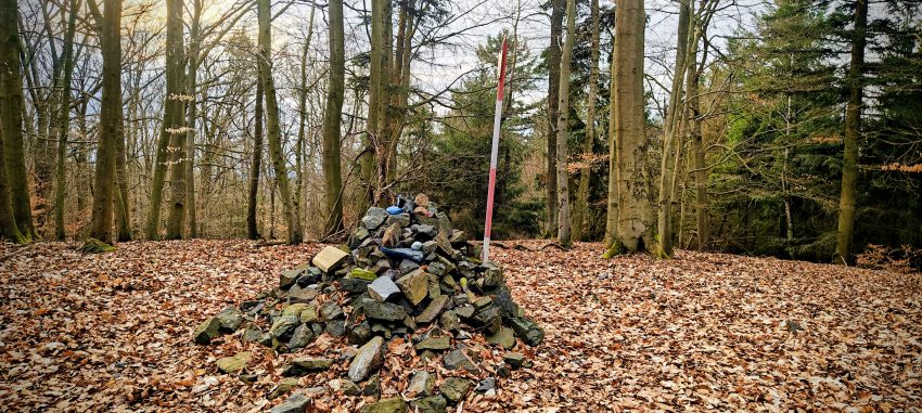
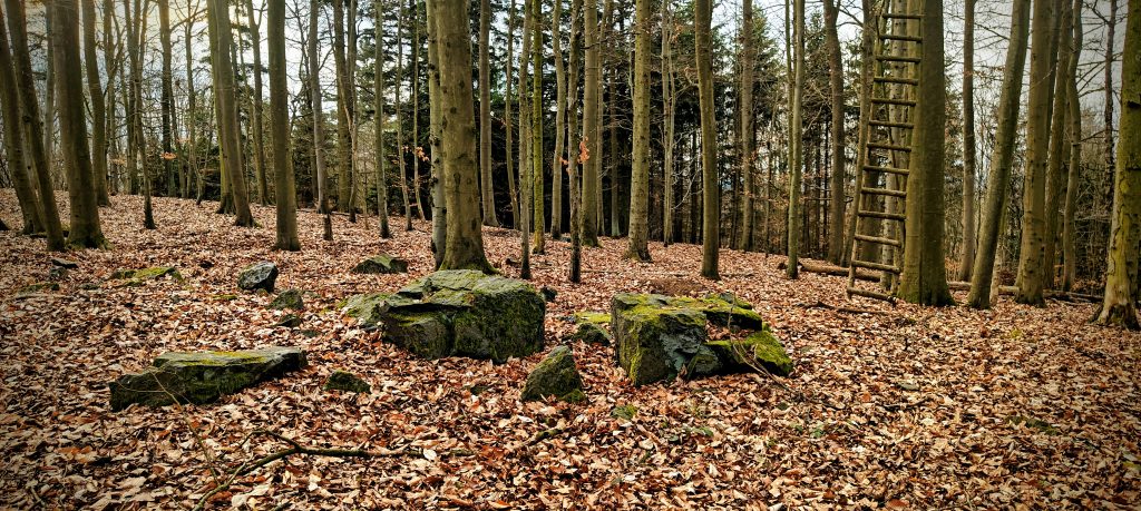
The line did not feel as if it led theatrically to a summit, and that suited the hill. Stramchyně is not one of those small Czech tops that gives itself away early with a tower, signpost, or obvious viewpoint clearing. The forest road brought me high, then the summit area broadened into the sort of wooded crest where a peakbagger starts paying attention instead of blindly accepting the first plausible bump. There were not many serious candidates, but the first stones I reached did not quite convince me. A little farther on I found the more persuasive top: a built-up cairn, a red-and-white triangulation pole, and the clear sense that this was the practical summit reference point of the hill.
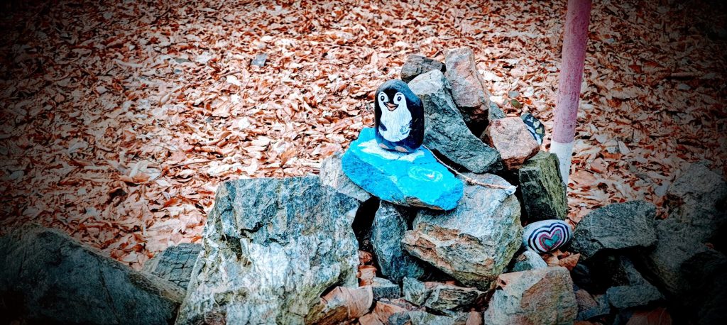
That summit setup gave Stramchyně far more identity than its short route would suggest. There was a fire ring near the top, ground torn up nearby in what looked very much like boar rooting, and a cairn decorated in a way no one would mistake for official survey infrastructure. The most memorable detail was a painted penguin perched on a blue stone among the rocks. It was ridiculous in a harmless, summit-improving way. The hill also had a few older stones scattered around the crest, and the surrounding ground was broad enough that the exact natural apex did not feel dramatically sharper than the cairn site. Still, the cairn and pole made the summit logic good enough on the ground. My highest recorded GPS point was 546.6 m at 49.508854, 13.286785, a little above the mapped 543 m in the usual way GPS likes to flatter short forest summits.
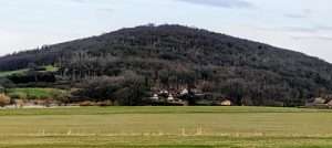
Stramchyně is not a viewpoint peak in any grand sense. The summit is wooded, and on this visit the hill’s value came much more from topographic definition and summit character than from open panoramas. Still, the setting is clear enough from the route and from the map logic of the day. This is a compact wooded dome above Červené Poříčí and the Úhlava valley corridor, with Borovy, Lhovice, and the low ridges of the surrounding countryside close at hand. In March, with the trees still bare, the woods felt open rather than claustrophobic, and the dry leaf litter kept the whole outing fast and clean. That mattered. A short P100 does not need scenery to justify itself if the ground is pleasant, the line is repeatable, and the summit is actually worth finding.
I returned by the same route. There was no real reason to invent anything more elaborate here, especially this late in the day. Car to car, the outing took just under 20 minutes, with a little under 10 minutes to the highest recorded point and a little over 10 minutes back down. That made Stramchyně exactly what it needed to be as peak 7 of 8: efficient, easy to repeat, and distinct enough to hold its own within the day. It is not an important mountain because of altitude. It matters because it cleanly clears the P100 line, stands apart enough from Tuhošť to be its own objective, and finishes with a summit that is far more memorable than the numbers first suggest.
Range: Europe / Eastern Europe Ranges / Bohemian Ranges / Böhmerwald
Administrative regions: Plzeň Region, Czech Republic
List / category: Prague P100 (Peakbagger rank #432); 100 m-prominence summit
Approx. timing: 17:24 start / 17:33 highest recorded GPS point / 17:34 descent / 17:43 finish (CET)
Trailhead / parking: east-side forest-road stopping point, approx. 49.510564, 13.293617
Summit coordinates: approx. 49.509, 13.287
Highest recorded GPS point: 546.6 m at 49.508854, 13.286785
Terrain: forest road, open mixed woodland, dry leaf litter, short summit wandering on a broad wooded crest
Sections: short forest-road ascent to the summit area, brief summit check around the cairn and pole, then the same line back
Difficulty: very easy short forest walk
Useful to know: on this visit I drove farther in than expected and could probably have gone a bit higher in dry conditions, but I stopped where it was convenient; the summit is broad enough that the cairn marks the practical top more clearly than the natural ground does; screenshots and map captures were used only as route research, not as article images.