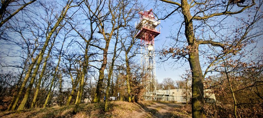
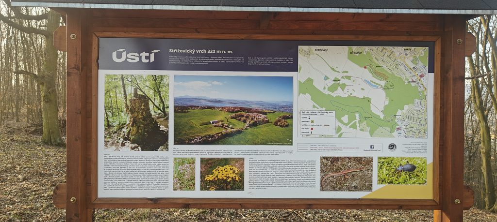
Střížovický vrch was the seventh stop of an eight-peak day, coming after Radešín and just before Vaňovský vrch, so by this point I was not looking for grand drama. I was looking for a clean summit tick that still meant something. This one did, mainly because it is a P100. The naming is slightly messy, which only improves it in the usual peakbagging way. The local board and the named hill point to Střížovický vrch around 332 metres, marked by the big antenna compound, while the peakbagging target is the nearby unnamed 346 m high point on the same broad ridge a little farther east. In other words, this was not just a quick walk to a telecom mast. It was a quick walk to a telecom mast, and then a few minutes more to the lump that actually counts.
I started from the west side of the ridge at the no-entry sign, parked at about 50.681532, 13.985655, and walked the rest. The track came to 3.15 km in total, with almost exactly 1.57 km each way. My estimate at the parking said it would be about a kilometre and a bit, and the track later confirmed that my late-day arithmetic had not completely collapsed. The route was simple: a paved service road, easy walking, gentle grades, and no navigational drama at all. Although the GPX recorded 29 metres of ascent and 29 metres of descent, the walk felt much easier than those numbers suggest, because the parked start was already high on the ridge and the altitude trace clearly contains some GPS noise.
What the hill lacked in mountain seriousness, it made up for in local life. The weather was good, and the whole ridge was busy. I kept meeting walkers, dog owners, runners, mountain bikers, and a few motorbike riders as well. It felt less like escaping into the hills and more like stepping into the Saturday outdoor habits of Ústí nad Labem. Driving farther up was officially prohibited, though at least one car on top suggested that some people had interpreted the sign as a philosophical suggestion rather than a rule.
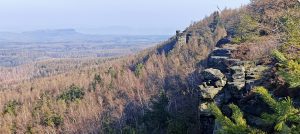
The antenna tower was visible ahead for much of the approach, so there was never much suspense about where the named summit area lay. When I reached it, the place felt exactly as expected: fenced infrastructure, plenty of people, and no real summit atmosphere to speak of. There was also no proper view from the point I treated as the summit area. For a hill that stands clearly above the city and is one of the local landmarks, that is a mildly disappointing outcome, but not a surprising one. Some peaks are scenic. Some are collectible. Some are communications infrastructure with a side business in weekend recreation.
The more interesting part came after the tower. Based on the mapping and on what I found on the ground, the true high point for peakbagging purposes lies a little farther east than the named antenna knoll, on the broad, slightly awkward crest near the fence, pond and picnic area. This is one of those tops where the highest point is easy to underplay because it is not dramatic at all. It is broad, a bit flat, and partly shaped by human use. A small rise near the picnic table that looked marginally higher than the surroundings, and that is the point I treated as the real objective. I reached that eastern high-point area in about 19 minutes, spent only a few minutes there, and then turned back the same way.
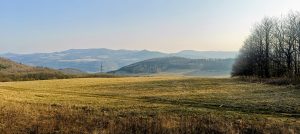
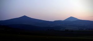
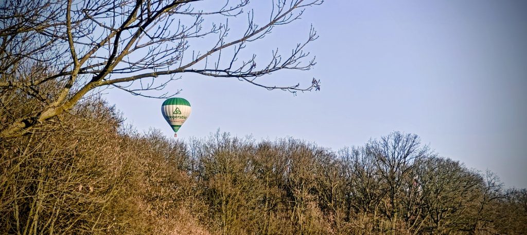
The setting matters more than the summit itself. This ridge sits right above the built-up eastern side of Ústí nad Labem, especially Bukov and Klíše, while to the west and southwest the landscape opens toward the fields, transport corridors and post-industrial lowlands around Lake Milada. It is a useful reminder that not every worthwhile hill sits in a clean, romantic mountain setting. Some of them stand at the edge between city and upland, where dog walking, radio towers, forestry tracks, local history boards and peakbagging logic all collide. Even a hot-air balloon drifted over the ridge while I was there, which gave the place a faintly surreal touch, like someone had briefly tried to turn a telecom hill above town into Cappadocia on a budget.
The return was the same paved walk back to the car, done in about 18 minutes, and the whole outing took 37 minutes. As a pure hiking experience, this was not the most beautiful stop of the day. As a practical peakbagging stop, it worked very well. It was quick, clear, and just complicated enough in its summit identity to stay interesting. On an eight-peak day that kind of efficiency has its own appeal. Střížovický vrch, or rather the unnamed 346 m high point just beyond it, was not the place to linger. It was the place to tag neatly, note the odd summit arrangement, accept the company of half the city, and move on to the final hill.
Approx. timing: 16:23 start / 16:42 high-point area / 16:45 descent / 17:01 finish
Trailhead / parking: 50.681532, 13.985655
True high point / summit area: approximately 50.67555, 14.00419
Highest recorded GPS point: 366.4 m at the trailhead, almost certainly a GPS altitude error rather than the real summit height
Terrain: paved service road, easy walking, short informal movement around the summit area
Sections: parking to named summit area roughly 15 min; on to PB high point about 4 more min; return the same way about 18 min
Difficulty: very easy
Useful to know: vehicle access was signed as prohibited; despite that, at least one car was on top. Expect walkers, runners, dog owners, mountain bikers and occasional motorbikes in good weather. There was no real summit panorama from the point I visited.