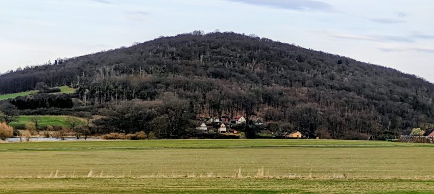
Tuhošť was the sixth summit in my eight-peak day, and by then the logic of the day was fully settled: drive as high as reasonably possible, walk only what still needed to be walked, and make sure the actual summit was handled properly rather than waved away just because the outing was short. Tuhošť fit that formula almost perfectly. At 601 m it is not a high mountain in any dramatic sense, and with 125 m of prominence and only 2.16 km of isolation it is less independent than some of the stronger peaks earlier in the day, but it still clears the P100 line cleanly and has enough topographic identity to matter as more than a nameless wooded rise above Mezihoří. In sequence, that was enough. After Běleč, Tuhošť made sense as the next efficient objective on the ridge-and-village chessboard south of Plzeň.
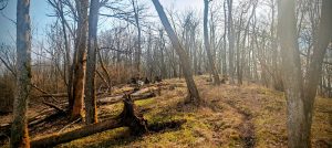
What helped immediately was that I managed to drive closer than expected. The forest road in was better than expected and perfectly serviceable in dry conditions. In rain it might be a different story. I pulled over on the roadside at about 49.492222, 13.257301, only a short distance west of the summit, and from there the outing shrank to just 0.87 km in total. For a peakbagger, that does not make the summit less legitimate. It just means the mountain’s value lies in its topographic definition and summit character rather than in any long approach. The first part followed an obvious forest road through open woodland. Higher up, the mapped line looked more substantial on the screen than it did on the ground. In reality it had faded into more of a well-trodden path, but it was still easy enough to follow.
The hill itself felt very springlike in a low, quiet way. The forest was open enough to move quickly, with plenty of oak around and the ground already showing early growth. Underfoot it was dry leaf litter rather than mud, and that made the short climb cleaner than it might have been a few weeks earlier or after rain. I also liked that Tuhošť never tried to pretend it was something grander than it is. It rises above villages, ponds, fields, and folded low hills rather than over a deep mountain basin. From below, especially across the open fields near Mezihoří, it has a compact, self-contained shape rather than the sprawling look of a broader upland. That modest local dominance is part of its appeal.
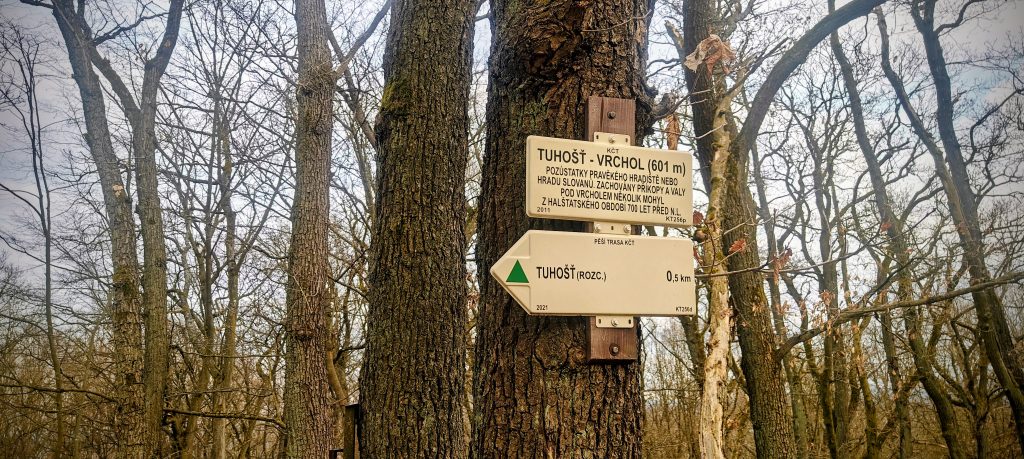
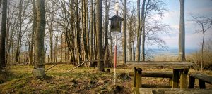
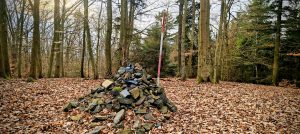
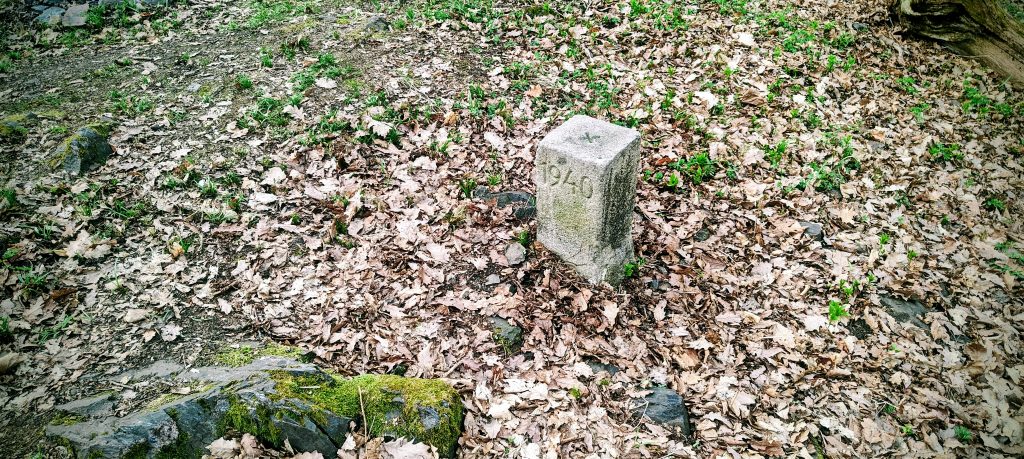
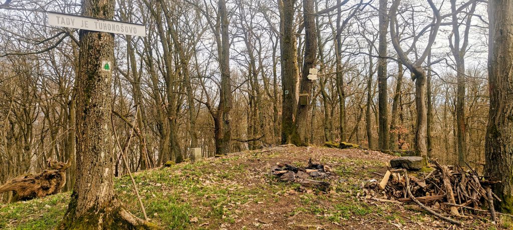
The summit itself turned out to be better furnished, and more memorable, than I expected from such a short stop. It is a wooded top rather than a viewpoint summit, but it has enough going on to feel like a real destination. There is a summit sign naming Tuhošť at 601 m, a register box, a thermometer, an old concrete marker dated 1940, and a small cleared crest with a fire ring and stacked wood. One sign also notes the remains of an early medieval hillfort or Slavic stronghold near the top, with preserved ditches and ramparts below the summit. That detail gives Tuhošť more historical weight than the average minor P100. It is still a quick forest summit, but not an anonymous one. My highest recorded GPS point was 603.1 m at 49.491811, 13.260555, a little above the signed elevation in the usual harmless way GPS likes to flatter people.
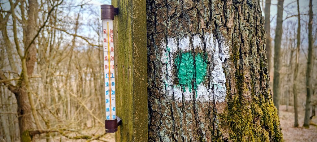
Even though the summit is wooded, it was not completely closed in on this mid-March visit. The trees were still bare enough that small gaps opened toward surrounding hills, which is probably more than the mountain gives in summer. Tuhošť is not a panorama summit, so there is no point pretending otherwise, but the filtered views were enough to remind me where I was: in the compact hill country above Švihov and Mezihoří, where wooded domes rise out of farmland and villages rather than out of some wilder mountain architecture. The thermometer reading, around 9 to 10°C, matched the feel of the afternoon exactly. Mild, dry, and easy moving. Not scenic in a theatrical sense, but comfortable and efficient.
For the descent I did not simply retrace every step. Instead I cut the corner directly back toward the car, and in these dry conditions that worked well. The slope was open enough, the leaf cover was manageable, and there was no serious undergrowth to punish the shortcut. That mattered because Tuhošť was never supposed to be a full-scale outing. It was a precise, compact summit stop in the later part of a busy day, and it delivered exactly what it needed to deliver: a real P100, a repeatable short route, and a summit with more identity than the statistics alone suggest. As peak 6 of 8, it did not need drama. It only needed to be worth the stop. It was.
Range: Europe / Eastern Europe Ranges / Bohemian Ranges / Böhmerwald
Administrative regions: Plzeň Region, Czech Republic
List / category: Prague P100 (Peakbagger rank #386); 100 m-prominence summit
Approx. timing: 16:46 start / 16:56 summit area / 16:57 descent / 17:02 finish (CET)
Trailhead / parking: roadside pull-off on the west side of the hill, approx. 49.492222, 13.257301
Highest recorded GPS point: 603.1 m at 49.491811, 13.260555
Terrain: dry forest road, narrower upper path, open deciduous woodland, leaf litter, short off-path descent shortcut
Sections: short forest-road approach, final footpath to the summit crest, then a direct dry shortcut back to the car
Difficulty: very easy short forest walk
Useful to know: on this visit the drive-in road was better than expected in dry conditions, but it may be much less friendly after rain; the mapped upper road is more of a path on the ground; the summit has a sign, register box, thermometer, and an old concrete marker dated 1940