Skip to content
Menu
p600.org
  • home
  • map
  • trips
  • about
p600.org

Vysoký kámen: A Quick Wooded Summit Above Povrly

hike | 2026-03-07

By the time I reached Vysoký kámen, it was already the fifth peak of the day. Děčínský Sněžník, Chmelník, Lotarův vrch, and Javorský vrch were already behind me, while Radešín, Střížovický vrch, and Vaňovský vrch still lay ahead. Vysoký kámen itself is only 494 m high, but with about 132 m of prominence and 4.89 km of isolation it is more than a completely throwaway bump, standing on the wooded uplands north of the Elbe above Povrly. That made it feel like a proper mid-afternoon objective rather than just a roadside formality. Even so, it turned out to be one of the more efficient little climbs of the day: short, straightforward, entirely in the woods, and just interesting enough at the top to justify the detour.

The approach was almost absurdly short. I parked at a small dedicated forest-side turnout where a few cars could fit and set off at 15:08. I had expected to leave the car farther away and walk more, so it was a pleasant surprise to be able to drive this close. The access road was a small forest road, but in reasonably good condition on this visit. From the trailhead, the route was only about 650 meters each way. The walk itself follows an easy forest road and then an equally easy path, so there was never much suspense about navigation. In dry early-spring conditions it was simply a matter of walking uphill through leaf litter and oak woodland and letting the summit come to me.

The afternoon helped. The afternoon felt dry, bright, and comfortable, with sunlight picking out the moss and old brown leaves rather than any lingering winter drama. The woods seemed to be mostly oak, or at least oak-like enough to leave the ground covered in a thick crunchy layer that still had not properly rotted down after winter. Near the top I came back onto a broader forest track running along the ridge, which made the whole thing feel even less remote. For a hill called Vysoký kámen, the practical message was clear: this was not going to demand heroic suffering.

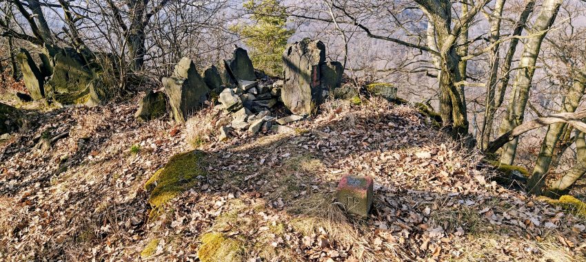
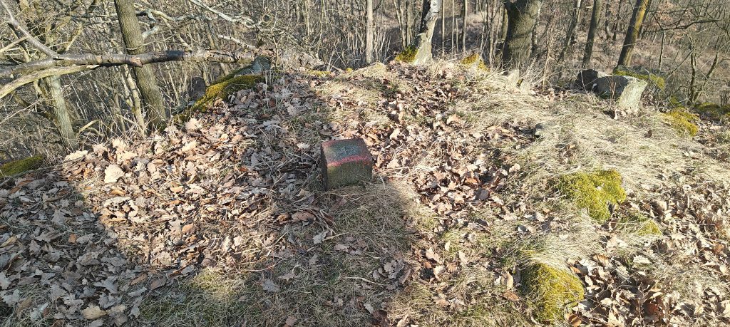
The summit is modest but not forgettable. It sits entirely in forest, with small rock outcrops and a grassy, leaf-covered crest. The concrete trig point gives the top a clearer identity than many similarly short wooded hills manage. My highest recorded GPS point was 495 m, close enough to the listed 494 m to confirm the spot. There is no broad panorama, but the trig point and rocky crest give the summit enough character to feel like a real objective rather than just a coordinate in the trees.

The understated high point of Vysoký kámen, marked by a small concrete block on a leaf-covered forest crest.

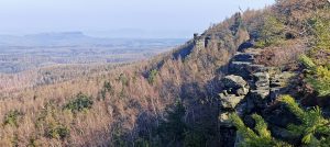
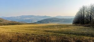
The name suggests rock, and at least that part delivers. A cluster of dark stones and broken outcrops gives the crown of the hill some texture, even if the forest keeps the wider landscape mostly to itself. Through the bare branches there were only limited glimpses rather than real views. Still, the setting is easy to place on the map: Vysoký kámen stands on the wooded heights north of the Elbe above Povrly, with Lužec and Mašovice pod Vysokou nearby. It is not a summit that dominates the region visually, but it does sit in a believable landscape rather than in some abstract database void, which is always appreciated.

I did not linger long. With almost no summit delay, I turned around and retraced the same route back to the car, finishing at 15:29. The descent took about 9 minutes, so the whole outing came to 21 minutes car to car. That brevity was exactly its strength. Vysoký kámen was never going to be the emotional center of the day, but as peak 5 of 8 it worked perfectly: quick to collect, pleasant underfoot, mildly distinctive at the top, and efficient in the best possible way. Not every hill needs to perform. Some just need to be sensible, and this one was.

Approx. timing: 15:08 start / 15:21 summit / immediate descent / 15:29 finish
Trailhead / parking: small dedicated forest turnout for a few cars at approximately 50.68963, 14.12805
Summit coordinates: approximately 50.68987, 14.13556
Highest recorded GPS point: 495 m
Terrain: good forest road, easy woodland path, leaf-covered ground, small rocky summit crest
Sections: parking to summit about 12 min; brief summit stop; return the same way about 9 min
Difficulty: very easy short walk in dry conditions
Useful to know: access was straightforward on this visit, and the small forest road was in reasonably good condition; do not expect major views; the summit area is fully wooded but clearly enough defined by the rocky crest and concrete trig point


Vysoký kámen494 m altitude
132 m prominence
4.89 km isolation
RangesBohemian Ranges
Countries/regionsÚsti nad Labem
Distance0.62 km up0.62 km down
Elevation119 m gain119 m loss
Time
0h12 up
0h01 other
0h09 down
0h22 total
RouteFrom the small forest turnout west of the summit, follow the good track east toward Vysoký kámen. The route stays in the woods the whole way and is short enough that navigation is uncomplicated. Near the top, the line joins a broader forest road along the ridge before a short final walk to the summit area. The summit is a wooded crest with small rock outcrops and a concrete marker. Return the same way. This is an ideal quick out-and-back and works especially well as part of a larger peakbagging day.
LinksGPX trail
  • Anatolia 2024
  • « Javorský vrch: A Short Open Summit with Wide Views Above Javory
  • Radešín: A Short Climb to a Hidden Trig Point Above Ústí nad Labem »

Mountain Ranges

Anatolia
Central Anatolia
Pontic Mountains
Southeast Anatolia
Taurus Mountains
Western Anatolia
Andes
Puna de Atacama
Atlas Mountains
High Atlas
Northwestern Atlas
Central America Ranges
Costa Rica-Panama Ranges
Central Central America
East China
Taiwan
Eastern Europe Ranges
Bohemian Ranges
Southeast Baltic Plains
Sudety
Iberian Peninsula
Cordillera Cantabrica
Castile Ranges
Portugal-Galicia
Pyrenees
Intermountain West
Great Basin Ranges
Korea-Amur Area
Taebaek Sanmae
Malay Archipelago
Java
Nusa Tengarra
Sulawesi
Sumatra
Mid-Atlantic Islands
North Atlantic Islands
Mongolia Ranges
Altai
Gobi Desert Ranges
Hangay Mountains
Northwest Europe
Great Britain
North France-West Rhine Area
Pacific Ranges
Cascade Range
Northwest U.S. Coast Ranges
Sierra Nevada
Central and Southern California Ranges
Philippines
Central Philippines
Luzon
Mindanao
Southeast Asia
Malay Peninsula
Southeast South America
Pampas
Sierras de Cordoba
Southern Africa
Malawi Highlands
West Africa Mountains
Bight of Benin
Cameroon Mountains
Guinea Highlands

Countries / regions

Algeria
Ain Guezzam
Ain Salah
Aïn Témouchent
El Bayadh
Ghardaïa
Oran
Ouargla
Saïda
Sidi Bel Abbès
Tamanrasset
Argentina
Catamarca
Ciudad Autónoma de Buenos Aires
Córdoba
Jujuy
Salta
Tucumán
Belgium
Brussels Capital Region
Flemish Region
Cameroon
Southwest
China
Taiwan
Costa Rica
Alajuela
Cartago
Guanacaste
Heredia
Limón
San José
Czechia
Prague
Ústi nad Labem
Denmark
Greenland
France
Hauts-de-France
Occitania
Germany
Berlin
Niedersachsen
Indonesia
Bali
Jambi
Jawa Tengah
Jawa Timur
Nusa Tenggara Barat
Sulawesi Tengah
Sulawesi Utara
Sumatera Barat
Lithuania
Vilnius County
Mongolia
Bayankhongor
Govi-Altai
Khovd
Omnogovi
Ovorkhangai
Ulan Bator
Zavkhan
Morocco
Béni Mellal-Khénifra
Drâa-Tafilalet
Fez-Meknes
Marrakesh-Safi
Souss-Massa
Tangier-Tetouan-Al Hoceima
Mozambique
Zambezia
Netherlands
Gelderland
Noord-Holland
Zeeland
Nicaragua
Chinandega
Managua
Masaya
Rivas
Philippines
Bicol Region (V)
Cagayan Valley (II)
Calabarzon (IV-A)
Central Luzon (III)
Cordillera Administrative Region
Davao Region
Metro Manila
Soccsksargen (XII)
Western Visayas (VI)
Poland
Greater Poland Voivodeship
Masovian Voivodeship
Portugal
Castelo Branco
Leiria
Lisbon
Madeira
Santarém
Qatar
Ad-Dawhah
São Tomé and Príncipe
São Tomé Province
Sierra Leone
Northern Province
Western Area
Singapore
South Korea
Gyeongsangnam-do
Seoul
Spain
Aragón
Asturias
Castilla-La Mancha
Castilla y León
Catalonia
Islas Canarias
Switzerland
Zürich
Turkey
Antalya
Bitlis
Erzincan
Hakkâri
Igdir
Isparta
Kahraman Maras
Muğla
United Kingdom
England
Scotland
United States
California
Delaware
Florida
Maryland
Nevada
New Jersey
New York
Pennsylvania
South Carolina
Utah

TRIPS

2026
Ústí nad Labem 2026
2024
Mid-Atlantic Islands 2024
North America 2024
Anatolia 2024
Southern Africa 2024
Korea-Amur Area 2024
East China 2024
2023
Mongolia Ranges 2023
Philippines 2023
West Africa III 2023
West Africa II 2023
Iberian Peninsula 2023
West Africa 2023
Central America 2023
2022
Andes 2022
Northwest Europe 2022
Malay Archipelago III 2022
Malay Archipelago II 2022
Anatolia Mountains 2022
Iberian Peninsula 2022
Atlas Mountains 2022
North France-West Rhine Area 2022

archaeology (3) climb (157) food (2) hike (163) p30 (17) p50 (4) p100 (31) p300 (12) p600 (17) p1000 (12) p1500 (76) ribu (10) sight (46) summary (17) trig (44) ultra (76)

1 611 km walked, 122 272 m climbed

©2026 p600.org | WordPress Theme by Superbthemes.com