Skip to content
Menu
p600.org
  • home
  • map
  • trips
  • about
p600.org

Star Peak

hike | 2024-06-18

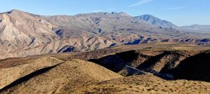
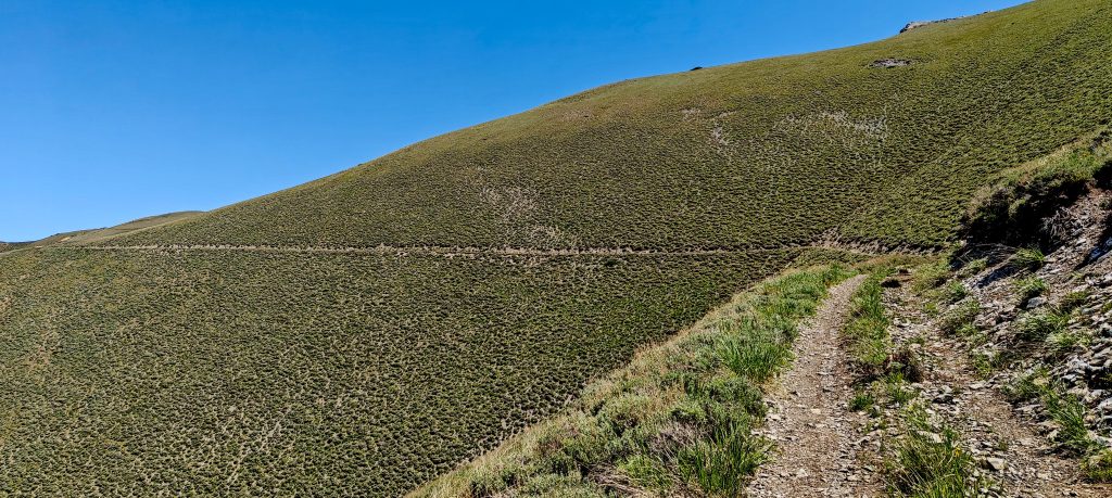
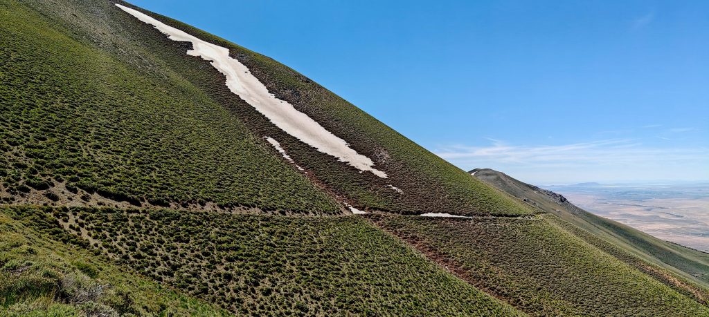
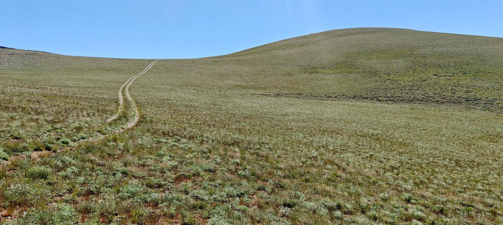
Waking up in Reno and drove a couple of hundred kilometers to the geothermal plant. I then turned right onto a reasonably good unpaved road, which soon became steep and then even steeper. A few sections really required a high-clearance 4WD car. Although it’s not impossible with a mini SUV (I switched to manual gear and made it), these cars aren’t designed for such roads. At one particularly high point, I gave up and left the car at the roadside. A more stubborn driver might make it all the way to the summit.

The surrounding peaks loom majestically from the spot where I parked my car.
Rye Patch Reservoir nestles quietly in the valley.
The steep route I drove twists and turns.
Old mercury mines sit ominously next to the road.
Most of the hike trudges along one unpaved road.
A few deer were spotted.
The summit plateau is relatively flat, and on the way down, I took a shortcut straight to the lower road.
The views on the way to the summit.
Views from ridge.

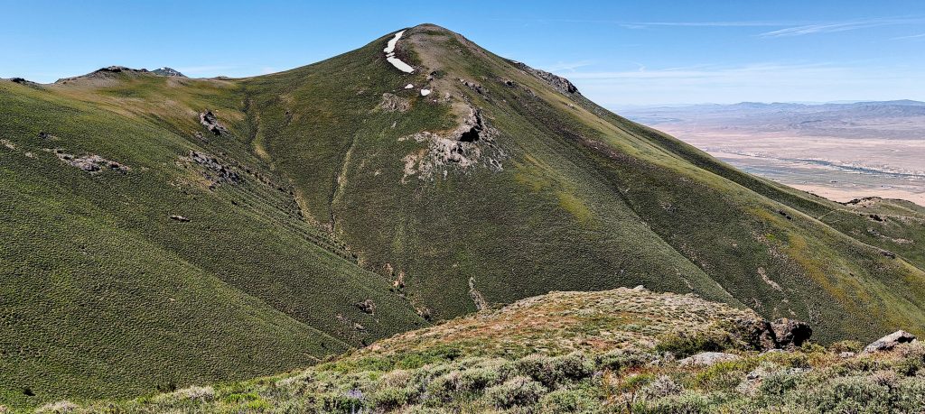
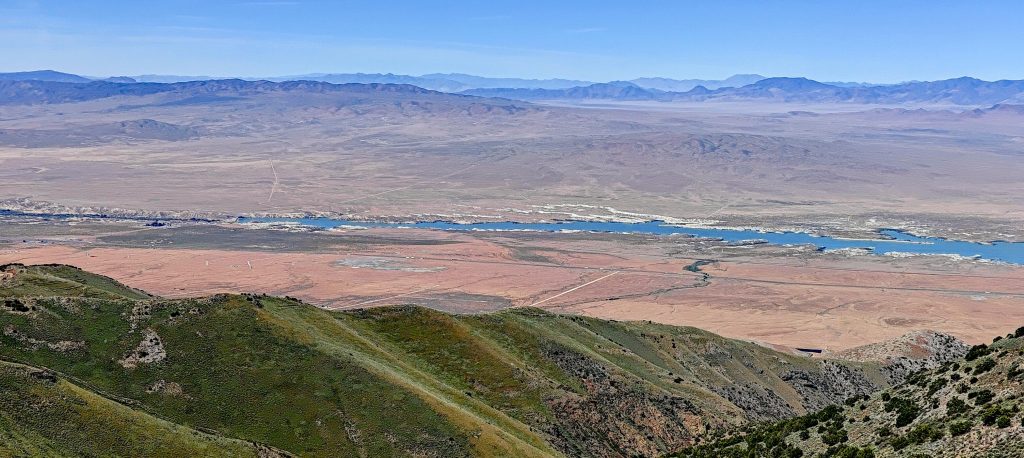
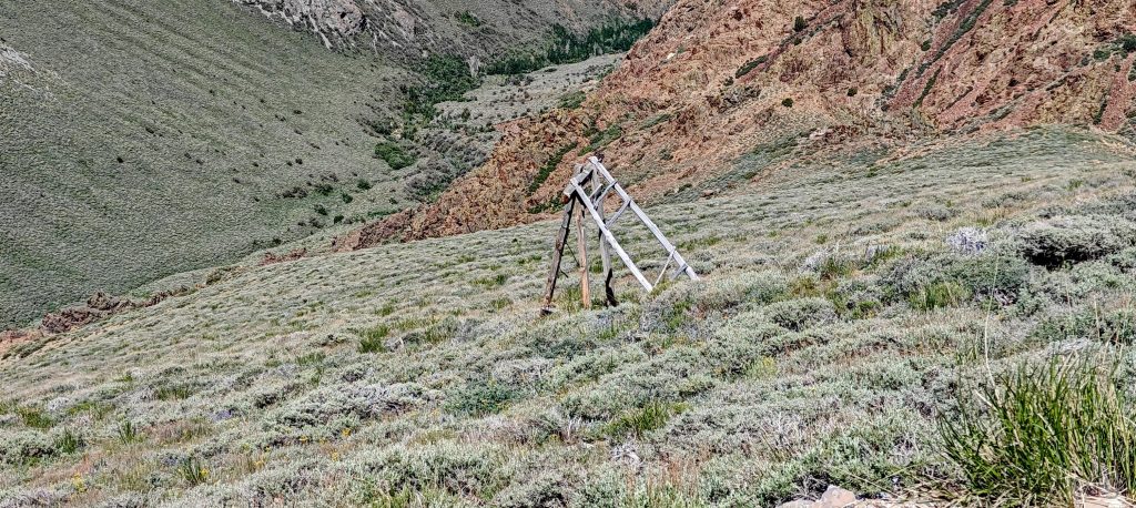
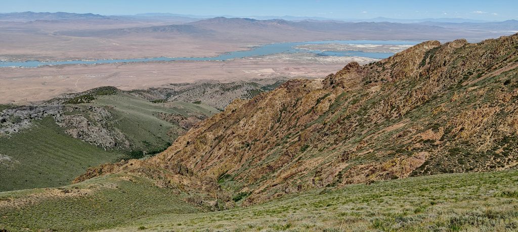
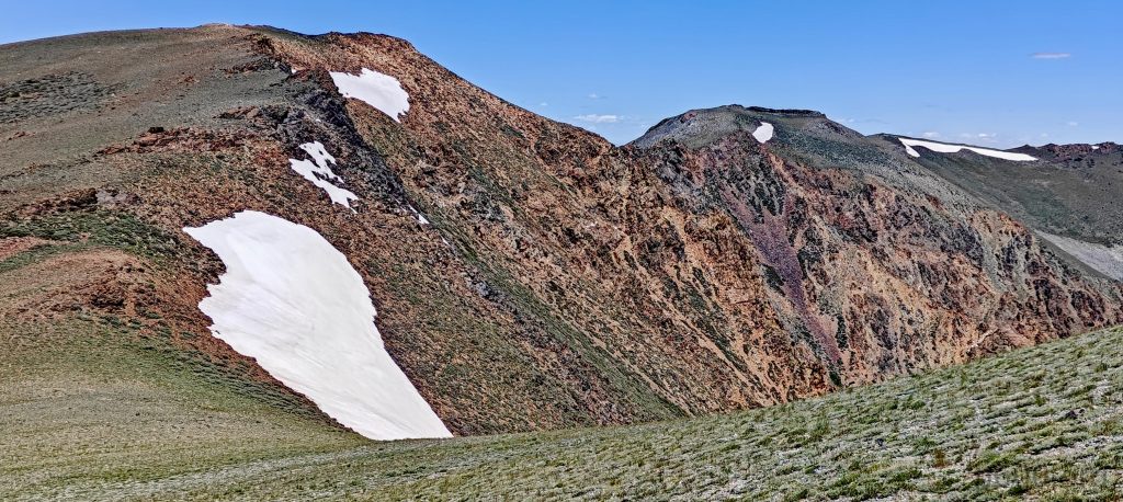
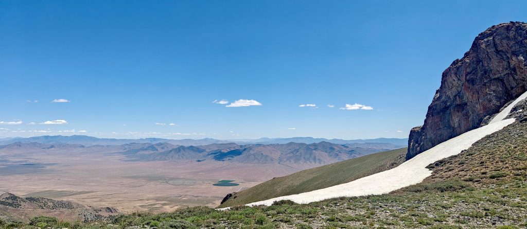
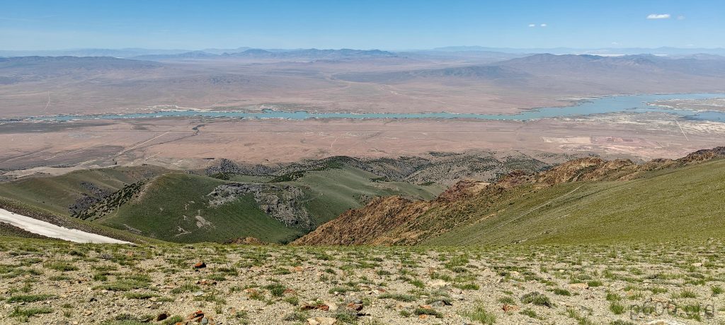
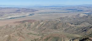
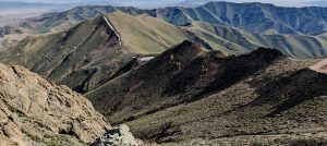
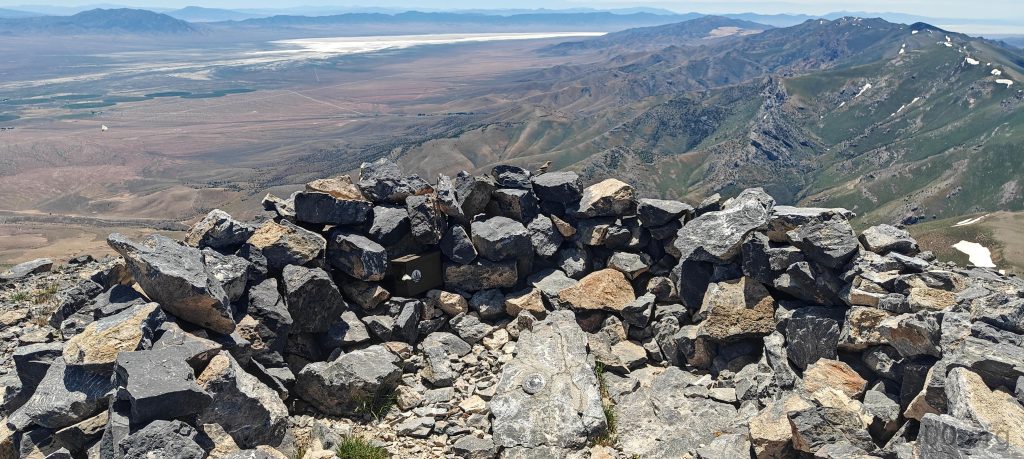
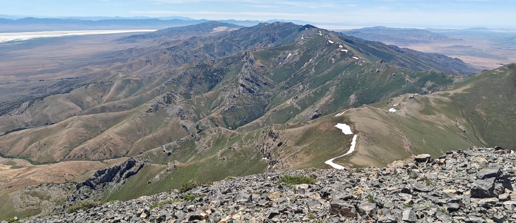
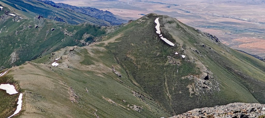
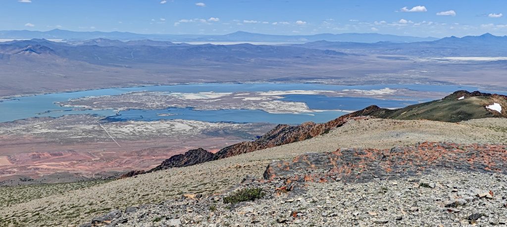
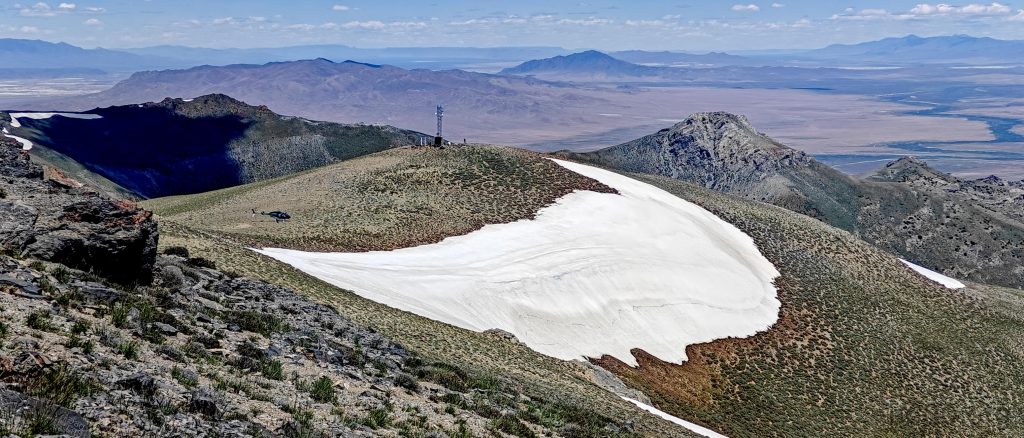
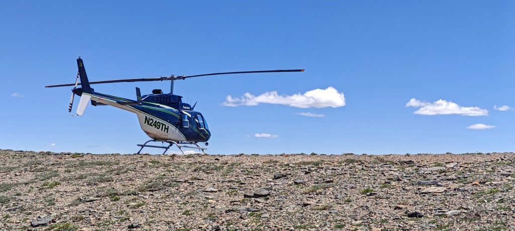
Approaching the summit on car tracks, I saw a helicopter delivering cargo bags to the nearby communication towers. Expecting solitude, I found this activity unexpected but it made the hike more interesting. The summit features a small stony wind shelter, a log box, and a benchmark. The views are stunning, with Rye Patch Reservoir being particularly captivating.

The summit features an ascent log box and a benchmark.
Buena Vista Valley stretches out beautifully.
The views from the summit feel quite remote.
Rye Patch Reservoir, a key water source, spans over 11,000 acres and supports irrigation, recreation, and wildlife in the region.

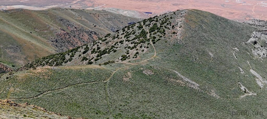
Soon, a helicopter pilot from Elko joined me on the summit. He was bored, waiting for the maintenance team to fix a solar panel for the fire detection system. It was his first ascent of Star Peak, just like mine. I jokingly asked if he could lift me to my car. He said yes, for $1,900 per hour—not a bad price, considering my journey might fit into 2-3 minutes! After a short conversation, I headed down the same route but took a shortcut directly to the lower road.

The communication tower maintenance team works diligently on the lower north peak.
Lycoming IO-540-AE1A5, 260 horsepower

It was quite an efficient day, with plenty of time left. I checked the map, found that Mount Lewis seemed easily accessible, and decided to drive towards it to make the most of the remaining daylight.


Star Peak2998 m altitude
1646 m prominence
111.09 km isolation
Ranges Intermountain West- Great Basin Ranges
Countries/regionsUnited States - Nevada
Distance3.50 km up3.20 km down
Elevation430 m gain430 m loss
Time
1h10 up
0h10 other
1h00 down
2h20 total
Trailhead2567 m altitude40.5190180, -118.1814100
RouteI followed the car tracks all the way to the summit, which took a bit longer than taking shortcuts but was easier. On the way down, I took shortcuts directly to the lower switchbacks.
DifficultiesSteep unpaved road requires high-clearance 4WD
LinksGPX trail
  • North America 2024
  • « Virginia Peak
  • Mount Lewis »

Mountain Ranges

Anatolia
Central Anatolia
Pontic Mountains
Southeast Anatolia
Taurus Mountains
Western Anatolia
Andes
Puna de Atacama
Atlas Mountains
High Atlas
Northwestern Atlas
Central America Ranges
Costa Rica-Panama Ranges
Central Central America
East China
Taiwan
Eastern Europe Ranges
Southeast Baltic Plains
Iberian Peninsula
Cordillera Cantabrica
Castile Ranges
Portugal-Galicia
Pyrenees
Intermountain West
Great Basin Ranges
Korea-Amur Area
Taebaek Sanmae
Malay Archipelago
Java
Nusa Tengarra
Sulawesi
Sumatra
Mid-Atlantic Islands
North Atlantic Islands
Mongolia Ranges
Altai
Gobi Desert Ranges
Hangay Mountains
Northwest Europe
Great Britain
North France-West Rhine Area
Pacific Ranges
Cascade Range
Northwest U.S. Coast Ranges
Sierra Nevada
Central and Southern California Ranges
Philippines
Central Philippines
Luzon
Mindanao
Southeast Asia
Malay Peninsula
Southeast South America
Pampas
Sierras de Cordoba
Southern Africa
Malawi Highlands
West Africa Mountains
Bight of Benin
Cameroon Mountains
Guinea Highlands

Countries / regions

Algeria
Ain Guezzam
Ain Salah
Aïn Témouchent
El Bayadh
Ghardaïa
Oran
Ouargla
Saïda
Sidi Bel Abbès
Tamanrasset
Argentina
Catamarca
Ciudad Autónoma de Buenos Aires
Córdoba
Jujuy
Salta
Tucumán
Belgium
Brussels Capital Region
Flemish Region
Cameroon
Southwest
China
Taiwan
Costa Rica
Alajuela
Cartago
Guanacaste
Heredia
Limón
San José
Czechia
Prague
Denmark
Greenland
France
Hauts-de-France
Occitania
Germany
Berlin
Niedersachsen
Indonesia
Bali
Jambi
Jawa Tengah
Jawa Timur
Nusa Tenggara Barat
Sulawesi Tengah
Sulawesi Utara
Sumatera Barat
Lithuania
Vilnius County
Mongolia
Bayankhongor
Govi-Altai
Khovd
Omnogovi
Ovorkhangai
Ulan Bator
Zavkhan
Morocco
Béni Mellal-Khénifra
Drâa-Tafilalet
Fez-Meknes
Marrakesh-Safi
Souss-Massa
Tangier-Tetouan-Al Hoceima
Mozambique
Zambezia
Netherlands
Gelderland
Noord-Holland
Zeeland
Nicaragua
Chinandega
Managua
Masaya
Rivas
Philippines
Bicol Region (V)
Cagayan Valley (II)
Calabarzon (IV-A)
Central Luzon (III)
Cordillera Administrative Region
Davao Region
Metro Manila
Soccsksargen (XII)
Western Visayas (VI)
Poland
Greater Poland Voivodeship
Masovian Voivodeship
Portugal
Castelo Branco
Leiria
Lisbon
Madeira
Santarém
Qatar
Ad-Dawhah
São Tomé and Príncipe
São Tomé Province
Sierra Leone
Northern Province
Western Area
Singapore
South Korea
Gyeongsangnam-do
Seoul
Spain
Aragón
Asturias
Castilla-La Mancha
Castilla y León
Catalonia
Islas Canarias
Switzerland
Zürich
Turkey
Antalya
Bitlis
Erzincan
Hakkâri
Igdir
Isparta
Kahraman Maras
Muğla
United Kingdom
England
Scotland
United States
California
Delaware
Florida
Maryland
Nevada
New Jersey
New York
Pennsylvania
South Carolina
Utah

TRIPS

2024
Southern Africa 2024
Mid-Atlantic Islands 2024
North America 2024
Anatolia 2024
Korea-Amur Area 2024
East China 2024
2023
Mongolia Ranges 2023
Philippines 2023
West Africa III 2023
West Africa II 2023
Iberian Peninsula 2023
West Africa 2023
Central America 2023
2022
Andes 2022
Northwest Europe 2022
Malay Archipelago III 2022
Malay Archipelago II 2022
Anatolia Mountains 2022
Iberian Peninsula 2022
Atlas Mountains 2022
North France-West Rhine Area 2022

archaeology (3) climb (157) food (2) hike (155) p30 (17) p50 (4) p100 (24) p300 (12) p600 (17) p1000 (11) p1500 (76) ribu (10) sight (46) summary (16) trig (44) ultra (76)

1 591 km walked, 121 298 m climbed

©2025 p600.org | WordPress Theme by Superbthemes.com