Říčej was the fourth peak on my eight-summit day, and by then efficiency mattered. Still, this was not just a filler stop. At 697 meters, with 133 meters of prominence and 2.86 kilometers of isolation, Říčej has enough independence to count as a real collecting summit rather than a nameless wooded rise. It also sits as one of the dominant forested tops on the Doubravský hřbet above the Chudenice area, so even though the route was very short, the hill had an actual identity. Unlike nearby Doubrava, which had a more obvious summit setup, Říčej turned out to be interesting in a quieter and slightly fussier way: the summit point that looked right on the screen did not feel quite right on the ground.
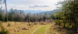
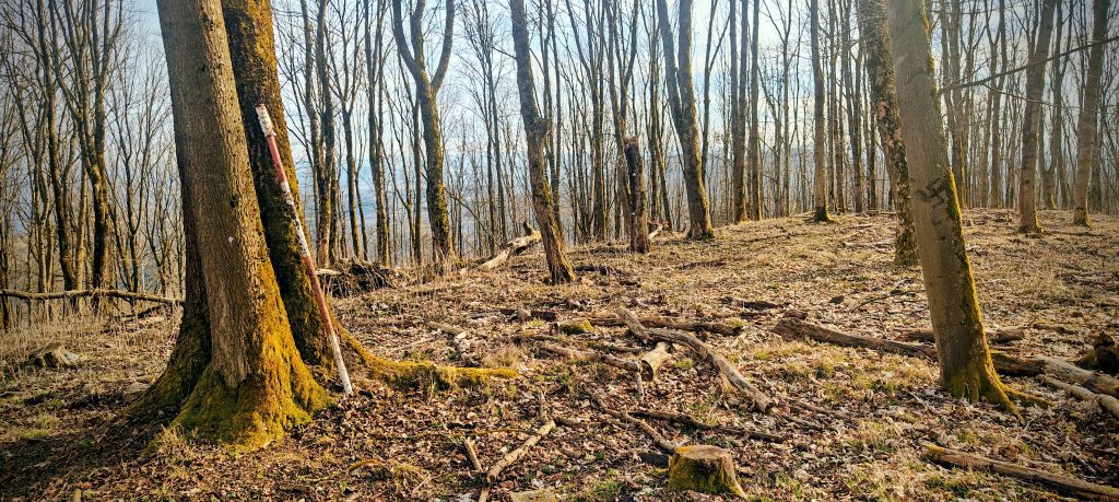
That mattered because I had managed to drive much closer to the mountain than expected. I parked at a forest-road junction on the west-northwest side of the hill and from there the outing shrank to just 1.61 km in total. On paper the lower line looked like a road. On the ground it was closer to an old forest track reduced in places to a path, easy to follow but no longer a road in any normal sense. The climb was gentle and direct, mostly through open beech woodland with dry leaf litter underfoot and the kind of mild, bright mid-March weather that makes even a short ascent feel clean and pleasant rather than perfunctory.
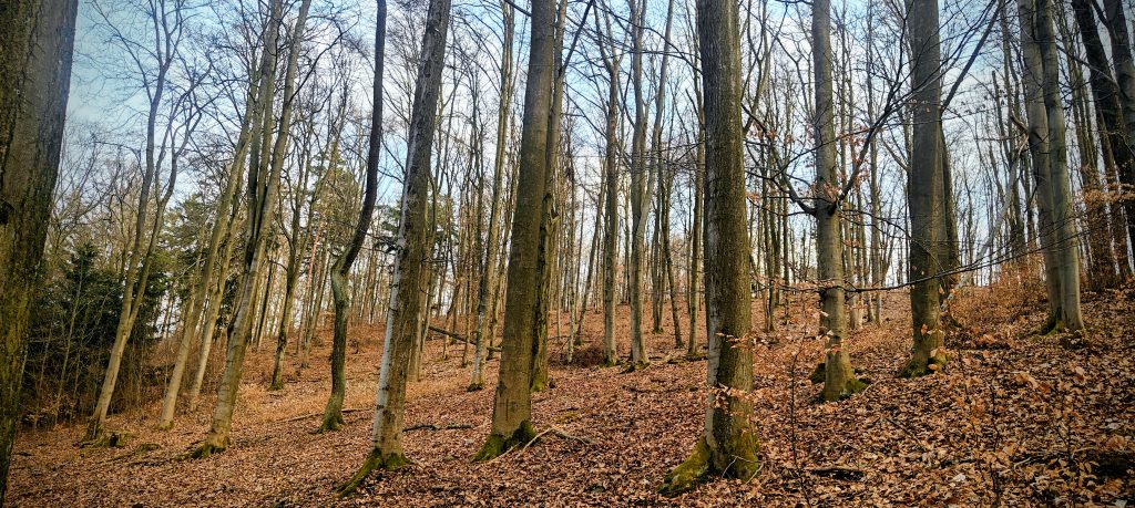
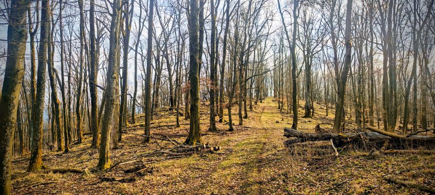
Higher up, the route improved rather than deteriorated. A clearer line developed along the upper ridge, and in one section the old track had enough stonework at the edges to suggest that it had once been built with more ambition than a casual woodland path. I had the sense that something more substantial may have existed here in the past, even if the present-day use is much simpler. Foresters had thinned the upper woods, which helped both with movement and with atmosphere. The summit forest remained enclosed overall, but the leafless trees and small openings let in plenty of light and offered occasional glimpses into the surrounding countryside.
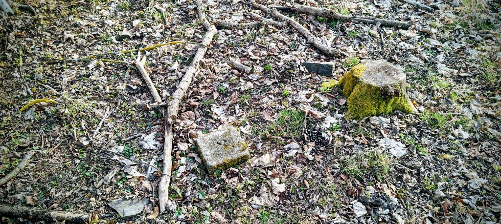
The summit itself was exactly the sort of place where a peakbagger spends a few extra minutes doing what most walkers would find faintly ridiculous. The computer point in the app appeared to sit slightly below the highest ground. About 30 meters farther on, I found what looked like the more convincing top: an old trig remnant set into the ground and a red-and-white pipe leaning against a tree. Visually, that spot also seemed just a touch higher than the nearby ground, which matched my impression from the map and from standing there. My highest recorded GPS point was 694.7 m at 49.458901, 13.213208, close to that area, but the practical value here was less about the exact decimal and more about recognizing that the summit is not handed to you theatrically. It is a broad, wooded top with a likely true high point rather than a single obvious apex.
Říčej does not win on summit spectacle. There is no tower, no open lookout, and no oversized summit furniture trying to announce the place. What it does have is local presence. This wooded hill helps define the edge of the Poleňka basin and stands among the named tops of the Doubravský hřbet above the villages and folds of countryside around Chudenice and Malechov. In the summit area, the thinning and the bare March canopy opened just enough slots in the trees to show that the mountain rises distinctly above its surroundings. That was enough. On a compact forest summit like this, partial views and a convincing sense of position matter more than some forced claim of panorama.
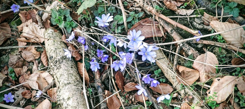
Small details helped too. Along the route I passed early hepatica flowers pushing through the leaf litter, and they suited the mountain well. Říčej was not grand, but it was alive, dry, and quietly enjoyable. The descent was by exactly the same line, with no reason to complicate things, and I was back at the car after about half an hour in total. As the fourth peak of eight, that was precisely what I wanted. Říčej did not need to be big or scenic to earn a place in the day. It just needed to be a proper summit with a repeatable route and a top worth identifying correctly. It was both.
Range: Korábská vrchovina / Doubravský hřbet
Administrative regions: Plzeň Region, Czech Republic
List / category: Prague P100 (Peakbagger rank #303); 100 m-prominence summit
Approx. timing: 15:19 start / 15:34 summit area / 15:37 descent / 15:49 finish (CET)
Trailhead / parking: forest-road junction on the west-northwest side of Říčej, approx. 49.464113, 13.218746
Highest recorded GPS point: 694.7 m at 49.458901, 13.213208
Terrain: old forest track narrowing to path, dry leaf litter, open beech woods, lightly thinned summit forest
Sections: parking to summit area on the old track and upper ridge, then the same line back
Difficulty: very easy short forest walk with mild summit ambiguity
Useful to know: the app/computer summit point appeared slightly lower than the likely natural high point, which seemed to be about 30 m farther on by the old trig remnant and leaning pipe; the upper access road allowed a high parking spot on this visit, but that may change